Europes ecological backbone.pdf
Europes ecological backbone.pdf
Europes ecological backbone.pdf

Create successful ePaper yourself
Turn your PDF publications into a flip-book with our unique Google optimized e-Paper software.
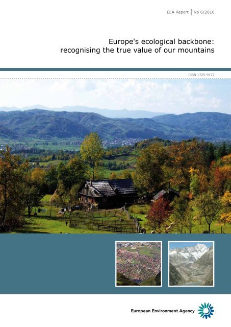
EEA Report No 6/2010<br />
Europe's <strong>ecological</strong> <strong>backbone</strong>:<br />
recognising the true value of our mountains<br />
ISSN 1725-9177
EEA Report No 6/2010<br />
Europe's <strong>ecological</strong> <strong>backbone</strong>:<br />
recognising the true value of our mountains
Cover design: EEA<br />
Cover photo © Catalina Munteanu<br />
Left photo © iStockphoto<br />
Right photo © Martin Price<br />
Layout: Pia Schmidt/EEA<br />
Copyright notice<br />
© EEA, Copenhagen, 2010<br />
Reproduction is authorised, provided the source is acknowledged, save where otherwise stated.<br />
Information about the European Union is available on the Internet. It can be accessed through the Europa<br />
server (www.europa.eu).<br />
Luxembourg: Office for Official Publications of the European Union, 2010<br />
ISBN 978-92-9213-108-1<br />
ISSN 1725-9177<br />
DOI 10.2800/43450<br />
© EEA, Copenhagen, 2010<br />
Environmental production<br />
This publication is printed according to high environmental standards.<br />
Printed by Schultz Grafisk<br />
— Environmental Management Certificate: ISO 14001<br />
— IQNet – The International Certification Network DS/EN ISO 14001:2004<br />
— Quality Certificate: ISO 9001: 2000<br />
— EMAS Registration. Licence no. DK – 000235<br />
— Ecolabelling with the Nordic Swan, licence no. 541 176<br />
Paper<br />
RePrint — 90 gsm.<br />
CyclusOffset — 250 gsm.<br />
Both paper qualities are recycled paper and have obtained the ecolabel Nordic Swan.<br />
Printed in Denmark<br />
REG.NO. DK-000244<br />
European Environment Agency<br />
Kongens Nytorv 6<br />
1050 Copenhagen K<br />
Denmark<br />
Tel.: +45 33 36 71 00<br />
Fax: +45 33 36 71 99<br />
Web: eea.europa.eu<br />
Enquiries: eea.europa.eu/enquiries
Contents<br />
Contents<br />
Acknowledgements..................................................................................................... 5<br />
Executive summary..................................................................................................... 9<br />
Introduction and background..................................................................................... 9<br />
Mountain people: status and trends............................................................................ 9<br />
Mountain economies and accessibility.........................................................................10<br />
Ecosystem services from Europe's mountains..............................................................10<br />
Climate change and Europe's mountains.....................................................................10<br />
The water towers of Europe......................................................................................10<br />
Land cover and uses................................................................................................11<br />
Biodiversity............................................................................................................11<br />
Protected areas.......................................................................................................11<br />
Integrated approaches to understanding mountain regions............................................12<br />
1 Introduction and background............................................................................... 13<br />
1.1 Introduction and objectives................................................................................13<br />
1.2 The legislative and policy framework for Europe's mountain areas...........................15<br />
1.3 Definitions of mountain areas.............................................................................24<br />
1.4 Scales and scope of analysis..............................................................................32<br />
2 Mountain people: status and trends..................................................................... 34<br />
2.1 Population numbers and density.........................................................................34<br />
2.2 Trends in population density..............................................................................38<br />
3 Mountain economies and accessibility.................................................................. 45<br />
3.1 Economic structures.........................................................................................45<br />
3.2 Economic density and accessibility......................................................................45<br />
4 Ecosystem services from Europe's mountains...................................................... 60<br />
4.1 The importance of mountain ecosystem services...................................................61<br />
4.2 Trends in mountain ecosystem services...............................................................71<br />
4.3 Mountains, ecosystem services and the future......................................................71<br />
5 Climate change and Europe's mountains.............................................................. 74<br />
5.1 Changes in climate across Europe.......................................................................74<br />
5.2 Changes in climate in European mountains..........................................................77<br />
5.3 Research needs................................................................................................84<br />
6 The water towers of Europe................................................................................. 85<br />
6.1 Water towers — mountain hydrology ..................................................................85<br />
6.2 Hydropower and hydromorphology.....................................................................94<br />
6.3 Water quality...................................................................................................96<br />
6.4 Floods...........................................................................................................101<br />
6.5 Climate change and impact on water temperature and ice cover ..........................102<br />
6.6 Climate change impacts on water availability......................................................104<br />
6.7 Future challenges and opportunities .................................................................107<br />
Europe's <strong>ecological</strong> <strong>backbone</strong>: recognising the true value of our mountains<br />
3
Contents<br />
7 Land cover and uses........................................................................................... 110<br />
7.1 Dominant landscape types...............................................................................111<br />
7.2 Land cover in mountain areas..........................................................................112<br />
7.3 Land cover changes in mountain massifs and countries........................................117<br />
7.4 European designations of land uses in mountain areas........................................132<br />
8 Biodiversity........................................................................................................ 142<br />
8.1 Mountain species and habitats linked to the EU Habitats Directive.........................143<br />
8.2 Birds and their habitats...................................................................................150<br />
8.3 Impacts of climate change...............................................................................152<br />
9 Protected areas.................................................................................................. 161<br />
9.1 Natura 2000 sites...........................................................................................164<br />
9.2 Nationally designated areas.............................................................................174<br />
9.3 Connectivity and adaptation to climate change...................................................184<br />
10 Integrated approaches to understanding mountain regions............................... 187<br />
10.1 Mountains and rurality....................................................................................187<br />
10.2 Natural and environmental assets of mountain areas...........................................190<br />
10.3 Mountains and wilderness................................................................................192<br />
References.............................................................................................................. 202<br />
Appendix 1 Mountain species in the Habitats Directive........................................... 237<br />
Appendix 2 Mountain habitat types in the Habitats Directive.................................. 244<br />
4 Europe's <strong>ecological</strong> <strong>backbone</strong>: recognising the true value of our mountains
Acknowledgements<br />
Acknowledgements<br />
This report was coordinated and compiled by<br />
Martin F. Price (Centre for Mountain Studies, Perth<br />
College UHI), with technical assistance from Ryan<br />
Glass, within the scope of activities of the European<br />
Topic Centre on Land Use and Spatial Information<br />
(ETC-LUSI) in 2008–2010 and the European Topic<br />
Centre on Biological Diversity (ETC-BD) in 2010.<br />
Guidance, support and review were provided by<br />
Agnieszka Romanowicz, Ronan Uhel and Branislav<br />
Olah, as Task Managers at the EEA, and further<br />
assistance and feedback were provided by other<br />
EEA staff: Elena Cebrian Calvo, Philippe Crouzet,<br />
Gorm Dige, Ybele Hoogeveen, Stéphane Isoard, Ana<br />
Sousa, Rania Spyridopoulou, and Hans Vos. Further<br />
input to the scope and structure of the report were<br />
provided by a group of experts, who met twice, on<br />
29 April 2008 and 26 March 2009. The EEA wishes<br />
to acknowledge and thank them, as well as all those<br />
who provided case studies and reviewed chapters,<br />
for their valuable input.<br />
ETC-LUSI project consortium<br />
Alterra, the Netherlands<br />
Gerard Hazeu, Marta Pérez-Soba and Laure Roupioz.<br />
Danube Delta National Institute, Romania<br />
Marian Mierla and Iulian Nichersu.<br />
Umweltbundesamt, Austria<br />
Gebhard Banko and Andreas Bartel.<br />
Universitat Autonòma de Barcelona, Spain<br />
Juan Arévalo and Andreas Littkopf.<br />
Expert group<br />
Astrid Bjoernsen (Mountain Research Initiative);<br />
Anders Brun (Norwegian Forest and Landscape<br />
Institute);<br />
Jean-Michel Courades (European Commission –<br />
DG Agriculture);<br />
Carmen de Jong (Institut de la Montagne);<br />
Nicolas Evrard (Association Européenne des Elus de<br />
Montagne);<br />
Erik Gloersen (Spatial Foresight);<br />
Gregory Greenwood (Mountain Research Initiative);<br />
Regula Imhoff (Alpine Convention);<br />
Robert Jandl (Austrian Federal Office & Research<br />
Centre for Forests);<br />
Laszlo Nagy (University of Vienna);<br />
Alexia Rouby (Euromontana);<br />
Pier Carlo Sandei (UNEP);<br />
Kristiina Urpalainen (Euromontana);<br />
Antonella Zona (European Commission —<br />
DG Agriculture).<br />
Authors by chapter<br />
Chapter 1 Introduction and background<br />
Martin Price (Centre for Mountain Studies, Perth<br />
College UHI, the United Kingdom).<br />
Section 1.2: The legislative and policy framework for<br />
Europe's mountain areas<br />
Calum Macleod (Centre for Mountain Studies, Perth<br />
College UHI, the United Kingdom).<br />
Section 1.3: Definitions of mountain areas<br />
Martin Price (Centre for Mountain Studies, Perth<br />
College UHI, the United Kingdom).<br />
Gebhard Banko (Umweltbundesamt, Austria).<br />
Boxes 1.1–1.3: Calum Macleod (Centre for Mountain<br />
Studies, Perth College UHI, the United Kingdom).<br />
Box 1.4: Matthias Jurek, Giacomo Luciani (EURAC<br />
Expert Team/Interim Secretariat of the Carpathian<br />
Convention, Vienna, Austria).<br />
Europe's <strong>ecological</strong> <strong>backbone</strong>: recognising the true value of our mountains<br />
5
Acknowledgements<br />
Box 1.5: Maja Vasilijevic (Transboundary<br />
Conservation Specialist Group, IUCN World<br />
Commission on Protected Areas, Croatia).<br />
Reviewer: Frank Gaskell (Integritas, the United<br />
Kingdom).<br />
Sections 1.3.4 to 1.3.5 are largely based on Price,<br />
M.F., Lysenko I. & Gloersen E., 2004. La délimitation<br />
des montagnes européennes/Delineating Europe's<br />
mountains. Revue de Geographie Alpine/Journal of<br />
Alpine Research 92(2): 61–86, with permission.<br />
Chapter 2 Mountain populations: status and<br />
trends<br />
Section 2.1: Population numbers and density<br />
Marian Mierla (Danube Delta National Institute,<br />
Romania);<br />
Martin Price (Centre for Mountain Studies, Perth<br />
College UHI, the United Kingdom).<br />
Data from the LandScanTM Global Population<br />
Database were used under licensing by Oak Ridge<br />
National Laboratory.<br />
Section 2.2: Trends in population density<br />
Laure Roupioz, Marta Pérez-Soba (Alterra, the<br />
Netherlands).<br />
Data from the Gridded Population of the World<br />
Version 3 (GPWv3) were provided by the Center for<br />
International Earth Science Information Network<br />
(CIESIN), Columbia University; and Centro<br />
Internacional de Agricultura Tropical (CIAT).<br />
Box 2.1: Dimitris Kaliampakos, Stella<br />
Giannakopoulou (National Technical University of<br />
Athens, Greece).<br />
Chapter 3 Mountain economies and<br />
accessibility<br />
Section 3.1: Economic structure<br />
Martin Price (Centre for Mountain Studies, Perth<br />
College UHI, the United Kingdom).<br />
Section 3.2: Economic density and accessibility<br />
Laure Roupioz, Marta Pérez-Soba (Alterra, the<br />
Netherlands).<br />
Section 3.2.1: Ten-T corridors<br />
Juan Arévalo (Universitat Autonòma de Barcelona,<br />
Spain);<br />
Marian Mierla (Danube Delta National Institute,<br />
Romania).<br />
Box 3.1: Jean-Pierre Biber (European Forum on<br />
Nature Conservation and Pastoralism, France).<br />
Box 3.2: Frédéric Bonhoure, (Mission Montagne,<br />
Conseil régional Rhône-Alpes, France).<br />
Box 3.3: Stefan Marzelli (Ifuplan, Germany).<br />
Box 3.4: Núria Blanes, Jaume Fons, Alejandro<br />
Simón and Juan Arévalo (ETC-LUSI – Universitat<br />
Autònoma de Barcelona); Reviewers: Roman Ortner,<br />
EAA (Environment Agency Austria) and Colin<br />
Nugent, EEA (European Environment Agency).<br />
Chapter 4 The provision of ecosystem services<br />
from Europe's mountains<br />
John Haslett (University of Salzburg, Austria).<br />
Box 4.1: John Haslett (University of Salzburg,<br />
Austria).<br />
Box 4.2: Costel Bucur (Maramures Mountains Nature<br />
Park, Romania).<br />
Box 4.3: Ché Elkin, Harald Bugmann (Department of<br />
Environmental Sciences, ETH Zurich, Switzerland).<br />
Box 4.4: Nigel Dudley (Equilibrium Research, the<br />
United Kingdom).<br />
Chapter 5 Climate change and Europe's<br />
mountains<br />
John Coll (National University of Ireland, Maynooth,<br />
Ireland).<br />
Box 5.1: Christer Jonasson, Terry Callaghan (Abisko<br />
Scientific Research Station, Sweden).<br />
Box 5.2: Gerhard Smiatek, Harald Kunstmann<br />
(Institute for Meteorology and Climate Research,<br />
Karlsruhe Institute of Technology, Germany).<br />
Box 5.3: Marco Conedera, Gianni Boris Pezzatti<br />
(Swiss Federal Research Institute, Switzerland).<br />
6 Europe's <strong>ecological</strong> <strong>backbone</strong>: recognising the true value of our mountains
Acknowledgements<br />
Chapter 6<br />
Sue Baggett;<br />
Peter Kristensen (EEA).<br />
Box 6.1: Sue Baggett.<br />
The water towers of Europe<br />
Box 6.2: Wilfried Haeberli, Michael Zemp<br />
(Geography Department, University of Zurich,<br />
Switzerland).<br />
Box 6.3: Mihael Brenčič (Faculty of Natural Sciences<br />
and Engineering, University of Ljubljana, Slovenia<br />
and Geological Survey of Slovenia), Walter Poltnig<br />
(Institute of Water Resources Management,<br />
Hydrogeology and Geophysics, Joanneum Research<br />
Forschungsgesellschaft m.b.H., Austria).<br />
Box 6.4: Sue Baggett.<br />
Box 6.5: Johan Törnblom, Per Angelstam (School for<br />
Forest Engineers, Swedish University of Agricultural<br />
Sciences, Sweden).<br />
Box 6.6: Josef Krecek (Department of Hydrology,<br />
Czech Technical University in Prague, Czech<br />
Republic).<br />
Box 6.7: Per Angelstam, Marine Elbakidze (School for<br />
Forest Engineers, Swedish University of Agricultural<br />
Sciences, Sweden), Johan Törnblom (Department<br />
of Physical Geography, Ivan Franko National<br />
University, Ukraine).<br />
Reviewer: Daniel Viviroli (Institute of Geography,<br />
University of Berne, Switzerland).<br />
Chapter 7 Land covers and uses in mountain<br />
areas<br />
Martin Price (Centre for Mountain Studies,<br />
Perth College UHI, the United Kingdom), with<br />
contributions as follows:<br />
Section 7.1: Dominant landscape types<br />
Juan Arévalo (Universitat Autonòma de Barcelona,<br />
Spain).<br />
Section 7.2: Land covers in mountain areas<br />
Juan Arévalo (Universitat Autonòma de Barcelona,<br />
Spain).<br />
Section 7.3: Land cover changes in mountain massifs and<br />
countries<br />
Gerard Hazeu, Laure Roupioz, and Marta<br />
Pérez‐Soba (Alterra, the Netherlands).<br />
Section 7.4.1: Less Favoured Areas<br />
Gebhard Banko, Andreas Bartel (Umweltbundesamt,<br />
Austria).<br />
Section 7.4.2: High Nature Value farmland<br />
Gerard Hazeu, Laure Roupioz, and Marta<br />
Pérez‐Soba (Alterra, the Netherlands).<br />
Section 7.4.3: Overlap of LFA and HNV farmland in<br />
mountain areas<br />
Gebhard Banko, Andreas Bartel (Umweltbundesamt,<br />
Austria).<br />
Box 7.1: Patrick Hostert (Geography Department,<br />
Humboldt Universität zu Berlin, Germany), Jacek<br />
Kozak, Dominik Kaim, Katarzyna Ostapowicz<br />
(Institute of Geography and Spatial Management,<br />
Jagiellonian University, Poland), Tobias Kuemmerle<br />
(Department of Forest and Wildlife Ecology,<br />
University of Wisconsin-Madison, USA), Daniel<br />
Mueller (Leibniz Institute of Agricultural<br />
Development in Central and Eastern Europe<br />
(IAMO), Germany).<br />
Box 7.2: Arantzazu Ugarte, Eider Arrieta (IKT,<br />
Spain).<br />
Box 7.3: Stefan Marzelli, Florian Lintzmeyer (ifuplan,<br />
Germany).<br />
Box 7.4: Karl Benediktsson (Department of<br />
Geography and Tourism, University of Iceland).<br />
Box 7.5: Robert Kanka (Institute of Landscape<br />
Ecology, Slovak Academy of Sciences, Slovakia).<br />
Box 7.6: Yildiray Lise (United Nations Development<br />
Programme Turkey Office), Melike Hemmami,<br />
Murat Ataol (Doğa Derneği – Nature Association,<br />
Turkey).<br />
Box 7.7: Lois Mansfield (University of Cumbria, the<br />
United Kingdom).<br />
Europe's <strong>ecological</strong> <strong>backbone</strong>: recognising the true value of our mountains<br />
7
Acknowledgements<br />
Chapter 8<br />
Mountain biodiversity<br />
Martin Price (Centre for Mountain Studies,<br />
Perth College UHI, the United Kingdom), with<br />
contributions as follows:<br />
Section 8.1: Mountain species and habitats linked to the<br />
EU Habitats Directive<br />
Ľuboš Halada, Peter Gajdoš, Július Oszlányi<br />
(Institute of Landscape Ecology, Slovak Academy of<br />
Sciences, Slovakia).<br />
Section 8.3: Impacts of climate change<br />
John Coll (National University of Ireland, Maynooth,<br />
Ireland).<br />
Box 8.1: Borut Stumberger, Martin Schneider-Jacoby<br />
(EuroNatur, Germany).<br />
Box 8.2: Christoph Kueffer (Institute of Integrative<br />
Biology, ETH Zurich, Switzerland) with<br />
contributions from the Mountain Invasion Research<br />
Network (MIREN) Consortium: Jake Alexander,<br />
Hansjörg Dietz, Keith McDougall, Andreas Gigon,<br />
Sylvia Haider, and Tim Seipel.<br />
Box 8.3: Harald Pauli, Michael Gottfried, Georg<br />
Grabherr (Department of Conservation Biology,<br />
Vegetation and Landscape Ecology, University<br />
of Vienna, Austria) and partners from the<br />
GLORIA‐Europe Network.<br />
Box 8.4: Ulf Molau (Department of Plant and<br />
Environmental Sciences, University of Gothenburg,<br />
Sweden).<br />
Reviewers: Douglas Evans (European Topic Centre<br />
on Biological Diversity), Ian Burfield (BirdLife<br />
International), Des Thompson (Scottish Natural<br />
Heritage).<br />
Chapter 9 Protected areas in Europe's<br />
mountains<br />
Martin Price (Centre for Mountain Studies,<br />
Perth College UHI, the United Kingdom), with<br />
contributions as follows:<br />
Gerard Hazeu, Laure Roupioz, and Marta<br />
Pérez‐Soba (Alterra, the Netherlands).<br />
Section 9.2: Nationally-designated areas<br />
Marian Mierla (Danube Delta National Institute,<br />
Romania).<br />
Box 9.1: Tomasz Pezold, Lee Dudley (IUCN<br />
Programme Office for South-Eastern Europe, Serbia).<br />
Box 9.2: Bjørn P. Kaltenborn (Norwegian Institute for<br />
Nature Research, Norway).<br />
Box 9.3: Branislav Olah (EEA).<br />
Box 9.4: Oguz Kurdoglu (Artvin Coruh University,<br />
Faculty of Forestry), Yildiray Lise (United Nations<br />
Development Programme Turkey Office).<br />
Box 9.5: Miquel Rafa, Josep M. Mallarach<br />
(Foundation Caixa Catalunya, Spain).<br />
Reviewers: Douglas Evans, Brian McSharry<br />
(European Topic Centre on Biological Diversity),<br />
Stig Johansson, Vice-Chair (Pan-Europe),World<br />
Commission on Protected Areas, IUCN), Patrizia<br />
Rossi (Deputy Vice-chair, Mountains, World<br />
Commission on Protected Areas, IUCN).<br />
Chapter 10 Integrated approaches to<br />
understanding mountain regions<br />
Section 10.1: Mountains and rurality<br />
Laure Roupioz, Marta Pérez-Soba (Alterra,<br />
the Netherlands).<br />
Section 10.2: Natural and environmental assets of<br />
mountain areas<br />
Stefan Kleeschulte, Manuel Löhnertz (Geoville<br />
Environmental Services sarl, Luxembourg).<br />
Section 10.3: Mountains and wilderness<br />
Stephen Carver (Wildland Research Institute,<br />
University of Leeds, the United Kingdom).<br />
Section 9.1: Natura 2000 sites<br />
8 Europe's <strong>ecological</strong> <strong>backbone</strong>: recognising the true value of our mountains
Executive summary<br />
Executive summary<br />
Introduction and background<br />
Europe's mountain areas have social, economic<br />
and environmental capital of significance for<br />
the entire continent. This importance has been<br />
recognised since the late 19th century through<br />
national legislation; since the 1970s through regional<br />
structures for cooperation; and since the 1990s<br />
through regional legal instruments for the Alps<br />
and Carpathians. The European Union (EU) first<br />
recognised the specific characteristics of mountain<br />
areas in 1975 through the designation of Less<br />
Favoured Areas (LFAs). During the last decade,<br />
EU cohesion policy and the Treaty of Lisbon have<br />
both focused specifically on mountains.<br />
A wide range of policies, from numerous<br />
sectors and levels of governance, influence the<br />
management of Europe's mountains. The key<br />
EU policy domains address agriculture and rural<br />
development, forestry, regional and cohesion<br />
policy, and nature conservation and biodiversity,<br />
although numerous other relevant and interacting<br />
policy domains exist. Some European countries<br />
have enacted specific legislation areas addressing<br />
their mountainous regions; others address them<br />
through sectoral or multisectoral approaches. There<br />
are also two regional agreements for the Alps and<br />
the Carpathians. Given the range and complexity of<br />
these various policies, there is a need to understand<br />
their interactions in order to formulate effective<br />
policy responses to contribute to sustainable<br />
development.<br />
Europe's mountains have been delineated in various<br />
ways, for example:<br />
• for the purposes of national and EU policies,<br />
particularly regarding agriculture and, more<br />
recently, territorial cohesion;<br />
• for the purposes of regional conventions;<br />
• for the purposes of studies commissioned by the<br />
European Commission in 2004 and the present<br />
EEA report.<br />
The present report delineates Europe's mountain<br />
areas according to topography and altitude criteria,<br />
based on data from digital elevation models. For<br />
the purposes of this study, 36 % of Europe's area<br />
is defined as mountainous, including 29 % of the<br />
EU‐27. Massifs also served as a unit of analysis and<br />
15 were defined.<br />
This report is based on a highly variable evidence<br />
base. For certain variables, comprehensive<br />
datasets are only available for EU Member States.<br />
Comprehensive Europe-wide datasets are only<br />
available for a few variable and topics, often only<br />
for one point in time. To help overcome these data<br />
gaps, many issues are illustrated through regional,<br />
national or sub-national case studies.<br />
Mountain people: status and trends<br />
Mountain areas often have low population densities<br />
because much of their area is unsuitable for human<br />
habitation. Densities in valleys may, however, be<br />
as high as in lowland areas. In total, 118 million<br />
people live in Europe's mountains (17 % of Europe's<br />
population), including 33 million in Turkey. In the<br />
EU, 63 million people (13 % of the population) live<br />
in mountain areas.<br />
Ten European countries have at least half of<br />
their population living in mountains: Andorra,<br />
Liechtenstein, Monte Carlo, Switzerland, the<br />
Faroes, San Marino, the former Yugoslav Republic<br />
of Macedonia, Bosnia and Herzegovina, Slovenia<br />
and Austria. The highest population densities are<br />
found in very small states: Andorra, Liechtenstein,<br />
Monte Carlo, and San Marino. Except for such small<br />
countries, population densities in the mountain<br />
parts of countries are always less than outside the<br />
mountains.<br />
Economic and political changes have influenced<br />
mountain populations significantly. From 1990 to<br />
2005, population density across Europe's mountains<br />
as a whole increased considerably, although at the<br />
level of both massifs and countries, there were both<br />
increases and decreases. The differences cannot<br />
easily be clustered in north-south, west-east or<br />
other terms, such as formerly socialist or not. In<br />
Europe's <strong>ecological</strong> <strong>backbone</strong>: recognising the true value of our mountains<br />
9
Executive summary<br />
general, population trends in mountain areas were<br />
similar to those in the country as a whole. In Poland,<br />
Serbia, Slovenia and Switzerland, however, relative<br />
population increases were higher in mountain areas.<br />
In Finland, Italy, Portugal and Sweden, they were<br />
lower there.<br />
Mountain economies and accessibility<br />
The economic structures in Europe's mountains<br />
vary greatly and many have changed rapidly in<br />
recent years, especially in new EU Member States.<br />
While the primary (natural resource) sector remains<br />
important for cultural identity and as a source of<br />
employment, especially in southern and eastern<br />
Europe, the tertiary (service) sector is the greatest<br />
source of employment in the mountains of all<br />
EU Member States except the Czech Republic and<br />
Romania, as well as in Norway and Switzerland.<br />
There is high heterogeneity in economic density<br />
within and between massifs, deriving both from<br />
internal national differences and the proximity of<br />
major urban centres. Generally, mountain areas are<br />
less accessible than non-mountain areas but there is<br />
great variability within both massifs and countries.<br />
One EU initiative to decrease such disparities is the<br />
Trans-European Transport Network (TEN-T). The<br />
massifs whose populations are most influenced are<br />
in the more densely populated parts of Europe: the<br />
Alps, Pyrenees, French/Swiss middle mountains;<br />
and Iberian mountains.<br />
Ecosystem services from Europe's<br />
mountains<br />
Europe's mountains provide a wide range of<br />
ecosystem services, although these vary greatly<br />
at all spatial scales. Provisioning services come<br />
from agricultural and forestry systems; natural<br />
ecosystems; and rivers, which provide water<br />
and hydroelectricity. Regulating services relate<br />
particularly to climate, air quality, water flow,<br />
and the minimisation of natural hazards. Cultural<br />
services are associated with tourism, recreation,<br />
aesthetics, protected areas and locations of religious<br />
importance. Services of increasing importance<br />
relate particularly to water regulation, protection<br />
against natural hazards, tourism, recreation, and<br />
forests. It is important to recognise that mountain<br />
ecosystems are highly multifunctional. Because the<br />
benefits of services accrue to both mountain and<br />
lowland populations, maximising highland-lowland<br />
complementarities is important to all. However,<br />
trade-offs may often have to be made.<br />
Climate change and Europe's mountains<br />
The climate of Europe's mountains has changed over<br />
the past century, with temperatures and snowlines<br />
both rising. Changes in precipitation have varied<br />
regionally. The availability of climatic data varies<br />
greatly between regions, with the longest records<br />
and most dense recording networks in the Alps,<br />
followed by the Carpathians and the mountains of<br />
the British Isles and Scandinavia. The availability of<br />
such data, as well as the technical challenges of using<br />
climate models — especially for regions with complex<br />
topography — mean that predicting future climates is<br />
uncertain.<br />
It is likely that temperatures will continue to increase,<br />
especially at higher altitudes, and that summer<br />
precipitation and wind speeds will increase in<br />
northern Europe and decrease in southern Europe.<br />
In the Alps and Pyrenees, snow fall and snow cover<br />
decreased during the last century and these trends<br />
are predicted to continue. The lower elevation of<br />
permafrost is likely to rise by several hundred metres.<br />
All these changes will significantly affect diverse<br />
ecosystem services and economies across Europe.<br />
The water towers of Europe<br />
Europe's mountains are 'water towers', providing<br />
disproportionate amounts of runoff in comparison<br />
to lowland areas and, hence, diverse ecosystem<br />
services at all spatial scales. Changes in land use,<br />
hydropower development, and climate change may<br />
all affect the provision of these services.<br />
Mountains are major sources of hydropower.<br />
Most potential sites in the Alps, and many in other<br />
massifs, have been developed. The associated<br />
reservoirs and dams affect both hydrological and<br />
<strong>ecological</strong> systems. Water quality has improved in<br />
mountain lakes, rivers and streams following the<br />
implementation of policies to decrease water and air<br />
pollution from diverse sources.<br />
Floods, often originating in mountain areas, are the<br />
most common natural disaster in Europe, leading to<br />
widespread impacts. The number of reported flood<br />
events has risen for various reasons, including better<br />
reporting, and changes in land-use and climate. Most<br />
of the damage is caused by a few severe events. Better<br />
flood protection requires not only structural changes<br />
along river systems but also better monitoring,<br />
prediction, coordination and information exchange.<br />
The temperature of mountain lakes, rivers and<br />
streams has increased in recent decades. This trend,<br />
10 Europe's <strong>ecological</strong> <strong>backbone</strong>: recognising the true value of our mountains
Executive summary<br />
together with receding glaciers, seasonal changes<br />
in runoff and more frequent and severe floods, will<br />
lead to significant changes in water availability,<br />
with impacts on both human and natural systems.<br />
Conflicts between sectors are likely to increase.<br />
All of these changes imply a greater need for<br />
more effective processes and policies to address<br />
uncertainty.<br />
Land cover and uses<br />
The land cover of Europe's mountains largely reflects<br />
complex interaction of cultural factors over very long<br />
timescales. Forests cover 41 % of the total mountain<br />
area — over half of the Carpathians, central European<br />
middle mountains, Balkans/South-east Europe, Alps,<br />
and Pyrenees — and are the dominant land cover<br />
except in the Nordic mountains. Three land-cover<br />
types each cover just under one sixth of Europe's total<br />
mountain area:<br />
• pasture and mosaic farmland, especially in<br />
central and south-eastern Europe;<br />
• natural grassland, heath and sclerophyllous<br />
vegetation, especially in the Nordic mountains,<br />
Turkey, and the Iberian mountains;<br />
• largely unvegetated open space, especially in the<br />
Nordic mountains and Turkey. Arable land is<br />
most common in southern Europe.<br />
From 1990 to 2006, the greatest changes in land<br />
cover were in the central European middle<br />
mountains, the Iberian mountains and the Pyrenees.<br />
Overall, the dominant change was forest creation<br />
and management. In new EU Member States,<br />
changes in types of farming were also important,<br />
especially from 1990 to 2000.<br />
In total, 69 % of the mountain area of the EU-25<br />
has been designated as Least Favoured Area under<br />
Article 18 (mountains) of the LFA regulation,<br />
although none in Hungary, Ireland or the United<br />
Kingdom. A further 23 % is designated under<br />
Articles 16, 19 and 20. High Nature Value (HNV)<br />
farmland covers 33 % of the total mountain area<br />
of the EU — almost double the proportion for the<br />
EU as a whole. LFA and HNV designations overlap<br />
considerably: only 5 % of the area designated as<br />
HNV is not designated under LFA.<br />
Biodiversity<br />
Most European biodiversity hotspots are in<br />
mountain areas. Among the 1 148 species listed<br />
in Annexes II and IV of the Habitats Directive,<br />
181 are exclusively or almost exclusively linked to<br />
mountains, 130 are mainly found in mountains and<br />
38 occur in mountains but mainly outside them.<br />
These include 180 endemic species found only in<br />
one country, including 74 found only in Spain. Of<br />
the 214 mountain species restricted to a particular<br />
biogeographic region, 114 are endemic to the<br />
Mediterranean, 51 to the Macaronesian region and<br />
42 to the Alpine region.<br />
Of the 231 habitat types listed in Annex I to the<br />
Habitats Directive, 42 are exclusively or almost<br />
exclusively linked to mountains and 91 also occur<br />
in mountain areas. Almost half of these are forests.<br />
Only one habitat group — temperate heath and<br />
scrub — has most of its habitat types in mountains.<br />
The majority of natural grassland habitat types are<br />
also found in mountains. For mountain habitat types<br />
as a whole, 21 % are assessed as having a favourable<br />
status, 28 % an unfavourable-inadequate status,<br />
32 % an unfavourable-bad status, and 18 %, mainly<br />
in Spain, as unknown. In most countries except for<br />
Ireland and the United Kingdom, the proportion of<br />
habitat types with a favourable status is higher in<br />
the mountains than outside them.<br />
Mountain areas provide favourable habitats for<br />
many bird species but can also be significant barriers<br />
to migration. The Eurasian high-montane (alpine)<br />
biome is one of the five biome types containing<br />
species that are seldom found elsewhere. Based on<br />
the existing classification of habitats for birds and<br />
available data it is difficult to present information<br />
about the status of mountain birds and their<br />
habitats.<br />
Climate change has already caused treelines to<br />
shift upwards and will affect biota both directly<br />
and indirectly. For plants and other species with<br />
restricted mobility, upslope migration is a limited<br />
option. Europe's mountain flora will therefore<br />
undergo major changes, with increased growing<br />
seasons, earlier phenology and upwards shifts<br />
of species distributions. Such changes will be<br />
influenced by inter-specific interactions and land<br />
uses. It is likely that many species will become<br />
extinct.<br />
Protected areas<br />
For centuries, specific parts of Europe's mountains<br />
have been protected to ensure continued provision<br />
of ecosystem services. Of the total area designated<br />
as Natura 2000 sites, 43 % is in mountain areas,<br />
compared to 29 % for the EU as a whole. These sites<br />
cover 14 % of the mountain area of the EU.<br />
Europe's <strong>ecological</strong> <strong>backbone</strong>: recognising the true value of our mountains<br />
11
Executive summary<br />
Among all Europe's massifs, the Iberian mountains<br />
have the greatest proportion of their area in Natura<br />
2000 sites. Nationally, Slovenia has the greatest<br />
proportion of its mountain area in these sites,<br />
followed by Slovakia, Spain and Bulgaria. In general,<br />
countries with a high proportion of their area in<br />
mountains have an even greater proportion of their<br />
Natura sites in mountains.<br />
Between 1990 and 2000, artificial and agricultural<br />
land cover changed less in Natura 2000 sites than<br />
outside them. This was generally also true for<br />
forests. In the EU as a whole, Natura 2000 sites<br />
cover a smaller proportion of mountain land than<br />
HNV farmland, although the relative proportions<br />
vary considerably across massifs and countries.<br />
In total 15 % of Europe's total mountain area<br />
lies within sites that countries have designated<br />
for conservation (nationally designated areas,<br />
NDAs). The highest proportions are in the small<br />
massifs of central Europe. Among larger massifs,<br />
proportions are particularly high in the Alps and the<br />
Nordic mountains. In most EU Member States, the<br />
proportion of mountain land within NDAs is higher<br />
than that within Natura 2000 sites. The extent to<br />
which these national and EU designations overlap<br />
varies considerably.<br />
Integrated approaches to understanding<br />
mountain regions<br />
Three typologies are presented to provide greater<br />
understanding of interactions between human<br />
populations and their environments. Most of<br />
Europe's mountain areas are 'deep rural', with<br />
low economic density and accessibility. In all<br />
countries with a significant mountain area, deep<br />
rural zones account for a greater proportion of the<br />
mountains than of other regions. However, some<br />
countries, especially Alpine countries, have high<br />
proportions of rural and even peri-urban areas in<br />
their mountains.<br />
In EU Member States, mountains account for<br />
a greater proportion of a country's natural and<br />
environmental assets than non-mountainous areas.<br />
In terms of wilderness, the greatest proportion and<br />
area in Europe is found in the Nordic mountains.<br />
Elsewhere, only Spain has more than 10 000 km 2 of<br />
mountain wilderness.<br />
12 Europe's <strong>ecological</strong> <strong>backbone</strong>: recognising the true value of our mountains
Introduction and background<br />
1 Introduction and background<br />
1.1 Introduction and objectives<br />
Mountains are the 'undervalued <strong>ecological</strong> <strong>backbone</strong><br />
of Europe' (EEA, 1999), providing essential<br />
ecosystem services and important marketed goods<br />
and services. They provide opportunities for<br />
Europe and have significant social, economic and<br />
environmental capital at the European scale. While<br />
the exploitation of the mineral deposits and forests<br />
of Europe's mountains has a centuries-old history,<br />
formal recognition of the importance of mountains<br />
as sources of ecosystem services began in the 19th<br />
century when individual states first gave specific<br />
status to their mountain areas in national laws.<br />
The first such laws in various Alpine countries<br />
underlined the need for protective forests to ensure<br />
reliable flows of water and minimise risks of floods<br />
(Farrell et al., 2000). From the second decade of the<br />
20th century, states also began to recognise the high<br />
biodiversity and landscape values of specific parts<br />
of their mountains through designation as national<br />
parks: from 1909 in Sweden; from the 1910s in Spain<br />
and Switzerland; the 1920s in Italy; and the 1930s<br />
in Bulgaria, Greece, Poland, and Romania (IUCN,<br />
1992). Since the Second World War, these and other<br />
areas with attractive landscapes and opportunities<br />
for recreation have increasingly become focal points<br />
for tourism, and tourism is now one of the major<br />
economic sectors in the European mountains.<br />
Nevertheless, more traditional economic activities<br />
have continued, and the importance of maintaining<br />
economically-active populations in mountain<br />
areas has been increasingly recognised in national<br />
legislation, with particular attention being paid to<br />
support for agriculture and the provision of services<br />
and infrastructure. Such legislation dates from<br />
the 1920s in Switzerland (Rudaz, 2005). In Italy,<br />
mountains were identified in the 1946 Constitution<br />
as requiring specific statutory advantages (Castelein<br />
et al., 2006), which led to targeted legislation from<br />
the 1950s. Comparable legislation also followed<br />
from the 1960s in Austria and France (European<br />
Commission, 2004b).<br />
The Alpine countries were also the first to develop<br />
transnational approaches to mountain regions, with<br />
the foundation of the International Commission<br />
for the Protection of Alpine Regions in 1952. At<br />
a subregional scale, working communities were<br />
established for different parts of the Alps from 1972<br />
to 1982, and subsequently in the Pyrenees in 1983 and<br />
the Jura in 1985 (Price, 1999). All of these initiatives<br />
recognised the reality that, while mountains often<br />
form frontiers between states, these frontiers often<br />
divide landscapes and ecosystems. However, people,<br />
other species, pollution, and water often cross these<br />
frontiers so that cooperation to address joint issues is<br />
essential. At a wider scale, the European Economic<br />
Commission published a Directive on mountain<br />
and hill-farming in less-favoured areas in 1975. This<br />
was the first European document to recognise that<br />
specific resources needed to be directed to agriculture<br />
in mountain areas, particularly because of physical<br />
constraints. A European perspective on mountain<br />
issues was also taken by the Council of Europe in<br />
1978, when the European Conference of Ministers<br />
responsible for Regional Planning organised a<br />
seminar on 'Pressures and regional planning<br />
problems in mountain regions'.<br />
The attention given to mountain areas increased<br />
significantly from the early 1990s, both in Europe<br />
and globally (Castelein et al., 2006; Price, 1998).<br />
The Alpine Convention was signed by the Alpine<br />
states and the European Community, and the<br />
(European) Association of Elected Representatives<br />
from Mountain Areas (AEM) was established in 1991.<br />
In 1992, mountains achieved recognition in the<br />
global arena, with the inclusion of a specific chapter<br />
in 'Agenda 21', the plan of action endorsed at the<br />
UN Conference on Environment and Development<br />
in Rio de Janeiro. Chapter 13 of this document is<br />
entitled 'Managing Fragile Ecosystems: Sustainable<br />
Mountain Development' and it placed mountains<br />
in the context of sustainable development on<br />
an equal footing with climate change, tropical<br />
deforestation, desertification and similar issues<br />
(Price, 1998). At the global scale, mountains have<br />
been specifically considered in the UN Framework<br />
Convention on Climate Change, in a Programme of<br />
Work for Mountain Diversity under the Convention<br />
on Biological Diversity (2004), in the Millennium<br />
Ecosystem Assessment (Körner and Ohsawa, 2005),<br />
and through the designation of the year 2002 as the<br />
Europe's <strong>ecological</strong> <strong>backbone</strong>: recognising the true value of our mountains<br />
13
Introduction and background<br />
International Year of Mountains. During this year,<br />
the World Summit on Sustainable Development<br />
adopted a Plan of Implementation in which<br />
paragraph 42 is specifically devoted to mountains.<br />
At the same meeting, the Mountain Partnership<br />
was created as a 'voluntary alliance of partners<br />
dedicated to improving the lives of mountain<br />
people and protecting mountain environments<br />
around the world' (www.mountainpartnership.<br />
org). European activities are coordinated through<br />
the Environmental Reference Centre at the<br />
Vienna Office of the United Nations Environment<br />
Programme (UNEP).<br />
One outcome of Chapter 13 of 'Agenda 21' is<br />
a series of intergovernmental consultations on<br />
sustainable mountain development. The two<br />
European sessions took place in 1996 and involved<br />
21 states and the European Commission (Backmeroff<br />
et al., 1997). These meetings took place in a wider<br />
context, as exemplified by other meetings in the<br />
1990s, including: the 3rd European conference<br />
on mountain regions, organised by the Council<br />
of Europe's European Congress of Local and<br />
Regional Authorities in 1994 (Council of Europe,<br />
1995); the international conference on 'Europe's<br />
mountains: new cooperation for sustainable<br />
development', organised by Euromontana in 1995<br />
(Euromontana, 1995) which led to its establishment<br />
as a legal association in 1996 and a consultation of<br />
non‐governmental organisations (NGOs), including<br />
both a detailed questionnaire on sustainable<br />
mountain development and an international<br />
meeting with participants from 24 countries, in<br />
1996 (Price, 2003), which led to the creation of<br />
the European Mountain Forum in 1998. All of<br />
these initiatives showed that mountains were of<br />
increasing importance to local, regional and national<br />
authorities, European institutions, and NGOs<br />
throughout the 1990s.<br />
By the year 2000, mountains were a particular<br />
theme of regional policy within the European<br />
Commission (2001b), and the Second Report<br />
on Economic and Social Cohesion (European<br />
Commission, 2001b) specifically identified them<br />
as regions with 'permanent natural handicaps'<br />
in. In this context, the European Commission's<br />
Directorate-General for Regional Policy<br />
commissioned a report on the mountain areas<br />
of all current member states of the EU in which<br />
Norway and Switzerland were also included.<br />
The resulting document (European Commission,<br />
2004b) was the first comprehensive overview of the<br />
mountains of these countries. However, it showed<br />
that detailed information relating specifically to<br />
mountain areas was unavailable for very many<br />
themes. A similar conclusion was drawn at the<br />
MONTESPON seminar in 2006 (Swiss Federal Office<br />
for Spatial Development, 2006). This situation limits<br />
possibilities to make informed statements about<br />
these areas and compare situations both within<br />
and between different countries. Nevertheless, in<br />
the context of territorial cohesion and relevant laws<br />
and policies, it is necessary to identify common<br />
issues, starting with land use and including social<br />
structure of mountain regions, that recognise the<br />
complex linkages between human presence and<br />
environmental characteristics, past and present.<br />
Since 2004, there has been a considerable increase<br />
in the availability of European-level data which<br />
can be analysed to present an overview of the<br />
current situation in the continent's mountain areas.<br />
The objective of the present report is to provide a<br />
comprehensive integrated assessment of the current<br />
status of and trends relating to the environment<br />
and sustainable development of the mountains of<br />
Europe, in order to provide the information needed<br />
for the development and implementation of relevant<br />
policies. Within the limits of available data and<br />
information, this report aims to:<br />
• be Europe-wide and based on quantitative<br />
data of as high a spatial resolution as possible.<br />
It builds particularly on the EEA Land and<br />
Ecosystem Accounts (LEAC) framework for the<br />
assessment of land-use changes and associated<br />
environmental concerns (Haines-Young and<br />
Weber, 2006) which are complemented by<br />
qualitative data and case studies where data<br />
are lacking at the European scale to illustrate<br />
specific issues;<br />
• be as integrated as possible in that it not only<br />
considers changes with regard to specific issues<br />
but also the relationships between them;<br />
• be based around the principle of environmental<br />
sustainability, which requires an integrated<br />
ecosystem-based approach relating to narratives<br />
of what affects what (interactions) in order to<br />
understand what policies are or are not working,<br />
where and why;<br />
• consider relationships and independencies<br />
between mountain areas and their resources<br />
and the wider European context; not only by<br />
analysis of states, trends and interactions within<br />
the mountains, but also their wider linkages and<br />
implications both between different mountain<br />
areas (e.g. connectivity) and between mountain<br />
areas and lowlands; and<br />
• provide results at a spatial scale that is<br />
meaningful and relevant for the development<br />
and implementation of policies at appropriate<br />
levels.<br />
14 Europe's <strong>ecological</strong> <strong>backbone</strong>: recognising the true value of our mountains
Introduction and background<br />
1.2 The legislative and policy<br />
framework for Europe's mountain<br />
areas<br />
The key public policy challenge facing mountain<br />
areas lies in safeguarding their environment as the<br />
'<strong>ecological</strong> <strong>backbone</strong> of Europe' (EEA, 1999), whilst<br />
also enhancing their economic competitiveness<br />
and social cohesion; the essence of sustainable<br />
development. Inevitably, this is a complex process,<br />
given the diverse, multi-level and multi-faceted<br />
public policy environment in which Europe's<br />
mountain areas are located. The aim of this section<br />
is to provide an overview of this policy environment<br />
by examining relevant policy frameworks at<br />
different scales of governance and highlighting<br />
key debates that shape the continuing evolution<br />
of public policy as it relates to Europe's mountain<br />
areas.<br />
1.2.1 European mountain policies in context<br />
There is no single, sectorally and territorially<br />
integrated policy framework for Europe's<br />
mountains. Instead, policy processes unfold at<br />
various scales of governance from the top down and<br />
from the bottom up. Thus, globally, mountain areas<br />
are the subject of a specific chapter in 'Agenda 21'<br />
and subject to the protocols of a variety of<br />
international conventions with an environmental or<br />
conservation focus; for example, the UN Convention<br />
on Biological Diversity.<br />
At the pan-European level, a draft European<br />
convention on mountain regions was discussed and<br />
developed by various structures within the Council<br />
of Europe during the 1990s. However, in 2000, while<br />
the Congress of Local and Regional Authorities<br />
(CLRAE) adopted a recommendation supporting<br />
this document, the Committee of Ministers decided<br />
not to approve it. Thus, the only formally approved<br />
pan-European document that specifically addresses<br />
integrated approaches for mountain regions is<br />
resolution 136 of the CLRAE in 2002 on 'A new<br />
political project for Europe's mountains: turning<br />
disinherited mountain areas into a resource'<br />
(Déjeant-Pons, 2004). With specific regard to<br />
mountain forests, in 1990, the Ministerial Conference<br />
on the Protection of Forests in Europe adopted<br />
Resolution S4 on 'Adapting the management of<br />
mountain forests to new environmental conditions'<br />
which has led to the publication of two overview<br />
documents (Buttoud et al., 2000, Zingari and Doro,<br />
2006).<br />
As mountain areas comprise a significant proportion<br />
of Europe's area, and include both rural and urban<br />
areas, almost all legal instruments deriving from<br />
the Council of Europe and European Ministerial<br />
Conferences apply in one way or another to<br />
mountain areas. This is also true at the spatial scales<br />
of the European Union (EU), individual states, and<br />
sub-national entities such as provinces and regions.<br />
Nevertheless, certain legal instruments do apply<br />
specifically to mountain areas, or are particularly<br />
relevant to them; and it is these instruments that are<br />
the focus of this section. Such instruments are also<br />
addressed in Chapter 8 of the European Commission<br />
(2004b) report, Castelein et al. (2006), Treves et al.<br />
(2002, and the website of the Policy and Law<br />
Initiative of the Mountain Partnership (Mountain<br />
Partnership, 2008).<br />
At the EU level, measures relating to agriculture,<br />
rural and regional development and nature<br />
conservation are important in shaping policy<br />
interventions within Member States although<br />
comparatively few of these are specifically targeted at<br />
mountain areas. However, it should be noted that the<br />
conclusions of the informal Ministerial meeting on<br />
'The Specificity of Mountain Areas in the European<br />
Union', in Taormina, Italy on 14–15 November 2003<br />
stated that the specificity of mountain areas should<br />
be, in principle, recognised in the EU, as well as in<br />
the framework of existing agreements on cooperation<br />
in European mountain areas. This was taken further<br />
in the Treaty of Lisbon in which Article 131 modifies<br />
Article 158 of the Treaty on European Union (now<br />
article 174 of the consolidated version of the Treaty<br />
on the Functioning of the European Union: EU,<br />
2008), stating that 'particular attention shall be paid<br />
to rural areas, areas affected by industrial transition,<br />
and regions which suffer from severe and permanent<br />
natural or demographic handicaps such as the<br />
northernmost regions with very low population<br />
density and island, cross-border and mountain<br />
regions.'<br />
Within Member States themselves, distinctive<br />
policy approaches have evolved over time reflecting<br />
specific priorities and preferences as regards the<br />
development and implementation of policies<br />
impacting upon their mountain areas. As Dax (2008)<br />
notes:<br />
[T]he majority of European countries dispose of mountain<br />
policies only implicitly: in general, these are mainly<br />
sectoral policies with specific adaptations. From the<br />
perspective of many public and private actors, they are<br />
also often essentially overlapping with rural or regional<br />
policies.<br />
The European Commission (EC, 2004b) study of<br />
mountain areas in Europe arrived at broadly the<br />
Europe's <strong>ecological</strong> <strong>backbone</strong>: recognising the true value of our mountains<br />
15
Introduction and background<br />
same conclusion. It identified four different types of<br />
countries in relation to their approach to mountain<br />
policies:<br />
• countries where no mountain policies can be<br />
identified due to the absence of mountains.<br />
These include Denmark, Estonia, Latvia,<br />
Lithuania, Malta and the Netherlands;<br />
• countries where mountain policies/measures<br />
are sectoral and in which agriculture is the<br />
dominant sector. These include Ireland,<br />
Hungary, Portugal and Slovakia;<br />
• countries where mountain policies are<br />
addressed to multi-sectoral development<br />
including agriculture, public infrastructure/<br />
services, training, regional development and<br />
environment. These include Germany, Spain and<br />
Austria;<br />
• countries where mountain policies are<br />
addressed to overall development through the<br />
consolidation of sectoral policies and the passing<br />
of specific mountain legislation and provision of<br />
specific mountain funds. These include France<br />
and Italy (EC, 2004b).<br />
The concepts of diversity and subsidiarity are<br />
also important to consider in assessing the<br />
fragmented policy terrain of mountain areas. As<br />
noted in Chapter 3, Europe's mountain areas share<br />
common characteristics in terms of the existence of<br />
'permanent natural handicaps' contributing to low<br />
economic density and relatively low accessibility. Yet<br />
in other crucial respects — for example, regarding<br />
environmental conditions, socioeconomic profile,<br />
and structural disparities — they exhibit significant<br />
diversity. Given these differing circumstances, the<br />
idea of a 'one size fits all' mountain policy is as<br />
unfeasible as it is undesirable. Moreover, the concept<br />
of subsidiarity — whereby decisions are taken as<br />
closely as possible to the citizen — is important in<br />
determining the competences and reach of EU policy<br />
in relation to the policy of Member States, and this<br />
extends to various policy sectors (such as forestry<br />
and tourism) as they relate to mountain areas.<br />
1.2.2 Territorial cohesion and place-based<br />
mountain development<br />
Both policy-makers and stakeholders need to<br />
manage a number of strategic issues in seeking<br />
to enhance sustainable development of mountain<br />
areas. These include:<br />
• safeguarding the natural resources of mountain<br />
areas in ways that will sustain their vital<br />
ecosystem functions;<br />
• addressing permanent natural handicaps to<br />
sustainable development linked to topographic<br />
and climatic barriers to economic activity and/or<br />
peripherality;<br />
• tackling socioeconomic structural factors relating<br />
to demography, production and growth, labour<br />
market dynamics and accessibility that impede<br />
economic development and social cohesion.<br />
Ongoing debate at the EU level regarding the scope<br />
and dimensions of territorial cohesion and the idea<br />
of a paradigm shift in rural development policy<br />
both have implications for evolving mountain policy<br />
approaches to address these strategic issues.<br />
The European Commission has articulated the<br />
goal of territorial cohesion as being 'to encourage<br />
the harmonious and sustainable development<br />
of all territories by building on their territorial<br />
characteristics and resources' (EC, 2009a).<br />
Although it rules out linking territorial cohesion<br />
to geographical features that may influence<br />
development, the Commission confirmed support<br />
for the three basic elements proposed to achieve this<br />
goal:<br />
• concentration (achieving critical mass while<br />
addressing negative externalities);<br />
• connection (reinforcing the importance of<br />
efficient connections of lagging areas with<br />
growth centres through infrastructure and access<br />
to services);<br />
• cooperation (working together across<br />
administrative boundaries to achieve synergies).<br />
More broadly, the Organisation for Economic<br />
Co-operation and Development (OECD, 2006)<br />
has characterised an evolving approach to rural<br />
development, which it terms the 'new rural<br />
paradigm'. The key features of this approach<br />
include:<br />
• rural competitiveness driven by local assets<br />
and resources, rather than relying only on<br />
agriculture;<br />
• broadly based rural economies encompassing<br />
tourism, manufacturing and ICT;<br />
• investment rather than subsidy; and<br />
• the involvement of different levels of<br />
government and various local stakeholders.<br />
The themes of territorial cohesion and place-based<br />
development, with their emphasis on maximising<br />
economic, social and environmental returns on<br />
local assets (natural and otherwise), are highly<br />
relevant to existing and potential policies and<br />
programmes relating to mountain areas in Europe.<br />
16 Europe's <strong>ecological</strong> <strong>backbone</strong>: recognising the true value of our mountains
Introduction and background<br />
A combination of climatic factors and structural<br />
disparities has exacerbated the marginalisation<br />
of mountain agriculture in some areas, leading<br />
to land abandonment with its attendant negative<br />
impacts for biodiversity, soil quality and landscape<br />
values, as discussed in Chapter 7 (EC, 2009b).<br />
Therefore, one important strand in the mountain<br />
development debate concerns how mountain<br />
farmers, in particular, can be paid for the ecosystem<br />
services that their agricultural practices (such as<br />
those relating to pastoralism and the seasonal<br />
movement of people with their livestock over<br />
relatively short distances, typically to higher<br />
pastures in summer and to lower valleys in winter)<br />
generate (Chapter 4). Closely related to this is<br />
the issue of how mountain communities should<br />
be compensated for the use of energy sources<br />
located in mountainous areas and how to optimise<br />
related market opportunities (Euromontana, 2010).<br />
A further related issue concerns the extent to which<br />
high-quality products (including food and crafts)<br />
directly relating to mountain assets and production<br />
processes can be turned to the competitive<br />
advantage of mountain producers by reflecting<br />
their added value in price (Robinson, 2009; Pasca<br />
et al., 2009).<br />
All these strands of debate on mountain<br />
development implicitly recognise the<br />
multifunctional dimensions of agriculture and<br />
forestry in mountain regions. There is further<br />
explicit recognition that harnessing these<br />
multifunctional dimensions and linking them to<br />
other sectors, such as tourism and recreation, can<br />
provide significant motors for the sustainable<br />
development of Europe's mountain areas.<br />
A plethora of policy frameworks, institutional<br />
arrangements and instruments exist at various<br />
spatial levels. They address elements of the<br />
sustainable development of mountain areas,<br />
either specifically and exclusively or, more<br />
commonly, implicitly as one element of broader<br />
policy initiatives. The next three sections provide<br />
an overview of these at the EU national and<br />
sub‐national, and regional levels.<br />
1.2.3 Policy frameworks and instruments:<br />
the European Union<br />
The policy competences with regard to agriculture,<br />
rural development, regional development and<br />
cohesion, and nature conservation within the<br />
EU have considerable influence on sustainable<br />
development of Europe's mountain areas, not only<br />
within Member States but also, to some extent, in<br />
other countries — as they harmonise their policies<br />
with those of the EU, for operational reasons and/or<br />
as a prelude to eventual membership.<br />
Common Agricultural Policy and rural development<br />
There is no specific overall EU mountain agriculture<br />
policy. Instead, interventions that shape the<br />
agricultural and related sectors within Europe's<br />
mountain areas mainly occur under the auspices of<br />
the Common Agricultural Policy (CAP) and, within<br />
that, the Rural Development Policy. Following<br />
CAP reform in 2003, its first pillar was redesigned<br />
to provide basic income support to farmers<br />
engaged in food production in response to market<br />
demand. Mountain farmers may be recipients<br />
of such support, although the low production<br />
levels of mountain agriculture place them at some<br />
disadvantage in this respect.<br />
Pillar two of the CAP, the Rural Development<br />
Policy, was subject to reform in 2005, resulting<br />
in an increasingly strategic and administratively<br />
simplified approach to rural development, which<br />
focuses on the following three core objectives<br />
(EC, 2008):<br />
• improving the competitiveness of agriculture<br />
and forestry;<br />
• supporting land management and improving<br />
the environment;<br />
• improving the quality of life and encouraging<br />
diversification of economic activities.<br />
Support for rural development in 2007–2013 is<br />
provided through the European Agricultural Fund<br />
for Rural Development (EAFRD), which allocates<br />
funding to Member States through a variety of<br />
measures organised as follows:<br />
• Axis 1 — Improving the competitiveness of the<br />
agriculture and forestry sector;<br />
• Axis 2 — Improving the environment and the<br />
countryside through land management;<br />
• Axis 3 — Improving the quality of life in<br />
rural areas and encouraging diversification of<br />
economic activity.<br />
In addition, a fourth 'LEADER axis' supports<br />
individual projects designed and implemented by<br />
local partnerships to address specific local problems.<br />
EU rural development measures have been targeted<br />
specifically at mountain regions since 1975 when<br />
a 'Mountain and Less Favoured Area' (LFA)<br />
(Directive 75/268 OJ No L128 of 19.05.1975 measure<br />
was introduced (see Chapter 7.4.1). This scheme,<br />
which is currently Measure 211 of Axis 2 of the<br />
Rural Development Policy, remains the key policy<br />
Europe's <strong>ecological</strong> <strong>backbone</strong>: recognising the true value of our mountains<br />
17
Introduction and background<br />
instrument for supporting mountain areas. Other<br />
measures in the Rural Development Policy may also<br />
be used by Member States to support activities in<br />
mountain areas as part of the general application<br />
of such measures. In addition to this wide-ranging<br />
approach, the Directorate-General for Agriculture<br />
and Rural Development suggests that there is also a<br />
general strategic trend of Member States supporting<br />
mountain farm/mountain rural diversification and<br />
the development of the forestry sector. Sixty Rural<br />
Development Programmes (RDPs) for 2007–2013<br />
cover mountain areas, and a number of these<br />
implement measures that specifically address the<br />
situations of these areas (by assigning priority,<br />
awarding higher grants or defining specific actions).<br />
The implementation of these measures in relation to<br />
mountain areas is as follows (EC, 2009b):<br />
• Measure 211 (Natural Handicap Payments in<br />
mountain areas) used in 60 RDPs;<br />
• Measure 214 (Agri-Environment payments) used<br />
in 35 RDPs;<br />
• Measure 121 (Modernisation of agricultural<br />
holdings) used in 27 RDPs;<br />
• Measure 112 (Setting up of young farmers) used<br />
in 21 RDPs;<br />
• Measure 311 (Diversification into<br />
non‐agricultural activities) used in 19 RDPs;<br />
• Measure 122 (Improvement of the economic<br />
value of forest) used in 17 RDPs;<br />
• Measure 125 (Improving agriculture and forestry<br />
infrastructure) used in 16 RDPs;<br />
• Measure 221 (First afforestation of agricultural<br />
land) used in 15 RDPs.<br />
The concept of High Nature Value (HNV) farming,<br />
in which low-intensity farming has a vital role in<br />
European biodiversity conservation (Baldock, et al.,<br />
1993), is highly relevant to mountain areas given<br />
the prevalence of such an approach in these areas<br />
(Section 7.4.2). Indeed, the EU Member States have<br />
committed themselves to three distinct actions<br />
regarding HNV farming (Beaufoy, 2008):<br />
• identifying HNV farming;<br />
• supporting and maintaining HNV farming,<br />
particularly through RDPs;<br />
• monitoring changes to the area of land covered<br />
by HNV farming, and to the nature values<br />
associated with HNV farming, as part of<br />
Member States' monitoring of RDPs.<br />
The European Commission appears confident<br />
that the existing policy framework is sufficiently<br />
comprehensive to enable agriculture in mountain<br />
areas to meet the various developmental challenges<br />
confronting the sector. However, it has expressed<br />
concern that understanding of problems, constraints,<br />
strategic priorities, approaches and methods of<br />
supporting mountain areas within the EU vary<br />
significantly within and between Member States<br />
(EC, 2009b). This suggests that there is potential<br />
for some Member States to more comprehensively<br />
analyse the developmental challenges and<br />
opportunities relating to agriculture in their mountain<br />
areas and recalibrate their application of RDP<br />
measures accordingly.<br />
Forestry<br />
The role of the EU in relation to forestry policy is<br />
limited by the subsidiarity principle and designed<br />
mainly to add value to national forest policies and<br />
programmes. This is done by:<br />
• monitoring and possibly reporting on the state of<br />
EU forests;<br />
• anticipating global trends and drawing Member<br />
States' attention to emerging challenges; and<br />
• proposing and possibly coordinating or<br />
supporting options for early action at EU scale<br />
(EC, 2010a).<br />
Despite the paramount importance of subsidiarity<br />
in shaping forestry policy within Member States,<br />
a strategic forestry policy framework does exist at<br />
EU level, together with specific policy instruments<br />
linking that framework to national and regional<br />
forestry policy contexts. The Forestry Strategy for<br />
the EU sets out sustainable forest management and<br />
multi-functionality as common principles of EU<br />
forestry (Council Resolution OJ 1999/C 56/01). The<br />
EU Forest Action Plan (2007–2011) sets out a coherent<br />
framework for forest-related activities at Community<br />
level and provides an instrument for coordinating<br />
Community initiatives within the forest policies of<br />
Member States. Its objectives include:<br />
• improving long‐term competiveness;<br />
• improving and protecting the environment;<br />
• contributing to a better quality of life;<br />
• fostering communication and coordination.<br />
These instruments, together with the Communication<br />
on Innovation and Sustainable Forest-based<br />
Industries (COM (2008) 113) reflect the<br />
multi‐functionality of forests and resonate with the<br />
Lisbon and Gothenburg strategies of competitiveness<br />
and sustainable development. The need to manage<br />
the socioeconomic and environmental impacts of<br />
climate change in forests is addressed in a Green<br />
Paper titled On forest protection and information in the<br />
EU: preparing forests for climate change (EC, 2010a),<br />
which is linked to the framework of key actions<br />
contained in the EU Forest Action Plan (2007–2011)<br />
18 Europe's <strong>ecological</strong> <strong>backbone</strong>: recognising the true value of our mountains
Introduction and background<br />
(EC, 2007b). Other EU policies and instruments<br />
impact upon the forestry sector within Member<br />
States and are linked to key actions contained in the<br />
Action Plan. These include the Natura 2000 network<br />
(discussed in more detail in Chapters 8 and 9); EU<br />
climate policy (COM (2007)2/COM (2005) 35) and the<br />
Directive on promotion of energy from renewable<br />
resources (Directive 2009/28/EC).<br />
Regional and cohesion policy<br />
As noted in Section 1.2.3, a number of the European<br />
Commission's reports on economic and social<br />
cohesion specifically mentioned mountains among<br />
other areas with 'permanent natural handicaps', and<br />
this was again recognised in the Treaty of Lisbon. In<br />
general, regional and cohesion policy impacts upon<br />
Europe's mountain areas within the broader context<br />
of reducing economic and social disparities between<br />
regions across the EU and increasing the solidarity<br />
of EU citizens. The policy has three objectives:<br />
convergence; regional competitiveness and<br />
employment; and European territorial cooperation.<br />
These are implemented through the policy<br />
instruments of the European Regional Development<br />
Fund (ERDF), the European Social Fund (ESF)<br />
and the Cohesion Fund. Member States are able<br />
to target interventions on mountain areas that fall<br />
within the eligibility criteria associated with each<br />
of these objectives; often within the broader scope<br />
of their regional development strategies in relation<br />
to the 'convergence' and 'regional competitiveness<br />
and employment' objectives. However, the<br />
'European territorial cooperation' objective includes<br />
programmes specifically aimed at mountain regions.<br />
The convergence objective involves funding<br />
EU regions with GDP per capita of less than 75 %<br />
of the EU average — and also certain regions, some<br />
of which are mountainous, with an average GDP<br />
that is slightly above the 75 % threshold due to the<br />
statistical effect of EU enlargement — to support<br />
the modernisation and diversification of economic<br />
structures and to safeguard or create sustainable<br />
jobs. ERDF and/or ESF measures address a wide<br />
range of areas including research and development,<br />
risk management, education, energy, environment,<br />
tourism and culture. Additionally, the Cohesion<br />
Fund supports Member States whose Gross<br />
National Income (GNI) is 90 % per inhabitant of<br />
the Community average. This fund focuses on<br />
developing trans-European transport networks and<br />
projects that can demonstrate clear environmental<br />
benefits, for example relating to energy efficiency,<br />
renewable energy use and transportation.<br />
The regional competitiveness and employment<br />
objective uses ERDF to support development<br />
programmes helping regions promote economic<br />
change through innovation and promotion of the<br />
knowledge society, environmental protection and<br />
improvement of accessibility. ESF support is applied<br />
to create more and better jobs through workforce<br />
adaptation and human resources investment.<br />
One example is given in Box 1.1. The territorial<br />
Box 1.1 The Midi-Pyrénées Operational Programme<br />
The Midi-Pyrénées Operational Programme is funded through the ERDF and has the following priorities:<br />
Priority 1<br />
Priority 2<br />
Priority 3<br />
Priority 4<br />
Priority 5<br />
Priority 6<br />
Priority 7<br />
Enhance the research potential of competitiveness poles and regional networks of excellence<br />
and modernise the higher education structures attached to them;<br />
Develop competitiveness among businesses by means of a support policy focusing on aid for<br />
projects, innovation and raising the level of professionalism;<br />
Preserve and enhance the environmental capital of the Midi-Pyrénées;<br />
Boost the development of the Pyrenees via a balanced and sustainable inter-regional policy;<br />
Improve accessibility, attractiveness and local transport;<br />
Support urban projects on social cohesion and multi-modality;<br />
Technical assistance.<br />
Under the programme, the Ecovars project, undertaken by the Pyrenean Botanical Conservatory, was<br />
awarded EUR 47 580 to protect mountainous terrain from erosion and improve the local environment.<br />
This was done by replanting seeds at newly developed ski resorts and on the sides of newly built roads to<br />
protect and improve the Pyrenees by restoring its verdant alpine grasslands (EC, 2010a).<br />
Source:<br />
Calum Macleod (Centre for Mountain Studies, Perth College UHI, the United Kingdom).<br />
Europe's <strong>ecological</strong> <strong>backbone</strong>: recognising the true value of our mountains<br />
19
Introduction and background<br />
cooperation objective also uses ERDF to support<br />
cross-border cooperation through joint local and<br />
regional initiatives, trans-national cooperation in<br />
pursuit of integrated territorial development, and<br />
interregional cooperation and exchange of experience.<br />
Some, such as the Alpine Space Programme (Box<br />
1.2), specifically concern mountain areas; others,<br />
such as the Northern Periphery Programme, include<br />
mountain areas, but are not specific to them.<br />
Nature conservation and biodiversity<br />
The Natura 2000 network of nature protection<br />
areas represents the main policy mechanism for<br />
nature conservation and biodiversity at EU level<br />
(Section 9.1). It aims to protect the most valuable and<br />
threatened species and habitats in Europe through<br />
designation of Special Areas of Conservation (SACs)<br />
by Member States under the 1992 Habitats Directive<br />
(92/43/EEC) (EC, 1992) and Special Protection Areas<br />
(SPAs) under the 1979 Birds Directive (79/409/EEC)<br />
(EC, 1979). The network also fulfils a Community<br />
obligation under the UN Convention on Biological<br />
Diversity.<br />
The process of designating Natura 2000 network<br />
sites remains incomplete in a number of Member<br />
States, particularly those that have recently joined<br />
the EU. Nevertheless, it represents an important<br />
horizontal and vertical driver for sustainable<br />
development in the EU. This is because the network<br />
of Natura 2000 sites requires that development<br />
activities supported by EU instruments relating<br />
to agricultural, rural and regional policy meet the<br />
legislative requirements of the Habitats and Birds<br />
Directives, which underpin that network.<br />
The challenge for policy-makers and other<br />
stakeholders is to ensure that the conservation<br />
objectives of Natura 2000 can be balanced with and<br />
used to reinforce wider economic development<br />
and social cohesion objectives. This challenge is<br />
particularly significant in relation to Europe's<br />
mountain areas given that, as shown in Section 9.1,<br />
43 % of all EU‐27 Natura 2000 sites are located in<br />
mountain massifs.<br />
Wilderness<br />
Considering the large proportion of Europe's<br />
wilderness in mountain areas (Section 10.3), the<br />
management of Europe's wilderness areas has<br />
significant implications for policy in relation to<br />
mountain regions. In February 2009, with an<br />
overwhelming majority the European Parliament<br />
passed a resolution calling for increased protection<br />
of wilderness areas in Europe. Subsequently in<br />
2009, the Czech Presidency and the European<br />
Commission hosted a conference in Prague<br />
organised by the Wild Europe partnership on the<br />
theme of 'Wilderness and Large Natural Habitat<br />
Areas in Europe'. Over 240 delegates helped draft an<br />
agreement to further promote a coordinated strategy<br />
to protect and restore Europe's wilderness and wild<br />
areas. This includes the following elements:<br />
• agreeing the definition and location of wild and<br />
nearly wild areas;<br />
Box 1.2 The Alpine Space Programme<br />
The Alpine Space Programme is an example of a transnational cooperation programme with a mountain<br />
area focus funded under this objective. The programme involves cooperation between Germany, France,<br />
Italy, Austria and Slovenia (with participation from Liechtenstein and Switzerland) and aims to enhance the<br />
competitiveness and attractiveness of the programme area by developing projects to meet the following<br />
four priorities:<br />
• competitiveness and attractiveness of the alpine space;<br />
• accessibility and connectivity;<br />
• environment and risk prevention;<br />
• technical assistance.<br />
The programme anticipates over 150 small and medium-sized enterprises (SMEs) and research and<br />
technological development (R&TD) centres, 30 environmental authorities and non‐governmental<br />
organisations (NGOs), and 10 transport authorities/mobility operators are expected to be involved in<br />
and benefit from the project activities. Results of the programme will be measured in terms of enterprise<br />
creation, employment rates, pollution levels, levels of environmental awareness and public investment<br />
generated (Alpine Space Programme, 2010).<br />
Source:<br />
Calum Macleod (Centre for Mountain Studies, Perth College UHI, the United Kingdom).<br />
20 Europe's <strong>ecological</strong> <strong>backbone</strong>: recognising the true value of our mountains
Introduction and background<br />
• determining the contribution that such areas can<br />
make to halting biodiversity loss and supporting<br />
Natura 2000;<br />
• recommendations for improved protection of<br />
such areas, within the existing legal framework;<br />
• review of opportunities for restoration of large<br />
natural habitat areas;<br />
• proposals for more effective support for such<br />
restoration;<br />
• identifying best practice examples for<br />
non‐intervention and restoration management;<br />
• defining the value of low-impact economic,<br />
social and environmental benefits from wild<br />
areas.<br />
Detailed outcomes from the Prague conference<br />
published in the agreement include a commitment<br />
to:<br />
• compile a Register of Wilderness using<br />
existing databases, such as the EEA and<br />
World Database of Protected Areas (IUCN<br />
and UNEP-WCMC, 2010), identifying in<br />
tandem with appropriate interested parties the<br />
remaining areas of wilderness and wildlands,<br />
the threats and opportunities related to these,<br />
and their economic values, with practical<br />
recommendations for action; and<br />
• complete the mapping wilderness and wildland<br />
areas in Europe, involving appropriate<br />
definitional and habitat criteria and level of scale<br />
to effectively support plans for protecting and<br />
monitoring such areas.<br />
Other policies and initiatives<br />
In addition to these five major policy areas of<br />
particular importance to mountain regions, there are<br />
many others, including:<br />
• water: the Water Framework Directive (2000/60/EC)<br />
(EC, 2000a), given that Europe's mountains are<br />
the sources of most of the continent's rivers;<br />
• climate change; the Strategy on climate<br />
change: the way ahead for 2020 and beyond<br />
(COM(2007)2) (EC, 2007a);<br />
• environmental impact assessment and strategic<br />
environmental assessment: respectively,<br />
Directives 85/337/EEC (EC, 1985) (as amended by<br />
97/11/EC [EC, 1997]) and 2001/42/EC (EC, 2001a);<br />
• sustainable development: European Sustainable<br />
Development Strategy 2006 (10917/06) (EC, 2006).<br />
Given the importance of Europe's mountains<br />
not only for mountain people, but as the source<br />
of many goods and services, both marketed<br />
and non‐marketed — and the large range of<br />
interacting policies, with many possibilities for<br />
synergy, complementarity and contradiction<br />
— there have been calls for both a plan for the<br />
sustainable development of the EU's mountain<br />
regions (Committee on Agriculture and Rural<br />
Development, 2001) and for a 'full-scale<br />
Community regulatory and financial strategy' for<br />
mountain areas (Economic and Social Committee,<br />
2002). In late 2006, the President of the European<br />
Commission indicated that he was in favour of<br />
the preparation of a Green Paper on future policy<br />
towards mountainous regions. However, this<br />
process has not proceeded.<br />
1.2.4 Policy frameworks and instruments: national<br />
and sub-national<br />
National legislation specifically targeted at<br />
mountain areas remains at an embryonic stage<br />
of development (Castelein et al., 2006). To date,<br />
only six European countries — France, Greece,<br />
Italy, Romania, Switzerland and Ukraine —<br />
have mountain legislation in place; a bill for the<br />
development of mountain regions has also been<br />
drafted for Bulgaria, but has not been passed<br />
by the Parliament. There are several common<br />
characteristics in terms of developing and<br />
implementing such laws amongst these countries,<br />
including:<br />
• a focus on promoting the socioeconomic<br />
development of mountain communities whilst<br />
simultaneously protecting the mountain<br />
environment, thereby framing policy within<br />
a sustainability perspective. For example,<br />
Article 1 of France's Mountain Act (Act 85-30 of<br />
1985) stipulates that the policy must meet the<br />
environmental, social and economic needs of<br />
mountain communities whilst preserving and<br />
renewing their cultures;<br />
• altitude as the main criterion for defining<br />
'mountain' areas but with legislation also<br />
incorporating other criteria such as scarcity<br />
of arable lands (included in the Ukrainian<br />
legal definition of 'mountain settlements')<br />
and gradient of slopes (included in Romanian<br />
legislation defining mountain towns) and a wide<br />
range of other topographic and socioeconomic<br />
features;<br />
• the establishment of institutions with special<br />
responsibilities for mountain development. For<br />
example, in Italy, Acts 1102 (1971) and 142 (1990)<br />
create and regulate 'Mountain Communities':<br />
decentralised and autonomous local bodies with<br />
a specific mandate to promote the development<br />
of their mountain areas;<br />
• the promotion of economic activities in<br />
mountain zones through a range of policy<br />
Europe's <strong>ecological</strong> <strong>backbone</strong>: recognising the true value of our mountains<br />
21
Introduction and background<br />
instruments including special funds, loans,<br />
subsidies and labelling schemes. For example,<br />
in Switzerland, Federal Act 901.1, 1997, on Aid<br />
to Investment in Mountain Regions, established<br />
a special federal fund to support infrastructure<br />
development in mountain regions. In France,<br />
Act 85–30 awards a special label to local products<br />
(usually crafts) from mountain areas as a quality<br />
guarantee and to promote local production;<br />
• the pursuit of social objectives, especially in<br />
relation to improving infrastructure, education,<br />
health and other services. For example, Romania's<br />
Mountain Act of 2004 contains measures to<br />
promote mountain agriculture via on-farm<br />
training courses;<br />
• protection of mountain environments, mainly<br />
through statutory provision for forest, soil and<br />
water resource conservation in mountain regions.<br />
For example, Italy's Mountain Act of 1994<br />
contains specific provisions relating to mountain<br />
forest management, and France's Mountain Act<br />
of 2005 authorises mountain municipalities to<br />
use municipal tax revenues to fund soil erosion<br />
prevention schemes (Castelein et al., 2006).<br />
In contrast, there are many countries with<br />
mountains for which no mountain policies can be<br />
identified (EC, 2004b). These include:<br />
• countries with very few or low mountains,<br />
where development policies are typically<br />
included in rural policies (for example, Belgium,<br />
Ireland and Luxembourg) or regional plans (for<br />
example, Poland);<br />
• countries that are largely mountainous (for<br />
example, Greece, Norway and Slovenia) and<br />
mountain policy is effectively the same as<br />
general development policy.<br />
In other countries, mountain policies are either<br />
sectoral or multi-sectoral (EC, 2004b). The first<br />
type principally comprises countries with middle<br />
mountains and new EU Member States. Most<br />
frequently, these policies are directed at the<br />
agricultural sector through LFA policies, and are<br />
often linked to environmental, rural development<br />
and tourism policies. The second type comprises<br />
countries where mountain policies are addressed<br />
to multi-sectoral development, beginning with<br />
mountain agriculture but also including other<br />
economic sectors (especially tourism), public<br />
infrastructure or services, and environment. Sectoral<br />
policies with specific adaptations address issues<br />
such as education, training, land use, regional<br />
development and spatial planning. Three federal<br />
countries — Austria, Germany and Spain — fit<br />
into this group; implementation is mainly at the<br />
provincial level. Austria has a relatively integrated<br />
policy with long‐standing initiatives (1960 for<br />
agriculture, 1975 for global development).<br />
There are also examples of sub-national<br />
arrangements within Europe, which mirror some<br />
of the characteristics identified at the national level<br />
above, including the High Mountain Law of the<br />
Province of Catalunya (Spain: Box 1.3) and the law<br />
for the Apuseni Mountains (Romania).<br />
Box 1.3 Mountain policy in Catalonia, Spain<br />
The Catalan Government passed its Mountain Act in 1983. The objectives of the Act include: to provide<br />
financial resources to ensure that living standards for inhabitants of mountain areas match the standards<br />
of citizens elsewhere in Catalonia; improving infrastructure provision in mountain areas; encouraging<br />
sustainable demography patterns in mountain areas; ensuring the sustainable development of mountain<br />
areas with reference to their historical, cultural and artistic heritage, preservation of environment and<br />
ecosystems and economic development priorities (particularly in relation to tourism, recreation and sport);<br />
and, creation of specific mountain agencies at district level.<br />
Policy instruments for putting the objectives of the Act into practice include:<br />
• the Mountain Regional Plan, designed as a comprehensive 5-year economic development plan which<br />
coordinates activities and investments of agencies of the government in each of the mountain counties;<br />
• pluri-municipal zoning programmes of complementary actions aimed at resolving issues arising from<br />
mountain areas' geographical and socio-economic conditions;<br />
• initiatives to offset social and economic imbalances in comparison to other areas of Catalonia, aimed at<br />
the agriculture sector.<br />
Source:<br />
Calum Macleod (Centre for Mountain Studies, Perth College UHI, the United Kingdom).<br />
22 Europe's <strong>ecological</strong> <strong>backbone</strong>: recognising the true value of our mountains
Introduction and background<br />
1.2.5 Policy frameworks and instruments: regional<br />
The Convention on the Protection of the Alps<br />
(Alpine Convention, 2005) and the Framework<br />
Convention on the Protection and Sustainable<br />
Development of the Carpathians (the Carpathian<br />
Convention) are the only two legally binding<br />
regional agreements specifically relating to<br />
mountain chains (Castelein et al., 2006).<br />
The Alpine Convention was adopted in 1991 and<br />
ratified by all nine of its signatories — Austria,<br />
France, the European Community, Germany, Italy,<br />
Liechtenstein, Switzerland, Slovenia and Monaco —<br />
by 1995. It provides for the protection and sustainable<br />
development of the Alps as a regional ecosystem<br />
with each of the signatories agreeing to develop a<br />
comprehensive policy in support of that objective.<br />
This policy is underpinned by the principles of<br />
prevention, 'polluter pays', and cooperation. As a<br />
framework convention, its application is through<br />
thematic protocols. Those on the following<br />
themes have been signed and ratified by most<br />
contracting parties: spatial planning and sustainable<br />
development; conservation of nature and landscape<br />
protection; mountain farming; mountain forests;<br />
tourism; energy; soil conservation; transport; and<br />
solution of litigation. Italy and Switzerland have<br />
still to ratify any of the protocols, and the European<br />
Union has yet to ratify five. There is a common<br />
understanding shared by the contracting parties not<br />
to elaborate further protocols, although important<br />
topics such as population and culture, and air<br />
pollution, are not covered in the nine protocols signed<br />
to date. For several years, the Alpine Convention has<br />
preferred to work with declarations and action plans,<br />
which, unlike protocols, are not legally binding.<br />
In 2003, a Permanent Secretariat was established<br />
in Innsbruck, Austria, with a scientific office at the<br />
European Academy in Bolzano/Bozen, Italy (Alpine<br />
Convention, 2010). Two other structures have also<br />
developed as outcomes of the Convention: the Alpine<br />
Network of Protected Areas (ALPARC, 2010) and<br />
Alliance in the Alps (2010) an association of over<br />
250 communities from all of the Alpine countries that<br />
'strive to develop their alpine living environment<br />
in a sustainable way'. The Multi-Annual Work<br />
Programme 2005–2010 for the convention (Permanent<br />
Secretariat of the Alpine Convention, 2005) addressed<br />
the following key topics:<br />
• mobility, accessibility, transit traffic;<br />
• society, culture identity;<br />
• tourism, leisure, sports;<br />
• nature, agriculture and forestry, cultural<br />
landscape.<br />
Each of these topics covers issues articulated in<br />
several protocols. Priority was given to issues that:<br />
firstly had a particular need for joint action; secondly,<br />
highlighted the interaction of different aspects of<br />
sustainable development; thirdly, were specific to the<br />
Alps; and fourthly, were likely to strengthen the sense<br />
of community in the Alps.<br />
The Framework Convention on the Protection<br />
and Sustainable Development of the Carpathians<br />
(Carpathian Framework Convention, 2010) was<br />
signed in 2003 by the Czech Republic, Hungary,<br />
Poland, Romania, Serbia and Montenegro, Slovak<br />
Republic and Ukraine. Its general objectives are to<br />
'pursue a comprehensive policy and cooperate for<br />
the protection and sustainable development of the<br />
Carpathians with a view to together improving<br />
quality of life, strengthening local economies and<br />
communities, and conservation of natural values<br />
and cultural heritage'. Following ratification by all<br />
countries, it came into force across the region in<br />
March 2008. The Convention foresees the adoption<br />
of specific protocols in different sectors; to date, a<br />
protocol on Conservation and Sustainable Use of<br />
Biological and Landscape Diversity (Biodiversity<br />
Protocol) has been adopted and will soon come<br />
into force. The Protocol on Sustainable Forest<br />
Management will be finalised soon, ready for<br />
approval by the Third Conference of the Parties to the<br />
Carpathian Convention in 2011. Pursuant to Article 4<br />
of the Convention, the Carpathian Network of<br />
Protected Areas was established by the first meeting<br />
of the Conference of the Parties to the Carpathian<br />
Convention in December 2006 in Kyiv, Ukraine, as<br />
'a thematic network of cooperation of mountain<br />
protected areas in the Carpathian Region'. The United<br />
Nations Environment Programme (UNEP) Vienna<br />
office serves as Interim Secretariat of the Convention.<br />
It supports its implementation and coordinates<br />
the thematic working groups established for the<br />
elaboration and implementation of the protocols and<br />
also promotes projects aiming at implementing the<br />
Convention (Box 1.4).<br />
In addition to these two existing conventions, there<br />
have been initiatives to create others for two other<br />
mountain regions. In 2003, the presidents of Andorra<br />
and the regions in France and Spain that comprise<br />
the Working Community of the Pyrenees issued a<br />
declaration calling for a Convention of the Pyrenees<br />
following the model of the Alpine Convention<br />
(Treves et al., 2002). There is a long history of<br />
trans‐national cooperation in this region, with<br />
projects including the development of an interactive<br />
statistical atlas of the Pyrenees (CTP, 2010) There<br />
have also been initial discussions regarding a<br />
convention for the mountains of southeastern<br />
Europe's <strong>ecological</strong> <strong>backbone</strong>: recognising the true value of our mountains<br />
23
Introduction and background<br />
Box 1.4 The Carpathian Space<br />
One project coordinated by The United Nations Environment Programme (UNEP) Vienna office in its capacity<br />
as Interim Secretariat of the Carpathian Convention is the Carpathian Project (EU, 2010) under the Interreg<br />
IIIC Central European Adriatic Danubian South-Eastern European Space (CADSES) programme. This<br />
recognises that the Carpathian area may be defined in different ways. In addition to the mountain area, as<br />
defined for this report, most of the services serving the mountain population are located at the foot of the<br />
mountains. Beyond this is the wider region, including the NUTS 3 (in Ukraine NUTS 2) level administrative<br />
units to which the mountainous areas belong. Most statistical data and analyses — for example, in the<br />
Carpathians Environment Outlook 2007 (UNEP, 2007) — refer to these latter units. For the purposes of<br />
the analysis and strategy building in the region, this wider region has been delineated as the Carpathian<br />
programme area, or Carpathian Space. Its area is significantly greater (470000 km 2 ) than that of the<br />
Carpathian mountains (190 000 km 2 ). Visions and strategies in the Carpathian Area (VASICA) (Borsa et al.,<br />
2009) is the first transnational spatial development document for the entire Carpathian Space and a core<br />
output of the Carpathian Project, representing a solid basis for future development of a comprehensive<br />
strategy for the Carpathian Space. One of the overall objectives of such a Carpathian Strategy is to ensure<br />
that sustainable development priorities of the Carpathian Space are fully included within and addressed by<br />
the future EU Danube Region Strategy and related high-level EU processes and programmes.<br />
Source:<br />
Matthias Jurek (United Nations Environment Programme, Vienna, Austria).<br />
Europe (Balkans), also supported by the UNEP<br />
Vienna office. In this context, to strengthen<br />
cooperation among the countries of the Dinaric Arc<br />
and Balkans, UNEP is leading the DABEO (Dinaric<br />
Arc and Balkans Environmental Outlook) process,<br />
aimed at elaborating an integrated environmental<br />
analysis of the region.<br />
A further set of initiatives includes those linking<br />
protected areas across countries (Box 1.5; Section 9.3).<br />
1.2.6 Conclusions<br />
The sustainable development of Europe's mountain<br />
areas is dependent upon a complex web of public<br />
policies interacting, to a greater or lesser extent,<br />
at various scales ranging from the supra-national<br />
to the local. At the EU level, measures contained<br />
in the CAP, as they relate especially to the rural<br />
development component, are designed to enhance<br />
agricultural and forestry competitiveness, support<br />
land management and environmental improvement,<br />
and improve quality of life and the diversification<br />
of economic activities. Enhanced competitiveness<br />
leading to greater economic and social cohesion is<br />
also the overarching goal of regional policy. The<br />
direction of travel for both of these policy areas<br />
is towards the type of multi-sectoral, place-based<br />
development promoted in the OECD's 'new rural<br />
paradigm' (OECD, 2006) and towards promoting<br />
greater territorial cohesion within the EU based on<br />
concentration, connection and cooperation. This has<br />
important implications for mountain areas in terms<br />
of focusing policy attention and interventions on<br />
maximising opportunities to foster cross‐sectoral<br />
linkages that can deliver on the economic,<br />
environmental and social components of sustainable<br />
development. In this respect, continuing to explore<br />
how multi-functional agriculture and forestry can<br />
contribute to economic diversification in mountain<br />
areas, whether through renewable energy supply,<br />
the provision of high-quality mountain products and<br />
services, or the provision of environmental public<br />
goods, represents a policy priority. More broadly,<br />
there are also important policy issues to consider<br />
regarding provision of transportation networks in<br />
mountain areas and their impacts upon accessibility<br />
and sustainability.<br />
At the macro-regional, national and sub-national<br />
levels, a significant amount of political capital has<br />
been invested in developing policy frameworks<br />
and instruments designed to address the economic,<br />
environmental and social challenges associated<br />
with mountain development. There remains a need<br />
to evaluate the impact of these frameworks and<br />
interventions on the sustainability of mountain<br />
areas and disseminate findings widely, to aid the<br />
development of effective policy responses to ensure<br />
the sustainability of Europe's mountain areas and<br />
beyond.<br />
1.3 Definitions of mountain areas<br />
An evidence-based approach to decision- and<br />
policy-making requires agreement on the area<br />
for which such decisions and policies are being<br />
24 Europe's <strong>ecological</strong> <strong>backbone</strong>: recognising the true value of our mountains
Introduction and background<br />
Box 1.5 Dinaric Arc Initiative — a framework for sustainable development and conservation of<br />
the Dinaric Alps<br />
The Dinaric Alps form the <strong>backbone</strong> of one of the most <strong>ecological</strong>ly diverse regions in Europe, stretching<br />
from Italy through Slovenia, Croatia, Bosnia and Herzegovina, Serbia, Montenegro and Albania, with an<br />
area of approximately 100 000 km 2 . Famous for its karstic geology, this is one of the most undisturbed<br />
mountain areas of Europe, hosting large and almost unspoilt forests as well as healthy populations of large<br />
carnivores such as bear, lynx, wolf and golden jackal. Within the Mediterranean basin, the eastern Adriatic<br />
area of the Dinaric Alps is the most water-rich area in terms of freshwater ecosystems.<br />
This area has a rich and diverse cultural heritage, and a complex political history intertwined with recent<br />
conflicts and instability, in which the building of trust among nations needed to be re-established and<br />
improved. Small states and thus many borders, often along mountain ridges, call for transboundary<br />
cooperation to ensure the protection of the region's highly valued ecosystems, as well as cultural diversity.<br />
The Dinaric Arc Initiative (DAI) was established to facilitate dialogue between governments, NGOs and<br />
other relevant partners in the region, with the goal to promote favourable conditions for safeguarding the<br />
region's rich biological and cultural diversity.<br />
The initiators of the DAI were WWF, International Union for Conservation of Nature (IUCN), and United<br />
Nations Educational Scientific and Cultural Organisation's (UNESCO) Regional Bureau for Science and<br />
Culture in Europe (BRESCE), which created an informal partnership in late 2004, and commenced a rapidly<br />
expanding initiative with important positive impacts in the region. The DAI now also includes United Nations<br />
Development Programme (UNDP), the Council of Europe, Food and Agriculture Organisation of the United<br />
Nations (FAO), UNEP, European Nature Heritage Fund (EuroNatur), Netherlands Development Organisation<br />
(SNV), Regional Environmental Center (REC) and European Centre for Nature Conservation (ECNC). These<br />
institutions chose to cooperate for the benefit of the region, adding value to each others' work by dealing<br />
with issues from different perspectives.<br />
Starting with simple activities such as organising a capacity-building seminar for NGOs working in the<br />
Dinaric Alps to improve their communication and networking in protected areas (2005, led by IUCN),<br />
the DAI encouraged the development of a territorial plan for the Lake Skadar area between Montenegro<br />
and Albania (led by UNESCO BRESCE), which showed the way to designation of a protected area on<br />
the Albanian side. Other projects are being implemented. FAO has led on a project on the sustainable<br />
development of the Dinaric karst poljes in Croatia and Bosnia and Herzegovina, supporting rural<br />
development and integrated territorial management. IUCN has worked to develop a network of eco‐villages<br />
in Montenegro, Serbia and Bosnia and Herzegovina. WWF started a large project 'Protected Areas for a<br />
Living Planet — Dinaric Arc ecoregion', focusing on the implementation of the Programme of Work on<br />
Protected Areas of the Convention on Biodiversity (CBD). The most recent project — Environment for<br />
People in the Dinaric Arc — is being implemented by IUCN, WWF and SNV to enhance local livelihoods and<br />
strengthen transboundary cooperation in six mountainous pilot sites.<br />
At the 9th Conference of the Parties to the CBD in Bonn, Germany in 2008, the governments of Albania,<br />
Bosnia and Herzegovina, Croatia, Montenegro, Serbia and Slovenia signed a joint statement towards<br />
enhanced transboundary cooperation to safeguard natural and cultural values of the Dinaric region. This<br />
moved the governments closer to a vision of creating an <strong>ecological</strong> network of protected areas through<br />
the enlargement of nine existing protected areas and plans to create 13 new ones. It also represents an<br />
excellent basis for lasting regional cooperation in the region where geopolitical circumstances in the past<br />
led to the deterioration of mutual collaboration. The DAI partners will continue to develop innovative and<br />
effective approaches in facilitating dialogue among countries in the region, supporting governments and<br />
civil societies, empowering local communities, favouring the growth of national and local economies, and<br />
supporting sustainable management of resources and the preservation of biological and cultural diversity.<br />
Source:<br />
Maja Vasilijevic (Transboundary Conservation Specialist Group, IUCN World Commission on Protected Areas, Croatia).<br />
Europe's <strong>ecological</strong> <strong>backbone</strong>: recognising the true value of our mountains<br />
25
Introduction and background<br />
made. With respect to mountains this is not<br />
a simple process. While there is widespread<br />
agreement that the summits of high mountains are<br />
indeed mountains, there are contrasting opinions<br />
regarding both the difference between mountains<br />
and hills and, particularly, the lower extent of<br />
these topographical features of the landscape. In<br />
addition, as discussed below, delimitations do<br />
not necessarily use only topographical criteria; in<br />
particular, they may also be related to land use,<br />
such as for agriculture. More generally, specific<br />
mountain areas may also be linked to cultural<br />
identity (Granet-Abisset, 2004).<br />
1.3.1 European and national definitions<br />
Various definitions of mountain areas have been<br />
developed for the implementation of national and<br />
European policies. For the EU, Article 50 of Council<br />
Regulation (EC) No 1698/2005, on support for rural<br />
development by the European Agricultural Fund<br />
for Rural Development, includes the following<br />
definition of mountains, which is substantially<br />
similar to the definitions in the instruments it<br />
superseded:<br />
'2. In order to be eligible for payments provided<br />
for in Article 36(a)(i) mountain areas shall be<br />
characterised by a considerable limitation of the<br />
possibilities for using the land and an appreciable<br />
increase in the cost of working it due to:<br />
(a) the existence, because of altitude, of very<br />
difficult climatic conditions, the effect of which is<br />
substantially to shorten the growing season;<br />
(b) at a lower altitude, the presence over the<br />
greater part of the area in question of slopes<br />
too steep for the use of machinery or requiring<br />
the use of very expensive special equipment, or<br />
a combination of these two factors, where the<br />
handicap resulting from each taken separately is<br />
less acute but the combination of the two gives<br />
rise to an equivalent handicap.<br />
Areas north of the 62nd parallel and certain<br />
adjacent areas shall be regarded as mountain<br />
areas.'<br />
In line with the principles of subsidiarity,<br />
EU Member States defined minimum altitudes<br />
and, in some cases slopes, to which these policy<br />
instruments applied (Table 1.1). However, in 2001,<br />
the Committee on Agriculture of the European<br />
Parliament took a more general view of mountain<br />
regions within the EU as: 'administratively distinct<br />
regions with over 50 % of the utilised agricultural<br />
area situated over 600 metres at least (if necessary<br />
with a higher limit up to 1 000 metres above sea<br />
level, depending on a specific number of days<br />
without frost) and with a shortened growing<br />
season… and also regions where the average degree<br />
of slope is over 20 %' (European Parliament, 2001).<br />
The criteria in Table 1.1 show a decrease in the<br />
altitude threshold from south to north. This is<br />
primarily because such limits have largely been<br />
defined to identify areas to receive subsidies<br />
because of limits on agricultural productivity. Thus,<br />
this trend reflects the shorter growing season at<br />
higher latitudes. A comparable disadvantage is the<br />
reason why all land north of the 62nd parallel was<br />
included in the definition following the accession on<br />
Finland and Sweden to the EU, in recognition of the<br />
similarities between the constraints on agriculture in<br />
mountain and subarctic climates. In other countries,<br />
the agricultural mountain region covers 57 % of<br />
Bosnia and Herzegovina; mountains occupy 66 %<br />
of the former Yugoslav Republic of Macedonia<br />
(Price, 2000); and about two-thirds of Switzerland is<br />
defined as 'mountain' according to the 1974 federal<br />
law on investment in mountain regions (Castelein<br />
et al., 2006). In summary, a considerable proportion<br />
of Europe has been designated as 'mountain' for<br />
various policies, largely in the context of agriculture.<br />
However, there is no consistency in the definitions.<br />
1.3.2 Regional definitions<br />
Two other definitions of mountain areas adopted for<br />
policy purposes appear in maps prepared to identify<br />
the extent of application of regional conventions. For<br />
the Alps, there is a map (Map 1.1) which is an annex<br />
to the Alpine Convention. According to this, the<br />
Alps include Monaco, but not the transport corridor<br />
directly to its north — a reflection of the difficult<br />
debate over transport corridors in the Alps which<br />
meant that the transport protocol to the Convention<br />
was one of the last to be negotiated (Price, 1999). For<br />
practical work, a preliminary list of municipalities<br />
(LAU 2) is used. For the Carpathians, following an<br />
exhaustive analysis of possible delimitations (Ruffini<br />
et al., 2006), a specific boundary was used for the<br />
Carpathians Environmental Outlook 2007 (UNEP,<br />
2007) (Map 1.2), though this boundary has not<br />
been formally agreed by all signatory states of the<br />
Carpathians Framework Convention.<br />
1.3.3 The need for a consistent delineation of<br />
European mountain areas<br />
In 1988, the Economic and Social Committee of the<br />
European Communities stated that 'an upland area<br />
[is] a physical, environmental, socio-economic and<br />
26 Europe's <strong>ecological</strong> <strong>backbone</strong>: recognising the true value of our mountains
Introduction and background<br />
Table 1.1<br />
Criteria for definition of mountain area in European countries<br />
State Minimum elevation Other criteria<br />
Albania<br />
650 m<br />
Austria 700 m Also above 500 m if slope > 20 %<br />
Belgium<br />
300 m<br />
Bulgaria 600m Also > 200 m altitudinal difference/km 2 ; or slope > 12 °<br />
Croatia<br />
650 m<br />
Cyprus 800 m Also above 500 m if average slope 15 %<br />
Czech Republic<br />
France<br />
700 m<br />
700 m (generally)<br />
600 m (Vosges)<br />
Slope > 20 % over > 80 % of area<br />
800 m (Mediterranean)<br />
Germany 700 m Climatic difficulties<br />
Greece 800 m Also 600 m if slope > 16 %;<br />
Below 600 m if slope > 20 %<br />
Hungary 600 m Also above 400 m if average slope > 10 %; or average slope<br />
>20 %<br />
Italy 600 m Altitudinal difference > 600 m<br />
Norway 600 m<br />
Poland 350 m Or > 12 ° for at least 50 % of agricultural land in a municipality<br />
Romania 600 m Also on slopes > 20 °<br />
Slovakia 600 m Also above 500 m on slopes > 7 °; or average slope > 12 °<br />
Slovenia 700 m Aalso above 500 m if more than half the farmland is on slopes of<br />
> 15 %; or slope > 20 %<br />
Portugal 700 m (north of the Tejo river) Slope > 25 %<br />
800 m (south of the Tejo river)<br />
Spain 1 000 m Slope > 20 %<br />
Elevation gain 400 m<br />
Ukraine 400 m Also relating to scarcity of agricultural land and climatic conditions<br />
Sources: Castelein et al. (2006); national reports for European Commission (2004b); European Observatory of Mountain Forests<br />
(2000); Price (2000).<br />
Map 1.1<br />
The Alps, as defined for application of the Alpine Convention<br />
Strasbourg<br />
GERMANY<br />
Munich<br />
Linz<br />
Vienna<br />
Bratislava<br />
The Alps, as defined for<br />
application of the Alpine<br />
Convention<br />
Dijon<br />
Bern<br />
Basel<br />
Zurich<br />
Vaduz<br />
LIECHTENSTEIN<br />
Innsbruck<br />
Salzburg<br />
AUSTRIA<br />
Graz<br />
Alpine region<br />
Lausanne<br />
Geneva<br />
Lyon<br />
SWITZER-<br />
LAND<br />
Milan<br />
Trento<br />
Venice<br />
Klagenfurt<br />
Ljubljana<br />
Zagreb<br />
SLOVENIA<br />
Trieste<br />
CROATIA<br />
Rijeka<br />
Turin<br />
FRANCE<br />
Genova<br />
ITALY<br />
Bologna<br />
Monaco Ville<br />
Marseille<br />
0 100 200 300 km<br />
Florence<br />
San Marino<br />
Ancona<br />
Source: Alpine Convention, Austria.<br />
Europe's <strong>ecological</strong> <strong>backbone</strong>: recognising the true value of our mountains<br />
27
Introduction and background<br />
Map 1.2 The Carpathians, as defined for the Carpathians Environment Outlook 2007<br />
The Carpathian Mountains<br />
and their sub-units<br />
m<br />
2000<br />
National border<br />
KEO extent<br />
Sub-units internal<br />
border<br />
Settlements<br />
> 500 000 citizens<br />
250 000 – 500 000<br />
1500<br />
1250<br />
1000<br />
750<br />
500<br />
200<br />
100<br />
50<br />
0<br />
0 50 100 200 Km<br />
Source: Carpathians Environment Outlook 2007. Provided courtesy of UNEP/DEWA-Europe and UNEP/GRID-Warsaw.<br />
cultural region in which the disadvantages deriving<br />
from altitude and other natural factors must be<br />
considered in conjunction with socio-economic<br />
constraints, spatial imbalance and environmental<br />
decay' (Economic and Social Committee, 1988: 1).<br />
The Committee estimated that upland areas covered<br />
around 28 % of Community territory inhabited by<br />
about 8.5 % of the population. While this report<br />
did not provide a map of such 'upland areas', it is<br />
notable because the key issues which it identified<br />
went well beyond those related to agricultural<br />
production.<br />
In the new century, a major emphasis of the work<br />
of the European Commission has been on social,<br />
economic, and territorial cohesion. In this, the<br />
Commission recognised three, often overlapping,<br />
types of region whose 'permanent natural<br />
handicaps' limit their potential for development<br />
in specific ways: mountain areas, territories with<br />
a low population density, and island territories.<br />
The Second Report on Economic and Social<br />
Cohesion (European Commission, 2001b: 35) noted<br />
that 'Mountainous areas represent geographical<br />
barriers… While some mountainous areas are<br />
economically viable and integrated into the rest of<br />
the EU economy, most have problems, as witnessed<br />
by the fact that more than 95 % of them (in terms<br />
of land area) are eligible for assistance under<br />
Objectives 1 or 2 of the Structural Funds'. The Third<br />
Cohesion Report (European Commission, 2004a: 31)<br />
noted that 'mountain areas are more dependent<br />
on agriculture than other areas particularly in the<br />
accession countries, but also in the EU-15. Although<br />
a number of mountainous areas are located close to<br />
economic centres and large markets, because of the<br />
28 Europe's <strong>ecological</strong> <strong>backbone</strong>: recognising the true value of our mountains
Introduction and background<br />
terrain, transport costs tend to be high and many<br />
agricultural activities unsuitable. Unemployment<br />
tends to be higher in mountain areas which are the<br />
most peripheral.'<br />
The Fourth Cohesion Report (European<br />
Commission, 2007c: 57) placed less of an emphasis<br />
on the 'handicaps' of mountain areas, stating that<br />
'Although most mountain areas share common<br />
features such as sensitive ecosystems, pressure from<br />
human settlement and problems of accessibility,<br />
they are in fact extremely diverse in terms of<br />
socio‐economic trends and economic performance…<br />
Similarly, traditional activities have tended to<br />
decline in some areas, while tourism has expanded,<br />
promoting economic development and providing<br />
job opportunities to the younger generation<br />
which was no longer obliged to leave in search of<br />
employment. In other mountain areas, however,<br />
productivity and employment have remained<br />
low and have shown little tendency in recent<br />
years to catch up. With economic development,<br />
however, pressure on the ecosystem of these<br />
regions has increased posing new threats to the<br />
environment. Mountain areas are also threatened<br />
by international road traffic, calling for solutions<br />
linking rail crossings to the road network. New<br />
opportunities may also be provided by modern<br />
telecommunications infrastructure, which —<br />
though slow to be installed largely because of the<br />
geographical features — can help to overcome many<br />
problems of accessibility which these regions face.'<br />
The need for special attention to mountain areas was<br />
formally recognised in article 174 of the consolidated<br />
version of the Treaty on the Functioning of the<br />
European Union, which states that 'particular<br />
attention shall be paid to rural areas, areas affected<br />
by industrial transition, and regions which suffer<br />
from severe and permanent natural or demographic<br />
handicaps such as the northernmost regions with<br />
very low population density and island, crossborder<br />
and mountain regions' (European Union,<br />
2008).<br />
In an expanding EU and in an increasingly complex<br />
continent the drive towards social and economic<br />
cohesion means that future policies for mountain<br />
areas should be based on thorough understanding<br />
of the social, economic, and environmental situation<br />
and the degree of success of past and current<br />
policies which directly or indirectly affect these<br />
areas. In this context, the European Commission's<br />
Directorate-General for Regional Policy (DG<br />
Regio) has recognised the need for statistical data<br />
to allow comparisons of the situation in mountain<br />
areas with national and European references and<br />
benchmarking the current situation for evaluation<br />
of the success of future policies. Consequently,<br />
DG Regio commissioned a study to provide an<br />
in-depth analysis of the mountain areas of all<br />
states that are now members of the EU: Norway<br />
and Switzerland joined the study at their own<br />
expense. The first objective of this study (European<br />
Commission, 2004b) was to develop a common<br />
delineation of the mountain areas of the 29 countries<br />
of the study area.<br />
1.3.4 The delineation of European mountain areas<br />
using digital elevation models<br />
The point of departure for the study was the global<br />
delimitation prepared by Kapos et al. (2000), using<br />
the GTOPO30 global digital elevation model (DEM)<br />
developed by the US Geological Survey. This study<br />
records the altitude of every square kilometre of<br />
the Earth's land surface in a database which was<br />
used to derive a detailed typology of mountains<br />
based on not only altitude, but also slope and terrain<br />
roughness (local elevation range, LER). Kapos<br />
et al. (2000) iteratively combined parameters from<br />
GTOPO30 to develop such a typology, starting from<br />
first principles and in consultation with scientists,<br />
policy-makers, and mountaineers. First, 2 500 m,<br />
the threshold above which human physiology is<br />
affected by oxygen depletion, was defined as a limit<br />
above which all environments would be considered<br />
'mountain'. Second, they considered that at middle<br />
elevations, some slope was necessary for terrain to<br />
be defined as 'mountain', and that slopes should<br />
be steeper at lower elevations. Finally, the LER was<br />
evaluated for a 7 km radius around each target cell<br />
to include low-elevation mountains. If the LER was<br />
at least 300 m, the cell was defined as 'mountain'.<br />
According to this typology, 35.8 million km 2 (24 % of<br />
global land area) was classified as mountainous.<br />
This work gave an area of nearly 1.7 million km 2 of<br />
mountains for the continent of Europe as far east<br />
and south as the Balkans and Carpathians, but not<br />
including the mountains of Turkey and Russia, or the<br />
Caucasus. However, while this global delineation is<br />
based on altitude and slope and has proved broadly<br />
acceptable to many international organisations and<br />
the scientific community, it does not include areas<br />
with marked topography at altitudes below 300 m.<br />
As mountains extend down to sea level in several<br />
parts of Europe, including the Iberian Peninsula, the<br />
British Isles, Greece, and Fennoscandia, a European<br />
delineation required a revision of the criteria of Kapos<br />
et al. (2000). Various combinations of altitude and<br />
topography and different ways of calculating the<br />
topographic element were tested. In addition, in a<br />
similar way to the inclusion of areas north of 62 °N<br />
in the definition of LFA mountain areas, DG Regio<br />
Europe's <strong>ecological</strong> <strong>backbone</strong>: recognising the true value of our mountains<br />
29
Introduction and background<br />
required the definition of not only mountain areas<br />
identified by their topographic characteristics, but<br />
also subarctic areas that are climatically equivalent.<br />
Consequently, an index based on average monthly<br />
minimum and maximum temperature data was<br />
used to identify mountain-like climates (European<br />
Commission, 2004b).<br />
Sixteen combinations of criteria were produced to<br />
test different thresholds for altitude, climate, and<br />
topography. Their advantages and disadvantages<br />
were discussed with representatives of the European<br />
Commission and European organisations concerned<br />
with mountain issues, as well as national experts<br />
in the study team. The principal advance over the<br />
method used by Kapos et al. (2000) was the addition<br />
of a class of mountains below 300m. This identifies<br />
areas with strong local contrasts in relief, such as the<br />
Scottish and Norwegian fjords and Mediterranean<br />
coastal mountain areas. The best approach to<br />
including such landscapes was to calculate the<br />
standard deviation of elevations between each<br />
point of the DEM and the eight cardinal points<br />
surrounding it. If this is greater than 50 m, the<br />
landscape is sufficiently rough to be considered as<br />
'mountain' despite the low altitude. For altitudes<br />
above 300 m, the following criteria were used:<br />
• between 300 m and 1 000 m, areas which either<br />
meet the previously mentioned criterion or<br />
where altitudes encountered within a radius of<br />
7 km vary by 300 meters or more are considered<br />
mountainous.<br />
• between 1 000 m and 1 500 m, all areas which<br />
meet any of the previously mentioned criteria<br />
are considered mountainous. In addition to this,<br />
areas where the maximum slope between each<br />
point (to which value is assigned to) and the<br />
8 cardinal points surrounding it is 5 ° or more<br />
are also considered mountainous.<br />
• between 1 500 m and 2 500 m, in addition to all<br />
previous criteria, areas where the maximum<br />
slope between each point (to which value<br />
is assigned to) and the 8 cardinal points<br />
surrounding it is 2 ° or more are also considered<br />
mountainous.<br />
• above 2 500 m, all areas are considered<br />
mountain.<br />
1.3.5 The delineation of European mountain areas<br />
for the present study<br />
For the present study, a very similar delineation<br />
was used, excluding the climatic criteria for areas<br />
north of 62 °N. Two further adjustments were<br />
made. First, isolated mountainous areas of less than<br />
10 km 2 were not considered so as to create more<br />
continuous areas and considering that topographic<br />
constraints play a greater role when they extend<br />
over a certain area. Second, non‐mountainous areas<br />
of less than 10 km 2 within mountain massifs were<br />
included. In the interests of a common approach<br />
across a topographically-complex continent it is<br />
recognised that this methodology leads to two<br />
counter-intuitive results. First, large high, but very<br />
low relief areas such as glaciated high plateaux and<br />
ice caps in the Nordic countries (predominantly<br />
Norway and Iceland) are not classed as mountains.<br />
However, given the aims of this study the exclusion<br />
of these areas is acceptable because these areas are<br />
uninhabited and, in the case of ice caps, have no<br />
human land uses and very limited biodiversity.<br />
Second, portions of steep river valleys in lowland<br />
areas are included, particularly in Sweden (due to<br />
postglacial uplift) and along the Danube (due to<br />
significant erosion). However, these linear features<br />
are easily identified and, in the next stage of<br />
analysis, easily excluded.<br />
The distribution of mountain areas across the<br />
countries of Europe is shown in Table 1.2.<br />
A further European level mountain data set was<br />
created for analysis, dividing the mountain area<br />
into massifs (or groups of massifs), as shown in<br />
Map 1.3. In all cases, the boundaries of massifs<br />
were drawn along the boundaries of NUTS 3<br />
areas. Two of these massifs — the Alps and the<br />
Carpathians — are effectively those identified in<br />
relation to their respective conventions (cf. Maps 1.1<br />
and 1.2). Similarly, the boundaries of the Pyrenees<br />
are generally agreed, for instance by the Working<br />
Community for the Pyrenees. The designation of<br />
the other massifs recognised the purpose of the<br />
subsequent analyses, and particularly the objective of<br />
addressing the outcomes of policy implementation.<br />
1.3.6 Biogeographic delineation of European<br />
mountains<br />
In addition to the delineations of mountains relative<br />
to agricultural productivity, the application of<br />
regional conventions, and topographic criteria,<br />
the European territory has been divided into nine<br />
biogeographic regions (Roekaerts, 2002) to quantify<br />
and report on various aspects of biodiversity with<br />
regard to the application of both the Habitats<br />
Directive and the Emerald network under the Bern<br />
Convention, particularly on numbers and trends in<br />
species, habitats, and protected areas. One of these is<br />
the Alpine biogeographic region, which covers 8.6 %<br />
of European territory (Sundseth, 2009). As shown<br />
in Map 1.4, this overlaps to a significant extent with<br />
the Carpathians, Alps and Nordic mountains, and<br />
30 Europe's <strong>ecological</strong> <strong>backbone</strong>: recognising the true value of our mountains
Introduction and background<br />
Table 1.2<br />
Mountain areas across the countries of Europe<br />
Country National area (km²) Mountain area (km²) Mountain area %<br />
European Union<br />
Austria 83 929 61 960 74<br />
Belgium 30 663 1 340 4<br />
Bulgaria 110 797 54 057 49<br />
Cyprus 9 248 4 259 46<br />
Czech Republic 78 866 25 668 33<br />
Denmark 43 360<br />
Estonia 45 330<br />
Finland 337 797 5 031 1<br />
France 549 169 137 524 25<br />
Germany 357 678 57 764 16<br />
Greece 132 021 94 886 72<br />
Hungary 93 018 4 755 5<br />
Ireland 70 177 10 096 14<br />
Italy 301 424 181 150 60<br />
Latvia 64 603<br />
Lithuania 64 892<br />
Luxembourg 2 596 212 8<br />
Malta 316 35 11<br />
Netherlands 37 357<br />
Poland 311 894 16 308 5<br />
Portugal 92 187 34 980 38<br />
Romania 237 948 90 094 38<br />
Slovakia 49 026 29 454 60<br />
Slovenia 20 274 15 378 76<br />
Spain 505 964 274 613 54<br />
Sweden 449 445 92 275 21<br />
United Kingdom 244 722 60 689 25<br />
European Union 4 231 683 1 247 773 29<br />
Non‐European Union<br />
Albania 28 531 23 002 81<br />
Andorra 465 465 100<br />
Bosnia And Herzegovina 51 275 40 379 79<br />
Croatia 56 634 22 512 40<br />
Former Yugoslav Republic of Macedonia 25 153 22 695 90<br />
Iceland 102 907 67 413 66<br />
Liechtenstein 161 161 100<br />
Moldova 33 924 1 132 3<br />
Montenegro 14 148 13 267 94<br />
Norway 323 453 252 112 78<br />
Serbia 88 428 47 035 53<br />
Switzerland 41 288 38 806 94<br />
Turkey 780 120 605 062 78<br />
Ukraine 592 135 21 662 4<br />
Europe 6 672 759 2 409 601 36<br />
Source: Mountain massif delineation as defined for this study, country borders from EEAMapdata_5210_v2_3EEA16722I.<br />
Europe's <strong>ecological</strong> <strong>backbone</strong>: recognising the true value of our mountains<br />
31
Introduction and background<br />
Map 1.3<br />
Mountain massifs<br />
-30°<br />
-20°<br />
-10°<br />
0°<br />
10°<br />
20°<br />
30°<br />
40°<br />
50°<br />
60°<br />
70°<br />
Mountain massifs<br />
Alps<br />
Carpathian mountains<br />
Apennines<br />
60°<br />
50°<br />
French/Swiss middle<br />
mountain<br />
Central Europe<br />
Middle mountain 1 *<br />
Central Europe<br />
Middle mountain 2 **<br />
Pyrenees<br />
Iberian mountains<br />
50°<br />
Western Mediterranean<br />
islands<br />
Western Mediterranean<br />
islands<br />
Turkey<br />
40°<br />
Balkan/Southeast<br />
Europe<br />
British isles<br />
Nordic mountains<br />
Atlantic islands<br />
40°<br />
0 500 1000 1500 Km<br />
0°<br />
10°<br />
20°<br />
30°<br />
40°<br />
Note:<br />
* = Belgium and Germany; ** = the Czech Republic, Austria and Germany.<br />
to a lesser extent in the Balkans/South-east Europe<br />
and Pyrenees, as well as the Apennines, where<br />
only the very highest parts are included. However,<br />
there is no overlap for other mountain areas,<br />
including the French/Swiss and Central European<br />
middle mountains, the Iberian mountains, or the<br />
mountains of Turkey, the British Isles, Iceland, and<br />
the Mediterranean islands.<br />
1.4 Scales and scope of analysis<br />
The evidence on which this integrated assessment<br />
is based is highly variable, with many information<br />
gaps. Comprehensive Europe-wide data sets of<br />
sufficiently detailed spatial resolution are currently<br />
available for only relatively few variables and topics<br />
and, in most cases, these are only for one point<br />
in time. For a few variables (e.g. population, land<br />
cover), data from two or more years are available,<br />
allowing trends to be identified and evaluated.<br />
For certain variables, comprehensive data sets<br />
are only available for the Member States of the<br />
European Union and; in some cases, only for the<br />
15 States before enlargement in 2004. Specifically<br />
for biodiversity data, some analyses only address<br />
the Alpine biogeographic region, as described in<br />
Section 1.3.6 above. For some regions, notably the<br />
Alps (e.g. Tappeiner et al., 2008), the Carpathians<br />
(e.g. UNEP, 2007) and the Pyrenees (e.g. http://atlas.<br />
ctp.org/site_fr/index_fr.php?lang=fr), the depth<br />
of usable information is greater than for Europe<br />
as a whole. For many regions, data are partial or<br />
only available at a relatively low level of spatial<br />
resolution. Consequently, throughout the report,<br />
many issues are illustrated through regional,<br />
national, or sub-national case studies provided<br />
by experts in their fields. As far as possible,<br />
these represent situations from across Europe's<br />
mountains.<br />
Given the constraints in the availability of data<br />
and resources, the following chapters are of two<br />
types. Some — Chapters 2, 3, 7, 8, 9, and 10 — are<br />
principally based on analyses undertaken for this<br />
report. The other chapters are primarily based on<br />
literature reviews. The approach taken is to consider<br />
first the human systems of Europe's mountains:<br />
populations (Chapter 2), economies and accessibility<br />
(Chapter 3). Chapter 4 introduces the concept<br />
32 Europe's <strong>ecological</strong> <strong>backbone</strong>: recognising the true value of our mountains
Introduction and background<br />
Map 1.4<br />
Biogeographic regions of Europe, with overlay of mountain area as defined for the<br />
present study<br />
-30°<br />
-20°<br />
-10°<br />
0°<br />
10°<br />
20°<br />
30°<br />
40°<br />
50°<br />
60°<br />
70°<br />
Biogeographic regions<br />
with overlay of mountain<br />
area<br />
Mountains<br />
60°<br />
50°<br />
50°<br />
Biogeographic region<br />
Alpine<br />
Anatolian<br />
Arctic<br />
Atlantic<br />
Black Sea<br />
Boreal<br />
Continental<br />
Macaronesia<br />
Mediterranean<br />
Pannonian<br />
Steppic<br />
Outside data coverage<br />
40°<br />
40°<br />
0 500 1000 1500 Km<br />
0°<br />
10°<br />
20°<br />
30°<br />
40°<br />
of ecosystem services, stressing key interactions<br />
between human systems and other parts of the<br />
biosphere. Chapter 5 considers climate change,<br />
given the major challenges that it poses to all aspects<br />
of the mountain biosphere and the other systems to<br />
which they provide ecosystem services. Considering<br />
that the provision of water is probably predominant<br />
among these services, this is the subject of Chapter 6.<br />
The three following chapters are linked, and<br />
address different elements of mountain ecosystems:<br />
land covers and uses (Chapter 7); biodiversity<br />
(Chapter 8); and protected areas (Chapter 9).<br />
Chapter 10 presents three integrated approaches<br />
to understanding mountain regions, and the<br />
concluding chapter discusses public policies relating<br />
to these regions.<br />
Europe's <strong>ecological</strong> <strong>backbone</strong>: recognising the true value of our mountains<br />
33
Mountain people: status and trends<br />
2 Mountain people: status and trends<br />
Human populations, whether resident in mountain<br />
areas, living near to them, or visiting as tourists, are<br />
major forces of environmental change in mountain<br />
areas. They are also influenced by environmental<br />
changes at all spatial and temporal scales. Mountain<br />
areas are often regarded as having low population<br />
densities. Although this may be true with regard to<br />
arithmetic density across an entire mountain region,<br />
a large proportion of the area is often unsuitable<br />
for human habitation for reasons of altitude, slope,<br />
exposure to natural hazards, or unsuitable substrate<br />
(rock, permafrost or ice), so the actual densities in<br />
the valleys where most mountain people live can be<br />
as high as in lowland areas. Such a 'physiological<br />
density' (Grötzbach and Stadel, 1997) may be more<br />
relevant for the people concerned and their impacts<br />
on their environment.<br />
This chapter presents data on the numbers and<br />
density of Europe's mountain populations;<br />
and changes in the density of populations. The<br />
compilation of consistent demographic data<br />
across a large number of states is very challenging,<br />
as noted in the most recent report on Europe's<br />
mountains (European Commission, 2004). This<br />
also presents data and maps from the limited<br />
number of countries for which data were available,<br />
regarding depopulation, outmigration and the<br />
age structure of mountain populations, which<br />
represent linked key factors in economic and social<br />
trends. Rates of depopulation for the period 1991<br />
to 2001 were generally higher in mountain than<br />
lowland areas; equally, many areas had experienced<br />
population growth, especially in many parts of<br />
the Alps. Outmigration was also generally higher<br />
from mountain areas except in France or Romania.<br />
Age structures (proportion of population below<br />
15 and over 60) were highly variable at all spatial<br />
scales. Overall, this report concluded that 'very<br />
different process of demographic change are<br />
taking place in different parts of the European<br />
mountains' (European Commission, 2004: 87).<br />
Similar statements can also be made for the massifs<br />
for which data at a high spatial resolution are<br />
available, notably the Alps (Tappeiner et al., 2008)<br />
and the Pyrenees (http://atlas.ctp.org/site_fr/index_<br />
fr.php?lang=fr).<br />
2.1 Population numbers and density<br />
The population data estimates for 2008 in the<br />
globally consistent Landscan data set, indicate<br />
that 118.4 million people live in the mountains<br />
of Europe: 17.1 % of the continent's population<br />
(Table 2.1). The Landscan data set is compiled on a<br />
30' x 30' latitude/longitude grid, with census counts<br />
(at sub‐national level) apportioned to each grid<br />
cell based on likelihood coefficients derived from<br />
proximity to roads, slope, land cover, night-time<br />
lights, and other information (Oak Ridge National<br />
Laboratory, 2010). It should be noted that, for most<br />
countries, the figures in Table 2.1 are lower than those<br />
presented in European Commission (2004), as this<br />
reported the populations in mountain municipalities,<br />
i.e. municipalities with at least 50 % of their area in<br />
mountain areas as defined in a similar way to this<br />
study. However, within these municipalities, many<br />
people often live on flatter land at lower altitudes and<br />
are therefore not included in the data in Table 2.1.<br />
Mountain populations vary greatly at the national<br />
level. Turkey has by far the greatest mountain<br />
population at 33.4 million. This is more than twice<br />
the mountain population of the next highest, Italy<br />
(14.0 million). The three countries with the next<br />
largest mountain populations are also EU Member<br />
States: Spain (10.1 million), Germany (7.4 million)<br />
and France (6.5 million). Together, these four states<br />
account for 60 % of the mountain population of<br />
the EU‐27. The EU Member States of Romania<br />
(4.6 million) and Austria (4.0 million) are also<br />
among the ten countries with the largest mountain<br />
population; as well as the non‐EU countries in this<br />
study — Turkey, Switzerland (6.3 million), Serbia<br />
and Montenegro (3.2 million), and Bosnia and<br />
Herzegovina (2.7 million).<br />
Certain groups of countries stand out as having<br />
particularly high proportions of the total population<br />
living in mountain areas. Of these ten countries have<br />
at least half their population living in mountain<br />
areas: is found in Andorra, in the Pyrenees (100 %);<br />
Liechtenstein (99 %), Monte Carlo (89 %) and<br />
Switzerland (81 %) in the Alps; the Faroes (82 %)<br />
and San Marino, in the Apennines (72 %); the<br />
34<br />
Europe's <strong>ecological</strong> <strong>backbone</strong>: recognising the true value of our mountains
Mountain people: status and trends<br />
Table 2.1<br />
Population number and density in and outside mountains, and at national level, for<br />
all European states, 2008<br />
Total<br />
population in<br />
Massifs<br />
% of total<br />
population in<br />
massifs<br />
Population<br />
density in<br />
massifs<br />
(per km 2 )<br />
Population<br />
density outside<br />
massifs (per km 2 )<br />
National<br />
population<br />
density<br />
(per km 2 )<br />
Austria 3 978 149 48.4 64.2 192.9 97.9<br />
Belgium 65 698 0.6 49 352.6 339.3<br />
Bulgaria 2 565 509 35.9 47.5 80.8 64.5<br />
Cyprus 51 894 6.6 12.2 146.9 84.9<br />
Czech Republic 2 137 409 20.9 83.3 151.9 129.6<br />
Denmark 0 0 0 125.2 125.2<br />
Estonia 0 0 0 28.7 28.7<br />
Finland 2 443 0.1 0.5 15.6 15.4<br />
France 6 454 677 10.4 46.9 134.6 112.7<br />
Germany 7 403 687 9.0 128.2 249.8 230.2<br />
Greece 2 612 508 24.8 27.5 213.2 79.8<br />
Hungary 293 163 2.9 61.7 109.2 106.8<br />
Ireland 115 924 2.8 11.5 66.7 58.7<br />
Italy 14 023 306 24.4 77.4 361.5 190.7<br />
Lithuania 0 0 0 55 55.0<br />
Luxembourg 20 488 4.2 96.6 195.3 187.2<br />
Latvia 0 0 0 34.8 34.8<br />
Malta 11 846 3.1 341.5 1 323.8 1 215.9<br />
Netherlands 0 0 0 445.5 445.5<br />
Poland 1 986 144 5.2 121.8 123.5 123.4<br />
Portugal 2 173 407 20.6 62.1 146.5 114.5<br />
Romania 4 553 602 20.6 50.5 119.1 93.1<br />
Slovakia 2 111 904 38.7 71.7 170.9 111.3<br />
Slovenia 1 010 649 50.6 65.7 201.7 98.6<br />
Spain 10 066 698 25.2 36.7 129.2 79.0<br />
Sweden 78 549 0.9 0.9 24.6 19.8<br />
United Kingdom 1 345 968 2.2 22.2 322 247.7<br />
EU‐27 63 063 622 13 50.3 137.8 112.5<br />
Albania 1 416 416 39.8 61.6 387 124.6<br />
Andorra 82 627 100 177.8 0 177.8<br />
Bosnia and<br />
Herzegovina 2 670 714 58.3 66.1 175 89.3<br />
Belarus 0 0 0 222 222.0<br />
Croatia 585 222 13.2 26.0 112.6 78.2<br />
Faroe Islands 27 651 82 26.3 20.2 24.9<br />
Gibraltar 7 319 34.9 1 653.9 10 254.9 3 643.9<br />
Iceland 25 875 8.9 0.4 7.4 2.8<br />
Liechtenstein 33 985 99 211.7 0 213.7<br />
Former Yugoslav<br />
Republic of Macedonia 1 369 141 66.6 60.3 279.3 81.7<br />
Moldova 146 685 3.4 129.6 126.3 126.4<br />
Monte Carlo 25 696 88.8 15 131.9 238 992.1 16 906.0<br />
Norway 1 305 841 29.6 5.2 43.6 13.7<br />
San Marino 20 901 71.9 430.5 623.5 471.5<br />
Serbia and Montenegro 3 169 008 32.0 52.6 159.2 96.5<br />
Switzerland 6 169 388 81.1 159.0 579.6 184.3<br />
Europe's <strong>ecological</strong> <strong>backbone</strong>: recognising the true value of our mountains<br />
35
Mountain people: status and trends<br />
Table 2.1<br />
Population number and density in and outside mountains, and at national level, for<br />
all European states, 2008 (cont.)<br />
Total<br />
population in<br />
Massifs<br />
% of total<br />
population in<br />
massifs<br />
Population<br />
density in<br />
massifs<br />
(per km 2 )<br />
Population<br />
density outside<br />
massifs (per km 2 )<br />
National<br />
population<br />
density<br />
(per km 2 )<br />
Turkey 33 394 686 46.9 55.2 216.2 91.3<br />
Ukraine 1 065 171 2.3 49.2 77.6 76.5<br />
Vatican 211 25.6 573.9 1 267.7 968.1<br />
Non‐EU 51 516 537 25.2 44.5 127.6 86.8<br />
Europe 114 580 159 16.6 47.6 134.9 103.4<br />
former Yugoslav Republic of Macedonia (66.6 %)<br />
and Bosnia and Herzegovina (58.3 %) in southern<br />
Europe and Slovenia (50.6 %) and Austria (48.4 %)<br />
in the Alps. Turkey also has a high proportion of its<br />
population in mountain areas — 46.9 %. At the other<br />
end of the spectrum, the United Kingdom (2.2 %),<br />
Ukraine (2.3 %) and Poland (5.2 %) are countries with<br />
a mountain population of more than 1 million where<br />
this represents a particularly low proportion of total<br />
population. Thus, when comparing different parts<br />
of Europe, while only 13 % of the total population of<br />
the EU‐27 lives in mountain areas, over a third of the<br />
population in the candidate and potential candidate<br />
countries of south-eastern Europe live in mountain<br />
areas — 44 % including Turkey, 38 % without Turkey.<br />
The highest population densities in mountain<br />
areas are found in small states, most of which also<br />
have high proportions of their population living in<br />
the mountains, notably Monte Carlo — the most<br />
densely populated state in Europe — as well as San<br />
Marino, Liechtenstein and Andorra. Except for such<br />
small countries, mountainous parts of countries are<br />
always less densely populated than the lowlands.<br />
Nevertheless , the difference is not very large for<br />
some countries with mountain populations of over<br />
a million: Poland (122 people/km²) in mountain<br />
areas; 123 in lowlands), Ukraine (49; 77), Bulgaria<br />
(47; 81), and Croatia (52; 95). Of those countries with<br />
mountain populations of over a million, Switzerland<br />
has the highest population density in its mountains:<br />
159 people/km²). The only other countries with large<br />
mountain populations and mountain population<br />
densities greater than 100 people/km² are Germany<br />
(128) and Poland (122). The countries with the<br />
lowest mountain population densities are all Nordic<br />
countries: Iceland (0.4 people/km²), Finland (0.5),<br />
Sweden (0.6) and Norway (5.2).<br />
Many of the analyses in this report refer to<br />
populations in the massifs presented in Map 1.3.<br />
Table 2.2 presents the populations of each massif,<br />
and Map 2.1 shows how the populations of these<br />
massifs are distributed between their constituent<br />
countries.<br />
The massif with the largest population is Turkey.<br />
The massif with the next largest population is<br />
the Balkans/South-east Europe, with 22 % of its<br />
population in Serbia and Montenegro, 18 % in<br />
Bosnia and Herzegovina, 17 % in Bulgaria, 15 %<br />
in Greece, 10 % in Albania, and 9 % in the former<br />
Yugoslav Republic of Macedonia. The population of<br />
the Alps is slightly smaller, with 30 % in Italy, 26 %<br />
in Austria, and 18 % in France and in Switzerland.<br />
Almost half of the population of the Carpathians<br />
(45 %) is in Romania; with Slovakia (22 %),<br />
Poland (14 %), and Ukraine (10 %). In the Iberian<br />
mountains, 79 % of the population is in Spain,<br />
which also includes 81 % of the population of the<br />
Pyrenees and 78 % of the population of the Atlantic<br />
Islands. The population of the French/Swiss middle<br />
mountains (Map 1.3) are almost evenly divided<br />
between Switzerland (51 %) and France (49 %).<br />
Most of the population of the Central European<br />
middle mountains 1 (Map 1.3) is in Germany (97 %).<br />
In the neighbouring Central European middle<br />
mountains 2 (Map 1.3), proportions are similar in<br />
the Czech Republic (41 %) and Germany (38 %).<br />
In the mountains of the British Isles, most of the<br />
population is in the United Kingdom (90 %). Of<br />
the population of the Nordic mountains 92 % is<br />
in Norway. The majority of the population of the<br />
western Mediterranean islands is in Italy (Sardinia<br />
72 %). As shown in Figure 2.1, the density of<br />
population varies considerably across the massifs,<br />
being particularly high in the central European<br />
middle mountains and Atlantic islands. Conversely,<br />
population densities are particularly low in the<br />
mountains of the British Isles and, especially, the<br />
Nordic mountains — the most sparsely populated<br />
parts of sparsely-populated countries.<br />
36 Europe's <strong>ecological</strong> <strong>backbone</strong>: recognising the true value of our mountains
Mountain people: status and trends<br />
Table 2.2 Population of mountain massifs, 2008<br />
Massif<br />
Population<br />
Alps 14 037 794<br />
Apennines 9 436 724<br />
Atlantic islands 1 000 181<br />
Balkans/South-east Europe 14 636 605<br />
British Isles 1 489 543<br />
Carpathians 9 966 351<br />
Central European middle mountains 1 (Belgium and Germany) 5 164 949<br />
Central European middle mountains 2 (the Czech Republic, Austria and Germany) 4 203 715<br />
Eastern Mediterranean islands 462 311<br />
French/Swiss middle mountains 7 069 632<br />
Iberian mountains 9 155 253<br />
Nordic mountains 1 412 708<br />
Pyrenees 2 503 926<br />
Turkey 33 394 686<br />
Western Mediterranean islands 645 781<br />
Source: LandScan TM Global Population Database. Oak Ridge, TN: Oak Ridge National Laboratory. Available at www.ornl.gov/landscan/.<br />
Mountain massif delineation as defined for this study.<br />
Map 2.1 National population in mountain massifs, 2008<br />
National population in<br />
mountain massifs, 2008<br />
Number of inhabitants<br />
(millions)<br />
< 0.1<br />
0.1–0.5<br />
0.5–1<br />
1–2.5<br />
2.5–5<br />
5–7.5<br />
7.5–10<br />
10–20<br />
20–30<br />
> 30<br />
Canary Is.<br />
Azores Is.<br />
Madeira Is.<br />
0 500 1000 2000 Km<br />
Source: LandScan TM Global Population Database. Oak Ridge, TN: Oak Ridge National Laboratory. Available at www.ornl.gov/landscan/.<br />
Mountain massif delineation as defined for this study.<br />
Europe's <strong>ecological</strong> <strong>backbone</strong>: recognising the true value of our mountains<br />
37
Mountain people: status and trends<br />
Figure 2.1 Population density in mountain massifs, 2008<br />
Number of people/km 2<br />
150<br />
140<br />
130<br />
120<br />
110<br />
100<br />
90<br />
80<br />
70<br />
60<br />
50<br />
40<br />
30<br />
20<br />
10<br />
0<br />
Alps<br />
Apennines<br />
Atlantic islands<br />
Balkans/South-east Europe<br />
British Isles<br />
Carpathians<br />
Central European middle mountains 1 *<br />
Central European middle mountains 2 **<br />
Eastern Mediterranean islands<br />
French/Swiss middle mountains<br />
Iberian mountains<br />
Nordic mountains<br />
Pyrenees<br />
Turkey<br />
Western Mediterranean islands<br />
Note:<br />
* = Belgium and Germany; ** = the Czech Republic, Austria and Germany.<br />
Source: LandScan TM Global Population Database. Oak Ridge, TN: Oak Ridge National Laboratory. Available at www.ornl.gov/landscan/.<br />
Mountain massif delineation as defined for this study.<br />
2.2 Trends in population density<br />
For centuries, economic and political changes, often<br />
involving wars and forced changes of population in<br />
their aftermath, have had major influences on the<br />
mountain populations of Europe, as exemplified<br />
by the case of Greece (Box 2.1). In recent decades,<br />
significant economic and political changes,<br />
particularly in the former socialist countries, have<br />
interacted with longer-term factors of demographic<br />
change to result in populations described in<br />
Section 2.1. Changes in population for the mountains<br />
of most of the EU‐27, Norway and Switzerland,<br />
derived from national data, have previously been<br />
presented and discussed in European Commission<br />
(2004). This section presents changes in population<br />
density in the period from 1990 to 2005, using the<br />
Gridded Population of the World dataset (version 3)<br />
(Balk and Yetman, 2004). This is a globally consistent<br />
dataset, at a resolution of 2.5 arc minutes, based on<br />
the national censuses conducted around the year<br />
2000 and in earlier years, and also includes estimates<br />
for the year 2005.<br />
Table 2.6 and Figure 2.2 present annual changes<br />
in population density by massif for the periods<br />
1990–2000 and 2000 to 2005. Overall, there was a<br />
considerable increase in population density across<br />
Europe's mountains, although the patterns differ<br />
between the massifs. The differences cannot be<br />
described easily either by geographic location<br />
or by former political status. Population density<br />
increased in both time periods in the Alps, French/<br />
Swiss middle mountain, Nordic mountains, and<br />
the mountains of the British Isles, Turkey and<br />
western Mediterranean islands. Population density<br />
decreased in both time periods, in the Apennines,<br />
Atlantic islands and Central European middle<br />
mountains 2.<br />
In the other massifs patterns differ between the<br />
two periods. In the Balkans — South-east Europe<br />
and Carpathians, population densities decreased<br />
from 1990 to 2000 and increased from 2000–2005.<br />
However, the latest increase in the Balkans did<br />
not compensate for the previous decrease (see last<br />
column of Table 2.6). The opposite occurred in the<br />
Central European middle mountains 1, Eastern<br />
38 Europe's <strong>ecological</strong> <strong>backbone</strong>: recognising the true value of our mountains
Mountain people: status and trends<br />
Box 2.1 Population shifts in the mountains of Greece<br />
While relics of ancient settlements can be found in many of the mountains in Greece, their population<br />
first increased markedly from the 15th to the 19th Centuries, while the Ottoman Empire was dominant.<br />
To control the mainland and the coastline, the Ottomans preferred to settle urban centres. Consequently,<br />
the Greeks, searching for protection and safety, moved to the mountains creating small settlements that<br />
evolved into well organised villages.<br />
The Ottoman Empire also developed inland European commercial routes as part of their strategy to<br />
compete with Venice that dominate the seas as the world commercial power of the Thus, Greek highlanders<br />
were employed to travel through the almost pathless mountains, and many Greek villages gained special<br />
privileges and a certain level of independence. Greek merchants from these villages travelled all over<br />
Europe and elsewhere. These villages reached their peak of development in the 18th century, and continued<br />
to evolve until the mid-20th Century, though at a lower rate., Four successive shocks then hit mountainous<br />
Greece. The first was World War II, which took place mainly in the mountains as the main theatre of<br />
operations and of the Greek Resistance. As a result mountain communities suffered many environmental<br />
and economic losses.<br />
Massive depopulation followed in the post-war years due to the Civil War (1946–1949), followed by<br />
emigration and mass urbanisation. During the Civil War, almost 800 000 mountain people were forced<br />
to move to the lowlands in order to cut off supplies to the combatants (Louloudis, 2007). The former<br />
inhabitants were able to return to their places of origin from 1950 onwards but very few chose to abandon<br />
their way of life for a second time. After the War, poverty and unemployment led many thousands to search<br />
for a better life, both in urban centres and abroad. The mountainous population of North Greece alone was<br />
reduced by 23 % from 1940 to 1951 (Table 2.3).<br />
Table 2.3 Population fluctuations (%) in mountainous areas of North Greece, 1940–2001<br />
Years 1940–1951 1951–1961 1961–1971 1971–1981 1981–1991 1991–2001 1940–2001<br />
Epirus – 26.59 – 3.05 – 25.77 7.11 – 10.91 + 14.70 – 42.17<br />
West Macedonia – 18.65 0.25 – 14.07 7.77 – 0.39<br />
Central Macedonia – 33.00 11.85 – 27.05 – 15.23 12.45<br />
+ 16.40 – 15.78<br />
East Macedonia – 36.25 0.82 – 23.37 – 10.48 – 7.35 + 0.22 – 50.05<br />
and Thrace<br />
North Greece – 22.90 0.43 – 18.17 4.98 – 2.00 + 16.31 – 24.17<br />
During this decade, Epirus, the most mountainous Greek region, lost almost 30 % of its population, and<br />
other mountainous regions — East Macedonia-Thrace, Central Macedonia and West Macedonia — lost<br />
36 %, 33 % and 19 % of their population respectively (Karanikolas et al., 2002). From 1951 to 1961, some<br />
regions experienced a small population increase: e.g. 12 % in Central Macedonia (Table 2.4).<br />
Table 2.4 Mountain population of peripheral areas and North Greece, 1940–2001<br />
Year 1940 1951 1961 1971 1981 1991 2001<br />
Epirus 110 484 81 111 78 636 58 374 62 527 55 708 63 893<br />
West Macedonia 292 217 237 708 238 307 204 771 20 676 219 811 West and<br />
Central Macedonia 41 249 27 636 30 912 22 549 19 114 21 494 Central<br />
280 813<br />
East Macedonia and 31 254 19 925 20 089 15 395 13 781 12 768 15 610<br />
Thrace<br />
North Greece 475 204 366 380 367 944 301 089 316 098 309 781 360 316<br />
The 1960s were a decade of mass urbanisation. The two main urban centres, Athens and Thessaloniki,<br />
attracted the majority. Already impoverished mountain villages again lost their inhabitants, especially the<br />
young. Older people remained behind, unwilling to give up the familiar way of life. In the early 1980s,<br />
mountainous Greece appeared poor and devastated compared to the vivid and rapidly developing urban<br />
centres. Overall, the population of Greece living in mountain areas decreased from 12 % in 1971 to<br />
9 % in 2001 (Table 2.5). Epirus and Macedonia, the most mountainous peripheral areas, were severely<br />
depopulated, losing half of their population.<br />
Europe's <strong>ecological</strong> <strong>backbone</strong>: recognising the true value of our mountains<br />
39
Mountain people: status and trends<br />
Box 2.1 Population shifts in the mountains of Greece (cont.)<br />
Table 2.5 Population fluctuations in Greece, 1951–2001<br />
Year 1951 1961 1971 1981 1991 2001<br />
Population<br />
Semi mountainous areas 1 341 850<br />
1 781 689 2 085 961 2 236 351 2 318 717<br />
(total Greece)<br />
No<br />
Mountainous areas<br />
1 069 470 1 047 894 941 586 939 843 935 585<br />
available<br />
(total Greece)<br />
data<br />
% of national population<br />
14 12 10 9 9<br />
in mountainous areas<br />
Depopulation of mountain regions continued throughout the 1980s (1981–1991), though at a lower<br />
rate. Populations have increased from 1991 to 2001 (Matsouka and Adamakopoulos, 2007), mainly<br />
due to internal migration and a growing interest in mountain areas. People have seemed to rediscover<br />
mountains, attracted by their unspoiled nature and the quality of life they offer. Tourism has been linked<br />
to the restoration of old buildings and the construction of new ones in mountain villages. During the last<br />
decade, a significant number of migrants (7 % of the total Greek population) moved to the mountainous<br />
regions, forming a population injection for many depopulated villages. Job opportunities in building, road<br />
construction and cattle-breeding keep immigrants in the mountains, preventing many schools from closing<br />
down and revitalising the villages.<br />
Source:<br />
Dimitris Kaliampakos and Stella Giannakopoulou (National Technical University of Athens, Greece).<br />
Mediterranean islands, Iberian mountains and<br />
Pyrenees. Overall, the net changes in population<br />
density for the entire period 1990–2005 varied<br />
considerably between the massifs.<br />
Changes in population density were not only<br />
different between the different massifs but there<br />
were also differences by country within the same<br />
massif (Table 2.7). At the national level, there<br />
is a consistently increasing trend in mountain<br />
population density in s is the British Isles, the<br />
Pyrenees, the eastern Mediterranean islands and<br />
Central European middle mountains 1. However,<br />
for the other massifs, trends varied between<br />
countries. In the Balkans/South-east Europe,<br />
densities increased considerably in Croatia and the<br />
former Yugoslav Republic of Macedonia, decreased<br />
considerably in Albania, Bulgaria and Romania,<br />
and changed little in Greece and Slovenia. In the<br />
Carpathians, densities decreased except in Poland<br />
and Slovakia. In Poland and Slovakia, this reflects<br />
the fact that the mountain area as defined for this<br />
report includes basins between mountains where the<br />
populations of smaller towns and cities increased,<br />
whereas, the population density in the other<br />
mountains of Poland (Central European middle<br />
mountains 2) decreased. A comparable pattern<br />
is evident for Germany, where the density in the<br />
middle mountains decreased, but the density in<br />
the Alps increased. Similarly population densities<br />
in the Italian Alps increased in contrast to a<br />
decreasing trend in other parts of Italy including the<br />
Apennines and Sardinia (western Mediterranean<br />
islands). Densities increased in all French and<br />
Spanish mountains, the two other countries whose<br />
mountains are divided between a number of<br />
massifs.<br />
A key issue here is the extent to which the changes<br />
in massifs, and parts of massifs, reflect national<br />
trends. To help resolve this question, population<br />
density changes inside and outside the mountain<br />
massifs per country are shown in Table 2.8. In<br />
general, the trends in population density observed<br />
in the mountains are consistent with the trends<br />
observed in the rest of the country. However, in<br />
Switzerland, Finland, Poland, Portugal, Serbia,<br />
Sweden and Slovenia the trends in mountain<br />
areas are the opposite of those in the rest of their<br />
respective countries. The population density<br />
increased outside the mountains and decreased<br />
inside the sparsely-populated mountains of<br />
Finland and Sweden; a similar pattern was shown<br />
in Portugal and Italy, but the changes are smaller.<br />
40 Europe's <strong>ecological</strong> <strong>backbone</strong>: recognising the true value of our mountains
Mountain people: status and trends<br />
Table 2.6<br />
Population density change for the time periods 1990–2000, 2000–2005 and<br />
1990–2005 (inhabitants per km 2 and in % per massif)<br />
Increase of<br />
inhab/km 2<br />
1990–2000 2000–2005 1990–2005<br />
% of<br />
density<br />
increase<br />
Increase of<br />
inhab/km 2<br />
% of<br />
density<br />
increase<br />
Increase of<br />
inhab/km 2<br />
% of<br />
density<br />
increase<br />
Alps 3.08 3.7 % 1.16 1.3 % 4.28 5.1 %<br />
Apennines – 1.23 – 1.0 % – 0.37 – 0.3 % – 1.59 – 1.4 %<br />
Atlantic islands – 21.90 – 6.6 % – 22.14 – 7.2 % – 44.10 – 13.3 %<br />
Balkan/South-east Europe – 2.29 – 3.0 % 0.90 1.2 % – 1.37 – 1.8 %<br />
British Isles 1.39 2.6 % 0.87 1.6 % 2.31 4.3 %<br />
Carpathians – 0.72 – 0.9 % 0.82 1.1 % 0.07 0.1 %<br />
Central European middle<br />
mountains 1 * 4.72 2.3 % – 0.15 – 0.1 % 4.66 2.3 %<br />
Central European middle<br />
mountains 2 ** – 2.64 – 2.4 % – 1.62 – 1.5 % – 4.31 – 3.9 %<br />
Eastern Mediterranean<br />
islands 2.31 5.6 % – 1.10 – 2.5 % 1.26 3.0 %<br />
French/Swiss middle<br />
mountains 1.91 2.2 % 0.37 0.4 % 2.36 2.7 %<br />
Iberian mountains 1.16 2.5 % – 1.35 – 2.9 % – 0.17 – 0.4 %<br />
Nordic mountains 0.13 2.1 % 0.02 0.4 % 0.16 2.6 %<br />
Pyrenees 1.96 3.4 % – 0.55 – 0.9 % 1.42 2.5 %<br />
Turkey 10.09 16.2 % 2.39 3.3 % 12.55 20.1 %<br />
Western Mediterranean<br />
islands 0.80 1.9 % 0.32 0.8 % 1.17 2.8 %<br />
All massifs 4.5 7.2 % 2.1 3.1 % 6.6 10.6 %<br />
Note: * = Belgium and Germany; ** = the Czech Republic, Austria and Germany.<br />
Source: Gridded Population of the World Version 3 (GPWv3), CIESIN.<br />
In contrast, in Switzerland, Poland, Serbia and<br />
Slovenia, the population density decreased outside<br />
the mountains and increased in the mountains.<br />
As both Switzerland and Poland have densities of<br />
over 100 inhabitants/km 2 in their mountains, these<br />
changes represent quite large population increases.<br />
Europe's <strong>ecological</strong> <strong>backbone</strong>: recognising the true value of our mountains<br />
41
Mountain people: status and trends<br />
Figure 2.2 Annual population density change (%) per massif for the time periods 1990–2000<br />
and 2000–2005<br />
Alps<br />
Apennines<br />
Atlantic islands<br />
Balkans/South-east Europe<br />
British Isles<br />
Carpathians<br />
Central European middle<br />
mountains 1 *<br />
Central European middle<br />
mountains 2 **<br />
Eastern Mediterranean islands<br />
French/Swiss middle mountains<br />
Iberian mountains<br />
Nordic mountains<br />
Pyrenees<br />
Turkey<br />
Western Mediterranean islands<br />
– 2.5 – 2.0 – 1.5 – 1.0 – 0.5 0.0 0.5 1.0 1.5 2.0 2.5 %<br />
Percentage of population density changes per year between 1990 and 2000<br />
Percentage of population density changes per year between 2000 and 2005<br />
Note:<br />
* = Belgium and Germany; ** = the Czech Republic, Austria and Germany.<br />
Source: Gridded Population of the World Version 3 (GPWv3), CIESIN.<br />
42 Europe's <strong>ecological</strong> <strong>backbone</strong>: recognising the true value of our mountains
Mountain people: status and trends<br />
Table 2.7 Population density change (%) per massif and per country between 1990 and 2005<br />
Massif Country % 2005–1990<br />
Alps Austria 4.1 %<br />
Switzerland 1.7 %<br />
Germany 8.1 %<br />
France 13.8 %<br />
Hungary – 3.5 %<br />
Italy 2.1 %<br />
Slovenia 0.5 %<br />
Apennines Italy – 1.4 %<br />
Atlantic islands Portugal – 13.4 %<br />
Balkans/South-east Europe Albania – 12.1 %<br />
Bosnia – 5.9 %<br />
Bulgaria – 14.8 %<br />
Greece 0.9 %<br />
Croatia 11.0 %<br />
Hungary – 7.9 %<br />
Montenegro 6.0 %<br />
Former Yugoslav Republic of Macedonia 7.9 %<br />
Romania – 8.0 %<br />
Serbia 5.9 %<br />
Slovenia 1.3 %<br />
British Isles Ireland 12.8 %<br />
United Kingdom 3.7 %<br />
Carpathians Czech Republic – 2.2 %<br />
Hungary – 6.2 %<br />
Moldova – 3.7 %<br />
Poland 4.4 %<br />
Romania – 4.4 %<br />
Serbia – 5.4 %<br />
Slovakia 11.8 %<br />
Ukraine – 0.8 %<br />
Central European middle mountains 1<br />
(Belgium and Germany)<br />
Central European middle mountains 2<br />
(The Czech Republic, Austria and Germany)<br />
Belgium 10.6 %<br />
Germany 2.2 %<br />
Luxembourg 17.3 %<br />
Austria 3.8 %<br />
Czech Republic – 0.8 %<br />
Germany – 8.1 %<br />
Poland – 6.3 %<br />
Eastern Mediterranean islands Cyprus 19.2 %<br />
Greece 0.4 %<br />
French/Swiss middle mountains Belgium – 3.0 %<br />
Switzerland 2.8 %<br />
France 2.5 %<br />
Iberian mountains Spain 0.4 %<br />
Portugal – 3.7 %<br />
Nordic mountains Finland – 24.1 %<br />
Iceland 5.4 %<br />
Norway 3.8 %<br />
Sweden – 14.6 %<br />
Pyrenees Spain 0.9 %<br />
France 1.8 %<br />
Turkey Turkey 19.2 %<br />
Western Mediterranean islands Spain 23.7 %<br />
France 7.5 %<br />
Italy – 2.4 %<br />
Malta 11.6 %<br />
Note:<br />
Increases are marked in white and decreases in blue.<br />
Source: Gridded Population of the World Version 3 (GPWv3), CIESIN.<br />
Europe's <strong>ecological</strong> <strong>backbone</strong>: recognising the true value of our mountains<br />
43
Mountain people: status and trends<br />
Table 2.8<br />
Population density change (%) per country, within and outside mountain massifs,<br />
between 1990 and 2005<br />
Percentage of population density<br />
change between 1990-2005<br />
within mountains<br />
Percentage of population density<br />
change between 1990-2005<br />
outside mountains<br />
Austria 4.1 % 2.4 %<br />
Belgium 10.3 % 3.4 %<br />
Bulgaria – 14.8 % – 16.7 %<br />
Croatia 11.1 % 11.1 %<br />
Cyprus 19.3 % 19.9 %<br />
Czech Republic – 1.0 % – 2.3 %<br />
Finland – 24.0 % 3.3 %<br />
France 7.2 % 6.3 %<br />
Germany 0.8 % 0.4 %<br />
Greece 0.7 % 9.5 %<br />
Hungary – 6.3 % – 5.0 %<br />
Iceland 5.6 % 19.6 %<br />
Ireland 12.7 % 16.9 %<br />
Italy – 0.5 % 1.3 %<br />
Luxembourg 17.3 % 20.8 %<br />
Former Yugoslav Republic of<br />
Macedonia 7.9 % 7.5 %<br />
Malta 11.6 % 9.0 %<br />
Moldova – 3.2 % – 2.0 %<br />
Montenegro 6.0 % 5.5 %<br />
Norway 3.7 % 11.2 %<br />
Poland 1.1 % – 1.2 %<br />
Portugal – 4.5 % 0.9 %<br />
Romania – 4.5 % – 2.9 %<br />
Serbia 5.9 % – 2.8 %<br />
Slovakia 11.8 % 7.4 %<br />
Slovenia 1.2 % – 3.9 %<br />
Spain 0.7 % 3.6 %<br />
Sweden – 14.5 % 0.2 %<br />
Switzerland 2.5 % – 2.0 %<br />
Turkey 20.1 % 37.9 %<br />
Ukraine – 0.8 % – 8.3 %<br />
United Kingdom 3.7 % 6.8 %<br />
All Europe 10.6 % 7.5 %<br />
Note:<br />
Contrasting trends are highlighted in italics, increases are marked in white and decreases in blue.<br />
Source: Gridded Population of the World Version 3 (GPWv3), CIESIN.<br />
44 Europe's <strong>ecological</strong> <strong>backbone</strong>: recognising the true value of our mountains
Mountain economies and accessibility<br />
3 Mountain economies and accessibility<br />
3.1 Economic structures<br />
There is a great diversity in economic structures<br />
across the mountains of Europe (Map 3.1), and many<br />
of these have been changing rapidly in recent years,<br />
especially in the new Member States (UNEP, 2007).<br />
The cultural identity and external image of many<br />
mountain areas remains tied to the primary sector<br />
(i.e. agriculture and forestry) and cultural landscapes<br />
are very important elements of the attractiveness<br />
of mountain areas for tourism. Today, the primary<br />
sector remains particularly important as a source of<br />
employment in southern and Eastern Europe, but<br />
is often experiencing significant internal change<br />
as the result of factors such as land reform and<br />
abandonment in areas further from settlements, and<br />
intensification nearer to settlements (see Chapter 7<br />
and Box 3.1). However, the tertiary sector is the<br />
greatest source of employment in the mountains of<br />
all members of the EU‐27 as well as Switzerland and<br />
Norway, except for the Czech Republic (European<br />
Commission, 2004) and Romania (UNEP, 2007).<br />
The public sector accounts for a particularly high<br />
proportion of this employment in the mountains of<br />
the Nordic countries and the French Alps (Borsdorf,<br />
2008). A number of mountain areas have had<br />
relatively high employment in the secondary sector<br />
for decades or longer, usually due to the availability<br />
of specific geological and energy resources and also,<br />
historically, of labour in the form of agricultural<br />
workers in winter (Box 3.2).<br />
3.2 Economic density and accessibility<br />
Previous work on the mountains of Europe,<br />
including all states that are now members of the EU,<br />
states of the former Yugoslavia, Albania, Moldova,<br />
Norway and Switzerland (Copus and Price 2002),<br />
has focused on the interactions between economic<br />
performance (in terms of GDP per capita) and<br />
peripherality (as defined by Schurmann and Talaat,<br />
2000). This work used data at the NUTS 3 level and<br />
suggested that economic performance declined with<br />
increasing peripherality for NUTS 3 regions with<br />
at least 40 % of their area defined as mountainous,<br />
but that the impact of the presence of mountains<br />
'is very entangled with that of peripherality, and<br />
can be improved by the presence of a large town<br />
or city' (Copus and Price, 2002: 33). The authors<br />
also concluded that 'NUTS 3 geography is clearly<br />
inadequate for such as exercise' (Copus and Price,<br />
2002) because most NUTS 3 regions are large in<br />
area and have both mountain and lowland areas,<br />
usually with most of the population and economic<br />
activity in the latter. This conclusion has been borne<br />
out by subsequent analysis, for example for the Alps<br />
(Tappeiner et al., 2008).<br />
For the present report, economic performance is<br />
expressed in terms of economic density, defined<br />
as the income generated per square kilometre<br />
(EUR km 2 ). This can be considered as an integrative<br />
indicator of economic power and population density,<br />
which has been used to rank countries by their<br />
level of development (Gallup et al., 1999). Economic<br />
density is defined in terms of GDP PPP (i.e. domestic<br />
product (GDP) at purchasing power parity (PPP)<br />
per capita, the value of all final goods and services<br />
produced within a nation in a given year divided by<br />
the average (or mid-year population for the same<br />
year) per capita, and is derived from CLC and EEA<br />
population density map. This work could only be<br />
done for the EU‐27.<br />
Accessibility through transportation and<br />
communication networks is a significant determinant<br />
of access of people to markets and other services.<br />
Accessibility is frequently used as a proxy for urban<br />
influence in rural areas; its converse is peripherality,<br />
as examined for Europe's mountain areas in<br />
European Commission (2004). A time‐cost model was<br />
used, based on the cost-distance algorithms (ESRI<br />
2006), to avoid interference with the economic density<br />
dataset and to use a comparable spatial unit and<br />
resolution. This approach calculates, for each square<br />
kilometre in Europe, the travel time to the nearest<br />
destination of interest given the transportation<br />
network. Since cities and towns of different sizes offer<br />
different opportunities and facilities, the travel time<br />
was calculated separately to towns and cities of more<br />
than 25 000, 60 000, 100 000, 250 000, 500 000 and<br />
750 000 inhabitants. The final measure of accessibility<br />
is based on the average time‐cost to these different<br />
Europe's <strong>ecological</strong> <strong>backbone</strong>: recognising the true value of our mountains<br />
45
Mountain economies and accessibility<br />
Map 3.1<br />
Classification of massifs according to the over- or under-representation of<br />
economic sectors<br />
Canary Is.<br />
Guadeloupe Martinique Réunion<br />
Guyane (F)<br />
Classification of massifs<br />
according to the overor<br />
under-representation<br />
of employment in<br />
agriculture, manufacturing<br />
and services<br />
Manufacturing<br />
over-represented<br />
Azores Is.<br />
Madeira Is.<br />
Agriculture<br />
overrepresented<br />
European average:<br />
- Agriculture 4 %<br />
- Manufacturing 26 %<br />
- Services 70 %<br />
Study area<br />
Missing data<br />
Services<br />
overrepresented<br />
© Eurogeographics, GISCO, NCRD, ESRI Romania for the administrative boundaries<br />
Software: Philcarto 3.1 - http://perso.club-internet.fr/philgeo<br />
0 500 Km<br />
Note:<br />
This map is from European Commission (2004), which addressed a different study area and defined massifs differently,<br />
especially in Sweden and Norway (see Section 1.2.4). Values estimated from data at NUTS 3 level for Czech Republic, Poland<br />
and Spain.<br />
city sizes. As result of the inclusion of the larger cities<br />
within all the travel time maps, the weight of the<br />
larger agglomerations is larger than the small towns.<br />
Therefore the average travel time represents the<br />
relative importance of the different city sizes for the<br />
surrounding rural areas. Travel times are calculated<br />
based on a friction surface that includes different<br />
road types, railroads and frequently used ferry<br />
connections. Each road type was assigned an average<br />
travel speed derived from commonly observed<br />
speeds relative to road type. The network maps do<br />
not include minor roads and paths so an off-road<br />
speed is assumed that is slightly higher than would<br />
be realistic were no minor roads present. The off-road<br />
speed was decreased in regions with steep slopes.<br />
Again, these calculations were confined to the EU‐27.<br />
Table 3.1 shows the distribution of the economic<br />
density and accessibility for the various massifs<br />
and illustrates the high heterogeneity in economic<br />
density both within and between massifs. Economic<br />
density, in particular, probably derives mainly<br />
from differences in economic conditions between<br />
countries. The central European mountains in<br />
Belgium and Germany and the French/Swiss<br />
middle mountains have the highest average<br />
economic densities, whereas, the Carpathians and<br />
Balkans/South-east Europe have the lowest values.<br />
In certain cases, high economic density results from<br />
the location of important urban conglomerations<br />
close to the mountain massif borders, when in the<br />
economic density raster, some pixels located in or<br />
46 Europe's <strong>ecological</strong> <strong>backbone</strong>: recognising the true value of our mountains
Mountain economies and accessibility<br />
Box 3.1 The changing economic importance of pastoralism in the Causses, France<br />
The Causses are high limestone plateaux at the western end of the French Massif Central. The steppe‐like<br />
habitat is mainly a consequence of deforestation by the first people living there in the early Neolithic,<br />
6 000 years ago. These were chiefly pastoralists keeping sheep, at a time when most people were hunters<br />
and gatherers, but goats and sheep had already been domesticated (Brisebarre, 1996). With the onset<br />
of a warmer climate 4000 years ago, livestock breeding became more important. Transhumance — the<br />
seasonal migration of herds between lowland areas to the mountains — from the lowlands of Languedoc to<br />
the Causses and the upper Cévennes also became a necessity because of the lack of pasture in the plains<br />
during summer.<br />
Between the Middle Ages and the French revolution (16th to 18th centuries), much of the land and the<br />
buildings of the southerly Causse de Blandas belonged to two noble families. The rest of the land was<br />
owned by lesser noble families (Durand-Tullou, 1995). From the early 19th century, the land was bought<br />
by industrialists, bankers, lawyers and notaries. After 1850, farmers started to buy the land they had<br />
been farming, partly because the landowners had left the region and were no longer interested in these<br />
properties, partly because they had enough money to buy the land.<br />
The now famous Roquefort cheese, legally protected since 1666, was the first to be given the Appellation<br />
d'Origine Contrôlée, in 1925. The pastoral economy on the Causse de Blandas was mainly dependent on the<br />
Roquefort cheese factories. The farmers delivered the sheep milk to a few collecting points, whence it was<br />
collected by lorry and taken to Roquefort. Industrialisation of cheese production started in the 20th century.<br />
The shepherds were expected to produce more and more efficiently. This required more modern sheep<br />
sheds and expensive infrastructure; many small shepherds could not afford these and ceased operation.<br />
In 1950, there were 80 farms, with resident full-time farmer son the 10 000 hectares of the Causse de<br />
Blandas: 75 % were smaller than 10 ha, 15% between 10 and 50 ha, and only 8 % larger than 50 ha. The<br />
discrepancy between the hard life on the Causse and perceived opportunities in the cities led to a dramatic<br />
exodus, which was accelerated because older farmers were not able or willing to adapt to more modern<br />
ways of farming. By the 1990s, only 20 farms remained. Today, the few remaining farmers who live on their<br />
farms each utilise several hundreds of hectares of land, having bought abandoned properties or parts of<br />
them (partly with EU subsidies) or by renting land, mainly from retired farmers. They can also, again partly<br />
thanks to EU aid, buy larger machines that allow them to do the work of the former shepherds in keeping<br />
the pastures free from encroachment by scrub and fertilising the soil mechanically.<br />
Some farmers have started to diversify their businesses during the past two decades. New farmers arrived<br />
in the 'back to nature' movement and started to farm with partly new ideas and introduced cattle (of the<br />
Aubrac type, a tough animal from the Lozère), llamas, donkeys, and goats. Small producers now produce<br />
cattle meat, goat cheese and meat, and sheep cheese for sale in local markets, to shops in surrounding<br />
settlements and to restaurants. Others started bed and breakfasts, horse riding (on the estates or as tours<br />
of up to a week), donkey tours, or sell firewood. Thus, from being largely dependent on Roquefort, farmers<br />
have diversified considerably. This was probably the only way to maintain the local farming economy, and<br />
also helped to preserve pastoralism in a region that was originally shaped mainly by pastoralists.<br />
Before humans came to the Causses, much of the land was forested. The very extensive pastoralism that<br />
has been going on for thousands of years has very slowly built the steppe like landscape we find now. The<br />
diversity of plants and animals is impressive, including species listed on the birds and habitats directives<br />
of the EU. Thus it can be said that the pastoralism on the Causses is a High Nature Value (HNV) farming<br />
system: see Section 7.4.2.<br />
Source:<br />
Jean-Pierre Biber (European Forum on Nature Conservation and Pastoralism, France).<br />
around cities present extremely GDP high values.<br />
Because of the broad boundaries of the massifs,<br />
some cities or pixels at the edge of cities are included<br />
within certain massifs. Thus, they are taken into<br />
account in the analysis and can distort the average,<br />
for example in the Alps around Milano and Torino<br />
and some cities in Germany. In other cases, cities are<br />
within the massif, e.g. Genoa is completely included<br />
in the Apennines (Map 3.2).<br />
Maps 3.3 and 3.4 compare the economic density<br />
and accessibility of mountain and lowland areas.<br />
Europe's <strong>ecological</strong> <strong>backbone</strong>: recognising the true value of our mountains<br />
47
Mountain economies and accessibility<br />
Box 3.2 The transformation of the industrial sector in mountain areas<br />
From the late 19th century, various industries based themselves in mountain areas due to the abundance<br />
of hydroelectric power and geological resources (minerals, coal etc.), as well as the availability of farm<br />
workers in winter. For instance, the Massif du Jura became, and remains, home to clock-making, the toy<br />
industry and spectacle manufacturing. The metal and chemical industries gravitated towards particularly<br />
advantageous alpine valleys. Other examples include textiles in the Vosges, paper manufacture in the<br />
Pyrenees, and timber in many mountain regions.<br />
In the early 21st century, the industrial fabric of mountain areas is becoming increasingly fragile, because<br />
of their remoteness from development clusters, the diversification of energy sources and delocalisation<br />
to sites in the plains or with cheaper labour (Borsdorf, 2008). This has had repercussions on employment<br />
and local economies in the mountains. The progressive decline had, and still has, traumatic effects on<br />
local communities, but industrial employment has not disappeared from the mountains. In France, 30 %<br />
of employees in mountain areas work in industry. A total of 20 000 industrial firms, with over 27 000 jobs,<br />
are active in the parts of the Alps, Jura and Massif Central in the Rhône Alpes region. In this region, and<br />
elsewhere in Europe's mountains, mountain people have been forced to adapt to change and to find new foci<br />
for development. One solution has been to exploit the abundant snow, or 'white gold', through winter tourism,<br />
though climate change means that this may not be a reliable long‐term strategy (Chapter 5). Traditional<br />
industries have also been gradually replaced by activities with a high added value such as microelectronics<br />
and nanotechnology, mechanics, plastic manufacturing, alpine equipment (ski lifts, winter sports and<br />
mountaineering equipment), and renewable energy. However, some firms and sectors remain fragile as they<br />
are subcontractors dependent on the dictates of major contractors and international competition.<br />
The future would seem to lie in innovation through research, diversification and quality niche products<br />
'made in the Mountains of Europe' but it is also crucial to integrate companies in an attractive local<br />
environment offering excellent services. Within the context of sustainable development, keys to success<br />
include a focus on all forms of innovation (technical, organisational, and human); banking on high‐tech,<br />
quality products, protection of the environment, diversification, and networking (creating clusters or<br />
competitiveness centres); and territorial cooperation at different scales, including cross-border and<br />
trans‐regional initiatives (Euromontana, 2008).<br />
Mountain areas benefit from industrial experience combined with a wealth of know-how and competent<br />
resource and training centres; it is essential to use existing structures and respect the industrial heritage.<br />
This existing potential must be the starting point for the redevelopment and diversification of the activities<br />
of an area. For example, Styria in Austria, home to metallurgy, has left steel working and mineral mining<br />
behind to join a high-tech era while remaining true to its history and traditions. Similarly, companies<br />
working in the field of natural hazard management and specialist equipment manufacture have transferred<br />
their know-how and skills in acrobatic work to the construction industry. The highly specific assets of<br />
mountain areas, such as water and renewable energies, forest and timber provide potential openings for<br />
future development without disrupting the natural balance.<br />
Source:<br />
Mission Montagne (Conseil régional Rhône-Alpes, France).<br />
As can be seen in Map 3.3, the economic density in<br />
mountain massifs is generally low to medium, so the<br />
dominant colour goes from green (low) to yellow<br />
(medium) in the massifs. In the United Kingdom, the<br />
only parts with low economic density correspond<br />
clearly to the mountain areas. However, higher<br />
economic densities are observed in the central<br />
European and French/Swiss middle mountains. This<br />
can be partly explained by the location of part of the<br />
area in Switzerland, a country with a high economic<br />
density. Similarly, in the Apennines, the narrow<br />
shape of Italy results in a shorter distance between<br />
the mountains and the valleys where most cities are<br />
located. Indeed, the higher values are located at the<br />
edges of the massifs. This finding corresponds to the<br />
results presented in European Commission (2004)<br />
with respect to population densities: the highest<br />
densities are within 10 km of the edge of massifs.<br />
Most mountain areas are less accessible than<br />
lowland areas (Table 3.1, Map 3.4). The most<br />
accessible massifs are the Central European<br />
mountains and the French/Swiss middle mountains,<br />
and around the main cities of the other countries.<br />
48 Europe's <strong>ecological</strong> <strong>backbone</strong>: recognising the true value of our mountains
Mountain economies and accessibility<br />
Table 3.1<br />
Summary of economic density and accessibility indicators values per massif<br />
Massif Economic density (kEuro) Accessibility (minutes)<br />
Average STD Average STD<br />
Alps 2 083 10 216 146 35.3<br />
Apennines 1 718 9 393 136 31.8<br />
Atlantic islands No data No data 157 28.4<br />
Balkans/South-east Europe 209 2 680 151 26.8<br />
British Isles 580 5 436 155 34.4<br />
Carpathians 203 1 412 148 23.7<br />
Central European middle mountains 1 * 3 981 14 069 110 26.<br />
Central European middle mountains 2 ** 1 242 4 544 129 26.6<br />
Eastern Mediterranean islands 469 2 080 169 15.3<br />
French/Swiss middle mountains 2 565 9 655 132 39<br />
Iberian mountains 524 6 542 156 26.6<br />
Nordic mountains 388 3 642 178 9.8<br />
Pyrenees 882 11 303 156 30.5<br />
Western Mediterranean islands 515 3 353 155 21<br />
Note:<br />
STD = standard deviation.<br />
* = Belgium and Germany; ** = the Czech Republic, Austria and Germany.<br />
Map 3.2<br />
Examples of areas with high GDP density values included in mountain massifs in<br />
Italy and Germany<br />
0 50 100 150 Km 0 50 100 150 Km<br />
Examples of areas with high GDP density values included in mountain massifs in Germany (left) and Italy (right)<br />
GDP density < 100 000 KEuro outside mountains<br />
GDP density < 100 000 KEuro inside mountains<br />
GDP density > 100 000 KEuro inside and outside mountains<br />
National boundary<br />
Massif boundary<br />
Europe's <strong>ecological</strong> <strong>backbone</strong>: recognising the true value of our mountains<br />
49
Mountain economies and accessibility<br />
Map 3.3<br />
Economic density in the EU‐27 and in mountain areas<br />
-30°<br />
-20°<br />
-10°<br />
0°<br />
10°<br />
20°<br />
30°<br />
40°<br />
50°<br />
60°<br />
-30°<br />
-20°<br />
-10°<br />
0°<br />
10°<br />
20°<br />
30°<br />
40°<br />
50°<br />
60°<br />
60°<br />
60°<br />
60°<br />
60°<br />
50°<br />
50°<br />
50°<br />
50°<br />
40°<br />
40°<br />
40°<br />
40°<br />
0 500 0° 1000 150010°<br />
km<br />
20°<br />
30°<br />
0 500 1000 1500 km<br />
0°<br />
10°<br />
20°<br />
30°<br />
Economic density in Europe and in mountain areas<br />
Economic density (KEuro)<br />
3 213 790<br />
0<br />
Map 3.4<br />
Accessibility in the EU‐27 and in mountain areas<br />
-30°<br />
-20°<br />
-10°<br />
0°<br />
10°<br />
20°<br />
30°<br />
40°<br />
50°<br />
60°<br />
-30°<br />
-20°<br />
-10°<br />
0°<br />
10°<br />
20°<br />
30°<br />
40°<br />
50°<br />
60°<br />
60°<br />
60°<br />
60°<br />
60°<br />
50°<br />
50°<br />
50°<br />
50°<br />
40°<br />
40°<br />
40°<br />
40°<br />
0 500 0° 1000 150010°<br />
km<br />
20°<br />
30°<br />
0 500 0° 1000 150010°<br />
km<br />
20°<br />
30°<br />
Accessibility in Europe and in mountain areas<br />
190<br />
Accessibility (minutes)<br />
0<br />
50 Europe's <strong>ecological</strong> <strong>backbone</strong>: recognising the true value of our mountains
Mountain economies and accessibility<br />
Figure 3.1, in which the massifs are sorted from<br />
the most to the least accessible, also shows how the<br />
variability of accessibility varies between massifs.<br />
For example, while the British Isles and western<br />
Mediterranean islands have the same average<br />
accessibility, there is a much greater variation in<br />
accessibility (difference between 25th and 75th<br />
percentiles) and there are as greater number of<br />
less accessible areas in the British Isles, which is<br />
not surprising given their greater spatial extent.<br />
A similar comparison can be made for the Alps and<br />
the Carpathians: the Carpathians massif is more<br />
accessible, as it contains proportionally fewer remote<br />
areas. Further detail on the Alps is provided in<br />
Box 3.3.<br />
As noted above, the results shown in Maps 3.3 and<br />
3.4 are linked to the geographical characteristics of<br />
the massif. In Italy and Germany, the mountain areas<br />
are never far from big cities, thus they are more<br />
accessible. In Switzerland, almost the entire country<br />
is considered as part of a mountain massif. The<br />
northern part of the country is the most populated<br />
and most accessible mountain area in Europe.<br />
The least accessible mountains are the Nordic<br />
mountains.<br />
Overall, a comparison of Maps 3.3 and 3.4 shows<br />
that accessibility is less heterogeneous than is<br />
economic density in mountain areas, indicating<br />
that low accessibility is a common feature of<br />
them. However, the broad areas selected for the<br />
delineation of some of the massifs leads to the<br />
inclusion of some high valleys, e.g. in Switzerland or<br />
Italy which do not present the same characteristics,<br />
thus introducing some bias to the results. Copus and<br />
Price (2002) and European Commission (2004b) also<br />
came to similar conclusions, which also correspond<br />
with the statement in the Fourth Cohesion Report<br />
that mountain areas are 'extremely diverse in terms<br />
of socio economic trends and economic performance'<br />
(European Commission, 2007).<br />
Figure 3.1 Box plots representing the accessibility in minutes per massif<br />
0<br />
50<br />
Accessibility (minutes)<br />
100<br />
150<br />
200<br />
Central European middle mountains 1 *<br />
Central European middle mountains 2 **<br />
French/Swiss middle mountains<br />
Apennines<br />
Alps<br />
Carpathians<br />
Balkans/South-east Europe<br />
British Isles<br />
Western Mediterranian islands<br />
Iberian mountains<br />
Pyrenees<br />
Atlantic islands<br />
Eastern Mediterranian mountains<br />
Nordic mountains<br />
Note:<br />
* = Belgium and Germany; ** = the Czech Republic, Austria and Germany.<br />
The green bars show values between the 25th and 75th percentiles. The white space in the green bars is the median (not the<br />
mean as shown in Table 3.1).<br />
Europe's <strong>ecological</strong> <strong>backbone</strong>: recognising the true value of our mountains<br />
51
Mountain economies and accessibility<br />
Box 3.3 Transport and accessibility in the Alpine region<br />
The Alps differ from other European mountain ranges by being situated between some of Europe's most<br />
productive industrial countries. They contain areas with strong economies, high population densities, and<br />
high intensities of tourism. These are pre-conditions for high levels of passenger and freight transport as<br />
well as commuting. Consequently, and as a result of EU market integration, transport volumes have risen<br />
continuously in recent decades and many Alpine citizens feel harmed, particularly by road transport, and<br />
perceive any further extension of transport as a disadvantage rather than as an increase of accessibility.<br />
Transport<br />
Road and rail are the dominant modes of transport for both passengers and freight. After freight transport<br />
by road nearly doubled over the previous decade (BAV, UVEK 2008), there was stagnation in 2008 in both<br />
road and rail freight transport. In general, road freight transport has increased to a significantly greater<br />
degree than rail freight transport (Figure 3.2), now accounting for about 75 % of the freight crossing the<br />
Alps, and dominating in most countries: e.g. 86 % road, 14 % rail in France; 69 % road, 31 % rail in<br />
Austria. The relationship is the opposite in Switzerland, which has a different transport policy: 36 % road,<br />
64 % rail (Cross Alpine Freight Transport survey, 2004; Survey in Alpine Convention 2007).<br />
The Transport Protocol of the Alpine Convention (AC) defines two categories of transport:<br />
• Intra-Alpine transport, whose origin and destination lies within the Alpine space, or transport whose<br />
destination or origin lies within the Alpine space;<br />
• Trans-Alpine transport, whose origin and destination lies outside the Alpine space.<br />
It appears likely that the exchange of goods between North and South and linkages between central<br />
European countries and Mediterranean ports mean that trans-Alpine transport is significant. However, clear<br />
analyses are not easy, as origin and destination data of counted trucks are aggregated at administrative<br />
units (NUTS 2) which are broader than the AC area. Origin and destination data of the Cross Alpine Freight<br />
Transport (CAFT) surveys suggest that, of all<br />
Alpine crossing road transport movements, about<br />
Figure 3.2<br />
Million tonnes<br />
250<br />
200<br />
150<br />
100<br />
50<br />
0<br />
107.3<br />
55.7<br />
Alpine-crossing transport total<br />
volumes 1999–2008 for the<br />
Alpine Arc C (Alpine crossings<br />
from Ventimiglia in the west to<br />
Wechsel in the east)<br />
128.2<br />
63.2<br />
208.9 205.8<br />
69.6 67.8<br />
1999 2004 2007 2008<br />
19% neither originate nor end in a region that are<br />
at least partly within the AC area. About 33 % of<br />
transport movements take place between regions<br />
that are at least partly within the AC perimeter,<br />
and about 47 % are between partly AC regions and<br />
non‐AC regions (Alpine Convention, 2007).<br />
Accessibility<br />
Although the Alps may be perceived intuitively as<br />
a region of low accessibility in terms of transport,<br />
in reality the accessibility of the region by road and<br />
rail differs remarkably, between high accessibility<br />
at the fringes of the mountain ranges (particularly<br />
in the catchment areas of large agglomerations)<br />
and the main valleys, and lower accessibility in<br />
the centre of mountain ranges (Alpine Convention<br />
2007). An analysis of road accessibility indicates<br />
that about 58 % of all Alpine municipalities are<br />
less than 14 km away from the next major road<br />
or motorway, while about 28 % are at a distance<br />
greater than 20 km (Tappeiner et al., 2008:<br />
Map 3.5).<br />
Road<br />
Rail<br />
Source: Alpinfo, 2008.<br />
52 Europe's <strong>ecological</strong> <strong>backbone</strong>: recognising the true value of our mountains
Mountain economies and accessibility<br />
Box 3.3 Transport and accessibility in the Alpine region (cont.)<br />
Map 3.5<br />
Road distance to nearest motorway or major road on base of LAU2-units<br />
(municipalities)<br />
F R A N C E<br />
Genève<br />
!(<br />
Annecy<br />
!(<br />
!.<br />
Lyon<br />
Chambéry<br />
!(<br />
Grenoble<br />
!(<br />
Lausanne<br />
!(<br />
S W I T Z E R -<br />
L A N D<br />
Sion<br />
!(<br />
!(<br />
Bern<br />
!(<br />
Aosta<br />
!( Thun<br />
Torino<br />
!.<br />
Luzern<br />
!(<br />
L I E C H T E N -<br />
S T E I N<br />
Zürich<br />
!(<br />
!(<br />
!(<br />
!(<br />
Bregenz<br />
Lugano !(<br />
Bergamo<br />
!(<br />
!( !.<br />
Brescia<br />
Novara Milano<br />
!(<br />
Vaduz<br />
Chur<br />
G E R M A N Y<br />
!(<br />
Augsburg<br />
!(<br />
Kempten<br />
!(<br />
Verona<br />
Trento<br />
!(<br />
München<br />
!.<br />
!(<br />
Innsbruck<br />
Bolzano/<br />
!( Bozen<br />
Belluno<br />
Venezia<br />
!(<br />
!(<br />
Padova<br />
!(<br />
Steyr<br />
!(<br />
!( Salzburg<br />
Leoben<br />
!(<br />
!( Graz<br />
Klagenfurt<br />
Villach<br />
Maribor<br />
!(<br />
!(<br />
!(<br />
!(<br />
Jesenice<br />
!( Nova<br />
Udine !(<br />
Gorica<br />
!(<br />
Trieste<br />
A U S T R I A<br />
!(<br />
Ljubljana<br />
S L O V E N I A<br />
Wien<br />
!.<br />
Gap<br />
!(<br />
!(<br />
Cuneo<br />
Genova<br />
!(<br />
I T A L Y<br />
!(<br />
Avignon<br />
!(<br />
!(<br />
Nice<br />
Marseille<br />
!.<br />
Draguignan<br />
0 50 100 Km<br />
Institute for<br />
Alpine Environment<br />
Road distance to nearest motorway or major road<br />
Road distance (km) ≤ 5 > 5–15 > 15–25 > 25–35 > 35<br />
≤ 2 > 2–8 > 8–14 > 14–20 > 20<br />
Source: Tappeiner et al., 2008.<br />
Accessibility in the Alps in 1995 was calculated at 3.67 million people within three hours travelling time<br />
(Pfefferkorn et al., 2005, in CIPRA 2007). Assuming that the planned large railway tunnel projects<br />
are completed by 2020, accessibility will rise to an average of 9 million people within three hours,<br />
corresponding to the highest values in 1995. Even the most remote municipalities will reach the average<br />
values of 1995.<br />
Options for future transport development<br />
In the long term, a transformation of the transport system will be needed to achieve the transport<br />
objectives of the Alpine Convention (i.e. polluter-pays principle, modal shift) and to comply with the<br />
objectives of sustainable development. General principles which may contribute to a comprehensive bundle<br />
of measures include:<br />
Europe's <strong>ecological</strong> <strong>backbone</strong>: recognising the true value of our mountains<br />
53
Mountain economies and accessibility<br />
Box 3.3 Transport and accessibility in the Alpine region (cont.)<br />
• strategic measures, such as stronger integration of transport issues into spatial policies;<br />
• regulatory measures, such as a system of ecopoints for limiting heavy goods vehicles transiting through<br />
Austria, as proposed by Tirol; or speed limits, as on the Inntal-motorway, which depend on the real-time<br />
emissions along the motorway;<br />
• infrastructure measures, such as the large EU projects (Lyon-Torino, Brenner base tunnel) and projects<br />
of the Swiss NEAT (St. Gotthard, Lötschberg base tunnel) currently under construction or realised to<br />
improve transalpine railway connections;<br />
• economic measures, such as internalisation of external transport costs for end consumers, to foster<br />
changes in mobility behaviour and market choices. One recent approach is the Alpine Crossing Exchange<br />
which aims to transfer transalpine freight transport from road to rail by issuing tradable transit rights for<br />
road freight traffic.<br />
Source:<br />
Stefan Marzelli (Ifuplan, Germany).<br />
Similar conclusions can be drawn from Table 3.2,<br />
which shows national averages (and standard<br />
deviations) of economic density and accessibility.<br />
Standard deviations are very high for economic<br />
density, particularly in view of the extreme values<br />
of some pixels quoted previously, so no conclusion<br />
can be drawn. Standard deviations of accessibility<br />
are much lower (see also Figure 3.3) and it is,<br />
therefore, appropriate to compare averages inside<br />
and outside mountains, even though these may not<br />
be statistically significant. Again, there is a clear<br />
general trend in that average accessibility is either<br />
Figure 3.3 Mean and standard deviation of accessibility within and outside mountains per<br />
country<br />
Minutes<br />
250<br />
200<br />
150<br />
100<br />
50<br />
0<br />
Mean accessibility within mountains<br />
Mean accessibility outside mountains<br />
Austria<br />
Belgium<br />
Bulgaria<br />
Cyprus<br />
Czech Republic<br />
Denmark<br />
Estonia<br />
Finland<br />
France<br />
Germany<br />
Greece<br />
Hungary<br />
Ireland<br />
Italy<br />
Latvia<br />
Lithuania<br />
Luxembourg<br />
Malta<br />
Netherlands<br />
Poland<br />
Portugal<br />
Romania<br />
Slovakia<br />
Slovenia<br />
Spain<br />
Sweden<br />
United Kingdom<br />
54 Europe's <strong>ecological</strong> <strong>backbone</strong>: recognising the true value of our mountains
Mountain economies and accessibility<br />
Table 3.2<br />
Summary of average values and standard deviations (STD) for economic density<br />
and accessibility indicators per country<br />
Country Economic density (KEuro) Accessibility (minutes)<br />
Inside mountains Outside mountains Inside mountains Outside mountains<br />
Average STD Average STD Average STD Average STD<br />
Austria 1 655 8 707 5 148 34 362 145 32 104 37<br />
Belgium 909 2 767 8 785 37 522 105 23 76 35<br />
Bulgaria 119 1 270 159 1 402 138 32 135 26<br />
Cyprus 412 923 2 003 4 522 171 12 161 20<br />
Czech Republic 516 2 147 1 022 5 506 128 26 112 32<br />
Denmark No mountain 4 092 23 798 No mountain 137 28<br />
Estonia No mountain 161 2089 No mountain 159 25<br />
Finland 8 27 417 4 516 180 0 168 20<br />
France 1 083 7 046 3 155 34 497 144 34 129 32<br />
Germany 3 614 12 647 6 323 23 190 117 29 102 33<br />
Greece 394 4 436 2 612 21 906 161 23 140 33<br />
Hungary 651 4 733 649 5 962 128 31 130 28<br />
Ireland 374 4 039 1 845 13 327 165 26 154 32<br />
Italy 1 795 9 848 7 622 29 882 142 33 105 35<br />
Latvia No mountain 149 2 276 No mountain 152 34<br />
Lithuania No mountain 208 1472 No mountain 142 30<br />
Luxembourg 5 692 16 294 8 840 30 390 127 9 121 12<br />
Malta 3 135 8 204 14 917 28 059 111 12 114 42<br />
Netherlands No mountain 12 611 32 999 No mountain 97 30<br />
Poland 502 2 010 690 5407 135 28 123 31<br />
Portugal 687 3 545 1 814 13 155 163 23 154 31<br />
Romania 102 784 236 2 321 150 24 129 29<br />
Slovakia 275 1 438 811 4 159 148 16 128 24<br />
Slovenia 780 2 871 1 949 6 755 121 27 114 30<br />
Spain 578 8 014 2 123 21 647 155 28 141 35<br />
Sweden 30 260 668 6 648 179 3 165 24<br />
United Kingdom 614 5 637 8 562 39 900 153 36 104 46<br />
lower or similar within mountains than outside<br />
mountains. Countries where the difference is most<br />
marked include Austria, Belgium, Greece, Italy<br />
and, particularly, the United Kingdom. Countries<br />
where the difference is least include Bulgaria,<br />
Hungary, Portugal, and Slovenia. Considering<br />
countries with a significant mountain area, the<br />
most accessible mountains are in Germany,<br />
Slovenia, the Czech Republic, and Bulgaria; and<br />
those with the least accessible mountains are<br />
Sweden, Cyprus, Ireland, Portugal, and Greece.<br />
There is no clear geographical or historical pattern<br />
to accessibility.<br />
3.2.1 TEN-T corridors<br />
Mountain areas have very often been regarded<br />
as barriers to communication for those who live<br />
in adjacent lowland areas. According to national<br />
priorities, and frequently for military or strategic<br />
reasons, particularly in the states along the former<br />
'Iron Curtain', road and rail access was developed<br />
from the lowlands into mountainous border areas,<br />
but not across borders. With the expansion of the<br />
European Union, European policy makers have<br />
decided to establish a single, multimodal network<br />
integrating land, sea and air transport networks.<br />
The aim of the Trans-European transport network<br />
(TEN-T) is to allow goods and people to circulate<br />
quickly and easily between Member States and<br />
to assure international connections, and is a key<br />
element in the Lisbon strategy for competitiveness<br />
and employment in Europe (http://ec.europa.eu/<br />
transport/infrastructure/index_en.htm). While<br />
the development of the TEN-T clearly contributes<br />
to economic and social cohesion at the European<br />
scale, it also creates disparities in accessibility<br />
within mountain regions and, like all types<br />
of transport infrastructure, may be linked to<br />
environmental impacts such as noise, pollution,<br />
and fragmentation of habitat and <strong>ecological</strong><br />
connectivity. A number of studies have been done<br />
to evaluate these impacts in the mountains of<br />
the EU‐27.<br />
Europe's <strong>ecological</strong> <strong>backbone</strong>: recognising the true value of our mountains<br />
55
Mountain economies and accessibility<br />
A significant number of TEN-T corridors cross<br />
mountain massifs (Map 3.6). This infrastructure<br />
covers a very small proportion of the area of<br />
a massif: greater than 1 % only in the Central<br />
European middle mountains (1.3 %). However,<br />
the environmental impacts of this infrastructure<br />
extends well beyond its physical limits and the<br />
proportion of each massif directly affected by<br />
this infrastructure varies considerably, as shown<br />
in Figure 3.4, which uses data from the GISCO<br />
database, 'Transport v1 (2005) TEN Links', which<br />
records the location of roads, railways and<br />
ferries. The database includes no relevant data<br />
for Albania, Andorra, Bosnia and Herzegovina,<br />
and Kosovo under UNSCR 1244/99, the former<br />
Yugoslav Republic of Macedonia, Montenegro, or<br />
Turkey. The percentage of mountain area affected<br />
by infrastructure is based on analysis of the 1 km<br />
buffers around the infrastructure recorded in this<br />
database. Massifs whose area is most influenced are<br />
either in or adjacent to highly‐populated areas: the<br />
Central European middle mountains 1, the Alps, and<br />
the French/Swiss middle mountains. The proportion<br />
is considerably higher in Central European middle<br />
mountains 1 than 2, probably reflecting the two<br />
regions' different histories, with investment in the<br />
latter being more recent, since the expansion of<br />
the EU. The Pyrenees and the Apennines also have<br />
relatively high proportions. The relative extent is<br />
low in the Balkans/South-east Europe (where some<br />
countries are not included) and the Carpathians,<br />
which include countries that have only recently<br />
joined the EU, or have yet to join, as well as in the<br />
sparsely-populated mountains of the British Isles<br />
and the Nordic countries. The low values for the<br />
various islands reflect their distance from major<br />
Map 3.6<br />
Location of TEN-T corridors crossing mountain massifs<br />
-30°<br />
-20°<br />
-10°<br />
0°<br />
10°<br />
20°<br />
30°<br />
40°<br />
50°<br />
60°<br />
Trans-European transport<br />
network (TEN-T) corridors<br />
in mountain massifs<br />
Infrastructure<br />
60°<br />
Massifs<br />
60°<br />
50°<br />
50°<br />
40°<br />
40°<br />
-20°<br />
Canary Is.<br />
-30° Azores Is.<br />
30°<br />
40°<br />
30°<br />
30°<br />
0°<br />
Madeira -30° Is.<br />
10°<br />
0 500 1000 1500 Km<br />
20°<br />
30°<br />
56 Europe's <strong>ecological</strong> <strong>backbone</strong>: recognising the true value of our mountains
Mountain economies and accessibility<br />
transport networks and major centres of population<br />
and industry.<br />
From these data, it was possible to calculate the<br />
proportion of the mountain population influenced<br />
by TEN-T infrastructure. Impacts may be positive<br />
(e.g. increased access to services, opportunities<br />
for commuting) and negative (e.g. noise (Box 3.4),<br />
pollution). The relative importance of these impacts<br />
changes with distance from the infrastructure.<br />
Accordingly, analyses were made of the proportion<br />
of population living within one, five and ten km of<br />
the infrastructure for both massifs and countries<br />
(Table 3.3). This approach gives rather different<br />
results to those presented in Table 3.1, which<br />
presents accessibility based on the average time‐cost<br />
Figure 3.4 Proportion of mountain massifs affected by TEN-T infrastructure<br />
Central European middle mountains 1 *<br />
Alps<br />
French/Swiss middle mountains<br />
Iberian mountains<br />
Pyrenees<br />
Apennines<br />
Central European middle mountains 2 **<br />
Eastern Mediterranean islands<br />
British Isles<br />
Balkans/South-east Europe<br />
Western Mediterranean islands<br />
Carpathians<br />
Nordic mountains<br />
Atlantic islands<br />
%<br />
0 1 2 3 4 5 6 7 8 9 10<br />
Note:<br />
* = Belgium and Germany; ** = the Czech Republic, Austria and Germany.<br />
Table 3.3<br />
Percentage of population near to TEN-T corridors within mountain massifs<br />
Mountain Massif TEN-t 1 km TEN-t 5 km TEN-t 10 km<br />
Alps 36.9 61.8 74.7<br />
Apennines 24.8 52.5 65.1<br />
Atlantic islands 24.7 55.0 61.0<br />
Balkans/South-east Europe 10.7 23.0 28.6<br />
British Isles 17.8 42.2 70.3<br />
Carpathians 16.8 33.4 44.2<br />
Central European middle mountains 1 * 21.0 49.8 69.7<br />
Central European middle mountains 2 ** 19.4 44.1 66.0<br />
Eastern Mediterranean islands 13.0 29.2 40.9<br />
French/Swiss middle mountains 33.6 61.2 77.2<br />
Iberian mountains 30.3 57.7 74.4<br />
Nordic mountains 27.6 52.4 59.9<br />
Pyrenees 30.1 62.2 78.8<br />
Western Mediterranean islands 13.8 29.1 42.1<br />
Note:<br />
* = Belgium and Germany; ** = the Czech Republic, Austria and Germany.<br />
Europe's <strong>ecological</strong> <strong>backbone</strong>: recognising the true value of our mountains<br />
57
Mountain economies and accessibility<br />
Box 3.4 Noise in the mountains of Austria<br />
One of the principal impacts of transport infrastructure on human populations — as well as on wildlife<br />
— is that of noise along transport corridors. The relationship between environmental noise and public<br />
health has emerged as a key issue in environmental legislation and policy, as exposure to high levels of<br />
noise, particularly for long periods of time and at night causes detrimental health effects. In 2002, the<br />
European Commission introduced the Environmental Noise Directive (END: Directive 2002/49 EC relating<br />
to the assessment and management of environmental noise). Although this is a step forward in improving<br />
knowledge of the situation of noise, limitations remain due to data comparability, delays and inconsistencies<br />
with reporting.<br />
To evaluate differences in noise exposure within and outside mountain areas, the example of Austria has<br />
been used, as the necessary data are available. Noise contour maps of major roads and of major railways<br />
have been used to estimate the potential population exposed to certain levels of noise inside and outside<br />
mountain areas, using two main indicators, L den<br />
(day, evening and night) and L night<br />
for roads with more<br />
than 6 million vehicles per year and railways with more than 60 000 train passages per year (Figure 3.5).<br />
Population data were derived from a population density grid developed by the Joint Research Centre and<br />
scaled by the total number of reported people, excluding agglomerations. About 458 000 people (5.7 %<br />
of the national population) are potentially exposed to a long-term average level above 55 dB Lden due to<br />
road traffic inside mountain areas. The impact of railways is less pronounced, with about 208 000 people<br />
exposed to the same long-term average level. However, at night, 188 000 people are potentially exposed<br />
to levels above above 50 dB Lnight inside mountain areas due to road traffic, while 209 000 people are<br />
exposed to railway noise.<br />
Figure 3.5<br />
Percentage of population exposed to noise within and outside mountain areas in<br />
Austria due to major roads and major railways with more than 6 mio vehicles or<br />
60 000 train passages per year (excluding Vienna)<br />
Percentage of population exposed to noise inside and outside mountain areas (excluding Vienna)<br />
Major roads L den<br />
4<br />
Major roads L night<br />
3<br />
Major railways L 2<br />
den<br />
%<br />
Major railways L night<br />
1<br />
0 2 4 6 8 10 12 14<br />
Outside mountain areas<br />
Within mountain areas<br />
Just under half of Austria's population lives in mountain areas in Austria; yet the proportion of people<br />
exposed in mountain areas is higher than outside mountain areas. However, other roads not considered in<br />
the END may still have a significant impact, which could imply that more people are exposed to damaging<br />
levels of transport noise. However, for primary prevention of adverse health effects, the World Health<br />
Organization (2009) recommends that people should not be exposed to night noise levels greater than<br />
40 dB of L night<br />
,outside. This would imply that many more people may be exposed to possibly damaging<br />
levels of night time noise than can be currently assessed by the present END reporting requirements.<br />
Further development of an effective policy on noise for Europe, as well as full and effective implementation<br />
of noise action plans, particularly at night, should be aimed to reduce the scale of exposure to high noise<br />
levels and protect areas where the noise quality is found to be good. In addition, further research and<br />
effective policy are essential to ensure that the impact of noise on wildlife is not adversely affected by the<br />
same sources that affect people.<br />
Source:<br />
Núria Blanes, Jaume Fons, Alejandro Simón and Juan Arévalo, ETCLUSI — UAB (European Topic Centre on Land Use<br />
and Spatial Information, Universitat Autònoma de Barcelona).<br />
58 Europe's <strong>ecological</strong> <strong>backbone</strong>: recognising the true value of our mountains
Mountain economies and accessibility<br />
to different city sizes. Table 3.3 shows that the<br />
proportions of population closest to these transport<br />
corridors are highest in the Alps, French/Swiss<br />
middle mountains, Iberian mountains and<br />
Pyrenees. However the rank order varies with<br />
distance, reflecting different population densities:<br />
the greatest proportion of the population in the<br />
Alps is within 1 km; the greatest proportion of<br />
the population in the Pyrenees is within 5 km and<br />
10 km. The importance of population density is<br />
shown particularly for the Nordic mountains: where<br />
the rank decreases markedly from 1 km (5th) to<br />
5 km (7th) to 10 km (10th). For these five massifs,<br />
as well as the Apennines and the Atlantic islands,<br />
at least half of the population lives within 5 km<br />
of the corridors. For the British Isles and Central<br />
European middle mountains 1 and 2, at least half<br />
of the population lives within 10 km. However, less<br />
than half of the population lives within 10 km of the<br />
corridors in the eastern and western Mediterranean<br />
islands and the Carpathians. In the eastern and<br />
western Mediterranean islands this presumably<br />
because of the sparseness of the population and,<br />
for the Carpathians, at least partly because of the<br />
limited infrastructure. The proportions for the<br />
Balkans/South-east Europe massif are always the<br />
lowest, which may not accurately reflect the density<br />
of infrastructure and its relation to population<br />
because data were not available for five countries in<br />
this region.<br />
Europe's <strong>ecological</strong> <strong>backbone</strong>: recognising the true value of our mountains<br />
59
Ecosystem services from Europe's mountains<br />
4 Ecosystem services from Europe's<br />
mountains<br />
Ecosystem services (ES) are the 'benefits that<br />
humans recognise as obtained from ecosystems<br />
that support, directly or indirectly, their survival<br />
and quality of life' (Harrington et al., in press,<br />
expanded from MA, 2003) and mountain ecosystems<br />
provide a multitude of these essential services<br />
to humankind across Europe and globally. The<br />
Millennium Ecosystem Assessment (MA), the most<br />
comprehensive global examination of the state<br />
of the world's ecosystems and the services they<br />
provide, defined four major categories of services:<br />
provisioning, regulating and cultural services that<br />
directly benefit people, and the supporting services<br />
needed to maintain the direct services (MA 2005a).<br />
Provisioning services are products obtained from<br />
ecosystems (e.g. food, water, timber), regulating<br />
services are benefits obtained from regulation<br />
of ecosystem processes (e.g. water purification,<br />
pollination), cultural services are non‐material<br />
benefits obtained from ecosystems (e.g. recreation,<br />
aesthetic experiences) and supporting services are<br />
services necessary for the provision of all other<br />
ecosystem services (e.g. soil formation, nutrient<br />
cycling). However, while the first three of these<br />
categories are uncontroversial and generally<br />
accepted, there is considerable controversy over the<br />
validity and usefulness of supporting services. The<br />
uncertainties come from two directions. First, there<br />
is no simple dividing line between what constitutes<br />
regulating and supporting services, so some workers<br />
prefer to pool these together. Second, the opinion<br />
of many ecologists is that supporting services are<br />
not services at all, but ecosystem processes and<br />
properties which are an integral part of ecosystem<br />
functions that happen independently of human<br />
benefit or valuation. This chapter follows the<br />
most updated service classification provided by<br />
the MA (Carpenter et al., 2009) for provisioning,<br />
regulating and cultural services, without referring<br />
to ecosystem processes as supporting services. It<br />
is based particularly on the most recent appraisal<br />
of the status and trends of ecosystem services in<br />
Europe as documented by the RUBICODE project<br />
(www.rubicode.net), funded by the European<br />
Commission as a 6th Framework Coordination<br />
Action Project, and by the scientific publications<br />
resulting from that project.<br />
Chapter 24 of the MA (Körner et al., 2005) assessed<br />
the conditions and trends associated with mountain<br />
biota and their ecosystem services at the global<br />
scale, treating regulating and supporting services<br />
together. The authors of this chapter highlight the<br />
exceptionally high multifunctionality of mountains<br />
(see also Messerli and Ives, 1997). Thus mountains<br />
provide a disproportionately large number of<br />
ecosystem services to many human communities.<br />
A key issue here is that the service beneficiaries —<br />
the humans affected positively by the provision<br />
of a particular service (see Harrington et al., in<br />
press) — include not only the local residents of the<br />
mountains, but also people inhabiting the lowlands.<br />
Mountain ecosystems can only continue to provide<br />
all these services in a rapidly changing world if<br />
such multifunctionality is taken into account in their<br />
management. However, to manage for multiple<br />
ecosystem services we must first identify, quantify<br />
and value the full suite of services provided by<br />
mountains. The remainder of this chapter is an<br />
account of the present state of the art.<br />
The wide spectrum of mountain ecosystem services<br />
arises from a diverse range of 'ecosystem providers'<br />
within mountain ecosystems. Ecosystem service<br />
providers (ESPs) are the component populations,<br />
communities, functional groups of organisms,<br />
interaction networks or habitat types that provide<br />
ecosystem services (Luck et al., 2009, adapted from<br />
Kremen, 2005). The ESP approach is paralleled<br />
by a similar concept, that of the service providing<br />
unit (SPU): the collection of individuals of a given<br />
species and their characteristics necessary to<br />
deliver an ecosystem service at the desired level<br />
(Luck et al., 2009, adapted from Luck et al., 2003).<br />
This also allows for negative influences and the<br />
necessity for trade-offs within ecosystems by<br />
recognising the concept of the ecosystem service<br />
antagoniser: an organism, species, functional<br />
group, population, community, or trait attributes<br />
thereof, which disrupts the provision of ecosystem<br />
services and the functional relationships between<br />
them and ESPs (Harrington et al., in press).<br />
Although originally developed independently,<br />
these two approaches have now been brought<br />
together, so that ESP and SPU should represent<br />
60<br />
Europe's <strong>ecological</strong> <strong>backbone</strong>: recognising the true value of our mountains
Ecosystem services from Europe's mountains<br />
a continuum of service providers across various<br />
organisational levels. The advantages of this<br />
are two-fold, both linking the appropriate<br />
organisational levels for a given service or group<br />
of services and accentuating the need to quantify<br />
the provider characteristics required to deliver<br />
an ecosystem service in the light of beneficiary<br />
demand and ecosystem dynamics (Luck et al.,<br />
2009).<br />
Consideration of the provision of ecosystem<br />
services at levels to satisfy beneficiary demand<br />
infers that some sort of value must be placed on<br />
each service (Box 4.1). Quantification is necessary<br />
to determine the relative importance of the services<br />
to those that benefit. It also exposes situations<br />
of conflicting interest and trade-offs in service<br />
provision and demand by different stakeholders.<br />
Thus, valuation of ecosystem services aims to<br />
inform better decision-making, ensuring that<br />
policy appraisals fully take into account costs and<br />
benefits to the natural environment. However,<br />
valuing ecosystem services in monetary terms is<br />
often difficult and controversial, particularly for<br />
many regulatory services and ecosystem processes<br />
for which the direct benefits to people are not clear<br />
(Wainger et al., 2010). Some argue that a monetary<br />
framework helps to shift context from 'nature free'<br />
to 'nature valuable', and can enhance the efficiency<br />
of policy. Others feel that it is inappropriate,<br />
unethical or dangerous, shifting focus from real<br />
<strong>ecological</strong> changes to monetary changes, and from<br />
sustainability constraints to trade-offs (RUBICODE,<br />
2008). It is important to bear in mind that these<br />
methods are merely tools for aiding thinking and<br />
decision-making, and that the ecosystem services<br />
approach does not necessarily or logically entail<br />
the monetary approach. However, the ways we<br />
identify and categorise ecosystem services are<br />
not value‐free, nor are they independent of the<br />
social and economic organisation of societies<br />
(RUBICODE, 2008).<br />
There are also non‐economic approaches to valuing<br />
ecosystem services, which involve the use of<br />
deliberative techniques to explore public opinion or<br />
make decisions, such as citizens' juries and citizens'<br />
panels. In these, participants are asked to consider<br />
different arguments and come to a reasoned<br />
conclusion about the best way forward. Such<br />
deliberative techniques are often used where the<br />
issue is more complex, for instance where competing<br />
interests have to be balanced or in other situations<br />
where there is no easy answer (e.g. stakeholder<br />
involvement in transport policy in the Peak District<br />
National Park in England as analysed by Connelly<br />
and Richardson, 2009).<br />
In addition, values are themselves dynamic: they<br />
change with time and over different temporal and<br />
spatial scales, reflecting changes in the perceived<br />
importance of services to the different beneficiaries.<br />
To place the issue of value dynamics in the MA<br />
terminology, the temporal dimension of social<br />
benefits derived from ecosystem services varies<br />
from direct, short‐ to medium-term benefits<br />
(provisioning) to indirect, medium- to long‐term<br />
benefits (regulating), to direct, long‐term benefits<br />
(cultural), to indirect, long‐ to very long‐term<br />
benefits (ecosystem processes and properties). The<br />
last category of long‐ to very long‐term benefits<br />
is what some researchers would prefer to call<br />
<strong>ecological</strong> benefits in contrast to the short- to<br />
medium-term socio-economic benefits (e.g. Skourtos<br />
et al., in press). Box 4.1 provides further information<br />
on the problems of valuation and some of the<br />
different terminologies that have been applied in<br />
relation to mountain ecosystems and resources.<br />
Building on the work of the MA (2005b) the<br />
RUBICODE project addressed all these issues using<br />
a more detailed classification of ecosystem types and<br />
confining attention to Europe. Within the project, as<br />
in the MA, mountain ecosystems were considered as<br />
a separate ecosystem category. They are inherently<br />
different to other areas because of their altitudinal<br />
variations, complex topography and associated<br />
habitat mosaics, atmospheric influences and because<br />
gravity links higher areas to places below. They<br />
are also areas of particularly high biodiversity<br />
(e.g. Körner and Spehn 2002; Nagy et al., 2003,<br />
Nagy and Grabherr 2009) and cover a considerable<br />
proportion of Europe, as discussed in Chapter 1.<br />
4.1 The importance of mountain<br />
ecosystem services<br />
Within the RUBICODE project, the relative<br />
importance of services provided by mountain<br />
ecosystems was ranked into four categories<br />
(Table 4.1): key contribution; some contribution;<br />
no contribution; and contribution poorly known<br />
(Harrison et al., 2010). The last category helps to<br />
distinguish where the ranking was based solely on<br />
expert opinion (obtained from project workshops<br />
and an e-conference, see Harrison et al., 2010); the<br />
other rankings were supported by evidence from the<br />
literature.<br />
The evidence represents Europe as a whole,<br />
acknowledging that the ranking can differ<br />
considerably across European mountain regions.<br />
Moreover, the ranking is based solely on service<br />
supply and does not consider who benefits from the<br />
Europe's <strong>ecological</strong> <strong>backbone</strong>: recognising the true value of our mountains<br />
61
Ecosystem services from Europe's mountains<br />
Box 4.1 Valuing nature: ecosystem services, public goods and externalities<br />
The reason we have to value nature and ecosystem services is choice. In a world of finite (natural)<br />
resources, we have to choose among competing uses of these resources and, if necessary, make trade‐offs.<br />
The criteria for choice can be manifold: economic, moral, cultural, aesthetic, <strong>ecological</strong>, etc. By the act<br />
of choosing we inevitably produce rankings, that is, (relative) values. Economic values for ecosystem<br />
services are based on human preferences and quantified on the basis of the intensity of these preferences.<br />
The intensity of preferences is expressed in the amount of money an individual is willing to pay in order<br />
to enjoy a certain level of service provision or the amount of money an individual is willing to accept as<br />
compensation in order to tolerate a certain level of loss in the provision of ecosystem services.<br />
In valuing a resource such as an ecosystem, the total economic value can be broken down into use value<br />
and non‐use value. Use value involves some interaction with the resource, either directly or indirectly.<br />
Indirect use value derives from regulating services provided by the ecosystem: for example, the removal of<br />
nutrients to provide cleaner water to those downstream, or the prevention of downstream flooding. Direct<br />
use value, on the other hand, involves interaction with the ecosystem functions themselves. It may be<br />
the consumption of goods such as the harvesting of fish or game animals, or it may be the consumption<br />
of services such as some recreational and educational activities. Non‐use value is associated with benefits<br />
derived simply from the knowledge that a resource, such as an individual species or an entire ecosystem,<br />
is maintained. Non‐use value is closely linked to ethical concerns and can be split into three basic<br />
components, although these may overlap depending upon exact definitions: Existence value can be derived<br />
simply from the satisfaction of knowing that some feature of the environment continues to exist, whether<br />
or not this might also benefit others. Bequest value is associated with the knowledge that a resource will be<br />
passed on to descendants to maintain the opportunity for them to enjoy it in the future. Philanthropic value<br />
is associated with the satisfaction from ensuring resources are available to contemporaries of the current<br />
generation.<br />
Finally, some values may be entirely disassociated with the concept of choice (or trade-off). These are<br />
intrinsic values (as opposed to instrumental values where the option of a trade-off exists) and may be given<br />
to items or beings that are to be preserved on their own right, irrespective of them serving any user‐specified<br />
goals, objectives or conditions, or that are so important for life itself, that no trade-off is tolerable.<br />
All the above explanation summarises the definitions and context of valuation of ES for all major ecosystem<br />
types in Europe as refined and adopted by the RUBICODE project and consistent with the MA (Harrington<br />
et al., in press). However, there are other, parallel terminologies and definitions presently in use in the<br />
literature that specifically address mountain ecosystems and their resources. These are exemplified in a<br />
report by Robinson (2007), who refers to externalities, which he defines as 'side effects of an economic<br />
activity such as agriculture'. Externalities directly affect the production or consumption conditions of<br />
economic actors and hence are external to the market: they cannot be bought and sold as they are not<br />
priced. If a market for an externality is created, it is transferred, or 'valorised' to become internalised and<br />
given monetary value as part of the economic market, and economic activity may increased in positive<br />
externalities. For example, a cultural mountain landscape created by traditional agricultural practices is<br />
valorised when images of the landscape are used to market local dairy products or honey. Distinction is<br />
made between positive (e.g. flood prevention) and negative (e.g. causing floods) externalities resulting<br />
from economic activities. Many externalities are also public goods: things that do not have a price as<br />
nobody can be excluded from its consumption (Cornes and Sandler, 1996). In economic terms, public goods<br />
are determined by their excludability (to what extent is it possible to prevent someone from benefiting<br />
from the resource?) and rivalry (do people compete for using the resource?). Thus clean air is supposed<br />
to represent a 'pure' public good because everyone has access to it, although this is not true for smog in<br />
towns or cities in mountain valleys, particularly during winter temperature inversions, e.g. Innsbruck in<br />
Austria (Schicker and Seibert, 2009).Water is a less pure public good because some people can be excluded<br />
by building dams or diverting water courses, although, this too is a naive view that does not consider<br />
drought situations, even in mountains. Rivalry simply refers to competition between people for the amount,<br />
or quality of a particular resource which must be limited in some way, which is the very basis of valuation<br />
as discussed here.<br />
These descriptions, although they give some general notions of the issues at hand, are mostly too imprecise<br />
in the present context: They are not well suited to dealing with the mix of socio-economics, ecosystems<br />
and ecosystem processes and indeed can lead to confusion. Thus ecosystem services and the 'ecosystem<br />
approach' to valuation, as developed by RUBICODE and adopted here, is to be advocated as a clear means<br />
62 Europe's <strong>ecological</strong> <strong>backbone</strong>: recognising the true value of our mountains
Ecosystem services from Europe's mountains<br />
Box 4.1 Valuing nature: ecosystem services, public goods and externalities (cont.)<br />
of understanding and communication across the disciplines (Harrington et al., in press). The approach and<br />
terminology has been put forward as consistent with the principles and workings of the CBD and MA, which<br />
are both familiar to and well accepted by policy makers (Harrington et al., in press). However, it is not the<br />
intention here, to attempt to map this typology onto those used by others. In this new and developing<br />
area of work, there are still gaps in knowledge that need to be addressed (Anton et al., in press) and<br />
terminologies will continue to evolve (Harrington et al., in press).<br />
Source:<br />
John Haslett (University of Salzburg, Austria).<br />
service (including highland-lowland interactions),<br />
cost-benefit ratios of service protection, threats to<br />
the service, or the availability of human-derived<br />
alternatives to service production.<br />
It may be seen from Table 4.1 that, for all the<br />
ecosystem services considered, mountain<br />
ecosystems are thought to give either a key or at<br />
least some contribution to service provision, or<br />
the contribution is poorly known. In other words,<br />
the 'no contribution' column is blank throughout;<br />
there is no service on the list for which mountain<br />
ecosystems were identified as of no relevance. This<br />
gives further emphasis to the multifunctionality of<br />
European mountains as noted above.<br />
Table 4.1<br />
Qualitative ranking of importance for services within European mountain<br />
ecosystems, as revealed by the RUBICODE Project<br />
MA category<br />
Ecosystem service<br />
Key<br />
contribution<br />
Some<br />
contribution<br />
No<br />
contribution<br />
Provisioning services Food and fibre X<br />
Timber/fuel/energy<br />
X<br />
Freshwater<br />
X<br />
Ornamental resources<br />
X<br />
Biochemicals/natural medicines X X<br />
Genetic resources X X<br />
Regulating services Pollination X X<br />
Seed dispersal X X<br />
Pest regulation X X<br />
Disease regulation X X<br />
Invasion resistance<br />
X<br />
Climate regulation<br />
X<br />
Air quality regulation<br />
X<br />
Erosion regulation<br />
X<br />
Natural hazard regulation<br />
X<br />
Water flow regulation<br />
X<br />
Water purification/waste treatment X X<br />
Cultural services Spiritual and religious values X<br />
Education and inspiration<br />
X<br />
Recreation and ecotourism<br />
X<br />
Cultural heritage<br />
X<br />
Aesthetic values<br />
X<br />
Sense of place<br />
X<br />
Poorly<br />
known<br />
Note:<br />
If no documented evidence exists to support key/some contribution then this is indicated by an additional 'X' in the 'poorly<br />
known' column.<br />
Source: Extracted from Harrison et al., 2010.<br />
Europe's <strong>ecological</strong> <strong>backbone</strong>: recognising the true value of our mountains<br />
63
Ecosystem services from Europe's mountains<br />
4.1.1 Provisioning services<br />
In Europe, although food is primarily produced in<br />
intensively managed agro-ecosystems, traditional<br />
extensive agricultural practices in European<br />
mountains continue to provide foods (such as dairy<br />
products, meat and honey), and more intensive<br />
agriculture is also practised on fertile valley floors<br />
(e.g. in the Alps; Staub et al., 2002). Furthermore,<br />
wild populations of animals and plants are<br />
harvested to provide foods, such as game, fish,<br />
berries and mushrooms. All these food products are<br />
particularly important to local communities for their<br />
own consumption and for marketing further afield.<br />
Some mountain areas are a source of wool fibre from<br />
grazed sheep, but many fibres are now imported<br />
from outside the EU.<br />
Mountain forests are major providers of timber<br />
and wood fuel, globally (Körner et al., 2005) and<br />
in European mountains such as the Alps (Ciais<br />
et al., 2008, Stöhr 2009) and Carpathians (Box 4.2).<br />
Recently, wood pellets have become a significant<br />
alternative fuel source for domestic and industrial<br />
use in some countries (e.g. Saracoglu and Gunduz,<br />
2009). A further source of energy comes from the<br />
many mountain rivers in Europe that are dammed<br />
for hydropower generation and hence make a<br />
key contribution to energy supply (WCD, 2000;<br />
Euromontana 2010). Hydropower generation<br />
continues to increase in Europe (Lehner et al., 2009),<br />
influenced by an increasing trade in green energy.<br />
The provision of freshwater is also a key<br />
contribution from mountain ecosystems. Abiotic<br />
characteristics of mountain ecosystems provide<br />
this service. Thus mountains act a water pump by<br />
pulling moisture from rising air masses, which<br />
they collect in their watersheds and then store and<br />
distribute, thus acting as 'water towers' (Viviroli<br />
et al., 2007; see Chapter 6). Mountain animal and<br />
plant biodiversity, on the other hand, often only<br />
contribute indirectly to provision of fresh water<br />
, as aquatic animals and plants account more for<br />
regulating services (e.g. preventing deterioration<br />
of water quality or supporting rehabilitation of<br />
freshwater resources).<br />
Ornamental resources provided by mountain<br />
ecosystems include hunting trophies of game<br />
animals such as deer, chamois and some fish, which<br />
are still cherished in some communities, both in<br />
the mountains and further afield. This may be<br />
acceptable as long as the species concerned are not<br />
threatened. Also, many plant species are ornamental<br />
in gardens and parks, such as alpine species<br />
(e.g. edelweiss, numerous alpine cushion plants).<br />
However, relative to other provisioning services,<br />
ornamental resources are not highly important.<br />
Indeed, changes in attitudes and trade regulations<br />
across Europe and globally (e.g. the CITES<br />
Convention, www.cites.org) mean that demand for<br />
some ornamental resources has declined, such as<br />
displays of rare butterflies, birds and mammals, and<br />
this is to be welcomed.<br />
The contribution of European mountain ecosystems<br />
to the provision of biochemical and natural<br />
medicines is poorly studied, although mountains are<br />
known to be a source of medicinal plants (e.g. arnica<br />
and many others: Planta Europa and Council of<br />
Europe 2002).<br />
Genetic resources are considered as being of key<br />
importance in mountain ecosystems. Globally,<br />
mountains include the original genotypes of many<br />
crop species, including wheat, which originated in<br />
Turkey (Özkan et al., 2002). However, knowledge is<br />
limited on the full potential of genetic resources and<br />
many are still unrecognised or untapped. Mountains<br />
are known to be not only rich in species, but also rich<br />
in genetic variability within plant species (Till-Bottraud<br />
and Gaudeul, 2002) and within and between insect<br />
species, such as Large Blue butterflies (Maculinea arion)<br />
(Als et al., 2004; Thomas and Settele 2004).<br />
4.1.2 Regulating services<br />
Pollination is certainly of some importance in<br />
mountain ecosystems because a large proportion of<br />
alpine herbs depend heavily on sexual reproduction<br />
(Forbis, 2003) and recruitment of alpine vascular<br />
plant flora is dependent on a sufficiently abundant<br />
and diverse pollinator community (Körner,<br />
1999). However, other alpine plant species are<br />
wind‐pollinated or are spread vegetatively. On<br />
the other hand, pollination services are thought to<br />
provide a key contribution to forest ecosystems and<br />
to semi‐natural grasslands across Europe in general;<br />
the actual importance in mountain ecosystems<br />
remains poorly known. In order to sustain the<br />
abundance and diversity of insect pollinators,<br />
preservation or restoration of semi‐natural habitats,<br />
including flower-rich grasslands, forest edges and<br />
forest gaps are essential.<br />
Seed dispersal is a service with some contribution<br />
coming from mountain ecosystems, though this is<br />
based primarily on expert opinion (Harrison et al.,<br />
2010). The service may be of particular relevance in<br />
mountain forests, where birds and mammals can act<br />
as seed vectors for berry- or nut-producing trees and<br />
shrubs (e.g. rowan tree regeneration in subalpine<br />
spruce forests, Zywiec and Ledwon, 2008).<br />
64 Europe's <strong>ecological</strong> <strong>backbone</strong>: recognising the true value of our mountains
Ecosystem services from Europe's mountains<br />
Box 4.2 Ecosystem services and the local economy in Maramures Mountains Nature Park, Romania<br />
The Maramures Mountains Nature Park (MMNP) was established in 2005, becoming the largest park in<br />
Romania and the second largest protected area in the country, with an area of 133 000 ha. Because of<br />
the restrictions imposed and the psychological impact on the people living within the park boundaries, the<br />
park administration decided to assess the total value of ecosystem services in the area. The assessment<br />
also addressed the potential for this region and its inhabitants to build a lively local economy by taking<br />
advantage of recently developed market mechanisms to protect natural resources, such as payments<br />
for ecosystem services. Thus, the study provided a key starting point to educate local institutions,<br />
organisations, and practitioners, as well as the community living in and around the park, about the<br />
contributions of ecosystem services to local and global economies.<br />
The project proceeded in five steps: 1) characterisation of the study area; 2) identification of ecosystem<br />
services; 3) selection of key ecosystem services (KES); 4) assessment of economic values for KES and<br />
other services; 5) assessment of the potential to capture these economic benefits through payments for<br />
ecosystem services to local communities. The approach is summarised in the scheme below, within which,<br />
it should be emphasised that stage 2 can be participatory and stage 4 should be participatory.<br />
Figure 4.1<br />
Assessment of ecosystem services: process<br />
1. Case study<br />
definition<br />
(ecology,<br />
socioeconomics,<br />
culture, history)<br />
2. Analysis of<br />
local and<br />
non-local<br />
costs/benefits:<br />
Who benefits<br />
from what goods<br />
and services<br />
locally,<br />
regionally,<br />
globally<br />
3. Selection of<br />
key ecosystem<br />
services:<br />
What services<br />
are crucial for<br />
local<br />
implementations<br />
of trading<br />
schemes or<br />
policy design?<br />
4. Outreach<br />
and creative<br />
economy:<br />
involve<br />
government<br />
offices, build a<br />
network of<br />
creative<br />
businesses,<br />
education<br />
It can be participatory<br />
It should be participatory<br />
The assessment focused on ecosystem services<br />
provided by forests, hayfields and alpine<br />
pasturelands. The forests cover 90 000 ha,<br />
more than half of which are still owned by the<br />
state. The study focused mostly on the following<br />
ecosystem services provide by forests: regulation<br />
of hydrological flows, soil erosion control,<br />
water supply, habitats for biodiversity, carbon<br />
sequestration, recreation, timber, non‐timber<br />
forest products, food production (hunting,<br />
gathering, fishing), medicinal resources (drugs and<br />
pharmaceuticals), and cultural/artistic activities.<br />
The study showed that timber and non‐timber<br />
forest products have an annual value of<br />
173 USD/ha. Forest services that were evaluated<br />
were: carbon sequestration (28.5 USD/ha/yr); water<br />
flow regulation (208.7 USD/ha/yr) and soil erosion<br />
Photo:<br />
© Costel Bucur<br />
Some ecosystem services provided by forest<br />
ecosystems in Maramures Mountains Nature Park,<br />
Romania.<br />
control (3.3 USD/ha/yr), totalling 240.5 USD/ha/yr. A comparison shows that the services provided by forest<br />
ecosystems have a greater value than the forest products coming from them. In an area where logging is<br />
a way of life, it is quite difficult to explain the real value of the environment. Nevertheless, due to the high<br />
demand for forest products, particularly timber, the study highlights the large responsibility of the new owners<br />
of the forests for their proper management and can be used by the park administration to raise awareness<br />
and to encourage sustainable use of resources based on scientific basis.<br />
Source:<br />
Costel Bucur (Maramures Mountains Nature Park, Romania).<br />
Europe's <strong>ecological</strong> <strong>backbone</strong>: recognising the true value of our mountains<br />
65
Ecosystem services from Europe's mountains<br />
Although mountains appear to present a clear<br />
physical barrier to many organisms, their role in<br />
invasion resistance remains poorly known. New<br />
research will be necessary to clarify how the spread<br />
of invasive alien plant and animal species is affected<br />
by mountain ecosystems. Similarly, the physical<br />
conditions and topography in mountains may act to<br />
influence pest and disease regulation, for example,<br />
fox distribution patterns and the potential for<br />
spread of rabies in the Bavarian Alps (Berberich and<br />
d´Oleire-Oltmanns, 1989; and see Haslett, 1990) or<br />
ticks carrying Lyme disease in the Northern Italian<br />
Alps (Rizzoli et al., 2002). However, there are few<br />
studies on the dynamics of other such organisms in<br />
European mountains.<br />
European mountains make a key contribution to<br />
both climate regulation and closely associated<br />
with this, air quality regulation. Large mountain<br />
forests play an important role in the global carbon<br />
cycle and contribute to climate regulation through<br />
the long‐term storage of carbon in forest soils and<br />
woody biomass (e.g. Ciais et al., 2008). However,<br />
there remain many unknowns about the net carbon<br />
balance of European forests, which may differ<br />
considerably in their ability to act as net carbon<br />
sinks, depending on management intensity and<br />
policy (Ciais et al., 2008). Articles 3.3 (mandatory<br />
afforestation, reforestation and deforestation)<br />
and 3.4 (optional forest management strategies<br />
for carbon sequestration) of the Kyoto Protocol<br />
recognise that forest management can influence<br />
the carbon balance. In Europe, 17 countries<br />
with large expanses of forest have elected forest<br />
management under Article 3.4 (see Nabuurs et al.,<br />
2008). Semi‐natural grasslands and heathlands and<br />
shrub lands in mountains make some contribution<br />
to regulating the climate, but biomass production<br />
and carbon sequestration tends to be modest due to<br />
nitrogen and phosphorus limitation (Niklaus and<br />
Körner, 2004).<br />
Air quality regulation is a key service provision<br />
in mountains as they extract water from the rising<br />
air masses passing over them; this feeds back to<br />
regulate the regional climate, and the air mixing is<br />
important to air quality regulation. The effects of<br />
mountain (or other) forests on air quality outside the<br />
tropics are not fully understood (Körner et al., 2005).<br />
Mountain agriculture can provide a negative service<br />
to air quality regulation due to emissions of nitrogen<br />
oxides (NO X<br />
) if soils on valley floors are intensively<br />
cultivated, which increases tropospheric ozone<br />
(Tilman et al., 2002), ammonia (NH 3<br />
) from livestock<br />
farming and manure applications, and pesticide drift<br />
which can result in the long‐distance atmospheric<br />
transport of pesticides (EEA, 1995).<br />
Regulation of erosion and natural hazards is of key<br />
importance in mountain ecosystems. Due to their<br />
topography and often slow-forming, fragile soils,<br />
high mountain landscapes are especially vulnerable<br />
to irreversible physical changes precipitated by<br />
human activities. The instability of upslope areas has<br />
a multitude of detrimental effects on human welfare<br />
even in the lowlands, including, for example,<br />
floods or mudslides (Hewitt, 1997). The only means<br />
of securing upslope stability is intact mountain<br />
vegetation (Körner, 2002; Quétier et al., 2007), which<br />
is likely to be threatened especially by climate<br />
warming (Grabherr, 2003; Nagy and Grabherr, 2009)<br />
(see Box 4.3).<br />
Mountains are very important in regulating<br />
water flow, as discussed in Chapter 6. They store<br />
water in glaciers, snowpacks, soil, vegetation and<br />
underground aquifers, and regulate water flow by<br />
modulating the run-off regime and groundwater<br />
seepage. Mountain ecosystems are also important<br />
for water purification. Results from study of moss<br />
mats in arctic systems (Jones et al., 2002) indicate<br />
that the alpine moss flora, which is especially<br />
threatened by climate warming and nitrogen<br />
deposition, may be particularly important for<br />
providing this service.<br />
4.1.3 Cultural services<br />
Mountains provide many cultural services. They<br />
may have spiritual or religious values for local<br />
inhabitants and/or serve as places of pilgrimage<br />
(Bernbaum, 1997; Price et al., 1997). However,<br />
religious values in mountains are not considered<br />
key in Europe although they can vary by location.<br />
For example, many monasteries in Greece and<br />
Spain are in mountain regions, while Croagh Patrick<br />
Mountain in Ireland is a place of pilgrimage and<br />
religious tourism. Humans have inhabited and used<br />
mountains for so long that traditional mountain<br />
ways of life and the landscape mosaics that have<br />
been created result in a strong sense of place and<br />
cultural heritage (Messerli and Ives, 1997; Körner<br />
et al., 2005). The Alps and other European mountains<br />
serve as focal points of international tourism<br />
(Godde et al., 2000), to the extent that it is now often<br />
detrimental and even destroys those services that<br />
originally attracted visitors (e.g. winter sports such<br />
as skiing (Wipf et al., 2005), climbing (Hanemann,<br />
2000), and walking and biking). With ever‐increasing<br />
demand across Europe, identification and<br />
conservation of the species and landscape features<br />
most relevant to such services are essential for<br />
promoting sustainable mountain ecotourism.<br />
For example, mountain rivers and lakes play a<br />
significant role in various kinds of recreational<br />
66 Europe's <strong>ecological</strong> <strong>backbone</strong>: recognising the true value of our mountains
Ecosystem services from Europe's mountains<br />
Box 4.3 Impact of climate change on ecosystem services in the Valais, Switzerland<br />
The Rhone valley and the side valleys of the Valais have steep slopes and strong climatic gradients, and are the<br />
driest part of Switzerland (Figure 4.2) (Rebetez and Dobbertin, 2004). While native vegetation is adapted to<br />
low water conditions, water availability critically influences ecosystem state and the provisioning of ecosystem<br />
goods and services.<br />
During the 20th century, the region's economy changed from mainly agriculture-oriented to more industry<br />
and particularly service-oriented. However, in the main valley, and at lower elevations, agriculture and wine<br />
production are still widely practiced (indicated with A in Figure 4.2). Forests dominate at higher elevations and<br />
in the side valleys, providing a range of ecosystem services, particularly protection from gravitational hazards<br />
(rockfall in the summer and avalanches in the winter), maintenance of biodiversity, maintenance of recreation/<br />
aesthetic value and, to a lesser degree, timber production (indicated with B and C in Figure 4.2). Tourism has<br />
been the major source of revenue in these parts of the Valais for 20–30 years.<br />
Future climate projections suggest that the region will become warmer, with less summer and more winter<br />
precipitation. Thus, drought, principally at low elevations, would substantially increase during summer; and the<br />
frequency of extremely dry and hot summers would increase (Lindner et al., 2010; Rebetez et al., 2006).<br />
Figure 4.2<br />
The Valais<br />
A A A<br />
B<br />
C<br />
Note:<br />
The main Rhone Valley runs through the centre of the region, with industry and agriculture mainly at lowers elevations<br />
(A). The impacts of increased temperature and drought on ecosystem services are predicted to be most pronounced in<br />
the main valley. Side valleys commonly have steep slopes and are dominated by forests that often provide protection<br />
from rock fall and avalanches (e.g. the Saas-Valley, B). Traditionally, grazing and high-elevation agriculture have been<br />
practiced at higher elevations. However, as the intensity of these activities has decreased over the past century, parts<br />
of these high-elevation areas are being reclaimed by forest (C).<br />
Source: © Atlas of Switzerland 2004.<br />
Europe's <strong>ecological</strong> <strong>backbone</strong>: recognising the true value of our mountains<br />
67
Ecosystem services from Europe's mountains<br />
Box 4.3 Impact of climate change on ecosystem services in the Valais, Switzerland (cont.)<br />
Figure 4.3<br />
Valais forest state for lower elevation areas<br />
Current A<br />
Current B<br />
Biomass (t/ha)<br />
Biomass (t/ha)<br />
300<br />
300<br />
250<br />
Tilia platyphyllos<br />
Sorbus aria<br />
250<br />
Tilia platyphyllos<br />
Sorbus aria<br />
200<br />
Acer platanoides<br />
Acer campestre<br />
200<br />
Acer platanoides<br />
Acer campestre<br />
Quercus pubescens<br />
Quercus pubescens<br />
150<br />
Acer<br />
pseudoplantanus<br />
Pinus sylvestris<br />
150<br />
Acer<br />
pseudoplantanus<br />
Pinus sylvestris<br />
100<br />
Pinus mugo<br />
Pinus cembra<br />
100<br />
Pinus mugo<br />
Pinus cembra<br />
Picea abies<br />
Picea abies<br />
50<br />
0<br />
640<br />
760<br />
Biomass (t/ha)<br />
880<br />
1000<br />
1120<br />
1240<br />
Elevation m a.s.l.<br />
Future A<br />
1360<br />
1480<br />
1600<br />
1720<br />
1840<br />
1960<br />
2080<br />
2200<br />
2320<br />
Larix decidua<br />
Abies alba<br />
2440<br />
2560<br />
2680<br />
50<br />
0<br />
660<br />
800<br />
Biomass (t/ha)<br />
940<br />
1080<br />
1220<br />
1360<br />
1500<br />
1640<br />
1780<br />
1920<br />
2060<br />
2200<br />
Elevation m a.s.l.<br />
Future B<br />
Larix decidua<br />
Abies alba<br />
2340<br />
2480<br />
2620<br />
300<br />
300<br />
250<br />
200<br />
150<br />
100<br />
50<br />
0<br />
Note:<br />
640<br />
750<br />
860<br />
970<br />
1080<br />
1190<br />
1300<br />
1410<br />
Elevation m a.s.l.<br />
Tilia platyphyllos<br />
Sorbus aria<br />
Acer platanoides<br />
Acer campestre<br />
Quercus pubescens<br />
Acer<br />
pseudoplantanus<br />
Pinus sylvestris<br />
Pinus mugo<br />
Pinus cembra<br />
Picea abies<br />
Larix decidua<br />
Abies alba<br />
1520<br />
1630<br />
1740<br />
1850<br />
1960<br />
2070<br />
2180<br />
2290<br />
2400<br />
2510<br />
2620<br />
2730<br />
Tilia platyphyllos<br />
Sorbus aria<br />
Acer platanoides<br />
Acer campestre<br />
Quercus pubescens<br />
Acer<br />
pseudoplantanus<br />
Pinus sylvestris<br />
Pinus mugo<br />
Pinus cembra<br />
Picea abies<br />
Larix decidua<br />
Abies alba<br />
(A, corresponding to A in Figure 4.2) and higher elevation areas (B, corresponding to B in Figure 4.2) under current<br />
and future climatic conditions. The forest state was derived using the stochastic forest simulation model LandClim.<br />
Simulation results represent both the direct impact of climate on forest growth and the indirect impact of increased<br />
forest fire disturbances (the expected increase in the virulence of forest pathogens is not included). Local temperature<br />
and precipitation data from 1900 to 2000 were used to simulate forest state under current climatic conditions.Future<br />
climate data was based on a regional downscaling of the B2 climatic scenario from the third IPCC report. The future<br />
forest state is shown for the year 2100.<br />
250<br />
200<br />
150<br />
100<br />
50<br />
0<br />
660<br />
800<br />
940<br />
1080<br />
1220<br />
1360<br />
1500<br />
Elevation m a.s.l.<br />
1640<br />
1780<br />
1920<br />
2060<br />
2200<br />
2340<br />
2480<br />
2620<br />
68 Europe's <strong>ecological</strong> <strong>backbone</strong>: recognising the true value of our mountains
Ecosystem services from Europe's mountains<br />
Box 4.3 Impact of climate change on ecosystem services in the Valais, Switzerland (cont.)<br />
Changes to ecosystem services will be driven directly by shifts in forest structure due to the influence of<br />
climate change on growth and competition of forest species, and indirectly through climate-driven shifts in<br />
forest disturbances such as wind throw, fire, and pathogens (Schumacher and Bugmann, 2006). The region's<br />
steep climatic gradients will strongly influence both the direct and indirect effects of climate change. At<br />
lower elevations (< 800 m) the predicted increase in the incidence of droughts will result in species shifts,<br />
e.g. Quercus sp. becoming more important in the forest, with a decrease in the total forest biomass (indicated<br />
with A in Figures 4.2 and 4.3). At intermediate elevations (800–1 400 m), more drought-resistant species<br />
would move to higher elevations, with Picea abies becoming less abundant (indicated with B in Figures 4.2<br />
and 4.3). At the highest elevations (1 400–2 300 m), the increased temperature would allow total forest<br />
biomass to increase, and possibly allow the tree line to move upwards (indicated with C in Figure 4.2 and B in<br />
Figure 4.3).<br />
Climate-induced increases in the frequency and intensity of forest disturbances would have a significant impact<br />
on ecosystem services. Future increases in summer temperature and a possible increase in strong foehn<br />
winds would increase fire risk (Schumacher et al., 2006). While fires, especially larger fires, have historically<br />
been more likely at lower elevations, climate change driven shifts in fire risk would have the largest impact<br />
at intermediate elevations where drought has the largest impact on fire occurrence (Zumbrunnen et al.,<br />
2009). Regional warming and higher summer temperatures would also increase the damage caused by<br />
forest pathogens such as pine wood nematodes, bark beetles and fungal agents (Wermelinger et al., 2008).<br />
A regional dieback of Pinus sylvestris, which began in the 1990s, has been attributed to regional warming that<br />
bolstered pathogen populations while simultaneously making trees more susceptible due to increased drought<br />
stress (Wermelinger et al., 2008; Dobbertin et al., 2004; Dobbertin and Rigling, 2006).<br />
The impact of these direct and indirect climate factors on ecosystem services will be region- and<br />
elevation‐specific. As the valleys are steep and the area is quite heavily populated, protection from<br />
gravitational hazards is a primary ecosystem service provided by forests. Pathogen-induced mortality of<br />
species such as Pinus sylvestris, in combination with the predicted decrease in forest biomass at lower<br />
elevations (indicated with A in Figure 4.3), would lead to a reduction in the protective function of lower<br />
elevation forest. At higher elevations, climate change induced increases in forest biomass will increase the<br />
forests' protective function. Increased temperature may also allow the tree line to shift upwards, providing<br />
further protection; however, this will be influenced more by land-use practices (e.g. the abandonment of<br />
high-elevation pastures) than by direct climate change effects.<br />
The impact of climate change on biodiversity and recreation will similarly be elevation-dependent. At low<br />
elevations, increased drought would lower total forest biomass and shift the species composition towards more<br />
drought-tolerant species. These combined effects will likely decrease both forest diversity and the diversity<br />
of organisms that rely on the forest system. Conversely, at high, and to a lesser degree at intermediate,<br />
elevations, climate change is predicted to increase both forest biomass and tree diversity (indicated with B<br />
in Figure 4.3). The dynamics of how forests change from their current state to one where drought-resistant<br />
species are more dominant will be a key factor that influences ecosystem services in the region.<br />
Source:<br />
Ché Elkin and Harald Bugmann (Department of Environmental Sciences, ETH Zurich, Switzerland).<br />
activities, such as bathing, rafting, canoeing, angling,<br />
hiking, photography or wildlife viewing. In general,<br />
the near-natural and most diverse sections of rivers<br />
in their upper reaches within mountain regions are<br />
more attractive to people due to their high aesthetic<br />
value coupled with a sense of wilderness.<br />
Species diversity in mountains, with many<br />
endemic or charismatic animals and plants (Nagy<br />
et al., 2003: Chapter 8), together with spectacular<br />
landscapes, many with a significant cultural<br />
component deriving from centuries or even<br />
millennia of human use, are of strong aesthetic<br />
value. The associated National Parks, UNESCO<br />
Biosphere Reserves and other protected areas in<br />
mountains (Chapter 9) provide a structured setting<br />
for ecotourism involving the full spectrum of<br />
ecosystem types occurring in these environments<br />
and also have an important role in education and<br />
awareness (e.g. Harmon and Worboys 2004, IUCN<br />
2009). As noted in Box 4.4, they also provide many<br />
other ecosystem services.<br />
Europe's <strong>ecological</strong> <strong>backbone</strong>: recognising the true value of our mountains<br />
69
Ecosystem services from Europe's mountains<br />
Box 4.4 Mountain ecosystem services in European protected areas<br />
Europe's mountain protected areas are increasingly recognised not only for their biodiversity but also for their<br />
wider social and environmental values, contributing to the delivery of ecosystem services (Stolton and Dudley,<br />
2010; Chapter 9). The earliest objective of ecosystem management in European mountains was usually to<br />
prevent disasters from landslides, avalanches or flooding and dates from seven centuries ago when Swiss<br />
communes first began to protect key forests. The Swiss government estimates that forests managed for<br />
their protective function in the Alps are worth USD 2–3.5 billion per year (International Strategy for Disaster<br />
Reduction, 2004). National parks such as Triglav in Slovenia and Hohe Tauern in Austria explicitly recognise<br />
the value of such services in their management plans. In Spain, 500 years of regular flooding in Malaga has<br />
been stemmed by reforesting part of the catchment above the city and incorporating this into Montes de<br />
Malaga Natural Park. The floodplain value of the Dyfi valley, draining the mountains of the Snowdonia National<br />
Park in Wales was one reason for its recognition in 2009 as a biosphere reserve by UNESCO.<br />
As noted in Chapter 6, forested catchments provide consistently higher quality water and mountains function<br />
as water towers, providing hydropower and irrigation. In Bulgaria, Sofia relies for much of its water on two<br />
mountain protected areas — the Rila and Vitosha National Parks. Particularly important is the Bistrishko<br />
Branishte Biosphere Reserve, a high mountain peat bog within Vitosha National Park. Other examples are<br />
given in Table 4.2.<br />
Table 4.2<br />
Protected areas in mountains supplying water to major European cities<br />
City<br />
Vienna, Austria<br />
Barcelona, Spain<br />
Madrid, Spain<br />
Istanbul, Turkey<br />
Protected area<br />
Donau-Auen National Park (10 000 ha)<br />
Sierra del Cadí-Moixeró (41 342 ha)<br />
Paraje Natural de Pedraforca (1 671 ha)<br />
Natural Park of Peñalara (15 000 ha)<br />
Regional Park Cuenca Alta del Manzanares (46 323 ha)<br />
WWF is lobbying for forests important for supplying water to be included in protected areas<br />
Mountains also maintain food security through farming, particularly of economically-valuable local breeds<br />
and crop varieties. Protected landscapes can serve as models of sustainable production; for example, organic<br />
agriculture has been recognised as a particularly useful option within the Mount Etna National Park in Sicily<br />
and the Sneznik Regional Park in Slovenia (Stolton et al., 2000). Protected areas also help to conserve<br />
agrobiodiversity for crop breeding. This is particularly important in far eastern Europe, where the loss of<br />
crop wild relatives (CWR) is a focus for conservation in, for example, Munzur Vadisi National Park, Turkey.<br />
Important CWR also occur in other mountains; for example, Sumava National Park in the Czech Republic has<br />
been studied as a source of wild fruit tree relatives for crop breeding, and Montseny National Park in Spain<br />
conserves several wild Prunus species.<br />
More recently, the potential for mountain ecosystems to help mitigate and adapt to climate change has<br />
been recognised. European biomes store 100 gigatonnes of carbon (UNEP World Conservation Monitoring<br />
Centre, 2008) and forest and peat restoration can recover historical carbon losses. Management choices can<br />
increase sequestration. For example, replacement of monocultures with indigenous tree species in Kroknose<br />
and Sumava National Parks in the Czech Republic is expected to sequester 1.6 million tonnes of carbon over<br />
15 years (World Resources Institute, 2007). Conversion of uneconomic upland farming to carbon storage and<br />
forest management is now being considered for British national parks such as the Cairngorms, Peak District,<br />
and Brecon Beacons.<br />
Ecosystem services also have economic and cultural benefits. Tourism is the largest source of income in<br />
many mountain areas containing protected areas. In Scotland, the Cairngorms National Park receives<br />
around 1.4 million visitors a year, each spending on average GBP 69 (EUR 80) a day on accommodation,<br />
food, transport and entertainment. Tourism is often connected to the cultural and spiritual values of<br />
mountains, which are linked to ecosystem services; for example, several monasteries actively manage<br />
their lands for conservation, as in Rila National Park in Bulgaria and Montserrat National Park in Spain. An<br />
understanding of ecosystem values from mountains may create major changes in management priorities<br />
in the near future, as exercises such as The Economics and Ecosystems and Biodiversity (TEEB) project<br />
(European Communities, 2008) draw increased attention to the value of natural ecosystems.<br />
Source:<br />
Nigel Dudley (Equilibrium Research, the United Kingdom).<br />
70 Europe's <strong>ecological</strong> <strong>backbone</strong>: recognising the true value of our mountains
Ecosystem services from Europe's mountains<br />
4.2 Trends in mountain ecosystem<br />
services<br />
Trends in the human use and status of services<br />
in Europe provided by ecosystems are shown<br />
in Table 4.3. Trends are divided into increasing,<br />
decreasing, or mixed for human use and enhanced,<br />
degraded or mixed for status using the same<br />
definitions as the MA (2005a). The MA identified<br />
trends for a single time frame from 1950 to 2000,<br />
although if the trend had changed within that time<br />
frame the most recent trend was indicated (MA<br />
2005a). Analysis of the information for Europe<br />
from the literature review and expert opinion of<br />
the RUBICODE project revealed that opposing<br />
trends were often exhibited in the distant to the<br />
recent past in the different major ecosystem types.<br />
Hence, trends were divided into two time periods:<br />
1950 to 1990 and 1990 to present. The evidence<br />
presented represents Europe as a whole, although<br />
if trends differ across European regions this is<br />
entered as 'mixed' in Table 4.3 and described below.<br />
The availability of evidence varied considerably<br />
between services. Very little direct evidence from<br />
the literature was found for trends in services in<br />
mountain semi‐natural ecosystems, and trends were<br />
mainly based on expert interpretation of proxies<br />
such as changes in habitat area or condition across<br />
Europe (Harrison et al., 2010).<br />
There are great variations in the human use and<br />
status of different services between mountain regions<br />
in Europe. For example, considerable regional<br />
differences arise in peoples' attitudes, values and<br />
available resources between Western Europe and<br />
post-socialist Europe (e.g. Svajda 2008; Szabo et al.,<br />
2008). Thus, spatio-temporal trends are mixed, with<br />
little distinction between pre- and post‐1990 periods.<br />
However, there are a few important services that may<br />
be exceptions to this and appear to exhibit overall<br />
patterns. Demand for timber from mountain forests<br />
in Europe has been vast over the last centuries, and<br />
remains so today (Ciais et al., 2008; Gimmi et al.,<br />
2009; Stöhr, 2009). The MA reports that there has<br />
been an overall expansion of natural forest area of<br />
1.2 % in the temperate regions of the world between<br />
1990 and 2000, mainly as a result of increasing<br />
forest cover in the mountainous countries of<br />
Europe (Körner et al. 2005). Similarly, as human<br />
demands for clean freshwater continue to increase,<br />
mountains remain central to the provision of this<br />
pivotal resource (Körner et al. 2005). The need for<br />
the sustainable delivery of water from mountains<br />
is now appreciated, and water regulation not only<br />
for human consumption but also to meet industrial<br />
needs and energy provision has generally been<br />
enhanced.<br />
Recreation and ecotourism have increased<br />
dramatically over the last half century. The<br />
industry is complex, involving both foreign and<br />
domestic visitors. The widespread increases<br />
in service use may be attributed to a range of<br />
factors, from attractiveness of the region and<br />
improved accessibility to the characteristics of<br />
the tourists themselves and the expansion of<br />
the range of leisure activities (Price et al., 1997).<br />
Increases in recreation and tourism have been<br />
responsible, to varying extents, for parallel and<br />
necessary increases in regulating services on<br />
mountains that deal with natural hazard regulation<br />
(e.g. avalanches, landslides, floods) and general<br />
erosion regulation. A last group of ecosystem<br />
services that appears to show a trend, this time in a<br />
negative direction, is that provided by pollinators.<br />
Though there is little or no documentation<br />
specifically for European mountain ecosystems,<br />
the recent global decline, which includes Europe,<br />
of wild and managed pollinator species, involving<br />
both wild and crop plant species in all types of<br />
environments (e.g. FAO, 2008) implies a seriously<br />
degraded status of pollination services in recent<br />
years. The importance of this trend is not to be<br />
underestimated, as pollination services regulate<br />
and are essential for the provision of many of the<br />
other services in mountain ecosystems.<br />
4.3 Mountains, ecosystem services and<br />
the future<br />
This chapter demonstrates that European mountains<br />
and their ecosystems provide many important<br />
services from each of the main MA categories,<br />
underlining the characteristically very high<br />
multifunctionality of these systems. Importantly,<br />
services in each category are included that make<br />
specific contributions to lowland as well as highland<br />
beneficiaries. Indeed, the MA stresses the major<br />
social and economic consequences of highlandlowland<br />
links, observing that, while people and<br />
industries in the lowlands tend to invest to harness<br />
highland opportunities largely for their own benefit,<br />
maximising highland-lowland complementarities<br />
is crucial to both communities. People making<br />
their living in mountains need linkages to<br />
lowland markets, while lowland inhabitants<br />
rely on mountain people to serve as stewards for<br />
maintaining the provision of mountain ecosystem<br />
services (Körner et al., 2005).<br />
However, it is important to stress that it is not<br />
only the economic trade-offs among the relevant<br />
beneficiaries. It is also essential to consider the<br />
biological side, including the need to maintain<br />
Europe's <strong>ecological</strong> <strong>backbone</strong>: recognising the true value of our mountains<br />
71
Ecosystem services from Europe's mountains<br />
and protect ecosystem service providers (ESPs) and<br />
the full spectrum of biodiversity and ecosystem<br />
function and integrity (Harrison et al., 2010; Haslett<br />
et al., 2010), recognising the dynamic nature of<br />
ecosystems and present conditions of environmental<br />
change. Here again, trade-offs between the<br />
biological ESPs are unavoidable, as a provider for<br />
one ecosystem service may antagonise a service by<br />
another. For example, complex vegetation provides<br />
slope stability (Körner, 2002), but management<br />
to maintain this runs contrary to the creation and<br />
management of smooth ski slopes (Wipf et al.,<br />
2005). These different roles then affect the levels<br />
of service provision to the beneficiaries. Given<br />
the complex relationships between ecosystem<br />
providers and human beneficiaries, a balance of<br />
cost-benefit trade-offs is required for conservation<br />
and production that is associated with different land<br />
management options (Luck et al., 2009). To this end,<br />
a new conceptual framework has been developed<br />
to assess the impacts of drivers of environmental<br />
change on provision of ecosystem service and<br />
societal responses, to enable them to be managed<br />
and protected more effectively. The framework,<br />
known as FESP (Framework for Ecosystem Service<br />
Provision), is based on an interpretation of the<br />
widely-used Drivers-Pressures-State-Impact-<br />
Response (DPSIR) framework and is set within<br />
the context of entire social-<strong>ecological</strong> systems (see<br />
Rounsevell et al., in press, for a full account). The<br />
value of such a common framework lies in making<br />
the comparison across competing services accessible<br />
and clear as well as highlighting the conflicts and<br />
trade-offs between both multiple ecosystem services<br />
and also multiple service beneficiaries.<br />
The FESP approach also illustrates the need to<br />
consider biodiversity conservation and ecosystem<br />
services together. This is contrary to traditional<br />
nature conservation philosophy, which was<br />
undertaken solely for the moral, ethical, or aesthetic<br />
reasons that are equivalent to the 'cultural services'<br />
Table 4.3<br />
Ecosystem services in the EU<br />
Ecosystems Agro<br />
Forests Grasslands Heath and Wetlands Lakes and rivers<br />
Services<br />
ecosystems<br />
scrubs<br />
Provisioning<br />
Crops/timber ↓ ↑ ↓<br />
Livestock ↓ = = = ↓<br />
Wild foods = ↓ ↓ =<br />
Wood fuel = =<br />
Capture fisheries = =<br />
Aquaculture ↓ ↓<br />
Genetic = ↓ ↓ = =<br />
Fresh water ↓ ↑ ↑<br />
Regulating<br />
Pollination ↑ ↓ =<br />
Climate regulation ↑ = = =<br />
Pest regulation ↑ =<br />
Erosion regulation = = =<br />
Water regulation = ↑ ↑ =<br />
Water purification = =<br />
Hazard regulation = =<br />
Cultural<br />
Recreation ↑ = ↓ ↑ ↑ =<br />
Aesthetic ↑ = = = ↑ =<br />
Status for period 1990–present<br />
Degraded<br />
Mixed<br />
Enhanced<br />
Unknown<br />
Not applicable<br />
Trend between periods<br />
↑ Positive change between the periods 1950–1990 and 1990 to present<br />
↓<br />
=<br />
Negative change between the periods 1950–1990 and 1990 to present<br />
No change between the two periods<br />
Note:<br />
Ecosystem services still degrading. Most of the ecosystem services in Europe are judged to be 'degraded' — no longer able to<br />
deliver the optimal quality and quantity of basic services such as crop pollination, clean air and water, and control of floods or<br />
erosion (RUBICODE project 2006–2009; marine ecosystems not included).<br />
72 Europe's <strong>ecological</strong> <strong>backbone</strong>: recognising the true value of our mountains
Ecosystem services from Europe's mountains<br />
of the MA. There is now a recognised strong<br />
interplay between conservation and economics in<br />
the other MA service groups (i.e. provisioning and<br />
regulating services). This means that managing<br />
habitats to protect service provision, while at<br />
the same time meeting the needs of biodiversity<br />
conservation may provide a 'value-added' strategy<br />
to complement and support existing biodiversity<br />
conservation (Harrison et al., 2010; Haslett et al.,<br />
2010). In addition, strategies to conserve ecosystem<br />
service provision involve a range of types and sizes<br />
of target units, from single populations to functional<br />
groups to entire species assemblages and habitat<br />
complexes at the landscape level, as well as how<br />
they change in space and time. Thus the approach is<br />
intrinsically dynamic, particularly as the target units<br />
are not always spatially fixed: service provision<br />
must follow environmental change and there is<br />
a need to be able to deal with projected changes.<br />
This is particularly true for Europe's mountains as<br />
habitats and species shift altitudes and run out of<br />
suitable climate space in the future (Section 8.3).<br />
A framework was developed within RUBICODE to<br />
bring together the relationships between present<br />
conservation approaches, wider societal needs,<br />
the provision of ecosystem services and dynamic<br />
ecosystems (Haslett et al., 2010). The framework<br />
involves the integration of appropriate policy and<br />
management for service provision in different<br />
sectors with ecosystem sustainability and integrity<br />
so as to provide biodiversity conservation within<br />
the framework of a Social-Ecological System, as<br />
with FESP. Such conservation strategies must also<br />
encompass management for sustainable ecosystem<br />
services, whilst still maintaining ecosystem<br />
integrity. This then reflects, and may influence,<br />
changing societal needs. The framework operates<br />
as a continuous, iterative process with dynamic<br />
and adaptive properties. However, it is of utmost<br />
importance that management for the protection of<br />
sustainable service provision be closely linked to<br />
existing conservation strategies and policy in all<br />
appropriate places and at all scales of organisation.<br />
This ensures that services whose provision will be<br />
antagonistic to conservation interests or to other<br />
services do not have severe detrimental effects on<br />
biodiversity. While ecosystem service provision<br />
has begun to creep into some aspects of European<br />
Conservation Strategy (e.g. Haslett, 2007), the whole<br />
will require a focus on governance and institutions<br />
and increased communication and integration across<br />
the different sectors, from agriculture and forestry to<br />
industry, transport and recreation.<br />
The implications of these new developments for<br />
mountain ecosystem management, sustainable<br />
ecosystem service provision and biodiversity<br />
conservation are considerable. The potential of<br />
adopting the ecosystem services approach in the<br />
conservation of the mountains and uplands of<br />
the United Kingdom has already been clearly<br />
acknowledged and is addressed in some detail by<br />
Bonn et al. (2009). A more general commentary on<br />
the use of ecosystem services within the Ecosystem<br />
Approach to biodiversity conservation of the<br />
Convention on Biodiversity (CBD), but specifically<br />
addressing the UK situation is provided by<br />
Haines‐Young and Potschin (2008). Now, new<br />
frameworks, that were not available to these<br />
authors, exist, but they have yet to be applied,<br />
tested and refined in mountain (and other)<br />
situations. This is one of the important next logical<br />
steps in this rapidly developing field.<br />
Europe's <strong>ecological</strong> <strong>backbone</strong>: recognising the true value of our mountains<br />
73
Climate change and Europe's mountains<br />
5 Climate change and Europe's<br />
mountains<br />
Europe's mountains stretch from the Arctic<br />
through the temperate and into the subtropical<br />
climatic zone of the Northern hemisphere, as well<br />
as from maritime to continental environments. As<br />
such, they encompass a wide range of bioclimatic<br />
zones. Across these very diverse mountains, local<br />
climatic and other environmental controls vary<br />
enormously as their effects are superimposed upon<br />
macro‐scale factors influencing mountain climates,<br />
such as continentality and latitude. Recognising<br />
the sensitivity of mountain environments and the<br />
potential vulnerabilities of these environments<br />
to climate change, the scientific community<br />
has increased research on global change in<br />
mountain regions including the possible impacts<br />
of anthropogenic climate change (Becker and<br />
Bugmann, 2001; Huber et al., 2005; EEA, 2009). This<br />
chapter presents recent observed changes in the<br />
climate of Europe's mountains and likely changes<br />
during this century. The likely impacts of these<br />
changes on glacier, hydrological and <strong>ecological</strong><br />
systems are presented in Box 6.2 and Sections 6.5,<br />
6.6, and 8.3, respectively.<br />
5.1 Changes in climate across Europe<br />
The availability of climatic data across Europe's<br />
mountain regions is highly variable in both space<br />
and time, with particularly high spatial density and<br />
length of record in the Alps, and lower densities<br />
and lengths of record in other mountain regions<br />
(Price and Barry, 1997). Consequently — and also<br />
because the spatial resolution of Global Climate<br />
Models (GCMs) generally does not permit detailed<br />
prediction of climates of regions such as mountains,<br />
and relatively few studies using statistical<br />
downscaling methods or regional climate models<br />
have considered mountain areas — this introductory<br />
section mainly presents data for Europe as a whole,<br />
rather than mountains specifically, to provide a<br />
context for the following sections.<br />
5.1.1 Observed changes in climate<br />
Observations of increases in global average air<br />
and ocean temperatures, widespread melting of<br />
snow and ice, and rising sea level are unequivocal<br />
evidence of warming of the climate system globally.<br />
Direct observations and proxy records indicate<br />
that historical and recent changes in climate in<br />
many mountain regions are at least comparable<br />
with, and locally may be greater than, those<br />
observed in the adjacent lowlands. Global mean<br />
temperature has increased by 0.8 °C compared<br />
with pre-industrial times for land and oceans, and<br />
by 1.0 °C for land alone (EEA, 2008). Most of the<br />
observed increase in global average temperatures<br />
is very likely due to increases in anthropogenic<br />
greenhouse gas concentrations (Albritton et al.,<br />
2001). During the 20th century, most of Europe<br />
experienced increases in average annual surface<br />
temperature (average increase 0.8 °C), with more<br />
warming in winter than in summer (IPPC, 2007).<br />
European warming has been greater than the global<br />
average, with more pronounced warming in the<br />
southwest, the northeast, and mountain areas. As<br />
the observed trend in western Europe over the past<br />
decade appears stronger than simulated by GCMs,<br />
climate change projections probably underestimate<br />
the effects of anthropogenic climate change (van<br />
Oldenborgh et al., 2009).<br />
5.1.2 Projected regional changes<br />
Landmasses are expected to warm more than the<br />
oceans, and northern, middle and high latitudes<br />
more than the tropics (Giorgi, 2005, 2006; Stendel<br />
et al., 2008; Kitoh and Mukano, 2009; Lean and<br />
Rind, 2009). Warming in the atmosphere is also<br />
expected to be more pronounced at progressively<br />
higher elevations in the troposphere, along a<br />
latitudinal gradient from the northern mid-latitudes<br />
to approximately 30 °S, with a maximum above<br />
the tropics and sub-tropics (Albritton et al., 2001).<br />
Many European mountain regions are situated in<br />
these high-latitude zones of anticipated enhanced<br />
warming.<br />
Projections from GCMs generally show increased<br />
precipitation at high latitudes (Frei et al., 2003). With<br />
more precipitation falling as rain rather than snow<br />
in a warmed atmosphere, soil moisture in northern<br />
areas in winter would increase, while in summer,<br />
74<br />
Europe's <strong>ecological</strong> <strong>backbone</strong>: recognising the true value of our mountains
Climate change and Europe's mountains<br />
simulations suggest a general tendency towards<br />
mid-latitude soil drying (Christensen, 2001). Despite<br />
possible reductions in average summer precipitation<br />
over much of Europe, precipitation amounts<br />
exceeding the 95th percentile are very likely in<br />
many areas, thus episodes of severe flooding may<br />
become more frequent despite the general trend<br />
towards drier summer conditions (Christensen and<br />
Christensen, 2002; Christensen, 2004; Pal et al., 2004;<br />
Frei et al., 2006).<br />
The details of outputs from different models vary,<br />
and so ensemble-based approaches have been<br />
used to bring together outputs from a range of<br />
models. In such an approach using outputs from<br />
20 GCMs for three of the emission scenarios of<br />
the Inter‐Governmental Panel on Climate Change<br />
(IPCC), the Mediterranean, northeast and northwest<br />
Europe are identified, in this order, as warming<br />
hot spots (Giorgi, 2006), albeit with regional and<br />
seasonal variations in the pattern and amplitude of<br />
warming (Giorgi and Lionello, 2008; Faggian and<br />
Giorgi, 2009; Brankovic et al., 2010).<br />
Most climate change studies for mountain areas<br />
rely on simulations of the future climate using<br />
statistical downscaling models (SDMs) or regional<br />
climate models (RCMs) forced by boundary data<br />
from GCMs. Table 5.1 lists RCM-based studies for<br />
different European regions, some of which evaluate<br />
model performance in mountainous areas. RCMs<br />
also project rising temperatures for Europe until the<br />
end of the 21st century, with an accelerated increase<br />
in the second half of the century. However, for many<br />
regions, there are substantial differences between<br />
the RCM surface temperature and precipitation<br />
simulations, depending on the driving GCM. There<br />
is no clear correlation of differences with regions,<br />
but the driving GCM has a dominant effect on<br />
temperature during spring, winter, and autumn,<br />
which seems to be larger than the effect of the<br />
specific RCM (Christensen and Christensen, 2007).<br />
For precipitation, the driving model seems to be<br />
relatively most important in spring and summer<br />
(Christensen and Christensen, 2007; Déqué et al.,<br />
2007). Despite the complex local character of<br />
simulated summertime change in RCMs, the<br />
larger‐scale pattern shows a gradient from increases<br />
in Northern Scandinavia to decreases in the<br />
Mediterranean region (Frei et al., 2006; Schmidli<br />
et al., 2007). In contrast, increases in wintertime<br />
precipitation primarily north of 45 °N are a robust<br />
feature of RCM projections over Europe, with<br />
decreases over the Mediterranean (Frei et al., 2006;<br />
Schmidli et al., 2007; Haugen and Iversen, 2008).<br />
Overall, therefore, there is likely to be an increase<br />
in precipitation in the north and a decrease in the<br />
south, with all models agreeing in the north, and<br />
12 out of 16 models agreeing in the south (van der<br />
Linden and Mitchell, 2009).<br />
The previous paragraphs refer to changes in mean<br />
values. However, for both <strong>ecological</strong> and human<br />
systems, changes in extremes may be far more<br />
important (Box 5.1). With regard to temperatures,<br />
biases in maximum temperatures during summer,<br />
and minimum temperatures during winter,<br />
tend to be larger at the extremes than in the<br />
mean values (Beniston et al., 2007; Hanson et al.,<br />
2007). RCMs generally underestimate maximum<br />
temperatures during summer in northern Europe<br />
and overestimate them in eastern Europe (Frei<br />
et al., 2006). In winter, minimum temperatures are<br />
overestimated over most of Europe. The spread<br />
between the models is generally also larger at the<br />
tails of the probability distributions (Frei et al.,<br />
2006). With regard to precipitation, simulated<br />
change in extremes from various RCMs shows a<br />
seasonally-distinct pattern (Frei et al., 2006; Jacob<br />
et al., 2007; Koffi and Koffi, 2008). In winter, land<br />
north of about 45 °N would experience an increase<br />
in multi-year return values, and the Mediterranean<br />
region would experience small changes, with a<br />
general tendency towards decreases (Hanson et al.,<br />
Table 5.1<br />
Recent literature, RCM projections and evaluations for European mountain regions<br />
Year Author Literature type Type of study Region addressed<br />
2003 Frei et al. Journal paper RCM evaluation European Alps<br />
2006 Schmidli et al. Journal paper Downscaling methods comparison European Alps<br />
2007 Coll Unpublished PhD thesis RCM evaluation Scottish Highlands<br />
2007 Schmidli et al. Journal paper Downscaling methods comparison European Alps<br />
2008 Lopez-Moreno et al. Journal paper RCM inter-comparison Pyrenees<br />
2008 Noguez-Bravo et al. Journal paper GCM projections Mediterranean mountains<br />
2009 Smiatek et al. Journal paper RCM inter-comparison European Alps<br />
Europe's <strong>ecological</strong> <strong>backbone</strong>: recognising the true value of our mountains<br />
75
Climate change and Europe's mountains<br />
2007). The increase in wintertime precipitation<br />
extremes is a robust feature in RCM projections<br />
over Europe, whereas the character of change for<br />
summer is more complex (Beniston et al., 2007;<br />
Christensen and Christensen, 2007; Déqué et al.,<br />
2007; Schmidli et al., 2007; Lopez-Moreno et al.,<br />
2008). The larger-scale pattern shows a gradient<br />
from increases in northern Scandinavia to decreases<br />
in the Mediterranean region which is fairly similar<br />
between models. Addressing uncertainty in<br />
scenarios of summer precipitation extremes is a<br />
research priority (Frei et al., 2006).<br />
Box 5.1 Climate change and extreme events in the mountains of northern Sweden<br />
Climate warming in the Swedish sub-Arctic since 2000 has reached a level where the current warming<br />
has exceeded that of the late 1930s and early 1940s and, significantly, has crossed the 0 °C mean annual<br />
temperature threshold that causes many cryospheric and <strong>ecological</strong> impacts. The accelerating trend<br />
of temperature increase has driven trends in snow thickness, loss of lake ice, increases in active layer<br />
thickness, and changes in tree line location and plant community structure. Changes in the climate are<br />
associated with reduced temperature variability at the seasonal scale, particularly a loss of cold winters<br />
and cool summers, and an increase in extreme precipitation events that decrease the stability of mountain<br />
slopes and cause infrastructure failure. Both mean annual precipitation and extreme precipitation events<br />
have increased, especially the number of days with more than 20 mm precipitation.<br />
Even more important from a landscape change perspective, the 'extremes of the extremes' have also<br />
increased. Except from one extreme precipitation event in the 1920s, these extremes have reached<br />
higher and higher levels, with increasing daily maxima up to 60 mm. Several of the geomorphological and<br />
hydrological impacts of these extreme events are well known in the Abisko area, where both a railroad<br />
and a road pass close to mountain slopes. The extreme precipitation events have caused disturbances for<br />
traffic; the latest extreme precipitation event, on 20 July 2004, triggered a number of debris flows and<br />
landslides and, for the first time in this area, badly damaged a road bridge. Parts of the road-bank were<br />
eroded and transported away by the running water, and it was only because of an attentive driver that<br />
severe car accidents were avoided. The trajectory of increasing extremes of extremes over time renders<br />
the planning, building and meteorological concept of 'return frequency' of extreme events obsolete, as each<br />
new extreme has not been experienced earlier in the instrumental record. Planning adaptation to climate<br />
change therefore requires the formulation of new concepts and building guidelines.<br />
Not only precipitation affects and causes changes in these landscapes; extreme temperature events are<br />
also occurring more frequently in winter. Experimental studies and findings from observations following<br />
natural events show that short winter warming events can cause major damage to plant communities<br />
even at the landscape scale. In such an event in December 2007, the temperature rose to 7 °C within a<br />
few days, resulting in more or less complete loss of the snow cover and hence exposure of the vegetation<br />
when low temperatures returned. After a short period of no or little snow cover, the temperature fell and, a<br />
few days later, the vegetation was again covered by snow. This single warming event, about 10 days long,<br />
caused substantial impacts to the vegetation cover. In the following summer, satellite-derived Normalised<br />
Differential Vegetation Index (NDVI) showed damage of dwarf shrubs over almost 15 000 km². Field<br />
studies in the affected areas showed that the frequency of dead roots of the dominant shrub, Emperum<br />
hermaphroditum, increased up to 16-fold, resulting in almost 90 % less summer growth compared with<br />
undamaged areas. Similarly, field experiments using infra-red heating lamps and soil warming cables<br />
to simulate extreme temperature events have shown that single-day snow-free conditions followed by<br />
freezing result in c. 20 times greater frequency of dead roots and almost 50 % less shoot growth of<br />
E. hermaphroditum and near complete absence of berry production in Vaccinium myrtillus.<br />
These events are of major concern both for conservation — as animals such as lemmings that depend on<br />
continuous snow cover decline, resulting in loss of predators such as the snowy owl and arctic fox — and<br />
for the reindeer-herding Sami, as damaged vegetation needs to be replaced by alternative pastures or<br />
expensive supplementary food pellets.<br />
Source:<br />
Christer Jonasson and Terry Callaghan (Abisko Scientific Research Station, Sweden).<br />
76 Europe's <strong>ecological</strong> <strong>backbone</strong>: recognising the true value of our mountains
Climate change and Europe's mountains<br />
5.2 Changes in climate in European<br />
mountains<br />
5.2.1 Long‐term trends in climatic variables<br />
Evidence of recent climate change comes from<br />
observations at high-altitude sites across the globe,<br />
with observed changes including increased winter<br />
rainfall and rainfall intensity (Groisman et al., 2005;<br />
Malby et al., 2007) and temperatures increasing<br />
more rapidly than at lowland sites, particularly<br />
through increases in minimum (nocturnal)<br />
temperatures (Bradley et al., 2006). However,<br />
evidence of altitude-based differences in warming<br />
is not equivocal (Pepin and Seidel, 2005). Actual<br />
and potential responses in cryospheric variables<br />
include: a rise in the snowline; a shorter duration of<br />
snow cover (Martin and Etchevers, 2005); changes<br />
in avalanche frequency and characteristics; glacier<br />
recession (Haeberli, 2005; Box 6.2); break-out of<br />
ice-dammed lakes; warming of perennially-frozen<br />
ground; and, thawing of ground ice (Barry, 2002;<br />
Harris et al., 2003; Harris, 2005).<br />
As noted above, the availability of climate data is<br />
greatest for the Alps (EEA, 2009). A compilation<br />
of 87 temperature records, with documentary and<br />
narrative reports and gridded reconstructions, some<br />
dating back to 1500, shows that 1994, 2001, 2002 and<br />
2003 were the warmest years in the record (Casty<br />
et al., 2005). Over the past 250 years, in the Greater<br />
Alpine Region (GAR):<br />
• there has been an overall annual temperature<br />
increase of ~ 2.0 °C from the late 19th to early<br />
21st century;<br />
• following a decrease in temperature from<br />
1790 to 1890, 20th century warming was more<br />
pronounced in summer than in winter;<br />
• during the past 25 years, winters and summers<br />
have warmed at comparable rates, leading to<br />
an annual mean temperature increase of 1.2 °C,<br />
an increase unprecedented in the instrumental<br />
record (Zebisch et al., 2008).<br />
While temperature changes have followed similar<br />
patterns across the Alps (Figure 5.1), trends at the<br />
Figure 5.1 Change in temperature for the Greater Alpine Region, 1760–2007: Single years<br />
and 20-year smoothed mean series<br />
Note:<br />
Single years (thin lines) and 20-year smoothed means (bold lines). All values relative to 1851–2000 averages, summer and<br />
winter half-years (first row), annual means and annual range (second row).<br />
Source: ZAMG-HISTALP database (version 2008, including the recent Early Instrumental (EI) period correction (Böhm et al., 2009).<br />
Europe's <strong>ecological</strong> <strong>backbone</strong>: recognising the true value of our mountains<br />
77
Climate change and Europe's mountains<br />
sub-regional scale are different for precipitation<br />
(EEA, 2009; Figure 5.2). Over the past two centuries,<br />
there has been a trend of increasing precipitation<br />
in the north-west Alps (eastern France, northern<br />
Switzerland, southern Germany, western Austria) and<br />
a decreasing precipitation in the south-east (Slovenia,<br />
Croatia, Hungary, south-east Austria, Bosnia and<br />
Herzegovina) (Auer et al., 2005).<br />
The frequency of temperatures exceeding the<br />
freezing point during the winter season in eastern<br />
Switzerland has more than doubled during periods<br />
of high North Atlantic Oscillation (NAO) index,<br />
compared to periods with low index values, thereby<br />
increasing the chances of early snowmelt. Despite<br />
strong inter‐annual variability, overall trends in snow<br />
cover have not changed much, as the rate of warming<br />
during the 20th century is modest in relation to future<br />
projections (Beniston, 2006). However, the upper<br />
tens of metres of permafrost warmed by 0.5 °C to<br />
0.8 °C during the 20th century (Gruber et al., 2004),<br />
especially at higher altitudes, with accompanying<br />
thickening of the seasonal active layer (Harris et al.,<br />
2009).<br />
After the Alps, the longest records and most dense<br />
networks are in parts of the Carpathians, the<br />
mountains of the British Isles, and the mountains<br />
of Scandinavia (Price and Barry, 1997). Changes<br />
have also been observed for areas of the more<br />
maritime UK uplands, including evidence of more<br />
rapid warming (Holden and Adamson, 2002) and<br />
marked precipitation changes (Barnett et al., 2006;<br />
Fowler and Kilsby, 2007; Maraun et al., 2008). In<br />
the Carpathians, annual temperature variability<br />
increased from 1962 to 2000 (e.g. from 0.3 °C to 0.5 °C<br />
in the Bucegi Mountains; from 0.5 °C to 0.7 °C in the<br />
Semenic Mountains; and, from 0.8 °C to 0.9 °C in<br />
the southern Carpathians and Apuseni Mountains<br />
(Ionita and Boroneant, 2005; Micu, 2009)). At other<br />
Carpathian locations, winter temperature increases of<br />
~ 3 °C characterised the end of the 1961–2003 period<br />
compared to the long‐term average (Micu and Micu,<br />
2008; Micu, 2009).<br />
Central European station data for 1901–1990 and<br />
1951–1990 indicate that mountain stations show only<br />
small changes of the diurnal temperature range from<br />
1901 to 1990, while low-lying stations in the western<br />
Alps show a significant decrease in the diurnal<br />
temperature range, caused by a strong increase<br />
in the minimum temperature. For 1951–1990, the<br />
diurnal temperature range decreased at the western<br />
low-lying stations, mainly in spring, but remained<br />
roughly constant at the mountain stations (Weber<br />
et al., 1997). Proxy measures elsewhere in European<br />
mountain regions also offer evidence of recent<br />
changes. For example:<br />
• Borehole monitoring of permafrost temperatures<br />
showed that relief and aspect led to greater<br />
variability between Swiss and Italian Alpine<br />
Figure 5.2 Annual precipitation series (left graph) and annual cloudiness series (right graph)<br />
for the northwest (NW) and southeast (SE) Alps<br />
Note:<br />
All values relative to 1901–2000 averages. Single years (thin lines) and 10-year smoothed means (bold lines).<br />
Source: ZAMG-HISTALP database (Auer et al., 2007).<br />
78 Europe's <strong>ecological</strong> <strong>backbone</strong>: recognising the true value of our mountains
Climate change and Europe's mountains<br />
boreholes than between those in Scandinavia<br />
and Svalbard. However, 15 years of thermal<br />
data from the 58 m-deep Murtèl–Corvatsch<br />
permafrost borehole in Switzerland, drilled in<br />
ice-rich rock debris, showed an overall warming<br />
trend, with high-amplitude inter-annual<br />
fluctuations reflecting early winter snow cover<br />
fluctuations more strongly than air temperatures<br />
(Harris et al., 2003).<br />
• In upland lakes, spring temperature trends were<br />
highest in Finland; summer trends were weak<br />
everywhere; autumn trends were strongest in<br />
the west, in the Pyrenees and western Alps;<br />
while winter trends varied markedly, being high<br />
in the Pyrenees and Alps, low in Scotland and<br />
Norway and negative in Finland (Thompson<br />
et al., 2009).<br />
5.2.2 Climate change scenarios<br />
A number of studies (Giorgi et al., 1994; Beniston<br />
and Rebetez, 1996; Fyfe and Flato, 1999) suggest<br />
that the highest mountainous areas are expected<br />
to experience the most intense increases in<br />
temperature. If this occurs, the impact of climate<br />
warming could be enhanced due to the high<br />
dependence of surrounding regions on the water<br />
resources provided by the mountains (Beniston,<br />
2003, 2006); this could be particularly important in<br />
river basins where snow and glaciers play a major<br />
part in regulating seasonal hydrological cycles<br />
(Barnett et al., 2006); this is discussed further in<br />
Chapter 6.<br />
Figure 5.3 presents predicted seasonal changes in<br />
precipitation and temperature in the Alps up to<br />
the end of the 21st century. By 2071–2100, summers<br />
in Europe's southern mountains are projected to<br />
warm by 5–6 °C (Räisänen et al., 2004; Christensen<br />
and Christensen, 2007), in the Alps by up to 5 °C<br />
(Smiatek et al., 2009; van der Linden and Mitchell,<br />
2009; Box 5.2) and in the north by 3–5 °C. A similar<br />
latitudinal contrast is projected for 21st century<br />
precipitation, with northern mountains experiencing<br />
increases of 20–50 %, and decreases of ~ 25–50 % in<br />
southern ranges, associated with a north-eastward<br />
extension of the summer mean Atlantic subtropical<br />
high pressure system. In summer, most RCMs<br />
simulate a strong decrease in mean precipitation for<br />
the Alps (Frei et al., 2003, 2006; Schmidli et al., 2007;<br />
Smiatek et al., 2009), a pattern also found for the<br />
Pyrenees (Lopez-Moreno et al., 2008). One significant<br />
outcome may be an increased frequency of lightning<br />
fires (Box 5.3). Mean net shortwave length radiation<br />
is projected to increase by around 10 watts per<br />
square metre (W/m 2 ) over much of Europe during<br />
the summer (Lenderink et al., 2007). Another climatic<br />
element strongly affected by circulation change is<br />
wind speed. In general, summer wind speeds are<br />
projected to decrease in southern Europe but to<br />
increase in the north (Räisänen et al., 2004), as the<br />
Atlantic storm track shifts polewards (Bengtsson<br />
et al., 2006).<br />
Winters are also projected to warm, with a<br />
geographically consistent pattern of 4–5 °C increases<br />
in mean winter temperature in Europe's eastern<br />
mountains, but increases of 1–3 °C in western, more<br />
maritime, settings (Christensen and Christensen,<br />
2007; Räisänen et al., 2004). All scenarios agree<br />
on a general increase in winter precipitation in<br />
northern and central Europe, and a decrease<br />
to the south of the Alps. However, large local<br />
changes in precipitation are projected for parts<br />
of Norway and the Alps, where the pronounced<br />
topography makes any change in precipitation<br />
pattern very sensitive to wind direction. A number<br />
of scenarios indicate a distinct wintertime increase<br />
in storm track density over the British Isles and<br />
across into Western Europe, but a decrease in the<br />
Mediterranean (Bengtsson et al., 2006). However,<br />
while the basic dynamics governing shifts in the<br />
strength and path of the mid-latitude storm track are<br />
well understood, the ability of models to reproduce<br />
these is limited. As it is unclear which, if any, climate<br />
model is capable of satisfactory projections, there is<br />
considerable uncertainty about the future behaviour<br />
of storm tracks in the north-east Atlantic (Woolf and<br />
Coll, 2007).<br />
5.2.3 Changes in snow cover and permafrost<br />
Both temperature and precipitation increases to date<br />
have impacted mountain snowpacks simultaneously<br />
on a global scale. However, the nature of the impact<br />
is strongly dependent on geographic location,<br />
latitude, and elevation, among other factors<br />
(Stewart, 2009). In general, snow cover throughout<br />
the Alps decreased throughout the 20th century, in<br />
particular since the 1980s and during the latter part<br />
of the century (Stewart, 2009), and continues to do so<br />
(EEA, 2009).<br />
Climate models suggest that future snowfall in<br />
the Alps could be reduced by 3 % in the winter,<br />
with altitudes above 1 500 m experiencing a loss<br />
of approximately 20 % up to the late 21st century<br />
(EEA, 2009); other results suggest that snow below<br />
500 m could almost disappear completely (Jacob<br />
et al., 2007). The duration of snow cover is expected<br />
to decrease by several weeks for each projected °C<br />
of temperature increase in the Alps, with the<br />
greatest sensitivity in the middle altitude bands<br />
(575–1 373 m) in winter and spring (Hantel et al.,<br />
Europe's <strong>ecological</strong> <strong>backbone</strong>: recognising the true value of our mountains<br />
79
Climate change and Europe's mountains<br />
Figure 5.3 Seasonal changes in precipitation and temperature until the end of the<br />
21st century, according to CLM Scenario A1B<br />
Source: EEA, 2009.<br />
2000; Wielke et al., 2004; Martin and Etchevers, 2005).<br />
Keller et al. (2005) report an average decrease of a<br />
month in the modelled snowmelt for Alpine rock<br />
and sward habitats in response to a 4 °C increase in<br />
mean temperature. According to model projections<br />
following different greenhouse gas emission<br />
scenarios, the thickness and duration of snowpack<br />
in the Pyrenees will decrease dramatically over the<br />
next century, especially in the central and eastern<br />
areas of the Spanish Pyrenees (Lopez-Moreno et al.,<br />
2008). The magnitude of these impacts will follow<br />
a marked altitudinal gradient. The maximum<br />
80 Europe's <strong>ecological</strong> <strong>backbone</strong>: recognising the true value of our mountains
Climate change and Europe's mountains<br />
Box 5.2 Future climate in the Greater Alpine Area<br />
Over the past century, the mean temperature in the Alps increased by 1.1 °C. GCMs indicate that, by 2100,<br />
the temperature of the Alpine region, relative to the period 1980–1999, may increase by up to 5 °C (IPCC,<br />
2007), and that summer precipitation will decrease significantly. Analysis of monthly mean values from<br />
six GCMs using the A1B emission scenario for the Greater Alpine Area for 2071–2100 showed increases in<br />
temperature of 3.4 °C in winter and 4.3 °C in summer relative to 1961–1990. On average, these models show<br />
that precipitation will increase by 10 % in winter and decrease by 30 % in summer (Smiatek et al., 2009).<br />
Several statistical and dynamic downscaling approaches have been applied to derive highly resolved climate<br />
change information for the Alpine region. While the regional models reproduce spatial precipitation patterns<br />
and the annual cycle in complex terrain, there are still large biases in precipitation when compared with<br />
observations. In the PRUDENCE project (Christensen and Christensen, 2007), an ensemble of 25 RCMs, mostly<br />
run with a horizontal resolution of 0.5 °C in a time slice experiment using the A2 scenario, showed a mean<br />
increase in the seasonal mean temperature in the Alps of 3.53 °C in winter and 5.04 °C in summer, compared<br />
to the 1961–1990 mean. The relative seasonal mean precipitation change was + 20 % in winter and – 26 %<br />
in summer. Schmidli et al. (2007) evaluated six statistical and three dynamical downscaling models, and found<br />
a strong decrease in mean precipitation for the entire Alpine region in summer for 2071–2100; a substantial<br />
reduction in the frequency of wet days in summer resulted in a large increase (50–100 %) in the maximum<br />
length of dry spells. Most models also simulate an<br />
increase in precipitation intensity on wet days in<br />
summer and in the 90 % quantile of precipitation on<br />
wet days in winter, compared to 1961–1990. Some<br />
models indicate increased precipitation intensity<br />
in summer, despite the strong decrease in mean<br />
precipitation.<br />
Figure 5.4 shows the simulated changes in<br />
temperature and various precipitation statistics as<br />
simulated by two RCMs — HIRHAM (Christensen and<br />
Christensen, 2007) and RegCM (Gao et al., 2006) —<br />
driven with boundary forcings from the HadAM3 GCM,<br />
and also the transient CCLM (Rockel et al., 2008)<br />
RCM, driven with boundary data from the ECHAM5<br />
GCM as evaluated by Smiatek et al. (2009). For the<br />
Alpine region, the RCM models simulate a winter<br />
temperature increase for 2071–2100 of 2 °C to over<br />
3 °C and, in summer, of almost 5 °C compared to<br />
1960–1990. Summer precipitation decreased up to<br />
29 %, with a substantial increase in the maximum<br />
length of dry spells. For winter, all models indicate a<br />
precipitation increase, with more wet days and strong<br />
precipitation events. In particular regions, however,<br />
the RCMs simulate much greater differences: an<br />
increase of more than 30 % in winter and a decrease<br />
of almost 40 % in summer.<br />
Figure 5.4<br />
a) Precipitation ratio<br />
1.6<br />
b)<br />
1.4<br />
1.2<br />
1.0<br />
0.8<br />
0.6<br />
Simulated change in precipitation<br />
(2071–2100 to 1961–1990)<br />
and temperature (2071–2100<br />
to 1961–1990) statistics in<br />
the Greater Alpine Area in (a)<br />
winter and (b) summer for four<br />
Regional Climate Models<br />
0.4<br />
MEA-P FRE-1 FRE-15 Q90 XCCD MEA-T<br />
Precipitation ratio<br />
1.6<br />
1.4<br />
1.2<br />
1.0<br />
Temperature difference (K)<br />
6<br />
Temperature difference (K)<br />
6<br />
5<br />
4<br />
3<br />
2<br />
1<br />
0<br />
5<br />
4<br />
3<br />
The analysis of the regional climate simulations<br />
shows that results based on different regional<br />
models, different driving global models, and different<br />
emission scenarios show similar trends — but that<br />
these differ in the magnitude of the expected climate<br />
change signal. Nevertheless, there are still large<br />
biases in the reproduction of the current climate, and<br />
therefore substantial uncertainties in the magnitude<br />
of expected climate change.<br />
Source:<br />
Gerhard Smiatek and Harald Kunstmann<br />
(Institute for Meteorology and Climate Research,<br />
Karlsruhe Institute of Technology, Germany).<br />
0.8<br />
0.6<br />
0.4<br />
Note:<br />
MEA-P FRE-1 FRE-15 Q90 XCCD MEA-T<br />
CLM A1B<br />
HIRHAM A2<br />
CLM REGCM B2<br />
CLM REGCM A2<br />
Statistics: MEAP: mean climatological precipitation,<br />
FRE-1: frequency (ratio) of wet-days with<br />
precipitation > 1 mm, FRE-15: frequency (ratio)<br />
of days with precipitation > 15 mm, Q90: 90 %<br />
quantile of the distribution function on wet days,<br />
XCCD: maximum number of consecutive dry days,<br />
MEA-T: mean climatological temperature.<br />
2<br />
1<br />
0<br />
Europe's <strong>ecological</strong> <strong>backbone</strong>: recognising the true value of our mountains<br />
81
Climate change and Europe's mountains<br />
Box 5.3 Lightning-induced fires in the Alpine region<br />
In most forest ecosystems, lightning is the only natural source of ignition (Pyne et al., 1996). As well as<br />
factors such as fuel (type, moisture, density and depth) and topography, the frequency and distribution<br />
of lightning-caused forest fires greatly depend on weather (drought or lack of precipitation, frequency<br />
and type of the thunderstorms and of the associated lightning discharges, and ventilation). This makes<br />
lightning-fires of particular relevance for assessing the possible impact of climate change (Street, 1989;<br />
Flannigan and van Wagner, 1991; Balling et al., 1992; Weber and Stocks, 1998).<br />
In Europe, most lightning-induced forest fires take place in the southern boreal forests of Fennoscandia<br />
(Granström, 1993; Larjavaara et al., 2005) and in the mountain regions from the Iberian Peninsula<br />
(Vasquez and Moreno, 1998; Galán et al., 2002) to the Western and Central Alps (Conedera et al., 2006).<br />
Lightning-caused forest fires may occur between May and October, but most events (90 % or more) take<br />
place during the warm summer months of June to August, with some differences due to the different<br />
elevation, expositions and start of the warm season (Granström, 1993; Wotton and Martell, 2005; Conedera<br />
et al., 2006). In general, lightning causes fires in coniferous forests located on steep slopes at high<br />
elevations. Such fires are often started by an underground ignition that may keep smouldering locally for<br />
days and weeks resulting in small-size burned areas (Conedera et al., 2006).<br />
Given their natural origin, the frequency and extent of lightning-ignited fires depend strongly on seasonal<br />
weather conditions; data for the southern slope of the Swiss Alps show an increase with drought indices. In<br />
the Swiss Alps, the inter-annual variability in fire frequency and burnt area is high, with no clear increasing<br />
trend (Figure 5.5).<br />
Figure 5.5<br />
Annual variability in lightning-induced fire frequency (dots) and burnt area (bars)<br />
in the Swiss Alps<br />
Number of fires<br />
50<br />
Burnt area (ha)<br />
200<br />
40<br />
30<br />
20<br />
10<br />
0<br />
Source: Swissfire database.<br />
1980<br />
1981<br />
1982<br />
1983<br />
1984<br />
1985<br />
1986<br />
1987<br />
1988<br />
1989<br />
1990<br />
1991<br />
1992<br />
1993<br />
1994<br />
1995<br />
1996<br />
1997<br />
1998<br />
1999<br />
2000<br />
2001<br />
2002<br />
2003<br />
2004<br />
2005<br />
2006<br />
2007<br />
2008<br />
2009<br />
82 Europe's <strong>ecological</strong> <strong>backbone</strong>: recognising the true value of our mountains<br />
160<br />
120<br />
80<br />
40<br />
0
Climate change and Europe's mountains<br />
Box 5.3 Lightning-induced fires in the Alpine region (cont.)<br />
The relative importance of lightning-caused fires, however, increased in recent decades (Figure 5.6). In<br />
the period from May to October, the proportion of lightning fires changed from an average of 20.3 % in<br />
the 1980s to 29.1 % in the 1990s, and 41.1 % in the 2000s (Figure 5.6), highlighting the difficulty of<br />
preventing the ignition of fires of natural origin. In addition, in drought-summer years such as 1983–1984,<br />
1990 and 2003, lightning fires are more likely to turn from underground into surface or crown fires, causing<br />
a significant increase in the burned area (Figure 5.5).<br />
From a management point of view, lightning-induced fires occur mostly in remote locations and burn<br />
underground (Conedera et al., 2006), making detection and suppression activities more difficult. When<br />
intense lightning activity occurs following a drought, lightning-ignited fires aggregate in both time and<br />
space, which may put a strain on the initial attack by the fire brigades and thus lead to longer and more<br />
difficult fire fighting campaigns (Podur et al., 2003; Wotton and Martell, 2005).<br />
As climate change may lead to an increased frequency of hot and dry summers (Schär et al., 2004), these<br />
results suggest that, in the future, lightning-induced fires may assume a significant <strong>ecological</strong> role and have<br />
a higher economic impact in the Alps, as suggested by Schumacher (2004).<br />
Source:<br />
Marco Conedera and Gianni Boris Pezzatti (Swiss Federal Research Institute, Switzerland).<br />
Figure 5.6<br />
Yearly relative frequency of lightning-induced fires with respect to total number of<br />
fires in the summer period (June to September) in the Swiss Alps<br />
%<br />
100<br />
80<br />
60<br />
40<br />
20<br />
0<br />
Source: Swissfire database.<br />
1980<br />
1981<br />
1982<br />
1983<br />
1984<br />
1985<br />
1986<br />
1987<br />
1988<br />
1989<br />
1990<br />
1991<br />
1992<br />
1993<br />
1994<br />
1995<br />
1996<br />
1997<br />
1998<br />
1999<br />
2000<br />
2001<br />
2002<br />
2003<br />
2004<br />
2005<br />
2006<br />
2007<br />
2008<br />
2009<br />
Europe's <strong>ecological</strong> <strong>backbone</strong>: recognising the true value of our mountains<br />
83
Climate change and Europe's mountains<br />
accumulated snow water equivalent may decrease<br />
by up to 78 %, and the season with snow cover may<br />
be reduced by up to 70 % at 1 500 m (Lopez-Moreno<br />
et al., 2009). However, the magnitude of the impacts<br />
decreases rapidly with increasing altitude, with<br />
snowpack characteristics projected to remain largely<br />
similar in the highest sectors (Lopez-Moreno et al.,<br />
2009). Stewart (2009) summarises work examining<br />
observed and projected changes in snow cover and<br />
snowmelt-derived streamflow for the European Alps<br />
and European mid-elevation mountain ranges.<br />
The lower elevation of permafrost is likely to rise by<br />
several hundred metres. Rising temperatures and<br />
melting permafrost will destabilise mountain walls<br />
and increase the frequency of rock falls, threatening<br />
mountain valleys (Gruber et al., 2004; Harris et al.,<br />
2009; Keiler et al., 2010). In northern Europe, lowland<br />
permafrost will eventually disappear (Haeberli<br />
and Burns, 2002). Changes in snowpack and glacial<br />
extent (Box 6.2) may also alter the likelihood of<br />
snow and ice avalanches, depending on the complex<br />
interactions of surface geometry, precipitation and<br />
temperature (Martin et al., 2001; Haeberli and Burns,<br />
2002).<br />
5.3 Research needs<br />
5.3.1 Instrumental data and monitoring networks<br />
Although some climatic information for mountain<br />
regions can be obtained from radiosonde<br />
measurements, significant differences between<br />
radiosonde and mountain surface data have<br />
been observed (e.g. Seidel and Free, 2003). This<br />
emphasises the need for paired station monitoring<br />
networks at lowland and mountain locations (Barry,<br />
2008) and, while there have been encouraging<br />
developments in expanding the instrumental data<br />
provision for the Alps, an expanded monitoring<br />
network across Europe's mountain regions is<br />
needed (Schär and Frei, 2005; Bjornsen Gurung<br />
et al., 2009; Smiatek et al., 2009). This scarcity of<br />
instrumental data in many mountainous regions<br />
also hampers the performance assessment of<br />
outputs from this and subsequent generations of<br />
RCMs; measures to address these data gaps could<br />
include the incorporation of more mountain areas in<br />
the integrated monitoring and observation system<br />
mooted for Europe (EEA, 2008).<br />
5.3.2 Sources of uncertainty in climate change<br />
projections<br />
Projections of climate change are subject to a high<br />
degree of uncertainty (Jones, 2000), as a consequence<br />
of both aleatory ('unknowable' knowledge) and<br />
epistemic ('incomplete' knowledge) uncertainty<br />
(Hulme and Carter, 1999; Oberkampf et al., 2002;<br />
Foley, 2010); at least some of which relates to<br />
knowledge gaps in the understanding of the climate<br />
system (Albritton et al., 2001; EEA, 2008). Adding to<br />
these, the accuracy of GCM performance in areas of<br />
complex terrain and the subsequent cascade through<br />
RCMs introduces a further tier of uncertainty.<br />
5.3.3 Climate modelling challenges<br />
Even with the evolution of ever more complex and<br />
sophisticated GCMs, issues remain concerning<br />
their robustness (Chase et al., 2004), and their<br />
reproduction of the detail of regional climates<br />
remains limited (Zorita and von Storch, 1999;<br />
Gonzalez-Rouco et al., 2000; Jones and Reid,<br />
2001; Bonsal and Prowse, 2006; Connolley and<br />
Bracegirdle, 2007; Perkins and Pitman, 2009). For<br />
regions of heterogeneous terrain, such as mountains,<br />
RCMs provide more credible information on<br />
changes in climates than GCMs. However,<br />
since each RCM is constrained by the boundary<br />
conditions of the GCM used to drive it, uncertainties<br />
in GCM predictions are effectively cascaded (Carter<br />
and Hulme, 1999; Frei et al., 2003; Jenkins and Lowe,<br />
2003; Saelthun and Barkved, 2003; Déqué et al., 2007;<br />
Jacob et al., 2007).<br />
An additional limitation of using RCM outputs in<br />
mountain regions relates to the fact that the true<br />
roughness of mountain terrain is represented by<br />
a smoothed surface in models. Consequently, the<br />
elevation of specific sites is poorly represented and<br />
the observed climate is not accurately reproduced<br />
(Coll et al., 2005; Engen-Skaugen, 2007; Beldring et al.,<br />
2008). Overall therefore, local controls on climate in<br />
mountain regions are not adequately captured by<br />
current GCMs and RCMs, and the best resolution of<br />
50 x 50 km remains inadequate for impact assessment<br />
(EEA, 2008), particularly in mountainous areas.<br />
Finally, for both GCMs and RCMs, even if models<br />
improve in performance in simulating current<br />
climate, this may not be a reliable indicator of their<br />
performance for predicting future climate.<br />
84 Europe's <strong>ecological</strong> <strong>backbone</strong>: recognising the true value of our mountains
The water towers of Europe<br />
6 The water towers of Europe<br />
Mountains are the 'water towers' of Europe. They<br />
provide both vital sources of fresh water and areas<br />
for its accumulation and storage in the form of<br />
rivers, lakes, reservoirs, glaciers and seasonal ice or<br />
snow. Water originating from the mountains is an<br />
essential natural resource (Figure 6.1) for a number<br />
of economic, environmental and social reasons:<br />
for the production of hydropower; for businesses<br />
and livelihoods within mountain regions and<br />
within adjacent lowlands; and for their valuable<br />
ecosystems. Consequently, not only the quantity but<br />
also the quality of mountain water is important.<br />
Hydrological systems in mountain areas are also<br />
under threat from climate change, which may alter<br />
patterns of precipitation, snow cover (Chapter 5) and<br />
glacier formation, with further effects downstream.<br />
Broad projections include more frequent droughts<br />
in summer, floods and landslides in winter, and<br />
higher inter-annual variability of precipitation<br />
(EEA, 2009a). Climate change will therefore have<br />
significant impacts on the availability of mountain<br />
water in terms of both total seasonal flows and water<br />
quality.<br />
6.1 Water towers — mountain<br />
hydrology<br />
The term 'water tower', in the context of hydrology,<br />
signifies an elevated area of land that supplies<br />
disproportional runoff in comparison to the adjacent<br />
Figure 6.1 Various dimensions of mountain and water use, modelling and management<br />
Remote sensing:<br />
Integrative environmental<br />
monitoring, validation<br />
Glaciology:<br />
Snow- and<br />
ice modelling<br />
Tourism:<br />
Water use and<br />
water conflicts<br />
Meteorology:<br />
Mesoskale modelling,<br />
atmosphere<br />
Human dimensions:<br />
Water use, conflicts,<br />
market, regulation<br />
Vegetation:<br />
Modelling of the<br />
natural vegetation<br />
Hydrology:<br />
Evapotranspiration,<br />
lateral flows,<br />
percolation, runoff<br />
Land use:<br />
Farming and<br />
forestry<br />
Water management:<br />
Surface water, water quality,<br />
resevoir management, groundwater,<br />
water supply<br />
Source: Glowa_Danube www.glowa-danube.de/frameset.htm.<br />
Europe's <strong>ecological</strong> <strong>backbone</strong>: recognising the true value of our mountains<br />
85
The water towers of Europe<br />
lowland areas (Viviroli et al., 2007). The phrase<br />
conveys the importance of a particular mountain<br />
area for the capture, retention, distribution and<br />
discharge of freshwater and the multiple functions it<br />
supports, including its utilisation in the surrounding<br />
lowlands (Figure 6.2). In Europe, water is generally<br />
provided by mountains at a time when precipitation<br />
and runoff are limited in the lowlands, and water<br />
demands are at their highest, especially during the<br />
typically low precipitation period of late summer.<br />
Mountains therefore 'play a distinct supportive role<br />
with regard to overall discharge and their natural<br />
storage mechanism benefits many river systems<br />
throughout Europe' (EEA 2009a, p. 30). The concept<br />
of a water tower is, however, relative, as the extent<br />
of disproportionality also depends on the location<br />
of a mountain and the functions it provides (Viviroli<br />
et al., 2007).<br />
Mountain climates are governed by four major<br />
geographical factors: continentality, latitude, altitude<br />
and topography (Barry, 2008). Europe's mountains<br />
vary greatly in all of these factors, as noted in<br />
Chapters 1 and 5. The average river flow within<br />
Europe is 450 mm per year, ranging from 50 mm<br />
per year in arid areas such as southern Spain to over<br />
1 500 mm in areas facing the Atlantic and in the<br />
Alps (EEA, 2009b). The Alps, for example, provide<br />
a disproportionately high contribution to the total<br />
discharge of four major rivers: the Danube, Rhine,<br />
Po and Rhone (Figure 6.4 and Table 6.1) which flow<br />
from the region (Weingartner et al., 2007). Box 6.1<br />
provides further detail on the hydrology of four<br />
major European mountain regions, and Box 6.2<br />
provides further detail on glaciers, which are vital<br />
elements of the water cycle, especially in the Alps<br />
and the Scandes.<br />
Figure 6.2 Conceptual diagram of a water tower<br />
Increasing<br />
precipitation with<br />
elevation<br />
More snow than<br />
rain with elevation<br />
Increased storage of<br />
snow with elevation<br />
(the water bank effect)<br />
Increasing good<br />
water quality with<br />
elevation<br />
Decreasing ET with<br />
increasing elevation<br />
Snowmelt acts like a drip<br />
irrigation system,<br />
infiltrating subsurface<br />
reservoirs<br />
Source: www.icpdr.org/icpdr-files/14181.<br />
86 Europe's <strong>ecological</strong> <strong>backbone</strong>: recognising the true value of our mountains
The water towers of Europe<br />
Box 6.1 The hydrology of four major European mountain regions<br />
The Alps<br />
The Alps are located in an area of extremely high humidity owing to their close proximity to the<br />
northern and western Atlantic Ocean, to the Mediterranean sea to the south, and due to the influence of<br />
predominantly westerly winds. Their hydrological importance is also due to the considerable amounts of<br />
meltwater from snow and ice originating from them during the summer months (Viviroli and Weingartner,<br />
2004). Almost two-thirds of the Central European perennial surface ice cover is located in the Alps, with the<br />
Aletsch Glacier being the largest valley glacier (Box 6.2). Many large and well-known European lakes are<br />
located in the Alps including Lake Constance, Lac Leman (Lake Geneva) and Lago Maggiore.<br />
Most of Europe's major rivers have their headwaters in the Alps and their discharge is transported via<br />
river systems to lower-lying areas. Hence, the water system of the Alps is very important not only for the<br />
countries of this mountain range but also for large parts of Europe (EEA, 2009a). The four main rivers<br />
draining the Alps (Rhine, Rhône, Po and upper Danube) contribute a remarkably high amount of water<br />
(Table 6.1), supplying up to 2–6 times more water than might be expected on the basis of catchment<br />
size alone (Viviroli and Weingartner, 2004). The importance of the Alps in relation to water resources is<br />
primarily based on enhanced precipitation as rainfall generally increases with altitude. A large proportion<br />
of the precipitation falls as snow at higher altitudes, and may form glaciers, which are key features of<br />
the hydrology of the Alps. Lower temperatures, shorter growth seasons and more shallow soils at higher<br />
elevations also result in lower evapo-transpiration rates, causing a positive water balance in the mountains.<br />
The Alpine rivers vary significantly in annual mean discharge per area, partly due to the positions of the<br />
monitoring stations, but mostly because of climatic conditions and water usage (EEA, 2009a). In the<br />
future, the combined effects of droughts and increased water consumption in the Alps could cause water<br />
supply problems throughout Europe. Future climate change is projected to lead to a shift from summer<br />
precipitation to winter precipitation and — together with an earlier and reduced snow melt due to lower<br />
storage of winter precipitation as snow, as well as less glacial melt water — will lead to an essential<br />
decrease in summer run-off all over the Alps (EEA, 2009a).<br />
Pyrenees<br />
The Pyrenees are the water towers for southwest France and northern Spain, particularly the basins of<br />
the Ebro and Garonne. The western and central part of the range receives a much greater amount of<br />
precipitation than the eastern part, due to moisture-laden air coming from the Bay of Biscay. The region<br />
is typically divided into three climatic zones: the Atlantic (or Western); the Central; and the Eastern<br />
Pyrenees. Precipitation falls predominantly during winter in areas adjacent to the Atlantic, and during<br />
spring and autumn in the Mediterranean regions, with extensive and thick snow cover from December<br />
to April in areas over 1 500 m above mean sea level, with a longer duration of snow cover at higher<br />
altitudes and in shaded areas (García-Ruiz et al., 1986; López-Moreno and Nogués-Bravo, 2005). Snow<br />
melt is vital for the <strong>ecological</strong> and socio-economic well-being of the region and is a major contributor to<br />
the amount of runoff and its seasonal distribution, playing a leading role within Pyrenean river basin water<br />
management in the semi-arid and highly populated Ebro valley (López-Moreno and García-Ruiz 2004;<br />
López and Justribó, 2010). The Ebro River receives 50–60 % of its discharge from the Pyrenees, although<br />
only 30 % of its catchment is in the mountains (López and Justribó, 2010). There are currently 41 glaciers<br />
in the Pyrenees, all centrally‐located within one 100 km stretch of the range and covering a total area of<br />
approximately 8.1 km 2 (Serrat and Ventura, 1993). These glaciers are small: the largest, Glaciar de Aneto,<br />
is only 1.32 km², while half are 0.1 km² or less in area. All glaciated peaks are higher than 3 000 m — but<br />
not all peaks that reach this height have glaciers — and, unlike the glaciers in the Alps, they do not descend<br />
far down into the valleys (Serrat and Ventura, 1993). The melting of glaciers in the Pyrenees is much more<br />
advanced than in the Alps (Box 6.2). In contrast to the Alps, there are no very large lakes in the region.<br />
However, there are numerous smaller lakes, such as those in the Aigüestortes in the Alta Ribagorza region.<br />
Scandinavian mountains<br />
The distance from the top of the Scandes range to the ocean is greatest on the Swedish side, where a<br />
dozen roughly parallel drainages run from the mountains into the Gulf of Bothnia. Most of the rivers at the<br />
northern end of the range are above the Arctic Circle, while those at the southern end flow into the ocean<br />
at about 60 °N. The region does not have large topographic relief, but the rivers have a number of steep<br />
rapids interspersed with lower-gradient segments. Mean annual precipitation is 500–1 000 mm, much of<br />
which falls as snow. The timing and level of runoff is variable and dependent on river location: the northern<br />
rivers have low winter flows with rapid snowmelt and intense flooding during spring to early summer; rivers<br />
draining into the central eastern coastal area have less intense spring floods; while rivers in the far south<br />
Europe's <strong>ecological</strong> <strong>backbone</strong>: recognising the true value of our mountains<br />
87
The water towers of Europe<br />
Box 6.1 The hydrology of four major European mountain regions (cont.)<br />
have a more even annual discharge pattern (Nilsson, 1999; Wohl, 2006, p. 225–226). The last Norwegian<br />
glacier inventory of 1988 recorded 1 627 glaciers covering a total area of 2 609 km², with an estimated<br />
volume of 164 km 3 (Nesje et al., 2008). Since 2000, all observed glaciers have experienced a mass deficit,<br />
with an annual frontal retreat of over 100 m mainly due to high summer temperatures (Andréassen et al.,<br />
2005; Nesje et al., 2008). In Norway, 15 % of utilised runoff originates from glacier basins and 98 % of<br />
their electricity is generated by hydropower (Andréassen et al., 2005).<br />
Carpathians<br />
The headwaters of several major rivers originate in the Carpathians. Most of the range is located in the<br />
middle and the lower parts of the Danube River Basin, with the remainder in the Dniester, Vistula and Oder<br />
basins. North of Vienna, the Outer Carpathian Depressions are drained by the upper courses of the Morava<br />
and Odra rivers. Approximately 90 % of the rivers which drain from the Carpathians flow into the Black<br />
Sea. Many, such as the Vah, Tisza and its tributaries lie within the Danube River Basin. To the east, the<br />
main river flowing into the Black Sea is the Dniester, while the northerly rivers — the Vistula and Oder —<br />
flow into the Baltic Sea. Numerous lakes are situated in cirques and glacial valleys within the high mountain<br />
zone. The largest glacial lakes are in the North-western Carpathians, where Quaternary glaciers were most<br />
prominent. The Eastern and Southern Carpathians contain over 200 glacial lakes, mostly in the Retezat<br />
(Bucura, Zănoaga) and Făgăraş Mountains. Many water storage reservoirs are found on rivers, such as the<br />
Bistriţa, Argeş and Olt in Romania, the San in Poland and the Osana in Slovakia; the largest on the Danube<br />
is the Iron Gate Dam between Romania and Serbia (UNEP, 2007a). Pressure to develop the Carpathians has<br />
increased during the last two decades giving rise to a number of key environmental concerns which include<br />
harmful mining technologies and the development of the agricultural sector without further impacts (WWF,<br />
2008).<br />
Source:<br />
Sue Baggett (Independent Consultant, the United Kingdom).<br />
Box 6.2 The uncertain future of European glaciers<br />
Glacier observations have been internationally coordinated since 1894. Despite its limitations, the<br />
compilation and free exchange of standardised glacier information for more than a century constitutes<br />
an invaluable treasure of global environmental monitoring and a key element with respect to scientific<br />
knowledge and public awareness of climate change. In the first decades, reported observations primarily<br />
concerned changes in glacier length as well as a few pioneer studies of glacier accumulation and melt at<br />
individual points. In the 1940s, glacier mass balance measurements were initiated. The extraordinary<br />
density and continuity of data about changes of glaciers in the Alps and Scandinavia thus constituted the<br />
<strong>backbone</strong> of the international glacier monitoring during its historical development (Haeberli, 1998). Glacier<br />
inventories based on aerial photographs and satellite images, together with digital terrain information,<br />
have opened new perspectives for documenting the distribution and ongoing changes of glaciers and ice<br />
caps. Computer models combining data from observed time series with glacier inventory information<br />
make it possible to look at changes of large numbers of glaciers over entire mountain regions. Information<br />
on glacier changes is available from regularly issued reports (WGMS 2008a; WGMS 2009; and earlier<br />
volumes). Standardised data on glacier changes and distribution are available through the Global Terrestrial<br />
Network for Glaciers (www.gtn-g.org). Recent overviews are provided by Haeberli et al. (2007), UNEP<br />
(2007b), WGMS (2008b), and Zemp et al. (2009).<br />
Glacier distribution and available datasets in Europe<br />
In the second half of the 20th century, European glaciers and ice caps with a total surface area of<br />
approximately 6 000 km 2 existed in Scandinavia (about 3 000 km 2 ), the Alps (slightly less than 3 000 km 2 ),<br />
and the Pyrenees (12 km 2 ) (WGMS, 1989). A few small glaciers and glacierets are also found in, for<br />
example, the Apennines and the mountains of Slovenia, Poland and Albania. Locations of long-term mass<br />
balance observations are shown in Map 6.1.<br />
88 Europe's <strong>ecological</strong> <strong>backbone</strong>: recognising the true value of our mountains
The water towers of Europe<br />
Box 6.2 The uncertain future of European glaciers (cont.)<br />
Most of the ice on the Scandinavian Peninsula is in southern Norway, with some glaciers and ice caps in<br />
northern Norway and the Swedish Kebnekaise mountains. Annual front variation measurements began<br />
in Norway and Sweden in the late 19th century. Several glaciers have been observed on a regular basis<br />
for over a century; over 60 Scandinavian front variation series are available. Storglaciären in Sweden<br />
(see photo later in this box) provides the longest existing mass balance record for an entire glacier,<br />
with continuous seasonal measurements since 1946. Mass balance measurements in Norway started<br />
at Storbreen (Jotunheimen) in 1949. Overall mass balance measurements have been reported from<br />
39 glaciers, with eight continuous series since 1970.<br />
The densely populated Alps, in which the Grosser Aletschgletscher is the longest, have the greatest number<br />
of length change and mass balance measurements, with many long-term data series. Annual observations<br />
of glacier front variations started in the second half of the 19th century in Austria, Switzerland, France,<br />
and Italy; there are now more than 680 data series, distributed over the entire Alpine mountain range.<br />
Mass balance measurements started in 1949; corresponding data are available for 43 glaciers, with<br />
10 continuous series since 1968.<br />
Some smaller glaciers are found in the Maladeta massif of the Pyrenees. There are two glaciers in the<br />
Pyrenees with length change data, one starting in the 1980s and a second one covering the 20th century,<br />
though with a few observation points. Mass balance measurements started in 1992 on the Maladeta Glacier.<br />
European glacier changes — past and future<br />
Scandinavian glaciers and ice caps probably disappeared in the early/mid Holocéne, approximately<br />
10 000 years ago (Nesje et al., 2008) and then reformed, with most reaching their maximum extent in<br />
the mid-18th century (Grove, 2004). Subsequently, following minor retreat with small frontal oscillations<br />
until the late 19th century, these glaciers experienced a general recession during the 20th century with<br />
intermittent periods of re-advances around 1910 and 1930, in the second half of the 1970s, and around<br />
1990; the last advance stopped at the beginning of the 21st century (Dowdeswell et al., 1997; Hagen<br />
et al., 2003; Grove, 2004; Andréassen et al., 2005) (Figure 6.3). Since 2001, all monitored glaciers have<br />
experienced a distinct mass deficit. With a scenario of a 2.3 °C summer temperature increase and a 16 %<br />
winter precipitation increase, 98 % of the Norwegian glaciers could disappear by the year 2100, involving a<br />
34 % decrease in total glacier surface area (Nesje et al. 2008).<br />
In the Alps, most glaciers reached their Little Ice Age (LIA) maximum towards the mid-19th century (Gross,<br />
1987; Maisch et al., 2000; Grove, 2004). Front variations show a general trend of retreat over the past<br />
150 years with intermittent re-advances in the 1890s, 1920s, and 1970s–1980s (Patzelt, 1985; Pelfini and<br />
Smiraglia, 1988; Zemp et al., 2007). The Alpine glacier cover is estimated to have diminished by about<br />
35 % from 1850 to the 1970s, and another 22 % by 2000 (Paul et al., 2004; Zemp et al., 2007). Mass<br />
balance measurements show accelerated ice loss after 1980 (Vincent, 2002; Huss et al. 2008) culminating<br />
in an annual loss of 5–10 % of the remaining ice volume in the extraordinarily warm year of 2003<br />
(Zemp et al., 2005). Combining data from mass balance studies and glacier inventories with digital terrain<br />
information and climate scenarios from ensemble calculations with regional climate models (RCMs) shows<br />
that 75 % of the glacier area still existing in 1970–1990 is likely to disappear if summer air temperature<br />
increases by 2.5 °C (Zemp et al., 2006). This loss appears to be almost independent of the scenario range<br />
in precipitation changes and might become reality during the first half the 21st Century (OcCC, 2007).<br />
In the Pyrenees, the LIA maximum extent of most glaciers was around the mid 19th century (Grove, 2004).<br />
Since then, about two-thirds of the ice cover was lost in the Pyrenees, with a marked glacier shrinking after<br />
1980 (Chueca et al., 2005).<br />
Perspectives on impacts<br />
As their glaciers vanish, European mountains lose a strong symbol of intact human-environment relations<br />
and a particular attractiveness for tourism. The recent retreat has often been associated with an increase<br />
in debris cover and glacier lake development. Such new lakes are fascinating, constitute an interesting<br />
new potential for hydropower production, and replace some of the landscape attractiveness lost as glaciers<br />
disappear. However, they constitute a growing hazard for flood waves and far-reaching debris flows caused<br />
by moraine breaching or by rockfall from deglaciated slopes or slopes containing degrading permafrost<br />
(Haeberli and Hohmann 2008; Frey et al., 2010).<br />
Europe's <strong>ecological</strong> <strong>backbone</strong>: recognising the true value of our mountains<br />
89
The water towers of Europe<br />
Box 6.2 The uncertain future of European glaciers (cont.)<br />
As a consequence, remedial actions have been needed at several locations in the Alps. Hydropower<br />
production from high-altitude reservoirs, of growing importance for covering short-term peak demands in<br />
the expanding European network, will also have to be fundamentally re-thought, with a view to storing<br />
more water in winter, and releasing it in summer — the opposite of current practice.<br />
The most serious impact of vanishing mountain glaciers undoubtedly concerns the water cycle. The<br />
seasonality of runoff is likely to strongly change due to the combined effects of less snow storage in winter,<br />
earlier snowmelt in spring, and decreasing glacier melt. The lack of water during extended future droughts<br />
caused by changing snow and ice cover in high mountain ranges has the potential to seriously affect<br />
economies and livelihoods in general. Problems during the warm or dry season include decreased resources<br />
on the supply side, with longer-lasting discharge minima and low flow periods in rivers, lower lake and<br />
groundwater levels, higher water temperatures, perturbed aquatic systems and less power production,<br />
as well as increasing needs on the demand side, for water for a growing population, urbanisation,<br />
industrialisation, irrigation, power production and fire fighting (e.g. Middelkoop et al., 2001; Watson and<br />
Haeberli, 2004; OcCC 2007).<br />
Map 6.1<br />
Glacier distribution in Europe<br />
0°<br />
10° E<br />
20° E<br />
Mass balance<br />
observation<br />
80° N 80° N<br />
X<br />
Region<br />
X<br />
Spitsberger<br />
G<br />
Inland Scandinavia<br />
"<br />
Coastal Scandinavia<br />
70° N 70° N<br />
#<br />
European Alps<br />
G<br />
"<br />
" " G G<br />
"<br />
60° N 60° N<br />
! Pyrenees<br />
Elevation<br />
> 1 000 m asl<br />
50° N 50° N<br />
#<br />
#<br />
#<br />
#<br />
#<br />
0°<br />
!<br />
10° E<br />
20° E<br />
Note:<br />
The map shows the distribution of glaciers and ice caps as well as the locations of the available long-term mass<br />
balance observations labeled according to their region. These are Austre Brøggerbreen (NO) and Midtre Lovénbreen<br />
(NO) for Spitsbergen; Gråsubreen (NO), Hellstugubreen (NO), Storbreen (NO) and Storglaciären (SE) for Inland<br />
Scandinavia; Ålfotbreen (NO), Engabreen (NO), Hardangerjøkulen (NO) and Nigardsbreen (NO) for Coastal<br />
Scandinavia; Hintereisferner (AT), Kesselwandferner (AT), Sonnblickkees (AT), Gries (CH), Silvretta (CH), Saint Sorlin<br />
(FR), Sarennes (FR) and Caresèr (IT) for the European Alps; and Maladeta (ES) for the Pyrenees.<br />
Source: Glacier data from WGMS, boundaries of glaciers and countries from ESRI data and maps, elevation data from<br />
GTOPO30 by US Geological Survey.<br />
90 Europe's <strong>ecological</strong> <strong>backbone</strong>: recognising the true value of our mountains
The water towers of Europe<br />
Box 6.2 The uncertain future of European glaciers (cont.)<br />
The combined effect of lower water supplies and increasing demands holds a potential for conflict. Together<br />
with higher air temperatures, increased evaporation and changing snow conditions, the vanishing of<br />
mountain glaciers could dramatically sharpen fundamentally important questions: who owns water and who<br />
will decide on the priorities of its use?<br />
Source:<br />
Wilfried Haeberli and Michael Zemp (Geography Department, University of Zurich, Switzerland).<br />
Figure 6.3<br />
Glacier mass balance of European<br />
regions, 1967–2008<br />
Cumulative mass balance (mm we)<br />
20 000<br />
15 000<br />
10 000<br />
5 000<br />
0<br />
Photo:<br />
© T. Koblet, University of Zurich<br />
Storglaciären, Sweden (September 2008).<br />
– 5 000<br />
– 10 000<br />
– 15 000<br />
– 20 000<br />
– 25 000<br />
1967 1977 1987 1997 2007<br />
European Alps<br />
Pyrenees<br />
Spitsbergen<br />
Inland Scandinavia<br />
Coastal Scandinavia<br />
Note:<br />
The figure shows cumulative mass balance of<br />
long-term monitoring programs averaged for the<br />
six European regions. The corresponding glaciers<br />
and regions are shown in Map 6.1.<br />
Source: Glacier data from WGMS.<br />
6.1.1 Water use in mountain regions and lowlands<br />
Mountain water is a vital resource for a number of<br />
economic, environmental and social reasons, both<br />
within mountain areas and downstream. It supports<br />
and provides ecosystem services to the following<br />
sectors (EEA, 2009a):<br />
• Agriculture<br />
The agricultural sector is one of the main<br />
water users in Europe, using 24 % of the total<br />
abstracted water from 1997 to 2005 (EEA, 2009a).<br />
Irrigation is concentrated in southern Europe<br />
(EEA, 2009a) with some countries growing<br />
water-intensive crops. Cotton growing in Greece,<br />
for example, requires 20 000 litres of flood water<br />
per kilogram of harvested product; in Andalusia,<br />
Spain, nearly 300 000 ha of land used for olive<br />
production are irrigated in the Guadalquivir<br />
river basin (EEA, 2009b). Most of this water<br />
originates in mountain areas.<br />
• Biodiversity<br />
As noted in Chapter 8, the availability of water<br />
is a key factor influencing the distribution<br />
of species and habitats, particularly those<br />
Europe's <strong>ecological</strong> <strong>backbone</strong>: recognising the true value of our mountains<br />
91
The water towers of Europe<br />
Figure 6.4 Annual water balance of Europe, showing the dominant influence of the Alps in<br />
producing runoff<br />
Alps<br />
Europe<br />
excluding the Alps<br />
E<br />
480<br />
P<br />
1460<br />
R<br />
980<br />
E<br />
510<br />
P<br />
780<br />
R<br />
270<br />
P Precipitation (mm)<br />
E Evaporation (mm)<br />
R Runoff (mm)<br />
Source: Liniger et al., 1998.<br />
Table 6.1<br />
Contribution of the Alps to total discharge of the four major Alpine rivers<br />
Rhine Rhone Po Danube<br />
Mean contribution of the Alps to total discharge (%) 34 41 53 25<br />
Areal proportion of total Alpine region (%) 15 23 35 10<br />
Disproportional influence of the Alpine region 2.3 1.8 1.5 2.6<br />
Source: Weingartner et al., 2007.<br />
associated with water bodies, flowing water,<br />
and wetlands. Habitat loss, fragmentation,<br />
changes in agricultural practice, pollution and<br />
shifts in water regimes due to climate change,<br />
are the most significant reasons for loss of<br />
biodiversity.<br />
• Energy<br />
The use of hydropower varies across countries.<br />
The European Environment Agency (EEA) states<br />
that: In the Alps, installed hydropower capacity<br />
ranges from more than 400 MW in Germany and<br />
Slovenia, to more than 2 900 MW in France, Italy<br />
and Austria and over 11 000 MW in Switzerland<br />
(CIPRA, 2001). Hydropower is especially important<br />
for supplying peak demands (CIPRA, 2001; BFE,<br />
2007a). The water demand of the energy sector is high<br />
and generally exceeds the demand of other industrial<br />
sectors (Létard et al., 2004) (EEA, 2009a).<br />
Mountains are also major sources of hydropower<br />
in other countries, including Belgium, Greece,<br />
Norway, Romania and Sweden (European<br />
Commission, 2004). This issue is discussed<br />
further in Section 6.2. Water originating from<br />
mountain areas is also vital for cooling other<br />
types of power stations in many parts of Europe,<br />
given that 26.5 % of existing power stations in<br />
Europe are located in mountain areas (European<br />
Commission, 2004). During the 20th century, the<br />
number and size of reservoirs rapidly increased<br />
(EEA, 2009b).<br />
• Forestry<br />
As noted in Chapter 7, forests cover around 41 %<br />
of the area of Europe's mountains. Tree growth<br />
92 Europe's <strong>ecological</strong> <strong>backbone</strong>: recognising the true value of our mountains
The water towers of Europe<br />
and the health of forests are crucially dependent<br />
not only on temperature, but also on the amount<br />
and distribution of precipitation. While forests<br />
fulfil a number of different functions, with<br />
regard to drinking water, the filtration functions<br />
of forests are important for securing water<br />
quality (EEA, 2009a).<br />
• Households<br />
Household use accounts for 60–80 % of the<br />
public water supply across Europe (EEA, 2009a,<br />
p. 49). Depending on the region, drinking<br />
water is obtained to a varying extent from<br />
groundwater (Box 6.3), bank filtration, surface<br />
water (mostly artificial dams), lakes and springs.<br />
In contrast, drinking water in remote mountain<br />
areas usually comes from private wells.<br />
• Industry<br />
Water consumption varies greatly between<br />
industries, although there is very little specific<br />
information available (Flörke and Alcamo, 2004).<br />
For example, in the Rhone basin 6 % of the water<br />
abstracted is used for industrial purposes while<br />
in river basins in northern Italy the figure is 20 %<br />
(DG Environment, 2007; EEA 2009a, p59).<br />
Box 6.3 Transboundary groundwater in the Karavanke/Karawanken<br />
The Karavanke (in Slovenian) or Karawanken (in German) mountain range lies along the border between<br />
Austria, Italy and Slovenia. It is a young mountain range which is still developing, lying along the boundary<br />
between two continental plates: the large European plate to the north and the smaller Adriatic plate to the<br />
south. The thrusting of the Adriatic plate over the European one has resulted in large lateral displacements<br />
and the folding of sediments previously deposited in the space between the plates. Much of the Karavanke<br />
is built of karstified limestone and dolomite, with underlying paleozoic schists. Precipitation infiltrates<br />
into fissures and bedding planes in the karstified rocks, so surface runoff is negligible, and groundwater<br />
discharges at large point sources.<br />
The border along the Karavanke is also an orographic divide, with surface water from the south flowing into<br />
the Sava and partly also the Drava, and from the north into the Drava. About 3 600 springs occur on both<br />
sides of the Austrian-Slovenian border; most have a small discharge. Some very large springs flowing from<br />
the karst aquifer — in the area of Peca in the east and Košuta in the centre of the range — have a recharge<br />
area extending across the state border. The outflow from some of these springs is up to several hundred<br />
litres per second. In addition, many small springs occur in areas whose rocks have a low permeability, e.g.<br />
the area of Zgornje Jezersko and Bad Eisenkappel, where mineral waters with a high CO 2<br />
concentration and<br />
distinctive geochemistry are found.<br />
With the opening of borders and the membership of both Slovenia and Austria in the European Union, this<br />
area, which had previously been sharply divided, became unified and open to development. Numerous<br />
plans for tourist developments, especially ski resorts, were prepared. However, such developments must<br />
be harmonised with natural conditions, and recognise that the groundwater is of very high quality and high<br />
yield; conditions that derive partly from the present settlement situation and relatively poor communication<br />
network. At present, larger settlements are supplied with drinking water from both sides of the border.<br />
The existence of transboundary aquifers, large springs used for drinking water supply, and large potential<br />
water reserves stimulated the authorities in both countries to support hydrogeological investigations in<br />
the Karavanke through the bilateral 'Drava Water Management Commission'. As a result, in 2005, Austria<br />
and Slovenia recognised their common transboundary groundwater body, and started to jointly solve<br />
questions related to groundwater management. Five distinctive transboundary karstic aquifers with proved<br />
transboundary flow were defined.<br />
To date, no detailed investigation has been carried out on the influence of climate change on the water<br />
balance of the Karavanke. There are some indications of changes in the precipitation and snowpack regime<br />
and their influence on the outflow from the region. However, as the available volume of water is relatively<br />
large, and only part of the reserves is used, no problems with water supply are envisaged in the near<br />
future.<br />
Source:<br />
Mihael Brenčič (Faculty of Natural Sciences and Engineering, University of Ljubljana, Slovenia and Geological Survey<br />
of Slovenia), Walter Poltnig (Institute of Water Resources Management, Hydrogeology and Geophysics, Joanneum<br />
Research Forschungsgesellschaft m.b.H., Austria).<br />
Europe's <strong>ecological</strong> <strong>backbone</strong>: recognising the true value of our mountains<br />
93
The water towers of Europe<br />
• Navigation<br />
The share of freight transport performance<br />
on inland waterways in 2006 was 12 % in<br />
Germany, and approximately 3 % in France and<br />
Austria (Eurostat, 2008). Transportation via the<br />
Rhine in Switzerland during 2006 accounted<br />
for approximately 9 % of the country's annual<br />
external trade (Port of Switzerland, 2007). As<br />
mountain rivers are at the upstream end of<br />
these waterways, mountain runoff is critical,<br />
especially during low flow periods in summer.<br />
• Tourism and snow-making<br />
Many European mountains are popular holiday<br />
destinations. In the Alps, for instance, there<br />
are more than 600 ski resorts and 10 000 ski<br />
installations, 85 % of which are in France,<br />
Switzerland, Austria and Italy (EEA, 2009a).<br />
A total of 41.8 million tourist overnight stays<br />
were recorded in 2006 in the Austrian Province<br />
of Tyrol; 52 % of these were from December<br />
to March (Vanham et al., 2008). Reliable snow<br />
coverage is a requirement of winter sports and,<br />
in recent years, the production of technical<br />
snow has become an important issue in most<br />
ski areas worldwide and is likely to increase<br />
due to climate change (OECD, 2007). Expanding<br />
communities and the temporary influx of<br />
tourists also put extra pressure on potable<br />
water supplies; these impacts are limited both<br />
seasonally and spatially.<br />
6.1.2 Pressures and impacts<br />
Steep slopes, frequent torrential rainfalls,<br />
and pressures such as unsustainable forestry,<br />
overgrazing, loss of traditional agriculture, land<br />
abandonment and fires are most abundant in<br />
mountain areas. In addition to overgrazing due to<br />
increased livestock and clear cutting, recent causes<br />
of soil erosion and compaction include tourism and<br />
sporting and recreational activities (walking, skiing,<br />
mountain bikes, off-road vehicles, etc.). Indirectly,<br />
soil erosion may cause contamination of surfaceand<br />
ground‐water. Deposits of eroded materials in<br />
riverbeds, lakes and water reservoirs might increase<br />
flood risks and can damage infrastructures such<br />
as roads, railways and power lines (EEA, 1999a,<br />
p. 386).<br />
The long tradition of utilising the energy potential<br />
of water has culminated in considerable changes<br />
within the natural environment of mountainous<br />
regions, such as the Alps. In the future, the<br />
combined effects of droughts and increased water<br />
consumption in the Alps and other mountain ranges<br />
could cause water supply problems throughout<br />
Europe; these are likely to be exacerbated by climate<br />
change (see Section 6.6).<br />
6.2 Hydropower and hydromorphology<br />
6.2.1 Overview of hydropower in European<br />
mountain regions<br />
From a purely technical point of view, due to their<br />
steep gradients and natural potential for dam sites,<br />
mountain valleys are well suited for generating<br />
energy through hydropower and storage of water<br />
in reservoirs while keeping costs low. However, as<br />
discussed below, this is often comes at an observable<br />
environmental cost (EEA, 1999a). Approximately<br />
84 % of the electricity generated from renewable<br />
energy sources in the EU‐15 and 19 % of total<br />
electricity production in Europe is generated by<br />
hydropower, with small hydropower plants (up to<br />
10 MW) contributing about 2 % of the total electricity<br />
generated (ESHA, 2005). Hydropower plants play a<br />
key role in the European power grid as their output<br />
can also be used to complement other renewable but<br />
intermittent energy sources, such as solar and wind,<br />
when they are not available (Fette et al., 2007). The<br />
majority of suitable sites in the Alps have already<br />
been developed, as shown in Map 6.2 for Austria,<br />
and export electricity across the European grid<br />
and, while hydro-electric generation capabilities<br />
have developed in other European mountain<br />
regions (Figure 6.5), many potential sites remain<br />
(EEA, 1999a).<br />
The contribution of hydropower to energy<br />
supplies varies considerably among countries,<br />
ranging from 0 % to 99 %, with varying shares<br />
between different types of hydropower plants<br />
(Lehner et al., 2005). Based on the criteria of the<br />
International Commission of Large Dams (ICOLD),<br />
there are currently around 7,000 large dams<br />
(i.e. dams higher than 15 metres or a reservoir<br />
with a capacity greater than 3 hm 3 ) in Europe. The<br />
following countries have the largest number of<br />
reservoirs: Spain (approximately 1 200), Turkey<br />
(approximately 610), Italy (approximately 570),<br />
France (approximately 550), the United Kingdom<br />
(approximately 500), Norway (approximately<br />
360) and Sweden (approximately 190). A large<br />
proportion of these are in mountain areas, though<br />
precise figures are not available, and many<br />
European countries also have numerous smaller<br />
dammed lakes. 'The principle of '20/20/20 by 2020'<br />
(a 20 % increase in energy efficiency, a 20 % cut in<br />
greenhouse gases and a 20 % share of renewables in<br />
total EU energy consumption, all by the year 2020),<br />
is likely to put further pressure on water resources<br />
94 Europe's <strong>ecological</strong> <strong>backbone</strong>: recognising the true value of our mountains
The water towers of Europe<br />
Map 6.2<br />
Hydropower plants in Austria<br />
CZECH REPUBLIC<br />
Hydropower plants in<br />
Austria<br />
Danube<br />
Storage power plant<br />
GERMANY<br />
Danube<br />
SLOVAKIA<br />
Storage power plant<br />
under construction<br />
Run-of-river plant > 5 MW<br />
Salzach<br />
Run-of-river plant under<br />
construction<br />
Inn<br />
Enns<br />
Mur<br />
HUNGARY<br />
Joint venture power<br />
generating plant<br />
VERBUND-Austrian Hydro<br />
Power AG<br />
Verbund participation<br />
SWITZERLAND<br />
ITALY<br />
Drau<br />
SLOVENIA<br />
Source: Based on Verbund AG.<br />
Figure 6.5 Hydropower in Europe: technically exploitable capacity and actual generation in<br />
2005<br />
TWh/year<br />
250<br />
200<br />
150<br />
100<br />
50<br />
0<br />
Turkey<br />
Norway<br />
Technically exploitable capacity Actual generation in 2005<br />
Source: World Energy Council, Survey of Energy Resources 2007.<br />
Italy<br />
Sweden<br />
France<br />
Austria<br />
Spain<br />
Iceland<br />
Switzerland<br />
Romania<br />
Portugal<br />
Germany<br />
Ukraine<br />
Bosnia and Herzegovina<br />
Finland<br />
Serbia<br />
Greece<br />
Bulgaria<br />
Albania<br />
Poland<br />
Slovenia<br />
Croatia<br />
Hungary<br />
Slovakia<br />
Former Yugoslav<br />
Republic of Macedonia<br />
Latvia<br />
Czech Republic<br />
United Kingdom<br />
Lithuania<br />
Belarus<br />
Moldova<br />
Ireland<br />
Netherlands<br />
Luxembourg<br />
Faroe Islands<br />
Estonia<br />
Denmark<br />
Belgium<br />
Europe's <strong>ecological</strong> <strong>backbone</strong>: recognising the true value of our mountains<br />
95
The water towers of Europe<br />
in the attempt to increase the share of renewable<br />
energy in the form of hydropower' (Alpine<br />
Convention, 2009, p. 154).<br />
6.2.2 Impact of reservoirs and hydropower on<br />
hydromorphology<br />
Despite the economic costs of production being<br />
relatively low, the environmental costs of reservoir<br />
construction are often very high and include<br />
sediment discharge, bank erosion, and changes in<br />
riparian biological diversity, difficulties of fauna<br />
migration, changes in microclimate, reservoir<br />
eutrophication, loss of farmland, changes in natural<br />
habitats and landscape, a rise in groundwater<br />
levels and contamination (EEA, 1999a; EEA, 2010).<br />
Rivers are transformed into a hybrid, neither a river<br />
nor a lake, changing environmental conditions<br />
such as currents, nutrients and light (Kristensen<br />
and Hansen, 1994; EEA, 1999a; EEA, 1999b). While<br />
it is has long been recognised that dams obstruct<br />
migration patterns of fish and other organisms,<br />
new research suggests that they also affect water<br />
temperature and the build up of silt downstream,<br />
and that short-term peaks of water flow negatively<br />
impact on fish and their habitats (Fette et al., 2007).<br />
The disconnection of wetlands or natural floodplains<br />
and water abstraction alter the hydrological and<br />
biological make-up and structure of a river; retained<br />
sediment upstream may mean problems for the<br />
supply of drinking water and increased erosion,<br />
causing damage to infrastructure, while increased<br />
sediment downstream may mean that material has<br />
to be brought in to help stabilise an eroded river bed<br />
(Kondolf, 1998; ICPDR, 2010). Most European rivers<br />
are already heavily affected by dams and reservoirs<br />
and most of the suitable stretches have already<br />
been used. However, there are still many plans<br />
and studies for new dams, reservoirs and small<br />
hydropower projects, which may conflict with the<br />
objectives of the Water Framework Directive (WFD)<br />
of achieving good <strong>ecological</strong> status (see Chapter 11).<br />
The Danube, for example, is highly regulated along<br />
over 80 % of its length; cut off from its floodplains,<br />
the frequency and duration of flooding events has<br />
changed, and its former floodplains are <strong>ecological</strong>ly<br />
degraded (ICPDR, 2010). However, there are plans<br />
to build dams on the Bavarian Danube, the Sava,<br />
and the Drava along the Croatian-Hungarian<br />
border. On the Drava, the Novo Virje dam (planned<br />
capacity: 121 MW) would break up the still largely<br />
pristine 370 km stretch of river along the Mura and<br />
Drava between the Austrian border and the Danube<br />
(ICPDR 2010).<br />
Increasing recognition of the environmental<br />
and social issues related to the construction and<br />
operation of hydropower facilities underlines the<br />
need for constructive debate on possible water<br />
allocation under scenarios of reduced or altered<br />
future river flows. Given the significant role<br />
of hydropower, Europe's present capacity and<br />
future potential for hydroelectricity generation<br />
and its mid- and long-term prospects require an<br />
assessment of the possible impacts of climate and<br />
water use changes on regional discharge regimes<br />
and hydroelectricity production. This will be<br />
critically important for the sustainable management<br />
of Europe's water resources (Lehner et al., 2005).<br />
Furthermore, the measures taken to ensure 'good<br />
practice' within hydropower schemes are also<br />
site‐dependent, i.e. the same measure can be in<br />
different circumstances either 'restoration' or<br />
'mitigation' (SedNet, 2006, p. 9).<br />
6.3 Water quality<br />
While some water bodies are still subject to excessive<br />
nutrient inputs or contamination, water quality in<br />
European lakes and rivers has been substantially<br />
improved in recent decades due to major wastewater<br />
treatment efforts. About 20 years ago, phosphorus<br />
inputs to water bodies were mainly due to the<br />
lack of adequate wastewater treatment facilities.<br />
The expansion of treatment works, moving the<br />
pollution downstream from lakes, and the ban on<br />
phosphates in detergents (e.g. introduced in 1986<br />
in Switzerland) has led to a substantial reduction<br />
of phosphorus concentrations in watercourses and<br />
lakes (Figure 6.6). However, levels of organic micro<br />
pollutants such as endocrine disruptors, biocides<br />
and pharmaceuticals are increasing (Schärer, 2009).<br />
Large deep lakes, which are mainly in mountain<br />
areas and are crucial for the supply of water in<br />
several European regions, are mostly glacial in<br />
origin and retain their own unique characteristics in<br />
comparison to other water bodies (see also Box 6.4).<br />
The catchment as a whole needs to be included<br />
in the management of these lakes to attain or<br />
maintain good <strong>ecological</strong> status (Eurolakes, 2004).<br />
For example, due to accumulative anthropogenic<br />
pressures, the water quality and ecology of Lac<br />
du Bourget in France have become increasingly<br />
threatened, particularly from eutrophication;<br />
recognition of these problems has led to a<br />
15‐year catchment plan to help manage the lake<br />
more sustainably (Eurolakes, 2004). Few, if any,<br />
European mountain lake ecosystems are pristine,<br />
with nearly all contaminated in some way by<br />
atmospherically‐transported pollutants, and in<br />
96 Europe's <strong>ecological</strong> <strong>backbone</strong>: recognising the true value of our mountains
The water towers of Europe<br />
Box 6.4 Large old lakes in southeast Europe<br />
Most of Europe's lakes were formed during or after the last glaciations; however, there are a few very<br />
old lakes, including: Lake Ohrid, on the mountainous border between south-western Former Yugoslav<br />
Republic of Macedonia and eastern Albania; and the two lakes within the Prespa basin, shared by Greece,<br />
Albania and the former Yugoslav Republic of Macedonia. Located within mountain ridges, they were formed<br />
probably 3–5 million years ago by earthquakes that fractured the landscape, often creating very deep<br />
lake bowls. Because these lakes are so old, and the mountains isolated them from other waters, a unique<br />
collection of plants and animals have evolved in them. While some of these species of plants and animals<br />
were common millions of years ago, these 'relicts' or living fossils have virtually disappeared from other<br />
European lakes.<br />
During the last 50–100 years, the populations within the catchments of the old lakes have markedly<br />
increased. The population in the Lake Ohrid catchment, for example, is five or six times larger now than<br />
at the end of World War II (EEA, 2003). In the past 15 years, a significant decline of the level of Lake<br />
Prespa has been observed, causing environmental and water resources management concerns. Population<br />
growth and development have impacted the old lakes in many ways and they are threatened by human<br />
activities such as: tourism development; water diversion resulting in lowering of water levels; damming for<br />
hydropower; and pollution from agriculture, waste water and mining — particularly near the sites of the<br />
old chromium, iron, nickel and coal mines outside Pogradec (EEA, 2003). Wastewater often receives limited<br />
treatment and is discharged, resulting in eutrophication and microbiological pollution. The lakes are also<br />
affected by agricultural activities such as the use of fertilisers and pesticides in the catchments which also<br />
results in pollution.<br />
The common problems of Lake Ohrid encouraged the governments of Albania and the former Yugoslav<br />
Republic of Macedonia to come together and sign an agreement on 20 November 1996 to begin the Lake<br />
Ohrid Conservation Project. It has four components: institutional strengthening; monitoring; participatory<br />
watershed management; and public awareness and participation. Its objective is to conserve and protect<br />
the natural resources and biodiversity of Lake Ohrid by developing and supporting effective cooperation<br />
between Albania and the former Yugoslav Republic of Macedonia for the joint environmental management<br />
of the watershed.<br />
Source:<br />
Sue Baggett (Independent Consultant, the United Kingdom).<br />
Figure 6.6 Phosphorous levels in the water<br />
of large mountain lakes in<br />
Switzerland<br />
Total phosphorus in micrograms<br />
per liter (annual averages)<br />
300<br />
250<br />
200<br />
150<br />
100<br />
50<br />
0<br />
1970 1975 1980 1985 1990 1995 2000 2005<br />
Genfersee<br />
Bodensee<br />
Hallwilersee<br />
Zugersee<br />
Source: Federal Office for Statistics, Switzerland.<br />
some cases a level of contamination sufficiently<br />
high to have caused significant <strong>ecological</strong> change<br />
'due to remaining threats from increased nitrogen<br />
deposition, trace metals and continual organic<br />
pollutant bioaccumulation' (Battarbee et al., 2009).<br />
A number of land-use activities also directly or<br />
indirectly affect the quality of mountain water;<br />
the history of changes in land use and streams in<br />
Switzerland is representative of many mountainous<br />
regions in Europe (Wohl, 2006). While atmospheric<br />
deposition has been and continues to be a major<br />
pressure on upland water quality, increasing<br />
concern has been voiced recently regarding the<br />
effect of changes in upland use; for example,<br />
the impacts of agriculturally-derived diffuse<br />
pollution (Stevens et al., 2008), overgrazing<br />
and plantation forestry practices (Emmett and<br />
Ferrier, 2004). Highland streams are generally<br />
clearer than lowland streams. For example, in<br />
the United Kingdom, concentrations of nitrate<br />
and orthophosphate in upland rivers are 3 to<br />
10 times lower than lowland arable and pasture<br />
Europe's <strong>ecological</strong> <strong>backbone</strong>: recognising the true value of our mountains<br />
97
The water towers of Europe<br />
Box 6.5 Carpathian streams as a reference for defining <strong>ecological</strong> integrity and the EU Water<br />
Framework Directive<br />
The conservation and restoration of aquatic ecosystems require biodiversity assessment methods and<br />
<strong>ecological</strong> performance targets derived from agreed policies. First, there is a need to evaluate the<br />
usefulness of indicators in assessing gradients from reference conditions for ecosystem functionality to<br />
anthropogenically-disturbed sites (e.g. Degerman et al., 2004). Second, the functionality of indicators<br />
should be evaluated with respect to how the results from monitoring could be communicated to, and<br />
used, by different societal actors (Törnblom and Angelstam, 2008). The landscapes of the Carpathians,<br />
spanning a steep gradient of land-use intensity, offer unique opportunities to evaluate such methods. This<br />
ecoregion has a great variation in the environmental history of forest and agricultural ecosystems among<br />
its countries, thus providing a suite of unique landscape-scale experiments. Landscape composition,<br />
riparian vegetation and instream habitat characteristics with stream macroinvertebrate assemblage<br />
structure were compared in 25 catchments located in Poland, Ukraine and Romania (Törnblom, 2008).<br />
This macroinvertebrate based methods have been in use for assessing biological quality of streams for at<br />
least four decades and are well documented.<br />
First, the use of three types of data — data at higher taxonomic levels, species-level data, and abundance<br />
data — for assessing macroinvertebrate species richness in second and third order streams was<br />
evaluated. The number of families was a reliable indicator of species richness within Ephemeroptera,<br />
Plecoptera and Trichoptera (EPT), suggesting that analyses focusing on this taxonomic level could offer<br />
a cost-efficient alternative to species-level assessments. Species richness of Trichoptera was strongly<br />
correlated to species richness in Ephemeroptera and Plecoptera, and thus representative of the EPT group<br />
as a whole, whereas species richness in Ephemeroptera and Plecoptera did not perform as well. Taxa<br />
richness in EPT was generally positively related to forest cover in the catchments and negatively related<br />
to the proportion of agricultural land. Loss and fragmentation of forests were major threats to <strong>ecological</strong><br />
integrity.<br />
Second, the abundance and numbers of taxa of Plecoptera were compared with forest proportions in the<br />
catchments and logistic regression was used to identify thresholds associated to forest proportion as a<br />
surrogate for catchment integrity. Plecoptera abundance and Plecoptera taxa richness were positively<br />
correlated both to each other and to forest proportion, but negatively correlated to catchment area,<br />
inorganic carbon, alkalinity and conductivity. Abundance gave a higher rate of correct classification<br />
of catchments with a high forest proportion than did taxa richness. Considering this, and because<br />
non‐experts find counting Plecoptera individuals easier than recognising different Plecoptera taxa,<br />
abundance was chosen as an indicator. This dose-response study of habitat characteristics and Plecoptera<br />
abundance indicates that this group is an effective bioindicator in headwater catchments for predicting<br />
the <strong>ecological</strong> status of headwater streams. A decrease of the forest proportion of catchments below<br />
79 % will reduce or affect Plecoptera abundance and taxa richness in second-order streams.<br />
Further studies are required to validate these results in other regions and to develop methods to<br />
effectively communicate the requirements of indicator taxa to managers and other stakeholders in rivers<br />
and streams. Assuring that <strong>ecological</strong> indicators have a high communication value, and collaborative<br />
spatial planning using an integrated landscape approach for restoring <strong>ecological</strong> integrity in impaired<br />
streams to whole catchments are key challenges to be solved. However, there is a mismatch between<br />
the need for such systematic planning and reality: monitoring programs and performance targets for<br />
assessment need to be in place, and supported by tools for adaptive governance and management<br />
towards <strong>ecological</strong> integrity by both formal and informal organisations. In addition to hierarchical<br />
planning, participatory approaches that include relevant actors and stakeholders and that enhance<br />
communication and collaboration are needed. Applied interdisciplinary research is also required in<br />
order to operationalise 'good <strong>ecological</strong> status' and '<strong>ecological</strong> integrity', and to understand how local<br />
and regional governance arrangements can deliver good <strong>ecological</strong> status as prescribed by the Water<br />
Framework Directive (WFD).<br />
Source:<br />
Johan Törnblom and Per Angelstam (School for Forest Engineers, Swedish University of Agricultural Sciences, Sweden).<br />
98 Europe's <strong>ecological</strong> <strong>backbone</strong>: recognising the true value of our mountains
The water towers of Europe<br />
rivers (DEFRA, 2010). Upland waters also play a<br />
vital role in the dilution of pollutant discharges<br />
downstream (Stevens et al., 2008). Reliable methods<br />
for monitoring the quality of mountain waters are<br />
essential (Box 6.5).<br />
6.3.1 Long-range transportation and acidification<br />
Since the recent widespread decline of sulphate<br />
concentrations in lakes and streams (see Box 6.6),<br />
nitrate concentrations have assumed greater<br />
importance as an acidifying anion. Within the<br />
monitoring sites of the International Cooperative<br />
Programme on Assessment and Monitoring of<br />
Acidification of Rivers and Lakes (ICP), no major<br />
trends in nitrate concentrations are evident at<br />
present (NIVA, 2008). While there is no evidence of<br />
widespread decline of NO 3<br />
in alpine areas, recovery<br />
may be delayed by a re-acidification effect, as it<br />
is leached from soils to surface water; this may be<br />
further exacerbated by climate change (Rogora<br />
et al., 2008). A study of long-term trends of N-NO 3<br />
concentrations in 10 rivers draining the forested<br />
catchments of Piedmont of northwest Italy and the<br />
Swiss Canton of Ticino show that warm periods<br />
were normally followed by an increase of N-NO 3<br />
in<br />
the river water as mineralisation and nitrification of<br />
the soil were enhanced (Rogora, 2007).<br />
The biological recovery of surface water bodies<br />
is attained when their chemical composition can<br />
sustain acid-sensitive species. The relationship<br />
between their acid neutralising capacity (ANC) and<br />
biological response is a robust indicator of the effect<br />
of water quality on populations of key freshwater<br />
species, such as the brown trout (NIVA, 2008). Signs<br />
of recovery of invertebrates in the Scandinavian<br />
countries, the United Kingdom and the Czech<br />
Republic are evident and well-documented, but<br />
improvements in water quality in the most acidified<br />
sites in central Europe have yet to reach a level which<br />
allows widespread biological effects to be detected<br />
(NIVA, 2008). Dynamic modelling of surface water<br />
chemistry indicates that, under current legislation,<br />
adverse biological effects associated with acidification<br />
will continue to be a significant problem in the<br />
Tatra mountains in Slovakia, Italian Alps, southern<br />
Pennines in the United Kingdom, southern Norway,<br />
and southern Sweden (NIVA, 2008).<br />
In the Alps, the consequences of acid precipitation<br />
may be exacerbated by the fact that precipitation<br />
increases with altitude, and thus the deposition<br />
of hydrogen ions increases strongly with height.<br />
Since the concentration of basic anions and cations<br />
in precipitation is rather uniform over central<br />
Europe, the Alps receive as much acid deposition<br />
as other areas because of the orographic controls on<br />
precipitation, although they are not a major source<br />
of sulphate-based pollutants (Beniston, 2006).<br />
A key question is whether current protocols and<br />
directives, when fully implemented, will lead to<br />
a more complete recovery to the 'good <strong>ecological</strong><br />
status' required by the WFD (Battarbee, 2004;<br />
Battarbee et al., 2009).<br />
The successful management of rivers for water<br />
quality requires scientific knowledge presented as<br />
well-grounded <strong>ecological</strong> principles in a format that<br />
is easily accessible and usable by water managers,<br />
linked to a political agenda and funding for their<br />
implementation. The nursing and sustaining of<br />
political commitment usually necessitate increased<br />
communication and education across disciplines<br />
and spatial scales, and between scientists, managers,<br />
and stakeholders to facilitate an integrated view<br />
of freshwater resources... (Nilsson and Malm<br />
Renöfält, 2008, p. 10).<br />
6.3.2 Impacts of mining<br />
Acid drainage is the single greatest environmental<br />
challenge in the mining sector and the industry's<br />
primary source of long-term pollution. It often<br />
becomes more acute after a mine is closed due<br />
to 'groundwater rebound'. The problem of acid<br />
drainage is visible at both active and abandoned<br />
mine sites. Capturing mine waters within<br />
mountainous areas is further complicated by the<br />
fact that chances of dispersal are greater due to<br />
gravity, geological structure and morphology.<br />
Water management in mining is both costly and<br />
a major environmental concern. While some<br />
mines are still active in Europe (e.g. Sweden has<br />
substantial base metal, gold and iron ore deposits<br />
that are still actively mined and developed), most<br />
ore fields are now abandoned, and the emphasis<br />
has shifted to the control of their environmental<br />
impact and remediation, including their effect on<br />
water quality (Wolkersdorfer and Bowell, 2005). The<br />
WFD applies to mining only in the generic sense.<br />
The mining industry's lack of concern regarding<br />
their environmental impact in the past is well<br />
documented; while many modern mines are obliged<br />
to pay more attention to their effluent and liquid<br />
discharge, accidents do happen (Fox, 1997).<br />
After the mining accidents in Aznalcollar, Spain<br />
(April 1998) and Baia Mare, Romania (January<br />
2000), the European Commission formed the Baia<br />
Mare Task Force (March 2000) to put together an<br />
action plan (Amezaga and Kroll, 2005). In their<br />
Europe's <strong>ecological</strong> <strong>backbone</strong>: recognising the true value of our mountains<br />
99
The water towers of Europe<br />
Box 6.6 Impact of the acid atmospheric deposition and commercial forest practices in protected<br />
watersheds of the Jizera Mountains (Czech Republic)<br />
The Jizera mountains are part of the 'Black Triangle' — the epicentre of acidity in Europe. The native tree<br />
species are mainly Common beech (Fagus sylvatica), Norway spruce (Picea abies) and Common silver fir<br />
(Abies alba). In the 18th and 19th centuries, native stands were converted to spruce plantations, which<br />
now comprise almost 90 % of the local forests.<br />
The control of forests in the Jizera Mountains began in the early Middle Ages, with the protection of the<br />
state border and an emphasis on maintaining populations of game animals. In 1902–2009, after several<br />
catastrophic floods, reservoirs were constructed to protect lowland cities against flooding. In the second<br />
half of the 20th century, the system of drinking water supply was developed. To support water and<br />
soil conservation, the 'Protected Headwater Area of the Jizera Mountains' was proclaimed by the Czech<br />
Government in 1978. Environmental watershed practices included limits to clear-cutting, peatland drainage,<br />
and heavy mechanisation.<br />
The slow weathering bedrock and pure podzolic soils have a small buffering capacity. In the 1970s and<br />
1980s, the forests of the headwater catchments declined as a consequence of the acid atmospheric load<br />
(sulphate) and commercial forestry practices: spruce plantations of low stability were extensively clear‐cut,<br />
using wheeled tractors, and both the control of insect epidemics and reforestation were ineffective. Both<br />
runoff and the water quality in watercourses and reservoirs deteriorated. Without pollution or acid rain,<br />
most lakes and streams would have had a pH near 6.5. In surface waters, extremely low pH (pH 4–5) and,<br />
consequently, high levels of toxic metals (aluminium, 1–2 mg/l) led to the extinction of fish and drastically<br />
reduced zooplankton, phytoplankton, and benthic fauna. The response to defoliation and the die‐back<br />
of spruce plantations was an extended harvest. The network of skid-roads — and the related length<br />
of drainage — increased from 1.3 km/km 2 to 4.7 km/km 2 , and the infiltration capacity of affected soils<br />
decreased from 150 m/hour to 40 mm/hour. With the drop in evapotranspiration, the annual water yield<br />
increased by 108 mm, but the direct (fast) runoff intensified from 50 % to 70 % of the annual runoff. The<br />
erosion of soil increased from 0.01 mm/year to 1.34 mm/year, and almost 30 % of the eroded volume of<br />
sediment was lost in runoff.<br />
In the 1990s, the first signs of recovery in surface waters appeared, resulting from: decreased air pollution<br />
(approximately 40 % of SO 2<br />
levels measured in the mid-1980s); a significantly reduced leaf area of forest<br />
canopies after the harvesting of spruce plantations (leaf area index dropped from 18.0 to 3.5); and, partly,<br />
by liming some reservoirs and watersheds. Traditional forestry practices — skidding timber by horses or<br />
cables, respecting riparian zones, seasonal skidding, and manual reforestation — have also contributed<br />
to the stabilisation of mountain catchments. Mean annual pH values increased to 5–6, and aluminium<br />
concentrations dropped to 0.2–0.5 mg/l. As some physical and chemical parameters in surface waters<br />
improved, fish were reintroduced: brook char (Salvelinus fontinalis, an acid-tolerant species) and brown<br />
trout (Salmo trutta morpha fario), which is native to the region. In the late 1990s, the population of char<br />
survived and reproduced, while brown trout starved in the headwaters. There is a relatively long delay<br />
between the drop in the atmospheric load and progress in the biota. Environmental indicators show a delay<br />
of almost 10 years, and the composition of algal mats and fish populations in surface waters take even<br />
longer to respond to the environmental changes.<br />
Acid atmospheric deposition in forests rises with canopy density (total leaf area) and height (related<br />
to roughness, and wind turbulence). Consequently, the clear-cutting of spruce plantations led to some<br />
positive impacts on the recharge of water supplies. In addition, beech stands which, in comparison to<br />
spruce plantations, have less canopy (particularly in the dormant season when the SO 2<br />
concentration in the<br />
atmosphere is higher) and a higher buffer capacity provide higher yields of water, which is of better quality;<br />
and base flow is higher, while direct flood flow is lower. In a long-term perspective, water quality might be<br />
improved by planting stands whose species composition is nearer to that of native forests — and which<br />
might be less endangered by climate change than spruce forests. The negative impact of forest practices<br />
on soil erosion, sedimentation and contamination of surface waters, observed in the 1980s, can also be<br />
avoided by alternative techniques: skidding timber using horses or cables, and respecting riparian buffer<br />
zones.<br />
Source:<br />
Josef Krecek (Department of Hydrology, Czech Technical University in Prague, Czech Republic).<br />
100 Europe's <strong>ecological</strong> <strong>backbone</strong>: recognising the true value of our mountains
The water towers of Europe<br />
environmental assessment of the Tisza river basin<br />
(TRB), UNEP (2004) warned of the environmental<br />
risks from flooding and industrial pollution of rivers<br />
within the basin, particularly heavy metal pollution<br />
originating from the mining and metal processing<br />
industries located upstream in northern Romania.<br />
The TRB assessment specifically noted: pollution<br />
by heavy metals with a high rate of toxicity at small<br />
concentrations (e.g. lead and cadmium) affecting<br />
natural fishery resources in the Romanian area of<br />
the TRB; destruction of planktonic and benthonic<br />
biocenoses in a 24 km stretch of the Abrudel River<br />
due to persistent pollution with highly acidic<br />
mine wastewater containing heavy metals; and<br />
the destruction of resident aquatic species by<br />
wastewater along a 10 km section of the Ampoi<br />
River downstream from the Zlatna industrial plant.<br />
A long-term recommendation by UNEP (2004)<br />
was that an integrated sustainable development<br />
strategy for the management of land and water<br />
should be agreed upon by the countries sharing<br />
the TRB, with the support of both their national<br />
governments and international communities.<br />
The acquisition of in‐depth knowledge and<br />
information regarding natural processes and human<br />
ecology within a mountain region, along with the<br />
biological relationships with montane habitats, is<br />
key to preventing mining catastrophes if further<br />
environmental damage is to be avoided (Fox, 1997).<br />
6.4 Floods<br />
Despite considerable variation between different<br />
mountain areas, they all have complex topography.<br />
Their orographic features include some of the<br />
sharpest gradients coupled with rapid changes in<br />
climate, vegetation and hydrology due to altered<br />
elevation over comparatively short horizontal<br />
distances (Whiteman, 2000). Due to their topography,<br />
mountain regions are more flood-prone (EEA, 1999a).<br />
Flood types include large-scale river floods, flash<br />
floods, ice-jam, and floods due to snow melt; inland<br />
river floods are predominantly linked to prolonged<br />
bouts of rain, heavy precipitation events or snowmelt.<br />
River floods are the most common natural disaster in<br />
Europe, sometimes resulting in widespread damage<br />
to infrastructure, huge economic and production<br />
losses, loss of life especially in the case of flash floods,<br />
displacement of people, and can be damage to human<br />
health and the environment (EEA, 2008).<br />
6.4.1 Overview of recent flood damage and costs<br />
The occurrence of river flow maxima doubled in<br />
Europe between 1981 and 2000 when compared to<br />
1961 and 1980; since 1990, 259 major river floods have<br />
been reported in Europe, 165 since 2000 (EEA, 2008).<br />
However, whether this can be regarded as a trend<br />
is not certain, as periods with few floods alternate<br />
with periods with frequent floods over long periods<br />
(Schmocker-Fackel and Naef, 2010). The rise in the<br />
number of reported flood events over recent decades<br />
is also due both to better reporting and to land‐use<br />
changes (EEA, 2008). For example, Swiss flood<br />
damage data collected between 1972 and 2007 reveal<br />
that most of the damage was caused by a few severe<br />
events: six single flood events in 1978, 1987, 1993,<br />
1999, 2000 and 2005 each caused damage costing<br />
more than EUR 350 million, contributing to 56 % of<br />
the total sum (Hilker et al., 2009). The proportion of<br />
the total estimated damage (EUR 8 billion) caused<br />
by the different processes in the investigated<br />
period are shown in Figure 6.7. While 89 % of the<br />
costs (EUR 7.11 billion) were due to floods and<br />
inundations, debris flows elicited only about 4 %<br />
(EUR 340 million), landslides 6 % (EUR 520 million)<br />
and rockfalls less than 1 % (EUR 15 million) of<br />
the total costs (Hilker et al., 2009). Heavy rains in<br />
the Carpathian Mountains at the end of July 2008<br />
caused rivers in Ukraine, Moldova and Romania to<br />
flood towns and villages, submerging homes and<br />
displacing tens of thousands of people. The direct<br />
damages exceeded EUR 1 billion (WHO, 2008a, b).<br />
6.4.2 Flood protection<br />
Riparian wetlands are useful for their ability to<br />
not only reduce nutrient loading in rivers but also<br />
to provide flood protection (Nilsson and Malm<br />
Renöfält, 2008). In the case of the Danube, for<br />
example, where over 80 % of former floodplains<br />
have been lost during the last 150 years, significant<br />
flood protection and other ecosystem services<br />
could be regained by their enhancement and<br />
restoration (WWF, 2008). In the Rhine basin, the<br />
best protection against flooding is to make space<br />
for the river to flood certain areas, in order to<br />
protect others from being flooded (Scholz, 2007).<br />
Setting aside certain areas for flooding could thus<br />
both protect valuable land and reduce the risk of<br />
pollutants being washed out in the water (Nilsson<br />
and Malm Renöfält, 2008).<br />
The need for flood protection within the major<br />
floodplains of northern Europe has generally<br />
received a higher level of attention than protection<br />
against water scarcity and droughts. Transboundary<br />
cooperation and handling of cross-boundary<br />
issues between different states has taken place in<br />
a number of flood protection schemes, e.g. (i) The<br />
Flood Early Warning System for the River Rhine<br />
(FEWS-Rhine), developed by a Swiss-Dutch-German<br />
consortium in close coordination with Germany<br />
Europe's <strong>ecological</strong> <strong>backbone</strong>: recognising the true value of our mountains<br />
101
The water towers of Europe<br />
Figure 6.7 Annual and cumulative cost of damage caused by floods/inundation, debris<br />
flows, landslides and rockfalls for 1972 to 2007, as well as the total costs of the<br />
six major flood events indicated by short horizontal lines and date<br />
Annual cost of damage (million EUR)<br />
Cumulative cost of damage (million EUR)<br />
2 000<br />
10 000<br />
1 800<br />
____<br />
21–22 August<br />
9 000<br />
1 600<br />
8 000<br />
1 400<br />
7 000<br />
1 200<br />
6 000<br />
1 000<br />
5 000<br />
800<br />
600<br />
7–8 August<br />
____<br />
24–25 August ____<br />
4 000<br />
3 000<br />
400<br />
200<br />
0<br />
Note:<br />
1972<br />
1973<br />
1974<br />
Cumulative cost<br />
1975<br />
1976<br />
1977<br />
1978<br />
1979<br />
1980<br />
Annual cost caused by:<br />
1981<br />
1982<br />
1983<br />
1984<br />
1985<br />
1986<br />
1987<br />
1988<br />
1989<br />
24 September ____<br />
11–15/20–22 May<br />
Flood/inundation<br />
1990<br />
1991<br />
1992<br />
1993<br />
1994<br />
1995<br />
1996<br />
Debris flow<br />
Landslide Rockfall (since 2002)<br />
____ ____ 14–15 October<br />
The p-value for the total cost of damage is 0.29, which indicates there is no statistically significant trend in the data.<br />
Source: Hilker et al., 2009, p. 916. This work is distributed under the Creative Commons Attribution 3.0 License.<br />
1997<br />
1998<br />
1999<br />
2000<br />
2001<br />
2002<br />
2003<br />
2004<br />
2005<br />
2006<br />
2007<br />
2 000<br />
1 000<br />
0<br />
and the Netherlands, enabling flood forecasts and<br />
warnings for the Rhine, its tributaries and for the<br />
major Swiss lakes within the basin; (ii) on the highly<br />
modified river Rhône which has many diversions,<br />
reservoirs and power plants, a forecasting and flood<br />
management system (MINERVE) is being developed<br />
(EEA, 2007). In such schemes, accurate prediction<br />
and monitoring of water coming from upstream<br />
mountain catchments, as well as better coordination<br />
and information exchange, are essential.<br />
6.5 Climate change and impact on water<br />
temperature and ice cover<br />
6.5.1 Increasing water temperature in rivers<br />
Generally, there is a strong correlation between air<br />
and water temperature (EEA, 2008). In addition<br />
to climate warming, flow regulation and cooling<br />
water from thermal power plants increase river<br />
temperature in larger rivers, while deforestation<br />
can have a strong impact on the heat balance of<br />
smaller streams. The surface temperatures of some<br />
major rivers have increased by 1–3 °C over the past<br />
century; shorter time series of 30 to 50 years show<br />
increases of 0.05–0.8 °C per decade. It is projected<br />
that climate change will result in increases in<br />
river temperature of 50 % to 70 % of projected air<br />
temperatures (EEA, 2008).<br />
6.5.2 Implications of increasing lake temperature<br />
For Northern European lakes, the most important<br />
climatic effects which have been experienced are the<br />
increased length of ice-free periods (Weyhenmeyer<br />
et al., 1999; 2005). For Western European lakes,<br />
increased winter rainfall (George et al., 2004) and<br />
102 Europe's <strong>ecological</strong> <strong>backbone</strong>: recognising the true value of our mountains
The water towers of Europe<br />
changes to the frequency of calm summer days are<br />
more significant (George et al., 2007; George, 2010).<br />
Annual mean deepwater (hypolimnetic)<br />
temperature data spanning 20 to 50 years, taken<br />
from 12 deep lakes across Europe, show a 'high<br />
degree of coherence among lakes, particularly<br />
within geographic regions', with temperatures<br />
varying between years but increasing consistently<br />
in all lakes by about 0.1–0.2 °C per decade (Dokulil<br />
et al., 2006) (Figure 6.8). However, there are<br />
two exceptions, both of which are remote, less<br />
wind‐exposed alpine valley lakes: '[i]n four of the<br />
deepest lakes, the climate signal fades with depth.<br />
The projected hypolimnetic temperature increase<br />
of approximately 1 °C in 100 years seems small.<br />
Effects on mixing conditions, thermal stability,<br />
or the replenishment of oxygen to deep waters<br />
result in accumulation of nutrients, which in turn<br />
will affect the trophic status and the food web'<br />
(Dokulil et al., 2006, p. 2787). Since 1950, water<br />
temperatures in some rivers and lake surface<br />
waters in Switzerland have increased by more<br />
than 2 °C (BUWAL, 2004; Hari et al., 2006). In the<br />
large lakes in the Alps, the water temperature<br />
has generally increased by 0.1–0.3 °C per decade<br />
(EEA, 2008): Lake Maggiore and other large Italian<br />
lakes (Ambrosetti and Barbanti, 1999), Lake Zürich<br />
Figure 6.8 Time series and regression lines for annual average deepwater temperatures<br />
7<br />
A) Windermere NB<br />
B) Lake Geneva<br />
C) Zürichsee<br />
D) Walensee<br />
6<br />
5<br />
4<br />
3<br />
year<br />
Q1<br />
100m<br />
200m<br />
300m<br />
1950 1960 1970 1980 1990 2000 1950 1960 1970 1980 1990 2000 1985 1990 1995 2000 1985 1990 1995 2000<br />
60m<br />
100m<br />
130m<br />
60m<br />
100m<br />
140m<br />
Hypolimnetic temperature ( o C)<br />
7<br />
6<br />
5<br />
4<br />
3<br />
E) Lake Constance F) Ammersee G) Lake Vänern H) Lake Vättern<br />
100m<br />
60m<br />
60m<br />
200m<br />
70m<br />
250m<br />
80m<br />
50m<br />
70m<br />
115m<br />
1970 1980 1990 2000 1980 1985 1990 1995 2000 2005 1980 1985 1990 1995 2000 2005 1980 1985 1990 1995 2000 2005<br />
I) Hallstätter See<br />
J) Traunsee<br />
K) Mondsee<br />
L) Attersee<br />
5<br />
80m<br />
100m<br />
120m<br />
40m<br />
50m<br />
60m<br />
100m<br />
120m<br />
160m<br />
100m<br />
140m<br />
190m<br />
4<br />
1970 1980 1990<br />
2000<br />
1970 1980<br />
1990 2000<br />
1970 1980<br />
1990 2000 1970 1980<br />
1990 2000<br />
Note:<br />
(A) Windermere North Basin 60 m and the first 10-week period (Q1), (B) Lake Geneva, (C) Zürichsee, (D) Walensee, (E)<br />
Lake Constance, (F) Ammersee, (G) Lake Vänern, (H) Lake Vättern, (I) Hallstättersee, (J) Traunsee, (K) Mondsee, and (L)<br />
Attersee for the depths indicated . T-increase in all lakes was 0.1–0.2 °C/decade.<br />
Source: Dokulil et al., 2006.<br />
Europe's <strong>ecological</strong> <strong>backbone</strong>: recognising the true value of our mountains<br />
103
The water towers of Europe<br />
(Livingstone, 2003), Lake Constance and Lake<br />
Geneva (Anneville et al., 2005). Similarly, studies<br />
of ice cover information on 11 Swiss lakes over the<br />
last century, show that ice cover has significantly<br />
reduced in the past 40 years, especially during<br />
the past two decades; this trend is more evident<br />
in lakes that rarely freeze as opposed to lakes that<br />
freeze more frequently (Franssen and Scherrer,<br />
2008). With climate change, more stable vertical<br />
stratification and higher surface and deep water<br />
temperatures are predicted (EEA, 2008).<br />
6.5.3 Ecological impacts of higher water<br />
temperature<br />
Ecological impacts of higher water temperatures<br />
have been studied in rivers and lakes (EEA, 2008).<br />
Increased thermal stability in lakes has led to<br />
increased anoxic conditions. Larger refugee zones<br />
for visually-oriented fish predators due to higher<br />
thermal stability influence the population density<br />
of invertebrate predators in a lake, an illustration<br />
of how climate change can affect the pelagic food<br />
web. Earlier algal blooms are predicted. In rivers,<br />
increased water temperatures: reduce the available<br />
habitat for cold-water species such as brown trout,<br />
which may be replaced by more thermophilic<br />
species; increase the incidence of temperaturedependent<br />
illnesses; threaten scarce invertebrate<br />
water species; and lead to oxygen depletion.<br />
Future water quality degradation may not only<br />
be due to expected climate change but is also<br />
likely to be due to new agricultural and industrial<br />
development. Due to limited data and the highly<br />
varied nature of climate over uplands, few studies<br />
have quantified the potential impact of climate<br />
change on water quality (Stevens et al., 2008).<br />
However, expected changes that could result in<br />
failure to reach water quality standards include:<br />
increased water temperature and reduced dissolved<br />
oxygen; decreased dilution capacity of receiving<br />
waters; increased erosion and diffuse pollution;<br />
photoactivation of toxic substances; metabolic rate<br />
change of organisms; augmented eutrophication;<br />
and greater prevalence of algal blooms (Wilby,<br />
2004; Wilby et al., 2006). Insufficient water during<br />
periods of low flow could also severely limit water<br />
abstraction in the uplands (Stevens et al., 2008). The<br />
frequency of catastrophic hydrological extremes<br />
could increase, alternating between drought and<br />
rapid runoff with downstream flooding. The<br />
extremity of water flows could further lead to soil<br />
erosion, landslips and sedimentation, while changes<br />
in soil quality could in turn reduce water quality<br />
and lead to the gradual and pervasive degradation<br />
of rivers (EEA, 2009a).<br />
6.6 Climate change impacts on water<br />
availability<br />
As water is intricately linked to climate through a<br />
number of connections and feedback cycles, any<br />
alterations within the climate system will initiate<br />
changes in the hydrological cycle (EEA, 2008).<br />
Increased glacier retreat (Box 6.2) and permafrost<br />
degradation, as well as changes in precipitation and<br />
decreases in the depth and length of snow cover<br />
(Stewart, 2009; EEA 2009a) have been observed in<br />
many mountain areas in Europe. In the southern<br />
Alps, groundwater levels in some regions have<br />
dropped by 25 % over the past 100 years (Harum<br />
et al., 2001). Projected changes in precipitation have<br />
been described in Section 5.2.2.<br />
Slight changes in the mean annual temperature<br />
may coincide with dramatic changes on an hourly,<br />
daily or even monthly basis, which is the time<br />
frame relevant for natural hazards, permafrost<br />
degradation and many other developments. Changes<br />
in the temperature and precipitation patterns have<br />
various consequences on a mountain environment,<br />
for example, snow cover reduction, glacier retreat,<br />
thawing of permafrost, vegetation shifts. Global<br />
warming might change the river discharge patterns<br />
including an increase in the frequency and intensity<br />
of floods and droughts... (ClimchAlp, 2008).<br />
Regional climate scenarios suggest that, by<br />
2050, there will be an increase in mean winter<br />
precipitation of 8 % compared to 1990 to the north<br />
of the Alps, and 11 % to the south of the Alps, with<br />
respective decreases of 17 % and 19 % in summer.<br />
The impact on the hydrological cycle in the Central<br />
Plateau and in the very south of Switzerland will be<br />
marked:<br />
...small and medium water-courses will dry up more<br />
frequently and natural replenishment of groundwater<br />
will decrease accordingly. Apart from changes to<br />
the average precipitation rate, increased intensity of<br />
storms and reduced snowfall and snow cover duration<br />
are expected in the coming decades...The warming<br />
trend and changing precipitation patterns are<br />
expected to have significant effects on ecosystems...<br />
Switzerland intends to include adaptation in its<br />
future climate legislation, in parallel with efforts<br />
aimed at greenhouse gas emissions reductions...<br />
(FOEN, 2009).<br />
6.6.1 Changes in glacier and snow storage<br />
Glaciers are important for water storage and<br />
accumulation, however, due to increasing<br />
temperatures and extended dry periods, it<br />
104 Europe's <strong>ecological</strong> <strong>backbone</strong>: recognising the true value of our mountains
The water towers of Europe<br />
appears that their ability to fulfil this function is<br />
diminishing. Glacier mass balance has responded<br />
very sensitively and negatively to warming since the<br />
end of the European 'Little Ice Age' in the mid-19th<br />
century (Haeberli and Beniston, 1998; Box 6.2). The<br />
shrinking of glaciers, permafrost and snow cover<br />
(Section 5.2.3), changes in precipitation patterns<br />
and increasing temperatures will severely change<br />
alpine habitats and thus influence the ecosystem<br />
services they provide (Beniston, 2006; EEA,<br />
2009a). 'In snow‐dominated regions, such as the<br />
Alps, Scandinavia and the Baltic, the fall in winter<br />
retention as snow, earlier snowmelt and reduced<br />
summer precipitation will reduce river flows in<br />
summer (Andréasson et al., 2004; Jasper et al., 2004;<br />
Barnett et al., 2005), when demand is typically<br />
highest' (EEA, 2008, p. 95).<br />
While climate change is one reason it is not the<br />
only one, for example, for the use of snow-making<br />
facilities in ski resorts, as technically produced<br />
snow is the most used adaptation strategy for<br />
extraordinarily warm winter seasons (Vanham et al.,<br />
2008). Snowmaking is a short- to medium-term<br />
adaptation strategy not only for high-altitude ski<br />
resorts, but also for financially strong year-round<br />
destinations at lower elevations, such as Kitzbühel,<br />
Austria (altitude 762–1 995 m) (Steiger and Meyer,<br />
2008). The natural altitudinally-dependent snow line<br />
is losing its relevance for Austrian ski lift operators,<br />
where 59 % of the ski area is covered by artificial<br />
snowmaking due to trends in tourism, prestige,<br />
and competitive advantage; 'despite the fact that<br />
snowmaking is limited by climatological factors,<br />
ski lift operators trust in technical improvements<br />
and believe the future will not be as menacing as<br />
assumed by recent climate change impact studies'<br />
(Vanham et al., 2008, p. 292).<br />
6.6.2 Changes in seasonality of river runoff<br />
There is some indication that annual river flow<br />
and the seasonality of river flow in Europe during<br />
the twentieth century was influenced by climate<br />
change (Figure 6.9). Climate change is projected<br />
to lead to strong changes in yearly and seasonal<br />
water availability across Europe (Beniston, 2006).<br />
A rising trend in annual flows within northern<br />
parts of Europe (with increases mainly in winter)<br />
and a decreasing trend in southern parts of Europe<br />
are evident (EEA, 2009b). Seasonal changes in<br />
river flows are also projected. For example, higher<br />
temperatures will push the snow limit in northern<br />
Europe and in mountainous regions upwards, and<br />
reduce the proportion of precipitation falling as<br />
snow. This would result in a marked drop in winter<br />
retention and higher winter run-off in northern<br />
European and Alpine rivers such as the Rhine,<br />
Rhône and Danube. The behaviour of winter snow<br />
pack is a key variable which controls the numerous<br />
components of the hydrological cycle that contribute<br />
to the timing and amount of alpine river discharge<br />
during the snow-melt season (Beniston, 2006). As<br />
a result of the declining snow reservoir, earlier<br />
snow melt and a general decrease in summer<br />
precipitation, longer periods of low river flow may<br />
be observed in late summer and early autumn in<br />
many parts of Europe.<br />
Hisdal et al. (2001) maintain that there is no evidence<br />
that river flow droughts have generally increased<br />
in frequency or severity over Europe in the last few<br />
decades. Nor is there conclusive proof of a general<br />
increase in summer dryness in Europe over the<br />
past 50 years due to reduced summer moisture<br />
availability (van der Schrier et al., 2006). While there<br />
is no general trend across Europe, however, there<br />
have been distinct regional differences (EEA, 2008),<br />
particularly in Spain, the eastern edge of Europe<br />
and many parts of the United Kingdom, where<br />
more severe river flow droughts have been observed<br />
(Hisdal et al., 2001). Yet in the latter, there is no<br />
evidence of a significant increase in the frequency of<br />
low river flows (Hanneford and Marsh, 2006).<br />
Climate change projections predict a shift from<br />
summer precipitation to winter precipitation, earlier<br />
and reduced snow melt due to lower storage of<br />
winter precipitation as snow and less glacial melt<br />
water, leading to an overall decrease in summer<br />
runoff in the Alps (EEA, 2009a, Chapter 5). The<br />
sectors that are likely to be most affected are:<br />
agriculture (increased demand for irrigation);<br />
energy (reduced hydropower potential and<br />
availability of cooling water); health (reduced<br />
water quality); recreation (water-related tourism);<br />
fisheries; navigation; and biodiversity (EEA, 2007).<br />
The dominant impacts by region are: flooding in<br />
central Europe; hydropower, health and ecosystems<br />
in northern Europe; and water scarcity in southern<br />
Europe (EEA, 2007). Climate change is also likely to<br />
exacerbate conflicts between drinking water supply,<br />
energy production, agriculture and artificial snow<br />
production (EEA, 2009a).<br />
6.6.3 Impacts of heatwaves<br />
The heatwave conditions experienced during 2003<br />
accord with climate change projections for Central<br />
Europe for summers in the second half of the<br />
21st century (Alcamo et al., 2007). During this heat<br />
wave, the NADUF stations downstream from Swiss<br />
lakes observed variations in oxygen content levels<br />
that had never been seen before, even during the<br />
Europe's <strong>ecological</strong> <strong>backbone</strong>: recognising the true value of our mountains<br />
105
The water towers of Europe<br />
Figure 6.9 Relative change in river flows between scenario (2071–2100) and reference period<br />
(1961–1990) (a) annual river flow and (b) seasonal river flow of three large<br />
European rivers<br />
(a) (b) Projected river flow 2071–2100<br />
(green line) and the observed river<br />
flow 1961–1990 (orange line)<br />
60°<br />
50°<br />
-30°<br />
-20°<br />
-10°<br />
0°<br />
10°<br />
20°<br />
30°<br />
40°<br />
50°<br />
60°<br />
60°<br />
50°<br />
m 3 /s<br />
1 000<br />
900<br />
800<br />
700<br />
600<br />
500<br />
400<br />
300<br />
200<br />
100<br />
0<br />
0<br />
Rhone (Chancy)<br />
90 180 270 360<br />
Calender day<br />
40°<br />
m 3 /s<br />
12 000<br />
Danube (Ceatal Izmail)<br />
40°<br />
0 500 0° 1000 1500 km 10°<br />
20°<br />
30°<br />
8 000<br />
Relative change in annual river flow (map) and<br />
change in seasonal river flow of three large European<br />
rivers between scenario (2071–2100) and reference<br />
period (1961–1990) (graph)<br />
Change in %<br />
+ 40<br />
+ 20<br />
+ 10<br />
+ 5<br />
– 5<br />
– 10<br />
– 20<br />
– 40<br />
Reduction Increase<br />
Observed river flow 1961–1990<br />
Projected river flow 2071–2100<br />
4 000<br />
0<br />
m 3 /s<br />
800<br />
700<br />
600<br />
500<br />
400<br />
300<br />
200<br />
100<br />
0<br />
0<br />
90 180 270 360<br />
Calender day<br />
Guadiana (Pulo do Lobo)<br />
90 180 270 360<br />
Calender day<br />
Source: EEA/JRC/WHO, 2008.<br />
106 Europe's <strong>ecological</strong> <strong>backbone</strong>: recognising the true value of our mountains
The water towers of Europe<br />
drought year of 1976. This effect is accentuated by<br />
slow-flowing river water, which does not maintain<br />
a balanced exchange with atmospheric oxygen<br />
(Spreafico and Weingartner, 2005). Heatwaves<br />
since 2003 have dried up several springs in Savoy,<br />
threatening cattle farming productivity in the<br />
region (de Jong et al., 2008). Whereas local water<br />
supply from springs was formerly sufficient for<br />
local populations, some regions of Savoy are now<br />
primarily experiencing water demand problems,<br />
exacerbated by a combination of supply limitation<br />
due to community expansion, influx of tourists and<br />
climate change impacts (EEA, 2009a).<br />
6.7 Future challenges and opportunities<br />
It is globally recognised that sustainable and<br />
appropriate solutions for water resources must<br />
jointly consider both mountain regions and the<br />
lowland regions, which are dependent on their good<br />
management. The contrasting conditions upstream<br />
and downstream need to be addressed, as well as<br />
the different demands of rural and urban areas and<br />
sectors such as agriculture, industry and domestic<br />
supply (Mountain Agenda, 2000). Climate change<br />
may worsen current water resource issues and lead<br />
to increased risk of conflicts between users both<br />
in the Alpine region (particularly the south) and<br />
outside the Alps where the incidence of droughts<br />
is likely to increase (EEA, 2009a). The International<br />
Commission for the Protection of the Rhine and<br />
International Commission for the Protection of<br />
the Danube River are critical in this regard. Recent<br />
extreme events, such as the heatwave of 2003,<br />
have 'raised national and community awareness<br />
of the need to develop adaptation strategies' (EEA,<br />
2009a). Human pressures are at the point where<br />
the aquatic systems of the continent can no longer<br />
be viewed as being controlled by natural processes<br />
only (Meybeck, 2003). Consequently, future<br />
management of river systems should consider longterm<br />
anthropogenic impacts on the hydrological<br />
system, such as river damming, large-scale water<br />
transfers and expanding irrigation, as these all<br />
result in a general decrease of river flow quantities,<br />
coupled with increasing water quality problems<br />
(Weingartner et al., 2007).<br />
and active communication is fundamental when<br />
addressing uncertainty, requiring substantial<br />
cooperation between scientists, policy-makers<br />
and stakeholders. Forthcoming challenges include<br />
how to embed climate change adaptation into the<br />
management of water resources. Despite remaining<br />
uncertainties regarding the extent of changes to<br />
precipitation levels in specific locations, enough is<br />
known to start taking action (EEA, 2009a).<br />
So far, only a few countries have overall national<br />
policy frameworks in place on climate change<br />
adaptation. In the water sector, initiatives include:<br />
long-term planning and policy-oriented research;<br />
institutional development; technical investments;<br />
spatial planning and regulatory measures; flood<br />
defence and management in response to observed<br />
trends; coastal defence; and management of water<br />
scarcity. Management plans need to consider<br />
existing or potential conflict over water resources<br />
and their usage in relation to rivers and lakes both<br />
upstream and downstream, and conflicts in the<br />
same place among different users or over time<br />
between uses (e.g. between fishing and recreation,<br />
or biodiversity) (Kennedy et al., 2009). Consequently,<br />
appropriate and timely inclusion of relevant<br />
stakeholders is an important consideration.<br />
Basin-wide scenarios and projections of water<br />
resource availability are useful tools for identifying<br />
potential future conflicts and supporting joint<br />
decision-making (EEA, 2009a; Gooch and Stålnacke,<br />
2010; Box 6.7). Unfortunately, knowledge transfer<br />
from national to regional level is often disconnected,<br />
and improvements need to be made to regional<br />
adaptation processes, as the sharing of information<br />
Europe's <strong>ecological</strong> <strong>backbone</strong>: recognising the true value of our mountains<br />
107
The water towers of Europe<br />
Box 6.7 Mountain rivers in northern Sweden as a natural resource — the need for an integrated<br />
landscape approach<br />
Running from the Scandinavian Mountains to the Baltic Sea, northern Sweden's rivers were modified to<br />
transport wood from the late 19th century, and later regulated to produce electricity. Four sub-catchments<br />
have been set aside as National Rivers for conservation. However, EU and national policies supported by<br />
state subsidies have revived interest for hydroelectric energy production. At the same time, nature-based<br />
tourism based on sport fishing and wilderness values is encouraged.<br />
The catchment of the River Ångermanälven (32 000 km²), and its sub-catchment River Vojmån<br />
(3 500 km²) in Vilhelmina municipality, provide a good example of the challenge of implementing the policy<br />
statements of <strong>ecological</strong> sustainability and stakeholder participation in, for example, the Water Framework<br />
Directive and the European Landscape Convention (Angelstam et al., 2009). These policy visions are<br />
consistent with the idea of a riverine landscape (e.g. Leuven and Poudevigne 2002; Selman, 2006), in<br />
which a catchment is regarded as an integrated social-<strong>ecological</strong> system with biophysical, socio-cultural and<br />
perceived dimensions. The state company Vattenfall planned to divert around 80 % of the water from one<br />
large mountain valley (River Vojmån) to another to generate more electricity. This plan led to a local debate<br />
and a referendum which stopped the river diversion.<br />
The <strong>ecological</strong> system<br />
Northern rivers are characterised by seasonally-dynamic flow patterns, with low flows during winter, high<br />
flows during spring snowmelt, and irregular summer and autumn peaks due to rainfall. As terrestrial<br />
biological production along the stream is often high, forests supply the stream channel with leaf litter and<br />
large amounts of dead wood that provide nutrients and morphological structure to the stream. At the<br />
catchment scale, fire-driven boreal forest dynamics make pH values fluctuate, increasing after fires and<br />
decreasing during the course of natural succession. Human fish harvests in the past were low, allowing for<br />
viable populations of migrating brown trout of large size, compared to today's rather small-sized brown<br />
trout. The diversion of water from the River Vojmån was expected to lead to a decline of over 76 % in the<br />
annual flow volume, and with a flow dynamic over the year deviating from the natural state less than from<br />
its current regulated state (Figure 6.10).<br />
Figure 6.10<br />
Flow volume (cubic m/s)<br />
160<br />
140<br />
120<br />
100<br />
80<br />
60<br />
40<br />
20<br />
0<br />
Natural (1909–1948) and<br />
recent (1949–2007) flows<br />
for the River Vojmån, and<br />
flow according to the plans<br />
for diverting water from its<br />
catchment<br />
Jan.<br />
Feb.<br />
Mar.<br />
April<br />
May<br />
June<br />
July<br />
Aug.<br />
Sept.<br />
Oct.<br />
Nov.<br />
Dec.<br />
1909–1948 1949–2007 Diversion<br />
Source: Data from the Vojmån feasibility study.<br />
The social system<br />
A common proposal to encourage sustainable<br />
development is to include diverse stakeholders<br />
in governance (e.g. Sabatier et al., 2005).<br />
According to the state company Vattenfall, the<br />
River Vojmån diversion plan was an attempt<br />
towards a participatory approach that aimed to<br />
include local stakeholders. Because of the heated<br />
debate that emerged, Vilhelmina municipality felt<br />
that a referendum to support the decision was<br />
needed. A 'yes' would result in starting the process<br />
of implementing the river diversion plan, and a<br />
'no'would result in closing the project. However,<br />
there were clear inequities, and the consultation<br />
processes initiated by Vattenfall was not perceived<br />
as participatory. The 'no' side won the referendum<br />
in November 2008, with 53 % of the votes.<br />
Implementation of sustainability and<br />
sustainable development?<br />
An important strength of the referendum<br />
process was that all actors really cared about<br />
the ecosystem, and had a strong sense of place<br />
(Thellbro, 2006). Both sides were convinced that<br />
their arguments and suggested actions would<br />
improve the fishery and thus support Vilhelmina<br />
municipality's development as a recreation and<br />
108 Europe's <strong>ecological</strong> <strong>backbone</strong>: recognising the true value of our mountains
The water towers of Europe<br />
Box 6.7 Mountain rivers in northern Sweden as a natural resource — the need for an integrated<br />
landscape approach (cont.)<br />
tourism destination. Table 6.2 presents an overview of strengths, weaknesses, opportunities and threats<br />
concerning the opportunity to implement the vision of <strong>ecological</strong> sustainability as a natural resource value<br />
in the catchment.<br />
Table 6.2<br />
Overview of strengths, weaknesses, opportunities and threats<br />
Strengths<br />
The <strong>ecological</strong> system<br />
The Vojmån sub-catchment within the<br />
large Ångermanälven catchment is the<br />
least impacted by human activity in central<br />
Sweden.<br />
The social system<br />
Internet was used for communication and<br />
debate; a local weekly magazine distributed to<br />
all households was used for announcements,<br />
the regional newspaper was used for debate.<br />
Weaknesses<br />
More than a century of stream alteration<br />
for log driving and water regulation, and<br />
cumulative effects in the terrestrial system,<br />
have had negative effects on local salmonid<br />
fish populations.<br />
Very technical discussion about the aquatic<br />
system, and very limited understanding of<br />
cumulative effects at the scales of the river<br />
channel, the riparian zone, and the entire<br />
catchment.<br />
Opportunities<br />
The upper half of the catchment is<br />
<strong>ecological</strong>ly intact; growing international<br />
knowledge about thresholds for assessing<br />
<strong>ecological</strong> sustainability, and about<br />
ecosystem restoration.<br />
A local population with a strong cultural and<br />
social capital supporting local development.<br />
Threats<br />
Lack of funding for restoration and<br />
communication of international knowledge<br />
about reference landscapes for ecosystem<br />
restoration.<br />
Limited understanding of the role of life modes<br />
and full-time employment in businesses and<br />
public sector vs part-time and self-employment<br />
in the process from use of landscape goods and<br />
services to landscape values.<br />
The need for collaboration and social learning<br />
Although the democratic process was active, knowledge about the ecosystem was limited and there<br />
were no legitimate governance arrangements with an overview of how, where, and when different actors<br />
benefit from mountain rivers. This controversy illustrates that, to implement the European Landscape<br />
Convention and the EU Water Framework Directive, an integrated landscape approach is needed including<br />
(1) knowledge production about the natural ecology of rivers and catchments, and the engineering of<br />
ecosystem restoration, and (2) collaborative learning about development based on the use of non‐tangible<br />
landscape values as complements to traditional goods and ecosystem services. This requires the<br />
combination of applied natural and human science analytical approaches to work in practice with policy,<br />
governance, management and assessment of linked social-<strong>ecological</strong> systems (Angelstam et al., 2009).<br />
Source:<br />
Per Angelstam and Marine Elbakidze (School for Forest Engineers, Swedish University of Agricultural Sciences,<br />
Sweden), Johan Törnblom (Department of Physical Geography, Ivan Franko National University, Ukraine).<br />
Europe's <strong>ecological</strong> <strong>backbone</strong>: recognising the true value of our mountains<br />
109
Land cover and uses<br />
7 Land cover and uses<br />
The current landscapes and land cover of<br />
Europe's mountain areas reflect major variations<br />
in biophysical characteristics and historical and<br />
recent land uses. A first set of biophysical factors<br />
that drive landscapes and land covers are those<br />
that derive from the highly diverse geology and<br />
geological histories of different parts of Europe<br />
(Ollier and Pain, 2000). There have been three<br />
major phases of mountain building in Europe: the<br />
Caledonian, approximately 500 million years ago<br />
during the Precambrian, and now represented by<br />
the Scandes (Norway and Sweden) and much of<br />
the Scottish Highlands; the Hercynian, during the<br />
younger Paleozoic (approximately 355 290 million<br />
years ago), which created the middle mountains<br />
running from the Massif Central to the Sudetes<br />
along the Czech/Polish border; and the youngest,<br />
most rugged mountains whose formation started<br />
in the Alpine era, starting about 65 million years<br />
ago and including the Alps, Apennines, Balkans,<br />
Carpathians, Dinaric Alps, the Pyrenees and other<br />
Spanish mountains, and the mountains of southeast<br />
Europe and Turkey. Some Hercynian mountains<br />
were also involved in the Alpine folding; for<br />
example, parts of the Carpathians, Corsica and<br />
Sardinia. In addition to the mountains deriving from<br />
these three major orogenies (structural deformation<br />
of the Earth's crust due to the engagement of<br />
tectonic plates), there are also more recent volcanic<br />
mountains in Europe, particularly in Iceland and<br />
Italy. The Caledonian and Alpine mountains, as<br />
well as the highest parts and north-facing slopes of<br />
the Hercynian mountains, were further modified<br />
by ice during the last glaciation. A second set of<br />
factors that define land cover derive from the great<br />
contrasts in climate from the north to south — from<br />
Arctic to Mediterranean — and from west to east:<br />
generally, from oceanic to continental. Within any<br />
one mountain range, these broad factors are further<br />
influenced by regional and local topography;<br />
examples include the dry central Alps and, at<br />
smaller scales, the ranges of microclimates resulting<br />
from variations in altitude, slope and aspect.<br />
Variation at such smaller scales is particularly<br />
important with regard to biodiversity, discussed in<br />
Chapter 8. In addition, as discussed in Chapter 8,<br />
changes in climate since the glacial period have also<br />
influenced the subsequent distribution of species in<br />
all of Europe's mountains as it has been possible for<br />
species to move upwards and northwards as the ice<br />
retreated.<br />
While geology, geological and glacial histories,<br />
and climate have shaped the topography and<br />
influence the types of vegetation that can live on<br />
Europe's mountains, their current land cover also<br />
reflect the activities of people — and their grazing<br />
animals — in these mountains. The mountains of<br />
the Mediterranean have been used by people for<br />
over four millennia (McNeill, 1992), initially with<br />
agriculture on upland plateaus in Turkey and<br />
probably some summer grazing more widely. From<br />
about 500 BC to AD 500, significant deforestation, and<br />
subsequent erosion, took place in the Mediterranean<br />
mountains. The outcomes of this period are reflected<br />
in today's vegetation. In other parts of Europe,<br />
people gradually moved into the mountains as the<br />
climate improved, first to graze their animals in<br />
summer (often using fire to clear higher vegetation<br />
and improve grazing) and then, where possible, to<br />
grow crops. Equally, mountain forests were cut down<br />
for local or regional use and, depending on demand<br />
and possibilities of access, for export. In more recent<br />
centuries, large-scale political, economic and social<br />
changes — most recently those following the end of<br />
the socialist era around the beginning of the 1990s —<br />
have had profound effects on land cover. In summary,<br />
the land cover of Europe's mountains comprises<br />
largely cultural landscapes, reflecting a series of<br />
complex and interacting factors over the timescales of<br />
both geological and human history.<br />
The main sources of data used to describe<br />
current and recent land covers are the Corine<br />
(CO‐oRdination of Information on the Environment)<br />
Land Cover (CLC) datasets for 1990, 2000 and 2006.<br />
These datasets have been derived from satellite<br />
images; 44 different land-cover classes have been<br />
identified (Heymann et al., 1994; Bossard et al.,<br />
2000; Feranec et al., 2007; Buttner et al., 2004). The<br />
European coverage of CLC2000 includes more<br />
countries than CLC1990 and therefore land-cover<br />
changes (5 ha MMU — Minimal Mapping Unit)<br />
are not available for all countries participating in<br />
110<br />
Europe's <strong>ecological</strong> <strong>backbone</strong>: recognising the true value of our mountains
Land cover and uses<br />
CLC2000. It should be noted that, unfortunately, the<br />
CLC2006 dataset does not include data for Greece,<br />
Switzerland or the United Kingdom, so in this<br />
chapter and in all other sections of this report where<br />
2006 data are presented or used for comparison,<br />
these countries are not included.<br />
7.1 Dominant landscape types<br />
To provide an overall evaluation of the<br />
characteristics of the landscapes of Europe's<br />
mountain areas, Maps 7.1 and 7.2 present, first,<br />
dominant landscape types for all of Europe, and<br />
second, the landscape types within massifs only.<br />
These maps have been produced from a spatial<br />
modeling technique based on the CLC2006 dataset<br />
and the CORILIS (CORIne LISage) approach to<br />
Mapping (Páramo and Arévalo, 2008). A 10 km<br />
smoothing radius has been applied to five<br />
aggregated CLC classes: urban/artificial, intensive<br />
agriculture, pastures/mosaics, forests, and<br />
semi‐natural/natural land. The dominant character<br />
has been assigned according to the rankings of the<br />
CORILIS values in each cell.<br />
A comparison of Maps 7.1 and 7.2 clearly shows<br />
that the mountains of the Nordic countries contain<br />
the majority of the open semi-natural or natural<br />
landscapes of these countries, and that much of<br />
the remainder of the landscape is a composite<br />
landscape (with high proportions of non-vegetated<br />
land). Such open landscapes also cover an<br />
important proportion of mountains in other parts<br />
of Europe, including the Iberian Peninsula and<br />
Turkey. These latter areas also have considerable<br />
proportions of forested landscape, as do most<br />
other mountain ranges outside northern Europe.<br />
Artificially dominated landscapes are almost<br />
exclusively outside mountains, though many<br />
extend to their margins; as noted in European<br />
Commission (2004), the flat land immediately<br />
adjacent to mountain areas is some of the most<br />
densely populated in Europe. Similarly, in some<br />
parts of Europe, such as Spain and the mainland<br />
of Italy, there is a clear boundary at the edge of<br />
the mountains between intensive agriculture on<br />
the plains and forest and other landscape types in<br />
the mountains. However, this is not as clear-cut in<br />
other parts of Europe.<br />
Map 7.1 Dominant landscape types in Europe, 2006<br />
-30°<br />
-20°<br />
-10°<br />
0°<br />
10°<br />
20°<br />
30°<br />
40°<br />
50°<br />
60°<br />
70°<br />
Dominant landscape type<br />
in Europe, 2006<br />
Artificial dominance<br />
60°<br />
Dispersed urban areas<br />
Broad pattern intensive<br />
agriculture<br />
Rural mosaic and<br />
pasture landscape<br />
Forest landscape<br />
Open semi–natural or<br />
natural landscape<br />
Composite landscape<br />
No data<br />
50°<br />
50°<br />
Outside data<br />
coverage<br />
40°<br />
40°<br />
0 500 0° 1000 150010°<br />
km<br />
20°<br />
30°<br />
40°<br />
Europe's <strong>ecological</strong> <strong>backbone</strong>: recognising the true value of our mountains<br />
111
Land cover and uses<br />
Map 7.2 Dominant landscape types in mountain areas of Europe, 2006<br />
-30°<br />
-20°<br />
-10°<br />
0°<br />
10°<br />
20°<br />
30°<br />
40°<br />
50°<br />
60°<br />
70°<br />
Dominant landscape<br />
types of mountain areas<br />
in Europe, 2006<br />
Artificial dominance<br />
Dispersed urban areas<br />
Broad pattern intensive<br />
agriculture<br />
Rural mosaic and<br />
pasture landscape<br />
Forest landscape<br />
Open semi–natural or<br />
natural landscape<br />
Composite landscape<br />
Massifs<br />
No data<br />
60°<br />
50°<br />
50°<br />
Outside data<br />
coverage<br />
40°<br />
40°<br />
0 500 0° 1000 150010°<br />
km<br />
20°<br />
30°<br />
40°<br />
7.2 Land cover in mountain areas<br />
In order to present and analyse land covers at the<br />
European, massif and national levels, the 44 CLC<br />
land-cover classes in the CLC2006 dataset have been<br />
grouped into eight broader classes (Figure 7.1 and<br />
Table 7.1). At the scale of massifs, the proportions<br />
of different land-cover types vary considerably<br />
in different parts of Europe. Again, it should be<br />
noted that values for the Alps do not include data<br />
for Switzerland; those for the Balkans/South-east<br />
Europe do not include Greece; and those for the<br />
British Isles do not include the United Kingdom.<br />
These missing data probably do not significantly<br />
affect the conclusions presented below for the two<br />
former massifs; since the majority of the mountains<br />
of the British Isles are in the United Kingdom, this<br />
massif is not further discussed here. Overall, the<br />
dominance of forests is clear in that they cover 41 %<br />
of the total area of Europe's mountains. Taking<br />
the European mountains as a whole, the greatest<br />
proportions of forests are in the mountains of<br />
Turkey (21 %), the Balkans/South-east Europe (16 %)<br />
and the Nordic mountains (14 %). At the scale of<br />
individual massifs (Table 7.1), there are particularly<br />
high proportions of forests in the Carpathians<br />
(62 %), the central European middle mountains (1:<br />
60 %; 2: 51 %), the Balkans/South-east Europe (59 %),<br />
and the Alps and Pyrenees (both 52 %). There is<br />
only one large massif where forests are not the most<br />
widespread land-cover type: the Nordic mountains,<br />
where forests occupy 31 % of the area, but open<br />
space with little or no vegetation covers 34 %.<br />
Looking at Europe as a whole, after forests, three<br />
land-cover types occur at similar frequencies:<br />
pastures and mosaic farmland (16 %), natural<br />
grassland, heathland and sclerophylous vegetation<br />
(15 %), and open space with little or no vegetation<br />
(14 %). The largest area of pastures and mosaic<br />
farmland is in the mountains of Turkey (31 %),<br />
followed by the Balkans/South-east Europe<br />
(15 %) and the Carpathians, French/Swiss middle<br />
mountains and the Alps (7–8 %), and, at the scale<br />
of individual massifs, there are particularly high<br />
proportions in the French/Swiss middle mountains<br />
(38 %), the central European middle mountains<br />
(2: 27 %; 1: 21 %), the Balkans/South-east Europe<br />
(22 %), and the Carpathians (21 %). For natural<br />
grassland, heathland and sclerophylous vegetation,<br />
in Europe as a whole, the greatest area is found<br />
in the Nordic mountains (mainly grassland and<br />
112 Europe's <strong>ecological</strong> <strong>backbone</strong>: recognising the true value of our mountains
Land cover and uses<br />
heathland: 29 %), followed by the mountains of<br />
Turkey (26 %) and the Iberian mountains (18 %).<br />
At the scale of individual massifs, there are<br />
particularly high proportions in the Atlantic islands<br />
(49 %), the western and eastern Mediterranean<br />
islands (38 %, 24 %), the Nordic mountains<br />
(23 %) and the Iberian mountains (22 %). The<br />
greatest proportions of open space with little or<br />
no vegetation are found in the Nordic mountains<br />
(47 % for Europe as a whole, 34 % within the<br />
massif) and the mountains of Turkey (39 % for<br />
Europe as a whole, 20 % within the massif); for<br />
the former, this includes a significant proportion<br />
of ice‐ and rock-covered land; while for the latter,<br />
this is mainly land above the tree line. Finally,<br />
arable land covers 10 % of Europe's mountains; the<br />
greatest areas are to the south, in Turkey (42 %),<br />
the Iberian mountains (20 %), and the Apennines<br />
(13 %), which also has the greatest proportion at<br />
the level of the massif (27 %).<br />
Proportions of land-cover classes in mountain areas<br />
are given for each country (Figures 7.2 and 7.3). In<br />
nearly all countries with any significant mountain<br />
area, forests are clearly the most frequent land<br />
cover, with proportions above 50 % in 17 countries;<br />
the highest being 78 % in Hungary, 67 % in Slovenia<br />
and Montenegro, 65 % in Croatia, and 64 % in<br />
Slovakia and Belgium. This not the case, however,<br />
for Norway and, particularly, Iceland, where open<br />
space with little or no vegetation is most frequent<br />
(37 %, 56 %, respectively) whilst the other Nordic<br />
countries of Finland and Sweden are also notable<br />
because they have very small proportions of<br />
pastures and mosaic farmland. It is also notable<br />
that, while forests cover the greatest area of the<br />
mountains of Turkey, the proportion (30 %) is<br />
the lowest of all countries with any significant<br />
mountain area, and four other land-cover types<br />
all have values from 14 to 20 %. A further general<br />
relationship is that pastures and mosaic farmland<br />
is the second most frequent land-cover type in<br />
most countries with the notable exceptions of the<br />
Nordic countries and Turkey, mentioned above,<br />
as well as the Mediterranean countries of Albania,<br />
Cyprus and Spain, where the proportion of natural<br />
grassland/heathland/sclerophylous vegetation is<br />
higher (24–28 % compared to 14–17 %) and Italy,<br />
where the proportion of arable land is higher<br />
(19 % compared to 15 %). It can also be seen that<br />
proportions of pastures and mosaic farmland and<br />
of arable land are also rather similar in Poland<br />
(22 %, 21 %, respectively).<br />
regard to the proportions of national area within<br />
different land‐cover classes. However, when the<br />
proportions of each land‐cover class distributed<br />
across European mountains as a whole is compared<br />
(Figures 7.4 and 7.5), different patterns emerge.<br />
Most marked is the fact that most of the artificial<br />
surfaces in Europe's mountain areas are within<br />
EU Member States, particularly Italy (12 %),<br />
Romania (11 %), and France (10 %). Outside the<br />
EU, only Turkey has a high proportion of the<br />
European mountain land within this class: 18 %.<br />
Within the EU, both Spain and Italy are notable<br />
for high proportions of arable land/permanent<br />
crops, forests, and natural grassland/heathland/<br />
sclerophylous vegetation: 20 %, 12 %, and 19 %;<br />
and 15 %, 9 %, and 7 %, respectively. Again, Turkey<br />
has particularly high proportions of land in these<br />
three classes: 42 %, 20 %, and 26 % respectively.<br />
In the EU, Spain has a large proportion (13 %) of<br />
pastures and mosaic farmland, as does France<br />
(10 %); and, outside the EU, Turkey (31 %). Within<br />
the vegetated class, particularly high proportions<br />
of wetlands are found in individual countries.<br />
Over half of Europe's mountain wetlands are in<br />
Norway (51 %), and high proportions are also<br />
found in Sweden (18 %) and Ireland (16 %). Over<br />
half of the area of water bodies is in the two Nordic<br />
countries of Norway (35 %) and Sweden (23 %); a<br />
further 19 % is in Turkey. Finally, the importance<br />
of largely unvegetated open space in non-EU<br />
countries is marked: two Nordic countries, Norway<br />
and Iceland, have 31 % and 12 % respectively, and<br />
Turkey 39 %. Overall, most of these countries are,<br />
not surprisingly, those with large mountain areas;<br />
and, given the fact that Turkey's mountain area is<br />
so much larger than that of any other country, it<br />
is equally unsurprising that this one country has<br />
more than 20 % of the total area within five of the<br />
eight classes, and only less than 17 % for one class:<br />
wetlands (5 %).<br />
A comparison of Figures 7.2 and 7.3 does not<br />
show particularly marked differences between<br />
the EU‐27 and other European countries with<br />
Europe's <strong>ecological</strong> <strong>backbone</strong>: recognising the true value of our mountains<br />
113
Land cover and uses<br />
Table 7.1 Distribution of Corine land‐cover classes in massifs (ha), 2006<br />
Massif 1<br />
Artificial<br />
surfaces<br />
% 2A<br />
Arable<br />
land and<br />
permanent<br />
crops<br />
% 2B<br />
Pastures<br />
and mosaic<br />
farmland<br />
% 3A<br />
Forests and<br />
transitional<br />
woodland<br />
shrub<br />
% 3B<br />
Natural<br />
grassland,<br />
heathland<br />
and sclerophylous<br />
vegetation<br />
% 3C<br />
Open<br />
space with<br />
little or no<br />
vegetation<br />
% 4<br />
Wetlands<br />
% 5 %<br />
Water<br />
bodies<br />
Alps 527 413 3.2 571 920 3.4 2 427 726 14.5 8 733 123 52.3 2 361 275 14.1 1 976 618 11.8 26 361 0.2 88 239 0.5<br />
Apennines 233 729 2.1 3 058 711 27.4 1 869 947 16.8 4 854 203 43.5 949 579 8.5 171 676 1.5 1 094 0.0 22 866 0.2<br />
Atlantic islands 21 443 4.0 101 706 19.0 22 538 4.2 90 675 16.9 263 373 49.2 35 868 6.7 0.0 59 0.0<br />
Balkans/South-east<br />
Europe<br />
383 041 1.6 1 112 343 4.8 5 241 562 22.4 13 900 510 59.4 2 147 167 9.2 461 469 2.0 12 975 0.1 155 371 0.7<br />
British Isles 3 851 0.4 7 872 0.8 240 435 23.6 183 905 18.0 98 630 9.7 22 127 2.2 451 363 44.3 11 736 1.2<br />
Carpathians 544 770 3.9 1 372 629 9.9 2 850 312 20.5 8 645 546 62.3 378 291 2.7 33 143 0.2 6 843 0.0 54 283 0.4<br />
Central European 208 587 5.5 489 568 12.9 800 373 21.0 2 274 674 59.7 18 784 0.5 161 0.0 2 922 0.1 14 122 0.4<br />
middle mountains<br />
1 *<br />
Central European 199 568 4.4 758 619 16.7 1 213 579 26.8 2 315 736 51.0 25 969 0.6 413 0.0 6 562 0.1 16 254 0.4<br />
middle mountains<br />
2 **<br />
Eastern<br />
14 163 3.3 65 014 15.3 60 380 14.2 175 806 41.4 102 988 24.2 5 653 1.3 0.0 705 0.2<br />
Mediterranean<br />
islands<br />
French/Swiss<br />
middle mountains<br />
185 847 2.7 312 913 4.5 2 618 833 37.6 3 346 023 48.1 445 466 6.4 13 157 0.2 7 249 0.1 28 388 0.4<br />
Iberian mountains 259 694 1.0 4 524 320 17.2 4 769 102 18.2 9 896 805 37.7 5 700 232 21.7 976 352 3.7 4 723 0.0 126 065 0.5<br />
Lakes 2 562 0.9 9 899 3.4 9 953 3.4 7 062 2.4 6 619 2.3 5 729 2.0 3 291 1.1 247 860 84.6<br />
Nordic mountains 105 713 0.3 164 371 0.4 779 569 1.9 12 989 340 31.4 9 319 801 22.5 14 136 721 34.2 2 184 786 5.3 1 690 946 4.1<br />
Pyrenees 74 280 1.4 484 470 8.9 704 452 12.9 2 819 885 51.6 1 036 048 19.0 320 477 5.9 337 0.0 21 464 0.4<br />
Turkey 602 821 1.0 9 673 408 16.1 10 790 899 17.9 18 308 099 30.4 8 530 922 14.2 11 825 431 19.6 126 123 0.2 329 159 0.5<br />
Western<br />
32 716 1.4 191 701 8.0 349 836 14.6 771 147 32.2 922 419 38.5 125 380 5.2 247 0.0 4 674 0.2<br />
Mediterranean<br />
islands<br />
All massifs 3 400 198 1.6 22 899 464 10.5 34 749 496 15.9 89 312 539 40.9 32 307 563 14.8 30 110 375 13.8 2 834 876 1.3 2 812 191 1.3<br />
Note:<br />
* = Belgium and Germany; ** = the Czech Republic, Austria and Germany.<br />
Source: European Environment Agency: CLC2006 and CLC classes according to the LEAC methodology (http://www.eea.europa.eu/<br />
data-and-maps/data/land-cover-accounts-leac-based-on-corine-land-cover-changes-database-1990-2000 [accessed 8 July<br />
2010]).<br />
114 Europe's <strong>ecological</strong> <strong>backbone</strong>: recognising the true value of our mountains
Land cover and uses<br />
Figure 7.1 Distribution of Corine land‐cover classes in massifs (ha), 2006<br />
Area in hectares<br />
20 000 000<br />
18 000 000<br />
16 000 000<br />
14 000 000<br />
12 000 000<br />
10 000 000<br />
8 000 000<br />
6 000 000<br />
4 000 000<br />
2 000 000<br />
0<br />
Alps<br />
Apennines<br />
Atlantic islands<br />
Balkans/South-east Europe<br />
British Isles<br />
Carpathians<br />
Central European middle mountains 1 *<br />
Central European middle mountains 2 **<br />
Eastern Mediterranean islands<br />
French/Swiss middle mountains<br />
Iberian mountains<br />
Lakes<br />
Nordic mountains<br />
Pyrenees<br />
Turkey<br />
Western Mediterranean islands<br />
1 Artificial surfaces 2A Arable land and permanent crops 2B Pastures and mosaic farmland<br />
3A Forests and transitional woodland shrub 3B Natural grassland, heathland, sclerophylous vegetation<br />
3C Open space with little or no vegetation 4 Wetlands 5 Water bodies<br />
Note:<br />
* = Belgium and Germany; ** = the Czech Republic, Austria and Germany.<br />
Figure 7.2 Land cover classes in the mountain area of each country as a proportion of<br />
national area: EU‐27 Member States with mountain areas<br />
%<br />
90<br />
80<br />
70<br />
60<br />
50<br />
40<br />
30<br />
20<br />
10<br />
0<br />
Austria<br />
Belgium<br />
Bulgaria<br />
Cyprus<br />
Czech Republic<br />
Finland<br />
France<br />
Germany<br />
Hungary<br />
Ireland<br />
Italy<br />
Luxembourg<br />
Malta<br />
Poland<br />
Portugal<br />
Romania<br />
Slovakia<br />
Slovenia<br />
Spain<br />
Sweden<br />
1 Artificial surfaces 2A Arable land and permanent crops 2B Pastures and mosaic farmland<br />
3A Forests and transitional woodland shrub 3B Natural grassland, heathland, sclerophylous vegetation<br />
3C Open space with little or no vegetation 4 Wetlands 5 Water bodies<br />
Europe's <strong>ecological</strong> <strong>backbone</strong>: recognising the true value of our mountains<br />
115
Land cover and uses<br />
Figure 7.3 Land cover classes in the mountain area of each country as a proportion of<br />
national area: other countries<br />
%<br />
80<br />
70<br />
60<br />
50<br />
40<br />
30<br />
20<br />
10<br />
0<br />
Albania<br />
Bosnia and Herzegovina<br />
Croatia<br />
Iceland<br />
Liechtenstein<br />
Kosovo<br />
Former Yugoslav<br />
Republic of Macedonia<br />
Montenegro<br />
Norway<br />
Serbia<br />
Turkey<br />
1 Artificial surfaces 2A Arable land and permanent crops 2B Pastures and mosaic farmland<br />
3A Forests and transitional woodland shrub 3B Natural grassland, heathland, sclerophylous vegetation<br />
3C Open space with little or no vegetation 4 Wetlands 5 Water bodies<br />
Figure 7.4 Land cover classes in the mountain area of each country as a proportion of<br />
the area of each class for all European mountains: EU‐27 Member States with<br />
mountain areas<br />
%<br />
25<br />
20<br />
15<br />
10<br />
5<br />
0<br />
Austria<br />
Belgium<br />
Bulgaria<br />
Cyprus<br />
Czech Republic<br />
Finland<br />
France<br />
Germany<br />
Hungary<br />
Ireland<br />
Italy<br />
Luxembourg<br />
Malta<br />
Poland<br />
Portugal<br />
Romania<br />
Slovakia<br />
Slovenia<br />
Spain<br />
Sweden<br />
1 Artificial surfaces 2A Arable land and permanent crops 2B Pastures and mosaic farmland<br />
3A Forests and transitional woodland shrub 3B Natural grassland, heathland, sclerophylous vegetation<br />
3C Open space with little or no vegetation 4 Wetlands 5 Water bodies<br />
116 Europe's <strong>ecological</strong> <strong>backbone</strong>: recognising the true value of our mountains
Land cover and uses<br />
Figure 7.5 Land cover classes in the mountain area of each country as a proportion of the<br />
area of each class for all European mountains: other countries<br />
%<br />
60<br />
50<br />
40<br />
30<br />
20<br />
10<br />
0<br />
Albania<br />
Bosnia and Herzegovina<br />
Croatia<br />
Iceland<br />
Liechtenstein<br />
Kosovo<br />
Former Yugoslav<br />
Republic of Macedonia<br />
Montenegro<br />
Norway<br />
Serbia<br />
Turkey<br />
1 Artificial surfaces 2A Arable land and permanent crops 2B Pastures and mosaic farmland<br />
3A Forests and transitional woodland shrub 3B Natural grassland, heathland, sclerophylous vegetation<br />
3C Open space with little or no vegetation 4 Wetlands 5 Water bodies<br />
7.3 Land cover changes in mountain<br />
massifs and countries<br />
The distribution of land cover presented in the<br />
previous section may be regarded as a snapshot<br />
in the middle of the first decade of our century,<br />
following changes over previous centuries and<br />
millennia. To evaluate changes over the past two<br />
decades, the CLC datasets for 1990, 2000 and 2006<br />
were used. At the first level, the five main land‐cover<br />
categories are: artificial surfaces, agricultural areas,<br />
forests and semi-natural areas, wetlands, and water<br />
bodies. Between these, nine land‐cover flows (LCFs)<br />
have been defined:<br />
• lcf1: Urban land management<br />
• LCF2: Urban residential sprawl<br />
• LCF3: Sprawl of economic sites and<br />
infrastructures<br />
• LCF4: Agriculture internal conversions<br />
• LCF5: Conversion from forested & natural land<br />
to agriculture<br />
• LCF6: Withdrawal of farming<br />
• LCF7: Forest creation and management<br />
• LCF8: Water body creation and management<br />
• LCF9: Changes of land cover due to natural and<br />
multiple causes<br />
Table 7.2 shows both the availability of data and<br />
percentage changes in land cover for the massifs<br />
from 1990 to 2000 and from 2000 to 2006. Notably,<br />
changes in the mountains of the British Isles cannot<br />
be analysed for either period; nor can changes<br />
in the Nordic mountains or the mountains of<br />
Turkey for 1990 to 2000. The value of evaluations<br />
of changes in the eastern Mediterranean islands<br />
is also limited by the lack of data for Greece in<br />
the CLC2006 dataset. In addition, it is important<br />
to note that the actual time period between the<br />
1990 and 2000 datasets differs from one country to<br />
another. For 2000–2006, the time elapsed is more<br />
regular across countries, always being five or six<br />
years except for Albania, Bosnia and Herzegovina,<br />
and the former Yugoslav Republic of Macedonia.<br />
As shown in Table 7.2, and taking into<br />
consideration the caveats mentioned above, the<br />
massifs undergoing the largest changes between<br />
1990 and 2000 were the central European middle<br />
mountains 2 (6.33 %), the Iberian mountains<br />
(5.38 %), western Mediterranean islands (3.04 %)<br />
and the Pyrenees (2.98 %). There are similar trends<br />
for 2000–2006, i.e. the largest changes are observed<br />
in the Iberian mountains (2.55 %), central European<br />
middle mountains 2 (1.44 %) and the Pyrenees<br />
(1.11 %). Tables 7.3 and 7.4 provide more detail<br />
regarding the relative contribution of the different<br />
LCFs to these overall changes in land cover,<br />
and examples are presented for the Carpathians<br />
(Poland, Slovakia, Ukraine) in Box 7.1 and the<br />
Basque Country, Spain, in Box 7.2.<br />
Europe's <strong>ecological</strong> <strong>backbone</strong>: recognising the true value of our mountains<br />
117
Land cover and uses<br />
Table 7.2<br />
Changes 1990–2000 and 2000–2006 (% of the first year), by massif<br />
Massif Changes 1990–2000 Changes 2000–2006<br />
% no % changes % no data % changes<br />
data<br />
Alps 13 0.87 13 0.31<br />
Apennines 0 1.04 0 0.57<br />
Atlantic islands 34 0.35 34 0.45<br />
Balkans/South-east Europe 29 0.82 26 0.52<br />
British Isles 86 3.19 86 0.55<br />
Carpathians 14 2.14 14 0.82<br />
Central European middle mountains 1 * 0.6 2.00 0.6 0.48<br />
Central European middle mountains 2 ** 0 6.33 0 1.44<br />
Eastern Mediterranean islands 25 1.18 76 0.85<br />
French/Swiss middle mountains 13 1.14 13 0.46<br />
Iberian mountains 0 5.38 0 2.55<br />
Nordic mountains 100 – 0 0.68<br />
Pyrenees 0.4 2.98 0.4 1.11<br />
Turkey 100 – 0 0.35<br />
Western Mediterranean islands 0 3.04 0 0.71<br />
Note:<br />
* = Belgium and Germany; ** = the Czech Republic, Austria and Germany.<br />
No data means that parts of the mountain massif are not covered by CLC data in one or both years.<br />
Source: Based on EEA datasets (CLC1990–2000–2006). www.eea.europa.eu/data-and-maps/data/corine-land-cover-1990-2000;<br />
www.eea.europa.eu/data-and-maps/data/corine-land-cover-2000-2006.<br />
Table 7.3 Contribution of each land‐cover flow to the total change between 1990 and 2000<br />
per massif (in %)<br />
Massif LCF1 LCF2 LCF3 LCF4 LCF5 LCF6 LCF7 LCF8 LCF9<br />
Alps 0.46 7.03 3.98 3.09 1.57 4.73 64.94 0.13 14.07<br />
Apennines 0.26 7.66 4.11 11.11 5.24 19.51 46.05 0.85 5.20<br />
Atlantic islands 0.00 34.94 9.16 14.87 33.19 0.21 7.63 0.00 0.00<br />
Balkans/South-east Europe 0.24 0.68 6.49 5.87 3.37 1.22 70.29 1.32 10.52<br />
British Isles 0.07 0.34 0.38 2.20 0.59 1.54 94.62 0.00 0.25<br />
Carpathians 0.06 0.53 0.63 14.05 3.03 8.55 71.91 0.62 0.61<br />
Central European middle<br />
mountains 1 * 0.52 7.13 7.63 32.53 0.39 0.74 50.78 0.02 0.27<br />
Central European middle<br />
mountains 2 ** 0.42 1.12 1.63 64.53 0.68 1.37 29.99 0.08 0.17<br />
Eastern Mediterranean<br />
islands 0.01 0.48 5.49 9.65 21.09 0.10 42.43 0.30 20.45<br />
French/Swiss middle<br />
mountains 0.30 3.29 4.16 2.41 5.58 1.71 81.18 0.23 1.14<br />
Iberian mountains 0.19 1.47 2.33 10.65 9.49 4.42 60.36 1.21 9.89<br />
Pyrenees 0.21 1.51 2.73 5.39 0.95 2.93 60.18 0.56 25.53<br />
Western Mediterranean<br />
islands 0.17 6.10 1.64 2.01 3.14 41.56 18.93 0.05 26.40<br />
All massifs 0.22 2.02 2.64 14.25 5.53 5.25 61.13 0.78 8.18<br />
Note:<br />
* = Belgium and Germany; ** = the Czech Republic, Austria and Germany.<br />
Source: Based on EEA datasets (CLC1990–2000). www.eea.europa.eu/data-and-maps/data/corine-land-cover-1990-2000.<br />
118 Europe's <strong>ecological</strong> <strong>backbone</strong>: recognising the true value of our mountains
Land cover and uses<br />
Table 7.4 Contribution of each land‐cover flow to the total amount of change between 2000<br />
and 2006 per massif (in %)<br />
Massif LCF1 LCF2 LCF3 LCF4 LCF5 LCF6 LCF7 LCF8 LCF9<br />
Alps 0.46 3.59 10.52 0.18 0.49 0.25 58.70 0.06 25.77<br />
Apennines 0.79 2.67 5.58 3.10 3.54 1.50 77.08 1.23 4.51<br />
Atlantic islands 2.39 32.09 18.93 5.80 1.68 0.00 14.18 0.00 24.93<br />
Balkans/South-east Europe 0.46 4.62 5.67 6.80 2.73 3.13 71.34 1.46 3.78<br />
British Isles 0.04 0.74 0.58 0.58 0.08 5.36 92.62 0.00 0.00<br />
Carpathians 0.25 0.83 1.94 8.17 0.50 3.15 85.12 0.05 0.00<br />
Central European middle<br />
mountains 1 * 2.96 6.54 5.78 1.90 1.00 0.19 81.52 0.04 0.06<br />
Central European middle<br />
mountains 2 ** 1.12 0.99 4.99 40.25 2.57 2.39 46.60 0.88 0.22<br />
Eastern Mediterranean<br />
islands 0.51 18.99 7.05 0.04 11.68 0.00 60.64 0.00 1.10<br />
French/Swiss middle<br />
mountains 2.10 6.69 8.17 0.53 0.85 0.19 78.06 0.19 3.22<br />
Iberian mountains 0.91 0.61 5.16 7.27 6.12 1.07 65.10 0.16 13.60<br />
Nordic mountains 0.02 0.25 2.26 0.02 0.08 0.01 90.02 0.26 7.07<br />
Pyrenees 1.22 1.26 5.26 7.97 0.69 0.18 38.91 1.01 43.51<br />
Turkey 2.24 1.02 9.78 5.14 5.34 0.73 66.64 5.22 3.89<br />
Western Mediterranean<br />
islands 0.32 1.52 1.91 0.20 2.69 1.30 39.43 2.78 49.85<br />
All massifs 0.86 1.59 5.23 6.28 3.53 1.26 70.45 0.97 9.83<br />
Note:<br />
* = Belgium and Germany; ** = the Czech Republic, Austria and Germany.<br />
Source: Based on EEA datasets (CLC2000–2006). www.eea.europa.eu/data-and-maps/data/corine-land-cover-2000-2006.<br />
Overall, 'forest creation and management' (LCF7)<br />
was the dominant land‐cover flow during both time<br />
periods (Figure 7.7) and was more pronounced in<br />
2000–2006. For the massifs for which a comparison<br />
is possible, the rates were considerably higher in<br />
1990–2000 in the Pyrenees and slightly higher in<br />
the Alps and French–Swiss middle mountains,<br />
while the converse was true for 2000–2006<br />
particularly in the Apennines, Carpathians and<br />
central European middle mountains and less so in<br />
the Iberian mountains. However, in the relatively<br />
little-forested mountains of the Atlantic islands,<br />
'urban residential sprawl' (LCF2) was the dominant<br />
change in both periods, which is probably related<br />
to the impact of the tourism sector. In addition, a<br />
significant 'conversion from forested and natural<br />
land to agriculture' (LCF5) was observed in<br />
1990–2000, which could be a consequence of more<br />
human activity. In the mountains of the western<br />
Mediterranean islands 'withdrawal of farming'<br />
(LCF6) was the major change in 1990–2000, but not<br />
in 2000–2006. A further massif where LCF7 was<br />
not the dominant change in 1990–2006 was the<br />
central European middle mountains 2: 'agricultural<br />
internal conversion' (LCF4) was the dominant<br />
change, and second in importance in 2000–2006,<br />
as discussed in Section 7.3.1 with regard to the<br />
Czech Republic. This flow was also important in<br />
central European middle mountains 1 in 1990–2000.<br />
The same analysis was performed at country level<br />
(Table 7.6), although in this case the changes were<br />
calculated on an annual basis in order to avoid the<br />
effect of time difference in data delivery.<br />
Europe's <strong>ecological</strong> <strong>backbone</strong>: recognising the true value of our mountains<br />
119
Land cover and uses<br />
Box 7.1 Land use and land-cover change in the Carpathians after 1989<br />
After the political transformation of 1989, land-use and land-cover changes (LUCC) accelerated in central<br />
and eastern Europe, due particularly to profound changes in agriculture, improvements in the welfare of<br />
societies, growth in the tertiary sector, and rural to urban migration (Turnock, 2003). While local‐scale<br />
studies are important for understanding fine-scale patterns and drivers of LUCC, regional‐scale and<br />
cross‐national studies often capture a broader range in the variability of underlying drivers, linking<br />
differences in land dynamics to differences in socioeconomics and policies. The variety of paths to<br />
market‐oriented economies among Carpathian countries offers unique opportunities to isolate particular<br />
drivers of LUCC and better understand their relative importance (Hostert et al., 2008; Kuemmerle et al.,<br />
2007, 2008).<br />
At the local scale, two types of LUCC were widespread (Kozak, 2009; Kuemmerle et al., 2008), especially<br />
in the post-socialist period: abandonment of agricultural land leading to shrub encroachment and forest<br />
expansion; and increase of built-up areas, both around urban centres and in rural areas. These changes<br />
were studied in two communes in Poland (Szczawnica — 88 km 2 , Niedźwiedź — 74 km 2 ) using a time<br />
series of air photographs (1977–2003; Dec et al., submitted). Both communes have similar environmental<br />
conditions (elevation from 400 to 1 200 m) and population (currently approximately 7 000 inhabitants).<br />
However, as Szczawnica has been a spa since the 19th century and an important tourism centre, the<br />
employment structures differ. Also, agricultural areas partially abandoned after World War II were<br />
designated for large-scale sheep grazing between the 1950s and 1980s (Kaim, 2009).<br />
In both communes, forested, abandoned and built-up areas have increased, and agricultural land has<br />
decreased. The higher dynamics of LUCC occurred mostly below 700 m, due to a striking increase of builtup<br />
areas; above 700 m, agricultural land abandonment and forest expansion dominated. These trends,<br />
related mostly to the declining importance of agriculture and major shifts in the employment structure,<br />
have been persistent in the Polish Carpathians for at least a century, as the forest transition began in<br />
the late 19th century (Kozak, 2010). The resulting landscape changes are well documented by visual<br />
comparisons of archive and contemporary photographs (see below).<br />
At the regional scale, analysis of multi-temporal satellite images of approximately 18 000 km2 in the border<br />
region of Poland, Slovakia and Ukraine revealed widespread land-use change after 1989, with rates and<br />
spatial patterns differing markedly between regions and countries. Up to 15–20 % of the cropland used in<br />
socialist times was abandoned after the system change in all countries (Figure 7.9), probably as a response<br />
to the decreasing profitability of agriculture. Topography, accessibility of farmland, land-use patterns, as<br />
well as land ownership regimes during socialism and land reforms after 1989, strongly determined the<br />
spatial pattern of abandonment. For example, cropland abandonment rates in Poland were twice as high on<br />
previously collectivised land than in areas that remained private throughout socialism (Kuemmerle et al.,<br />
2008; Kuemmerle et al., 2009b).<br />
Photo:<br />
Courtesy and permission for the archive photograph: Pieniny National Park, Poland.<br />
Landscape changes in Szczawnica as documented by the archive (left: beginning of the 20th century) and right:<br />
contemporary) photographs, 2009.<br />
120 Europe's <strong>ecological</strong> <strong>backbone</strong>: recognising the true value of our mountains
Land cover and uses<br />
Box 7.1 Land use and land-cover change in the Carpathians after 1989 (cont.)<br />
While the extent of forests in the Carpathians has not changed dramatically since the fall of the Iron<br />
Curtain, disturbance rates in forest ecosystems have varied between regions due to differences in forest<br />
management policies, privatisation strategies, nature protection regimes, land-use legacies, and air<br />
pollution effects (Hostert et al., 2008; Kuemmerle et al., 2007, 2009c; Main et al., 2009). Although forest<br />
disturbance rates often increased immediately after the system change in all countries, harvesting was<br />
more widespread and forests were more fragmented in Slovakia and Ukraine than in Poland. As with<br />
land abandonment, ownership regimes were important in determining forest harvesting patterns. Forest<br />
disturbance rates in Poland were five times higher in private than in public forests (Figure 7.6).<br />
Figure 7.6<br />
Differences in forest disturbance rates among ownership regimes in Poland (a);<br />
clear-cut in the Ukrainian Carpathians (b); abandonment rates in the Polish,<br />
Slovak and Ukrainian parts of the study area (c); forest expansion on former<br />
cropland in the Polish Carpathians (d)<br />
(a)<br />
(b)<br />
Yearly disturbance rate (%)<br />
0.5<br />
0.4<br />
0.3<br />
0.2<br />
0.1<br />
0.0<br />
Before 1988 1988–1994 1994–2000<br />
Bieszczady National Park Private forest<br />
State forest<br />
Photo:<br />
T. Kuemmerle<br />
(c)<br />
(d)<br />
Abandonment rate (%)<br />
25<br />
20<br />
15<br />
10<br />
5<br />
0<br />
Poland Slovakia Ukraine<br />
Photo:<br />
T. Kuemmerle<br />
Abandoned farmland<br />
Afforestation<br />
Europe's <strong>ecological</strong> <strong>backbone</strong>: recognising the true value of our mountains<br />
121
Land cover and uses<br />
Box 7.1 Land use and land-cover change in the Carpathians after 1989 (cont.)<br />
Yet, changes in ownership did not necessarily result in large-scale harvesting (Kuemmerle et al., 2007,<br />
2009b, c). The effectiveness of nature conservation policies also differed. For instance, forest harvesting<br />
rates dropped in Slovakia after protected areas were designated, whereas protected areas were less<br />
effective in Ukraine and much harvesting occurred just before designation. Illegal logging, widespread<br />
during the early transition years when institutions transformed and law enforcement was weak, persists in<br />
some regions (for example, Ukraine), often because of loopholes in forest legislation (Kuemmerle et al.,<br />
2007, 2009a).<br />
These local- and regional-scale studies underpin the importance of land-use related research across spatial<br />
and temporal scales, to avoid missing important socioeconomic processes that often drive environmental<br />
change in mountains. Cross-border studies further deepen understanding of policies and institutions<br />
influencing land-use and land‐cover change. Ultimately, the combination of physiographic, socioeconomic<br />
and institutional analyses is an important step towards integrated mountain research with a focus on land<br />
system science (Turner et al., 2008).<br />
Source:<br />
Patrick Hostert (Geography Department, Humboldt Universität zu Berlin, Germany), Jacek Kozak, Dominik Kaim and<br />
Katarzyna Ostapowicz (Institute of Geography and Spatial Management, Jagiellonian University, Poland), Tobias<br />
Kuemmerle (Department of Forest and Wildlife Ecology, University of Wisconsin-Madison, USA), Daniel Mueller (Leibniz<br />
Institute of Agricultural Development in central and eastern Europe (IAMO), Germany).<br />
Box 7.2 Changes in the land cover of the Basque Country, Spain<br />
Most of the Basque Country is rural, with 85 % of the municipalities classified as mountainous; a situation<br />
that generates both limitations and potential. This rural space has a characteristic appearance: 55 % is<br />
covered by forest and 30 % by agriculture, with diverse crops. Natura 2000 sites cover 20.3 % of the<br />
area. With a population of 2 137 691 in an area of 7 224 km 2 , this non-metropolitan region has one of the<br />
highest population densities (296 inhabitants/km 2 ) in the European Union, following transformations over<br />
the past decade. This population lives and works in only about one third of the region, in a wide littoral strip<br />
and in the valleys, because the rest is too mountainous.<br />
The Basque Country used to be organised around central cities, industrial zones and rural centres with<br />
clearly defined functions. This structure has evolved towards a 'city-region' or 'dispersed city', as the limits<br />
of the centres have become blurred, and functions and activities have been dispersed. Everyday activities<br />
now happen in a rural/urban continuum, with no defined limits between rural and urban.<br />
Changes in land use in the period 1966 to 2005 are shown in Table 7.5. The Basque Country is situated in<br />
the economic corridor of the European communications network, connecting the Iberian Peninsula with the<br />
rest of Europe. This strategic location involves more urbanisation and infrastructure: in the last 10 years,<br />
these areas have increased by 20.6 % to the detriment of agricultural land. This exponential development<br />
is principally due to an increase in economic activities, especially large commercial surfaces and business<br />
and industrial areas. The Basque Country also has one of the highest proportions of artificial surfaces in<br />
Spain: 5.62 % of in 2005, compared to 2.22 % for the country as a whole. Speculation in the construction<br />
industry and the development of low density residential areas are also important factors. In the near future,<br />
these trends will deepen as new highways and high-speed trains are constructed.<br />
The usable agriculture area decreased by 5.85 %: a loss of approximately 14 000 ha. Most of this land,<br />
mainly in the valleys, has become industrial and urban zones, communication infrastructure, or forests.<br />
The primary sector is in a delicate situation: in recent decades, factors such as the low profitability of<br />
farms, changes in lifestyle and high prices for agricultural land (appropriate for other uses) have caused<br />
abandonment and meant that younger generations no longer take over farms. Agricultural activity is<br />
unappealing when urban areas offer employment relatively close to farms. Consequently, many rural areas<br />
have a residential rather than productive function; or agricultural production becomes a complement to<br />
jobs that have nothing to do with it; and there is considerable part-time agriculture. Nevertheless, urban<br />
people value local products and are conscious of their importance in terms of identity and landscape.<br />
The challenges are particularly to adapt the productive and distribution sector to emerging demands,<br />
i.e. producing sustainable quality products and selling them by short-cycle marketing.<br />
122 Europe's <strong>ecological</strong> <strong>backbone</strong>: recognising the true value of our mountains
Land cover and uses<br />
Box 7.2 Changes in the land cover of the Basque Country, Spain (cont.)<br />
The forest area increased by 1.7 % from 1996 to 2005. Deciduous forest increased while coniferous<br />
cover decreased slightly; they respectively account for 50.5 % and 49.5 % of the forested area. On the<br />
Cantabrian slope, forests are mainly private short-cycle plantations of Pinus radiata, managed by final<br />
felling and subsequent reforestation. However, strong international competition and the effects of gales in<br />
Aquitania have caused a reduction in foreign demand for Basque forest products and have aggravated the<br />
crisis in forestry. This is reflected in decreases in logging and the economic value of forests. Challenges to<br />
the current productive model include: the rough topography, which limits mechanisation; lack of economic<br />
viability due to high labour costs to obtain quality wood; extreme specialisation of production; small<br />
landholdings; absence of generational takeover; and associated risks such as loss of soil and disease.<br />
Source: Arantzazu Ugarte and Eider Arrieta (IKT, Spain).<br />
Table 7.5 Evolution of land uses in the Basque Country, Spain, 1996–2005<br />
Land uses Year Area (ha) Change %<br />
Usable agricultural area<br />
1996<br />
2005<br />
234 246<br />
220 523<br />
5.85 % ↓↓<br />
Forest<br />
1996<br />
2005<br />
390 005<br />
396 701<br />
1.70 % ↑<br />
Urban and infrastructure<br />
1996<br />
2005<br />
33 701<br />
40 642<br />
20.60 % ↑↑↑<br />
Unproductive<br />
1996<br />
2005<br />
66 069<br />
64 571<br />
2.27 % ↓<br />
Total<br />
1996<br />
2005<br />
724 021<br />
722 437<br />
Note:<br />
Unproductive: brush, marshes, water, rocks, etc.<br />
Source: Environmental and Territorial Planning Department of the Basque Government.<br />
Europe's <strong>ecological</strong> <strong>backbone</strong>: recognising the true value of our mountains<br />
123
Land cover and uses<br />
Figure 7.7 Average contribution of each<br />
land‐cover flow to the total<br />
amount of change in the periods<br />
1990–2000 and 2000–2006 in<br />
European mountain massifs<br />
Urban land management<br />
Urban residential sprawl<br />
Sprawl of economic sites and<br />
infrastructure<br />
Agricultural internal conversions<br />
Conversion from forested and<br />
natural land to agriculture<br />
Withdrawal of farming<br />
Forests creation and<br />
management<br />
Water bodies creation and<br />
management<br />
Changes of land cover due to<br />
natural and multiple causes<br />
%<br />
0 20 40 60 80<br />
1990–2000 2000–2006<br />
In Table 7.6, the countries with the highest percentage<br />
of land‐cover changes in mountain areas (ranging<br />
from 0.3 % to 1.3 %) for the two time periods have<br />
been highlighted in grey and are discussed in<br />
Section 7.3.1. Detailed analysis of the changes in<br />
mountains at country level, differentiating between<br />
Member States of the former EU‐15 and new Member<br />
States of the EU‐27, is presented in Figures 7.8 and 7.9.<br />
'Forest creation and management' and 'agricultural<br />
internal conversion' were the two main changes<br />
in the EU‐15 and the new EU‐27 Member States in<br />
both periods. Rates of the former were similar for<br />
both sets of Member States in both periods, but<br />
higher in the EU‐15 in 1990–2000 and for the new<br />
Member States in 2000–2006. However, reflecting the<br />
differing social, economic and political trends, the<br />
changes in 'agricultural internal conversion' were<br />
considerably larger in the new Member States —<br />
especially in 1990–2000.<br />
7.3.1 Assessment of potential drivers of land‐cover<br />
changes at country level<br />
The drivers of land-use change vary considerably<br />
at all spatial scales. Box 7.3 discusses these drivers<br />
Table 7.6 Annual changes in land cover (%)<br />
in the mountains of each country:<br />
1990–2000 and 2000–2006<br />
Country<br />
Annual<br />
change<br />
1990–2000<br />
Annual<br />
change<br />
2000–2006<br />
Albania – 0.12<br />
Austria 0.03 0.09<br />
Belgium 0.43 0.37<br />
Bosnia and Herzegovina – 0.12<br />
Bulgaria 0.09 0.07<br />
Croatia 0.07 0.17<br />
Cyprus – 0.58<br />
Czech Republic 1.29 0.44<br />
Finland – 0.03<br />
France 0.13 0.08<br />
Germany 0.19 0.07<br />
Greece 0.19 –<br />
Hungary 0.59 0.33<br />
Iceland – 0.06<br />
Ireland 0.69 0.65<br />
Italy 0.14 0.07<br />
Luxembourg 0.04 0.07<br />
Former Yugoslav<br />
Republic of Macedonia – 0.14<br />
Malta 0.09 0.00<br />
Montenegro – 0.04<br />
Norway – 0.09<br />
Poland 0.10 0.08<br />
Portugal 0.86 1.84<br />
Romania 0.20 0.09<br />
Serbia – 0.05<br />
Slovakia 0.64 0.32<br />
Slovenia 0.02 0.02<br />
Spain 0.30 0.25<br />
Sweden – 0.27<br />
Turkey – 0.06<br />
United Kingdom 0.27 –<br />
Note:<br />
Countries with the highest percentage of land-cover<br />
change are maked in grey.<br />
Source: Based on EEA datasets (CLC1990–2000–2006).<br />
www.eea.europa.eu/data-and-maps/data/corine-landcover-1990-2000<br />
and<br />
www.eea.europa.eu/data-and-maps/data/corine-landcover-2000-2006.<br />
for the Alps, and Box 7.4 presents the specific<br />
example of the mountains of Iceland. To assess the<br />
potential drivers of land‐cover changes at country<br />
level, the six countries with the highest proportions<br />
of land‐cover changes for the two time periods<br />
(Table 7.6) were selected. These countries are in<br />
124 Europe's <strong>ecological</strong> <strong>backbone</strong>: recognising the true value of our mountains
Land cover and uses<br />
Figure 7.8 Distribution of land-cover changes in mountain massifs of EU‐15 Member States<br />
(excluding Denmark, Finland, Netherlands, Sweden) and the new EU‐27 Member<br />
States (excluding Cyprus, Estonia, Latvia, Lithuania) in 1990–2000<br />
Urban land management<br />
Urban residential sprawl<br />
Sprawl of economic sites and infrastructures<br />
Agricultural internal conversions<br />
Conversion from forested and natural land to agriculture<br />
Withdrawal of farming<br />
Forests creation and management<br />
Water bodies creation and management<br />
Changes of land cover due to natural and multiple causes<br />
0 10 20 30 40 50 60 70 %<br />
EU-15 Member States (excl. Netherlands, Denmark, Finland and Sweden)<br />
New EU-27 Member States (excl. Cyprus, Estonia, Lithuania and Latvia)<br />
Figure 7.9 Distribution of land-cover changes in mountain massifs of EU‐15<br />
Member States (excluding Denmark, Finland, Netherlands, Sweden) and the new<br />
EU‐27 Member States (excluding Cyprus, Estonia, Latvia, Lithuania) in 2000–2006<br />
Urban land management<br />
Urban residential sprawl<br />
Sprawl of economic sites and infrastructures<br />
Agricultural internal conversions<br />
Conversion from forested and natural land to agriculture<br />
Withdrawal of farming<br />
Forests creation and management<br />
Water bodies creation and management<br />
Changes of land cover due to natural and multiple causes<br />
0 20 40 60 80<br />
%<br />
EU-15 Member States (excl. Netherlands, Denmark, Greece and the United Kingdom)<br />
New EU-27 Member States (excl. Estonia, Lithuania and Latvia)<br />
various parts of Europe, and include both EU‐15<br />
Member States (Belgium, Ireland, Portugal) and new<br />
EU‐27 Member States (Czech Republic, Hungary,<br />
Slovakia). Figures 7.11 and 7.12 show the observed<br />
changes in land‐cover flows.<br />
In both time periods, 'forest creation and<br />
management' is the most important land‐cover<br />
flow, observed in all the countries except the<br />
Czech Republic, where 'agricultural internal land<br />
conversion' was most important. The first period,<br />
1990–2000, was more heterogeneous, with a greater<br />
diversity of land‐cover flows, than the second,<br />
when 'forest creation and management' increased<br />
in all countries — and became the only flow in the<br />
mountains of Belgium. While 'agricultural internal<br />
Europe's <strong>ecological</strong> <strong>backbone</strong>: recognising the true value of our mountains<br />
125
Land cover and uses<br />
Box 7.3 Land resource management and driving forces across the Alps<br />
Compared to surrounding lowlands, the area for permanent settlement in mountain areas is limited<br />
by steep slopes, altitude, soil productivity for agriculture, and natural hazards — as well as climate<br />
extremes. In the Alps, characterised by intensive land use in the valleys related to agriculture, tourism,<br />
and industrial activities and highly populated areas, land-use conflicts are pronounced and land is a<br />
scarce resource.<br />
While the spatial planning authorities in the Alpine states define the permanent settlement area in<br />
different ways, the challenge that the proportion of land available for economic use is less than in<br />
the lowlands prevails across the Alps. On average, about 17 % of the area identified under the Alpine<br />
Convention can be considered as appropriate for permanent settlement (Tappeiner et al., 2008). While<br />
some municipalities have a permanent settlement area of less than 1 %, in others it is almost 100 %;<br />
about 16 % of municipalities have more than 50 % of their territory as permanent settlement area. Along<br />
the main ridge of the Alps, the proportion is lower than in the pre-Alpine foothills and the large valleys<br />
(Map 7.3). Population densities in some places, such as the areas around Grenoble or Annecy or around<br />
Lake Como, correspond to those of agglomerations such as Berlin, Munich or Vienna.<br />
Map 7.3<br />
Permanent settlement area within the Alpine Convention area<br />
!.<br />
Lyon<br />
F R A N C E<br />
Lausanne<br />
!(<br />
Genève<br />
!(<br />
Annecy<br />
!(<br />
Chambéry<br />
!(<br />
Grenoble<br />
!(<br />
S W I T Z E R -<br />
L A N D<br />
Sion<br />
!(<br />
!(<br />
Bern<br />
!(<br />
Aosta<br />
!( Thun<br />
Torino<br />
!.<br />
Luzern<br />
!(<br />
L I E C H T E N -<br />
S T E I N<br />
Zürich<br />
!(<br />
!(<br />
!(<br />
!(<br />
Bregenz<br />
Lugano !(<br />
Bergamo<br />
!(<br />
!( !.<br />
Brescia<br />
Novara Milano<br />
!(<br />
Vaduz<br />
Chur<br />
G E R M A N Y<br />
!(<br />
Augsburg<br />
!(<br />
Kempten<br />
!(<br />
Verona<br />
Trento<br />
!(<br />
München<br />
!.<br />
!(<br />
Innsbruck<br />
Bolzano/<br />
!( Bozen<br />
Belluno<br />
Venezia<br />
!(<br />
!(<br />
Padova<br />
!(<br />
Wien<br />
A U S T R I A<br />
!.<br />
Steyr<br />
!(<br />
!( Salzburg<br />
Leoben<br />
!(<br />
!( Graz<br />
Klagenfurt<br />
Villach<br />
Maribor<br />
!(<br />
!(<br />
!(<br />
!(<br />
Jesenice<br />
!( Nova<br />
Udine !(<br />
Gorica<br />
!(<br />
Trieste<br />
!(<br />
Ljubljana<br />
S L O V E N I A<br />
Gap<br />
!(<br />
!(<br />
Cuneo<br />
Genova<br />
!(<br />
I T A L Y<br />
:<br />
:<br />
(<br />
!(<br />
Avignon<br />
!(<br />
!(<br />
Nice<br />
Marseille<br />
!.<br />
Draguignan<br />
0 50 100 Km<br />
Institute for<br />
Alpine Environment<br />
Permanent settlement area within the Alpine Convention area<br />
Available settlement area per municipal area (%)<br />
≤ 6.1 > 6.1–13.5 > 13.5–23.9 > 23.9–43.6 > 43.6<br />
Source: Tappeiner et al., 2008.<br />
126 Europe's <strong>ecological</strong> <strong>backbone</strong>: recognising the true value of our mountains
Land cover and uses<br />
Box 7.3 Land resource management and driving forces across the Alps (cont.)<br />
Available land becomes a shrinking resource even if land is not lost but converted from agricultural and<br />
forest land into built-up areas. In the German part of the Alpine Convention area, the area of settlement<br />
and transport increased by 20 % from 1992 to 2004. In the Austrian Alpine Convention area, built up land<br />
increased by about 30 000 ha from 1995 to 2004. In Switzerland, developed land increased by 6 664 ha<br />
(16 %) in the period between the census in 1979/1985 to 1992/1997 (UBA, 2004).<br />
Driving forces for land resources<br />
What are the main driving forces for this remarkable change of land use? Two opposing general trends can be<br />
observed: first, the abandonment of traditional agricultural areas and their related settlements in favour of<br />
easier job opportunities in services or industry; second, the concentration of economic power, labour markets<br />
and public services in the easily accessible core towns of the Alps. There are many single drivers, which<br />
may be summarised within six categories: socioeconomic and technological change; individual preferences;<br />
infrastructure policies and subsidies; spatial planning; municipal budgets and financing; and land prices and<br />
availability of brownfield sites (Hofmeister, 2005).<br />
Each driver is embedded in different, mutually overlaying and complex cause effect relationships. Examples<br />
include the competition between municipalities for commercial investors and related tax revenues, higher<br />
private living standards combined with decreasing household sizes demanding an increase of residential<br />
area, or the functional separation of residential and working places. The latter causes growing work-related<br />
mobility and thus a demand for more land for transport infrastructure, triggering processes of sub- and<br />
peri-urbanisation. Cultural backgrounds and national differences in social security systems also play a part,<br />
as owner-occupied homes are the most common means of providing for private retirement (Helbrecht and<br />
Behring, 2002). Because of their natural assets and relatively easy accessibility in the middle of Europe,<br />
certain regions of the Alps have become destinations of European amenity migration. This phenomenon<br />
appears particularly in municipalities offering good accessibility, outstanding natural assets and a high level<br />
of services. Amenity migration is driven by soft locational factors such as landscape qualities and recreation<br />
opportunities, as well as improved commuting possibilities, which are attractive for retirees, qualified<br />
employees and service businesses alike.<br />
How could land resources be managed in a better way?<br />
By signing the Spatial Planning and Soil Protection Protocols to the Alpine Convention, its Contracting Parties<br />
have acknowledged that the increase in land take needs to be slowed down. The implementation of such<br />
a sustainable land resource policy requires adequate instruments. In the Alpine countries, instruments<br />
exist at different levels and in different categories (Figure 7.10); about 110 instruments influence land<br />
resource management at the regional scale (Marzelli et al., 2008; DIAMONT, 2008). Policy options include<br />
urban development concepts, incentives to mobilise inner-urban plots for construction, regional pools for<br />
commercial areas and the rezoning of residential land for agriculture. Overall, challenges for sustainable<br />
land development in the Alps include an integrated view of settlement and traffic infrastructure policy, cost<br />
transparency between densified and dispersed settlement structures, and a strengthening of municipal<br />
planning responsibilities at the regional level.<br />
Figure 7.10<br />
Main categories of instruments for land resource management<br />
European level<br />
National level<br />
Federal state level<br />
Regional level<br />
Civil society,<br />
industry, SME<br />
and other<br />
interest groups,<br />
and their<br />
representations,<br />
consumers<br />
(Sub) Municipal level<br />
Laws<br />
and<br />
regulations<br />
Spatial<br />
planning<br />
instruments<br />
Economic<br />
burdens and<br />
incentives<br />
Voluntary<br />
approaches<br />
and<br />
agreements<br />
Information<br />
and<br />
research<br />
Source: Stefan Marzelli and Florian Lintzmeyer (Ifuplan, Germany).<br />
Europe's <strong>ecological</strong> <strong>backbone</strong>: recognising the true value of our mountains<br />
127
Land cover and uses<br />
Box 7.4 Land-use pressures and planning in the central highlands of Iceland<br />
Iceland's highland interior is uninhabited. Nevertheless, socioeconomic pressures are rapidly changing<br />
the character of this mountainous region. The central highlands are increasingly the subject of conflicting<br />
economic interests and divergent visions of nature. Historically, they were important as grazing<br />
commons for sheep farming communities in the lowlands — a form of land use that continues. Each<br />
rural municipality adjacent to the highlands controlled a slice of territory extending into the centre, in<br />
some places without a clear border. The municipality was responsible for managing the common grazing<br />
lands and gathering the sheep in autumn. Many individual farms also claimed parts of the territory. The<br />
ownership pattern was thus quite complicated. Under legislation passed in 1998 to clarify ownership, the<br />
national government would assume ownership wherever documented evidence could not substantiate<br />
private tenure. This led to a lengthy legal procedure, which continues. To move from rather ad hoc<br />
land-use decisions and a lack of coherent planning, in 1999, a general plan was approved for the region,<br />
and a permanent committee was set up to develop and administer it. The committee must deal with<br />
several municipalities, landowners and other involved stakeholders. Farmers, power companies, tourism<br />
operators, recreational users and conservationists all have a stake in the area. With increased diversity<br />
in land use, planning becomes more complex.<br />
The origins of recreational travel in the highlands can be traced to new transport technology — jeeps and<br />
other four-wheel-drive vehicles introduced after World War II (Huijbens and Benediktsson, 2007). The<br />
development of the 'superjeep' in the 1980s led to greatly increased traffic in the region, which is now<br />
crisscrossed by vehicle tracks. The recent addition of quad bikes has added to the problem of off-road<br />
driving, in some places causing serious damage to vegetation. The massive increase in international<br />
tourist arrivals in Iceland in recent years has also affected the highlands. Certain destinations have<br />
become very popular and crowded in summer (Sæþórsdóttir, 2010). Trampling by hikers is a problem in<br />
several areas with highly erodible volcanic soils and delicate mossy vegetation.<br />
Hydropower infrastructure has been expanding since the 1960s. Dams, reservoirs, large power stations,<br />
high-voltage transmission lines and service roads have changed the appearance of large tracts in the<br />
mountains of southwest Iceland. The construction of the Blanda power station in North Iceland caused<br />
the flooding of a large area and led to conflicts with farmers. Most controversial has been the building<br />
of Europe's highest dam at Kárahnjúkar in northeast Iceland in the early 2000s, and the corresponding<br />
radical changes to the natural landscapes of this remote highland area (Benediktsson, 2007). This led<br />
to a severe clash between conservationists and proponents of power-intensive industrialisation. In an<br />
attempt to resolve such conflicts, a 'Master Plan for Hydro and Geothermal Resources in Iceland' has<br />
been in preparation since 1999. Its <strong>backbone</strong> is a multi-criteria numerical assessment and ranking<br />
of all major potential sites for energy development in the country. Technical and economic feasibility,<br />
socioeconomic impacts, and impacts on tourism, recreation, farming, and the natural and cultural<br />
heritage are evaluated. Much effort has been put into developing methods for some of these complex<br />
tasks (cf. Thórhallsdóttir, 2007).<br />
Partly in response to the controversies surrounding hydropower development, ideas of new protected<br />
areas in the central highlands gained ground during the 1990s. This led to the designation in 2008 of<br />
Vatnajökull National Park (Map 7.4), which covers 13 600 km 2 and is Europe's largest national park.<br />
Conservation planning for the park is under way. Rural communities adjacent to the park want to make<br />
the most of the opportunities for tourism provided by the park designation, but this has to be carefully<br />
balanced against conservation of ecosystems and landscapes in the planning process.<br />
In early 2010, Iceland's planning legislation is under review by Parliament. The bill under discussion<br />
includes a provision for a countrywide coordination of the diverse sectoral plans and policies that affect land<br />
use. The need for careful planning in the central highland area is emphasised. If the bill is passed, this may<br />
create conditions for more orderly decisions about the uses of this vast and precious region.<br />
Source:<br />
Karl Benediktsson (Department of Geography and Tourism, University of Iceland).<br />
128 Europe's <strong>ecological</strong> <strong>backbone</strong>: recognising the true value of our mountains
Land cover and uses<br />
Box 7.4 Land-use pressures and planning in the central highlands of Iceland (cont.)<br />
Map 7.4<br />
National parks and nature reserves in Iceland<br />
National parks and nature<br />
reserves in Iceland<br />
Ísafjörður<br />
Sauðárkrókur<br />
Akureyri<br />
Húsavík<br />
Elevation (m)<br />
> 400 > 1 000<br />
glacier<br />
Egilsstaðir<br />
National park<br />
Nature reserve<br />
Major road<br />
Summer track<br />
Borgarnes<br />
Akranes<br />
Reykjavík<br />
Keflavík<br />
Selfoss<br />
0 50 100km<br />
town<br />
summer track<br />
major road<br />
Source: Map by Karl Benediktsson, based on data from the National Land Survey of Iceland and the Environment Agency of<br />
Iceland.<br />
Table 7.7<br />
Distribution of the land-cover flow 'forest creation and management' among more<br />
detailed land‐cover flow categories (changes in %)<br />
Total forest creation and<br />
management (LCF7)<br />
Afforestation (LCF72)<br />
and conversion from<br />
transitional woodland to<br />
forest (LCF71)<br />
Recent felling and<br />
transition (LCF74)<br />
1990–2000 2000–2006 1990–2000 2000–2006 1990–2000 2000–2006<br />
Belgium 96.8 100 52 43 36 57<br />
Czech Republic 31.2 40 18 31 13 7<br />
Hungary 70.1 85.4 39 7 29 66<br />
Ireland 59.5 67.7 29 28 30 44<br />
Portugal 69.2 80.8 29 13 37 64<br />
Slovakia 61.8 86.4 28 14 32 75<br />
Source: Based on EEA datasets (CLC1990–2000).<br />
CLC2006 and CLC classes according to the LEAC methodology (http://www.eea.europa.eu/data-and-maps/data/land-coveraccounts-leac-based-on-corine-land-cover-changes-database-1990-2000<br />
[accessed 8 July 2010]).<br />
www.eea.europa.eu/data-and-maps/data/corine-land-cover-1990-2000; www.eea.europa.eu/data-and-maps/data/corineland-cover-2000-2006.<br />
Europe's <strong>ecological</strong> <strong>backbone</strong>: recognising the true value of our mountains<br />
129
Land cover and uses<br />
Figure 7.11<br />
Contribution of each land-cover flow to the total change per year in mountains<br />
(100 %) between 1990 and 2000 for six selected countries<br />
Slovakia<br />
Portugal<br />
Ireland<br />
Hungary<br />
Czech Republic<br />
Belgium<br />
%<br />
0 20 40 60 80 100<br />
Urban land management Urban residential sprawl Sprawl of economic sites and infrastructure<br />
Conversion from forested and natural land to agriculture<br />
Agricultural internal conversion<br />
Withdrawal of farming Forests creation and management Water bodies creation and management<br />
Changes of land cover due to natural and multiple causes<br />
Figure 7.12<br />
Contribution of each land-cover flow to the total change per year in mountains<br />
(100 %) between 2000 and 2006 for six selected countries<br />
Slovakia<br />
Portugal<br />
Ireland<br />
Hungary<br />
Czech Republic<br />
Belgium<br />
%<br />
0 20 40 60 80 100<br />
Urban land management Urban residential sprawl Sprawl of economic sites and infrastructure<br />
Conversion from forested and natural land to agriculture<br />
Agricultural internal conversion<br />
Withdrawal of farming Forests creation and management Water bodies creation and management<br />
Changes of land cover due to natural and multiple causes<br />
conversion' remained important in the Czech<br />
Republic in 2000–2006, it decreased from more than<br />
20 % to less than 7 % in both Hungary and Slovakia.<br />
In order to understand the mechanisms behind these<br />
land‐cover flows, further detailed analysis was done<br />
for the most common land‐cover flows, including<br />
the use of additional data to explain the observed<br />
patterns.<br />
With regard to forest creation and management,<br />
Table 7.7 shows the distribution of the land‐cover<br />
flow 'forest creation and management' among more<br />
detailed land‐cover flow categories. Between 1990<br />
and 2000, the flows in Belgium, Czech Republic<br />
and Hungary were mostly due to 'afforestation and<br />
conversion from transitional woodland to forest,<br />
followed by 'recent felling and transition'. The latter<br />
category is more important in Ireland, Portugal and<br />
Slovakia. Between 2000 and 2006, 'recent felling<br />
and transition' became most important for all the<br />
selected countries except the Czech Republic.<br />
'Agricultural internal conversion' took place mainly<br />
in the Czech Republic, Hungary and Slovakia. In<br />
the Czech Republic, most of the change was due to<br />
the extension of set-aside fallow land and pasture,<br />
130 Europe's <strong>ecological</strong> <strong>backbone</strong>: recognising the true value of our mountains
Land cover and uses<br />
as large parcels were converted from cropland<br />
to grassland. In Hungary, the same process of<br />
conversion was dominant between 1990 and 2000,<br />
but from 2000 to 2006, there was a wider range of<br />
processes. For Slovakia, there is not one particular<br />
change trend. 'Change of land cover due to natural<br />
and multiple causes' are the main flows in both<br />
Ireland and Portugal in both time periods. Most of<br />
these flows were semi-natural rotation, i.e. rotation<br />
between dry semi-natural and natural land‐cover<br />
types of CLC. In Portugal, there was also some<br />
natural colonisation of land previously used for<br />
human activities, as well as forest and shrub fires.<br />
From this analysis, the six countries can be grouped<br />
according to the land‐cover changes observed. In<br />
Belgium, the dominance of 'forest creation and<br />
management' can be explained by national and<br />
regional policy. Mountains occupy a relatively<br />
small part (4.4 %) of the national area and are not<br />
the subject of any particular policy. The small area<br />
of the mountains, their low altitude (max. 694 m)<br />
and the absence of significant disadvantages in<br />
regard to the rural areas as a whole do not justify<br />
a differentiated policy initiative. Forestry is<br />
significantly more developed in the mountains than<br />
elsewhere in Belgium. In addition to producing<br />
wood, they are an essential asset for tourism, which<br />
represents the main economic activity of the area.<br />
In the Czech Republic, the changes in land cover<br />
derive from the employment structure in mountain<br />
areas, with a high proportion of employment in<br />
the primary sector, and the implementation of<br />
programmes for agriculture development in the<br />
Box 7.5 The abandonment of vineyards in Slovakia<br />
Agricultural areas are declining in many parts of the former socialist countries, often because socioeconomic<br />
and political changes make agriculture less profitable. The decreased profitability of viniculture and<br />
viticulture after 1989 represents a striking and negative phenomenon affecting a relatively large area of<br />
Slovakia.<br />
The south slopes of the mountains, and partly also the lowlands, provide good conditions for the cultivation<br />
of a broad spectrum of grape varieties. Vitis vinifera, the common grape vine, has been grown in Slovakia<br />
since Roman times, with the first written accounts from the early 9th century. In the 16th and 17th century,<br />
all viticultural towns became free royal towns. The golden age of viticulture was the 18th century, with<br />
approximately 57 000 ha of vineyards in the current area of Slovakia in 1720: almost three times more<br />
than today. In the second half of the 19th century, fungal disease affected production severely. After the<br />
revolution in 1948, forced collectivism of agriculture brought the end of business enterprises. Each village<br />
established a farmers' association, and the Slovak viticultural cooperative society became the State Vine<br />
Factory as monopoly producer of wine. In the 1970s, Slovakia was changed by land reclamation, with a<br />
focus on quantity rather than quality.<br />
After the Velvet revolution in 1989, the viticultural area was on the edge of self-sufficiency. The long-term<br />
process of restitution meant that many estates did not have an owner. At present, there are 22 000 ha<br />
of registered vineyards, of which 16 000 ha are managed and only 12 000 ha are productive; down<br />
from 19 000 ha in 1997, of which approximately 40 % were more than 20 years old. Current technology<br />
means that many of these vineyards will be uprooted; thousands of hectares have been abandoned. They<br />
are also economically uncompetitive in comparison to those in countries such as Australia, New Zealand,<br />
South Africa, Chile and Argentina, which have multiplied their production and export of wines to European<br />
Union. In addition, there are subsidies of EUR 7 000/ha for uprooting and abandoning vineyards, to<br />
decrease the overproduction of unsalable wine in the European Union. Finally, many owners — often the<br />
grandchildren of former wine producers, who have no interest in work in vineyards — are waiting for<br />
the reclassification of vineyards as building land, a trend strongly supported by developers. At the same<br />
time, EUR 3–5 million/year is allocated to Slovakia for the development of products, restructuring and<br />
conversion of vineyards, investment in companies and crops insurance: all essential contributions to the<br />
modernisation of viniculture and viticulture in Slovakia.<br />
The effects of the abandonment of vineyards on biodiversity is significant, with is secondary succession<br />
heading towards several successional stages — for example, continental deciduous thickets (Prunion<br />
spinosae de Soó 1951) to climax forests, mainly oak hornbeam forests (Carici pilosae—Carpinion Issler<br />
1931), which are found where vineyards abandoned in the 19th or the early 20th century.<br />
Source:<br />
Robert Kanka (Institute of Landscape Ecology, Slovak Academy of Sciences, Slovakia).<br />
Europe's <strong>ecological</strong> <strong>backbone</strong>: recognising the true value of our mountains<br />
131
Land cover and uses<br />
country before its accession to the European Union.<br />
Forest harvesting is a major activity in mountain<br />
areas, as is tourism. For Ireland and Portugal, the<br />
importance of land‐cover change due to 'natural<br />
and multiple causes' can be linked to the fact that,<br />
of these six countries, the mountains of these two<br />
countries are the least accessible (see Table 3.2).<br />
The mountains of Portugal have also experienced<br />
depopulation (Table 2.8), which could be linked to<br />
the natural colonisation of land previously used for<br />
human activities, as well as to forest fires. Finally, in<br />
Hungary and Slovakia, the contribution of 'agriculture<br />
internal conversion', especially between 1990 and<br />
2000, was linked to changes in the importance of the<br />
agricultural sector in mountain areas as well as the<br />
implementation of national and European agriculture<br />
plans (Box 7.5). However, other driving forces behind<br />
the trends are likely to have been rather different,<br />
given that the mountain population of Hungary<br />
decreased in this period, while that of Slovakia grew<br />
(Table 2.8).<br />
7.4 European designations of land uses<br />
in mountain areas<br />
As discussed in Chapter 1, the only policy<br />
instrument that has focused specifically on<br />
mountain areas at the scale of the European<br />
Union has been Article 18 of the LFA regulation.<br />
However, mountain land uses also have other<br />
particular characteristics recognised under other<br />
articles of the Rural Development Regulation<br />
(Council Regulation EC No 1257/1999) as well<br />
as through the concept of High Nature Value<br />
farmland. This section presents the distribution of<br />
land defined under in these ways and compares<br />
them.<br />
7.4.1 Less Favoured Areas<br />
The Rural Development Regulation (Council<br />
Regulation EC No 1257/1999) not only recognises<br />
mountain land under Article 18, but also<br />
land within three other categories: areas with<br />
environmental restrictions (Article 16); areas in<br />
danger of abandonment of land use (Article 19);<br />
and areas with specific handicaps (Article 20).<br />
As shown in Table 7.8 and Map 7.5, 69 % of the<br />
mountain area of the EU (excluding Bulgaria and<br />
Romania, where Less Favoured Areas (LFAs)<br />
have not been defined) is classified under Article<br />
18. There are significant differences between<br />
countries. None of the mountainous areas of<br />
Hungary, Ireland or the United Kingdom are<br />
classified under Article 18. There are also three<br />
Map 7.5<br />
Area classified under LFA Article 18 and mountain area<br />
-30°<br />
-20°<br />
-10°<br />
0°<br />
10°<br />
20°<br />
30°<br />
40°<br />
50°<br />
60°<br />
70°<br />
Areas classified under<br />
Less Favoured Areas<br />
(LFA) Article 18 and<br />
mountain area<br />
60°<br />
LFA (Art. 18) and<br />
mountains<br />
Partially LFA (Art. 18)<br />
and mountains<br />
Not LFA (Art. 18), but<br />
mountains<br />
50°<br />
No LFA data<br />
Outside data<br />
coverage<br />
50°<br />
40°<br />
40°<br />
0 500 1000 1500 km<br />
0°<br />
10°<br />
20°<br />
30°<br />
40°<br />
132 Europe's <strong>ecological</strong> <strong>backbone</strong>: recognising the true value of our mountains
Land cover and uses<br />
other countries where a relatively low proportion<br />
of their mountain area is classified under Article<br />
18: Germany (25 %), Cyprus (34 %) and Poland<br />
(37 %). In Germany, these areas are principally<br />
those outside Bavaria and Baden‐Württemberg.<br />
In Cyprus, it should be noted that the LFA is only<br />
in the part of the island that is within the EU, and<br />
therefore does not include the mountains in the<br />
northeast, which are within the 'Turkish Republic<br />
of Northern Cyprus'. In Poland, the primary reason<br />
appears to be that only higher-altitude areas are<br />
defined under Article 18. Conversely, 42 % of the<br />
area classified under this Article is outside the area<br />
defined as mountain. A large proportion of this<br />
(30 % of the area) is within Sweden and Finland,<br />
deriving from the agreement made on accession<br />
that areas north of 62 °N would be classified as<br />
'mountain areas' under Article 18. Other countries<br />
where a large proportion of the national area<br />
classified under Article 18 is outside the mountain<br />
area are Czech Republic (31 %), Germany (25 %)<br />
and Portugal (25 %).<br />
While only 69 % of the mountain area of the EU<br />
(excluding Bulgaria and Romania) is classified<br />
under Article 18, a further 23 % of this area is<br />
classified under Articles 16, 19 and 20, bringing the<br />
overall percentage of the area to 92 % (Table 7.9).<br />
As shown in Table 7.9, in terms of area, the lack<br />
of mountain land classified under Article 18 LFA<br />
in Hungary, Ireland, and the United Kingdom is<br />
compensated by classification under the other<br />
Articles; thus, 52 % of the mountain area of<br />
Hungary, and 98 % of the mountain area of Ireland<br />
and the United Kingdom is classified as LFA<br />
under Articles 16, 19, or 20. Comparable patterns<br />
are found in the other three Member States with<br />
a relatively small proportion of their mountain<br />
area classified under Article 18; thus 42 % of the<br />
mountain area of Cyprus (all of the area within the<br />
EU part of Cyprus), 53 % of the mountain area of<br />
Poland, and 68 % of the mountain area of Germany<br />
is classified as LFA under Articles 16, 19, or 20. It<br />
should, however, be noted that very significant<br />
areas of all EU Member States — not only in<br />
mountain areas — are classified as LFA under one<br />
of these four articles (Map 7.6). Conversely, some<br />
74 000 km 2 of mountain area (6 % of the total for<br />
Europe) is not included under any of these articles.<br />
These mountains are generally at lower elevations,<br />
particularly in Spain (34 014 km 2 : 12.3 % of<br />
mountain area), Italy (13 024 km 2 : 7.2 %, especially<br />
in Sicily), and France (8 434 km 2 : 6.1 %, especially<br />
in Provence), as well as Germany (3 888 km²:<br />
6.7 %, especially in the Harz), Greece (3 229 km 2 :<br />
3.4 %, especially in Attiki), the Czech Republic<br />
(2 650 km 2 : 10.3 %) and Hungary (2 264 km 2 :<br />
47.6 %) (Map 7.7).<br />
7.4.2 High Nature Value farmland<br />
The High Nature Value (HNV) farming concept<br />
was established in the early 1990s and describes<br />
those types of farming activity and farmland<br />
that, because of their characteristics, can be<br />
expected to support high levels of biodiversity<br />
or species and habitats of conservation concern.<br />
The EU and its Member States have committed<br />
themselves to supporting and maintaining<br />
HNV farming, especially through Rural<br />
Development Programmes (RDPs) (Beaufoy,<br />
2008; see Section 1.2.3). The HNV approach has<br />
also been applied outside the EU; for example,<br />
in Turkey (Box 7.6). The dominant characteristic<br />
of HNV farming is its low intensity and a<br />
significant presence of semi-natural vegetation.<br />
A high diversity of land cover (mosaic) under<br />
low‐intensity farming may enable significant<br />
levels of biodiversity to survive, especially if<br />
there is a high density of features providing<br />
<strong>ecological</strong> niches. However, a high diversity of<br />
such land cover alone does not indicate HNV<br />
farming. Typical HNV farmland areas are<br />
extensively grazed uplands, Alpine meadows and<br />
pasture, steppic areas in eastern and southern<br />
Europe, and dehesas and montados in Spain and<br />
Portugal. Certain more intensively farmed HNV<br />
areas in lowland Western Europe can also host<br />
concentrations of species of particular conservation<br />
interest, such as migratory waterfowl (IEEP, 2007).<br />
Because of these characteristics, there is a widely<br />
acknowledged need for measures to prevent the<br />
loss of HNV farmland, and therefore, an HNV<br />
farmlands dataset has been created to fill the<br />
gap in pan‐European data on distribution and<br />
conservation status of HNV farmland in order to<br />
take adequate conservation measures (Paracchini<br />
et al., 2008). The dataset used here combines:<br />
• the result of the selection of specific CLC2000<br />
classes in combination with Farm Accountancy<br />
Data Network (FADN) data/national datasets;<br />
• the reselection of CLC2000 classes in selected<br />
Natura 2000 sites;<br />
• the reselection of CLC2000 classes in selected<br />
Important Bird areas;<br />
• the reselection of CLC2000 classes in selected<br />
primary butterfly areas.<br />
These layers were upscaled to a resolution of 1 km<br />
and combined to create the total HNV dataset with<br />
Europe's <strong>ecological</strong> <strong>backbone</strong>: recognising the true value of our mountains<br />
133
Land cover and uses<br />
Table 7.8<br />
National areas (in ha) classified under LFA Article 18 (mountains/hills) in both<br />
mountain and non-mountain areas, as defined for this study<br />
Article 18 —<br />
mountains and<br />
hills Mountains No mountains LFA<br />
Country P T No LFA P T No LFA Sub-total<br />
mountains<br />
Sub-total<br />
no<br />
mountains<br />
Country<br />
area<br />
P+T % of<br />
mountain<br />
area under<br />
LFA<br />
Austria 1 515 55 162 5 278 391 2 628 18 947 61 955 21 966 59 696 83 921 91 % 5 %<br />
% of LFA<br />
outside<br />
mountains<br />
Belgium 1 340 29 321 1 340 29 321 30 662<br />
Cyprus 1 433 2 827 15 4 975 4 260 4 990 1 448 9 250 34 % 1 %<br />
Czech Republic 2 978 11 939 10 750 2 823 3 802 46 567 25 667 53 192 21 542 78 859 58 % 31 %<br />
Denmark 43 360 – 43 360 – 43 360<br />
Estonia 45 330 – 45 330 – 45 330<br />
Finland 5 028 3 1 541 258 137 73 073 5 031 332 751 264 706 337 782 100 % 98 %<br />
France 115 040 22 490 11 815 399 831 137 530 411 646 126 855 549 176 84 % 9 %<br />
Germany 6 786 7 676 43 299 4 071 702 295 133 57 761 299 906 19 235 357 667 25 % 25 %<br />
Greece 44 848 41 582 8 451 16 571 2 677 17 885 94 881 37 133 105 678 132 014 91 % 18 %<br />
Hungary 4 754 88 262 4 754 88 262 93 018<br />
Ireland 10 096 60 083 10 096 60 083 70 179<br />
Italy 14 594 117 442 49 167 10 163 2 765 107 357 181 203 120 285 144 964 301 488 73 % 9 %<br />
Latvia 64 602 – 64 602 – 64 602<br />
Lithuania 64 891 – 64 891 – 64 891<br />
Luxembourg 212 2 384 212 2 384 – 2 596<br />
Malta 35 281 35 281 – 316<br />
Netherlands 37 356 – 37 356 – 37 356<br />
Poland 757 5 236 10 314 2 333 295 248 16 307 295 583 6 328 311 890 37 % 5 %<br />
Portugal 28 437 6 543 38 9 676 47 495 34 980 57 209 38 151 92 189 81 % 25 %<br />
Slovakia 361 21 219 7 877 624 18 948 29 457 19 572 22 204 49 029 73 % 3 %<br />
Slovenia 6 214 8 957 206 3 024 309 1 560 15 377 4 893 18 504 20 270 99 % 18 %<br />
Spain 3 407 174 377 96 830 724 22 188 208 437 274 614 231 349 200 696 505 963 65 % 11 %<br />
Sweden 205 91 956 114 12 033 199 154 145 981 92 275 357 168 303 348 449 443 100 % 70 %<br />
United Kingdom 60 952 184 559 60 952 184 559 – 245 511 0 %<br />
Europe 81 665 685 484 341 538 51 381 514 825 2 301 866 1 108 687 2 868 072 1 333 355 3 976 762 69 % 42 %<br />
Europe * 81 460 588 500 280 469 37 807 57 534 1 898 253 950 429 1 993 594 765 301 2 944 026 70 % 12 %<br />
Note:<br />
P: partial community is eligible for LFA funding; T: total community is eligible for LFA funding; No LFA: communities are not<br />
eligible for LFA funding. * = excl. the United Kingdom, Sweden and Finland.<br />
Source: LFA: EUROSTAT GISCO download service. However the data represents the LFA 2001–2006, excluding Romania and Bulgaria.<br />
Download: http://epp.eurostat.ec.europa.eu/portal/page/portal/gisco/geodata/reference file: LFA_03M_2001_SH.zip<br />
[accessed July 2010].<br />
134 Europe's <strong>ecological</strong> <strong>backbone</strong>: recognising the true value of our mountains
Land cover and uses<br />
Table 7.9<br />
National areas (in ha) classified under LFA Article 16, 18, 19. 20 in both mountain<br />
and non-mountain areas, as defined for this study<br />
All LFA articles<br />
(16, 18, 19,<br />
20) Mountains No mountains LFA<br />
Country P T No LFA P T No LFA Sub-total<br />
mountains<br />
Subtotal<br />
no<br />
mountains<br />
Country<br />
area<br />
P+T % of<br />
mountain<br />
area under<br />
LFA<br />
% of LFA<br />
outside<br />
mountains<br />
Austria 2 442 58 599 914 2 522 7 508 11 936 61 955 21 966 71 071 83 921 99 % 14 %<br />
Belgium 116 1 224 – 11 730 6 408 11 184 1 340 29 322 19 478 30 662 100 % 93 %<br />
Cyprus 3 246 1 014 1 093 3 897 4 260 4 990 4 339 9 250 76 % 25 %<br />
Czech Republic 4 647 18 370 2 650 6 424 20 140 26 628 25 667 53 192 49 581 78 859 90 % 54 %<br />
Denmark 3 888 373 39 099 – 43 360 4 261 43 360 100 %<br />
Estonia 29 830 12 091 3 409 – 45 330 41 921 45 330 100 %<br />
Finland 5 028 3 2 590 319 671 10 490 5 031 332 751 327 289 337 782 100 % 98 %<br />
France 217 128 879 8 434 789 159 795 251 062 137 530 411 646 289 680 549 176 94 % 55 %<br />
Germany 14 388 39 485 3 888 64 581 130 301 105 024 57 761 299 906 248 755 357 667 93 % 78 %<br />
Greece 47 165 44 487 3 229 23 288 6 348 7 497 94 881 37 133 121 288 132 014 97 % 24 %<br />
Hungary 2 486 4 2 264 28 999 20 59 245 4 754 88 264 31 509 93 018 52 % 92 %<br />
Ireland 1 296 8 645 155 11 540 36 622 11 921 10 096 60 083 58 103 70 179 98 % 83 %<br />
Italy 23 539 144 640 13 024 19 799 19 470 81 016 181 203 120 285 207 448 301 488 93 % 19 %<br />
Latvia 44 762 14 311 5 529 – 64 602 59 073 64 602 100 %<br />
Lithuania 32 609 26 995 5 287 – 64 891 59 604 64 891 100 %<br />
Luxembourg 42 170 – 225 2 105 54 212 2 384 2 542 2 596 100 % 92 %<br />
Malta 35 – 275 6 35 281 310 316 100 % 89 %<br />
Netherlands 19 501 1 17 854 – 37 356 19 502 37 356 100 %<br />
Poland 6 373 8 310 1 624 94 972 111 814 88 797 16 307 295 583 221 469 311 890 90 % 93 %<br />
Portugal 33 599 1 381 38 41 703 15 468 34 980 57 209 75 340 92 189 96 % 55 %<br />
Slovakia 960 28 048 449 2 734 9 352 7 486 29 457 19 572 41 094 49 029 98 % 29 %<br />
Slovenia 6 214 9 106 57 3 529 643 721 15 377 4 893 19 492 20 270 100 % 21 %<br />
Spain 3 407 237 193 34 014 724 155 381 75 244 274 614 231 349 396 705 505 963 88 % 39 %<br />
Sweden 291 91 974 10 74 143 263 361 19 664 92 275 357 168 429 769 449 443 100 % 79 %<br />
United Kingdom 14 902 44 996 1 054 44 819 34 355 105 385 60 952 184 559 139 072 245 511 98 % 57 %<br />
Europe 128 485 906 038 74 164 524 036 1 380 136 963 903 1 108 687 2 868 075 2 938 695 3 976 762 93 % 65 %<br />
Europe * 113 075 640 189 64 666 404 285 922 625 587 792 817 930 1 914 702 2 080 174 2 732 632 92 % 64 %<br />
Note:<br />
P: partial community is eligible for LFA funding; T: total community is eligible for LFA funding; No LFA: communities are not<br />
eligible for LFA funding. * = excl. the United Kingdom, Sweden and Finland.<br />
Source: LFA: EUROSTAT GISCO download service. However the data represents the LFA 2001–2006, excluding Romania and Bulgaria.<br />
Download: http://epp.eurostat.ec.europa.eu/portal/page/portal/gisco/geodata/reference file: LFA_03M_2001_SH.zip<br />
[accessed July 2010].<br />
Europe's <strong>ecological</strong> <strong>backbone</strong>: recognising the true value of our mountains<br />
135
Land cover and uses<br />
Map 7.6<br />
Area classified under LFA Articles 16, 18, 19 and 20 and mountain area<br />
-30°<br />
-20°<br />
-10°<br />
0°<br />
10°<br />
20°<br />
30°<br />
40°<br />
50°<br />
60°<br />
70°<br />
Areas classified under<br />
Less Favoured Areas (LFA)<br />
Articles 16, 18, 19 or 20<br />
and mountain area<br />
LFA and mountains<br />
60°<br />
Partially LFA and<br />
mountains<br />
Not LFA, but mountains<br />
50°<br />
LFA, but not mountains<br />
Partially LFA, but not<br />
mountains<br />
No LFA data<br />
Outside data coverage<br />
50°<br />
40°<br />
40°<br />
0 500 1000 1500 km<br />
0°<br />
10°<br />
20°<br />
30°<br />
40°<br />
Map 7.7 Mountain areas not classified under LFA Articles 16, 18, 19 or 20<br />
-30°<br />
-20°<br />
-10°<br />
0°<br />
10°<br />
20°<br />
30°<br />
40°<br />
50°<br />
60°<br />
70°<br />
Mountain areas not<br />
classified under Less<br />
Favoured Areas (LFA)<br />
Articles 16, 18, 19 or 20<br />
Not LFA (16, 18, 19,<br />
20), but mountains<br />
60°<br />
LFA and mountains<br />
No LFA data<br />
50°<br />
Outside data<br />
coverage<br />
50°<br />
40°<br />
40°<br />
0 500 1000 1500 km<br />
0°<br />
10°<br />
20°<br />
30°<br />
40°<br />
136 Europe's <strong>ecological</strong> <strong>backbone</strong>: recognising the true value of our mountains
Land cover and uses<br />
Box 7.6 Identifying HNV farmland types in Turkey<br />
Turkey's rich biodiversity has been vital in the development of agriculture, horticulture and animal<br />
husbandry over more than 10 000 years (Lise and Stolton, 2010). Approximately half (53 %) of country's<br />
area is used for crop and livestock production. While the share of agriculture in total GDP has been<br />
declining each year (for example, from 26.1 % in 1980 to 9.2 % in 2006), almost a third of the Turkish<br />
population are involved in agriculture. The High Nature Value (HNV) farming concept is highly relevant due<br />
to the long history of traditional agriculture. This results in many important semi-natural habitats and large<br />
areas of low intensity agriculture, which provide key habitats for wildlife.<br />
Following the typology developed by the EEA and UNEP (2004), a typology of HNV farming systems in<br />
Turkey was developed within the 'Supporting the Development of a National Agri-environment Programme<br />
for Turkey' project, implemented in 2006–2008 by the Bugday Association for Supporting Ecological Living<br />
and the Avalon Foundation (Redman and Hemmami, 2008). The main types are:<br />
• extensive crop production (predominantly HNV Type 2 farmland — mix of semi-natural vegetation and<br />
low intensity cropland) with crop rotations using mainly local cultivars of cereals, pulses and forage<br />
crops in dry land areas combined with extensive livestock grazing;<br />
• extensive livestock production (predominantly HNV Type 1 farmland — 100 % semi-natural) with<br />
highland mixed farming systems (rangeland grazing with meadows and forage crops used for hay, and<br />
some cropping); and with alpine farming systems (grazing on alpine pastures with meadows for hay),<br />
with some traditional mountain pastoralism;<br />
• extensive forest farming (predominantly HNV Type 1 and Type 2 farmland) with mixed farming<br />
systems (rangeland grazing with meadows and forage crops used for hay, and some cropping)<br />
(see photo below); extensive livestock grazing with no cropping; and traditional mountain pastoralism.<br />
An HNV map of Turkey was developed through three stages of mapping: 1) land use and current<br />
agricultural practices; 2) Mapping of key biodiversity areas and biodiversity values from the national<br />
database for vascular plants, birds, mammals, amphibians, reptiles, butterflies, freshwater fish and<br />
dragonflies; 3) local breeds of cattle, sheep and goats. The map was finalised using CLC data, and<br />
shows that 25.9 million ha of Turkey (33.3 % of the total area) is classified as HNV farmland, of which<br />
66.7 % (17.2 million ha) is in the mountains (Map 7.8). These areas require specific natural resource and<br />
agriculture management systems and new incentive schemes.<br />
Source:<br />
Yildiray Lise (United Nations Development Programme Turkey Office); Melike Hemmami, Murat Ataol and<br />
Doğa Derneği (Nature Association, Turkey).<br />
Photo:<br />
© Yildiray Lise<br />
Extensive mixed farming systems, associated with<br />
villages in the lowland areas, dominated by livestock<br />
(cattle and sheep) in Küre Mountains National Park,<br />
Turkey.<br />
Europe's <strong>ecological</strong> <strong>backbone</strong>: recognising the true value of our mountains<br />
137
Land cover and uses<br />
Box 7.6 Identifying HNV farmland types in Turkey (cont.)<br />
Map 7.8<br />
High Nature Value farmland in the mountains of Turkey, defined as areas above<br />
750 m<br />
0 100 200 KM<br />
High Nature Value (HNV) farmland in the mountains of Turkey, defined as areas above 750 m<br />
Mountains<br />
HNV farmland<br />
the rule that the maximum value of the four is<br />
retained.<br />
HNV farmland covers approximately 17 % of the<br />
area of the EU‐27 as a whole. However, in the<br />
mountains of these Member States — excluding<br />
the Nordic mountains, where there is very little<br />
arable or pasture land in the mountains of Finland<br />
and Sweden (Figure 7.2) — the proportion is<br />
almost double: 32.8 %. Table 7.10 shows the<br />
distribution at the massif level. The greatest<br />
area of HNV farmland in mountains is in the<br />
Iberian mountains, and the second greatest area<br />
is in the mountains of the Balkans/South-east<br />
Europe; in both of these massifs, the proportion<br />
is just slightly less than 40 %. Other massifs with<br />
particularly high proportions are the mountains of<br />
the British Isles (56.8 %: Box 7.7), the eastern and<br />
western Mediterranean islands (54.9 %, 53.6 %),<br />
the French/Swiss middle mountains (35.4 %),<br />
and the Pyrenees (30.0 %). Apart from the Nordic<br />
mountains, the lowest proportions are found in<br />
the central European middle mountains 1 and 2.<br />
One explanation may be that these are lower<br />
mountains, which are largely forested and have<br />
been more intensively managed; this conclusion<br />
merits further investigation.<br />
7.4.3 Overlap of LFA and HNV farmland in<br />
mountain areas<br />
As noted in Chapter 1, a major challenge for the<br />
development and implementation of policies for<br />
Europe's mountain areas relates to the overlap<br />
between designations that were, at least originally,<br />
developed with different aims. The two types<br />
of designations presented in this section are a<br />
case in point: LFAs have a history dating back<br />
to the mid-1970s for the purposes of supporting<br />
agricultural production, while the concept of<br />
HNV farmland emerged in the early 1990s and,<br />
while addressing particular modes of agricultural<br />
production, has a strong emphasis on management<br />
138 Europe's <strong>ecological</strong> <strong>backbone</strong>: recognising the true value of our mountains
Land cover and uses<br />
Box 7.7 HNV farmland in the mountains of England<br />
Mountain areas in England support extensive livestock production, with sheep moving seasonally between<br />
agriculturally improved, semi-improved and higher altitude unimproved land, and beef cattle staying on the<br />
lower slopes or around the farm. Historically, cattle were more prevalent, but were replaced gradually by<br />
sheep as wool became more profitable (Dark, 2004; Williamson, 2002) and, more recently, due particularly<br />
to changes in agricultural subsidies (Winter et al., 1998). Generations of farmers have adapted to and<br />
manipulated this environment, leading to over 70 recognised vegetation communities (Backshall et al.,<br />
2001), which are synonymous with this High Nature Value (HNV) landscape supported by other land<br />
management such as sporting estates.<br />
A typical upland farm has three distinctive land types, each with specific habitats (Figure 7.13). In the<br />
valley bottom lie the inbye fields demarcated with dry stone walls and formerly cut in late summer to<br />
provide winter fodder. With the advent of silage production, many of these hay meadows have disappeared;<br />
they are now one of the rarest semi-natural habitats (JNCC, 2007). Whilst silage is nutritionally far more<br />
beneficial for livestock, the grassland is impoverished through increased soil nutrient status, drainage<br />
and re-seeding; as a result, populations of passerines and waders in the Pennines have declined sharply<br />
(Fuller et al., 2002). Further up the valley sides are the semi-improved intakes, supporting a range of wet<br />
grassland and flush communities, and used by farmers for grazing in winter or when stock need to be closer<br />
to the farm (for example, at lambing time). Increasing economic pressure on farm businesses has led to<br />
many intakes being improved, losing their <strong>ecological</strong> richness.<br />
Open fell covers the highest land. These extensive areas are in sole ownership but, historically, each farmer<br />
had grazing rights in a system of communal land management (Aitchison and Gadsden, 1992). Over<br />
time, the sheep have developed an inherent behavioural ability to stay on specific grazing areas without<br />
active shepherding. This instinct is passed from mother to lambs as long as an intergenerational flock is<br />
maintained, gathered from time to time for animal welfare or sale. A particularly widespread habitat is<br />
heather moorland; a mosaic of grassland, dwarf shrub heath (DSH) and bogs, with some internationally<br />
rare communities, such as Calluna vulgaris — Ulex gallii dry heath, designated as SACs. For agriculture,<br />
these habitats provide little grazing, so stocking densities are kept low. These low rates and related sporting<br />
estate management have perpetuated heather moorland until quite recently. The introduction of headage<br />
payments nationally (1947 to 1974) and the subsequent LFA Directive (1975 to 2001) encouraged many<br />
farmers to overstock and overgraze, impoverishing <strong>ecological</strong> diversity, replacing DSH with less <strong>ecological</strong>ly<br />
desirable communities, or triggering extensive soil erosion (Bardgett et al., 1995).<br />
Policy change towards agri-environment grants and then Agenda 2000 modulation away from production<br />
has encouraged the de-stocking of many farms. Coupled with dwindling labour, lower stocking has become<br />
problematic as sheep spread further, requiring complex and costly gathering. Lower rates have also led to<br />
undergrazing and the spread of less palatable coarse grasses and Pteridium aquilinium, lowering <strong>ecological</strong><br />
interest. To maintain and enhance these unique HNV upland farmlands requires that financial reward goes<br />
beyond the current system of profit-foregone, including recognition of the ecosystem services provided.<br />
Source:<br />
Lois Mansfield (University of Cumbria, the United Kingdom).<br />
Figure 7.13 High Nature Value farming landscape in the mountains of northern England<br />
Dry stone wall<br />
A Typical Cumbrian Hill Farm<br />
Moorland/<br />
common land<br />
unenclosed<br />
land<br />
Fell wall<br />
Intake<br />
Inbye<br />
enclosed land<br />
Main farm buildings<br />
Europe's <strong>ecological</strong> <strong>backbone</strong>: recognising the true value of our mountains<br />
139
Land cover and uses<br />
Table 7.10 Total area and proportion of massif areas covered by HNV farmland, indicating<br />
countries not included in HNV dataset<br />
Massif area<br />
covered by<br />
HNV (km 2 )<br />
% of massif<br />
area covered<br />
by HNV<br />
Countries without HNV<br />
designation<br />
Alps 41 655 24.9 Switzerland<br />
Apennines 27 556 24.7<br />
Atlantic islands – – Portuguese and Spanish islands<br />
Balkans/South-east Europe 56 633 38.5 Albania, Bosnia and Herzegovina,<br />
Croatia, the former Yugoslav Republic<br />
of Macedonia, Montenegro, Serbia<br />
British Isles 40 211 56.8 Faroe Islands<br />
Carpathians 29 631 21.4 Moldova, Ukraine<br />
Central European middle mountains 1 * 4 632 12.2<br />
Central European middle mountains 2 ** 9 444 20.8<br />
Eastern Mediterranean islands 9 531 54.9<br />
French/Swiss middle mountains 24 656 35.4 Switzerland<br />
Iberian mountains 102 382 39.0<br />
Nordic mountains 363 0.4 Iceland, Norway<br />
Pyrenees 16 379 30.0 Andorra<br />
Western Mediterranean islands 12 885 53.6<br />
Total (without Nordic countries) 375 596 32.8<br />
Note:<br />
* = Belgium and Germany; ** = the Czech Republic, Austria and Germany.<br />
Source: Based on JRC datasets (HNV).<br />
Table 7.11 Overlaps of HNV and LFA designations in mountain areas<br />
Within LFA Outside LFA Total area Total HNV area HNV inside<br />
Country Total area HNV area<br />
mountains<br />
Total HNV area<br />
without LFA (%)<br />
area<br />
Austria 61 033 19 198 911 222 61 944 19 420 1.1<br />
Belgium 1 336 301 1 0 1 337 302 0.0<br />
Cyprus 3 242 1 402 1 010 472 4 252 1 873 25.2<br />
Czech Republic 22 983 4 961 2 638 196 25 622 5 156 3.8<br />
Finland 5 010 17 3 0 5 013 17 1.0<br />
France 128 988 44 367 8 399 1 488 137 387 45 854 3.2<br />
Germany 53 736 7 159 3 867 150 57 603 7 309 2.1<br />
Greece 91 531 44 674 3 218 1 148 94 749 45 822 2.5<br />
Hungary 2 480 363 2 255 270 4 735 633 42.6<br />
Ireland 9 865 5 599 154 38 10 019 5 638 0.7<br />
Italy 168 019 45 701 12 967 2 797 180 986 48 498 5.8<br />
Luxembourg 209 10 0 0 209 10 0.0<br />
Malta 34 9 0 0 34 9 0.0<br />
Poland 14 673 2 596 1 621 265 16 294 2 861 9.3<br />
Portugal 30 816 9 881 1 328 263 32 144 10 145 2.6<br />
Slovakia 28 974 4 138 446 25 29 419 4,163 0.6<br />
Slovenia 15 306 3 968 58 19 15 364 3 988 0.5<br />
Spain 235 759 93 080 33 157 10 518 268 916 103 599 10.2<br />
Sweden 92 058 218 9 0 92 067 218 0.0<br />
United Kingdom 59 705 34 352 1 047 166 60 751 34 518 0.5<br />
Total 1 025 757 321 995 140 407 18 038 1 166 165 340 033 5.3<br />
Sources: LFA: EUROSTAT GISCO download service. However the data represents the LFA 2001–2006, excluding Romania and Bulgaria.<br />
Download: http://epp.eurostat.ec.europa.eu/portal/page/portal/gisco/geodata/reference file: LFA_03M_2001_SH.zip [accessed<br />
July 2010]. HNV: EEA-JRC Project on High Nature Value farmland, 100 x 100 m HNV data, delivery May 2008. Paracchini et al.,<br />
2008.<br />
140 Europe's <strong>ecological</strong> <strong>backbone</strong>: recognising the true value of our mountains
Land cover and uses<br />
Map 7.9<br />
Overlaps of HNV farmland and LFA designations in Spain<br />
-10°<br />
0°<br />
Overlaps of HNV farmland<br />
and LFA designations in<br />
Spain<br />
HNV areas and mountains<br />
HNV and mountain,<br />
not LFA<br />
HNV in mountain<br />
and LFA<br />
LFA and mountains, but<br />
not HNV<br />
Mountains and LFA,<br />
not HNV<br />
Mountains, but not<br />
LFA, not HNV<br />
40°<br />
40°<br />
0 100 200 400 km<br />
0°<br />
for the conservation of biodiversity. As shown in<br />
Table 7.11, across the mountain areas of the EU‐27,<br />
there is a very large overlap between HNV and LFA<br />
(Articles 16, 18, 19, 20) and HNV: only just over 5 %<br />
of the area of HNV farmland within mountains is<br />
not covered by any LFA scheme. In one country,<br />
Hungary, nearly half of the HNV in its mountain<br />
area is not within an LFA designation. However,<br />
this is also a country with a small mountain area,<br />
and the lowest proportion of its mountain area<br />
under LFA designation. In Cyprus, another country<br />
with a relatively small mountain area, just over<br />
a quarter of the mountain area is neither HNV<br />
farmland nor under LFA designation; a large part<br />
of this is in northern Cyprus. Of countries with a<br />
significant mountain area, 10.2 % of Spain is HNV<br />
farmland but not designated as LFA; most of this is<br />
at lower altitudes, as can be seen from a comparison<br />
between Maps 7.7 and 7.9. A similar situation may<br />
be found in Poland (9.3 %) and Italy (5.8 %).<br />
Europe's <strong>ecological</strong> <strong>backbone</strong>: recognising the true value of our mountains<br />
141
Biodiversity<br />
8 Biodiversity<br />
At the global scale, mountains are centres<br />
of biodiversity. For instance, of the 25 global<br />
hotspots identified by Conservation International<br />
(Mittermeier et al., 2005), all but two are entirely or<br />
partly mountainous. Two of these hotspots — the<br />
Mediterranean Basin and the Irano-Anatolian —<br />
include mountains in southern and south-eastern<br />
Europe. Similarly, within Europe, most hotspots of<br />
plant, bird and mammal diversity are in mountain<br />
areas (Map 8.1). A number of factors interact to<br />
cause these high levels of biodiversity (Körner,<br />
2002). These include the compression of thermal and<br />
climatic zones over relatively short distances, steep<br />
slopes, the diversity of aspects, variations in geology<br />
and soils, and the fragmentation of mountain<br />
terrain. In addition, many mountain areas are<br />
isolated from one another either in terms of distance<br />
or because of unsuitable habitats — at least since<br />
the end of the last Ice Age, or because of significant<br />
anthropogenic modification of lowland ecosystems<br />
— so that species have evolved separately; a major<br />
reason for the high levels of endemism in many<br />
mountains. Species endemism often increases<br />
with altitude (Nagy and Grabherr, 2009; Schmitt,<br />
2009). Within mountain areas themselves, centuries<br />
or millennia of human intervention, particularly<br />
through burning and grazing, have also been<br />
important for maintaining populations of many<br />
species and particular habitats in spatially diverse<br />
cultural landscapes.<br />
In the mountains of Europe, while some<br />
publications have considered all mountain<br />
ecosystems (for example, Ozenda, 2000), a major<br />
focus of research attention has been on the<br />
biodiversity of the alpine life zone, i.e. land<br />
above the tree line, which covers about 3 % of the<br />
continent's area, ranging from approximately1 %<br />
of the area of the mountains of Corsica to 40 % of<br />
the area of the Italian Alps (Nagy et al., 2003b).<br />
Although limited in its extent, and often including<br />
significant proportions of unvegetated rock,<br />
snow and ice, this life zone includes about 20 %<br />
of Europe's plant species (Väre et al., 2003),with<br />
numbers of vascular plants decreasing from south<br />
to north and numbers of cryptogams (bryophytes<br />
and macrolichens) showing the opposite trend<br />
(Virtanen et al., 2003). The diversity of the alpine<br />
life zone is further increased by its fauna (Nagy<br />
et al., 2003a). For this life zone, our knowledge of<br />
the distribution of certain vertebrates, especially<br />
certain groups of birds, is quite good, though<br />
basic questions such as the variable(s) that govern<br />
presence or absence often remain unanswered<br />
(Thompson, 2003); overall knowledge of<br />
invertebrates is patchy, though groups such as the<br />
Lepidoptera, Coleoptera and Arenaea are better<br />
documented (Brandmayr et al., 2003). Nevertheless,<br />
while the alpine life zone includes a significant<br />
proportion of the total biodiversity of Europe's<br />
mountain areas, it is smaller than the alpine<br />
biogeographic zone described in Section 1.3.6;<br />
and the number of both plant and animal species<br />
decreases with altitude (Körner, 2002; Nagy and<br />
Grabherr, 2009). Thus, overall, the wide range<br />
of mountain habitats — alpine, forested, grazed,<br />
mown, burned, cultivated, and wet — includes a<br />
significantly larger number of species.<br />
Within the European Union, the primary policy<br />
instruments aimed at the conservation of<br />
biodiversity are the Birds Directive (European<br />
Commission, 1979) and Habitats Directive (EC, 1992)<br />
(see Chapter 1). Birds are considered in Section 8.2;<br />
the following section is drawn mainly from<br />
reports under Article 17 of the Habitats Directive,<br />
which requires Member States to report on its<br />
implementation every six years. The most recent<br />
reporting period covers the period 2001–2006<br />
(EC, 2009); consequently, reports for this period<br />
are a primary source for this chapter. However,<br />
this means that much of the available analysis is<br />
restricted to the mountains of EU Member States<br />
— with the exception of Bulgaria and Romania,<br />
as they only joined the EU in 2007 — and that<br />
Switzerland, Norway, Iceland and the countries<br />
in the Balkans that are not Member States of the<br />
EU are not considered. Apart from this work, the<br />
most comprehensive source of information on<br />
biodiversity in mountain areas — though almost<br />
entirely in the alpine life zone — is Nagy et al.<br />
(2003), which resulted from the Alpine Biodiversity<br />
Network (ALPNET), sponsored by the European<br />
Science Foundation.<br />
142<br />
Europe's <strong>ecological</strong> <strong>backbone</strong>: recognising the true value of our mountains
Biodiversity<br />
Map 8.1<br />
Hotspots of plant, bird and mammal diversity based on species richness and<br />
narrow endemism<br />
-30°<br />
-20°<br />
-10°<br />
0°<br />
10°<br />
20°<br />
30°<br />
40°<br />
50°<br />
60°<br />
Hotspots of plant, bird<br />
and mammal diversity<br />
based on species richness<br />
and narrow endemism<br />
60°<br />
Richness<br />
60°<br />
Richness and narrow<br />
endemism<br />
Narrow endemism<br />
50°<br />
50°<br />
40°<br />
40°<br />
-20°<br />
Canary Is. Is.<br />
Azores Is.<br />
-30°<br />
30°<br />
40°<br />
30°<br />
30°<br />
0°<br />
Madeira is.<br />
10°<br />
0 20° 500 1000 30° 1500 km<br />
Source: Williams et al., 1998, updated according to Médail and Quézel, 1999.<br />
8.1 Mountain species and habitats<br />
linked to the EU Habitats Directive<br />
The EU Habitats Directive has a number of Annexes.<br />
For the purpose of this report, three are of particular<br />
relevance. Annex I lists 'natural habitat types<br />
of Community interest' that '(i) are in danger of<br />
disappearance in their natural range; or (ii) have<br />
a small natural range following their regression<br />
or by reason of their intrinsically restricted area;<br />
or (iii) present outstanding examples of typical<br />
characteristics of one or more of the nine following<br />
biogeographical regions: Alpine, Atlantic, Black Sea,<br />
Boreal, Continental, Macaronesian, Mediterranean,<br />
Pannonian and Steppic' (Sundseth and Creed, 2008).<br />
The directive also identifies 'Species of Community<br />
interest', which may be designated as endangered,<br />
vulnerable, rare or 'endemic and requiring<br />
particular attention by reason of the specific nature<br />
of their habitat and/or the potential impact of their<br />
exploitation on their habitat and/or the potential<br />
impact of their exploitation on their conservation<br />
status' (EC, 1992). These species are listed in Annex<br />
II (for those requiring designation of special areas<br />
of conservation), Annex IV (for species in need<br />
of strict protection), and Annex V (with regard to<br />
species taken from the wild). This section presents<br />
an analysis of the mountain habitats and species<br />
listed in Annexes I, II and IV of the Habitats<br />
Directive.<br />
Europe's <strong>ecological</strong> <strong>backbone</strong>: recognising the true value of our mountains<br />
143
Biodiversity<br />
The geographic scope of the analysis is the mainland<br />
of Europe, islands geographically belonging to<br />
Europe (including Svalbard, Iceland, Azores,<br />
Canary Islands, Madeira and the islands in the<br />
Mediterranean Sea, including Cyprus). In general,<br />
an altitudinal threshold of 800–1 000 m was used to<br />
identify mountain species in temperate and southern<br />
Europe; though in the north, especially in the boreal<br />
zone, the limit is significantly lower. Consequently,<br />
lower areas within the mountain massifs generally<br />
used for analysis in this report are not included.<br />
In addition, it should be noted that these massifs<br />
are not used as a unit of analysis; rather, the<br />
biogeographical zones described in Section 1.3.6 are<br />
used for certain parts of the analysis.<br />
For species, four categories of species linked to<br />
mountain ecosystems were assigned:<br />
• mountain species: species exclusively or almost<br />
exclusively linked to mountains;<br />
• predominantly mountain species ('mainly<br />
mountain'): species distributed in mountains,<br />
but living in lower altitudes as well;<br />
• predominantly not mountain ('facultatively<br />
mountain'): species distributed mainly outside<br />
mountains, but occasionally occurred in<br />
mountains as well;<br />
• non-mountain species: species not occurring in<br />
mountains.<br />
For habitat types, three categories were assigned:<br />
• mountain habitats: exclusively or almost<br />
exclusively distributed in mountains;<br />
• partially mountain habitats: habitat types<br />
distributed both inside and outside mountains;<br />
• non-mountain habitats: habitat types distributed<br />
exclusively or almost exclusively outside<br />
mountains.<br />
The distribution maps and reports delivered by<br />
EU-25 Member States with Article 17 reports in<br />
2007 (Eionet, 2007) were key sources of information<br />
for this analysis. These were complemented by<br />
published literature, which represented the main<br />
source of information about species, habitats and<br />
distribution; the most important publications are<br />
included in the references. As Internet sources also<br />
contributed to decisions regarding the classification<br />
of individual species, the main websites used are<br />
also listed in the references. For certain species and<br />
habitats, information was not sufficient to classify<br />
them with full certainty; these were classified<br />
with more coarse information. The assignment<br />
of individual species of the Habitat Directive<br />
Annex II and Annex IV to the above-mentioned<br />
categories (first 3 categories, non-mountain species<br />
not included) is in Appendix 1, habitat types in<br />
Appendix II. Nomenclature is according to the<br />
Annexes of the Habitat Directive.<br />
8.1.1 Distribution of species<br />
The analysis includes all of the 1 148 taxi listed in<br />
Annex II and Annex IV of the Habitats Directive<br />
(version 1.1.2007) and covered five taxonomic<br />
groups of animals (invertebrates, amphibians,<br />
reptiles, freshwater lampreys and fish, and<br />
mammals) and three taxonomic groups of plants<br />
(mosses and liverworts, ferns, and flowering<br />
plants). The classification of individual taxa is<br />
in Appendix 1. Table 8.1 presents a statistical<br />
summary of results for individual taxonomical<br />
groups of organisms, in terms of the numbers of the<br />
Habitat Directive organisms classified in the three<br />
categories of mountain species mentioned above.<br />
The taxonomical group with the highest number<br />
of exclusively mountain species was flowering<br />
plants; this group is also the most abundant in the<br />
Annexes of the Habitats Directive.<br />
Table 8.1<br />
Number of species of different taxonomical groups classified in three categories of<br />
mountain species<br />
Mountain<br />
species<br />
Mainly<br />
mountain<br />
Facultatively<br />
mountain<br />
Fish<br />
Invertebrates<br />
Amphibians<br />
Reptiles Mammals Mosses<br />
and<br />
liverworts<br />
Ferns<br />
Flowering<br />
plants<br />
15 9 5 4 8 6 134 181<br />
8 2 14 6 9 11 3 77 130<br />
0 0 0 1 1 2 3 31 38<br />
Total<br />
144 Europe's <strong>ecological</strong> <strong>backbone</strong>: recognising the true value of our mountains
Biodiversity<br />
Considering the high rates of endemism in mountain<br />
species, a further stage of analysis was a review of<br />
endemism of the 'mountain species' of the Habitat<br />
Directive in relation to countries, biogeographical<br />
regions used by the Habitat Directive, mountain<br />
ranges, islands and some regions of Europe. This<br />
review contains all of the three above-mentioned<br />
groups of mountain species. Table 8.2 shows the<br />
mountain species with a distribution limited to the<br />
territory of one country. The highest number of<br />
species — of which most are flowering plants — is<br />
in Spain; Portugal, Italy and Greece also have quite<br />
high numbers.<br />
Table 8.3 shows the number of mountain species in<br />
individual taxonomical groups that are restricted<br />
by their distribution to a particular biogeographic<br />
region. There are 214 of these species: 114 of<br />
them endemic to the Mediterranean, 51 to the<br />
Macaronesian, and 42 to the Alpine biogeographic<br />
region.<br />
Table 8.4 summarises the endemism of mountain<br />
species in individual mountain areas, some of<br />
which coincide reasonably well with the massifs<br />
used elsewhere in the report, while others represent<br />
sub‐sets of these (for example, the Bohemian range<br />
is within central European middle mountains 2; the<br />
Dinaric mountains are part of the Balkans/South‐east<br />
Europe). With regard to the island mountains, the<br />
Azores, Madeira and Canary Islands are in the<br />
Atlantic islands; the Balearic Islands, Corsica and<br />
Sardinia are in the western Mediterranean; Sicily is<br />
included with the Apennines; Crete with the Aegean<br />
islands and Cyprus with the eastern Mediterranean<br />
islands. The Iberian mountains have the greatest<br />
level of endemism; as noted above, Spain is the<br />
country with the most endemic species — levels in<br />
the Canary Islands are also high — and similarly,<br />
the majority of endemic species in Portugal are<br />
on Madeira and the Azores. The mountains of the<br />
Balkans/South-east Europe also have high levels of<br />
endemism, followed by the Alps and Carpathians.<br />
Table 8.2<br />
Number of mountain species endemic to one country<br />
Country<br />
Fish<br />
Reptiles Mammals Mosses<br />
and<br />
liverworts<br />
Ferns<br />
Flowering<br />
plants<br />
Austria 1 1<br />
Cyprus 13 13<br />
Czech Republic 2 2<br />
France 2 1 2 5<br />
Greece 1 20 21<br />
Italy 1 1 7 17 26<br />
Portugal 1 1 28 30<br />
Romania 1 2 3<br />
Sweden 1 1<br />
Slovakia 1 3 4<br />
Spain 2 1 1 70 74<br />
Total 4 2 10 1 1 1 2 159 180<br />
Total<br />
Table 8.3<br />
Number of mountain species endemic to each biogeographic region<br />
Biogeographic<br />
region<br />
Fish<br />
Invertebrates<br />
Amphibians<br />
Invertebrates<br />
Amphibians<br />
Reptiles Mammals Mosses<br />
and<br />
liverworts<br />
Ferns<br />
Flowering<br />
plants<br />
Alpine 4 1 2 5 2 28 42<br />
Atlantic 2 2<br />
Continental 5 5<br />
Macaronesian 1 1 49 51<br />
Mediterranean 4 10 3 1 1 95 114<br />
Two or more<br />
14 11 8 6 12 17 4 63 135<br />
regions<br />
Total 23 11 19 11 18 19 6 242 349<br />
Total<br />
Europe's <strong>ecological</strong> <strong>backbone</strong>: recognising the true value of our mountains<br />
145
Biodiversity<br />
Recognising that not all endemic species are<br />
included within Annexes II and IV of the Habitats<br />
Directive, these figures can be compared to those<br />
of Väre et al. (2003), who found the highest number<br />
of endemics and narrow-range taxa in the Alps and<br />
the Pyrenees, with high numbers also in the Balkan<br />
mountains, Crete and the Sierra Nevada, as well<br />
as in the Massif Central, Corsica and the central<br />
Apennines.<br />
8.1.2 Distribution of habitats<br />
Of the 231 habitat types listed in the Annex I of<br />
the Habitat Directive (version 1.1.2007), 42 can be<br />
considered as mountain habitats — i.e. habitats<br />
exclusively or almost exclusively distributed in<br />
mountains. A further 91 habitat types occur in both<br />
mountain and non-mountain areas, and 98 are nonmountain<br />
habitats. The results are summarised in<br />
Table 8.5 and Figure 8.1, and there is a classification<br />
of individual habitat types in Appendix 2.<br />
Considering habitats found in mountain areas<br />
(i.e. mountain and both mountain and nonmountain),<br />
some key points may be drawn from<br />
these results. First, almost half (46 %) of these<br />
135 habitat types are forests, which corresponds<br />
with the high proportion of this habitat in<br />
Europe's mountains. This includes one habitat<br />
group that is only found in mountains (temperate<br />
mountainous coniferous forests) and another<br />
that is predominantly found in mountains<br />
(Mediterranean and Macaronesian mountainous<br />
coniferous forests). Second, there is only one<br />
habitat group — temperate heath and scrub —with<br />
most of its habitat types in mountains. Those that<br />
are restricted to mountains are the widespread<br />
alpine and boreal heaths and sub-arctic Salix spp.<br />
scrub and others that are more restricted to the<br />
mountains of central Europe (Mugo-Rhododendrum<br />
hirsuti), the Mediterranean mountains (endemic<br />
oro‐Mediterranean heaths with gorse), and the<br />
Rhodope mountains of Bulgaria (Potentilla fruticosa<br />
Table 8.4<br />
Number of mountain species endemic to mountain ranges, mountain regions and<br />
islands<br />
Area<br />
Invertebrates<br />
Mountain ranges<br />
Fish Amphibians Reptiles Mammals Mosses and<br />
liverworts<br />
Ferns<br />
Flowering<br />
plants<br />
Pyrenees 1 1 5 7<br />
Alps 3 1 1 1 18 24<br />
Apennines 2 3 5<br />
Bohemian range 4 4<br />
Carpathians 1 2 3 1 11 18<br />
Mountain regions<br />
Iberian 2 2 2 2 56 64<br />
Scandes 1 2 8 11<br />
Dinaric 6 6<br />
Balkan 1 1 1 1 20 24<br />
Island mountains<br />
Aegean 1 1 2<br />
Azores 1 9 10<br />
Canary Islands 30 30<br />
Balearic 1 3 4<br />
Corsica, Sardinia 2 1 7 1 3 14<br />
Madeira 1 11 12<br />
Sicily 1 2 3<br />
Crete 5 5<br />
Cyprus 13 13<br />
Total 10 4 15 5 7 4 3 208 256<br />
Total<br />
146 Europe's <strong>ecological</strong> <strong>backbone</strong>: recognising the true value of our mountains
Biodiversity<br />
Table 8.5<br />
Number of mountain habitat types in individual habitat groups: 'Both' represents<br />
habitats occurring in both mountain and non-mountain areas<br />
Habitat type Mountain Both Non-mountain<br />
1. Coastal and halophytic habitats 0 0 28<br />
11. Open sea and tidal areas 8<br />
12. Sea cliffs and shingle or stony beaches 5<br />
13. Atlantic and continental salt marshes and salt meadows 4<br />
14. Mediterranean and thermo-Atlantic salt marshes and salt meadows 3<br />
15. Salt and gypsum inland steppes 3<br />
16. Boreal Baltic archipelago, coastal and landupheaval areas 5<br />
2. Coastal sand dunes and inland dunes 0 0 21<br />
21. Sea dunes of the Atlantic, North Sea and Baltic coasts 10<br />
22. Sea dunes of the Mediterranean coast 7<br />
23. Inland dunes, old and decalcified 4<br />
3. Freshwater habitats 3 8 8<br />
31. Standing water 5 5<br />
32. Running water 3 3 3<br />
4. Temperate heath and scrub 5 4 3<br />
5. Sclerophyllous scrub (matorral) 1 6 6<br />
51. Sub-Mediterranean and temperate scrub 1 2 1<br />
52. Mediterranean arborescent matorral 2 1<br />
53. Thermo-Mediterranean and pre-steppe brush 1 2<br />
54. Phrygana 1 2<br />
6. Natural and semi-natural grassland formations 8 11 12<br />
61. Natural grasslands 5 3 1<br />
62. Semi-natural dry grasslands and scrubland facies 1 4 7<br />
63. Sclerophillous grazed forests (dehesas) 1<br />
64. Semi-natural tall-herb humid meadows 1 4 1<br />
65. Mesophile grasslands 1 2<br />
7. Raised bogs and mires and fens 2 10 0<br />
71. Sphagnum acid bogs 6<br />
72. Calcareous fens 1 3<br />
73. Boreal mires 1 1<br />
8. Rocky habitats and caves 4 9 1<br />
81. Scree 3 3<br />
82. Rocky slopes with chasmophytic vegetation 4<br />
83. Other rocky habitats 1 2 1<br />
9. Forests 19 43 19<br />
90. Forests of boreal Europe 1 6 1<br />
91. Forests of temperate Europe 5 20 12<br />
92. Mediterranean deciduous forests 3 8 2<br />
93. Mediterranean sclerophyllous forests 6 4<br />
94. Temperate mountainous coniferous forests 3<br />
95. Mediterranean and Macaronesian mountainous coniferous forests 7 3<br />
Total 42 91 98<br />
Europe's <strong>ecological</strong> <strong>backbone</strong>: recognising the true value of our mountains<br />
147
Biodiversity<br />
Figure 8.1 Number of mountain habitat types in individual groups of habitats<br />
Number of types<br />
50<br />
45<br />
40<br />
35<br />
30<br />
25<br />
20<br />
15<br />
10<br />
5<br />
0<br />
1. Coastal and<br />
halophytic<br />
habitats<br />
2. Coastal<br />
sand dunes<br />
and<br />
inland<br />
dunes<br />
3. Freshwater<br />
habitats<br />
4. Temperate<br />
heath and<br />
scrub<br />
5. Schlerphyllous<br />
scrub<br />
(matorral)<br />
6. Natural<br />
and seminatural<br />
grassland<br />
formations<br />
7. Raised bogs<br />
and mires<br />
and fens<br />
8. Rocky<br />
habitats<br />
and caves<br />
9. Forest<br />
Mountain Both mountain and non-mountain Non-mountain<br />
thickets). Third, at the level of habitat types, in<br />
addition to the two forest habitat types mentioned<br />
above and screes, the majority of natural grassland<br />
habitat types are found only in mountains. Two<br />
of these are widespread (alpine and sub-alpine<br />
calcareous grasslands; siliceous alpine and boreal<br />
grasslands) and others are more restricted: siliceous<br />
Pyrenean Festuca eskia grasslands; Oro-Iberian<br />
Festuca indigesta grasslands (Iberian mountains);<br />
and Macaronesian mesophile grasslands.<br />
8.1.3 Status of habitats<br />
As part of the reporting process under Article 17<br />
of the Habitats Directive, Member States have to<br />
report on the conservation status of habitats listed<br />
in Annex I of the Directive. A common assessment<br />
method has been developed for this purpose (EC,<br />
2005). The outcomes of this method are assessments<br />
as to whether the status of a habitat is favourable,<br />
unfavourable–inadequate, unfavourable–bad, or<br />
unknown. It should be noted that, for the EU as a<br />
whole, 13 % of habitat assessments were reported<br />
by Member States as unknown, particularly for<br />
the countries of southern Europe (EC, 2009). The<br />
data used for the analysis below are at a resolution<br />
of 10 km x 10 km; the value for each grid cell<br />
expresses the occurrence of the habitat within<br />
that cell. Using these data, the quantification<br />
of values for conservation status followed the<br />
method of the European Topic Centre on Biological<br />
Diversity (2008) to identify habitats, in sequence,<br />
as: 'Unfavourable — bad' (U2); 'Favourable'<br />
(FV); 'Unknown' (XX); or 'Unfavourable —<br />
inadequate (U1).<br />
Table 8.6 presents the numbers of habitat types in<br />
each massif classified according to these criteria,<br />
and Figure 8.2 presents these data as proportions.<br />
Overall, 21 % of habitats are assessed as being<br />
in favourable status, 28 % are in unfavourable–<br />
inadequate status, 32 % are in unfavourable–bad<br />
status, and 18 % are unknown. As noted previously,<br />
the majority of the latter are in Spain (Iberian<br />
mountains, Pyrenees); since the status of 90 %<br />
of the habitat types in the Iberian mountains is<br />
unknown, this massif is not discussed further here.<br />
In Figure 8.2, the massifs are ordered from left to<br />
right in terms of the proportion of habitat types in<br />
favourable status. Within this category, proportions<br />
range from 56 % in the Apennines to almost 0 % in<br />
the mountains of the British Isles. There is no clear<br />
geographical pattern to these findings. While the<br />
proportions of habitat types in favourable status<br />
shown in Figure 8.2 may appear low, it should be<br />
recognised that one of the criteria for being listed<br />
on Annex I was threat or historical decline, so<br />
that it would be expected that most habitats and<br />
species would to be in an unfavourable status;<br />
these results also need to be seen in the national<br />
context. As shown in Figure 8.3, in most countries,<br />
the proportion of habitat types in favourable status<br />
is higher within mountains than outside them,<br />
sometime by a very significant margin in countries<br />
with large mountain areas (for example, Austria,<br />
Greece, Italy) and those with small mountain areas<br />
(for example, Finland, Sweden, Poland). The only<br />
countries for which this trend does not hold true<br />
are in the British Isles: Ireland and the United<br />
Kingdom.<br />
148 Europe's <strong>ecological</strong> <strong>backbone</strong>: recognising the true value of our mountains
Biodiversity<br />
Table 8.6<br />
Numbers of habitat types in each massif classified by conservation status<br />
FV U1 U2 XX Total<br />
Apennines 47 26 3 8 84<br />
Balkans/South-east Europe 32 27 23 1 83<br />
Atlantic islands 11 12 7 1 31<br />
Nordic mountains 22 13 27 2 64<br />
Central European middle mountains 1 * 16 18 12 2 48<br />
Eastern Mediterranean islands 13 18 6 8 45<br />
Carpathians 10 21 18 2 51<br />
Alps 14 37 35 7 93<br />
French/Swiss middle mountains 11 22 37 7 77<br />
Western Mediterranean islands 7 17 14 15 53<br />
Central European middle mountains 2 ** 4 15 32 51<br />
Pyrenees 3 19 30 36 88<br />
British Isles 1 7 52 4 64<br />
Iberian mountains 6 3 77 86<br />
Total mountains 191 258 299 170 918<br />
Note:<br />
* = Belgium and Germany; ** = the Czech Republic, Austria and Germany.<br />
FV = Favourable, U1 = Unfavourable — inadequate, U2 = Unfavourable — bad, XX = Unknown.<br />
Figure 8.2 Proportions of habitat types in each massif classified by conservation status<br />
%<br />
100<br />
80<br />
60<br />
40<br />
20<br />
0<br />
Apennines<br />
Balkans/South-east Europe<br />
Atlantic islands<br />
Nordic mountains<br />
Central European middle mountains 1 *<br />
Eastern Mediterranean islands<br />
Carpathians<br />
Alps<br />
French/Swiss middle mountains<br />
Western Mediterranean islands<br />
Central European middle mountains 2 **<br />
Unknown Unfavourable — bad Unfavourable — inadequate Favourable<br />
Pyrenees<br />
British Isles<br />
Iberian mountains<br />
Note:<br />
* = Belgium and Germany; ** = the Czech Republic, Austria and Germany.<br />
Europe's <strong>ecological</strong> <strong>backbone</strong>: recognising the true value of our mountains<br />
149
Biodiversity<br />
Figure 8.3 Habitats in favourable conservation status in EU Member States, inside and outside<br />
mountain areas<br />
%<br />
80<br />
70<br />
60<br />
50<br />
40<br />
30<br />
20<br />
10<br />
0<br />
Austria<br />
Belgium<br />
Inside<br />
Cyprus<br />
Czech Republic<br />
Outside<br />
Germany<br />
Spain<br />
Finland<br />
France<br />
United Kingdom<br />
Greece<br />
Hungary<br />
Ireland<br />
Italy<br />
Luxembourg<br />
Malta<br />
Poland<br />
Portugal<br />
Sweden<br />
Slovenia<br />
Slovakia<br />
8.2 Birds and their habitats<br />
Mountain areas provide important habitats for<br />
many bird species. Mountain ranges can also be<br />
significant bottlenecks to migration (Heath and<br />
Evans, 2000), which is a key issue as populations of<br />
long-distance migrants are 'declining alarmingly'<br />
(BirdLife International., 2004b; Sanderson et al.,<br />
2006); their water bodies and associated wetland<br />
and grassland ecosystems are critical resting sites<br />
(Box 8.1). Under Article 12 of the Birds Directive,<br />
EU Member States are required to report on its<br />
implementation on a three-yearly basis. However,<br />
the most recent period for which reports have<br />
been consolidated is 1999–2001 (EC, 2006), and<br />
relatively few species with distributions primarily in<br />
mountain areas are listed in its Annex I as in danger<br />
of extinction, rare, vulnerable to specific changes<br />
in their habitat or requiring particular attention for<br />
reasons of the specific nature of their habitat. The<br />
relatively small number of mountain species listed<br />
in Annex I may be one reason that knowledge about<br />
them is often particularly lacking; it has also been<br />
suggested that there is a greater interest in mammals<br />
than in birds in alpine regions (Thompson, 2003).<br />
Complementing the Birds Directive, under which<br />
Special Protection Areas (SPAs) have been identified,<br />
BirdLife International has prepared an inventory<br />
of Important Bird Areas (IBAs) using comparable<br />
scientific criteria. The total area of IBAs is greater<br />
than that of SPAs; the latter cover only 44 % of the<br />
total area of IBAs (BirdLife International, 2010).<br />
The identification of IBAs is based around habitats<br />
(Tucker and Evans, 1997; Heath et al., 2000). Of<br />
these, a small number can be unequivocally<br />
identified as occurring in mountain areas. Tucker<br />
and Evans (1997) distinguish four such habitat<br />
types within broader habitats:<br />
• boreal and temperate forests: montane forests<br />
(widely distributed across different mountain<br />
areas);<br />
• agricultural and grassland habitats: montane<br />
grassland (widespread in the Alps, Carpathians<br />
and Pyrenees and mountain ranges to their<br />
south, including in Turkey);<br />
• tundra, mires, and moorland: boreal montane<br />
(almost all in the Nordic mountains), moorland<br />
dominated by Calluna (at lower altitudes in the<br />
mountains of Norway, and covering much of<br />
the mountains of the British Isles).<br />
150 Europe's <strong>ecological</strong> <strong>backbone</strong>: recognising the true value of our mountains
Biodiversity<br />
Box 8.1 Karst poljes in the Dinarides and their significance for water bird conservation<br />
The Dinaric Karst is the most extensive, continuous karst area in Europe (Gams, 1974). This huge<br />
mountain fringe from Slovenia to Albania, approximately 800 km long and up to 150 km wide, is<br />
interspersed by extensive depressions or karst poljes. They are often covered by wetlands and extensive<br />
periodically flooded grasslands, which harbour significant resting sites and nesting habitats for water and<br />
grassland birds (cf. Valvasor, 1689; Reiser, 1896, 1939; Kmecl and Rizner, 1993; Polak, 1993, 2000).<br />
They are of great conservation value for both European bird populations and western Palearctic migrants<br />
(Schneider‐Jacoby et al., 2006; Stumberger et al., 2008).<br />
As the seasonality, duration and extent of flooding<br />
limit land use, large areas of the karst poljes are<br />
traditionally used as temperate grassland. The<br />
occurrence and numbers of the water birds depends<br />
on the flooding (Schneider-Jacoby, 1993, 2005).<br />
There are at least 139 karst poljes, of which 44 are<br />
classified as dry, 48 as rarely inundated, and 47 as<br />
frequently flooded. With a total area of 3 056 km 2 ,<br />
the surface area varies from 0.2 to 408 km 2 .<br />
Seasonal flooding occurs on about 2 745 km 2<br />
(90 %) of the total area of the karst poljes, but only<br />
1 547 km 2 (51 %) are regularly flooded for longer<br />
periods.<br />
Two billion birds from Eurasia winter in the Sahel,<br />
the transition zone between the Sahara desert and<br />
the Sudanian savannas (Zwart et al., 2009). During<br />
migration to their winter quarters and back to their<br />
Photo:<br />
© Peter Sackl<br />
Migrating spoonbills in front of the Prokletije Massif,<br />
Bojana-Buna Delta, Albania.<br />
breeding areas, many cross large areas unsuitable for resting, such as the Sahara and the Mediterranean<br />
Sea. Some species, such as common cranes (Grus grus), use discrete migration corridors; others, such as<br />
Eurasian spoonbills (Platalea leucorodia) use traditional resting sites in narrow front migration (Berthold,<br />
2000). For trans-Mediterranean migrants that cross the central Mediterranean (Schneider-Jacoby, 2008),<br />
the mountain ridges and dry highlands of the Dinaric Karst represent a considerable additional barrier after<br />
the sea and the desert. During the return passage after crossing the Adriatic Sea, suitable resting sites are<br />
rare along the mostly rocky shore (Smit, 1986; Stipčević, 1997) and 80 % are heavily impacted (Willinger<br />
and Stumberger, 2009); the karst poljes offer vital resting sites.<br />
Studies of bird migration on periodically flooded karst poljes — Cerkniško polje in Slovenia (Kmecl and<br />
Rizner, 1993) and the largest polje, Livanjsko polje, Bosnia and Herzegovina (Stumberger et al., 2008) —<br />
and analyses of ringing data indicate that the Dinaric Karst is frequented by populations from central and<br />
northeastern Europe and migrants from western and northwestern Siberia. The karst poljes are key resting<br />
sites along major migration routes (Scott and<br />
Rose, 1996), for the Western Siberian/Black Sea–<br />
Mediterranean populations of ducks, geese, swans<br />
and waders. Current estimates of the population<br />
trends of water birds that migrate through the<br />
Dinaric Karst, mostly in SW–SSW directions, indicate<br />
long-term declines for 33 species (Table 8.1).<br />
Some species that use the Adriatic flyway, such<br />
as slender‐billed curlew (Numenius tenuirostris),<br />
are already on the brink of extinction (Wetland<br />
International, 2006). The significance of the karst<br />
poljes for bird migration and the conservation of<br />
Eurasian water birds has been largely overlooked, as<br />
bird hunting seems to be a major impact and large<br />
concentrations of resting birds are lacking in most<br />
poljes (Schneider-Jacoby, 2008; Schneider-Jacoby<br />
and Spangenberg, 2009; Stumberger et al., 2009).<br />
Photo:<br />
© Borut Stumberger<br />
Livanjsko polje, Bosnia and Herzegovina, during<br />
winter floods 2009.<br />
Source:<br />
Borut Stumberger and Martin Schneider-Jacoby<br />
(EuroNatur, Germany).<br />
Europe's <strong>ecological</strong> <strong>backbone</strong>: recognising the true value of our mountains<br />
151
Biodiversity<br />
For each habitat type, further information is<br />
provided on <strong>ecological</strong> characteristics; values,<br />
roles and land uses; and influencing political<br />
and socioeconomic factors. Similarly, various<br />
requirements are listed for individual priority<br />
species. With regard to conservation status, for the<br />
boreal montane and moorland habitats, statements<br />
relate only to the broader habitats, so it is generally<br />
not possible to be more specific about the status<br />
of, and threats to, these species specifically in<br />
mountain areas. For the other two habitat types,<br />
priority birds, all with unfavourable conservation<br />
status, are listed, together with threats. There<br />
are 46 priority species in montane forests, with<br />
an increase in the species richness of breeding<br />
priority birds from west to east, with the highest<br />
numbers in Romania, Slovakia and Slovenia;<br />
and also in France. Over a 20-year timeframe,<br />
widespread threats to these forests (affecting at<br />
least 10 % of the total habitat type) were judged<br />
to be inappropriate forest management and<br />
overgrazing; regional threats (1–10 % of the total<br />
habitat type) were logging, habitat fragmentation,<br />
air pollution and severe or frequent fires. In<br />
montane grassland, there are 33 priority species,<br />
of which a third are dependent on this habitat type<br />
in Europe. Comparably, widespread threats were<br />
high stocking levels, recreation, and atmospheric<br />
nutrient pollution; regional threats were land<br />
abandonment and reductions in livestock carcasses.<br />
There has been further research on a number of<br />
these threats, such as the impact of ski areas on<br />
high-altitude bird communities (Rolando et al.,<br />
2007; Lowen, 2009); as well as the more recent<br />
threat posed by wind farms (for example, Bright<br />
et al., 2008). In 2004, BirdLife International (2004a)<br />
identified 13 montane grassland species that had<br />
an unfavourable conservation status and therefore<br />
qualified as Species of European Conservation<br />
Concern. Of these, populations of three were<br />
declining, populations of seven were stable, and<br />
the status for three was unknown.<br />
A habitat-based approach was also taken by Heath<br />
et al. (2000) in their comprehensive evaluation<br />
of all IBAs in Europe. One of the levels of<br />
analysis considered sites with biome-restricted<br />
species, i.e. sites 'known or thought to hold a<br />
significant assemblage of species whose breeding<br />
distributions are largely or wholly restricted to<br />
one biome' (Heath et al., 2000, p. 11). There are five<br />
of these, including the 'Eurasian high-montane<br />
(alpine) biome', with 10 species restricted to this<br />
biome, which includes 14 IBAs in Switzerland,<br />
12 in Italy, five in both Greece and Spain, two in<br />
the former Yugoslavia, and one in each of Bulgaria,<br />
France, Germany, Poland, Slovakia, Slovenia, and<br />
Turkey. Most of the analysis within this volume<br />
is for habitat types, but only one of these is<br />
unequivocally mountainous: alpine/sub-alpine/<br />
boreal grassland, which is present in 7 % (263)<br />
of the 3 619 IBAs at the time. More recent work<br />
(Huntley et al., 2007) recognises biogeographical<br />
elements in Europe's avifauna, grouping species<br />
according to the overall similarity of their recorded<br />
breeding distributions recorded in 50 x 50 km grid<br />
squares. However, none of the 19 elements can<br />
unequivocally be compared to mountain areas;<br />
and Huntley et al. (2007) note that one of the two<br />
groups whose geographical distribution could<br />
not be modelled using this approach comprised<br />
species whose distributions were restricted to<br />
areas of very high relief, given the relatively<br />
coarse resolution of both distribution data and<br />
climatic data (cf. Section 5.2). In summary,<br />
while information is available regarding the<br />
distribution of, and threat to, priority bird species<br />
and the habitats of IBAs, and of the distribution<br />
of bird species in general (for example, BirdLife<br />
International, 2004a), further work needs to be<br />
done to evaluate both distributions and threats<br />
specifically in Europe's mountain areas.<br />
8.3 Impacts of climate change<br />
Mountain species and habitats are subject to many<br />
stresses and vulnerabilities due to anthropogenic<br />
factors, including land-use practices and changes,<br />
freshwater abstraction, tourism and recreation,<br />
infrastructure development, the introduction<br />
and expansion of alien species (Box 8.2), and air<br />
and water pollution (Huber et al., 2005; Nagy<br />
and Grabherr, 2009; Price, 2008). Increased<br />
concentrations of atmospheric CO 2<br />
, the primary<br />
cause of climate change, may eventually have<br />
significant impacts on alpine plant biodiversity<br />
because of species' differential responses (Körner,<br />
2005). The likely changes in the climate of Europe's<br />
mountains, outlined in Chapter 5, will influence<br />
their biota both directly and indirectly, for instance<br />
through changes in the availability of water,<br />
as discussed in Chapter 6. For vegetation, the<br />
two main climatic drivers are temperature and<br />
precipitation. More emphasis is usually placed on<br />
temperature because, as discussed in Chapter 5,<br />
there is more consistency in prediction. Various<br />
model-based studies of changes in vegetation have<br />
been undertaken, often with temperature as the<br />
sole driving factor (Nagy and Grabherr, 2009).<br />
However, precipitation is also an important factor,<br />
and observed changes in precipitation in the Alps<br />
have already been associated with changes in<br />
vegetation (Cannone et al., 2007).<br />
152 Europe's <strong>ecological</strong> <strong>backbone</strong>: recognising the true value of our mountains
Biodiversity<br />
Box 8.2 Alien plants in the Alps: status and future invasion risks<br />
Alien (or non-native) species occur outside their native range only because of human-mediated dispersal.<br />
Among them, invasive alien species are those which spread rapidly in their new range and may have a<br />
negative impact on native biodiversity or lead to other economic costs. In the Alps, some 450 to 500<br />
alien vascular plant species have been recorded (Aeschimann et al., 2004): approximately 10 % of the<br />
total flora of the Alps (Aeschimann et al., 2004) and 15 % to 20 % of all alien plant species recorded in<br />
Europe (Pysek et al., 2008). However, the number of recorded alien plants is increasing rapidly in Europe<br />
(Pysek et al., 2008) and probably also in the Alps. Most alien plant species in the Alps occur only at low<br />
elevations. A comprehensive survey along roadsides in the Swiss mountains showed that only about 90 out<br />
of 155 recorded alien plants were found above 1000 m, approximately 50 species above 1 500 m, and<br />
approximately 10 species above 2 000 m (see photo below); and that species that are more abundant and/or<br />
present for a longer time in lowlands tend to reach higher elevations (Becker et al., 2005). Among the major<br />
invasive plant species of the European lowlands (Wittenberg, 2005), 23 occur in the montane zone, of which<br />
nine reach the subalpine zone (Table 8.7). At higher elevations, none of these species is known to have a<br />
strong negative impact on biodiversity or other human values.<br />
The relative resistance of mountain ecosystems to plant invasions may be transient in the light of ongoing<br />
global change (Pauchard et al., 2009). The paucity of alien species in mountains is partially related to the<br />
historic introduction process. Alien species were introduced to the lowlands and had to survive in lowland<br />
climates and habitats before they could spread to higher elevations. This low-altitude filter effect (Becker<br />
et al., 2005) limited alien species found at higher elevations to climatically broadly adapted species<br />
that can occur across the complete altitudinal range (MIREN [Mountain Invasion Research Network],<br />
unpublished data). Increasingly, however, alien plants are directly introduced from one high elevation<br />
region to another, especially through the horticultural plant trade. These alien mountain specialists are<br />
pre-adapted to high‐elevation climates and are expected to pose a greater invasion risk in mountains. The<br />
relative resistance of mountain ecosystems to plant invasions may also weaken in the future through other<br />
global change processes, in particular climate change and the expansion of anthropogenic disturbances.<br />
Invasive plants from lower elevations (Table 8.7) may move to higher elevations in a warming climate, and<br />
anthropogenic disturbances generally facilitate plant invasions.<br />
Prevention is considered the most cost-efficient management strategy against the threats posed by invasive<br />
species. Globally, the Alps are one of few eco-regions not yet badly affected by plant invasions, but this<br />
may change. Now is thus the time to act to prevent future invasions: probable invasive species should be<br />
identified, and their transportation regulated. Species that have proven problematic in other mountain areas<br />
are particularly likely to become invasive, and MIREN (2010) has developed an online database of invasive<br />
plant species in mountains worldwide. However, most species currently listed in the database are native<br />
to Europe and thus, based on past invasions, only few potentially invasive alien species can be predicted<br />
for the Alps (Table 8.7). A threat may rather be<br />
expected from future introductions from novel<br />
source areas (for example, the very species‐rich<br />
mountain region of Yunnan in China).<br />
The establishment of <strong>ecological</strong> corridors will<br />
probably not increase the risk of the unassisted<br />
spread of most alien plants, because they mainly<br />
spread in anthropogenic habitats and through<br />
human movements. However, alien species can be<br />
transported accidentally between protected areas<br />
of an <strong>ecological</strong> network by tourists or natural<br />
area managers. Codes of conduct on the cleaning<br />
of clothes, tools and machines before entering<br />
natural areas may reduce the risk of spreading<br />
alien species. Networks of institutions and experts<br />
associated with <strong>ecological</strong> corridors represent an<br />
important institutional capacity for coordinating<br />
monitoring and control of these species.<br />
Source:<br />
Christoph Kueffer (Institute of Integrative Biology,<br />
ETH Zurich, Switzerland) with contributions from<br />
Jake Alexander, Hansjörg Dietz, Keith McDougall,<br />
Andreas Gigon, Sylvia Haider and Tim Seipel<br />
(MIREN).<br />
Photo:<br />
Lupinus polyphyllus, native to western North<br />
America, reaches the subalpine zone in the<br />
European Alps where it occasionally forms<br />
monospecific stands.<br />
The picture shows the species next to the Furka<br />
pass road in Switzerland at about 2 100 m above<br />
sea level.<br />
Europe's <strong>ecological</strong> <strong>backbone</strong>: recognising the true value of our mountains<br />
153
Biodiversity<br />
Box 8.2 Alien plants in the Alps: status and future invasion risks (cont.)<br />
Table 8.7<br />
Potentially invasive plants of higher elevations in the European Alps<br />
Genus Species Family Elevation<br />
Acacia dealbata ( 1 ) Fabaceae colline ( 12 )<br />
Ambrosia artemisiifolia (*) Asteraceae colline ( 12 )<br />
Artemisia verlotiorum (*) Asteraceae montane<br />
Buddleja davidii (*) Buddlejaceae montane<br />
Bunias orientalis (*) Brassicaceae montane<br />
Caragana arborescens Fabaceae no data<br />
Conyza canadensis (*) Asteraceae subalpine<br />
Elodea canadensis ( 2 ,*) Hydrocharitaceae subalpine<br />
Epilobium ciliatum (*) Onagraceae montane<br />
Erigeron annuus (*) Asteraceae montane<br />
Fagopyrum esculentum Polygonaceae montane<br />
Fagopyrum tataricum ( 3 ) Polygonaceae subalpine<br />
Heracleum mantegazzianum ( 4 ,*) Apiaceae subalpine<br />
Hordeum jubatum Poaceae montane<br />
Impatiens glandulifera ( 5 ,*) Balsaminaceae montane<br />
Impatiens parviflora (*) Balsaminaceae subalpine<br />
Juncus tenuis (*) Juncaceae subalpine<br />
Lupinus polyphyllus (*) Fabaceae subalpine<br />
Matricaria discoidea (*) Asteraceae subalpine<br />
Mimulus guttatus (*) Scrophulariaceae montane<br />
Papaver croceum ( 6 ) Papaveraceae alpine<br />
Pinus strobus ( 7 ) Pinaceae montane<br />
Polygonum nepalense ( 8 ) Polygonaceae montane<br />
Polygonum polystachyum (*) Polygonaceae colline ( 12 )<br />
Prunus laurocerasus (*) Rosaceae montane<br />
Reynoutria ( 9 ) japonica (*) Polygonaceae montane<br />
Reynoutria ( 9 ) sachalinensis (*) Polygonaceae subalpine<br />
Robinia pseudoacacia (*) Fabaceae montane<br />
Sedum spurium ( 10 ,*) Crassulaceae montane<br />
Senecio inaequidens (*) Asteraceae montane<br />
Senecio rupestris (*) Asteraceae alpine<br />
Solidago canadensis ( 11 ,*) Asteraceae montane<br />
Solidago gigantea ( 12 ,*) Asteraceae montane<br />
Note: The table includes species that are recognised invaders in a European country (Wittenberg, 2005; DAISIE, 2010)<br />
and occur in the montane zone or higher in the European Alps (Aeschimann et al., 2004); and species that are, on a<br />
species or genus level, invasive in mountains outside of Europe (MIREN, 2010). Priority invasive species in Europe are<br />
indicated in bold.<br />
(*) Listed as an invasive species for lowland areas in Europe (Wittenberg, 2005); ( 1 ) a subspecies subalpina has been<br />
described in Australia; ( 2 ) aquatic plant; ( 3 ) synonym: Polygonum tataricum, ( 4 ) and other alien Heracleum species;<br />
( 5 ) syn: Impatiens taprobanica; ( 6 ) syn: Papaver nudicaule; ( 7 ) and other alien Pinus species; ( 8 ) syn: Persicaria<br />
nepalensis; ( 9 ) syn: Fallopia; ( 10 ) syn: Phedimus spurious; ( 11 ) syn: Solidago altissima; ( 11 ) syn: Solidago serotina;<br />
( 12 ) experts believe the species has the potential to reach higher elevations.<br />
154 Europe's <strong>ecological</strong> <strong>backbone</strong>: recognising the true value of our mountains
Biodiversity<br />
Research in Austria, Norway and Switzerland has<br />
shown increasing numbers of plant species on<br />
many summits (Parolo and Rossi, 2008), and the<br />
Global Observation Research Initiative in Alpine<br />
Environments (GLORIA: Box 8.3) has been designed<br />
to monitor this process. A likely impact of climate<br />
change is upslope migration of vegetation climatic<br />
belts, generally — but not always — leading to a<br />
decrease in their area, and the loss of the coldest<br />
climatic zones at the summits. Migration of habitats<br />
around mountains to a different aspect may also<br />
be possible. Yet migration is typically severely<br />
restricted as a spatial response in mountain areas<br />
because of their topography and, often, both the<br />
availability of suitable soils and past and present<br />
land uses (Theurillat and Guisan, 2001). Thus<br />
upslope migration will probably result in the<br />
contraction and fragmentation of populations of<br />
plants and fauna in present montane, alpine and<br />
nival belts.<br />
Box 8.3 Climate change and Europe's alpine plant diversity: the GLORIA long-term<br />
observation network<br />
Biota living in high mountain environments, i.e. the alpine area from the tree line ecotone upwards and<br />
the nival zone above the closed dwarf alpine vegetation (Nagy and Grabherr, 2009), are exposed to and<br />
governed by low-temperature conditions and should respond sensitively to climate warming. There is<br />
growing evidence of increased plant species richness at alpine and nival observation sites resulting from<br />
upwards range expansions induced by warming (for example, Grabherr et al., 1994; Klanderud and Birks,<br />
2003; Britton et al., 2009). An acceleration of this process during the exceptionally warm years of the past<br />
decades has been found by Walther et al. (2005) in the Swiss Alps. Concurrently, enhanced tree growth at<br />
the tree-line ecotone and the encroachment of trees into the alpine zone has been documented (Moiseev<br />
and Shiyatov, 2003; Kullman and Öberg, 2009).<br />
Model studies show diverging projections, ranging from potential species losses of around 60 % in some<br />
European mountain regions within this century, based on coarse grid cells across Europe (Thuiller et al.,<br />
2005) to fine-scaled approaches resulting in a persistence of up to 100 % of habitats of high mountain<br />
species in a regional case study in one of the highest parts of the Alps in Valais, Switzerland (Randin et al.,<br />
2009). Other local-scale models project severe contractions of the habitats of nival species (Schrankogel,<br />
Tyrol, Austria: Gottfried et al., 1999) and of the alpine zone in an outer and lower mountain range where<br />
many endemic species dwell (northeast Alps), with a temperature increase of + 2 °C (Dirnböck et al.,<br />
2003). However, some subalpine to alpine biota, such as Pinus mugo communities, might be very resilient<br />
and could delay invasion of new competitors from lower elevations (Dullinger et al., 2004).<br />
The diverging model predictions on the fate of alpine biodiversity reflect different spatial and temporal<br />
scales and resolutions, different interpretations, but particularly gaps in knowledge about the potential of<br />
species to keep pace with climate warming. Systematic, coordinated, and long-term monitoring approaches<br />
that endeavour to fill this gap have only recently been implemented. One successful monitoring approach is<br />
the Global Observation Research Initiative in Alpine Environments (GLORIA), which began in Europe at the<br />
turn of the millennium through the EU FP-5 project GLORIA-Europe in 18 mountain regions (Grabherr et al.,<br />
2001). The observation network now includes sites on five continents, with permanent monitoring sites in<br />
more than 75 mountain regions (GLORIA, 2010a) and continues to expand.<br />
In terms of both comparability and cost, the basic approach of GLORIA focuses on summit areas as being<br />
easily locatable sites for resurveys that enclose all aspects within a small area. On summits, shading effects<br />
from neighbouring land features are minimised and, due to the absence of escape routes, they may act<br />
as climate warming traps for cold-adapted species with weak competitive abilities. Four such summit sites<br />
are established along an altitudinal gradient in each region from the tree-line ecotone to the uppermost<br />
vegetated zone available (Pauli et al., 2004). On each summit site, all vascular plant species (cryptogams<br />
optional, dependent on the availability of experts) are recorded at spatial scales ranging from the entire<br />
summit area (within the uppermost 10 m of vertical distance), the 10 m x 10 m level, down to 1 m x 1 m<br />
and 0.1 m x 0.1 m levels. Dependent on the plot size, species abundance, species cover using a line‐point<br />
method, visual cover estimation, and fine-scaled species frequency are recorded (GLORIA, 2010b).<br />
Continuous measurements of soil temperature at 10 cm below the surface at the four cardinal directions on<br />
each summit are used to compare changes in temperature and snow regimes. Resurveys are to be made<br />
at intervals of 5 to 10 years. A higher recording frequency would risk enhanced damage caused by the<br />
observers and be of limited importance, as most alpine plants are long-lived and slow-growing.<br />
Europe's <strong>ecological</strong> <strong>backbone</strong>: recognising the true value of our mountains<br />
155
Biodiversity<br />
Box 8.3 Climate change and Europe's alpine plant diversity: the GLORIA long-term<br />
observation network (cont.)<br />
Data from the European GLORIA sites show pronounced differences in vascular plant species richness,<br />
ranging from 14 species (Cairngorms, Scotland) to around 200 (southern Alps, Dolomites, Italy) per<br />
GLORIA target region (species of all four summits pooled). While the greatest species richness is in the<br />
calcareous Alps, the Mediterranean mountains have the highest percentage of endemic species (Figure 8.4).<br />
The proportion of endemics in Mediterranean mountains such as the Majella (central Apennines; (Stanisci<br />
et al., 2005) and the Sierra Nevada (Spain) increases with altitude; most of the locally distributed species<br />
are restricted to high elevations (Pauli et al., 2003). With regard to species threatened by extinction,<br />
Mediterranean mountains appear to be particularly vulnerable. The marginal mountain ranges of the Alps,<br />
hosting alpine refugia of locally restricted plants (Essl et al., 2009) may be in a similar situation.<br />
In 17 out of the 18 GLORIA-Europe target regions (Figure 8.4) resurveys were conducted seven years<br />
after setting the baseline. Data from 2001 and 2008 are being used to develop a Europe-wide indicator for<br />
the impacts of climate change on alpine plant diversity in cooperation with the European Topic Centre of<br />
Biological Diversity and the European Environment Agency. This may already be sensitive enough to detect<br />
shifts of species composition in relation to the thermal preferences.<br />
While warming-induced extinction process in Europe's mountains are not yet expected to be discernible<br />
within the short period of seven years, observations at Schrankogel indicate a range contraction of the most<br />
cryophilic plant species (Pauli et al., 2007). At the alpine–nival ecotone, several pioneer species of alpine<br />
grassland were increasing in cover, while all of the true nival species declined over 10 years (Figure 8.5).<br />
Source:<br />
Harald Pauli, Michael Gottfried and Georg Grabherr (Department of Conservation Biology, Vegetation and Landscape<br />
Ecology, University of Vienna, Austria) and partners from the GLORIA-Europe Network.<br />
Figure 8.4<br />
The GLORIA target regions in Europe<br />
Zackenberg,<br />
E-Greenland<br />
Tröllaskagi,<br />
Iceland<br />
67<br />
NODOV<br />
131<br />
SELAT<br />
72<br />
RUPUR<br />
Streymoy ,<br />
Faroe Islands<br />
137<br />
198<br />
ITADO<br />
174<br />
ATHSW<br />
75<br />
RUSUR<br />
14<br />
CHVAL<br />
UKCAI<br />
65<br />
116<br />
ESCPY<br />
79<br />
FRAME<br />
MS<br />
169<br />
SKCTA<br />
46<br />
ROCRO<br />
115<br />
GECAK<br />
ITNAP<br />
79<br />
ESSNE<br />
27<br />
FRCRI<br />
93<br />
ITCAM<br />
70<br />
GRLEO<br />
The GLORIA target regions in Europe<br />
GLORIA-Europe target region (setup in 2001)<br />
More recent target region (setup between 2003 and 2009)<br />
MS: GLORIA Master Site Schrankogel (Tyrol, Austria)<br />
991 taxa (spp. and subspp.)<br />
248 taxa endemic s.l.<br />
99 taxa endemic s.str.<br />
156 Europe's <strong>ecological</strong> <strong>backbone</strong>: recognising the true value of our mountains
Biodiversity<br />
Box 8.3 Climate change and Europe's alpine plant diversity: the GLORIA long-term<br />
observation network (cont.)<br />
Vascular plant species richness (total and endemic species; data pooled from four summit sites per region)<br />
is shown for the initial 18 GLORIA-Europe regions. Colours indicating the proportion of endemic species<br />
(endemics in the wider sense, light blue; in the strict sense, dark blue) correspond with the homochromatic<br />
distribution areas around a particular region.<br />
Figure 8.5<br />
The high-elevation GLORIA master site Mount Schrankogel (Tyrol, Austria)<br />
Note:<br />
The alpine–nival ecotone (approximately 2 900–3 200 m) is the transition zone between the upper alpine grassland<br />
zone and the rock-, scree- and snow-dominated nival zone, where vegetation disintegrates into open plant<br />
assemblages. Data from 362 permanent plots across the ecotone showed significant differential cover changes of<br />
20 species (out of a total of 59) in relation to their vertical distribution ranges (blue: increase in cover, orange:<br />
decrease in cover).<br />
Source: Pauli et al., 2007.<br />
During the present century, it is likely that Europe's<br />
mountain flora will undergo major changes due<br />
to climate change (Theurillat and Guisan, 2001;<br />
Walther, 2004). Change in snow-cover duration<br />
and growing season length should have much<br />
more pronounced effects than direct effects of<br />
temperature changes on metabolism (Grace et al.,<br />
2002; Körner et al., 2003). Overall trends are towards<br />
increased growing season, earlier phenology and<br />
shifts of species distributions towards higher<br />
elevations (Kullman, 2002; Körner et al., 2003;<br />
Egli et al., 2004; Sandvik et al., 2004; Walther, 2004;<br />
Casalegno et al., 2010). Similar shifts in elevation<br />
are also documented for animal species (Hughes,<br />
2000). However, the spatial scale of modelling<br />
can strongly influence the predicted persistence<br />
of suitable habitats (Trivedi et al., 2008; Randin<br />
et al., 2009). Recent phenological work in the Alps<br />
suggests a stronger advance of flowering phases at<br />
high altitudes, with a tendency towards a stronger<br />
altitudinal response in the northern than in the<br />
southern Alps (Ziello et al., 2009).<br />
Europe's <strong>ecological</strong> <strong>backbone</strong>: recognising the true value of our mountains<br />
157
Biodiversity<br />
The pattern of succession and change in upland<br />
forest ecosystems with climate change could also<br />
be driven by changes to the frequency and intensity<br />
of the natural fire cycle. In the period from May to<br />
October, the proportion of lightning fires changed<br />
from an average of 20.3 % in the 1980s to 29.1 % in<br />
the 1990s, and 41.1 % in the 2000s for areas of the<br />
Swiss Alps (Box 5.3). As climate change may lead<br />
to an increased frequency of hot and dry summers<br />
(Schär et al., 2004), these results suggest that, in<br />
the future, lightning-induced fires may assume<br />
a significant <strong>ecological</strong> role and have a higher<br />
economic impact in the Alps.<br />
Many northern hemisphere tree lines have shifted<br />
upwards (Rosenzweig et al., 2007), and it is predicted<br />
that the eventual shift may be several hundred<br />
metres (Badeck et al., 2004). There is evidence that<br />
this process has already begun in Scandinavia<br />
(Kullman, 2002; Box 8.4), the Ural Mountains<br />
(Shiyatov et al., 2005), West Carpathians (Mindas<br />
et al., 2000) and the Mediterranean (Peñuelas<br />
and Boada, 2003; Camarero and Gutiérrez, 2004;<br />
Jump et al., 2007). In the Alps and Carpathians,<br />
the potential area of broadleaved tree species is<br />
expected to increase relative to conifers (Lexer et al.,<br />
2002; Skvarenina, et al., 2004). In the Montseny<br />
Mountains in Spain, the distributions of Quercus ilex<br />
and Fagus sylvatica have already shifted towards<br />
higher elevations during recent decades (Peñuelas<br />
et al., 2007). The tree line will also rise where<br />
suitable microsites become available as a result<br />
of decreased tree mortality and increased growth<br />
and reproduction where temperature is currently<br />
limiting. For example, upward movement of tree<br />
lines dominated by Picea abies and Pinus cembra in<br />
the Alps has already been observed. However, tree<br />
lines are sensitive not only to changes in climate<br />
but also to changes in land use, which may either<br />
offset or amplify climatic effects (Gehrig-Fasel et al.,<br />
2007). In particular, the level of grazing by both<br />
wild and domestic herbivores is a significant factor<br />
(Hofgaard, 1997; Stutzer, 2000).<br />
Overall, mountain ecosystems are among the<br />
most threatened in Europe (Schröter et al., 2005).<br />
This relates not only to direct impacts of changing<br />
climate, often compounded by changes in land use,<br />
but also, especially for birds, to indirect impacts.<br />
For example, changes in the availability of key food<br />
species may affect the abundance of insectivorous<br />
birds, such as golden plover (Pluvialis apricaria), as<br />
suggested by research based on recent temperature<br />
trends and climate modelling (Pearce-Higgins<br />
et al., 2009). Their main prey species, tipulids, are<br />
also important prey for a wide range of species,<br />
particularly other waders (Buchanan et al., 2006),<br />
whose populations would be similarly affected.<br />
For both flora and fauna, high-latitude and -altitude<br />
countries are likely to have a greater proportion of<br />
species colonising suitable climatic areas than the<br />
remaining European countries where more species<br />
are expected to lose suitable climate space. Therefore<br />
high-latitude and -altitude countries may gain<br />
species at the expense of the loss of cold-adapted<br />
species, some of which are narrow endemics<br />
(Araújo, 2009). Measures to ensure the long-term<br />
survival of populations of species affected by climate<br />
change are considered in Section 9.3.<br />
The possible combination of these types of<br />
changes, together with the effect of abandonment<br />
of traditional alpine pastures, will restrict the<br />
alpine zone to higher elevations (Guisan and<br />
Theurillat, 2001; Grace et al., 2002; Dirnböck et al.,<br />
2003; Dullinger et al., 2004), severely threatening<br />
nival flora (Gottfried et al., 2002). The composition<br />
and structure of alpine and nival communities are<br />
very likely to change (Guisan and Theurillat, 2000;<br />
Walther, 2004). Local plant species losses of up to<br />
62 % are projected for Mediterranean and Lusitanian<br />
mountains by the 2080s under the A1 scenario<br />
(Thuiller et al., 2005).<br />
158 Europe's <strong>ecological</strong> <strong>backbone</strong>: recognising the true value of our mountains
Biodiversity<br />
Box 8.4 Recent changes of vegetation pattern in the mountains of northern Sweden<br />
Arctic and subarctic alpine landscapes are currently undergoing substantial changes in plant community<br />
structure, mainly due to increasing temperatures and a prolonged snow-free season. Observed changes<br />
include advancing tree lines, increasing shrub cover in the treeless tundra, and the decreasing area<br />
of long-lasting snowbeds (Björk and Molau, 2007; Huntley et al., 2000; Kullman, 2002; Sturm et al.,<br />
2001; Sundqvist et al., 2008). Recent synthesis efforts within the circumpolar ITEX (International Tundra<br />
Experiment) network emphasise a shift in dominance among species as the main short-term (3–5 years)<br />
response to experimental warming; species turnover requires longer-term exposure to a shifting climate<br />
regime (Walker et al., 2006).<br />
The basic ITEX research programme includes moderate warming of experimental plots employing open-top<br />
chambers to enhance surface temperature by 1–3 °C (ITEX, 2010). A number of variables (for example,<br />
plant community structure, cover, growth and phenology) have been assessed at intervals from one to<br />
several years in experimental plots and their associated non-manipulated controls. Time series of at least<br />
10 years are now available for vegetation at most of the approximately 20 ITEX sites in the arctic and<br />
alpine tundra around the world.<br />
The Swedish ITEX site was established at Latnjajaure Field Station in the mountains of northernmost<br />
Swedish Lapland (68 ° 21' N, 18° 30' E) in May 1992 (see photo below). The site is in the mid alpine zone<br />
at 1 000 m and has a floristic composition typical of the low Arctic. From 1992 to 2009, the annual mean<br />
air temperature increased significantly at about 0.1 °C/year (Björk et al., 2007; Figure 8.6). Studies<br />
have both been at the landscape level and have focused on typical subarctic–alpine plant communities;<br />
for example, dry and mesic heaths and meadows, wet sedge communities, tussock tundra, moderate<br />
snowbeds, and calcareous cliff ecosystems. The results are consistent across ecosystems, with an increase<br />
in boreal species that tend to gradually out-compete alpine species. Forerunners of an advancing tree line<br />
are established as ≤ 30-yr-old treelets of mountain birch (Betula tortuosa) at altitudes up to 500 m above<br />
the current forest line at 700 m (Sundqvist et al., 2008). The highest outpost trees, some < 1.5 m tall and<br />
anticipated to reach fertility and seed production within a few decades, are on cliff ledges with a favorable<br />
microclimate, protected against winter grazing by hares. The advancing mountain birch is accompanied by<br />
other boreal plant species; for example, blueberry (Vaccinium myrtillus), lingonberry (V. vitis-idaea) and<br />
the grass Dechampsia flexuosa. An increase in shrubby willows (Salix spp.) has been observed in moist<br />
meadows, tussock tundra, and snowbed meadows. In the tussock tundra dominated by Arctic cottongrass<br />
(Eriophorum vaginatum), the cover of lingonberry increased by about 100 % in the experimental warming<br />
and 50 % in the control plots over a 12-year period, concurrent with degrading permafrost (Molau,<br />
in press).<br />
These changes in alpine vegetation pattern are in<br />
good accordance with changes observed in recent<br />
decades in the southern Scandes in mid‐Sweden<br />
(Kullman, 2002), especially with regard to the<br />
altitudinal advance of mountain birch and other<br />
boreal species. The increase in shrub cover<br />
(Jägerbrand et al., 2009) parallels observations from<br />
low-arctic Alaska (cf. Sturm et al., 2001). Few plant<br />
species have been recorded as new to Latnjajaure<br />
as a result of climatic warming — apart from the<br />
sub-alpine willow Salix phylicifolia, established<br />
as saplings in snowbed meadows during the past<br />
decade.<br />
Photo:<br />
© Ulf Molau<br />
Latnjajaure Field Station, Sweden. Viewed from<br />
the south-west. Open-top chambers in a dry-death<br />
ecosystem and a point-frame for sampling are seen<br />
in the foreground (photo taken 7 August 2008).<br />
Europe's <strong>ecological</strong> <strong>backbone</strong>: recognising the true value of our mountains<br />
159
Biodiversity<br />
Box 8.4 Recent changes of vegetation pattern in the mountains of northern Sweden (cont.)<br />
Overall, monitoring of vegetation structure, species composition and species-specific performance in<br />
the ITEX network provides a reliable forecast that may assist in modelling future vegetation in alpine<br />
landscapes under climate warming, with associated changes in physiognomy and species richness. Aims<br />
and targets for the programme of work on mountain biodiversity under the UN Convention on Biological<br />
Diversity (CBD, 2010) are far from being reached as outlined in agreed protocols and in situ conservation of<br />
specialist alpine plant species may become increasingly hard to achieve.<br />
Source:<br />
Ulf Molau (Department of Plant and Environmental Sciences, University of Gothenburg, Sweden).<br />
Figure 8.6<br />
Annual mean air temperature (dots and regression line) and thawing degree days<br />
(TDD; bar plot)<br />
Annual mean temperature (°C)<br />
0.0<br />
TDD (°C)<br />
1 600<br />
– 1.0<br />
– 2.0<br />
r 2 =0.584<br />
p = 0.001<br />
1 400<br />
1 200<br />
1 000<br />
– 3.0<br />
800<br />
– 4.0<br />
– 5.0<br />
600<br />
400<br />
200<br />
– 6.0<br />
1993 1994 1995 1996 1997 1998 1999 2000 2001 2002 2003 2004 2005 2006 2007 2008<br />
0<br />
Note: i.e. temperature sum > 0 °C, from May to September at Latnjajaure, northern Sweden, 1993–2008.<br />
Source: Modified from Björk et al., 2007.<br />
160 Europe's <strong>ecological</strong> <strong>backbone</strong>: recognising the true value of our mountains
Protected areas<br />
9 Protected areas<br />
The history of protected areas in the mountains<br />
of Europe goes back many centuries. For forests,<br />
reasons for protection include spiritual and<br />
religious motivations; hunting, with areas reserved<br />
from the medieval period by noblemen and<br />
royalty; and limiting the risks of natural hazards,<br />
with the first protective forests being declared<br />
by communes in Switzerland from the late<br />
13th century (Price, 1988; Welzholz and Johann,<br />
2007). Such designations recognised cultural,<br />
provisioning and regulating ecosystem services<br />
provided by mountain areas (see Chapter 4). From<br />
the 19th century, the protection by nation‐states<br />
of specific areas of land specifically for their<br />
environmental qualities — often in supposedly<br />
'pristine' environments that were actually cultural<br />
landscapes — began with the designation of<br />
Yellowstone National Park in the USA. Around the<br />
world, most of the first national parks were created<br />
in mountain areas; in Europe, the first were in<br />
Sweden, where six of the eight national parks<br />
designated in 1909 are in mountain areas. The<br />
International Union for the Conservation of Nature<br />
(IUCN) defines a protected area as 'A clearly<br />
defined geographical space, recognised, dedicated<br />
and managed, through legal or other effective<br />
means, to achieve the long-term conservation of<br />
nature with associated ecosystem services and<br />
cultural values' (Dudley, 2008). Thus, as noted<br />
by Stolton and Dudley (2010), most protected<br />
areas are managed — and increasingly so — to<br />
provide multiple ecosystem services to diverse<br />
communities. Protected areas recognised by the<br />
IUCN now cover 12.9 % of the Earth's land surface<br />
(IUCN and UNEP-WCMC, 2010). In addition,<br />
considerable areas of mountain forest ecosystems,<br />
in Europe and elsewhere, continue to be protected<br />
specifically to ensure the provision of the<br />
regulating services they provide, but not explicitly<br />
for conservation objectives; such areas are not<br />
considered further in this chapter.<br />
The most recent evaluation of the coverage of<br />
protected areas, as defined by the IUCN, in<br />
mountains showed that, in 2005, the proportion of<br />
the global mountain area within protected areas<br />
was 11.4 %, slightly higher than the proportion<br />
in non-mountain areas (11.0 %) (Kollmair et al.,<br />
2005). In Europe, protected areas in mountains<br />
have been designated by institutions at levels<br />
from the sub-national to the global; the latter<br />
include World Heritage Sites, biosphere reserves,<br />
and sites designated under the Convention on<br />
Wetlands (Ramsar Convention). Given the fact<br />
that mountains often form the boundaries between<br />
many European countries — including much of the<br />
European Green Belt, which spans approximately<br />
13 000 km of the former Iron Curtain from the<br />
Barents Sea in the north to the Adriatic and<br />
Black Seas in the south (Terry et al., 2006) — their<br />
ecosystems have often been protected because of<br />
their military importance. Even when they are not<br />
along national frontiers, many mountain areas<br />
have also been — and continue to be — used for<br />
military purposes. In both cases, such situations<br />
present particular opportunities and challenges as<br />
political conditions change (Boxes 9.1 and 9.2).<br />
This chapter focuses on protected areas designated<br />
at the national scale and under the Habitats and<br />
Birds Directives of the European Union (see<br />
Chapter 1). At the national level, while the primary<br />
purpose of many designations is to conserve<br />
biodiversity at the levels of ecosystems, habitats<br />
and species, other designations have a greater<br />
focus on the maintenance of specific landscapes<br />
or sustainable development. Consequently, these<br />
nationally designated areas correspond to the<br />
wide range of the categories recognised by the<br />
IUCN, from strict nature reserves (category Ia)<br />
to 'protected areas with sustainable use of<br />
natural resources' (category VI) (Dudley, 2008).<br />
As discussed in Section 9.2.2, much of the land<br />
designated within the Natura 2000 network as<br />
Special Protection Areas under the Birds Directive<br />
and as Special Areas of Conservation under the<br />
Habitats Directive is also designated by national<br />
authorities. However, these Directives focus on a<br />
narrower range of ecosystem services: specifically,<br />
their aim is to assure the long-term survival of<br />
Europe's most valuable and threatened species and<br />
habitats, as discussed in Chapter 8.<br />
Europe's <strong>ecological</strong> <strong>backbone</strong>: recognising the true value of our mountains<br />
161
Protected areas<br />
Box 9.1 Sharr Mountains — towards a transboundary <strong>ecological</strong> corridor<br />
The south-western Balkan Peninsula is a hotspot of biodiversity. The high mountains have an outstanding<br />
richness of diversity of plant species, and are one of the last retreats of large European carnivores, such<br />
as bear, wolf and lynx. The border areas were strictly guarded for decades; some sections were among the<br />
most divisive barriers in history. They now represent some of Europe's last sites with intact natural flora<br />
and fauna.<br />
The Sharr Mountains extend from southern Kosovo* and the northwestern part of the former Yugoslav<br />
Republic of Macedonia to northeastern Albania. The mountain system is about 80 km long and 10 to 30 km<br />
wide. It includes several high peaks (the highest, Titov Vrv, is 2 747 m) and extends to Korab Mountain<br />
(2 764 m) in the southwest and continues along the border between Albania and the former Yugoslav<br />
Republic of Macedonia as the Dešat/Deshat mountain range. The European Green Belt (Terry et al.,<br />
2006) is important in this context, as an existing <strong>ecological</strong> <strong>backbone</strong>. This was partly achieved through<br />
the restrictive border controls of the recent past, which were probably stricter than anywhere else along<br />
the former Iron Curtain. In addition, the mountainous nature of the terrain contributed to biodiversity<br />
protection. The key to future protection is to protect the existing <strong>ecological</strong> infrastructure and landscape,<br />
particularly for large carnivores, and to ensure that mutually agreed management and development plans<br />
are applied across the now open boundaries.<br />
The first attempts to protect the natural values in the region started in the former Yugoslav Republic of<br />
Macedonia (then in Yugoslavia) with the proclamation of Mavrovo National Park in 1949. With an area of<br />
73 088 ha, it is the country's largest national park, bordering both Albania and Kosovo. The first National<br />
Park in the Sharr Mountains was established in Kosovo (then in Yugoslavia) in 1986. The Park covers<br />
approximately 39 000 ha; its boundaries are artificial, both on the border with the former Yugoslav Republic<br />
of Macedonia and along the boundary between two municipalities within Kosovo. Although Albania has<br />
made significant progress in recent years in developing a system of protected areas, the establishment of a<br />
protected area along the border with Kosovo and the former Yugoslav Republic of Macedonia remains at the<br />
planning and development stage.<br />
After years of uncoordinated actions related to nature conservation across the borders, prospects for<br />
the future are promising. The government of the former Yugoslav Republic of Macedonia has announced<br />
that a national park protecting the Sharr Mountains and their outstanding biodiversity will be proclaimed<br />
in 2010, adjacent to Mavrovo National Park. It will cover approximately 48 000 ha and extend the area<br />
already legally protected in Kosovo. Another important initiative in the former Yugoslav Republic of<br />
Macedonia aimed at the improved coherence of protected area systems in the transboundary context is the<br />
establishment of Jablanica National Park. Once proclaimed, in cooperation with Albanian counterparts, the<br />
Park would constitute another transboundary mountain area in the region in the Jablanica-Mali e Shebenikut<br />
Mountains. Although the Park in Kosovo is facing numerous problems related to management, financing<br />
and external pressures on the environment, it is an important base for sustainable development in a region<br />
affected by poverty, high unemployment and emigration. A process heading towards enlargement of the<br />
existing Park in the municipality of Dragash/Dragaš has started and is broadly supported by multi‐ethnic<br />
local communities. In Albania, the Government has prepared a proposal to designate a 'Korabi Protected<br />
Landscape' covering over 30 000 ha bordering Kosovo and the former Yugoslav Republic of Macedonia. The<br />
legal proclamation of the area is foreseen for 2012.<br />
If all the proposed initiatives related to the establishment of a transboundary 'Sharr/Šar Planina — Korab<br />
— Deshat/Dešat' protected area in Albania, Kosovo and Macedonia are implemented, the area could<br />
cover over 250,000 ha and become one of the largest protected areas in Europe. Together with adjacent<br />
Mavrovo and Jablanica National Parks in the former Yugoslav Republic of Macedonia and protected areas<br />
to be established in the triangle between Montenegro, Albania and Kosovo, enhancing the protection of<br />
the Dinaric Alps, this region will become the biggest functional, legally protected <strong>ecological</strong> corridor in the<br />
European mountains.<br />
* The name Kosovo has been used to refer to the territory under the United Nations Interim Administration<br />
Mission in Kosovo, established in 1999 by the UN Security Council resolution 1244.<br />
Source:<br />
Tomasz Pezold and Lee Dudley (IUCN Programme Office for South-Eastern Europe, Serbia).<br />
162 Europe's <strong>ecological</strong> <strong>backbone</strong>: recognising the true value of our mountains
Protected areas<br />
Box 9.2 Reconstructing a protected area — the restoration of the Hjerkinn firing range in<br />
Dovre-Sunndalsfjella, Norway<br />
In 2002, Dovre National Park in southern Norway was expanded into the much larger Dovre-Sunndalsfjella<br />
National Park. The former park had coexisted with a controversial neighbour for decades. Since the 1920s,<br />
the Hjerkinn military firing range had been used for extensive military field training. In 1999, the Norwegian<br />
Parliament decided to establish a new firing range in a less vulnerable area and that military activities should<br />
be phased out in 2005–2008. The ultimate goal is to restore the areas used for military activities to a nearnatural<br />
condition and include them in a larger complex of conservation areas in the Dovre Mountains.<br />
The restoration of the firing range is by far the largest, most complex, and costly <strong>ecological</strong> restoration<br />
project initiated in Norway, and probably rivals any restoration project in mountain regions globally. The<br />
firing range covers 165 km 2 of high alpine terrain. Large technical firing facilities, including around 100<br />
buildings and up to 90 km of roads, will be removed, and a number of large mass deposits reshaped<br />
to blend into the terrain. The total cost of the project is not yet known, but is likely to be at least<br />
EUR100 million. In phase 1, from 2006–2012, at a cost of approximately EUR40 million, most of the<br />
buildings and firing facilities will be removed. Restorative actions such as replanting and building up seed<br />
banks are already under way, partly building on a pilot project in 2002 when 2.2 km of road was removed<br />
and experiments with species and restoration techniques were undertaken. In phase 2, from 2013–2020,<br />
most of the roads will be removed. The cost of phase 2 has not yet been calculated.<br />
The project is driven by an ambitious objective. It is intended to lead to increased conservation values,<br />
and land to be incorporated in the surrounding protected areas will be restored to as 'natural' a condition<br />
as possible. A project of this size and complexity raises a series of practical and scientific challenges.<br />
Large volumes of gravel, rocks and soil need to be relocated and fitted to the terrain. Vegetation needs<br />
to be grown from seed or transplanted from areas adjacent to roads and sites. Often, large plots need to<br />
be fertilised to establish plant cover within a reasonable time in an otherwise cold and harsh mountain<br />
environment. There are also challenges associated with human security, scientific approaches and<br />
public values. The firing range has been bombarded for 80 years and the entire area has to be searched<br />
and cleared manually of undetonated explosives before restoration. The roads transect a multitude of<br />
vegetation and terrain types, and different techniques have been used to construct them. Some stretches<br />
are homogenous, allowing the same restoration techniques for hundreds of metres; along other sections,<br />
techniques must be adapted to much shorter stretches. Furthermore, alpine environments have nutrientpoor<br />
soils and low temperatures, so regrowth is very slow. No exotic plants and seeds can be introduced, so<br />
all restoration must rely on indigenous species and processes.<br />
Researchers are faced with interesting questions. 'Naturalness' has potentially very different meanings to<br />
scientists and other stakeholders such as recreational groups, the tourism industry, or local communities.<br />
Restoration ecologists need to identify what is<br />
scientifically feasible. How can one realistically,<br />
within the available budget and time frame, ensure<br />
a reasonable level of <strong>ecological</strong> functions; and<br />
what <strong>ecological</strong> condition is a relevant comparison?<br />
These evaluations must also be aligned with public<br />
perceptions of what constitutes 'naturalness' — a<br />
largely aesthetic issue. The goal of bringing the<br />
area back to more or less its 'original' condition also<br />
entails negotiation between interest groups about<br />
the baseline condition: does 'naturalness' exclude<br />
any signs of former human activities in an area<br />
that is partly seen as a cultural landscape by local<br />
communities; or can added conservation value be<br />
interpreted as increasing the future value for tourism<br />
and hence an argument for keeping some roads for<br />
better access? Ultimately, this project may contribute<br />
to an important discussion of what we call restored<br />
environments and how they are valued.<br />
Source:<br />
Bjørn P. Kaltenborn (Norwegian Institute for Nature<br />
Research, Norway).<br />
Photo:<br />
© Bjørn P. Kaltenborn (Norwegian Institute for<br />
Nature Research, Norway).<br />
This sign in Dovre-Sunndalsfjella National Park<br />
contains information about the environmental<br />
history and attributes of the area as well as<br />
recreational opportunities. A major objective of the<br />
restoration is to open up the area for more public<br />
access and provide new recreational opportunities.<br />
Europe's <strong>ecological</strong> <strong>backbone</strong>: recognising the true value of our mountains<br />
163
Protected areas<br />
9.1 Natura 2000 sites<br />
The issues addressed in this section are the relative<br />
proportions of Natura 2000 sites within and outside<br />
mountains at the level of massifs and at the national<br />
level, the habitat types within these sites, changes in<br />
land‐cover classes in these sites, and overlaps with<br />
High Nature Value farmland. The analyses are based<br />
on data held by the EEA.<br />
9.1.1 Distribution<br />
To characterise the distribution of Natura 2000 sites<br />
across the massifs, the following variables were<br />
analysed:<br />
• percentage of the area of each massif covered by<br />
Natura 2000 sites;<br />
• percentage of the total area covered by Natura<br />
2000 sites in Europe per massif;<br />
• percentage of the total area covered by Natura<br />
2000 sites in mountains per massif.<br />
The results are shown in Figure 9.1. From this, the<br />
following conclusions can be derived:<br />
• of the total area occupied by Natura 2000 sites<br />
in the EU‐27, 43 % is in mountain areas, a<br />
considerably greater proportion than the 29 % of<br />
the EU covered by mountain areas (Table 1.2);<br />
• Natura 2000 sites cover 14.6 % of the mountain<br />
area of the EU‐27;<br />
• the proportion of the area within Natura 2000<br />
sites in specific massifs varies considerably;<br />
• the massifs with the highest proportion of their<br />
area within Natura 2000 sites are the Atlantic<br />
islands (41 %), the Pyrenees (35 %), the Iberian<br />
mountains (34 %) and the eastern Mediterranean<br />
islands (32 %);<br />
• the massifs with the lowest proportion of<br />
their area within Natura 2000 sites all include<br />
considerable proportions of their area within<br />
non-EU Member States: the Nordic mountains<br />
(9 %) which include the non-EU Member States<br />
of Iceland and Norway; Balkans/South-east<br />
Europe (13 %), which include many non‐EU<br />
Member States; the French/Swiss middle<br />
mountains (15 %), which include a considerable<br />
area in Switzerland;<br />
• among massifs that are predominantly within<br />
EU Member States, the massif with the lowest<br />
Figure 9.1 Distribution of the area of Natura 2000 sites in mountain massifs<br />
%<br />
50<br />
40<br />
30<br />
20<br />
10<br />
0<br />
Alps<br />
Apennines<br />
Atlantic islands<br />
Balkan/South-east Europe<br />
British isles<br />
Carpathian<br />
Central European<br />
middle mountains 1 *<br />
Central European<br />
middle mountains 2 **<br />
Eastern Mediterranean islands<br />
French/Swiss<br />
Iberian<br />
Nordic mountains<br />
Pyrenees<br />
Western Mediterranean islands<br />
Total<br />
% of the total massif area covered by N2000 sites<br />
% of the total N2000 area in Europe per massif<br />
% of the total N2000 area in mountains per massif<br />
Note:<br />
* = Belgium and Germany; ** = the Czech Republic, Austria and Germany.<br />
164 Europe's <strong>ecological</strong> <strong>backbone</strong>: recognising the true value of our mountains
Protected areas<br />
proportion of its area in Natura 2000 sites is the<br />
British Isles (16 %);<br />
• of all the massifs in the EU‐27 the Iberian<br />
mountains have the highest proportion of their<br />
area within Natura 2000 sites.<br />
Map 9.1 shows the distribution of Natura 2000 sites<br />
in mountains across Europe, and Table 9.1 shows<br />
the area of Natura 2000 sites in mountains for each<br />
EU‐27 Member State and massif. Considering the<br />
larger massifs and specific countries, the following<br />
conclusions may be noted with regard to high<br />
proportions of area within Natura 2000 sites:<br />
• the massifs with the highest proportion of their<br />
area within Natura 2000 sites are on the Iberian<br />
Peninsula: the Iberian mountains (34 %) and<br />
the Pyrenees (35 %); these are mainly in Spain,<br />
which has 19 % of its national area within these<br />
sites — it should also be noted that, overall,<br />
Spain has the third highest proportion of its<br />
national area in Natura 2000 sites (26 %);<br />
• Slovenia has the largest proportion (29 %)<br />
of its mountain area within Natura 2000<br />
sites, with slightly more in the Alps than the<br />
Balkans/South-east Europe massif; overall,<br />
it should also be noted that Slovenia has the<br />
highest proportion of its national area in<br />
Natura 2000 sites (36 %);<br />
• Slovakia has the second highest proportion<br />
(23 %) of its mountain area within Natura<br />
2000 sites; again, this is a country with a high<br />
proportion of its national area in Natura 2000<br />
sites (29 %);<br />
• Bulgaria also has a high proportion (19 %) of its<br />
mountain area within Natura 2000 sites; this is<br />
another country with a high proportion of its<br />
national area in Natura 2000 sites (29 %).<br />
Thus, for all four countries, a high area of<br />
Natura 2000 sites within mountains is closely linked<br />
to the fact that these countries have a significant<br />
proportion of their national area within Natura 2000<br />
sites.<br />
Map 9.1<br />
Distribution of Natura 2000 sites in mountains across Europe<br />
-30°<br />
-20°<br />
-10°<br />
0°<br />
10°<br />
20°<br />
30°<br />
40°<br />
50°<br />
60°<br />
70°<br />
Distribution of Natura<br />
2000 sites in mountains<br />
across Europe<br />
Natura 2000 sites<br />
60°<br />
Mountain massifs<br />
Alps<br />
Apennines<br />
Atlantic islands<br />
50°<br />
Balkans/<br />
South-east Europe<br />
British Isles<br />
Carpathians<br />
50°<br />
Central European<br />
middle mountains<br />
1 *<br />
Central European<br />
middle mountains<br />
2 **<br />
40°<br />
Eastern<br />
Mediterranean<br />
islands<br />
40°<br />
French/Swiss middle<br />
mountains<br />
Iberian mountains<br />
Nordic mountains<br />
Pyrenees<br />
-20°<br />
30°<br />
Canary Is.<br />
30°<br />
Azores Is.<br />
-30°<br />
40°<br />
30°<br />
Turkey<br />
Western<br />
Mediterranean<br />
islands<br />
0°<br />
Madeira Is.<br />
10°<br />
20°<br />
0 500 30° 1000 1500 km<br />
Note:<br />
* = Belgium and Germany; ** = the Czech Republic, Austria and Germany.<br />
Europe's <strong>ecological</strong> <strong>backbone</strong>: recognising the true value of our mountains<br />
165
Protected areas<br />
Table 9.1<br />
Area of Natura 2000 (N2000) sites within mountains for each EU‐27 Member State<br />
and massif (km 2 )<br />
Area Natura<br />
2000 mountain<br />
(% of country<br />
area)<br />
Western<br />
Mediterranean<br />
islands<br />
Pyrenees<br />
Nordic<br />
mountains<br />
Iberian<br />
mountains<br />
French/<br />
Swiss middle<br />
mountains<br />
Eastern<br />
Mediterranean<br />
islands<br />
Central<br />
European middle<br />
mountains 2 **<br />
Central<br />
European middle<br />
mountains 1 *<br />
Carpathian<br />
mountains<br />
British Isles<br />
Balkans/Southeast<br />
Europe<br />
Atlantic islands<br />
Apennines<br />
Alps<br />
Area of Natura<br />
2000<br />
(% of the<br />
country area)<br />
Austria 12 307 (15 %) 8 497 9 529 (11 %)<br />
Belgium 3 900 (13 %) 286 19 305 (1 %)<br />
Bulgaria 31 927 (29 %) 21 254 21 254 (19 %)<br />
Cyprus 1 003 (11 %) 950 950 (10 %)<br />
Czech<br />
10 532 (13 %) 1 647 5 827 7 474 (9 %)<br />
Republic<br />
Denmark 3 863 (9 %) 0 (0 %)<br />
Estonia 7 921 (17 %) 0 (0 %)<br />
Finland 48 791 (14 %) 4 285 4 285 (1 %)<br />
France 68 170 (12 %) 9 723 11 12 492 6 512 1 138 29 876 (5 %)<br />
Germany 48 882 (14 %) 2 107 8 522 1 637 0.2 12 266 (3 %)<br />
Greece 25 056 (19 %) 16 062 4 538 20 600 (16 %)<br />
Hungary 19 916 (21 %) 90 192 3 161 3 443 (4 %)<br />
Ireland 4 484 (6 %) 1 861 1 861 (3 %)<br />
Italy 57 337 (19 %) 14 920 27 890 67 3 387 46 264 (15 %)<br />
Latvia 7 135 (11 %) 0 (0 %)<br />
Lithuania 7 373 (11 %) 0 (0 %)<br />
Luxembourg 456 (18 %) 49 49 (2 %)<br />
Malta 38 (12 %) 16 16 (5 %)<br />
Netherlands 5 785 (15 %) 0 (0 %)<br />
Poland 51 703 (17 %) 4 931 1 488 6 419 (2 %)<br />
Portugal 18 861 (20 %) 534 8 275 8 809 (10 %)<br />
Romania 30 903 (13 %) 1 053 19 155 20 208 (8 %)<br />
Slovakia 14 116 (29 %) 11 162 11 162 (23 %)<br />
Slovenia 7 203 (36 %) 2 605 3 343 5 948 (29 %)<br />
Spain 133 662 (26 %) 2 780 81 571 12 939 455 97 745 (19 %)<br />
Sweden 56 406 (13 %) 32 425 32 425 (7 %)<br />
United<br />
17 013 (7 %) 9 338 2 9 340 (4 %)<br />
Kingdom<br />
4 996<br />
(21 %)<br />
19 451<br />
(35 %)<br />
36 710<br />
(9 %)<br />
89 848<br />
(34 %)<br />
12 511<br />
(15 %)<br />
5 488<br />
(32 %)<br />
9 984<br />
(22 %)<br />
8 868<br />
(23 %)<br />
40 056<br />
(25 %)<br />
11 199<br />
(16 %)<br />
41 971<br />
(13 %)<br />
3 314<br />
(41 %)<br />
27 890<br />
(25 %)<br />
Total 37 942<br />
(20 %)<br />
Note:<br />
* = Belgium and Germany; ** = the Czech Republic, Austria and Germany.<br />
The last row gives the surface area and percentage for each massif. The last column gives the surface area and percentage<br />
for each EU‐27 Member State. Empty cells mean 0 km 2 .<br />
166 Europe's <strong>ecological</strong> <strong>backbone</strong>: recognising the true value of our mountains
Protected areas<br />
In terms of proportion of national mountain area<br />
within Natura 2000 sites, the next highest ranking<br />
countries are Greece (16 %) and Italy (15 %); these<br />
proportions are similar to the national proportion<br />
(19 %) of their territory in Natura 2000 sites.<br />
9.1.2 Relative area of Natura 2000 sites within and<br />
outside mountains<br />
In order to assess the representation of Natura<br />
2000 sites inside mountain massifs, Figure 9.2<br />
compares the percentage of sites located inside<br />
and outside mountains for each country, as well<br />
Figure 9.2 National percentage of area<br />
covered by Natura 2000 sites<br />
inside and outside mountains by<br />
country, and of area covered by<br />
mountains<br />
Austria<br />
Belgium<br />
Bulgaria<br />
Cyprus<br />
Czech Republic<br />
Finland<br />
France<br />
Germany<br />
Greece<br />
Hungary<br />
Ireland<br />
Italy<br />
Luxembourg<br />
Malta<br />
Poland<br />
Portugal<br />
Romania<br />
Slovakia<br />
Slovenia<br />
Spain<br />
Sweden<br />
United Kingdom<br />
%<br />
0 20 40 60 80 100<br />
Percentage of the country covered by mountains<br />
Percentage of the Natura 2000 sites of the country<br />
located inside mountains<br />
Percentage of the Natura 2000 sites of the country<br />
located outside mountains<br />
as the proportion of the national area covered by<br />
mountains (Table 1.2).<br />
From Figure 9.2, it is clear that the proportion of<br />
the total area of Natura 2000 sites in mountains is<br />
very high in a number of countries: Cyprus (95 %),<br />
Slovenia (83 %), Greece (82 %), Italy (81 %), Slovakia<br />
(79 %), Austria (78 %), Spain (73 %) and Czech<br />
Republic (71 %). Only five countries have less than<br />
20 % of the total area of Natura 2000 in mountains:<br />
Belgium (8 %), Finland (9 %), Luxembourg (11 %),<br />
Poland (12 %) and Hungary (17 %). For the majority<br />
of the first group (apart from Cyprus), mountains<br />
cover at least half of their national area, from 54 %<br />
in Spain to 74 % in Austria. Conversely, for all of<br />
the second group, mountains cover less than 10 %<br />
of their national area. To provide a further basis<br />
for comparison, a ratio relating the percentage<br />
of the national area covered by mountains to the<br />
percentage of the area of Natura 2000 sites located<br />
inside mountains was computed. Countries with a<br />
ratio < 1.5 (i.e. the percentage of Natura 2000 sites<br />
located inside mountains is less than 50 % larger than<br />
the percentage of mountain coverage) were regarded<br />
as having a good proportion of Natura 2000 sites in<br />
mountainous areas. These countries were Austria,<br />
Bulgaria, Greece, Italy, Luxembourg, Portugal,<br />
Slovakia, Slovenia and Spain. Most of these countries<br />
are those that have mountains covering at least half<br />
their national area, with the exception of Luxembourg<br />
(8 %), Portugal (38 %) and Bulgaria (49 %). Countries<br />
with a ratio > 1.5 (i.e. the percentage of Natura 2000<br />
sites located inside mountains is more than 50 %<br />
larger than the percentage of mountain coverage)<br />
were regarded as having an over-representation<br />
of Natura 2000 sites in mountainous areas. These<br />
countries were Belgium, Cyprus, the Czech Republic,<br />
Finland, France, Germany, Hungary, Ireland, Malta,<br />
Poland, Romania, Sweden and the United Kingdom.<br />
In none of these countries do mountains cover more<br />
than half of their area; the highest proportions are<br />
in Cyprus (46 %), Romania (38 %), and the Czech<br />
Republic (33 %). Finally, in every country with<br />
mountains, the proportion of the area within Natura<br />
2000 sites was greater than the proportion of the<br />
area covered by mountains; the smallest ratios were<br />
1.05 (Austria) and 1.14 (Greece). Overall, these<br />
figures show the relative importance of the habitat<br />
types of mountain areas across the European Union<br />
with regard to the conservation of biodiversity,<br />
whatever the proportion of the national area within<br />
mountains.<br />
9.1.3 Habitat types<br />
To gain a deeper understanding of the habitat<br />
types represented within Natura 2000 sites across<br />
Europe's <strong>ecological</strong> <strong>backbone</strong>: recognising the true value of our mountains<br />
167
Protected areas<br />
the mountains of the EU, an analysis was made of<br />
the relative area of Annex I habitat types within<br />
each Natura 2000 site. The available data only<br />
record the presence and area of a particular habitat<br />
within each site, but not the geographical location<br />
of the area of the habitat; thus it was not possible<br />
to make a comparative spatial analysis of the area<br />
covered by each habitat type across Natura 2000<br />
sites. Table 9.2 shows the total number of Annex I<br />
habitats and the total number of different habitat<br />
types for each massif. The list of habitat types<br />
is available in Appendix 2. This is therefore an<br />
analysis of the frequency with which a habitat<br />
type occurs, not its relative area. From this<br />
information, it is possible to gain some insight into<br />
the distribution of each habitat type. The last row<br />
of Table 9.2 shows the number of Annex I habitat<br />
types for each massif. This information shows<br />
that the Iberian mountains, Balkans/South-east<br />
Europe, Alps, Apennines, Pyrenees and western<br />
Mediterranean islands massifs contain almost<br />
every habitat type (27–30 out of 33 types), while<br />
the central European, Nordic, Atlantic islands and<br />
Carpathian massifs have the fewest habitat types<br />
(16–19 types).<br />
Figures 9.3 to 9.9 illustrate the relative distribution<br />
of a number of habitat types across the massifs.<br />
Eight habitat types are found in every massif. Some<br />
of these are particularly linked to mountains, such<br />
as the rocky habitats and caves (habitat types 81, 82,<br />
83) shown in Figure 9.3. These are predominantly<br />
found in the Alps (21 %), the central European<br />
middle mountains 1 and 2 (16 %) and the Iberian<br />
mountains (13 %) and are also the most frequent<br />
habitat type in the Natura 2000 sites of the Atlantic<br />
islands. As noted in Chapter 7, forests are the<br />
predominant land cover in most European massifs,<br />
and the 'forests of temperate Europe' habitat type<br />
(91) is also found in all massifs. Figure 9.4 shows<br />
that this is most frequently found in the Alps (20 %)<br />
and the central European middle mountains 2<br />
(18 %). This is the most frequent habitat type in the<br />
Natura 2000 sites of seven massifs. The two habitat<br />
types specifically named as 'mountainous' are also<br />
both forest, but are limited in their distribution.<br />
'Temperate mountainous coniferous forests' (94)<br />
are found predominantly in the Alps (54 %), as<br />
well as in the Carpathians (13 %) and central<br />
European middle mountains 2 (12 %) (Figure 9.5).<br />
'Mediterranean and Macaronesian mountainous<br />
coniferous forests' (95) are more evenly distributed,<br />
with 30 % in the Iberian mountains and 10–16 %<br />
in the Alps, Apennines, Atlantic islands, Balkans/<br />
South-east Europe, and the Pyrenees (Figure 9.6).<br />
'Mediterranean deciduous forests' (92) are the most<br />
frequent habitat type in mountain Natura 2000 sites<br />
in the Iberian mountains. 'Forests of boreal Europe'<br />
(90) are only found in the Nordic mountains, where<br />
they are the most frequent habitat type in Natura<br />
2000 sites.<br />
With regard to lower stature habitat types,<br />
'temperate heath and scrub' (40) is found in all<br />
massifs, with the highest frequency in the Iberian<br />
mountains (24 %) and the Alps (18 %) (Figure 9.7).<br />
This is the most frequent habitat type in the British<br />
Isles, which have relatively little forested area. The<br />
high frequency of this habitat type contrasts with<br />
'thermo‐Mediterranean and pre-steppe brush' (53),<br />
which is also predominantly found in the Iberian<br />
mountains (35 %) and the Apennines (31 %), but is<br />
confined to only eight massifs in the southern part<br />
of Europe (Figure 9.8). Another frequently occurring<br />
habitat type is 'semi-natural dry grasslands and<br />
scrubland facies' (62), which is the most frequent<br />
type in the Apennines (22 %), and is also found<br />
particularly in the Alps (16 %), Central European<br />
middle mountains 1 (14 %) and Iberian mountains<br />
(14 %) (Figure 9.9).<br />
9.1.4 Changes in land use<br />
As noted in Section 8.1.3, one of the principal aims<br />
of the Habitats Directive is to maintain habitats<br />
within Natura 2000 sites in favourable conservation<br />
status. An analysis of specific changes between types<br />
of land use can therefore be useful in assessing the<br />
effects of designation and the impacts on this status.<br />
Tables 9.3 and 9.4 show data for 1990 and 2000 for<br />
four land‐cover classes (see Section 7.2) between<br />
which changes in land use might have particular<br />
impacts on conservation status:<br />
• 1: Artificial surfaces;<br />
• 2A: Arable land and permanent crops;<br />
• 2B: Pastures and mosaic farmland;<br />
• 3A1: Standing forests.<br />
While these tables show the distribution of the<br />
different land‐cover groups in all massifs for 1990<br />
and 2000, it should be noted that not all the area<br />
of each massif is taken into account because no<br />
land‐cover data are available for some parts of<br />
certain massifs. Particularly significant among these<br />
data gaps are the lack of 1990 and 2000 data for<br />
Switzerland (Alps, French/Swiss middle mountains),<br />
the islands of Portugal (Atlantic islands), Iceland<br />
and Norway (Nordic mountains). In addition, no<br />
data were available for 1990 for Finland and Sweden<br />
(Nordic mountains), the United Kingdom (British<br />
Isles) or for Albania, Bosnia and Herzegovina,<br />
and the former Yugoslav Republic of Macedonia<br />
(Balkans/South-east Europe).<br />
168 Europe's <strong>ecological</strong> <strong>backbone</strong>: recognising the true value of our mountains
Protected areas<br />
Table 9.2<br />
Total number of Annex I habitat types per massif<br />
Habitat types<br />
Alps<br />
Apennines<br />
Atlantic islands<br />
Balkans/<br />
South-east Europe<br />
British Isles<br />
Carpathian mountains<br />
Central European<br />
middle mountains 1 *<br />
Central European<br />
middle mountains2 **<br />
Eastern Mediterranean<br />
islands<br />
French/Swiss middle<br />
mountains.<br />
Iberian mountains<br />
Nordic mountains<br />
Pyrenees<br />
Western Mediterranean<br />
islands<br />
11 13 69 23 38 41 47 3 73 14 54<br />
12 12 83 70 29 38 46 2 68 1 10 68<br />
13 4 21 13 26 7 5 2 14 6 69 9 10<br />
14 1 34 11 23 5 18 136 19 29<br />
15 2 8 5 7 126 18 12<br />
16 1<br />
21 17 10 27 25 33 2 47 4 29<br />
22 3 28 11 1 18 28 3 43<br />
23 2 1 4 3 2<br />
31 320 205 11 60 89 58 178 119 23 94 264 125 73 40<br />
32 373 232 7 99 22 99 352 179 55 115 248 130 134 15<br />
40 424 182 94 79 155 143 157 99 9 112 547 98 169 34<br />
51 85 229 23 25 59 141 27 102 102 96 8<br />
52 59 132 58 35 15 311 69 59<br />
53 15 262 113 11 40 295 7 101<br />
54 3 32 37 80 2 3 30<br />
61 440 183 11 60 55 159 128 70 60 271 65 103 6<br />
62 584 797 157 83 264 493 242 37 185 509 32 182 57<br />
63 8 64 1 3 146 19<br />
64 606 265 15 89 50 212 445 247 14 155 399 43 143 24<br />
65 450 103 60 7 253 526 281 138 128 35 104<br />
71 328 37 9 14 128 106 128 146 111 117 154 51 1<br />
72 434 129 13 39 80 139 146 61 1 67 148 70 92 14<br />
73 103<br />
81 427 169 49 48 113 201 120 25 81 169 52 105 9<br />
82 536 432 33 145 83 186 306 218 61 140 456 65 180 59<br />
83 231 100 119 106 26 123 136 69 47 65 139 14 101 40<br />
90 295<br />
91 738 355 4 215 134 436 704 373 5 237 381 121 205 13<br />
92 166 662 21 141 11 72 23 624 155 62<br />
93 71 433 105 55 71 22 492 143 110<br />
94 388 5 19 97 31 91 20 3 76<br />
95 84 129 95 79 2 46 5 234 78 31<br />
Total 29 29 18 30 20 19 17 16 22 25 30 17 28 27<br />
Note:<br />
* = Belgium and Germany; ** = the Czech Republic, Austria and Germany.<br />
The last row gives the total number of different Annex I habitat types present in the massif. Empty cells indicate the absence<br />
of the habitat type in the massif. The habitat type description corresponding to the habitat code can be found in Appendix 2.<br />
Europe's <strong>ecological</strong> <strong>backbone</strong>: recognising the true value of our mountains<br />
169
Protected areas<br />
Figure 9.3 Distribution of the 'rocky habitats<br />
and caves' (8 is an aggregation<br />
of 81, 82 and 83) Annex I Habitat<br />
across the massifs<br />
Figure 9.4 Distribution of the 'forests of<br />
temperate Europe' (91) Annex I<br />
Habitat across the massifs<br />
2 %<br />
7 % 2 %<br />
21 %<br />
3 %<br />
0.3 %<br />
5 %<br />
20 %<br />
10 %<br />
13 %<br />
5 %<br />
12 %<br />
2 %<br />
3 %<br />
7 %<br />
5 %<br />
3 %<br />
11 % 7 %<br />
Alps<br />
Apennines<br />
Atlantic islands<br />
Balkands/South-east Europe<br />
British Isles<br />
Carpathians<br />
Central European middle mountains 1 *<br />
Central European middle mountains 2 **<br />
Eastern Mediterranean islands<br />
French/Swiss middle mountains<br />
Iberian mountains<br />
Nordic mountains<br />
Pyrenees<br />
Western Mediterranean islands<br />
6 %<br />
0.1 %<br />
10 %<br />
18 %<br />
11 %<br />
Alps<br />
Apennines<br />
Atlantic islands<br />
Balkands/South-east Europe<br />
British Isles<br />
Carpathians<br />
Central European middle mountains 1 *<br />
Central European middle mountains 2 **<br />
Eastern Mediterranean islands<br />
French/Swiss middle mountains<br />
Iberian mountains<br />
Nordic mountains<br />
Pyrenees<br />
Western Mediterranean islands<br />
9 %<br />
0.1 %<br />
5 %<br />
3 %<br />
Note:<br />
* = Belgium and Germany;<br />
** = the Czech Republic, Austria and Germany.<br />
Note:<br />
* = Belgium and Germany;<br />
** = the Czech Republic, Austria and Germany.<br />
In both 1990 and 2000, the proportion of group 1<br />
(artificial surfaces) is less than 1 % of the area of<br />
Natura 2000 sites within mountains in all the massifs<br />
except for central European mountains 2. Overall,<br />
this land‐cover group is most frequent in the central<br />
European middle mountains 1, and in all massifs the<br />
proportion is significantly less within Natura 2000<br />
sites than outside them.<br />
Classes 2A (arable land and permanent crops)<br />
and 2B (pastures and mosaic farmland) are also<br />
more frequent outside Natura 2000 sites than<br />
inside them. The proportions of 2A are particularly<br />
high in the Apennines, with 10.8 % of the area<br />
of Natura 2000 sites in both 1990 and 2000 (and<br />
32.2 % outside, the second highest proportion<br />
after the Atlantic islands, 35.8 %). Particularly high<br />
proportions are also found in the Natura 2000<br />
sites of the central European middle mountains 2<br />
(7.5 % in 2000) and the Iberian mountains (6.9 %<br />
in 2000). The lowest proportions are in the Nordic<br />
mountains, British Isles and Alps, both within and<br />
outside Natura 2000 sites.<br />
Class 2B is most frequent in the Natura 2000 sites<br />
of the French/Swiss middle mountains (France<br />
only: 22.9 % in 2000), where the highest proportion<br />
outside Natura 2000 sites (39.1 %) is also found.<br />
High proportions are also found in the Natura 2000<br />
sites of the central European middle mountains 1<br />
and 2 (15.9 % and 17.9 %, respectively, in 2000).<br />
Again, the lowest proportions in Natura 2000 sites<br />
are in the Nordic mountains and the British Isles;<br />
170 Europe's <strong>ecological</strong> <strong>backbone</strong>: recognising the true value of our mountains
Protected areas<br />
Figure 9.5 Distribution of the 'temperate<br />
mountainous coniferous forests'<br />
(94) Annex I Habitat across the<br />
massifs<br />
Figure 9.6 Distribution of the 'Mediterranean<br />
and Macaronesian mountainous<br />
coniferous forests' (95) Annex I<br />
Habitat across the massifs<br />
0.4 %<br />
3 %<br />
10 %<br />
10 %<br />
4 %<br />
11 %<br />
12 %<br />
16 %<br />
4 %<br />
54 %<br />
30 %<br />
12 %<br />
Note:<br />
13 %<br />
3 %<br />
1 %<br />
Alps<br />
Apennines<br />
Balkands/South-east Europe<br />
Carpathians<br />
Central European middle mountains 1 *<br />
Central European middle mountains 2 **<br />
French/Swiss middle mountains<br />
Iberian mountains<br />
Pyrenees<br />
* = Belgium and Germany;<br />
** = the Czech Republic, Austria and Germany.<br />
1 %<br />
10 %<br />
6 % 0 %<br />
Alps<br />
Apennines<br />
Atlantic islands<br />
Balkands/South-east Europe<br />
Carpathians<br />
Eastern Mediterranean islands<br />
French/Swiss middle mountains<br />
Iberian mountains<br />
Pyrenees<br />
Western Mediterranean islands<br />
Table 9.3<br />
Distribution of the land‐cover classes within and outside Natura 2000 sites in each<br />
mountain massif in 1990 (% of total massif area, excluding surface without data)<br />
Massif Land cover classes 1990<br />
1 2A 2B 3A1<br />
Inside<br />
N2000<br />
Outside<br />
N2000<br />
Inside<br />
N2000<br />
Outside<br />
N2000<br />
Inside<br />
N2000<br />
Outside<br />
N2000<br />
Inside<br />
N2000<br />
Outside<br />
N2000<br />
Alps 0.41 3.38 1.13 4.05 4.93 17.46 40.75 51.03<br />
Apennines 0.48 2.42 10.84 32.35 8.60 19.03 50.69 33.47<br />
Atlantic islands 0.18 4.86 3.98 35.79 2.35 7.14 27.84 4.55<br />
Balkans/South-east Europe 0.62 1.69 3.43 8.01 10.26 21.64 53.52 39.92<br />
British Isles 0.01 0.25 0.00 0.68 2.52 27.90 3.10 11.62<br />
Carpathian mountains 0.88 5.24 2.74 12.69 10.14 25.45 74.48 50.49<br />
Central European middle<br />
mountains 1 *<br />
0.58 6.27 4.83 15.77 15.75 22.64 75.07 54.10<br />
Central European middle<br />
mountains 2 **<br />
1.20 4.79 10.88 25.05 14.61 24.25 61.27 43.39<br />
Eastern Mediterranean islands 0.18 0.97 4.33 20.83 9.41 21.74 10.35 5.54<br />
French/Swiss middle mountains 0.67 2.86 3.24 6.01 22.91 39.15 52.40 44.20<br />
Iberian mountains 0.16 0.79 6.91 22.77 10.23 22.03 32.89 20.01<br />
Nordic mountains No data No data No data No data No data No data No data No data<br />
Pyrenees 0.20 1.59 1.95 12.91 4.51 17.45 47.46 40.66<br />
Western Mediterranean islands 0.26 1.35 3.60 9.63 5.90 17.54 29.43 26.13<br />
Total 0.45 2.58 4.95 14.47 9.67 22.35 47.17 38.11<br />
Note:<br />
* = Belgium and Germany; ** = the Czech Republic, Austria and Germany.<br />
Europe's <strong>ecological</strong> <strong>backbone</strong>: recognising the true value of our mountains<br />
171
Protected areas<br />
Figure 9.7 Distribution of the 'temperate<br />
heath and scrub' (40) Annex I<br />
Habitat across the massifs<br />
4 %<br />
7 % 1 %<br />
18 %<br />
Figure 9.8 Distribution of the 'thermo-<br />
Mediterranean and pre-steppe<br />
brush' (53) Annex I Habitat<br />
across the massifs<br />
12 %<br />
2 %<br />
1 %<br />
24 %<br />
8 %<br />
31 %<br />
4 %<br />
Alps<br />
5 %<br />
0.4 %<br />
4 %<br />
Apennines<br />
Atlantic islands<br />
7 %<br />
Balkands/South-east Europe<br />
British Isles<br />
Carpathians<br />
6 %<br />
Central European middle mountains 1 *<br />
7 %<br />
Central European middle mountains 2 **<br />
Eastern Mediterranean islands<br />
French/Swiss middle mountains<br />
Iberian mountains<br />
Nordic mountains<br />
Pyrenees<br />
Western Mediterranean islands<br />
3 %<br />
35 %<br />
13 %<br />
5 % 1 %<br />
Alps<br />
Apennines<br />
Atlantic islands<br />
Balkands/South-east Europe<br />
Eastern Mediterranean islands<br />
Iberian mountains<br />
Pyrenees<br />
Western Mediterranean islands<br />
Note:<br />
* = Belgium and Germany;<br />
** = the Czech Republic, Austria and Germany.<br />
Table 9.4<br />
Distribution of land‐cover classes within and outside Natura 2000 sites in each<br />
mountain massif in 2000 (% of total massif area, excluding surface without data)<br />
Massif Land cover classes 2000<br />
1 2A 2B 3A1<br />
Inside<br />
N2000<br />
Outside<br />
N2000<br />
Inside<br />
N2000<br />
Outside<br />
N2000<br />
Inside<br />
N2000<br />
Outside<br />
N2000<br />
Inside<br />
N2000<br />
Outside<br />
N2000<br />
Alps 0.42 3.51 1.13 4.03 4.91 17.35 41.09 51.38<br />
Apennines 0.50 2.58 10.84 32.21 8.54 18.86 50.91 33.75<br />
Atlantic islands 0.18 5.37 4.02 35.81 2.35 7.12 27.78 4.54<br />
Balkans/South-east Europe 0.64 1.51 3.45 6.48 10.26 22.36 53.57 40.44<br />
British Isles 0.05 0.87 0.03 0.73 3.85 18.60 3.14 13.59<br />
Carpathian mountains 0.88 5.26 2.62 12.46 10.11 25.54 74.64 50.34<br />
Central European middle<br />
mountains 1 *<br />
0.61 6.62 4.62 15.39 15.93 22.69 74.93 53.84<br />
Central European middle<br />
mountains 2 **<br />
1.21 4.93 7.53 21.11 17.91 28.01 60.76 43.79<br />
Eastern Mediterranean islands 0.34 1.68 4.13 20.38 8.14 20.71 21.19 9.64<br />
French/Swiss middle mountains 0.69 2.95 3.26 6.02 22.92 39.11 52.56 44.13<br />
Iberian mountains 0.21 1.05 6.93 22.76 10.30 22.20 33.23 19.88<br />
Nordic mountains 0.02 0.21 0.01 0.32 0.03 0.33 34.53 43.67<br />
Pyrenees 0.24 1.76 1.94 12.88 4.48 17.30 47.49 39.72<br />
Western Mediterranean islands 0.31 1.62 3.47 9.17 5.67 16.61 29.25 26.12<br />
Total 0.42 2.36 4.19 11.91 8.59 21.03 44.89 37.48<br />
Note:<br />
* = Belgium and Germany; ** = the Czech Republic, Austria and Germany.<br />
172 Europe's <strong>ecological</strong> <strong>backbone</strong>: recognising the true value of our mountains
Protected areas<br />
Figure 9.9 Distribution of the 'semi-natural<br />
dry grasslands and scrubland<br />
facies' (62) Annex I Habitat<br />
across the massifs<br />
5 %<br />
1 %<br />
14 %<br />
7 %<br />
14 %<br />
5 % 2 %<br />
1 %<br />
7 %<br />
16 %<br />
4 %<br />
2 %<br />
Alps<br />
Apennines<br />
Balkands/South-east Europe<br />
British Isles<br />
Carpathians<br />
Central European middle mountains 1 *<br />
Central European middle mountains 2 **<br />
Eastern Mediterranean islands<br />
French/Swiss middle mountains<br />
Iberian mountains<br />
Nordic mountains<br />
Pyrenees<br />
Western Mediterranean islands<br />
22 %<br />
outside 51.4 %); or the British Isles (inside 3.1 %,<br />
outside 13.6 %) where a large proportion of the<br />
forests were planted in the 20th century.<br />
An analysis of changes in land cover between<br />
1990 and 2000 was done for two countries that<br />
were covered in both CLC1990 and CLC2000:<br />
the Czech Republic and Germany (Figures 9.10<br />
and 9.11). As noted in Section 7.3.1, the changes in<br />
the Czech Republic from 1990 to 2000 were greater<br />
than in any other EU Member State and were<br />
particularly in the category of 'agricultural internal<br />
land conversion'. The changes inside and outside<br />
Natura 2000 areas showed similar directions, with<br />
the largest changes in agricultural land, i.e. a 4 %<br />
decrease in arable land and permanent crops<br />
(class 2A) and a 4 % increase in pastures and<br />
mosaic farmland (class 2B). Overall, changes in<br />
Germany were much smaller. However, degrees<br />
of change were markedly different inside and<br />
outside Natura 2000 sites for artificial surfaces<br />
(class 1), which decreased in Natura 2000 sites,<br />
but increased outside them; and for pastures and<br />
mosaic farmland (class 2B), where the rate of<br />
increase in Natura 2000 sites was more than twice<br />
that outside them. A general conclusion is that<br />
the changes observed in 10 years are quite small,<br />
and that analysis over a longer time period — as<br />
represented, for instance for Slovakia's biosphere<br />
reserves in Box 9.3 — and in more detail (for<br />
example, Mücher et al., 2006) is needed to assess<br />
trends and evaluate the effect of policies.<br />
Note:<br />
* = Belgium and Germany;<br />
** = the Czech Republic, Austria and Germany.<br />
9.1.5 Overlaps between Natura 2000 and High<br />
Nature Value farmland<br />
though in the latter the proportion outside Natura<br />
2000 sites is quite high (18.6 % in 2000).<br />
As might be expected from the findings on land<br />
cover (Section 7.2) and habitat types (Section 9.1.3),<br />
class 3A1 (standing forests) was the dominant<br />
land‐cover group in mountains, covering 44.9 %<br />
of the total area of Natura 2000 sites in mountains<br />
and 37.5 % outside these sites. The highest<br />
proportions are in the Natura 2000 sites of central<br />
and south‐eastern Europe, with values over 50 %<br />
also in sites in the French/Swiss middle mountains<br />
and the Apennines. However, this group is poorly<br />
represented in the British Isles (3.1 % in Natura 2000<br />
sites in 2000), which also has the lowest proportion<br />
outside these sites after the massifs of the eastern<br />
Mediterranean islands. While the proportion of this<br />
land‐cover group is generally higher within Natura<br />
2000 sites than outside them, this was not true for<br />
the Nordic mountains (inside 34.5 %, outside 43.7 %)<br />
which are largely forested; the Alps (inside 41.1 %,<br />
As noted in Section 7.4.2, High Nature Value (HNV)<br />
farmland covers 17 % of the area of the mountains<br />
of the EU‐27 as a whole, and 33 % if the mountains<br />
of Finland and Sweden, where there is very little<br />
arable or pasture land, are excluded. It should also<br />
be noted that the presence of Natura 2000 sites is<br />
one of the criteria for designating HNV farmland.<br />
Nevertheless, considering that different policies<br />
often apply to these two designations, one deriving<br />
from EU legislation (Natura 2000 sites) and the<br />
other relating to modes of agricultural production<br />
through the Rural Development Programme (HNV<br />
farmland) , a comparison of the areas covered by<br />
the two designations may be useful to inform policy<br />
development and implementation (EEA, 2004). The<br />
assessment of overlaps between Natura 2000 sites<br />
and HNV farmlands per massif is summarised in<br />
Table 9.5. As HNV data refer only to EU Member<br />
States, only the areas covered by these data were<br />
considered when calculating the percentages shown.<br />
Europe's <strong>ecological</strong> <strong>backbone</strong>: recognising the true value of our mountains<br />
173
Protected areas<br />
Figure 9.10 Changes in land covers inside and<br />
outside Natura 2000 sites in the<br />
Czech Republic from 1990 to 2000<br />
Figure 9.11 Changes in land covers inside<br />
and outside Natura 2000 sites in<br />
Germany from 1990 to 2000<br />
%<br />
5.0<br />
4.0<br />
3.0<br />
2.0<br />
1.0<br />
0.0<br />
%<br />
0.6<br />
0.4<br />
0.2<br />
0.0<br />
– 0.2<br />
– 1.0<br />
– 2.0<br />
– 0.4<br />
– 0.6<br />
– 3.0<br />
– 0.8<br />
– 4.0<br />
– 5.0<br />
Class 1 Class 2A Class 2B Class 3A1 No pressure<br />
Inside Natura 2000 Outside Natura 2000<br />
– 1.0<br />
Class 1 Class 2A Class 2B Class 3A1 No pressure<br />
Inside Natura 2000 Outside Natura 2000<br />
Note:<br />
'No pressure' groups all land‐cover classes except for<br />
the four shown, as these were judged to have little<br />
influence on biodiversity.<br />
Note:<br />
'No pressure' groups all land‐cover classes except for<br />
the four shown, as these were judged to have little<br />
influence on biodiversity.<br />
For the mountains of the EU‐27 as a whole, the<br />
proportion of the area covered by HNV farmland<br />
is greater than that covered by Natura 2000 sites.<br />
However, at the level of massifs, the difference in<br />
proportion varies considerably. In three massifs<br />
(central European middle mountains 1, Carpathians,<br />
Pyrenees), the area of Natura 2000 sites is greater than<br />
the area of HNV farmland. In two others (Apennines,<br />
central European middle mountains 2), it is similar.<br />
In all others, HNV covers a greater area than Natura<br />
2000 sites; the greatest difference is in the British Isles.<br />
In terms of overlap between the two designations,<br />
although Natura 2000 data were used to produce the<br />
HNV dataset, so that the two datasets are correlated,<br />
the proportions of HNV farmland in any massif that<br />
is also with Natura 2000 sites are quite similar. The<br />
proportions are highest in the southern massifs of<br />
the Iberian mountains, the Pyrenees and the eastern<br />
Mediterranean islands, and lowest in the French/<br />
Swiss middle mountains (all in France).<br />
The same data are presented at country level in<br />
Figure 9.12. This shows that the countries with the<br />
highest percentage of HNV farmland overlapped<br />
by Natura 2000 sites are those with less than 10 % of<br />
national areas within mountains, for instance Malta,<br />
Luxembourg and Finland. In a number of other<br />
countries, such as Slovakia, Portugal, Spain and<br />
Bulgaria, the proportion is over a third. There are<br />
only four countries where the proportion of HNV<br />
overlapped by Natura 2000 sites is greater outside<br />
mountains than inside them: Belgium, France,<br />
United Kingdom and Germany, in decreasing order<br />
of difference. If one considers that designation of<br />
HNV farmlands within Natura 2000 sites provide a<br />
greater level of habitat protection — which might be<br />
expected, because habitats within Natura 2000 sites<br />
should be maintained in a favourable conservation<br />
status — a low percentage of overlap may imply<br />
a potential risk of loss of HNV areas and thus a<br />
threat for biodiversity. From this point of view,<br />
HNV farmland in countries with a lower percentage<br />
of HNV farmland overlapped by Natura 2000<br />
sites could be at greater risk; such as Cyprus and<br />
Belgium with a percentage below 10 %. All of these<br />
findings certainly relate to national differences in the<br />
designation of both HNV farmland and Natura 2000<br />
sites, but may be used to inform future policy.<br />
9.2 Nationally designated areas<br />
As noted in the introduction to this chapter, all<br />
European states have designated protected areas —<br />
with a very wide range of objectives — under their<br />
own legislation. In some countries, protected areas<br />
174 Europe's <strong>ecological</strong> <strong>backbone</strong>: recognising the true value of our mountains
Protected areas<br />
Box 9.3 Land use development and nature conservation problems in Slovak biosphere reserves<br />
The aim of biosphere reserves (BRs) within UNESCO's Man and Biosphere programme is to reconcile<br />
biodiversity conservation, economic and social development and local cultural values through the<br />
sustainable use of landscapes and their resources (UNESCO, 2008). There are four BRs in Slovakia, all in<br />
mountain areas: Poľana; Tatry and Slovak Karst (both bilateral BRs, with Poland and Hungary respectively);<br />
and East Carpathians (a trilateral BR with Poland and Ukraine). The Slovak Karst and Tatry BRs extend from<br />
basin slopes up to karst plateaus (Slovak Karst) or periglacial high mountain landscapes (Tatry). Though<br />
their natural assets are different, their land-use development has been quite similar. The adjacent basins,<br />
settled in prehistoric and medieval times, were used mainly for crop production and grazing that strongly<br />
affected nearby forests. The areas of the Poľana and the East Carpathians BRs were colonised in the late<br />
16th to 17th centuries, influencing the traditional land use, with smaller villages in narrow valleys with<br />
numerous forest pastures and subsistence based mainly on sheep and cattle grazing.<br />
Until the first half of the 20th century, land use in all four BRs was quite stable and similar, based mainly<br />
on agriculture and forestry. Subsequently, urbanisation, agricultural collectivisation, and the development<br />
of industry and transport were predominantly in more suitable lowlands or basins where land use<br />
intensification prevailed. In higher and remote locations, extensification took place (Olah et al., 2006). The<br />
few exceptions were in areas where land use was affected by new socioeconomic phenomena, such as the<br />
development of tourism centres in the Tatry BR, and the construction of dams and forced emigration in<br />
the East Carpathians BR (Map 9.2). The end of the 20th century and the first decade of this century were<br />
characterised by the rapid acceleration of land-use changes mainly because of socioeconomic changes, but<br />
also because of more frequent climate events.<br />
Land use extensification, or even total abandonment, of these agricultural landscapes results from<br />
unprofitable management and changing social preferences. Most mountain grasslands are secondary<br />
vegetation formations whose continuity demands a certain amount of subsidiary energy through human<br />
activities. The economic regression of the 1990s, combined with negative demographic trends — emigration<br />
to larger towns and the rupture of peasants' links to their land due to 40 years of collectivised property<br />
— has led to land abandonment and secondary succession. Between 1949 and 2003, two-thirds of the<br />
grasslands in Poľana BR were overgrown (Gallayová, 2008). This natural process can lead to the loss of<br />
specialised species whose existence depends on specific management practices, as in the East Carpathians<br />
(Ružičková et al., 2001). Decreases in biodiversity not only mean that the objectives of Natura 2000 are not<br />
achieved, but also cause significant loss of cultural landscapes, their scenery and traditional character (Olah<br />
and Boltižiar, 2009), especially in such extensively used sub-mountain and mountain cultural landscapes<br />
with HNV farmland. Land use intensification — either more intense management (forest monocultures<br />
or clearcutting) or urbanisation — also significantly alters or even completely destroys natural assets in<br />
protected areas. While forestry intensification affects almost all Slovak mountain BRs, the development of<br />
tourism centres and sport infrastructure mainly affects Tatry BR.<br />
Relatively new phenomena affecting land use in the mountains of Slovakia are natural disasters: strong<br />
winds and heavy rain. These have caused wind destruction in forests, resulting in significant economic loss.<br />
While many consider these disasters to be a serious<br />
recent problem, analysis of historical maps shows<br />
that they have occurred several times in the same<br />
areas (Olah et al., 2009). About 12 500 ha of forests<br />
were destroyed in Tatry BR after a wind storm in<br />
2004, and are now a site of conflict between nature<br />
conservation (leaving part of the area to natural<br />
afforestation), forestry (fast clearing of the area and<br />
artificial reforestation), and tourism interests (using<br />
open space for new tourism infrastructure).<br />
Source:<br />
Branislav Olah (EEA).<br />
Photo:<br />
© Martin Boltižiar<br />
Wind destruction area in the Tatry Biosphere<br />
Reserve, Slovakia.<br />
Europe's <strong>ecological</strong> <strong>backbone</strong>: recognising the true value of our mountains<br />
175
Protected areas<br />
Box 9.3 Land use development and nature conservation problems in Slovak biosphere reserves<br />
(cont.)<br />
Map 9.2<br />
Vanishing open landscape in the East Carpathians Biosphere Reserve, Slovakia<br />
Slovak Republic<br />
1949<br />
Tatry<br />
Polana<br />
Slovak Karst<br />
East<br />
Carpathians<br />
0 90 180 360 Km<br />
1987<br />
2003<br />
0 10 20 Km<br />
Land use<br />
Urbanised area<br />
Agricultural mosaic<br />
Shrub<br />
Construction area<br />
Grassland<br />
Forest<br />
Water<br />
176 Europe's <strong>ecological</strong> <strong>backbone</strong>: recognising the true value of our mountains
Protected areas<br />
Table 9.5<br />
Percentage overlap between HNV farmland and Natura 2000 sites in each massif<br />
Massif<br />
Coverage HNV<br />
farmland per massif<br />
Coverage Natura<br />
2000 per massif<br />
Km 2 % Km 2 %<br />
% of HNV<br />
farmland<br />
overlapped by<br />
Natura 2000<br />
per massif<br />
Alps 41 655 24.9 37 997 19.7 21.7<br />
Apennines 27 556 24.7 27 966 25.0 27.8<br />
Atlantic islands – – – – –<br />
Balkans/South-east Europe 56 633 38.5 42 072 13.3 26.8<br />
British Isles 40 211 56.8 11 249 15.5 22.2<br />
Carpathians 29 631 21.4 40 123 24.9 20.9<br />
Central European middle mountains 1 * 4 632 12.2 8 824 23.0 26.7<br />
Central European middle mountains 2 ** 9 444 20.8 9 928 21.9 23.3<br />
Eastern Mediterranean islands 9 531 54.9 5 510 31.6 33.2<br />
French/Swiss middle mountains 24 656 35.4 12 573 15.4 16.7<br />
Iberian mountains 102 382 39.0 89 872 34.2 38.9<br />
Nordic mountains 363 0.4 36 706 8.8 18.4<br />
Pyrenees 16 379 30.0 19 400 35.2 35.6<br />
Western Mediterranean islands 12 885 53.6 5011 20.8 20.2<br />
Total (without Nordic mountains) 375 595 34.3 310 525 23.3 26.2<br />
Note:<br />
* = Belgium and Germany; ** = the Czech Republic, Austria and Germany.<br />
The Nordic mountains are not included in the average value in the last row because the HNV dataset includes only 23 % of<br />
the area of the massif, and the coverage is close to 0 %.<br />
are also designated by sub-national authorities.<br />
The European inventory of these sites is held in<br />
the national module of the Common Database on<br />
Designated Areas (CDDA), maintained by the EEA<br />
and based on data submitted by national authorities<br />
— which may or may not include data relating to<br />
sub-national designations. This section presents<br />
the distribution of the nationally designated areas<br />
(NDAs) within massifs and countries, and compares<br />
the relative areas of NDAs both within and outside<br />
mountain areas in the EU‐27, and also in relation to<br />
Natura 2000 sites.<br />
9.2.1 Distribution<br />
To characterise the distribution of NDAs across the<br />
massifs, the following variables were analysed:<br />
• percentage of the area of each massif covered<br />
by NDAs;<br />
• percentage of the total area covered by NDAs<br />
in Europe per massif;<br />
• percentage of the total area covered by NDAs<br />
in mountains per massif.<br />
As the CDDA database does not include data<br />
for NDAs in the EU Member States of Ireland,<br />
Luxembourg and Poland, and the non-EU countries<br />
of Andorra, Albania, Bosnia and Herzegovina, the<br />
former Yugoslav Republic of Macedonia, Moldova<br />
and Ukraine, these countries are excluded from all<br />
analyses in this section.<br />
The results are shown in Figure 9.13. From this, the<br />
following conclusions can be derived:<br />
• Across Europe as a whole, 43.5 %<br />
• of the total area of nationally designated areas<br />
is within mountain massifs;<br />
• NDAs occupy 15.1 % of the total mountain area<br />
of Europe, a greater percentage than the global<br />
average of 11.4 % (Kollmair et al., 2005);<br />
• The proportion of the area within NDAs varies<br />
considerably between massifs;<br />
• The middle mountains of central Europe<br />
(1: 74 %; 2: 40 %) have the highest proportions<br />
of their area in NDAs, far higher than the<br />
proportion in Natura 2000 sites (23, 22 %<br />
respectively);<br />
• Four other massifs also have over a quarter<br />
of their area in NDAs: French/Swiss middle<br />
mountains (34 %); Atlantic islands (31 %, much<br />
lower than the relative area of Natura 2000 sites);<br />
eastern Mediterranean islands (26 %); British<br />
Isles (25 %);<br />
• Only Turkey has less than 10 % of its mountain<br />
area in NDAs (2.6 %: Box 9.4) ;<br />
• The Nordic mountains have the highest number<br />
of nationally designated areas at the European<br />
scale (10 %), followed by the Alps (5.6 %).<br />
Europe's <strong>ecological</strong> <strong>backbone</strong>: recognising the true value of our mountains<br />
177
Protected areas<br />
Figure 9.12 Percentage of HNV farmland<br />
overlapped by Natura 2000 sites<br />
inside and outside mountains at<br />
country level, and the mountain<br />
area of the country<br />
Austria<br />
Belgium<br />
Bulgaria<br />
Cyprus<br />
Czech Republic<br />
Finland<br />
France<br />
Germany<br />
Greece<br />
Hungary<br />
Ireland<br />
Italy<br />
Luxembourg<br />
Malta<br />
Poland<br />
Portugal<br />
Romania<br />
Slovakia<br />
Slovenia<br />
Spain<br />
Sweden<br />
United Kingdom<br />
%<br />
0 10 20 30 40 50 60 70 80<br />
Percentage of the country covered by HNV farmlands<br />
% of the HNV overlapped by Natura 2000<br />
inside mountains<br />
% of the HNV overlapped by Natura 2000<br />
outside mountains<br />
Map 9.3 shows the distribution of nationally<br />
designated areas in mountains across Europe for<br />
all countries for which data are available in the<br />
CDDA database (and can therefore be compared<br />
with Figure 9.4), and Tables 9.6 and 9.7 show the<br />
area of these sites per country and massif (compare<br />
Table 9.1). The following key conclusions may be<br />
drawn:<br />
• the massifs with the highest proportion of<br />
their area in nationally designated areas are<br />
the relatively small central European middle<br />
mountains (1: 74 %; 2: 40 %) and the French/Swiss<br />
middle mountains (36 %); proportions that are far<br />
higher than those for Natura 2000 sites in these<br />
massifs;<br />
• among the larger mountain massifs, the Alps<br />
have the largest proportion of their area in<br />
NDAs (24 %), including Austria's mountain<br />
area and France's mountain area; the proportion<br />
in EU Member States (24 %) is higher than for<br />
Natura 2000 sites (20 %);<br />
• among the larger mountain massifs, the Nordic<br />
mountains rank second with respect to area<br />
within NDAs (20 %), including the mountain<br />
areas of Norway, Sweden, Iceland and Finland; in<br />
Island the proportion has recently been increased<br />
significantly by the designation of Vatnajökull<br />
National Park (Box 7.4);<br />
• other large massifs have far less of their area in<br />
nationally designated areas; third and fourth<br />
in rank are the Carpathians (15 %, including<br />
mountain areas in Slovakia and Romania) and<br />
the Iberian mountains (14 %, including Spain's<br />
and Portugal's mountain areas); for both of these<br />
massifs, the proportion of the area within NDAs<br />
is significantly less than for Natura 2000 sites<br />
(25 % and 34 %, respectively);<br />
• considering Europe as a whole, four countries<br />
account for nearly half of the total mountain<br />
area within nationally designated areas: France;<br />
Germany, Norway and Spain;<br />
• after Finland, the countries with the highest<br />
proportion of their national mountain area<br />
in nationally designated areas are Hungary,<br />
another country with a small mountain area, and<br />
Lichtenstein, which is entirely mountainous;<br />
• the countries with the next largest proportions<br />
of their mountain area in nationally designated<br />
areas are all countries with a considerable<br />
mountain area: Spain, Romania, Sweden, France,<br />
the United Kingdom and Austria).<br />
9.2.2 Relative area of nationally-designated areas<br />
within and outside mountains in the EU‐27,<br />
and in relation to Natura 2000 sites<br />
In order to assess the representation of NDAs inside<br />
mountain massifs within the EU‐27, Figure 9.14<br />
compares the percentage of sites located inside<br />
and outside mountains for each country, as well<br />
as the proportion of the national area covered by<br />
mountains (cf. Table 1.2). Unfortunately, no data<br />
were available for Ireland or Poland. Figure 9.14<br />
shows that the proportion of the total area of NDAs<br />
in mountains is very high in a number of countries:<br />
Cyprus (93 %), Slovakia (91 %), Austria (89 %), Italy<br />
(87 %), Bulgaria (84 %), Greece (81 %), Spain (80 %)<br />
and Slovenia (73 %). These are the same mountainous<br />
countries with a similarly large proportion of their<br />
178 Europe's <strong>ecological</strong> <strong>backbone</strong>: recognising the true value of our mountains
Protected areas<br />
Figure 9.13 Distribution of nationally designated areas in mountain massifs<br />
%<br />
80<br />
70<br />
60<br />
50<br />
40<br />
30<br />
20<br />
10<br />
0<br />
Alps<br />
Apennines<br />
Atlantic islands<br />
Balkans/South-east Europe<br />
% of the total massif area<br />
covered by NDAs<br />
British Isles<br />
Carpathians<br />
Central European middle<br />
mountains 1 *<br />
Eastern Mediterranean<br />
islands<br />
Central European middle<br />
mountains 2 **<br />
% of the total area of NDAs<br />
in Europe per massif<br />
Nordic mountains<br />
French/Swiss middle<br />
mountains<br />
Iberian mountains<br />
Pyrenees<br />
% of the total area<br />
of NDAs per massif<br />
Turkey<br />
Western Mediterranean<br />
islands<br />
Total<br />
Note:<br />
* = Belgium and Germany; ** = the Czech Republic, Austria and Germany.<br />
Map 9.3<br />
Distribution of nationally designated areas in mountain areas<br />
-30°<br />
-20°<br />
-10°<br />
0°<br />
10°<br />
20°<br />
30°<br />
40°<br />
50°<br />
60°<br />
70°<br />
Distribution of nationally<br />
designated areas (NDA)<br />
Nationally designated<br />
areas<br />
Mountain massifs<br />
60°<br />
Alps<br />
Apennines<br />
50°<br />
Atlantic islands<br />
Balkans/<br />
South-east Europe<br />
British Isles<br />
Carpathians<br />
50°<br />
Central European<br />
middle mountains 1 *<br />
Central European<br />
middle mountains 2 **<br />
40°<br />
Eastern<br />
Mediterranean islands<br />
French/Swiss middle<br />
mountains<br />
Iberian mountains<br />
40°<br />
Nordic mountains<br />
Pyrenees<br />
Turkey<br />
-20°<br />
Canary Is.<br />
Azores Is.<br />
-30°<br />
30°<br />
Western<br />
Mediterranean islands<br />
30°<br />
40°<br />
30°<br />
0°<br />
Madeira Is.<br />
10°<br />
20°<br />
0 500 30° 1000 1500 km 40°<br />
Note:<br />
* = Belgium and Germany; ** = the Czech Republic, Austria and Germany.<br />
NDAs in the mountains of Andorra, Albania, Bosnia and Herzegovina, Ireland, Luxembourg, the former Yugoslav Republic of<br />
Macedonia, Moldova, Poland and Ukraine are not shown as data are unavailable.<br />
Europe's <strong>ecological</strong> <strong>backbone</strong>: recognising the true value of our mountains<br />
179
Protected areas<br />
Box 9.4 Kaçkar Mountains National Park, Turkey<br />
Kaçkar Mountains National Park, located in the Caucasus global hotspot (one of the 34 determined by<br />
Conservation International) was designated in 1994. It is a Key Biodiversity Area and the sixth largest<br />
national park in Turkey, with an area of 51 550 ha (Eken et al., 2006). The park has high geologic,<br />
geomorphologic and biodiversity value, and the unique historical, architectural and cultural features<br />
characteristic of northeastern Turkey.<br />
Three peaks are higher than 3 000 m, and glaciers still remain. There are 79 glacial lakes larger than<br />
0.5 ha, nine main glacial valleys with average length of 7 km, cirques and moraines (Kurdoglu, 2002).<br />
Forest, alpine and subalpine, riverine and lake are the main ecosystems. High mountain forests and<br />
natural old forests (4 603 ha) are of particular conservation value; this is the only place in Turkey where<br />
rhododendron species can be observed at 3 000 m. The park hosts 661 species, 72 subspecies and<br />
23 varieties of plants, of which 54 are endemic and seven are endangered (Anonymous, 2007). The<br />
national park is rich in fauna, with grey wolf, brown bear, wild boar, red fox, roe deer, mountain goat, deer,<br />
golden jackal, Caucasian black grouse, Caucasian salamander and rare butterfly species. There are also<br />
149 invertebrate taxa (six endemic species) and 10 amphibian, 28 reptile, 14 freshwater fish, 69 bird and<br />
60 mammal species (Anonymous, 2007).<br />
The park also has unique architectural features, with the best examples of houses, grazing traditions,<br />
festivals and handicrafts in the region, as well as many old stone bridges, castles, churches, monasteries<br />
and mosques from different periods and civilisations (Acar et al., 2006). There are more than 1 084 houses<br />
inside the park, in seven villages, and more than 30 yayla (grazing settlements: see photo below). The<br />
number of villagers decreased from 712 in 1980 to 384 in 1990, and 286 in 2000; projections suggest a<br />
decrease to 228 in the next 30 years (Anonymous, 2007). Grazing now has only traditional values rather<br />
than economic values, as before. In recent decades, as the site has become one of the main tourist<br />
attractions of northeastern Turkey, the main income source is now tourism. Tourist pressures are high<br />
during the short summer season, and the number of legal protection statuses within the site creates<br />
management problems. Other key problems for management and conservation are road construction,<br />
illegal utilisation of forests and wildlife, environmental pollution, an increased number of concrete buildings<br />
and lack of sufficient staff and equipment (Kurdoglu et al., 2004). To address these issues, the Kaçkar<br />
Mountains Management Plan was approved in 2008 and is now being implemented.<br />
Source: Oguz Kurdoglu (Artvin Coruh University, Faculty of Forestry), Yildiray Lise (United Nations Development Programme<br />
Turkey Office).<br />
Photo:<br />
© Oguz Kurdoglu<br />
Avusor Yayla, Kaçkar Mountains National Park, Turkey.<br />
180 Europe's <strong>ecological</strong> <strong>backbone</strong>: recognising the true value of our mountains
Protected areas<br />
Table 9.6<br />
Area of nationally designated areas (NDAs) within mountains in EU Member States,<br />
by massif (km 2 )<br />
NDA mountain % of<br />
country area<br />
Western Mediterranean<br />
islands<br />
Turkey<br />
Pyrenees<br />
Nordic mountains<br />
Iberian mountains<br />
French/Swiss middle<br />
mountains<br />
Eastern Mediterranean<br />
islands<br />
Central middle<br />
mountains 2 **<br />
Central middle<br />
mountains 1 *<br />
Carpathians<br />
British Isles<br />
Balkans/South-east<br />
Europe<br />
Atlantic islands<br />
Apennines<br />
Alps<br />
NDA % of the<br />
country area<br />
Austria 23 16 754 0 0 0 0 0 0 676 0 0 0 0 0 0 0 21<br />
Belgium 4 0 0 0 0 0 0 21 0 0 0 0 0 0 0 0 0<br />
Bulgaria 3 0 0 0 2 505 0 0 0 0 0 0 0 0 0 0 0 2<br />
Cyprus 32 0 0 0 0 0 0 0 0 2 718 0 0 0 0 0 0 29<br />
Czech Republic 16 0 0 0 0 0 1 848 0 6 781 0 0 0 0 0 0 0 11<br />
Denmark 4 0 0 0 0 0 0 0 0 0 0 0 0 0 0 0 0<br />
Estonia 17 0 0 0 0 0 0 0 0 0 0 0 0 0 0 0 0<br />
Finland 9 0 0 0 0 0 0 0 0 0 0 0 3 816 0 0 0 1<br />
France 15 13 739 0 0 0 0 0 166 0 0 25 203 0 0 4 092 0 3 625 9<br />
Germany 42 2 613 0 0 0 0 0 28 087 10 670 0 0 0 0 0 0 0 12<br />
Greece 13 0 0 0 12 547 0 0 0 0 1 733 0 0 0 0 0 0 11<br />
Hungary 9 85 0 0 94 0 2 003 0 0 0 0 0 0 0 0 0 2<br />
0 0 0 0 0 0 0 0 0 0 0 0 0 0 0 No<br />
data<br />
Ireland No<br />
data<br />
Italy 10 6 486 18 149 0 12 0 0 0 0 0 0 0 0 0 0 890 8<br />
Lithuania 15 0 0 0 0 0 0 0 0 0 0 0 0 0 0 0 0<br />
0 0 0 0 0 0 0 0 0 0 0 0 0 0 0 No<br />
data<br />
Luxembourg No<br />
data<br />
Latvia 18 0 0 0 0 0 0 0 0 0 0 0 0 0 0 0 0<br />
Malta 18 0 0 0 0 0 0 0 0 0 0 0 0 0 0 17 5<br />
Netherlands 12 0 0 0 0 0 0 0 0 0 0 0 0 0 0 0 0<br />
0 0 0 0 0 0 0 0 0 0 0 0 0 0 0 No<br />
data<br />
Poland No<br />
data<br />
Portugal 8 0 0 0 0 0 0 0 0 0 0 4 268 0 0 0 0 5<br />
Romania 7 0 0 0 1 360 0 9 410 0 0 0 0 0 0 0 0 0 5<br />
Spain 9 0 0 2 571 0 0 0 0 0 0 0 31 271 0 3 681 0 20 7<br />
Slovakia 23 0 0 0 0 0 10 353 0 0 0 0 0 0 0 0 0 21<br />
Slovenia 12 1 076 0 0 689 0 0 0 0 0 0 0 0 0 0 0 9<br />
Sweden 12 0 0 0 0 0 0 0 0 0 0 0 30 773 0 0 0 7<br />
United Kingdom 13 0 0 0 0 18 225 0 0 0 0 0 0 0 0 0 0 7<br />
NDA % for each<br />
24 16 31 12 26 17 74 40 26 36 14 36 14 3 19<br />
massif: EU‐27 only<br />
Note:<br />
The first column gives the percentage of the national area designated within NDAs. The last column gives the percentage<br />
of the national area of each EU Member State in NDAs in mountain areas. The last row gives the percentage of each massif<br />
designated within NDAs within EU Member States.<br />
* = Belgium and Germany; ** = the Czech Republic, Austria and Germany.<br />
Europe's <strong>ecological</strong> <strong>backbone</strong>: recognising the true value of our mountains<br />
181
Protected areas<br />
Table 9.7<br />
Area of nationally designated areas within mountains in countries outside the<br />
European Union, by massif (km 2 )<br />
NDA mountain % of<br />
country area<br />
Western Mediterranean<br />
islands<br />
Turkey<br />
Pyrenees<br />
Nordic mountains<br />
Iberian mountains<br />
French/Swiss middle<br />
mountains<br />
Eastern Mediterranean<br />
islands<br />
Central middle<br />
mountains 2 **<br />
Central middle<br />
mountains1 *<br />
Carpathians<br />
British Isles<br />
Balkans/South-east<br />
Europe<br />
Atlantic islands<br />
Apennines<br />
Alps<br />
NDA % of the country<br />
area<br />
Albania No data No data<br />
Andorra No data No data<br />
Bosnia and Herzegovina No data No data<br />
Croatia 8.2 3 607 6.4<br />
No data No data<br />
Former Yugoslav<br />
Republic of Macedonia<br />
Iceland 11.1 8 723 8.0<br />
Liechtenstein 42.5 68 42.5<br />
Moldova No data No data<br />
Serbia and Montenegro 10.3 8 681 8.5<br />
Norway 14.4 40 110 12.4<br />
Switzerland 23.4 6 637 95 2 456 22.9<br />
Turkey 2.4 0 0 0 0 0 0 0 0 0 0 0 0 0 15 518 0 2<br />
Ukraine No data 4 No data<br />
25 16 32 9 25 15 74 40 26 34 14 20 14 3 19<br />
Totals for massifs<br />
including EU‐27 and<br />
other countries<br />
Note:<br />
The first column gives the percentage of the national area designated within NDAs. The last column gives the percentage of<br />
the national area in NDAs in mountain areas. The last row gives the percentage of each massif designated within NDAs.<br />
* = Belgium and Germany; ** = the Czech Republic, Austria and Germany.<br />
182 Europe's <strong>ecological</strong> <strong>backbone</strong>: recognising the true value of our mountains
Protected areas<br />
Natura 2000 sites in their mountain area; in most<br />
cases the area of NDAs is greater, though this<br />
is not the case for Cyprus, Slovenia and Greece,<br />
where Natura 2000 sites cover 95 %, 83 % and<br />
82 %, respectively. Of the countries with data, two<br />
countries, both with small mountain areas, have less<br />
than 20 % of the total area of NDAs in mountains:<br />
Belgium (2 %) and Finland (12 %). As with Natura<br />
2000 sites, the ratio relating the percentage of<br />
the national area covered by mountains to the<br />
percentage of the area of NDAs inside mountains<br />
was computed. Countries with a ratio < 1.5 (i.e. the<br />
percentage of NDAs located inside mountains is less<br />
than 50 % larger than the percentage of mountain<br />
coverage) were regarded as having good proportion<br />
of NDAs in mountainous areas. These countries<br />
were Austria, Belgium, Greece, Italy, Slovenia and<br />
Spain. Most of these countries are those that have<br />
mountains covering at least half their national<br />
area, with the exception of Belgium, which is also<br />
the only one of these countries with a ratio of < 1.5<br />
for Natura 2000 sites. All other countries had a<br />
ratio > 1.5 (i.e. the percentage of Natura 2000 sites<br />
located inside mountains is more than 50 % larger<br />
than the percentage of mountain coverage), i.e. an<br />
over‐representation of NDAs in mountainous<br />
areas. Of these countries, the only ones in which<br />
mountains cover a high proportion of the national<br />
area are Slovakia (60 %), Bulgaria (49 %), Cyprus<br />
(46 %) and Romania and Portugal (38 %). As for<br />
Natura 2000 sites, ratios were particularly high<br />
for Finland (8.3), Hungary (5.2), and Sweden (2.8),<br />
showing the high relative importance of mountain<br />
ecosystems for biodiversity conservation at both<br />
national and European scales in these relatively<br />
non-mountainous countries. Two further reasons<br />
may be that the mountain areas of these countries,<br />
in particular, have been least subject to pressure<br />
to use land for other purposes such as agriculture;<br />
and hence have also often become state lands or<br />
'common property' allowing for easy designation<br />
in comparison to areas under more intensive land<br />
use, often under private ownership. Finally, in every<br />
country with mountains except for Belgium (ratio<br />
0.44) and Slovenia (0.96), the proportion of area<br />
within NDAs was greater than proportion covered<br />
by mountains; as for Natura 2000 sites, ratios were<br />
also low for Greece (1.13) and Austria (1.21).<br />
National policies for the management of NDAs<br />
do not necessarily have the same objectives as<br />
those defined in the Habitats and Birds Directives;<br />
although management of any Natura 2000 site<br />
must comply with this European legislation. It<br />
is consequently of value to compare the extent<br />
to which designations under national and<br />
EU legislation overlap. As can be seen from<br />
Figure 9.15, the proportions to which NDAs and<br />
Natura 2000 sites overlap in mountain areas vary<br />
considerably: 100 % in this graph is the total area<br />
covered by NDAs, Natura 2000 sites, or both. As<br />
data are lacking for either NDAs, Natura 2000<br />
sites, or both for Austria, Ireland, Poland and the<br />
United Kingdom, these countries are not included.<br />
The greatest overlap — at least 50 % — is in four<br />
countries where mountains cover a rather small<br />
proportion of the national area: Finland (87 %),<br />
Sweden (72 %), Malta (70 %), and Hungary (56 %).<br />
These are rather small areas in terms of extent, but<br />
clearly of significant importance at the European<br />
Figure 9.14 EU‐27: Percentage of area<br />
covered by nationally designated<br />
areas inside and outside<br />
mountains by country, also<br />
indicating the percentage of<br />
the national area covered by<br />
mountains<br />
Austria<br />
Belgium<br />
Bulgaria<br />
Cyprus<br />
Czech Republic<br />
Denmark<br />
Estonia<br />
Finland<br />
France<br />
Germany<br />
Greece<br />
Hungary<br />
Ireland<br />
Italy<br />
Latvia<br />
Lithuania<br />
Luxembourg<br />
Malta<br />
Netherlands<br />
Poland<br />
Portugal<br />
Romania<br />
Slovakia<br />
Slovenia<br />
Spain<br />
Sweden<br />
United Kingdom<br />
%<br />
0 20 40 60 80 100<br />
% of country with mountains % of CDDA in mountains<br />
% CDDA outside mountains<br />
Europe's <strong>ecological</strong> <strong>backbone</strong>: recognising the true value of our mountains<br />
183
Protected areas<br />
scale. Overlaps are also high in countries with<br />
quite a high proportion of mountain area: Slovakia<br />
(49 %), the Czech Republic (46 %), and Portugal<br />
(41 %). Three countries have a particularly high<br />
proportion of their mountain protected area<br />
within NDAs: Germany (68 %), Cyprus (66 %)<br />
and France (52 %). This suggests a relatively low<br />
dependence on EU legislation for the conservation<br />
of biodiversity. Conversely, seven have a particularly<br />
high proportion of their mountain protected area<br />
only within Natura 2000 sites, which suggests a<br />
high dependence on EU legislation for biodiversity<br />
conservation: Luxembourg (99 %), Bulgaria (90 %),<br />
Slovenia (72 %), Spain (63 %), Romania (58 %),<br />
Portugal (54 %), and Greece (53 %). There are no<br />
clear patterns in these relationships; undoubtedly<br />
to some extent they reflect national differences in<br />
the process of submitting sites for inclusion in the<br />
Natura 2000 network.<br />
9.3 Connectivity and adaptation to<br />
climate change<br />
Despite the considerable proportion of Europe's<br />
mountains that is within both nationally<br />
designated protected areas and the Natura 2000<br />
network, there is increasing recognition that site<br />
designation alone may not be adequate to maintain<br />
viable populations of many mountain species<br />
and functional habitats, given the interacting<br />
challenges of land-use change and climate change.<br />
As noted in Section 8.3, many mountain species<br />
may be at particular risk because of limited<br />
habitats and barriers to movement, and most<br />
protected areas in mountains are projected to<br />
lose suitable conditions for species rather than<br />
gain (Araújo, 2009). In addition, the maintenance<br />
of functioning ecosystems is essential if they<br />
are to continue to provide ecosystem services.<br />
Such issues have been recognised through the<br />
development of a range of bioregional concepts<br />
such as the ecosystem approach, as adopted by the<br />
Convention on Biological Diversity (CBD, 2000),<br />
connectivity conservation (Worboys et al., 2010)<br />
and, in European Union, fragmentation (EEA,<br />
2010) and green infrastructure (Sundseth and<br />
Sylwester, 2009).<br />
Mountain areas have been a particular focus of<br />
such approaches both globally (Worboys et al.,<br />
2010; CBD, 2004) and in Europe, with initiatives<br />
in the Alps (Kohler and Heinrichs, 2009) and to<br />
adjacent mountain massifs (Box 9.5), the Apennines<br />
(Romano, 2010), Carpathians (Zingstra et al.,<br />
2009), various mountain ranges in southeast<br />
Europe, including the Sharr mountains (Box 9.1),<br />
Figure 9.15 Proportion of national mountain<br />
protected area within nationally<br />
designated areas, Natura 2000<br />
sites, or both<br />
Belgium<br />
Bulgaria<br />
Cyprus<br />
Czech Republic<br />
Finland<br />
France<br />
Germany<br />
Greece<br />
Hungary<br />
Italy<br />
Luxembourg<br />
Malta<br />
Poland<br />
Portugal<br />
Romania<br />
Slovakia<br />
Slovenia<br />
Spain<br />
Sweden<br />
%<br />
0 50 100<br />
Only NDA<br />
Both Natura 2000 and NDA<br />
Only Natura 2000<br />
mountains in Bulgaria and Romania (BirdLife<br />
European Forest Task Force, 2009) and the wider<br />
mountains around the Mediterranean (Regato and<br />
Salman, 2008). The importance of, and progress<br />
with, such initiatives was recognised as a result<br />
of the In-depth Review of the Implementation<br />
of the CBD Programme of Work on Protected<br />
Areas (CBD, 2010). Nevertheless, a wide range<br />
of challenges have been recognised, particularly<br />
184 Europe's <strong>ecological</strong> <strong>backbone</strong>: recognising the true value of our mountains
Protected areas<br />
the need for clear frameworks for management<br />
(Worboys and Lockwood, 2010), effective process<br />
management involving the very wide range<br />
of stakeholders (Bennett, 2009) and long‐term<br />
commitment, including monitoring to assess<br />
the implementation of such approaches as a<br />
part of adaptive management (Price, 2008). In<br />
addition to connectivity initiatives, two other<br />
types of approach are necessary to promote the<br />
conservation of species under climate change<br />
(Araújo, 2009). The first type comprises stationary<br />
refugia, or range retention areas, where species<br />
are most likely to survive despite climate changes.<br />
The second type comprises displaced refugia,<br />
where species can find suitable habitats after they<br />
have been displaced from their original location<br />
by climate change. These are typically at the<br />
leading edge of species ranges, so that bioclimatic<br />
envelope models can be used to identify them.<br />
Both types can be found in some mountain ranges,<br />
deep valleys, and other areas with steep climate<br />
gradients where certain types of climate that<br />
become regionally restricted with climate change<br />
can persist. Such approaches are key elements<br />
in adapting to the impacts of climate change on<br />
biodiversity and ensuring the long-term delivery<br />
of ecosystem services from Europe's mountains<br />
but, as noted more generally with regard to climate<br />
Box 9.5 Cantabrian mountains-Pyrenees-Massif Central-Western Alps Initiative<br />
The purpose of this conservation initiative is to rebuild the <strong>ecological</strong> linkages between four major western<br />
European mountain ranges: the Cantabrian Mountains, the Pyrenees, the Massif Central, and the Alps (Map<br />
9.4). The maximum length of the Initiative is about 1 300 km; the total area is 161 780 km²; and linkages<br />
between mountain ranges include 19 000 km². The area includes parts of six countries (Andorra, France,<br />
Italy, Portugal, Spain and Switzerland), and 24 different administrative units, of which over half have<br />
full political responsibilities concerning land-use planning, agriculture, forestry and nature conservation<br />
(Mallarach et al., 2010).<br />
These mountain ranges have exceptional scenic<br />
and <strong>ecological</strong> values. They include little-disturbed<br />
landscapes, being the last stronghold for flagship<br />
species such as brown bear (Ursus arctos), chamois<br />
(Rupicapra rupicapra and R. pyrenaica), ibex<br />
(Capra ibex), lammergeier (Gypaetus barbatus) and<br />
capercaillie (Tetrao urogallus). Wildlife is significant<br />
at both global and regional scales, with numerous<br />
endemic and relict species. The cultural heritage is<br />
also rich, including a variety of cultural landscapes,<br />
with thousands of prehistoric and historic sites,<br />
some of them World Heritage Sites. Intangible<br />
cultural heritage is also rich, with nine languages,<br />
including Basque, Europe's oldest living language.<br />
Population is concentrated among and around the<br />
mountain ranges. The economy combines pastoral,<br />
forest and craft activities with either mass tourism<br />
related to ski resorts and second homes, or more<br />
sustainable ecotourism.<br />
Map 9.4<br />
Mountain ranges involved in the<br />
Cantabrian mountains-Pyrenees-<br />
Alps Initiative<br />
Within the mountain ranges, threats include: rural depopulation linked to the abandonment of traditional<br />
agricultural landscapes, expansion of forests and cultural impoverishment; the fact that, despite difficult<br />
economic viability, large ski resorts have major impacts, and some are expanding; and urban sprawl linked<br />
to mountain recreation, creating environmental degradation and local population disturbances in a number<br />
of valleys. Between the mountain ranges, threats include: road and railway networks fragmenting the<br />
landscape; irrigation infrastructure, intensive agricultural uses, and forestry plantations transforming the<br />
remaining semi-natural habitats; and artificial areas expanding through urban and industrial development,<br />
creating new barriers for wildlife. In addition, climate change is having noticeable impacts on some of the<br />
most fragile species and communities, especially in the highest alpine ecosystems.<br />
Europe's <strong>ecological</strong> <strong>backbone</strong>: recognising the true value of our mountains<br />
185
Protected areas<br />
Box 9.5 Cantabrian mountains-Pyrenees-Massif Central-Western Alps Initiative (cont.)<br />
There are also positive trends. Protected areas<br />
have significantly increased, due to Natura 2000,<br />
and now cover about 38 % of the Initiative area.<br />
However, the heterogeneity of legal protection<br />
categories, weak integration of sectoral policies,<br />
and insufficient international cooperation undermine<br />
conservation effectiveness. Forest expansion,<br />
cropland reduction, and rural depopulation are<br />
increasing <strong>ecological</strong> permeability for forest species,<br />
including large mammals. Ungulate reintroduction,<br />
restocking, and population growth provide the<br />
necessary prey for large carnivore recovery,<br />
which is already taking place, for example the<br />
spontaneous expansion of wolf and lynx populations<br />
and the recovery of the Cantabrian brown bear.<br />
Map 9.5<br />
Existing and proposed protected<br />
areas within the Cantabrian<br />
mountains-Pyrenees-Massif<br />
Central-Western Alps Initiative<br />
To identify the geographical scope of the Initiative<br />
and its <strong>ecological</strong> viability, a GIS-based analysis<br />
was undertaken: 1) delimitation of the mountain<br />
ranges and linkages among them; 2) analysis of<br />
fragmentation processes and man-made barriers<br />
both within the mountain ranges and between<br />
them, identifying critical points; 3) analysis of the<br />
distribution of the existing protected areas coverage<br />
(Map 9.5); 4) a SWOT analysis. The Initiative has<br />
been led by Caixa Catalunya Savings Bank, through<br />
its Social Work Foundation, under the auspices of<br />
Existing and proposed protected areas (PA) within the<br />
Cantabrian Mountains-Pyrenees-Alps Initiative<br />
Existing PAs Natura 2000<br />
the Council of Europe, with support from the IUCN, Europarc Federation, Eurosite, European Commission<br />
DG XI, and Spanish regional and provincial governments. Since 2005, several regional and provincial<br />
governments have adopted <strong>ecological</strong> connectivity strategies or consistent regional land-use plans,<br />
including sound systems of <strong>ecological</strong> corridors.<br />
Lessons learned include: the power of 'thinking big', based on bioregional and ecosystem criteria,<br />
overcoming proposals limited by political and administrative barriers; the capabilities of civil society and<br />
private organisations to promote and lead international initiatives followed by both public powers and<br />
private organisations, when key international organisations provide support; the need for a wide multi-scale<br />
and multi-sectoral approach, aimed towards all sectors that may have an impact on <strong>ecological</strong> connectivity,<br />
avoiding a narrow conservation biology focus. The Initiative provides a framework for promoting new and<br />
stronger cooperation projects at both national and international levels, aimed toward rebuilding a 'green<br />
infrastructure' of continental significance.<br />
Source:<br />
Miquel Rafa and Josep M. Mallarach (Foundation Caixa Catalunya, Spain).<br />
change and protected areas, they must take a<br />
long-term view. This needs to include integrated<br />
management of the wider landscapes including<br />
protected areas (as for example, in the many<br />
biosphere reserves in mountains areas), supported<br />
by better integration across sectors. At the policy<br />
level, adaptation to climate change may imply<br />
more flexible planning mechanisms for classifying,<br />
reclassifying and declassifying protected-area<br />
networks, and updating the species and habitats<br />
classified under the Birds and Habitats Directives<br />
(Araújo, 2009).<br />
186 Europe's <strong>ecological</strong> <strong>backbone</strong>: recognising the true value of our mountains
Integrated approaches to understanding mountain regions<br />
10 Integrated approaches to<br />
understanding mountain regions<br />
All of the different demographic, socioeconomic,<br />
and environmental factors described in the previous<br />
chapters interact in complex ways to influence<br />
both human populations and the environments<br />
on which they depend in various ways. A number<br />
of typologies have been developed to in order to<br />
provide a greater understanding of such interactions<br />
and provide spatial and 'visual' frameworks<br />
for scientific analysis and communication to<br />
policy‐makers and local stakeholders. For instance,<br />
the European Commission (EC, 2004) developed<br />
a typology of social and economic capital based<br />
on three sets of criteria: population development,<br />
population density and access to markets. However,<br />
this typology did not consider all the mountain<br />
regions addressed in the present report. Below,<br />
we present three typologies that do consider the<br />
majority of these mountains and are based on more<br />
recent data and analyses, each linked to providing a<br />
better evidence base for specific EU policies.<br />
10.1 Mountains and rurality<br />
The FARO-EU (Foresight Analysis of Rural areas<br />
Of Europe) project was a three-year (2007–2010)<br />
specific targeted research project funded through the<br />
European Commission's 6th Framework Programme<br />
(FARO-EU, 2009). The project aimed to answer the<br />
following questions: what are major trends and<br />
driving forces affecting rural regions; at which<br />
scales do they operate; which of these processes are<br />
amenable to change through rural development<br />
policies and where; and how might rural policies<br />
to take account of these processes? One of the key<br />
outcomes of the project was the FARO-EU rural<br />
typology (Eupen et al., in press), the main role of<br />
which is to provide a flexible spatial framework that<br />
helps systemise the heterogeneous European rural<br />
context and link the different steps of the FARO-EU<br />
conceptual framework. Recently, the typology has<br />
been described and compared in an overview of<br />
five recent European stratifications and typologies<br />
that illustrate the most up-to-date methods for<br />
classifying the European environment, including<br />
their limitations and challenges (Hazeu et al., 2010).<br />
The resulting framework enables the determination<br />
of which rural areas and situations are comparable<br />
and the degree of generalisation that is possible. The<br />
typology consists of homogenous units (1 km 2 grid)<br />
and has two dimensions which represent:<br />
• biogeographical differences (altitude and<br />
climate) based on the Environmental<br />
Stratification of Europe (EnS) (Metzger et al.,<br />
2005; Jongman et al., 2006);<br />
• socio-economic differences (accessibility and<br />
economic density).<br />
Accessibility (in time) is chosen because it is<br />
important to distinguish between 'accessible<br />
rural' areas and 'remote rural' areas in terms of<br />
relational space, the definition being in terms of<br />
accessibility rather than geographical location. The<br />
economic density dimension is selected to deal with<br />
major differences in level of economic power and<br />
population density, which has been used to rank<br />
countries by their level of development (Gallup<br />
et al., 1999), which in turn determines the capacity<br />
to compete or take advantage of new opportunities.<br />
These two dimensions were addressed in more<br />
detail with regard to mountain areas in Chapter 3.<br />
Table 10.1 shows the economic density and<br />
accessibility thresholds used to classify the<br />
12 environmental zones (ENZs) into three classes,<br />
i.e. low, average and high. The statistical analysis<br />
of combining and clustering the socioeconomic<br />
dimensions per environmental zone, results in nine<br />
classes ranging from low to high accessibility and<br />
economic density (see Figure 10.1), which were<br />
grouped into three rural types: peri-urban, rural and<br />
deep rural (see Figure 10.2).<br />
The distribution of FARO-EU rural classes is<br />
shown in map form in Map 10.1 and for individual<br />
countries in Table 10.2, comparing mountain and<br />
non-mountain areas.<br />
According to the FARO-EU topology, most of<br />
Europe's mountain areas are classified as deep rural,<br />
i.e. they have both a low economic density and a<br />
low accessibility. The countries with the highest<br />
proportion of deep rural in their mountains are<br />
Europe's <strong>ecological</strong> <strong>backbone</strong>: recognising the true value of our mountains<br />
187
Integrated approaches to understanding mountain regions<br />
Table 10.1<br />
Economic density and accessibility thresholds per environmental zone (ENZ)<br />
Environmental zone Economic density (thousand EUR) Accessibility (minutes)<br />
Low Average High Low Average High<br />
Atlantic central < 395 395–2 001 > 2 001 > 80 45–80 < 45<br />
Atlantic north < 234 234–1 450 > 450 > 85 55–85 < 55<br />
Lusitanian < 175 175–772 > 772 > 90 55–90 < 55<br />
Mediterranean north < 99 99–630 > 630 > 90 60–90 < 60<br />
Continental < 98 98–585 > 585 > 95 65–95 < 65<br />
Mediterranean south < 97 97–536 > 536 > 100 65–100 < 65<br />
Mediterranean mountains < 68 68–423 > 423 > 95 70–95 < 70<br />
Alpine south < 53 53–303 > 303 > 100 70–100 < 70<br />
Nemoral < 47 47–263 > 263 > 100 70–100 < 70<br />
Boreal < 44 44–170 > 170 > 105 80–105 < 80<br />
Pannonian < 34 34–157 > 157 > 120 85–120 < 85<br />
Alpine north < 0.5 0.5–77 > 77 > 115 100–115 < 100<br />
Figure 10.1 Classifying rural areas: nine<br />
classes resulting from the<br />
combination of economic density<br />
and accessibility within each<br />
environmental zone<br />
Figure 10.2 Classification of the nine classes<br />
into three rural types: periurban,<br />
rural and deep rural<br />
Environmental zone<br />
Environmental zone<br />
Accessibility (minutes)<br />
Low Average High<br />
Accessibility (minutes)<br />
Low Average High<br />
Rural<br />
Deep rural<br />
Deep rural<br />
Rural<br />
Rural<br />
Deep rural<br />
Peri-urban<br />
Rural<br />
Rural<br />
Low Average High<br />
Low Average High<br />
Economic density (kEuro)<br />
Source: Eupen et al., in press.<br />
Source: Eupen et al., in press.<br />
Economic density (kEuro)<br />
Finland (100 %), Sweden (98 %), Ireland (94 %),<br />
Slovakia, the United Kingdom (84 %) and Romania<br />
(82 %). In all countries with any significant mountain<br />
area, the proportion of deep rural is greater within<br />
the mountains than outside, even though this<br />
may not be apparent from Map 10.1. However,<br />
some European mountain areas have also higher<br />
proportions of the other two classes. For example,<br />
there is a high proportion of rural in the mountains<br />
of Germany (64 %), Slovenia (60 %), Italy (56 %),<br />
and Austria (54 %), for the reasons mentioned<br />
previously. In Switzerland, a considerable<br />
proportion of the country — particularly the highly<br />
populated Mittelland, the most accessible mountain<br />
188 Europe's <strong>ecological</strong> <strong>backbone</strong>: recognising the true value of our mountains
Integrated approaches to understanding mountain regions<br />
Map 10.1<br />
Distribution of FARO-EU rural classes across Europe and massifs<br />
-30°<br />
-20°<br />
-10°<br />
0°<br />
10°<br />
20°<br />
30°<br />
40°<br />
50°<br />
60°<br />
-30°<br />
-20°<br />
-10°<br />
0°<br />
10°<br />
20°<br />
30°<br />
40°<br />
50°<br />
60°<br />
60°<br />
60°<br />
60°<br />
60°<br />
50°<br />
50°<br />
50°<br />
50°<br />
40°<br />
40°<br />
40°<br />
40°<br />
0 500<br />
0°<br />
1000 1500 km<br />
10°<br />
20°<br />
30°<br />
0 500<br />
0°<br />
1000 1500 km<br />
10°<br />
20°<br />
30°<br />
Distribution of FARO-EU (Foresight Analysis of Rural areas Of Europe) rural classes across Europe and mountains<br />
Peri–urban Rural Deep rural Urban<br />
area in Europe — is classified as peri-urban (and<br />
even urban). Peri-urban, and even some urban areas<br />
are also found along the edge of the Alps, and even<br />
in inner-Alpine valleys. Thus, 29 % of the mountains<br />
of Slovenia are peri-urban, 20 % in Germany, 14 %<br />
in Italy, and 10 % in Austria — particularly in the<br />
Alps, but also (often with small urban areas) in other<br />
mountain ranges such as the Apennines of Italy, the<br />
lower mountains of Germany; and also in the Massif<br />
Central of France.<br />
policies covering the whole massif. In addition,<br />
they show the need for further research to analyse<br />
the potential functional interactions between these<br />
spaces.<br />
In conclusion, the high spatial-resolution FARO-EU<br />
typology allows the first consistent overview at the<br />
pan-European level of the great heterogeneity and<br />
diversity of Europe's mountain areas. It reveals that<br />
deep-rural regions and wilderness (as described in<br />
Section 10.3) coexist with dynamic urban areas over<br />
relatively short distances. This is consistent with the<br />
conclusion of the European Commission (EC, 2004),<br />
which showed the great variation in demographic<br />
and socioeconomic variables. Both studies indicate<br />
the need to implement different and targeted policy<br />
instruments to these 'mountainous spaces' within<br />
the same mountain massif rather than uniform<br />
Europe's <strong>ecological</strong> <strong>backbone</strong>: recognising the true value of our mountains<br />
189
Integrated approaches to understanding mountain regions<br />
Table 10.2 Distribution of the FARO-EU classes inside and outside the mountain massifs per<br />
country<br />
Country Peri-urban Rural Deep rural<br />
Inside<br />
mountains<br />
Outside<br />
mountains<br />
Inside<br />
mountains<br />
Outside<br />
mountains<br />
Inside<br />
mountains<br />
Outside<br />
mountains<br />
Austria 10.4 % 44.2 % 53.8 % 40.0 % 34.3 % 11.2 %<br />
Belgium 11.2 % 33.6 % 60.2 % 43.7 % 27.1 % 9.5 %<br />
Bulgaria 0.9 % 1.8 % 17.2 % 27.8 % 80.5 % 66.3 %<br />
Cyprus No data No data No data No data No data No data<br />
Czech Republic 6.0 % 8.2 % 50.1 % 53.3 % 42.5 % 35.6 %<br />
Denmark No mountains 7.1 % No mountains 62.3 % No mountains 26.4 %<br />
Estonia No mountains 1.0 % No mountains 18.7 % No mountains 79.3 %<br />
Finland 0.0 % 3.1 % 0.1 % 23.4 % 99.9 % 72.6 %<br />
France 8.0 % 8.8 % 41.1 % 38.3 % 50.0 % 49.7 %<br />
Germany 20.1 % 26.4 % 63.8 % 56.8 % 13.7 % 11.5 %<br />
Greece 1.4 % 9.6 % 24.5 % 55.8 % 73.8 % 31.7 %<br />
Hungary 6.1 % 9.1 % 43.9 % 54.1 % 48.6 % 33.5 %<br />
Ireland 0.6 % 1.6 % 5.1 % 15.9 % 94.2 % 81.3 %<br />
Italy 14.4 % 53.0 % 55.8 % 36.7 % 29.0 % 4.8 %<br />
Latvia No mountains 0.6 % No mountains 20.5 % No mountains 78.2 %<br />
Lithuania No mountains 1.4 % No mountains 52.2 % No mountains 44.9 %<br />
Luxembourg 2.8 % 9.1 % 84.3 % 79.7 % 9.2 % 6.2 %<br />
Malta 26.9 % 32.1 % 61.5 % 28.1 % 7.7 % 9.0 %<br />
Netherlands No mountains 28.4 % No mountains 57.7 % No mountains 4.6 %<br />
Poland 9.7 % 3.5 % 40.9 % 48.2 % 48.2 % 46.6 %<br />
Portugal 3.6 % 8.4 % 21.8 % 26.2 % 74.3 % 63.4 %<br />
Romania 0.7 % 2.4 % 15.0 % 36.2 % 82.5 % 57.3 %<br />
Slovakia 0.6 % 7.8 % 14.8 % 48.6 % 83.6 % 38.9 %<br />
Slovenia 29.4 % 41.2 % 59.9 % 51.1 % 10.1 % 4.5 %<br />
Spain 3.9 % 10.4 % 27.2 % 38.5 % 68.6 % 49.5 %<br />
Sweden 0.0 % 4.6 % 1.5 % 27.6 % 98.4 % 66.8 %<br />
United Kingdom 2.6 % 17.3 % 13.4 % 48.6 % 83.5 % 27.0 %<br />
10.2 Natural and environmental assets of<br />
mountain areas<br />
The Green Paper on Territorial Cohesion (EC, 2008)<br />
has noted the need to coordinate and integrate<br />
different policy actions for specific territories that<br />
are functionally defined. One way of doing this<br />
is to develop 'new geographies' that support the<br />
identity of such territories through the identification<br />
of particular assets. One such set is represented<br />
by natural and environmental assets; described in<br />
the context of spatial planning by the European<br />
Commission (EC, 1999) as 'characteristics of<br />
ecosystems and other natural areas — their relative<br />
importance, sensitivity, size and rarity … (to) supply<br />
a basis for the assessment of related functions of<br />
different natural assets across Europe'. This section<br />
describes the characterisation of regions according<br />
to the set of assets listed in Table 10.3. These were<br />
selected from a wider range of possible assets<br />
because 1) data were available for all EU‐27 Member<br />
States; 2) they were not significantly correlated with<br />
each other.<br />
All the data sets were re-sampled to 10 x 10 km grid<br />
cells, and standardised to five classes, as shown in<br />
Table 10.4, and assumed to represent a gradient of<br />
assets for each cell. Scores were attributed to each<br />
class as follows:<br />
• very low assets: average > – 1.5 standard<br />
deviations: score = 1<br />
• low assets: average – 0.5 to – 1.5 standard<br />
deviations: score = 3<br />
• average assets: average +/– 0.5 standard<br />
deviations: score = 6<br />
• high assets: average + 0.5 to 1.5 standard<br />
deviations: score = 10<br />
190 Europe's <strong>ecological</strong> <strong>backbone</strong>: recognising the true value of our mountains
Integrated approaches to understanding mountain regions<br />
Table 10.3 Natural and environmental assets used for characterisation<br />
Dataset Description Source<br />
Rural typologies Economic density and accessibility FARO-EU project (see above)<br />
High Nature Value<br />
Presence of HNV farmlands Paracchini et al. (2008)<br />
farmlands<br />
Proximity to natural areas Proximity to natural areas (Natura 2000, CLC<br />
semi-natural classes, water)<br />
Air quality<br />
Inverse distance weighted availability of natural<br />
areas on an area of 10 km radius, expressed as<br />
percentage of the theoretical maximum<br />
PM 10<br />
emissions<br />
µg/m 3 for the year 2004<br />
Annex to Green Paper on Territorial<br />
Cohesion : European Commission<br />
(EC, 2008)<br />
AirBase 4.0 data (EEA, 2010a)<br />
EEA Fast Track Service<br />
Precursor on Land<br />
Monitoring — Degree of soil<br />
sealing 100 m<br />
Extrapolation of measured values to surface<br />
areas<br />
Percentage of sealed (artificial) area per grid<br />
cell<br />
EEA data service (EEA, 2010b)<br />
• very high assets: average > 1.5 standard<br />
deviations: score = 15<br />
The input data are classified according to their<br />
inherent differences, without a subjective rating<br />
of 'good' or 'bad'. For example, areas in northern<br />
Scandinavia with a low proportion of farmland also<br />
score low with regard to HNV farmland, but this<br />
does not mean that these areas have few natural<br />
assets.<br />
Maps 10.2 and 10.3 present the natural and<br />
environmental assets for the EU‐27, and mountain<br />
massifs within these countries, respectively. Even<br />
in Map 10.2 it can be seen that mountain massifs<br />
generally stand out; but it should also be noted<br />
that there are significant areas with high levels of<br />
natural and environmental assets in other parts of<br />
the EU‐27, including much of Sweden, Finland and<br />
Estonia.<br />
Table 10.5 permits a comparison of the relative<br />
proportions of natural and environmental assets<br />
across the massifs, though considering only the parts<br />
within EU Member States. As can be seen in column 2<br />
(data for class 0), large areas in the Nordic mountains<br />
(Norway) and the Balkans/South-east Europe are<br />
not considered and are not discussed further below;<br />
no results are shown for Turkey. The massifs that<br />
have very high assets (class 5) over particularly high<br />
proportions of their area are those of the British<br />
Isles (59 %), western Mediterranean islands (25 %)<br />
and Iberian mountains (22 %). Many more massifs<br />
have high assets (class 4) over particularly high<br />
proportions of their area: Pyrenees (44 %), Iberian<br />
mountains (31 %), Alps (29 %), French/Swiss middle<br />
Table 10.4 Thresholds for the definition of classes of natural and environmental assets<br />
Class 1 2 3 4 5<br />
Asset level Very low Low Average High Very high<br />
Score 1 3 6 10 15<br />
Rural typologies Urban Peri-urban – Rural Deep rural<br />
High Nature Value<br />
0 0–25 25–50 50–75 75–100<br />
farmland (%)<br />
Proximity to<br />
0–4 4–34 34–65 65–95 95–100<br />
natural areas (%)<br />
Air quality (PM 10<br />
> 56 50–64 30–49 20–29 0–19<br />
emissions, µg/m 3 )<br />
Degree of soil<br />
sealing (%)<br />
51–100 37–51 23–37 9–23 0–9<br />
Europe's <strong>ecological</strong> <strong>backbone</strong>: recognising the true value of our mountains<br />
191
Integrated approaches to understanding mountain regions<br />
Map 10.2<br />
Natural and environmental assets for the EU‐27<br />
-30°<br />
-20°<br />
-10°<br />
0°<br />
10°<br />
20°<br />
30°<br />
40°<br />
50°<br />
60°<br />
Natural and environmental<br />
assets for the EU-27<br />
60°<br />
60°<br />
Class 1<br />
Class 2<br />
Class 3<br />
Class 4<br />
Class 5<br />
Environmental assets<br />
Outside data<br />
coverage<br />
50°<br />
50°<br />
40°<br />
40°<br />
0 500<br />
0°<br />
1000 1500 km<br />
10°<br />
20°<br />
30°<br />
mountains (only France: 28 %) and Carpathians<br />
(21 %). The dominant class for most massifs, however,<br />
is that of average assets (class 3), which covers<br />
more than a third of the area of five massifs: central<br />
European middle mountains 2 (60 %), Carpathians<br />
(57 %), Apennines (54 %), central European middle<br />
mountains 1 (51 %), French/Swiss middle mountains<br />
(France only: 42 %). In the class of low assets (class 2),<br />
particularly high proportions are only found in the<br />
central European middle mountains (1: 44 %, 2: 33 %)<br />
and the Apennines (31 %).<br />
In order to provide a greater detail of analysis,<br />
Figure 10.3 shows the percentages of the national<br />
area of the EU‐27 Member States with any<br />
significant mountain area (i.e. excluding Estonia,<br />
Latvia, Lithuania, Malta and the Netherlands)<br />
across the five classes, comparing mountain and<br />
non-mountain areas. A clear conclusion from<br />
these graphs is that, in every country, the profile<br />
of natural and environmental assets, as defined<br />
here, is higher in mountain areas than outside<br />
mountains.<br />
10.3 Mountains and wilderness<br />
In February 2009, the European Parliament passed<br />
a Resolution — with a majority of 538 votes in<br />
favour and only 19 votes against — calling for<br />
increased protection of wilderness areas in Europe.<br />
Three months later, the Czech Presidency and<br />
the European Commission hosted a conference in<br />
Prague organised by the Wild Europe partnership<br />
on 'Wilderness and Large Natural Habitat Areas<br />
in Europe'. Over 240 delegates helped draft an<br />
agreement to further promote a coordinated<br />
strategy to protect and restore Europe's wilderness<br />
192 Europe's <strong>ecological</strong> <strong>backbone</strong>: recognising the true value of our mountains
Integrated approaches to understanding mountain regions<br />
Map 10.3<br />
Natural and environmental assets for mountain areas of the EU‐27<br />
-30°<br />
-20°<br />
-10°<br />
0°<br />
10°<br />
20°<br />
30°<br />
40°<br />
50°<br />
60°<br />
Natural and environmental<br />
assets for mountain areas<br />
of the EU-27<br />
60°<br />
60°<br />
Class 1<br />
Class 2<br />
Class 3<br />
Class 4<br />
Class 5<br />
Environmental assets<br />
Mountains<br />
Outside data<br />
coverage<br />
50°<br />
50°<br />
40°<br />
40°<br />
0 500 1000 1500 km<br />
0°<br />
10°<br />
20°<br />
30°<br />
and wild areas (Coleman and Aykroyd, 2009), see<br />
also Chapter 1). This section details the current<br />
status of mapping wilderness across Europe as<br />
part of this programme and discusses the extent to<br />
which wilderness is represented within Europe's<br />
mountain areas.<br />
10.3.1 Defining wilderness<br />
Wilderness is just one extreme along a continuum<br />
of human modification of the natural environment<br />
from the 'paved to the primeval' (Nash, 1982),<br />
and may be seen as a relative condition dictated<br />
by the degree of naturalness and lack of human<br />
influence and intrusion. It is possible to identify<br />
and map the wilderness continuum for Europe<br />
using GIS methods that take different perceptions of<br />
wilderness and associated definitions into account<br />
(Carver, 1996; Carver and Fritz, 1999).<br />
Most definitions of wilderness stress the natural<br />
state of the environment, the absence of human<br />
habitation and the lack of other human related<br />
influences and impacts (for example, Leopold,<br />
1921; US Congress, 1964; Hendee et al., 1990). The<br />
definition used at the Prague conference is that wild<br />
areas 'refer generally to large areas of existing or<br />
potential natural habitat, recognising the desirability<br />
of progressing over time through increased stages<br />
of naturalness — via restoration of native vegetation<br />
and a moving towards natural rather than built<br />
infrastructure'.<br />
There are relatively few areas of Europe where true<br />
wilderness can be found, at least in the sense of<br />
the IUCN Classification of Protected Areas (IUCN,<br />
1994) that refers to large areas that are untouched<br />
by human activities (Dudley, 2008). Thousands of<br />
years of human activity, from early settlement and<br />
Europe's <strong>ecological</strong> <strong>backbone</strong>: recognising the true value of our mountains<br />
193
Integrated approaches to understanding mountain regions<br />
Table 10.5 Natural and environmental assets of mountain massifs (km 2 )<br />
Class 0 1 2 3 4 5 Total (km²)<br />
Alps 28 636 4 530 22 429 60 284 55 937 21 000 192 816<br />
Apennines 2 195 3 073 34 374 60 685 9 635 1 700 111 663<br />
Atlantic islands 8 177 0 0 0 0 0 8 177<br />
Balkans/South-east Europe 176 368 1 394 10 607 61 597 48 703 17 251 315 919<br />
British Isles 3 812 506 2 129 10 225 12 719 42 709 72 100<br />
Carpathians 20 891 1 266 11 510 92 281 34 268 780 160 996<br />
Central European middle mountains 1 * 7 1 916 16 691 19 440 230 0 38 285<br />
Central European middle mountains 2 ** 0 686 15 063 27 036 2 348 200 45 332<br />
Eastern Mediterranean islands 8 225 63 918 3 273 3 404 1 483 17 367<br />
French/Swiss middle mountains 9 801 1 041 6 146 34 017 22 941 7 763 81 710<br />
Iberian mountains 2 067 3 135 23 435 94 174 82 726 57 099 262 637<br />
Nordic mountains 310 494 0 10 691 54 920 50 696 416 811<br />
Pyrenees 120 583 3 470 17 070 24 001 9 814 55 058<br />
Western Mediterranean islands 2 611 92 1 223 4 700 9 372 6 046 24 044<br />
Total 573 403 18 285 148 006 485 474 361 205 216 539<br />
Note:<br />
* = Belgium and Germany; ** = the Czech Republic, Austria and Germany.<br />
forest clearance for agriculture to the urbanisation<br />
and industrialisation of the 19th and 20th centuries<br />
has created a rich and varied, but highly modified<br />
landscape mosaic across much of the continent.<br />
However, wilderness conditions can be seen in<br />
certain high-latitude and high-altitude areas, such<br />
as parts of Scandinavia and the mountains of central<br />
and southern Europe. In addition, smaller, more<br />
fragmented wildland areas can be found over a<br />
range of intermediate landscapes across the whole<br />
of Europe where the original natural <strong>ecological</strong><br />
conditions have only been slightly modified by<br />
grazing, forestry, recreation or isolated human<br />
developments.<br />
10.3.2 Mapping the wilderness continuum in Europe<br />
GIS can be a valuable tool for wilderness<br />
management (Lesslie, 1993; Carroll and Hinrichsen,<br />
1993; Ouren et al., 1994), particularly for mapping,<br />
monitoring and analysis. The Australian Heritage<br />
Commission (AHC) used GIS to successfully<br />
identify wilderness areas for their National<br />
Wilderness Inventory on the basis of four attributes:<br />
remoteness from settlement, remoteness from<br />
access, apparent naturalness and biophysical<br />
naturalness (Lesslie, 1994; Miller, 1995). Minimum<br />
indicator thresholds were applied to exclude areas<br />
that did not meet minimum levels of remoteness<br />
and naturalness, thus making an absolute distinction<br />
between wilderness and non-wilderness land use.<br />
A more open-ended approach is adopted here,<br />
using a less deterministic approach. This is more<br />
appropriate for Europe because of the need to be<br />
able to identify both large core wilderness areas and<br />
the smaller, more fragmented pattern of wildlands<br />
across the rest of the continent. On this basis, a more<br />
flexible definition of the wilderness continuum<br />
based on quantifiable indices and values is required<br />
in order to effectively map the environmental<br />
characteristics of an area that pertain to wilderness.<br />
Thus it is more appropriate to evaluate several<br />
wilderness criteria or attributes by considering their<br />
different levels of importance. This is achieved by<br />
using a multi-criteria evaluation (MCE) approach to<br />
investigate a large number of geographical locations<br />
in the light of multiple and often conflicting criteria<br />
and wilderness values (Janssen and Rietveld, 1990;<br />
Carver, 1991; Eastman et al., 1993). MCE methods<br />
allow continuous datasets, describing a range of<br />
wilderness attributes and conditions, to be combined<br />
in a way that best utilises the full range of the data<br />
and allows user weights to be applied as a way of<br />
describing the relative importance of each input<br />
layer. In doing so, it is possible to generate maps<br />
that show the spatial variability and geographical<br />
patterns in wilderness quality across Europe.<br />
194 Europe's <strong>ecological</strong> <strong>backbone</strong>: recognising the true value of our mountains
Integrated approaches to understanding mountain regions<br />
Figure 10.3 Proportion of area of classes of natural and environmental assets within<br />
mountains (above) and outside mountains (below) in EU Member States with<br />
mountains<br />
class 5<br />
class 4<br />
100<br />
80<br />
60<br />
class 2<br />
class 3<br />
40<br />
20<br />
class 1<br />
0<br />
Belgium<br />
Bulgaria<br />
Czech Republic<br />
Germany<br />
Greece<br />
Spain<br />
France<br />
Ireland<br />
Italy<br />
Luxembourg<br />
Hungary<br />
Austria<br />
Poland<br />
Portugal<br />
Romania<br />
Slovakia<br />
Finland<br />
Sweden<br />
United Kingdom<br />
class 5<br />
class 4<br />
100<br />
class 3<br />
80<br />
60<br />
class 2<br />
40<br />
20<br />
class 1<br />
0<br />
Belgium<br />
Bulgaria<br />
Czech Republic<br />
Germany<br />
Greece<br />
Spain<br />
France<br />
Ireland<br />
Italy<br />
Luxembourg<br />
Hungary<br />
Austria<br />
Poland<br />
Portugal<br />
Romania<br />
Slovakia<br />
Finland<br />
Sweden<br />
United Kingdom<br />
Europe's <strong>ecological</strong> <strong>backbone</strong>: recognising the true value of our mountains<br />
195
Integrated approaches to understanding mountain regions<br />
Wilderness attribute maps are combined using a<br />
simple weighted linear summation MCE model as<br />
follows:<br />
I<br />
=<br />
sum<br />
∑ j( )<br />
W w e ij<br />
j=<br />
n<br />
where:<br />
W sum = position on wilderness continuum<br />
w j = j th user-specified attribute weight<br />
e ij = standardised score<br />
n = number of attributes<br />
Other, more complex, MCE algorithms exist<br />
(Carver, 1991), but the weighted linear summation<br />
model has the advantages of simplicity and<br />
transparency. By applying different attribute maps<br />
and weights, different continuum maps can be<br />
produced reflecting different model and policy<br />
requirements.<br />
A reconnaissance-level wilderness map was<br />
produced for the Prague conference in May 2009.<br />
Map 10.4 is an updated version of this map using<br />
more up-to-date information supplied by the EEA,<br />
and has been developed using established methods<br />
of combining wilderness attributes as GIS data<br />
layers based on MCE techniques (Voogd, 1983;<br />
Carver, 1991; Fritz et al., 2000; Carver et al., 2002).<br />
The wilderness attributes used to inform the<br />
production of Map 10.4 were each mapped<br />
individually using the best available spatial datasets<br />
and are as follows:<br />
• Population density: data were derived from the<br />
Landscan global dataset (ORNL, 2010) see also<br />
Chapter 3. Population density is used here as an<br />
indicator of likely population pressure on the<br />
landscape;<br />
• Road density: derived from the Digital Chart<br />
of the World (DCW). This is the United States<br />
Defense Mapping Agency's (DMA) Operational<br />
Navigation Chart (ONC) 1:1 000 000 scale paper<br />
map series (DCW, 1992). While this dataset is<br />
not the most current, it has the advantage of<br />
being consistent across all European states.<br />
Road density was calculated using a 25 km<br />
radius kernel density filter and is used here as<br />
an indicator of not just road density, but also<br />
the likelihood of encountering other human<br />
structures such as bridges, dams, power lines,<br />
etc., as these are most often found alongside the<br />
road network;<br />
• Rail density: derived from the DCW, calculated<br />
using a 25 km radius kernel density filter<br />
and used here, as with road density, as an<br />
indicator of the density of the transportation<br />
infrastructure and associated human artefacts;<br />
• Distance from nearest road and railway line:<br />
individually derived from the DCW as separate<br />
attributes. Linear distance to the nearest road<br />
link and railway line are used as indicators of<br />
local remoteness and a proxy for likely visual<br />
influence on the landscape from modern human<br />
artefacts;<br />
• Naturalness of land cover: derived by<br />
reclassifying Corine land cover 2000 data (see<br />
Chapter 7) into a series of five naturalness<br />
classes. The 2000 dataset was used because,<br />
unlike the 2006 dataset, it includes data for all<br />
countries in Europe. The naturalness of land<br />
cover is used as an indicator of the likely level<br />
of human disturbance of natural ecosystem<br />
function and vegetation patterns;<br />
• Terrain ruggedness: derived from NASA's<br />
Shuttle Radar Telemetry Mission (SRTM) digital<br />
elevation model data at a resolution of 250 m.<br />
The Topographic Ruggedness Index (TRI) (Riley<br />
et al., 1999; Evans, 2004) was used to describe the<br />
difference in elevation between adjacent cells of<br />
a digital elevation grid. Terrain ruggedness is<br />
used here as a likely indicator of difficulty of the<br />
terrain and associated inaccessibility as well as<br />
an indicator of scenic grandeur.<br />
10.3.3 Wilderness in Europe's mountain areas<br />
Numerous permutations of the above wilderness<br />
attributes are possible and can be combined using<br />
MCE using any number of weighting schemes<br />
to reflect particular desired outcomes or policies.<br />
The map shown in Map 10.4 is based on a simple<br />
equal‐weighted combination of population density,<br />
road density, distance from nearest road, naturalness<br />
of land cover and terrain ruggedness. The top 10 %<br />
wildest areas are defined on a simple equal area<br />
percentile basis and highlighted in blue. Comparing<br />
the resulting map against the distribution of<br />
mountain massifs (Map 10.5) demonstrates a high<br />
degree of correlation in the general pattern of the<br />
core wild areas. This is perhaps unsurprising given<br />
the inclusion of ruggedness, which is normally<br />
associated with mountainous landscapes. The<br />
alternative wilderness continuum map (Map 10.6)<br />
leaves out ruggedness and therefore may be more<br />
discriminating in its identification of wilderness<br />
mountain landscapes, but the underlying pattern of<br />
core high latitude and high-altitude areas remains,<br />
together with the more fragmented pattern of<br />
wildland areas dispersed across the remainder of<br />
Europe.<br />
The differences between Maps 10.5 and 10.6 appear<br />
mainly in the local detail in that the wilderness<br />
196 Europe's <strong>ecological</strong> <strong>backbone</strong>: recognising the true value of our mountains
Integrated approaches to understanding mountain regions<br />
Map 10.4<br />
Wilderness Quality Index (including terrain ruggedness) for Europe<br />
-30°<br />
-20°<br />
-10°<br />
0°<br />
10°<br />
20°<br />
30°<br />
40°<br />
50°<br />
60°<br />
Wilderness Quality Index<br />
(including terrain<br />
ruggedness) for Europe<br />
60°<br />
High<br />
60°<br />
Low<br />
50°<br />
50°<br />
40°<br />
40°<br />
0 500<br />
0°<br />
1000 1500 km<br />
10°<br />
20°<br />
30°<br />
continuum map in Map 10.6 (which excludes terrain<br />
ruggedness criteria) becomes more fragmented. This<br />
has the result of similarly fragmenting the top 10 %<br />
wildest areas in this map, making them appear to<br />
cover a larger area when viewed at this broad scale.<br />
In addition, the removal of the ruggedness variable<br />
leads to a number of lowland areas in Finland being<br />
included among the top 10 % wildest areas.<br />
As the Wilderness Quality Index is a continuum,<br />
the most appropriate way to compare the extent<br />
of wilderness in different massifs and countries<br />
is with respect to the top 10 % wildest areas<br />
(referred to below as wilderness). Figure 10.4<br />
shows wilderness areas relative to total area of<br />
each massif, and Figure 10.5 shows the wilderness<br />
areas as a percentage of the area of each massif.<br />
Clearly, the Nordic mountains contain by far the<br />
largest proportion (28 %) and area of wilderness of<br />
all mountain areas in Europe. While the total areas<br />
of wilderness are smaller in other massifs, there are<br />
notable proportions in other massifs including the<br />
Pyrenees (12 %), eastern Mediterranean islands and<br />
Alps (9 %), and British Isles (8 %). These patterns<br />
are comparable at the national scale (Figures 10.6<br />
and 10.7). It is only in the Nordic countries<br />
that wilderness covers both very large areas of<br />
mountain land and quite high proportions of<br />
national mountain area (Norway 62 946 km 2 , 25 %<br />
of national mountain area; Sweden 30 180 km 2 ,<br />
33 %; Iceland 23 070 km 2 , 34 %); the only other<br />
country with more than 10 000 km² of wilderness<br />
is Spain (15 639 km 2 , 6 %). Nevertheless, what<br />
is also clear from Figures 10.6 and 10.7 is that,<br />
with the sole exception of Finland, wilderness<br />
is predominantly in mountain areas, even if the<br />
proportion of national mountain area that it covers<br />
is less than 10 % — except for the three previously<br />
mentioned Nordic countries as well as Hungary<br />
(18 %), Albania and Bosnia and Herzegovina (both<br />
12 %), Slovenia (11 %), Ireland and Croatia (both<br />
10 %).<br />
Europe's <strong>ecological</strong> <strong>backbone</strong>: recognising the true value of our mountains<br />
197
Integrated approaches to understanding mountain regions<br />
Map 10.5<br />
Wilderness Quality Index (including terrain ruggedness) for Europe, showing<br />
massifs and top 10 % wildest areas<br />
-30°<br />
-20°<br />
-10°<br />
0°<br />
10°<br />
20°<br />
30°<br />
40°<br />
50°<br />
60°<br />
Wilderness Quality Index<br />
(including terrain<br />
ruggedness) for Europe<br />
60°<br />
High<br />
60°<br />
Low<br />
Massifs<br />
Top 10 % wildest<br />
areas<br />
50°<br />
50°<br />
40°<br />
40°<br />
0 500<br />
0°<br />
1000 1500 km<br />
10°<br />
20°<br />
30°<br />
198 Europe's <strong>ecological</strong> <strong>backbone</strong>: recognising the true value of our mountains
Integrated approaches to understanding mountain regions<br />
Map 10.6<br />
Wilderness Quality Index (excluding terrain ruggedness) for Europe, showing<br />
massifs and top 10 % wildest areas<br />
-30°<br />
-20°<br />
-10°<br />
0°<br />
10°<br />
20°<br />
30°<br />
40°<br />
50°<br />
60°<br />
Wilderness Quality Index<br />
(excluding terrain<br />
ruggedness) for Europe<br />
60°<br />
High<br />
60°<br />
Low<br />
Massifs<br />
Top 10 % wildest<br />
areas<br />
50°<br />
50°<br />
40°<br />
40°<br />
0 500<br />
0°<br />
1000 1500 km<br />
10°<br />
20°<br />
30°<br />
Europe's <strong>ecological</strong> <strong>backbone</strong>: recognising the true value of our mountains<br />
199
Integrated approaches to understanding mountain regions<br />
Figure 10.4 Massifs: comparison of area and area of top 10 % wildest areas (wilderness)<br />
km 2<br />
450 000<br />
400 000<br />
350 000<br />
300 000<br />
250 000<br />
200 000<br />
150 000<br />
100 000<br />
50 000<br />
0<br />
Alps<br />
Appennines<br />
Balkans/South-east Europe<br />
Massif area<br />
British Isles<br />
Carpathians<br />
Central European middle mountains *<br />
Wilderness area<br />
Central European middle mountains **<br />
Eastern Mediterranean islands<br />
French/Swiss middle mountains<br />
Iberian mountains<br />
Nordic mountains<br />
Pyrenees<br />
Western Mediterranean islands<br />
Note:<br />
* = Belgium and Germany; ** = the Czech Republic, Austria and Germany.<br />
Figure 10.5 Massifs: area of top 10 % wildest areas (wilderness) as a proportion of total<br />
massif area<br />
%<br />
30<br />
25<br />
20<br />
15<br />
10<br />
5<br />
0<br />
Alps<br />
Appennines<br />
Balkans/South-east Europe<br />
British Isles<br />
Carpathians<br />
Central European middle mountains *<br />
Wilderness area as percentage of massif area<br />
Central European middle mountains **<br />
Eastern Mediterranean islands<br />
French/Swiss middle mountains<br />
Iberian mountains<br />
Nordic mountains<br />
Pyrenees<br />
Western Mediterranean islands<br />
Note:<br />
* = Belgium and Germany; ** = the Czech Republic, Austria and Germany.<br />
200 Europe's <strong>ecological</strong> <strong>backbone</strong>: recognising the true value of our mountains
Integrated approaches to understanding mountain regions<br />
Figure 10.6 EU‐27 Member States: wild mountains (top 10 % wildest areas, or wilderness, in<br />
mountains) as proportion of all wilderness in countries and of national mountain<br />
area<br />
%<br />
100<br />
80<br />
60<br />
40<br />
20<br />
0<br />
Austria<br />
Belgium<br />
Bulgaria<br />
Cyprus<br />
Czech Republic<br />
Finland<br />
France<br />
Germany<br />
Greece<br />
Hungary<br />
Ireland<br />
Italy<br />
Poland<br />
Portugal<br />
Romania<br />
Slovakia<br />
Slovenia<br />
Spain<br />
Sweden<br />
United Kingdom<br />
Wild mountains as percentage of total wilderness<br />
Wild mountains as percentage of mountainous area<br />
Figure 10.7 Non-EU‐27 countries: wild mountains (top 10 % wildest areas, or wilderness, in<br />
mountains) as proportion of all wilderness in countries and of national mountain<br />
area<br />
%<br />
100<br />
80<br />
60<br />
40<br />
20<br />
0<br />
Albania<br />
Bosnia<br />
Croatia<br />
Iceland<br />
Former Yugoslav<br />
Republic of Macedonia<br />
Norway<br />
Switzerland<br />
Yugoslavia<br />
Wild mountains as percentage of total wilderness<br />
Wild mountains as percentage of mountainous area<br />
Europe's <strong>ecological</strong> <strong>backbone</strong>: recognising the true value of our mountains<br />
201
References<br />
References<br />
Chapter 1<br />
Alliance in the Alps, 2010. Website home page,<br />
www.alpenallianz.org [accessed July 2010].<br />
ALPARC, 2010. Alpine Network of Protected Areas<br />
website home page, www.alparc.org [accessed July<br />
2010].<br />
Alpine Convention, 2005. The multi-annual work<br />
programme of the Alpine conference: 2005–2010.<br />
Permanent Secretariat of the Alpine Convention,<br />
Innsbruck.<br />
Alpine Convention, 2010. Website home page,<br />
www.alpconv.org [accessed July 2010].<br />
Alpine Space Programme, 2010.Website home page,<br />
www.alpine-space.eu/ [accessed July, 2010].<br />
Backmeroff, C.; Chemini C. and La Spada, P. (eds.),<br />
1997. European Intergovernmental Consultation on<br />
Sustainable Mountain Development. Proceedings of the<br />
Final Trento Session. Provincia Autonoma di Trento,<br />
Trento.<br />
Baldock, D.; Beaufoy, G. and Clark, J., 1993.<br />
Nature conservation and new directions in the<br />
Common Agricultural Policy. Institute for European<br />
Environmental Policy, London.<br />
Beaufoy, G., 2008. HNV farming — explaining<br />
the concept and interpreting EU and national<br />
policy commitments. European Forum on Nature<br />
Conservation and Pastoralism, Stratford-upon-Avon.<br />
Borsa, M.; Chifelea, C.; Egerer, H.; Gal, Z.;<br />
Glowacki, W.; Halas, M.; Hopfgartner, V.; Illes, I.;<br />
Niewiadomski, Z.; Ptacek, P. and Wiederwald, D.,<br />
2009. VASICA: Visions and Strategies in the Carpathian<br />
Area. Protection and sustainable spatial development<br />
of the Carpathians in a transnational framework.<br />
Carpathian Project, Vienna.<br />
Buttoud, G.; Brun, F.; Gluck, P.; Price, M.F.;<br />
Schonenburger, W. and Zingari, P.C., 2000. White<br />
Book 2000 on mountain forests in Europe. European<br />
Observatory of Mountain Forests, Saint Jean<br />
d'Arvey.<br />
Carpathian Framework Convention, 2010. The<br />
convention on the protection and sustainable development<br />
of the Carpathians, www.carpathianconvention.org<br />
[accessed July 2010].<br />
Castelein, A.; Dinh, T.T.V.; Mekouar, M.A. and<br />
Villeneuve, A., 2006. Mountains and the law: Emerging<br />
trends. Legislative study 75, Rev.1. FAO, Rome.<br />
Committee on Agriculture and Rural Development,<br />
2001. Report on 25 years' application of Community<br />
legislation for hill and mountain farming. Document<br />
A5-0277/2001. European Parliament, Strasbourg.<br />
Communauté de Travail des Pyrénées, 2010.<br />
Working Community of the Pyrenees, Atlas<br />
statistique des Pyrénées, http://atlas.ctp.org/site_fr/<br />
index_fr.php?lang=fr in French, Spanish, Catalan<br />
and Basque[accessed July 2010].<br />
Council of Europe, 1995. 3rd European Conference of<br />
Mountain Regions. Council of Europe, Strasbourg.<br />
Dax, T., 2008. The role of mountain regions in territorial<br />
cohesion: a contribution to the discussion on the Green Paper<br />
on territorial cohesion. Euromontana, Brussels. p. 35.<br />
Dejeant-Pons, M., 2004. 'L'action du Conseil<br />
de l'Europe: les principles directeurs pour le<br />
développement territorial durable du continent<br />
Européen de la CEMAT et les regions de montagne'.<br />
In: Treves, T., Pineschi, L. and Fodella, A. (eds),<br />
Sustainable development of mountain areas: legal<br />
perspectives beyond Rio and Johannesburg. Giuffre,<br />
Milan, pp. 249–261.<br />
Economic and Social Committee, 1988. A Policy for<br />
Upland Areas. Press, Information and Publications<br />
Division, European Communities, Brussels.<br />
Economic and Social Committee, 2002. Opinion of<br />
the Economic and Social Committee on the future of<br />
upland areas in the EU. ECO/90. European Parliament,<br />
Brussels.<br />
202<br />
Europe's <strong>ecological</strong> <strong>backbone</strong>: recognising the true value of our mountains
References<br />
EEA, 1999. Environment in the European Union at the<br />
turn of the century. European Environment Agency,<br />
Copenhagen.<br />
Euromontana, 1995. Montagnes d'Europe: nouvelles<br />
coopérations pour un développement durable.<br />
Euromontana, Paris.<br />
Euromontana, 2010. Energy in mountain regions. a<br />
strategy. Euromontana, Brussels.<br />
European Commission, 1979. Council Directive<br />
79/409/EEC, 2 April 1979 on the conservation of wild<br />
birds. European Commission, Brussels.<br />
European Commission, 1985. Council Directive<br />
85/337/EEC, 27 June 1985 on the assessment of the<br />
effects of certain public and private projects on the<br />
environment, European Commission, Brussels.<br />
European Commission, 1992. Council Directive 92/43/<br />
EEC, 21 May 1992 on the conservation of natural<br />
habitats and of wild fauna and flora. European<br />
Commission, Brussels.<br />
European Commission 1997, Council Directive 97/11/<br />
EC, 3 March 1997 amending Directive 85/337/EEC<br />
on the assessment of the effects of certain public<br />
and private projects on the environment, European<br />
Commission, Brussels.<br />
European Commission, 2000a. Council Directive<br />
2000/60/EC, 23 October 2000 on integrated<br />
river basin management for Europe. European<br />
Commission, Brussels.<br />
European Commission, 2000b. Structural policies<br />
and European territory: The mountains. Office for<br />
Official Publications of the European Communities,<br />
Luxembourg.<br />
European Commission, 2001a. Council Directive<br />
2001/42/EC, 27 June 2001: Strategic Environmental<br />
Assessment. European Commission, Brussels.<br />
European Commission, 2001b. Unity, solidarity,<br />
diversity for Europe, its people and its territory. Second<br />
Report on Economic and Social Cohesion. European<br />
Commission, Brussels.<br />
European Commission, 2004a. A new partnership for<br />
cohesion. European Commission, Brussels.<br />
European Commission, 2004b. Mountain areas in<br />
Europe: Analysis of mountain areas in EU Member<br />
states, Acceding and other European countries.<br />
Directorate-General for Regional Policy, European<br />
Commission, Brussels.<br />
European Commission, 2006. Council Document No<br />
10917/06: Review of the EU Sustainable Development<br />
Strategy (EU SDS). European Commission, Brussels.<br />
European Commission, 2007a. Limiting global climate<br />
change to 2 degrees Celsius: the way ahead for 2020<br />
and beyond, COM(2007)2, European Commission,<br />
Brussels.<br />
European Commission, 2007b. EU forest action plan.<br />
European Commission, Brussels.<br />
European Commission, 2007c. Growing regions,<br />
growing Europe. Fourth Report on Economic and Social<br />
Cohesion. European Commission, Brussels.<br />
European Commission, 2008. EU Rural Development<br />
Policy 2007–2013: fact sheet. Directorate General for<br />
Agriculture and Rural Development, European<br />
Commission, Brussels.<br />
European Commission, 2009a. Sixth progress report on<br />
economic and social cohesion. European Commission,<br />
Brussels, p. 11.<br />
European Commission, 2009b. Peak performance:<br />
new insights into mountain farming in the European<br />
Union. Directorate General for Agriculture and Rural<br />
Development, European Commission, Brussels.<br />
European Commission, 2010a. On forest protection<br />
and information in the EU: preparing forests for climate<br />
change. European Commission, Brussels.<br />
European Commission, 2010b. Natural resources come<br />
to mountain rescue, http://ec.europa.eu/regional_<br />
policy/projects/stories/details_new.cfm?pay=FR&the<br />
=72&sto=1775&lan=7®ion=656&obj=ALL&per=2<br />
&defL=en [accessed July 2010].<br />
European Observatory of Mountain Forests, 2000.<br />
White Book 2000 on Mountain Forest in Europe.<br />
Agriculture Directorate General, European<br />
Commission, Brussels.<br />
European Parliament, 2001. Draft report on 25 years<br />
of application of Community legislation for hill and<br />
mountain farming (2000/2222(INI)). Committee on<br />
Agriculture and Rural Development, European<br />
Parliament, Strasbourg.<br />
European Union, 2008. Consolidated version of the<br />
Treaty on the Functioning of the European Union<br />
2008/C 115/01. European Union, Brussels.<br />
Europe's <strong>ecological</strong> <strong>backbone</strong>: recognising the true value of our mountains<br />
203
References<br />
European Union, 2010. Protection and sustainable<br />
development of the Carpathians in a transnational<br />
framework, www.carpathianproject.eu [accessed<br />
July 2010].<br />
Farrell, E.P.; Fuhrer, E.; Ryan, R.; Anderson, F.;<br />
Huttl, R. and Piussi, P. 2000. European forest<br />
ecosystems: building the future on the legacy of the<br />
past. Forest Ecology and Management 132: 5–20.<br />
Granet-Abisset, A-M., 2004. Alpine memory and<br />
European construction. Revue de Geographie Alpine/<br />
Journal of Alpine Research 92: 49–60.<br />
Haines-Young, R. and Weber, J-L., 2006. Land<br />
accounts for Europe 1990–2000: Towards integrated<br />
land and ecosystem accounting. European<br />
Environment Agency, Copenhagen.<br />
IUCN (International Union for the Conservation of<br />
Nature), 1992. Protected areas of the world: A review of<br />
national systems, Volume 2: Palearctic. IUCN, Gland<br />
and Cambridge.<br />
IUCN (International Union for Conservation<br />
of Nature) and UNEP-WCMC (United Nations<br />
Environment Programme — World Conservation<br />
Monitoring Centre), 2010. The World Database on<br />
Protected Areas (WDPA): Annual Release. WDPA,<br />
Cambridge.<br />
Kapos, V.; Rhind J.; Edwards, M.; Price, M.F. and<br />
Ravilious C., 2000. Developing a map of the world's<br />
mountain forests. In: Price, M.F. and Butt, N. (eds.),<br />
Forests in sustainable mountain development: A report<br />
for 2000. CAB International, Wallingford: 4–9.<br />
Körner, C. and Ohsawa, M. (eds.), 2005. Mountain<br />
systems. In: Hassan, R.; Scholes, R. and Ash, N.<br />
(eds.), Ecosystems and Human Well-being: Current<br />
State and Trends, Volume 1. Island Press, Washington<br />
DC: 681–716.<br />
Mountain Partnership, 2008. Policy and law,<br />
www.mountainpartnership.org/initiatives/display.<br />
asp?id_init=3 [accessed July 2010].<br />
Organisation for Economic Co-operation and<br />
Development, 2006. The new rural paradigm: policies<br />
and governance. OECD, Paris.<br />
Pasca, A.; Guitton, M. and Rouby, A., 2009.<br />
Designation of mountain quality food products in<br />
Europe: policy recommendations. Euromontana,<br />
Brussels.<br />
Price, M.F., 1998. Mountains: globally important<br />
ecosystems. Unasylva: 49 (195): 3–12.<br />
Price, M.F., 1999. Cooperation in the European<br />
mountains 1: The Alps. IUCN, Cambridge and Gland.<br />
Price, M.F. (ed.), 2000. Mountain regions east and south<br />
of the Adriatic Sea. SAB-Verlag, Brugg.<br />
Price, M.F., 2003. Sustainable mountain development<br />
in Europe. In: Mather, A. and Bryden, J. (eds.)<br />
Regional Sustainable Development Review: Europe,<br />
Encyclopedia of Life-Support Systems. EOLSS, Oxford.<br />
Robinson, R., 2009. Mountain development based on<br />
cultural and environmental assets: European case studies<br />
and proposals to guide Carpathian and Balkan pilot<br />
projects. Euromontana SARD-M report on positive<br />
externalities 2008–2009. Euromontana, Brussels.<br />
Roekaerts, M., 2002. The Biogeographical Regions Map<br />
of Europe: Basic principles of its creation and overview<br />
of its development. European Environment Agency,<br />
Copenhagen.<br />
Rudaz, G., 2005. Porter la voix de la montagne :<br />
Objectivation et différenciation du territoire par le<br />
Groupement de la population de montagne du Valais<br />
romand (1945–2004). Unpublished doctoral thesis,<br />
University of Geneva.<br />
Ruffini, F.V; Streifeneder, T. and Eiselt, B. (eds.),<br />
2006. Implementing an International Convention:<br />
An Approach for the Delimitation of the Carpathian<br />
Convention Area. European Academy, Bolzano.<br />
Sundseth, K., 2009. Natura 2000 in the Alpine Region.<br />
Office for Official Publications of the European<br />
Communities, Luxembourg.<br />
Swiss Federal Office for Spatial Development<br />
(ARE), 2006. MONTESPON: International Seminar on<br />
Mountainous Areas in Europe: Synthesis Report. ARE,<br />
Bern.<br />
Tappeiner, U.; Borsdorf, A. and Tasser, E. (eds.),<br />
2008. Alpenatlas/Atlas des Alpes/Atlante delle Alpi/<br />
Atlas Alp/Mapping the Alps: Society – Economy –<br />
Environment. Spektrum, Heidelberg.<br />
Treves, T., Pineschi, L. and Fodella, A. (eds), 2002.<br />
Sustainable development of mountain areas. Giuffre,<br />
Milan.<br />
UNEP (United Nations Environment Programme),<br />
2007. Carpathians Environmental Outlook 2007. UNEP,<br />
Geneva.<br />
204 Europe's <strong>ecological</strong> <strong>backbone</strong>: recognising the true value of our mountains
References<br />
Zingari, P.C. and Doro, C. (eds), 2006.<br />
Characterisation of mountain forests in Europe:<br />
improving the quality of information as a tool for<br />
communication, participation, negotiation and<br />
management. European Observatory of Mountain<br />
Forests, Saint Jean d'Arvey.<br />
Chapter 2<br />
Balk, D. and Yetman, G., 2004. The global distribution<br />
of population: Evaluating the gains in resolution<br />
refinement. Center for International Earth Science<br />
Information Network, Columbia University, New<br />
York.<br />
European Commission, 2004. Mountain areas in<br />
Europe: Analysis of mountain areas in EU Member<br />
States, acceding and other European countries. Report<br />
2004: 1. Nordregio, Stockholm.<br />
Grötzbach, E. and Stadel, C., 1997. Mountain peoples<br />
and cultures. In: Messerli, B. and Ives, J.D. (eds.),<br />
Mountains of the World: A Global Priority. Parthenon,<br />
London and New York: 17–38.<br />
Karanikolas, N.; Lafazani, P.; Myridis, M. and<br />
Ramnalis, D., 2002. The depopulation of the Northern<br />
Greece mountainous settlements: Planning an<br />
“observatory” for the residential network vitiation<br />
of the Balkans. International Symposium under<br />
the auspices of the School of Architecture:<br />
Reconstruction of declining and destroyed areas of<br />
Europe. University Studio Press, Athens.<br />
Louloudis, L., 2007. The dynamics of local survival<br />
in the mountainous and semi mountainous areas.<br />
In: Efthimiopoulos, E. and Modinos, M. (eds.),<br />
Mountain space and forests. Ellinika Grammata and<br />
Inter-scientific Institute for Environmental Research,<br />
Athens: 101–127.<br />
Matsouka, P. and Adamakopoulos, T., 2007. Greek<br />
mountains: Environment – inhabitation - mountain<br />
tourism. In: Efthimiopoulos, E. and Modinos, M.<br />
(eds.), Mountain space and forests. Ellinika Grammata<br />
and Inter-scientific Institute for Environmental<br />
Research, Athens: 27–43.<br />
Oak Ridge National Laboratory, 2010. LandScan TM<br />
Global Population Database. Oak Ridge National<br />
Laboratory, Oak Ridge, TN. www.ornl.gov/landscan/<br />
[Accessed June 2010].<br />
Tappeiner, U.; Borsdorf, A. and Tasser, E. (eds.),<br />
2008. Alpenatlas/Atlas des Alpes/Atlante delle Alpi/<br />
Atlas Alp/Mapping the Alps: Society – Economy –<br />
Environment. Heidelberg: Spektrum.<br />
Chapter 3<br />
Alpine Convention, 2007. Report on the State of the<br />
Alps. Alpine Signals – Special edition 1: Transport<br />
and Mobility in the Alps. Permanent Secretariat of<br />
the Alpine Convention, Innsbruck.<br />
BAV (Bundesamt für Verkehr) and UVEK<br />
(Eidgenössisches Departement für Umwelt,<br />
Verkehr und Kommunikation), 2008. Alpinfo 2008.<br />
Alpenquerender Güterverkehr auf Strasse und Schiene.<br />
BAV, Bern.<br />
Borsdorf, A., 2008. Public sector jobs. In: Tappeiner,<br />
U., Borsdorf, A. and Tasser, E. (eds.), Alpenatlas/<br />
Atlas des Alpes/Atlante delle Alpi/Atlas Alp/Mapping<br />
the Alps: Society – Economy – Environment. Spektrum,<br />
Heidelberg: 184-5.<br />
Brisebarre, A.M. (ed.), 1978 (re-edited 1996). Bergers<br />
des Cévennes. Histoire et ethnographie du monde pastoral<br />
et de la transhumance en Cévennes. Berger-Levrault,<br />
Montpellier.<br />
CIPRA (Commission Internationale pour la<br />
Protection des Alpes), 2007. Wir Alpen! Menschen<br />
gestalten Zukunft. Alpenreport 3. Bonn, Stuttgart,<br />
Wien.<br />
Copus, A.K. and Price, M.F. 2002. A Preliminary<br />
Characterisation of the Mountain Areas of Europe.<br />
Euromontana, Brussels.<br />
Durand-Tullou, A., 1995. Evolution de la propriété<br />
sur le Causse de Blandas depuis la libération. In:<br />
Bonniol, J.L. and Saussol, A. (eds.), Grands Causses<br />
– nouveaux enjeux, nouveaux regards. Fédération pour<br />
la vie et la sauvegarde du pays des Grands Causses.<br />
Causses and Cévennes, Saint-Georges-de-Luençon:<br />
391–394.<br />
ESRI, 2006. ArcGIS 9.2. ESRI, Redlands, CA, US.<br />
Euromontana, 2010. Energy in mountain regions. a<br />
strategy. Euromontana, Brussels.<br />
European Commission, 2004. Mountain areas in<br />
Europe: Analysis of mountain areas in EU Member<br />
states, Acceding and other European countries.<br />
Directorate-General for Regional Policy, European<br />
Commission, Brussels.<br />
Europe's <strong>ecological</strong> <strong>backbone</strong>: recognising the true value of our mountains<br />
205
References<br />
European Commission, 2007. Growing regions,<br />
growing Europe. Fourth Report on Economic and Social<br />
Cohesion. European Commission, Brussels. p. 57.<br />
Gallup, J.L.; Scach, J.D. and Mellinger, A.D.,<br />
1999. 'Geography and economic development'.<br />
International Regional Science Review 22, pp. 179–232.<br />
Pfefferkorn, W.; Egli, H.R. and Massarutto, A., 2005.<br />
Regional Development and Cultural Landscape Change<br />
in the Alps. The Challenge of Polarisation. Geographica<br />
Bernensia, Bern.<br />
Schürmann, C. and Talaat, A. 2000. Towards a<br />
European Peripherality Index. Report for General<br />
Directorate XVI Regional Policy of the European<br />
Commission. Institute for Spatial planning,<br />
Dortmund.<br />
Tappeiner, U.; Borsdorf, A. and Tasser, E. (eds.),<br />
2008. Alpenatlas/Atlas des Alpes/Atlante delle Alpi/<br />
Atlas Alp/Mapping the Alps: Society – Economy –<br />
Environment. Spektrum, Heidelberg.<br />
UNEP (United Nations Environment Programme),<br />
2007. Carpathians Environmental Outlook 2007. UNEP,<br />
Geneva.<br />
World Health Organisation, 2009. Night Noise<br />
Guidelines for Europe. WHO Publications, Regional<br />
Office for Europe, Copenhagen.<br />
Chapter 4<br />
Als, T.D.; Vila, R.; Kandul, N.P.; Nash, D.R.; Yen,<br />
S.H.; Hsu, Y.F.; Mignault, A.A.; Boomsma, J.J. and<br />
Pierce, N.E., 2004. The evolution of alternative<br />
parasitic life histories in large blue butterflies. Nature<br />
432: 386–390.<br />
Anton, C.; Young, F.; Harrison, P.A.; Musche, M.;<br />
Feld, C.K.; Harrington, R.; Haslett, J.R.; Pataki, G.;<br />
Rounsevell, M.D.A.; Souso, J.P.; Sykes, M.T.; van den<br />
Hove, S.; Watt, A. and Settele, J., in press. Ecosystem<br />
services and biodiversity conservation: knowledge<br />
gaps and roadmap for future research needs.<br />
Biodiversity and Conservation.<br />
Atlas of Switzerland 2 (2004) [1 DVD / 2 CD-ROM]:<br />
Atlas der Schweiz/Atlas de la Suisse/Atlante della<br />
Svizzera/Atlas of Switzerland 2. Wabern: Swiss Federal<br />
Office of Topography.<br />
Berberich, W.; d´Oleire-Oltmanns, W., 1989. Das<br />
Raum-Zeit-System des Rotfuches. Forschungsbericht<br />
17. Nationalpark Berchtesgaden. National Park<br />
Administration, Berchtesgaden.<br />
Bernbaum, E., 1997. The spiritual and cultural<br />
significance of mountains. In: Messerli, B. and Ives,<br />
J.D. (eds.), Mountains of the world: a global priority.<br />
Parthenon, London and New York, 39–60.<br />
Bonn, A.; Rebane, M. and Ried, C., 2009. Ecosystem<br />
services: a new rationale for conservation of upland<br />
environments. In: Bonn, C.; Allott, T.; Hubacek, K.<br />
and Stewart, J. (eds.), Drivers of Environmental Change<br />
in Uplands. Routledge, New York: 448–474.<br />
Carpenter, S.R.; Mooney, H.A.; Agard, J.; Capistrano,<br />
D.; DeFries, R.S.; Díaz, S.; Dietz, T.; Duraiappah, A.K.;<br />
Oteng-Yeboah, A.; Miguel Pereira, H.; Perrings, C.;<br />
Reid, W.V.; Sarukhan, J.; Scholes, R.J. and Whyte, A.,<br />
2009. Science for managing ecosystem services: beyond the<br />
Millennium Ecosystem Assessment. Proceedings of the<br />
National Academy of Sciences of the United States of<br />
America 106: 1305–1312.<br />
Ciais, P.; Schelhaas, M.J.; Zaehle, S.; Piao, S.L.;<br />
Cescatti, A.; Liski, J.; Luyssaert, S.; Le-Maire, G.;<br />
Schulze, E.D.; Bouriaud, O.; Freibauer, A.; Valentini,<br />
R. and Nabuurs, G.J., 2008. Carbon accumulation in<br />
European forests. Nature Geoscience 1: 425–429.<br />
Connelly, S. and Richardson, T., 2009. Effective<br />
policy-making in the uplands, a case study in the<br />
Peak District National Park. In: Bonn, C.; Allott,<br />
T.; Hubacek, K. and Stewart, J. (eds.), Drivers of<br />
Environmental Change in Uplands. Routledge, New<br />
York: 376–392.<br />
Cornes, R. and Sandler, T., 1996. The Theory of<br />
Externalities, Public Goods, and Club Goods. Cambridge<br />
University Press, Cambridge.<br />
Dobbertin, M. and Rigling, A., 2006. Pine mistletoe<br />
(Viscum album ssp austriacum) contributes to Scots<br />
pine (Pinus sylvestris) mortality in the Rhone valley<br />
of Switzerland. Forest Pathology 36: 309–322.<br />
Dobbertin, M.; Mayer, P.,; Wohlgemuth, T.;<br />
Feldmeyer-Christe, E.; Graf, U.; Zimmerman, N.E.;<br />
Rigling, A., 2004. The decline of Pinus sylvestris L. forests<br />
in the swiss Rhone Valley - a result of drought stress?<br />
Tsukuba, Japan.<br />
EEA, 1995. Europe's environment: the Dobris assessment.<br />
Environmental Assessment Report. European<br />
Environmental Agency, Copenhagen.<br />
Euromontana, 2010. Energy in mountain regions.<br />
A strategy. Euromontana, Brussels.<br />
206 Europe's <strong>ecological</strong> <strong>backbone</strong>: recognising the true value of our mountains
References<br />
European Communities, 2008. The Economics of<br />
Ecosystems and Biodiversity (TEEB): An interim report.<br />
European Communities, Brussels.<br />
FAO (Food and Agriculture Organisation), 2008.<br />
A contribution to the International Initiative for the<br />
Conservation and Sustainable Use of Pollinators: rapid<br />
assessment of pollinators´ status. FAO Publishing,<br />
Rome.<br />
Forbis, A., 2003. Seedling demography in an alpine<br />
ecosystem. American Journal of Botany 90: 1197–1206.<br />
Gimmi, U.; Wolf, A.; Bürgi, M.; Scherstjanoi, M. and<br />
Bugmann, H., 2008. Quantifying disturbance effects<br />
on vegetation carbon pools in mountain forests<br />
based on historical data. Regional Environmental<br />
Change 9: 121–130.<br />
Godde, P.M.; Price, M.F. and Zimmermann, F.M.<br />
(eds.), 2000. Tourism and Development in Mountain<br />
Regions. CABI Publishing, Oxon.<br />
Grabherr, G., 2003. Overview: alpine vegetation<br />
dynamics and climate change – a synthesis of<br />
long-term studies and observations. In: Nagy, L.;<br />
Grabherr, G.; Körner, C. and Thompson, D.B.A.<br />
(eds.), Alpine biodiversity in Europe. Ecological Studies<br />
No. 167. Springer, Berlin and Heidelberg: 399–409.<br />
Haines-Young, R. and Potschin, M., 2008. England´s<br />
Terrestrial ecosystem services and the rationale for an<br />
ecosystem approach. Full technical report to Defra:<br />
project code NRO107.<br />
Hanemann, B., 2000. Cooperation in the European<br />
mountains 3: the sustainable management of climbing<br />
areas in Europe. Environmental Research Series 14.<br />
IUCN, Gland.<br />
Harmon, D. and Worboys, G.L. (eds.), 2004.<br />
Managing mountain protected areas: Challenges and<br />
responses for the 21 st Century. Andromeda Editrice,<br />
Colledara.<br />
Harrington, R.; Dawson, T.; Feld, C.; Haslett, J.R.;<br />
Kluvankova-Oravska, T.; Kontogianni, A.; Luck,<br />
G.; Rounsevell, M.; Samways, M.; Skourtos, M.;<br />
Settele, J.; Zobel, M. and Harrison, P.A., in press.<br />
Terminology used in the RUBICODE approach<br />
to biodiversity conservation. Biodiversity and<br />
Conservation.<br />
Harrison, P.A.; Vandewalle, M.; Sykes, M.T.; Berry,<br />
P.M.; Bugter, R.; de Bello, F.; Feld, C.K.; Grandin, U.;<br />
Harrington, R.; Haslett, J.R.; Jongman, R.H.G.; Luck,<br />
G.W.; da Silva, P.M.; Moora, M.; Settele, J.; Sousa,<br />
J.P. and Zobel, M., 2010. Identifying and prioritising<br />
services in European terrestrial and freshwater<br />
ecosystems. Biodiversity and Conservation doi: 10.1007/<br />
s10531-010-9789-x.<br />
Haslett, J.R.; Berry, P.M.; Jongman, R.H.G.; Bela, G.;<br />
Samways, M.; Zobel, M.; Scholten, L. and Pataki, G.,<br />
2010. Changing conservation strategies in Europe:<br />
a framework integrating ecosystem services and<br />
dynamics. Biodiversity and Conservation doi: 10.1007/<br />
s10531-009-9743-y.<br />
Haslett, J.R., 2007. European Strategy for the<br />
Conservation of Invertebrates. Nature and<br />
Environment No. 145. Council of Europe Publishing,<br />
Strasbourg.<br />
Haslett, J.R., 1990. Geographic information systems:<br />
a new approach to habitat definition and the study<br />
of distributions. Trends in Ecology and Evolution 5:<br />
214–218.<br />
Hewitt, K., 1997. Risk and disasters in mountain<br />
lands. In: Messerli, B. and Ives, J.D. (eds.), Mountains<br />
of the world: a global priority. Parthenon, London and<br />
New York: 371–408.<br />
International Strategy for Disaster Reduction, 2004.<br />
Living with Risk: A global review of disaster reduction<br />
initiatives. UN/ISDR, Geneva.<br />
IUCN (International Union for Conservation<br />
of Nature), 2009. IUCN World Commission on<br />
Protected Areas. www.iucn.org/about/union/<br />
commissions/wcpa/ [Accessed March 2009).<br />
Jones, M.L.M.; Oxley, E.R.B. and Ashenden,<br />
T.W., 2002. The influence of nitrogen deposition,<br />
competition and desiccation on growth and<br />
regeneration of Racomitrium lanuginosum (Hedw.)<br />
Brid. Environmental Pollution 120: 371–378.<br />
Körner, C., 1999. Alpine plant life. Springer, Berlin.<br />
Körner, C., 2002. Mountain biodiversity, its causes<br />
and function: an overview. In: Körner, C. and Spehn,<br />
E. (eds.), Mountain biodiversity: a global assessment.<br />
Parthenon, London and New York: 3–20.<br />
Körner, C. and Spehn, E.M. (eds.), 2002. Mountain<br />
biodiversity: a global assessment. Parthenon, London<br />
and New York.<br />
Körner, C.; Ohsawa, M.; Spehn, E.; Berge, E.;<br />
Bugmann, H.; Groombridge, B.; Hamilton, L.;<br />
Hofer, T.; Ives, J.; Jodha, N.; Messerli, B.; Pratt, J.;<br />
Price, M.; Reasoner, M.; Rodgers, A.; Thonell, J. and<br />
Europe's <strong>ecological</strong> <strong>backbone</strong>: recognising the true value of our mountains<br />
207
References<br />
Yoshino, M., 2005. Mountain systems. In: Hassan,<br />
R.; Scholes, R. and Ash, N. (eds.), Ecosystems and<br />
human well‐being: current state and trends, Volume<br />
1 Millennium Ecosystem Assessment. Island Press,<br />
Washington DC: 681–716.<br />
Kremen, C., 2005. Managing ecosystem services:<br />
what do we need to know about their ecology?<br />
Ecology Letters 8: 468–479.<br />
Lehner, B.; Czisch, G. and Vassolo, S., 2009.<br />
Europe's hydropower potential today and in the future.<br />
EuroWasser. www.usf.uni-kassel.de/usf/archiv/<br />
dokumente/kwws/5/ ew_8_hydropower_low.<strong>pdf</strong><br />
[Accessed February 2009).<br />
Lindner, M.; Maroschek, M.; Netherer, S.; Kremer,<br />
A.; Barbati, A.; Garcia-Gonzalo, J.; Seidl, R.; Delzon,<br />
S.; Corona, P.; Kolstro, M.; Lexer, M.J. and Marchetti,<br />
M., 2010. Climate change impacts, adaptive capacity,<br />
and vulnerability of European forest ecosystems.<br />
Forest Ecology and Management 259: 698–709.<br />
Luck, G.W.; Harrington, R.; Harrison, P.A.; Kremen,<br />
C.; Berry, P.M.; Bugter, R.; Dawson, T.P.; de Bello,<br />
F.; Díaz, S.,; Feld, C.K.; Haslett, J.R.; Hering, D.;<br />
Kontogianni, A.; Lavorel, S.; Rounsevell, M.;<br />
Samways, M.J.,; Sandin, L.; Settele, J.; Sykes, M.T.;<br />
van den Hove, S.; Vandewalle, M. and Zobel, M.,<br />
2009. Quantifying the contribution of organisms to<br />
the provision of ecosystem services. Bioscience 59:<br />
223–235.<br />
Luck, G.W.; Daily, G.C. and Ehrlich, P.R., 2003.<br />
Population diversity and ecosystem services. Trends<br />
in Ecology and Evolution 18: 331–336.<br />
MA (Millennium Ecosystem Assessment), 2003.<br />
Ecosystems and human well-being. Island Press,<br />
Washington DC.<br />
MA (Millennium Ecosystem Assessment),<br />
2005a. Ecosystems and human well-being: synthesis.<br />
Millennium Ecosystem Assessment. Island Press,<br />
Washington DC.<br />
MA (Millennium Ecosystem Assessment), 2005b.<br />
Ecosystems and human well-being: current state and<br />
trends. Millennium Ecosystem Assessment. Island<br />
Press, Washington DC.<br />
Messerli, B. and Ives, J.D., 1997. Mountains of the<br />
world: a global priority. Parthenon, London and New<br />
York.<br />
Nabuurs, G.J.; Thürig, E.; Heidema, N.; Armolaitis,<br />
K.; Biber, P.; Cienciala, E.; Kaufmann, E.; Mäkipää,<br />
R.; Nilsen, P.; Petritsch, R.; Pristova, T.; Rock, J.;<br />
Schelhaas, M.J.; Sievanen, R.; Somogyi, Z. and Vallet,<br />
P., 2008. Hotspots of the European forests carbon<br />
cycle. Forest Ecology and Management 256: 194–200.<br />
Nagy, L. and Grabherr, G., 2009. The biology of alpine<br />
habitats. Oxford University Press, Oxford.<br />
Nagy, L.; Grabherr, G.; Körner, C. and Thompson,<br />
D.B.A. (eds.), (2003). Alpine biodiversity in Europe.<br />
Ecological Studies 167. Springer, Berlin<br />
Niklaus, P.A. and Körner, C., 2004. Synthesis of a<br />
six-year study of calcareous grassland responses to<br />
in situ CO 2<br />
enrichment. Ecological Monographs 74:<br />
491–511.<br />
Özkan, H.; Brandolini, A.; Schäfer-Pregl, R. and<br />
Salamini, F., 2002. AFLP Analysis of a Collection of<br />
Tetraploid Wheats Indicates the Origin of Emmer<br />
and Hard Wheat Domestication in Southeast Turkey.<br />
Molecular Biology and Evolution 19: 1797–1801.<br />
Planta Europa and Council of Europe, 2002.<br />
European Plant Conservation Strategy. Council of<br />
Europe, Strasbourg<br />
Price, M.F.; Moss, L.A.G. and Williams, P.W., 1997.<br />
Tourism and amenity migration. In: Messerli, B.<br />
and Ives, J.D. (eds.). Mountains of the world: a global<br />
priority. Parthenon, London and New York: 249–280.<br />
Quétier, F.; Thébault, A. and Lavorel, S., 2007.<br />
Linking vegetation and ecosystem response to<br />
complex past and present land use changes using<br />
plant traits and a multiple stable state framework.<br />
Ecological Monographs 77: 33–52.<br />
Rebetez, M. and Dobbertin, M., 2004. Climate<br />
change may already threaten Scots pine stands in<br />
the Swiss Alps. Theoretical and Applied Climatology 79:<br />
1–9.<br />
Rebetez, M.; Mayer, H.; Dupont, O.; Schindler, D.;<br />
Gartner, K.; Kropp, J.P. and Menzel, A., 2006. Heat<br />
and drought 2003 in Europe: a climate synthesis.<br />
Annals of Forest Science 63: 569–577.<br />
Rizzoli, A.; Merler, S.; Furlanello, C. and Genchi,<br />
C., 2002. Geographical information systems and<br />
bootstrap aggregation (bagging) of tree-based<br />
classifiers for lyme disease risk prediction in<br />
Trentino, Italian Alps. Journal of Medical Entomology<br />
39: 485–492.<br />
Robinson, R., 2007. Positive mountain externalities:<br />
Valorisation through policies and markets. Discussion<br />
208 Europe's <strong>ecological</strong> <strong>backbone</strong>: recognising the true value of our mountains
References<br />
paper for the Third Meeting of the Adelboden<br />
Group. Richard Robinson Consulting, Fortrose.<br />
Rounsevell, M.D.A.; Dawson, T.P. and Harrison,<br />
P.A., in press. A conceptual framework to analyse<br />
the effects of environmental change on ecosystem<br />
services. Biodiversity and Conservation doi: 10.1007/<br />
s10531-010-9838-5.<br />
RUBICODE, 2008. Workshop on Habitat Management<br />
and Conservation Policy - Strategies for a new dynamic<br />
approach focused on ecosystem service provision. Final<br />
report. Kranjska Gora, Slovenia, 29–30 April 2008.<br />
www.rubicode.net/rubicode/RUBICODE_Slovenian_<br />
Workshop_Report.<strong>pdf</strong> [Accessed June 2010].<br />
Saracoglu, N. and Gunduz, G., 2009. Wood pellets<br />
– tomorrow's fuel for Europe. Energy Sources A:<br />
Recovery, Utilization and Environmental Effects 31:<br />
1708–1718.<br />
Schicker, I. and Siebert, P., 2009. Simulation of<br />
meteorological conditions during a winter smog<br />
episode in the Inn valley. Meteorology and Atmospheric<br />
Physics 103: 211–222.<br />
Schumacher, S. and Bugmann, H., 2006. The<br />
relative importance of climatic effects, wildfires and<br />
management for future forest landscape dynamics in<br />
the Swiss Alps. Global Change Biology 12: 1435–1450.<br />
Schumacher, S.; Reineking, B.; Sibold, J. and<br />
Bugmann, H., 2006. Modeling the impact of<br />
climate and vegetation on fire regimes in mountain<br />
landscapes. Landscape Ecology 21: 539–554.<br />
Skourtos, M.; Kontogianni, A. and Harrison, P.A.,<br />
2009. Reviewing the dynamics of ecosystem values<br />
and preferences. Biodiversity Conservation doi:<br />
10.1007/s10531-009-9722-3.<br />
Staub, R.; Buchgraber, U.; Dietrich, R.; Hilbert, A.;<br />
Kals, R.; Sladek, C.; Steininger, K. and Tappeiner,<br />
U., 2002. Données sur l'agriculture de montagne. In:<br />
CIPRA (ed.), 2e Rapport sur l'état des Alpes. CIPRA,<br />
Schaan: 155–175.<br />
Stöhr, D., 2009. Is there a future for mountain<br />
forestry? Alpine space – man and environment 7: 31–38.<br />
Stolton, S. and Dudley, N. (eds.), 2010. The arguments<br />
for protected areas. Earthscan, London.<br />
Stolton, S.; Geier, B. and McNeely, J.A., 2000. The<br />
Relationship between Nature Conservation, Biodiversity<br />
and Organic Agriculture. IFOAM, IUCN and WWF,<br />
Berlin.<br />
Svajda, J., 2008. Participatory conservation in a<br />
post‐communist context: the Tatra National Park and<br />
Biosphere Reserve, Slovakia. International Journal of<br />
Biodiversity Science and Management 4: 200–208.<br />
Szabo, E.A.; Lawrence, A.; Iusan, C. and Canney, S.,<br />
2008. Participatory protected area management – a<br />
case study from Rodna Mountains National Park,<br />
Rumania. International Journal of Biodiversity Science<br />
and Management 4: 187–199.<br />
Thomas, J.A. and Settele, J., 2004. Evolutionary<br />
biology: butterfly mimics of ants. Nature 432: 283–284.<br />
Till-Bottraud, I. and Gaudeul, M., 2002. Intraspecific<br />
genetic diversity in alpine plants. In: Körner, C. and<br />
Spehn, E.M. (eds.), 2002. Mountain biodiversity: a<br />
global assessment. Parthenon, London and New York:<br />
23–34.<br />
Tilman, D.; Cassman, K.G.; Matson, P.A.; Naylor, R.<br />
and Polasky, S., 2002. Agricultural sustainability and<br />
intensive production practices. Nature 418: 671–677.<br />
UNEP-WCMC (United Nations Environment<br />
Programme World Conservation Monitoring<br />
Centre), 2008. State of the world's protected areas: an<br />
annual review of global conservation progress, UNEP-<br />
WCMC, Cambridge.<br />
Viviroli, D.; Dürr, H.H.; Messerli, B.; Meybeck, M.<br />
and Weingartner, R., 2007. Mountains of the world,<br />
water towers for humanity: typology, mapping, and<br />
global significance. Water Resources Research, 43.<br />
Wainger, L.A.; King, D.M.; Mack, R.N.; Price, E.W.<br />
and Maslin, T., 2010. Can the concept of ecosystem<br />
services be practically applied to improve natural<br />
resource management decisions? Ecological<br />
Economics 69: 978–987.<br />
WCD (World Commission on Dams), 2000. Dams<br />
and development: a new framework for decision making.<br />
The report of the World Commission on Dams.<br />
Earthscan Publications, London.<br />
Wermelinger, B., Rigling, A., Schneidermathis, D.<br />
and Dobbertin, M., 2008. Assessing the role of barkand<br />
wood-boring insects in the decline of Scots<br />
pine (Pinus sylvestris) in the Swiss Rhone valley.<br />
Ecological Entomology 33: 239–249.<br />
Wipf, S.; Rixen, C.; Fischer, M.; Schmid, B. and<br />
Stoeckli, V., 2005. Effects of ski piste preparation<br />
on alpine vegetation. Journal of Applied Ecology 42:<br />
306–36.<br />
Europe's <strong>ecological</strong> <strong>backbone</strong>: recognising the true value of our mountains<br />
209
References<br />
World Resources Institute, 2007. Database on<br />
carbon sequestration projects. www.wri.org/climate/<br />
sequestration.cfm [accessed 15 August, 2007].<br />
Zumbrunnen, T.; Bugmann, H.; Conedara, M. and<br />
Bürgi, M., 2009. Linking Forest Fire Regimes and<br />
Climate-A Historical Analysis in a Dry Inner Alpine<br />
Valley. Ecosystems 12: 73–86.<br />
Zywiec, M. and Ledwon, M., 2008. Spatial and<br />
temporal (Sorbus aucuparia L.) regeneration in West<br />
Carpathian subalpine spruce forest. Plant Ecology<br />
194: 283–291.<br />
Chapter 5<br />
Albritton, D.L.; Meira Filho, L.G.; Cubasch, U. , Dai,<br />
X.; Ding, Y.; Griggs, D.J.; Hewitson, B.; Houghton,<br />
J.T.; Isaksen, I.; Karl, T.; McFarland, M.; Meleshko,<br />
V.P.; Mitchell, J.F.B.; Noguer, M.; Nyenzi, B.S.;<br />
Oppenheimer, M.; Penner, J.E.; Pollonais, S.; Stocker,<br />
T. and Trenberth, K.E., 2001. 'Technical Summary<br />
of the Working Group I Report'. In: Houghton, J.T.;<br />
Ding, Y.; Griggs, D.J.; Noguer, M.; van der Linden,<br />
P.J.; Dai, X.; Maskell, K. and Johnson, C.A., (eds.).<br />
Climate Change 2001: The Scientific Basis. Contribution<br />
of Working Group I to the Third Assessment Report<br />
of the Inter-governmental Panel on Climate Change.<br />
Cambridge University Press, Cambridge, pp. 21–83.<br />
Auer, I.; Bohm, R.; Jurkovic, A.; Lipa, W.; Orlik, A.;<br />
Potzmann, R.; Schoner, W.; Ungersbock, M.; Matulla,<br />
C.; Briffa, K.; Jones, P.; Efthymiadis, D.; Brunetti,<br />
M.; Nanni, T.; Maugeri, M.; Mercalli, L.; Mestre, O.;<br />
Moisselin, J.M.; Begert, M.; Muller-Westermeier,<br />
G.; Kveton, V.; Bochnicek, O., Stastny, P., Lapin,<br />
M.; Szalai, S.; Szentimrey, T.; Cegnar, T.; Dolinar,<br />
M.; Gajic-Capka, M.; Zaninovic, K.; Majstorovic,<br />
Z. and Nieplova, E., 2007. 'HISTALP — historical<br />
instrumental climatological surface time series of<br />
the Greater Alpine Region', International Journal of<br />
Climatology 27, pp. 17–46.<br />
Auer, I.; Bohm, R.; Jurkovic, A.; Orlik, A.; Potzmann,<br />
R.; Schoner, W.; Ungersbock, M.; Brunetti, M.;<br />
Nanni, T.; Maugeri, M.; Briffa, K.; Jones, P.;<br />
Efthymiadis, D.; Mestre, O.; Moisselin, J.M.; Begert,<br />
M.; Brazdil, R.; Bochnicek, O.; Cegnar, T.; Gajic-<br />
Capkaj, M.; Zaninovic, K.; Majstorovic, Z.; Szalai,<br />
S.; Szentimrey, T. and Mercalli, L, 2005. 'A new<br />
instrumental precipitation dataset for the greater<br />
alpine region for the period 1800–2002', International<br />
Journal of Climatology 25, pp. 139–166.<br />
Balling, R.C.; Meyer, G.A. and Wells, S.G., 1992.<br />
'Climate change in Yellowstone National Park: Is the<br />
drought-related risk of wildfires increasing?' Climate<br />
change 22, pp. 35–45.<br />
Barnett, C.; Hossell, J.; Perry, M.; Procter, C.<br />
and Hughes, G., 2006. Patterns of climate change<br />
across Scotland: Technical Report. SNIFFER Project<br />
CC03. Scotland and Northern Ireland Forum for<br />
Environmental Research, Edinburgh.<br />
Barry, R.G., 2002. 'Mountain climate change and<br />
cryospheric responses: A review'. In: Berger, T. (ed.),<br />
Mountains of the World. Proceedings of the World<br />
Mountain Symposium 2001. Swiss Agency for<br />
Development and Cooperation, Bern.<br />
Barry, R.G., 2008. Mountain Weather and Climate.<br />
Cambridge University Press, Cambridge.<br />
Becker, A. and Bugmann, H. (eds.), 2001. Global<br />
Change and Mountain Regions (The Mountain Research<br />
Initiative). International Geosphere–Biosphere<br />
Programme Report No 49, Stockholm.<br />
Beldring, S.; Engen-Skaugen, T.; Forland, E.J. and<br />
Roald, L.A., 2008. 'Climate change impacts on<br />
hydrological processes in Norway based on two<br />
methods for transferring regional climate model<br />
results to meteorological station sites', Tellus.<br />
Series A, Dynamic Meteorology and Oceanography 60,<br />
pp. 439–450.<br />
Bengtsson, L.; Hodges, K.I. and Roeckner, E., 2006.<br />
'Storm tracks and climate change', Journal of Climate<br />
19, 3518–3543.<br />
Beniston, M., 2003. 'Climatic change in mountain<br />
regions: a review of possible impacts', Climatic<br />
Change 59, 5–31.<br />
Beniston, M., 2006. 'Mountain weather and climate: a<br />
general overview and a focus on climatic changes in<br />
the Alps', Hydrobiologia 562, pp. 3–16.<br />
Beniston, M. and Rebetez, M., 1996. 'Regional<br />
behaviour of minimum temperatures in Switzerland<br />
for the period 1979–1993', Theoretical and Applied<br />
Climatology 53, 231–244.<br />
Beniston, M.; Stephenson, D.B.; Christensen, O.B.;<br />
Ferro, C.A.T.; Frei, C.; Goyette, S.; Halsnaes, K.; Holt,<br />
T.; Jylha, K.; Koffi, B.; Palutikof, J.; Scholl, R.; Semmler,<br />
T. and Woth, K., 2007. 'Future extreme events in<br />
European climate: an exploration of regional climate<br />
model projections', Climatic Change 81, 71–95.<br />
Bjornsen Gurung, A.; Bokwa, A.; Chemicki, W.;<br />
Elbakidze, M.; Hirschmugl, M.; Hostert, P.; Ibisch, P.;<br />
210 Europe's <strong>ecological</strong> <strong>backbone</strong>: recognising the true value of our mountains
References<br />
Kozak, J.; Kuemmerle, T.; Matei, E.; Ostapowicz, K.;<br />
Pociask-Karteczka, J.; Schmidt, L.; van der Linden, S.<br />
and Zebisch, M., 2009. 'Global Change Research in<br />
the Carpathian Mountain Region', Mountain Research<br />
and Development 29, 282–288.<br />
Böhm, R.; Jones, P.D.; Hiebl, J.; Frank, D.; Brunetti,<br />
M. and Maugeri, M., 2009. 'The early instrumental<br />
warm-bias: a solution for long central European<br />
temperature series 1760–2007', Climatic Change 101,<br />
pp. 41–67.<br />
Bonsal, B.R. and Prowse, T.D., 2006. 'Regional<br />
assessment of GCM-simulated current climate<br />
over northern Canada', Arctic, Antarctic and Alpine<br />
Research 59, 115–128.<br />
Bradley, R.S.; Vuille, M.; Diaz, H.F. and Vergara,<br />
W., 2006. 'Threats to water supplies in the tropical<br />
Andes', Science 312, pp. 1755–1766.<br />
Brankovic, C.; Smec, L. and Patarcic, M., 2010. 'An<br />
assessment of global and regional climate change<br />
based on the EH5OM climate model ensemble',<br />
Climatic Change 98, pp. 21–49.<br />
Carter, T. and Hulme, M. 1999. Interim<br />
Characterizations of Regional Climate and<br />
Related Changes Up To 2100 Associated With The<br />
Provisional SRES Marker Emissions Scenarios:<br />
Guidance for the Lead Authors of the IPCC Working<br />
Group II Third Assessment Report (available online<br />
at: www.usgcrp.gov/ipcc/html/ecosystem.html).<br />
Casty, C.; Wanner, H.; Luterbacher, J.; Esper, J. and<br />
Böhm, R., 2005. 'Temperature and precipitation<br />
variability in the European Alps since 1500',<br />
International Journal of Climatology 25, pp. 1855–1880.<br />
Chase, T.N.; Pielke, R.A.; Herman, B. and Zeng,<br />
X., 2004. 'Likelihood of rapidly increasing surface<br />
temperatures unaccompanied by strong warming<br />
in the free trophosphere', Climate Research 25,<br />
pp. 185–190.<br />
Christensen, J.H., 2001. 'Major Characteristics of the<br />
Global Climate System and Global Climate Models'.<br />
In: Lange, M.A. (ed.), Integrated Regional Impact<br />
Studies in the European North. Institute for Geophysics,<br />
University of Munster, Munster, pp. 99–120.<br />
Christensen, J.H., 2004. Prediction of Regional<br />
Scenarios and Uncertainties for Defining European<br />
Climate Change Risks and Effects (PRUDENCE).<br />
Report No. EVK2-CT2001-00132, Danish<br />
Meteorological Institute, Copenhagen.<br />
Christensen, J.H. and Chistensen, O.B., 2002. 'Severe<br />
summertime flooding in Europe', Nature 421, p. 805.<br />
Christensen, J.H. and Christensen, O.B., 2007.<br />
'A summary of the PRUDENCE model projections<br />
of changes in European climate by the end of this<br />
century', Climatic Change 81, pp. 7–30.<br />
Coll, J., 2007. 'Local scale assessment of climate<br />
change and its impacts in the Highlands and<br />
Islands of Scotland', Unpublished PhD thesis, UHI<br />
Millennium Institute/The Open University.<br />
Coll, J.; Gibb, S.W. and Harrison, J., 2005. 'Modelling<br />
future climates in the Scottish Highlands — an<br />
approach integrating local climatic variables and<br />
regional climate model outputs'. In: Thompson,<br />
D.B.A.; Price, M.F. and Galbraith, C.A. (eds.),<br />
Mountains of Northern Europe: Conservation,<br />
Management, People and Nature. TSO, Edinburgh, pp.<br />
103–119.<br />
Conedera, M.; Cesti, G.; Pezzatti, G.B.; Zumbrunnen,<br />
T. and Spinedi, F., 2006. 'Lightning-induced fires in<br />
the Alpine region: An increasing problem'. In: Viegas,<br />
D.X. (ed.), V International Conference on Forest Fire<br />
Research. Figueira da Foz, Portugal, 27–30 November<br />
2006 (CD-ROM), ADAI/CEIF University of Coimbra,<br />
Portugal.<br />
Connolley, W.M. and Bracegirdle, T.J., 2007. 'An<br />
Antarctic assessment of IPCC AR4 coupled models',<br />
Geophysical Research Letters 34, L22505.<br />
Crane, W.J.B., 1982. 'Computing grassland and forest<br />
fire behaviour, relative humidity and drought index<br />
by pocket calculator', Australian Forestry 45, pp. 89–97.<br />
Deque, M.; Rowell, D.P.; Luthi, D.; Giorgi, F.;<br />
Christensen, J.H.; Rockel, B.; Jacob, D.; Kjellstrom,<br />
E.; de Castro, M. and van den Hurk, B., 2007. 'An<br />
intercomparison of regional climate simulations for<br />
Europe: assessing uncertainties in model projections',<br />
Climatic Change 81, pp. 53–70.<br />
EEA, 2008. Impacts of Europe's changing climate — 2008<br />
indicator-based assessment. EEA Report No 4/2008,<br />
European Environment Agency, Copenhagen.<br />
EEA, 2009. Regional climate change and adaptation: The<br />
Alps facing the challenge of changing water resources. EEA<br />
Report No 8/2009, European Environment Agency,<br />
Copenhagen.<br />
Engen-Skaugen, T., 2007. 'Refinement of dynamically<br />
downscaled precipitation and temperature scenarios',<br />
Climatic Change 84, pp. 365–382.<br />
Europe's <strong>ecological</strong> <strong>backbone</strong>: recognising the true value of our mountains<br />
211
References<br />
Faggian, P. and Giorgi, F., 2009. 'An analysis of<br />
global model projections over Italy, with particular<br />
attention to the Italian Greater Alpine Region<br />
(GAR)', Climatic Change 96, pp. 239–258.<br />
Flannigan, M.D. and van Wagner, C.E., 1991.<br />
'Climate change and wildfires in Canada', Canadian<br />
Journal of Forest Research 21, pp. 66–72.<br />
Foley, A.M., 2010. 'Uncertainty in regional<br />
climate modelling: A review', Progress in Physical<br />
Geography first published on August 23, 2010<br />
doi:10.1177/0309133310375654 .<br />
Fowler, H.J. and Kilsby, C.G., 2007. 'Using regional<br />
climate model data to simulate historical and future<br />
river flows in north west England', Climatic Change<br />
80, pp. 337–367.<br />
Frei, C.; Christensen, J.H.; Deque, M.; Jacob, D.;<br />
Jones, R.G. and Vidale P.L., 2003. 'Daily precipitation<br />
statistics in regional climate models: Evaluation and<br />
intercomparison for the European Alps', Journal of<br />
Geophysical Research 108, pp. 1–22.<br />
Frei, C.; Scholl, R.; Fukutome, S.; Schmidli, J. and<br />
Vidale, P.L., 2006. 'Future change of precipitation<br />
extremes in Europe: Intercomparison of scenarios<br />
from regional climate models', Journal of Geophysical<br />
Research-Atmospheres 111, D06105.<br />
Fyfe, J.C. and Flato, M., 1999. 'Enhanced climate<br />
change and its detection over the Rocky Mountains',<br />
Journal of Climate 12, pp. 230–243.<br />
Galán, M.; Castellnou, M.; Arilla, E.; Martinez, E.;<br />
Lleonart, S.; Larrañaga, A. and Lopez, M., 2002. 'Fire<br />
events on the NE Mediterranean coast of the Iberian<br />
Peninsula and lightning fires in Catalonia: Is there<br />
a significant fire regime?' In: Viegas, D.X. (ed.), IV<br />
International Conference on Forest Fire Research. Luso,<br />
Portugal (CD-ROM), Millpress, Rotterdam.<br />
Gao, X.; Pal, J.S. and Giorgi, F., 2006. 'Projected<br />
changes in mean and extreme precipitation over the<br />
Mediterranean region from a high resolution double<br />
nested RCM simulation', Geophysical Research Letters<br />
33, L03706.<br />
Giorgi, F., 2005. 'Climate Change prediction', Climatic<br />
Change 73, pp. 239–265.<br />
Giorgi, F., 2006. 'Climate change hot-spots',<br />
Geophysical Research Letters 33, L08707.<br />
Giorgi, F.; Hurrell, J.W.; Marinucci, M.R. and<br />
Beniston, M., 1994. 'Elevation dependency of the<br />
surface climate change signal: A model study',<br />
Journal of Climate 10, pp. 288–296.<br />
Giorgi, F. and Lionello, P., 2008. 'Climate change<br />
projections for the Mediterranean region', Global and<br />
Planetary Change 63, pp. 90–104.<br />
Gonzalez-Rouco, J.F.; Heyen, H. and Valero, E.,<br />
2000. 'Agreement between observed rainfall trends<br />
and climate change simulations in the southwest of<br />
Europe', Journal of Climate 13, pp. 3057–3065.<br />
Granström, A., 1993. 'Spatial and temporal variation<br />
in lightning ignitions in Sweden', Journal of Vegetation<br />
Science 4, pp. 737–744.<br />
Groisman, P.Y.; Knight, R.W.; Easterling, D.R. et al.,<br />
2005. 'Trends in intense precipitation in the climate<br />
record', Journal of Climate 18, pp. 1326–1350.<br />
Gruber, S.; Hoelzle, M. and Haeberli, W. 2004.<br />
'Permafrost thaw and destabilization of Alpine rock<br />
walls in the hot summer of 2003'.Geophysical Research<br />
Letters, 31, L13504, doi: 10.1029/2006JF000547.<br />
Haeberli, W., 2005. 'Mountain glaciers in global<br />
climate-related observing systems'. In: Huber, U.M.;<br />
Bugmann, H. and Reasoner, M.A. (eds.), Global<br />
Change and Mountain Regions: An Overview of Current<br />
Knowledge. Springer, Dordrecht.<br />
Haeberli, W. and Burn, C.R. 2002. 'Natural hazards<br />
in forests: glacier and permafrost effects as related<br />
to climate change'. In: Sidle, R.C (ed.), Environmental<br />
Change and Geomorphic Hazards in Forests. IUFRO<br />
Research Series 9, CABI Publishing, Wallingford/<br />
New York, pp. 167–202.<br />
Hanson, C.E.; Palutikof, J.P.; Livermore, M.T.J.;<br />
Barring, L.; Bindi, M.; Corte-Real, J, Durao, R,<br />
Giannakopoulos, C.; Good, P.; Holt, T.; Kundzewicz,<br />
Z.; Leckebusch, G.C.; Moriondo, M.; Radziejewski,<br />
M.; Santos, J.; Schlyter, P.; Schwarb, M.; Stjernquist,<br />
I. and Ulbrich, U., 2007. 'Modelling the impact of<br />
climate extremes: an overview of the MICE project',<br />
Climatic Change 81, pp. 163–177.<br />
Hantel M.; Ehrendorfer, M.; and Haslinger, A.,<br />
2000. 'Climate sensitivity of snow cover duration<br />
in Austria'. International Journal of Climatology, 20,<br />
pp. 615–640.<br />
Harris, C., 2005. 'Climate change, mountain<br />
permafrost degradation and geotechnical hazard'.<br />
In: Huber, U.M.; Bugmann, H. and Reasoner, M.A.,<br />
(eds.), Global Change and Mountain Regions: An<br />
Overview of Current Knowledge. Springer, Dordrecht.<br />
212 Europe's <strong>ecological</strong> <strong>backbone</strong>: recognising the true value of our mountains
References<br />
Harris, C.; Vonder Muhll, D.; Isaken, K.; Haeberli,<br />
W.; Ludvig Sollid, J.; King, L.; Holmlund, P.; Dramis,<br />
F.; Guglielmin, M. and Palacios, D., 2003. 'Warming<br />
permafrost in European mountains', Global and<br />
Planetary Change 39, pp. 215–225.<br />
Harris, C.; Arenson, L.U.; Christiansen, H.H.;<br />
Etzelmüller, B.; Frauenfelder, R.; Gruber, S.;<br />
Haeberli, W.; Hauck, C.; Hölzle, M.; Humlum, O.;<br />
Isaksen, K.; Kääb, A.; Kern-Lütschg, M.A.; Lehning,<br />
M.; Matsuoka, N.; Murton, J.B.; Nötzli, J.; Phillips,<br />
M.; Ross, N.; Seppälä, M.; Springman, S.M. and<br />
Vonder Mühll, D., 2009. 'Permafrost and climate<br />
in Europe: Monitoring and modelling thermal,<br />
geomorphological and geotechnical responses',<br />
Earth-Science Reviews 92, pp. 117–171.<br />
Haugen, J.E. and Iversen, T. 2008. 'Response in<br />
extremes of daily precipitation and wind from a<br />
downscaled multi-model ensemble of anthropogenic<br />
global climate change scenarios'. Tellus A 60,<br />
pp. 411–426.<br />
Holden, J. and Adamson, J.K., 2002. 'The Moor House<br />
long-term upland temperature record: new evidence<br />
of recent warming', Weather 57, pp. 119–127.<br />
Huber, U.M.; Bugmann, H.K.M. and Reasoner, M.<br />
A., 2005. Global Change and Mountain Regions: An<br />
Overview of Current Knowledge. Springer, Dordrecht.<br />
Hulme, M. and Carter, T.R., 1999. 'Representing<br />
uncertainty in climate change scenarios and impact<br />
studies'. In: Carter, T. (ed.). Representing uncertainty<br />
in climate change scenarios and impact studies.<br />
Proceedings of ECLAT–2 Workshop, 14–16 April,<br />
Helsinki.<br />
Ionita, M. and Boroneant, C., 2005. 'Assessment<br />
of some statistical climatic parameters for the<br />
present‐day climate at regional scale over Romania<br />
and future projections of climate change for the<br />
period 2010–2100'. EMS Annual Meeting Abstracts,<br />
Utrecht, Holland, 12–16 September, ISSN 1812–7053.<br />
IPCC, 2007. Climate Change 2007: The Physical Science<br />
Basis. Summary for Policymakers. Intergovernmental<br />
Panel on Climate Change (IPCC) Secretariat,<br />
Geneva.<br />
Jacob, D.; Barring, L.; Christensen, O.B.; Christensen,<br />
J.H.; de Castro, M.; Deque, M.; Giorgi, F.; Hagemann,<br />
S.; Lenderink, G.; Rockel, B.; Sanchez, E.; Schar, C.;<br />
Seneviratne, S.I.; Somot, S.; van Ulden, A. and van<br />
den Hurk, B., 2007. 'An inter-comparison of regional<br />
climate models for Europe: model performance in<br />
present-day climate', Climatic Change 81, pp. 31–52.<br />
Jenkins, G. and Lowe, K., 2003. Handling uncertainties<br />
in the UKCIP02 scenarios of climate change. Hadley<br />
Centre technical note 44, Hadley Centre for Climate<br />
Change Research, Exeter.<br />
Jones, R.N., 2000. 'Managing uncertainty in climate<br />
change projections – issues for impact assessment'.<br />
Climatic Change 45, pp. 403–419.<br />
Jones, P.D. and Reid, P.A., 2001. 'Assessing future<br />
changes in extreme precipitation over Britain using<br />
Regional Climate Model integrations', International<br />
Journal of Climatology 21, pp. 1337–1356.<br />
Keiler, M.; Knight, J. and Harrison, S., 2010. 'Climate<br />
change and geomorphological hazards in the eastern<br />
European Alps', Philosophical Transactions of the Royal<br />
Society A 368, pp. 2461–2479.<br />
Keller, F.; Goyette, S. and Beniston, M. 2005.<br />
'Sensitivity analysis of snow cover to climate change<br />
scenarios and their impact on plant habitats in<br />
alpine terrain'. Climatic Change 72:, pp. 299–319.<br />
Kitoh, A. and Mukano, T., 2009. 'Changes in Daily<br />
and Monthly Surface Air Temperature Variability by<br />
Multi-Model Global Warming Experiments', Journal<br />
of the Meteorological Society of Japan 87, pp. 513–524.<br />
Koffi, B. and Koffi, E., 2008. 'Heat waves across<br />
Europe by the end of the 21st century: multiregional<br />
climate simulations', Climate Research, 36, pp. 153–168.<br />
Larjavaara, M.; Kuuluvainen, T. and Hannu, H.R.,<br />
2005. 'Spatial distribution of lightning-ignited forest<br />
fires in Finland', Forest Ecology and Management, 208,<br />
pp. 177–188.<br />
Lautenschlager, M.; Keuler, K.; Wunram, C.;<br />
Keup‐Thiel, E.; Schubert, M.; Will, A.; Rockel, B.<br />
and Boehm, U., 2009. Climate Simulation with CLM,<br />
Scenario A1B run no.1, Data Stream 3: European region<br />
MPI-M/MaD. World Data Center for Climate, doi:<br />
10.1594/WDCC/CLM_A1B_1_D3.<br />
Lean, J.L. and Rind, D.H., 2009. 'How will Earth's<br />
surface temperature change in future decades?'<br />
Geophysical Research Letters 36, L15708.<br />
Lenderink, G.A.; van Ulden, B.; van den Hurk,<br />
B. and van Meijgaard, E., 2007. 'Summertime<br />
inter‐annual temperature variability in an ensemble<br />
of regional model simulations: analysis of the<br />
surface energy budget', Climate Change 81,<br />
pp. 233–247.<br />
Europe's <strong>ecological</strong> <strong>backbone</strong>: recognising the true value of our mountains<br />
213
References<br />
Lopez-Moreno, J.I.; Goyette, S. and Beniston, M.,<br />
2008. 'Climate change prediction over complex<br />
areas: spatial variability of uncertainties and<br />
predictions over the Pyrenees from a set of regional<br />
climate models', International Journal of Climatology<br />
28, pp. 1535–1550.<br />
Lopez-Moreno, J.I.; Goyette, S. and Beniston, M.<br />
2009. 'Impact of climate change on snowpack in the<br />
Pyrenees: horizontal spatial variability and vertical<br />
gradients'. Journal of Hydrology 374, pp. 384–396.<br />
Malby, A.R.; Whyatt, J.D.; Timmis, R.; Wilby, R.L.<br />
and Orr, H.G., 2007. 'Forcing of orographic rainfall<br />
and rainshadow processes by climate change:<br />
analysis and implications in the English Lake<br />
District', Hydrological Processes 52, pp. 276–291.<br />
Maraun, D.; Osborn, T.J. and Gillett, N.P., 2008.<br />
'United Kingdom daily precipitation intensity:<br />
improved early data, error estimates and an update<br />
from 2000 to 2006', International Journal of Climatology<br />
28, 833–842.<br />
Martin, E. and Etchevers, P., 2005. 'Impact of climatic<br />
change on snow cover and snow hydrology in the<br />
French Alps'. In: Huber, U.M.; Bugmann, H. and<br />
Reasoner, M.A. (eds.), Global Change and Mountain<br />
Regions: An Overview of Current Knowledge. Springer,<br />
New York, pp. 235–242.<br />
Martin, E.; Giraud, G.; Lejeune, Y. and Boudart,<br />
G. 2001. 'Impact of climate change on avalanche<br />
hazard'. Annals of Glaciology, 32, pp. 163–167.<br />
Micu, D. and Micu, M., 2008. 'Winter temperature<br />
trends in Romanian Carpathians — A climate<br />
variability index', Annales of Western University,<br />
Geography Series XVI, pp. 141–159.<br />
Micu D., 2009. 'Snow pack in the Romanian<br />
Carpathians under changing climatic conditions',<br />
Meteorological and Atmospheric Physics 105, pp. 1–16.<br />
Oberkampf, W.L.; DeLand, S.M.; Rutherford, B.M.;<br />
Diegert, K.V. and Alvin, K.F., 2002. 'Error and<br />
uncertainty in modelling and simulation', Reliability<br />
Engineering and System Safety 75, pp. 333–357.<br />
Nogués-Bravo, D.; Araújo, M.B.; Romdal, T. and<br />
Rahbek, C. 2008. ' Scale effects and human impact<br />
on the elevational species richness gradients'. Nature<br />
453, p. 216.<br />
Pal, J.S.; Giorgi, F. and Bi, X., 2004. 'Consistency of<br />
recent European summer precipitation trends and<br />
extremes with future regional climate projections',<br />
Geophysical Research Letters 31, L13202.<br />
Pepin, N.C. and Seidel, D.J., 2005. 'A global<br />
comparison of surface and free-air temperatures at<br />
high elevations', Journal of Geophysical Research 110,<br />
D03104.<br />
Perkins, S.E. and Pitman, A.J., 2009. 'Do weak AR4<br />
models bias projections of future climate changes<br />
over Australia?' Climatic Change 93, 527–558.<br />
Podur, J.; Martell, D.L. and Csillag, F., 2003. 'Spatial<br />
pattern of lightning-caused forest fires in Ontario,<br />
1976–1998', Ecological Modelling 164, pp. 1–20.<br />
Price, M.F. and Barry R.G., 1997. 'Climate change'.<br />
In: Messerli, B. and Ives, J.D. (eds.), Mountains of<br />
the World: A Global Priority. Parthenon, London and<br />
New York, pp. 409–445.<br />
Pyne, S.J.; Andrews, P.L. and Laven, R.D., 1996.<br />
Introduction to Wildland fire. John Wiley and Sons,<br />
New York.<br />
Räisänen, J.; Hansson, U.; Ullerstig, A.; Döscher, R.;<br />
Graham, L.P.; Jones, C.; Meier, H.E.M.; Samuelsson,<br />
P. and Willén, U., 2004. 'European climate in the late<br />
twenty-first century: regional simulations with two<br />
driving global models and two forcing scenarios',<br />
Climate Dynamics 22,13–31.<br />
Rockel, B.; Will, A. and Hense, A., 2008. 'The<br />
regional climate model COSMOCLM (CCLM)',<br />
Meteorologische Zeitschrift 17, 347–348.<br />
Saelthun, N.R. and Barkved, L.J., 2003. Climate<br />
Change Scenarios for the SCANNET Region. Report<br />
No. O-21083, Norwegian Institute for Water<br />
Research, Oslo.<br />
Schär, C. and Frei, C., 2005. 'Orographic<br />
precipitation and climate change'. In: Huber, U.M.;<br />
Bugmann, H. and Reasoner, M.A. (eds.), Global<br />
Change and Mountain Regions: An Overview of Current<br />
Knowledge. Springer, Dordrecht.<br />
Schär, C.; Vidale, P.L.; Lüthi, D.; Frei, C.; Häberli, C.;<br />
Liniger, M.A. and Appenzeller, C., 2004. 'The role<br />
of increasing temperature variability in European<br />
summer heatwaves', Nature 427, pp. 332–336.<br />
Schmidli, J.; Frei, C. and Vidale, P.L. 2006.<br />
'Downscaling from GC precipitation: A benchmark<br />
for dynamical and statistical downscaling methods',<br />
International Journal of Climatology 26, 679–689.<br />
214 Europe's <strong>ecological</strong> <strong>backbone</strong>: recognising the true value of our mountains
References<br />
Schmidli, J.; Goodess, C.M.; Frei, C.; Haylock,<br />
M.R.; Hundecha, Y.; Ribalaygua, J. and Schmith,<br />
T., 2007. 'Statistical and dynamical downscaling<br />
of precipitation: An evaluation and comparison<br />
of scenarios for the European Alps', Journal of<br />
Geophysical Research 112, D04105.<br />
Schumacher, S., 2004. 'The role of large-scale<br />
disturbances and climate for the dynamics of the<br />
landscape in European Alps', PhD thesis no 15573,<br />
Swiss Federal Institute of Technology (ETHZ), Zurich.<br />
Seidel, D.J. and Free, M., 2003. 'Comparison of<br />
lower-tropospheric temperature climatologies and<br />
trends at low and high elevation radiosonde sites.<br />
Climatic Change 59, 53–74.<br />
Smiatek, G.H.; Kunstmann, R.; Knoche, R. and Marx,<br />
A., 2009. 'Precipitation and temperature statistics in<br />
high-resolution regional climate models: evaluation<br />
for the European Alps', Journal of Geophysical Research<br />
114, D19107.<br />
Stendel, M.; Christensen, J.H. and Petersen, D., 2008.<br />
'Arctic climate and climate change with a focus on<br />
Greenland', Advances in Ecological Research 40, 13–43.<br />
Stewart, I.T., 2009. 'Changes in snowpack and<br />
snowmelt runoff for key mountain regions',<br />
Hydrological Processes 23, pp. 78–94.<br />
Street, R.B., 1989. 'Climate Change and Forest Fires<br />
in Ontario', Proceedings of the 10th Conference on Fire<br />
and Forest Meteorology, April 17–21, Ottawa, Canada,<br />
pp. 177–182.<br />
Thompson, R.; Ventura, M. and Camarero, L.,<br />
2009. 'On the climate and weather of mountain and<br />
sub arctic lakes in Europe and their susceptibility<br />
to future climate change', Freshwater Biology 54,<br />
pp. 2433–2451.<br />
van der Linden, P. and Mitchell, J.F.B., 2009.<br />
ENSEMBLES: Climate Change and its Impacts:<br />
Summary of research and results from the ENSEMBLES<br />
project. Met Office Hadley Centre, Exeter.<br />
van Oldenborgh, G.J.; Drijfhout, S.; van Ulden, A.;<br />
Haarsma, R.; Sterl, A., Severijns, C.; Hazeleger, W. and<br />
Dijkstra, H., 2009. 'Western Europe is warming much<br />
faster than expected',Climate of the Past 5, pp. 1–12.<br />
Vasquez, A. and Moreno, J.M., 1998. 'Patterns of<br />
lightning- and people-caused fires in Peninsular<br />
Spain', International Journal of Wildland Fire 8,<br />
pp. 103–115.<br />
Weber, M.G. and Stocks, B.J., 1998. 'Forest fires<br />
and sustainability in the boreal forests of Canada',<br />
Ambio 27, pp. 545–550.<br />
Weber, R.O.; Talkner, P.; Auer, I.; Bohm, R.; Gajik-<br />
Capka, M.; Zaninovic, K.; Brazdil, R. and Fasko,<br />
P., 1997. '20th-Century changes of temperature in<br />
the mountain regions of Central Europe', Climatic<br />
Change 36, pp. 327–344.<br />
Wielke, L.-M.; Haimberger, L., and Hantel, M. 2004.<br />
'Snow cover duration in Switzerland compared to<br />
Austria'. Meteorologisch Zeitschrift, 13, pp. 13–17.<br />
Woolf, D. and Coll, J., 2007. 'Impacts of Climate<br />
Change on Storms and Waves'. In: Buckley, P.J., Dye,<br />
S.R. and Baxter, J.M. (eds.), Marine Climate Change<br />
Impacts Annual Report Card 2007. MCCIP, Lowestoft.<br />
Wotton, B.M. and Martell, D.L., 2005. 'A lightning<br />
fire occurrence model for Ontario', Canadian Journal<br />
of Forest Research 35, pp. 1389–1401.<br />
Zebisch, M.; Zimmerman, P.; Bohm, R.; Auer, I.;<br />
Matulla, C. and Schoner, W., 2008. 'Climate change<br />
in the Alps'. In: Regional climate change and adaptation.<br />
The Alps facing the challenge of changing water<br />
resources. EEA Report 8/2009, European Environment<br />
Agency, Copenhagen.<br />
Zorita, E. and von Storch, H., 1999. 'The analog<br />
method as a simple statistical downscaling<br />
technique: Comparison with more complicated<br />
methods', Journal of Climate 12, pp. 2474–2489.<br />
Chapter 6<br />
Alcamo, J.; Moreno, J.M.; Nováky, B.; Bindi, M.;<br />
Corobov, R.; Devoy, R.J.N.; Giannakopoulos, C.;<br />
Martin, E.; Olesen, J.E. and Shvidenko, A. 2007.<br />
Europe. In: M.L. Parry, Canziani, O.F.; Palutikof,<br />
J.P.; van der Linden P.J. and Hanson, (eds.). Climate<br />
Change 2007: Impacts, Adaptation and Vulnerability.<br />
Contribution of Working Group II to the Fourth<br />
Assessment Report of the Intergovernmental Panel<br />
on Climate Change. Cambridge University Press,<br />
Cambridge, the United Kingdom, pp. 541–580.<br />
Alpine Convention, 2009. Water and water<br />
management issues. Report on the state of the Alps.<br />
Alpine signals, Special Edition 2. Permanent<br />
Secretariat of the Alpine Convention, Innsbruck,<br />
Austria. http://www.alpconv.org/documents/<br />
Permanent_Secretariat/web/RSAII/20090625_RSA_<br />
II_long.<strong>pdf</strong> [Accessed June 2010].<br />
Europe's <strong>ecological</strong> <strong>backbone</strong>: recognising the true value of our mountains<br />
215
References<br />
Ambrosetti, W. and Barbanti, L. 1999. 'Deep water<br />
warming in lakes: An indicator of climatic change'.<br />
Journal of Limnology 58, pp. 1–9.<br />
Amezaga, J.M. and Kroll, A., 2005. 'European<br />
Union Policies and Mine Water Management'.<br />
In: Wolkersdorfer, C. and Bowell, R. (eds.),<br />
Contemporary Reviews of Mine Water Studies in Europe.<br />
Mine Water and the Environment 24: Supplementary<br />
Material. Springer, Verlag, pp. 3–4.<br />
Andréassen, L.M.; Elvehøy, H.; Kjøllmoen, B.;<br />
Engeset, R.V. and Haakensen, N., 2005. 'Glacier mass<br />
balance and length variations in Norway', Annals of<br />
Glaciology 42: 317–325.<br />
Angelstam, P.; Törnblom, J.; Axelsson, R.; Elbakidze,<br />
M. and Andersson, K., 2009. 'The challenge of<br />
governing and managing a riverine landscape<br />
— towards integrative knowledge production'.<br />
In: Breuste, J., Kozova, M. and Finka, M., (eds.),<br />
European landscape in transformation: challenges for<br />
landscape ecology and management. European IALE<br />
Conference, pp. 256–259.<br />
Anneville, O.; Gammeter, S. and Straile, D. 2005.<br />
'Phosphorus decrease and climate variability:<br />
mediator of synchrony in phytoplankton changes<br />
among European peri-alpine lakes'. Freshwater<br />
Biology 50, pp. 1731–1746.<br />
Barnett, T.P; Ada, J.C and Lettenmaier, D.P., 2005.<br />
Potential impacts of a warming climate on water<br />
availability in snow-dominated regions. Nature 438,<br />
pp. 303–309.<br />
Barry, R.G., 2008. Mountain Weather and Climate.<br />
Third edition. Cambridge University Press,<br />
Cambridge.<br />
Battarbee, R., 2004. 'The acid rain-acid waters debate<br />
in the UK — a brief history'. In: Battarbee, R.W.,<br />
Curtis, C.J. and Binney, H.A. (eds.), The future of<br />
Britain's upland waters. Proceedings of a meeting<br />
held on 21st April 2004. Environmental Change<br />
Research Centre, University College London. Ensis<br />
Publishing, London, pp. 2–7.<br />
Battarbee, R.W.; Kernan, M. and Rose, N., 2009.<br />
'Threatened and stressed mountain lakes of Europe:<br />
Assessment and progress', Aquatic Ecosystem Health<br />
& Management 12, pp. 118–128.<br />
Beniston, M., 2006. 'Mountain weather and climate:<br />
A general overview and a focus on climatic change<br />
in the Alps'. In: Lami, A. and Boggero, A. (eds.),<br />
'Ecology of High Altitude Aquatic Systems in the<br />
Alps', Hydrobiologia 562, pp. 3–16.<br />
BFE, 2007. Die Energieperspektiven 2035 – Band 4<br />
Exkurse. Bundesamt für Energie, Bern.<br />
BUWAL, 2004. Auswirkungen des Hitzesommers<br />
2003 auf die Gewässer. Schriftenreihe Umwelt Nr.<br />
369. Bundesamt für Umwelt, Wald und Landschaft,<br />
Bern-Ittigen.<br />
Chueca, J.; Julian, A.; Saz, M.A.; Creus, J. and<br />
Lopez, J.I., 2005. 'Responses to climatic changes<br />
since the Little Ice Age on Maladeta Glacier (Central<br />
Pyrenees)', Geomorphology, 68, pp. 167–182.<br />
CIPRA (Commission International pour la Protection<br />
des Alpes) (ed.), 2001. 2. Alpenreport. Daten, Fakten,<br />
Probleme, Lösungsansätze. Verlag Paul Haupt, Bern.<br />
ClimChAlp, 2008. Climate Change, Impacts and<br />
Adaptation Strategies in the Alpine Space. Strategic<br />
Interreg III B Alpine Space Project. The ClimChAlp<br />
Partnership, Schledorf. www.climchalp.org/images/<br />
stories/documents-final_texts/climchalp_common_<br />
strategic_paper_en.<strong>pdf</strong> [Accessed June 2010].<br />
DEFRA, 2010. e-Digest statistics about: Inland water<br />
quality and use. Freshwater quality. Nutrients. www.<br />
defra.gov.uk/evidence/statistics/environment/<br />
inlwater/iwnutrient.htm [Accessed June 2010].<br />
Degerman, E.; Sers, B.; Törnblom, J. and Angelstam,<br />
P., 2004. 'Large woody debris and brown trout<br />
in small forest streams — towards targets for<br />
assessment and management of riparian landscapes',<br />
Ecological Bulletins 51, pp. 233–239.<br />
de Jong, C.; Masure, P. and Barth, T., 2008.<br />
'Challenges of alpine catchment management under<br />
changing climatic and anthropogenic pressures'.<br />
In: Sànchez-Marrè, M.; Béjar, J.; Comas, J.; Rizzoli,<br />
A. and Guariso, G. (eds.), Integrating Sciences and<br />
Information Technology for Environmental Assessment<br />
and Decision Making. International Congress on<br />
Environmental Modelling and Software,4th Biennial<br />
Meeting of the International Environmental<br />
Modelling and Software Society (iEMSs). www.<br />
iemss.org/iemss2008/index.php?n=Main.Proceedings<br />
[Accessed June 2010].<br />
DG Environment, European Commission, 2007.<br />
Water scarcity and droughts. Second interim report,<br />
June 2007, Version no 1.0.<br />
Dokulil, M.T.; Jagsch, A.; George, G.D.; Anneville,<br />
O.; Jankowski, T.; Wahl, B.;, Lenhart, B.; Blenckner,<br />
216 Europe's <strong>ecological</strong> <strong>backbone</strong>: recognising the true value of our mountains
References<br />
T. and Teubner, K., 2006. 'Twenty years of spatially<br />
coherent deepwater warming in lakes across Europe<br />
related to the North Atlantic Oscillation', Limnology<br />
and Oceanography 51, pp. 2787–2793.<br />
Dowdeswell, J.A.; Hagen, J.O.; Björnsson, H.;<br />
Glazovsky, A.F.; Harrison, W.D.; Holmlund, P.; Jania,<br />
J.; Koerner, R.M.; Lefauconnier, B.; Ommanney,<br />
C.S.L. and Thomas, R.H., 1997. 'The mass balance of<br />
circum‐Arctic glaciers and recent climate change',<br />
Quaternary Research 48, pp. 1–14.<br />
EEA, 1999a. Environment in the European Union at the<br />
turn of the century. Environmental Assessment Report<br />
No 2, European Environment Agency, Copenhagen.<br />
EEA, 1999b. Lakes and Reservoirs in the EEA Area.<br />
Topic Report No 1/99. European Environment<br />
Agency, Copenhagen.<br />
EEA, 2003. Europe's Environment: The third assessment.<br />
Environmental Assessment Report No 10, European<br />
Environment Agency, Copenhagen.<br />
EEA , 2007. Climate change and water adaptation issues.<br />
Technical Report No 2, European Environment<br />
Agency, Copenhagen.<br />
EEA, 2008. Impacts of Europe's changing climate — 2008<br />
indicator based assessment. Report No 4/2008, European<br />
Environment Agency, Copenhagen.<br />
EEA, 2009a. Regional climate change and adaptation:<br />
The Alps facing the challenge of changing water resources.<br />
Report No 8, European Environment Agency,<br />
Copenhagen.<br />
EEA, 2009b. Water resources across Europe —<br />
confronting water scarcity and drought. Report No 2,<br />
EEA, Copenhagen.<br />
EEA, 2010. 10 Messages for 2010: Freshwater Ecosystems,<br />
European Environment Agency, Copenhagen.<br />
EEA/JRC (Joint Research Centre)/WHO (World<br />
Health Organisation), 2008. Impacts of Europe's<br />
Changing Climate – 2008 Indicator-based<br />
Assessment. Report no 4, European Environment<br />
Agency, Copenhagen.<br />
Emmett, B. and Ferrier, B., 2004. 'Land-use change in<br />
upland catchments and effects on upland waters'. In:<br />
Battarbee, R.W., Curtis, C.J. and Binney, H.A. (eds.),<br />
The future of Britain's upland waters. Proceedings of<br />
a meeting held on 21st April 2004, Environmental<br />
Change Research Centre, University College London.<br />
Ensis Publishing, London, pp. 21–24.<br />
ESHA (European Small Hydropower Association),<br />
2005. 'State of the art of small hydropower in EU–25'.<br />
European Small Hydropower Association, Brussels.<br />
Eurolakes, 2004. Precious blue eyes — Europe's large<br />
deep lakes — Eurolakes Integrated Water Resource<br />
Management for Important Deep European Lakes and<br />
their Catchment Areas. Hydromod, Germany.<br />
European Commission, 2004. Mountain Areas in<br />
Europe: Analysis of mountain areas in EU member states,<br />
acceding and other European countries. Final report,<br />
Nordregio, Stockholm.<br />
Eurostat, 2008. Statistics in focus, transport, modal split<br />
in the inland transport of the EU. 35/2008, European<br />
Commision, Eurostat.<br />
Fette, M.; Weber, C.; Peter, A. and Wehrli, B., 2007.<br />
'Hydropower production and river rehabilitation:<br />
A case study on an Alpine river', Environmental<br />
Modelling and Assessment 12, pp. 257–267.<br />
Flörke, M. and Alcamo, J., 2004. European outlook<br />
on water use. Final Report EEA/RNC/03/007, Centre<br />
for Environmental Systems Research, University of<br />
Kassel, Germany.<br />
FOEN (Federal Office for the Environment (ed.),<br />
2009. Switzerland's Fifth National Communication<br />
under the UNFCCC. FOEN, Bern.<br />
Fox, D. J., 1997. 'Mining in mountains'. In: Messerli,<br />
B. and Ives, J.D. (eds.), Mountains of the world: a global<br />
priority. Parthenon, London and New York.<br />
Franssen, H.J.H. and Scherrer, S.C., 2008. 'Freezing of<br />
lakes on the Swiss Plateau in the period 1901–2006',<br />
International Journal of Climatology 28, pp. 421–433.<br />
Frey, H., Haeberli, W., Linsbauer, A., Huggel, C. and<br />
Paul, F., 2010. 'A multi level strategy for anticipating<br />
future glacier lake formation and associated<br />
hazard potentials', Natural Hazards and Earth System<br />
Science 10, pp. 339–352.<br />
García-Ruiz, J.M.; Puigdefábregas, J. and Creus, J.<br />
1986. 'La acumulación de nieve en el Pirineo central<br />
y su influencia hidrológica'. Pirineos 127, pp. 27–72.<br />
George, G. (ed.), 2010. The impact of climate change<br />
on European lakes. Aquatic Ecology Series. Springer,<br />
Verlag.<br />
George, G.; Hurley, M. and Hewitt, D., 2007.<br />
'The impact of climate change on the physical<br />
Europe's <strong>ecological</strong> <strong>backbone</strong>: recognising the true value of our mountains<br />
217
References<br />
characteristics of the larger lakes in the English Lake<br />
District', Freshwater Biology 52, pp. 1647–1666.<br />
George, D.G.; Maberly, S.C. and Hewitt, D.P.,<br />
2004.'The influence of the North Atlantic Oscillation<br />
on the physics, chemistry and biology of four lakes<br />
in the English Lake District', Freshwater Biology 49,<br />
pp. 760–774.<br />
Gooch, G. and Stålnacke, P. (eds.), 2010. Science,<br />
policy and stakeholders in water management — an<br />
integrated approach to river basin management.<br />
Earthscan, London.<br />
Gross, G., 1987. 'Der Flächenverlust der Gletscher<br />
in Österreich 1850–1920–1969', Zeitschrift für<br />
Gletscherkunde und Glazialgeologie 23, pp. 131–141.<br />
Grove, J.M., 2004. Little Ice Ages: Ancient and modern.<br />
Vol. I + II, 2nd edition. Routledge, London and New<br />
York.<br />
Haeberli, W., 1998. Historical evolution and operational<br />
aspects of worldwide glacier monitoring. Into the second<br />
century of world glacier monitoring: prospects and<br />
strategies. UNESCO, Paris.<br />
Haeberli, W., 2003. Spuren des Hitzesommers 2003<br />
im Eis der Alpen. Submission to the Parliament of<br />
Switzerland, 30 September.<br />
Haeberli, W. and Beniston, M., 1998. 'Climate change<br />
and its impacts on glaciers and permafrost in the<br />
Alps', Ambio 27, pp. 258–265.<br />
Haeberli, W., 1998. Historical evolution and operational<br />
aspects of worldwide glacier monitoring. Into the second<br />
century of world glacier monitoring: prospects and<br />
strategies. UNESCO, Paris.<br />
Haeberli, W.; Hoelzle, M.; Paul, F. and Zemp, M.,<br />
2007. 'Integrated monitoring of mountain glaciers<br />
as key indicators of global climate change: the<br />
European Alps', Annals of Glaciology 46, pp. 150–160.<br />
Haeberli, W. and Hohmann, R., 2008. 'Climate,<br />
glaciers and permafrost in the Swiss Alps 2050:<br />
scenarios, consequences and recommendations'.<br />
In: Kane, D.L. and Hinkel, K.M. (eds.). Ninth<br />
International Conference on Permafrost, Institute<br />
of Northern Engineering. University of Alaska<br />
Fairbanks, 1, pp. 607–612.<br />
Hagen, J.O.; Kohler, J.; Melvold, K. and Winther,<br />
J.G., 2003. 'Glaciers in Svalbard: mass balance, runoff<br />
and fresh water flux', Polar Research 22, pp. 145–159.<br />
Hanneford, J. and Marsh, T. 2006. 'An assessment of<br />
trends in UK runoff and low flows using a network<br />
of undisturbed catchments', International Journal of<br />
Climatology, 26, pp. 1237–1253.<br />
Hari, R.E.; Livingstone, D.M.; Siber, R.; Burkhardt-<br />
Holm, P. and Guttinger, H.., 2006. 'Consequences of<br />
climateic change for water temperature and brown<br />
trout populations in Alpine rivers and streams'.<br />
Global Change Biology 12, pp. 10–26.<br />
Harum, T.; Holler, C.; Saccon, P.; Entner, I. and<br />
Hofrichter, J., 2001. Abschätzung der nachhaltig<br />
nutzbaren Quellwasserdargebotes im alpinen<br />
Raum Österreichs. Wasserwirtschaftskataster.<br />
Bundesministerium für Land, Forstwirtschaft,<br />
Umwelt und Wasserwirtschaft, Vienna. www.<br />
joanneum.at/index.php?id=382 [Accessed June 2010].<br />
Hilker, N.; Badoux, A. and Hegg, C., 2009. 'The Swiss<br />
flood and landslide damage database 1972–2007',<br />
Natural Hazards and Earth System Sciences 9,<br />
pp. 913–925.<br />
Hisdal, H.; Stahl, K.; Tallaksen, L.M. and Demuth, S.,<br />
2001. 'Have droughts in Europe become more severe<br />
or frequent?' International Journal of Climatology 21,<br />
pp. 317–333.<br />
Huss, M.; Bauder, A.; Funk, M. and Hock, R., 2008.<br />
'Determination of the seasonal mass balance of four<br />
Alpine glaciers since 1865', Journal of Geophysical<br />
Research 113, F01015.<br />
ICPDR (International Commission for the Protection<br />
of the Danube River), 2009. Danube river basin district<br />
management plan. Part A — Basin-wide overview.<br />
ICPDR, Vienna.<br />
ICPDR, 2010. Dams and structures. www.icpdr.org/<br />
icpdr-pages/dams_structures.htm [Accessed June<br />
2010].<br />
Jasper, K.; Calanca, P.; Gyalaistra, D. and Fuhrer, J.,<br />
2004. 'Differential impacts on the hydrology of two<br />
Alpine rivers'. Climate research 26, pp. 113–125.<br />
Kennedy, K.; Simonovic, S.; Tejada-Guibert, A.; de<br />
França Doria, M. and Martin, J. L., 2009. IWRM<br />
implementation in basins, sub-basins and aquifers:<br />
state of the art review. International hydrological<br />
programme of UNESCO. WWDR3 Side publication<br />
series UNESCO, Paris.<br />
Kondolf, G. M., 1998. 'Hungry water: effects of dams<br />
and gravel mining on river channels', Environmental<br />
Management 21, pp. 533–551.<br />
218 Europe's <strong>ecological</strong> <strong>backbone</strong>: recognising the true value of our mountains
References<br />
Kristensen, P. and Hansen, H.O., 1994. European<br />
Rivers and Lakes. Assessment of their Environmental<br />
State. Environmental Monograph 1. EEA,<br />
Copenhagen.<br />
Lehner, B.; Czisch, G. and Vassolo, S., 2005. 'The<br />
impact of global change on the hydropower<br />
potential of Europe: a model-based analysis', Energy<br />
Policy 33, pp. 839–855.<br />
Létard, V.; Flandre, H. and Lepeltier, S., 2004. La<br />
France et les français face à la canicule : les leçons d'une<br />
crise. Rapport d'information du Sénat 195, Février<br />
2004.<br />
Leuven, R.S.E.W. and Poudevigne, I., 2002. 'Riverine<br />
landscape dynamics and <strong>ecological</strong> risk assessment',<br />
Freshwater Biology 47, pp. 845–865.<br />
Liniger, H.P.; Weingartner, R. and Grosjean, M.,<br />
1998. Mountains of the World: Water Towers for the<br />
21st Century. A Contribution to Global Freshwater<br />
Management. Mountain Agenda, Institute of<br />
Geography, University of Bern, Bern.<br />
Livingstone, D.M., 2003. 'Impact of secular climate<br />
change on the thermal structure of a large temperate<br />
central European lake'. Climatic Change 37,<br />
pp. 205–225.<br />
López, R. and Justribó, C., 2010. 'The hydrological<br />
significance of mountains: a regional case study,<br />
the Ebro River basin, northeast Iberian Peninsula',<br />
Hydrological Sciences Journal 55, pp. 223–233.<br />
López-Moreno, J.I. and García-Ruiz, J.M., 2004.<br />
'Influence of snow accumulation and snowmelt<br />
on streamflow in the Central Spanish Pyrenees'.<br />
Hydrological Sciences Journal 49, pp. 787–802..<br />
López-Moreno, J.I. and Nogués-Bravo, D., 2005.<br />
'Interpolating local show depth data: an evaluation<br />
of methods'. Hydrological Processes, 19, pp. 3167–3176.<br />
Maisch, M.; Wipf, A.; Denneler, B.; Battaglia, J. and<br />
Benz, C., 2000. Die Gletscher der Schweizer Alpen.<br />
Gletscherhochstand 1850, Aktuelle Vergletscherung,<br />
Gletscherschwund Szenarien. Schlussbericht NFP31. 2.<br />
Auflage, VdF Hochschulverlag, Zürich.<br />
Meybeck, M., 2003. 'Global analysis of river systems:<br />
from Earth system controls to Anthropocene<br />
syndromes', Philosophical Transactions of the Royal<br />
Society: Biological Sciences 358, pp. 1935–1955.<br />
Schädler, B.; Schulla, J. and Wilke, K., 2001. 'Impact<br />
of Climate Change on Hydrological Regimes and<br />
Water Resources Management in the Rhine Basin',<br />
Climatic Change 49, pp. 105–128.<br />
Mountain Agenda, 2000. Mountains of the world<br />
— mountain forests and sustainable development.<br />
Department of Geography, University of Bern,<br />
Switzerland.<br />
Nesje, A.; Bakke, J.; Dahl, S.O.; Lie, O. and<br />
Matthews, J.A., 2008. 'Norwegian mountain glaciers<br />
in the past, present and future', Global and Planetary<br />
Change 60, pp. 10–27.<br />
Nilsson, C. 1999. 'Rivers and streams'. Acta<br />
Phytogeographica Suecica, 84, pp. 135- 148.<br />
Nilsson, C. and Malm Renöfält, B., 2008. 'Linking<br />
flow regime and water quality in rivers: a challenge<br />
to adaptive catchment management', Ecology and<br />
Society 13, p. 18.<br />
NIVA (Norwegian Institute for Water Research),<br />
2008. ICP Waters — 20 year with monitoring effects of<br />
long-range transboundary air pollution on surface waters<br />
in Europe and North-America. NIVA, Norway.<br />
OcCC (L'Organe consultatif sur les changements<br />
climatiques), 2007. Klimaänderung und die Schweiz<br />
2050. Erwartete Auswirkungen auf Umwelt, Gesellschaft<br />
und Wirtschaft. OcCC, Bern.<br />
OECD (Organisation for Economic Co-operation and<br />
Development), 2007. Climate Change in the European<br />
Alps — Adapting winter tourism and natural hazards<br />
management. OECD, Paris.<br />
Patzelt, G., 1985. 'The period of glacier advances in<br />
the Alps, 1965 to 1980', Zeitschrift für Gletscherkunde<br />
und Glazialgeologie 21, pp. 403–407.<br />
Paul, F.; Kääb, A.; Maisch, M.; Kellenberger, T.W. and<br />
Haeberli, W., 2004. ‚Rapid disintegration of Alpine<br />
glaciers observed with satellite data', Geophysical<br />
Research Letters 31, L21402.<br />
Pelfini, M. and Smiraglia, C., 1988. 'L'evoluzione<br />
recente del glacialismo sulle Alpi Italiani: strumenti<br />
e temi di ricerca', Bollettino della Societa Geografica<br />
Italiana 1–3, pp. 127–154.<br />
Port of Switzerland, 2007. Aussenhandelsverkehr der<br />
Schweiz in Tonnen. Port of Switzerland, Basel.<br />
Middelkoop, H.; Daamen, K.; Gellens, D.; Grabs,<br />
W.; Kwadijk, J.C.J.; Lang, H.; Parmet, B.W.A.H.;<br />
Europe's <strong>ecological</strong> <strong>backbone</strong>: recognising the true value of our mountains<br />
219
References<br />
Rogora, M., 2007. 'Synchronous trends in N-NO 3<br />
export from N-saturated river catchments in relation<br />
to climate', Biogeochemistry 86, pp. 251–268.<br />
Rogora, M.; Arese, C.; Balestrini, R. and Marchetto,<br />
A., 2008. 'Climate control on sulphate and nitrate in<br />
alpine streams of Northern Italy along a nitrogen<br />
saturation gradient', Hydrological Earth Systems<br />
Science 12, pp. 371–381.<br />
Sabatier, P.A.; Focht, W.; Lubell, M.; Trachtenberg, Z.;<br />
Vedlitz, A. and Matlock, M. (eds.), 2005. Swimming<br />
upstream — collaborative approaches to watershed<br />
management. The MIT Press, London.<br />
Schärer M., 2009. Evaluation of surface waters in<br />
Switzerland and Europe. EAWAG News 67e. www.<br />
eawag.ch/medien/publ/eanews/news_67/en67e_<br />
schaerer.<strong>pdf</strong> [Accessed June 2010].<br />
Schmocker-Fackel, P. and Naef, F., 2010. 'More<br />
frequent flooding? Changes in flood frequency in<br />
Switzerland since 1850', Journal of Hydrology 381,<br />
pp. 1–8.<br />
Scholz, M., 2007. 'Expert system outline for the<br />
classification of sustainable flood retention basins<br />
(SFRBs)', Civil Engineering and Environmental Systems<br />
24, pp. 193–209.<br />
SedNet, 2006. Good practice in managing the <strong>ecological</strong><br />
impacts of hydropower schemes; flood protection works;<br />
and works designed to facilitate navigation under<br />
the Water Framework Directive. www.sednet.org/<br />
download/061130_WFD_paper.<strong>pdf</strong> [Accessed June<br />
2010].<br />
Selman, P. H., 2006. Planning at the landscape scale.<br />
Routledge, London and New York.<br />
Serrat, D., and Ventura, J., 1993. Glaciers of the<br />
Pyrenees, Spain and France'. In: Williams, R. Jr., and<br />
J. Ferrigno (eds.) Glaciers of Continental Europe: Satellite<br />
Image Atlas of Glaciers of the World, U.S. Geological<br />
Survey Professional Paper 1386-E, E49–E61.<br />
Spreafico, M. and Weingartner, R., 2005. The<br />
Hydrology of Switzerland. Federal Office for Water<br />
and Geology, Bern.<br />
Steiger, S. and Meyer, M., 2008. 'Snowmaking and<br />
climate change: future options for snow production<br />
in Tyrolean ski resorts', Mountain Research and<br />
Development 28, pp. 292–298.8<br />
Stevens, C.; Quinton, J.; Harriett, O.; Reynolds, B.;<br />
Deasy, C. and Armstrong, A., 2008. Understanding<br />
the contribution of grass uplands to water quality. Defra<br />
project WQ012 . DEFRA, the United Kingdom.<br />
Stewart, I.T., 2009. 'Changes in snowpack and<br />
snowmelt runoff for key mountain regions',<br />
Hydrological Processes 23, pp. 78–94.<br />
Thellbro, C., 2006. Local Natural Resource Dependency<br />
in a Swedish Boreal Municipality Context. Licentiate<br />
Thesis, Report No. 19. Swedish University of<br />
Agricultural Sciences, Department of Forest Resource<br />
Management and Geomatics. Umeå, Sweden.<br />
Törnblom, J., 2008. 'A landscape approach towards<br />
<strong>ecological</strong> integrity of catchments and streams',<br />
Doctoral Thesis 2008: 70. Acta Universitas<br />
Agriculturae Sueciae.<br />
Törnblom, J. and Angelstam, P., 2008. Assessment,<br />
planning and management of <strong>ecological</strong> sustainability<br />
in riverine landscapes: towards an integrated tool-box<br />
and adaptive governance. Proceedings from the VHU<br />
Conference on Science for Sustainable Development.<br />
Linköping, Sweden, 2007.<br />
UNEP (United Nations Environment Programme),<br />
2004. Rapid Environmental Assessment of the TiszaRiver<br />
Basin. UNEP, Geneva.<br />
UNEP (United Nations Environment Programme),<br />
2007a. Carpathians Environment Outlook 2007.<br />
UNEP/DEWA, Europe.<br />
UNEP (United Nations Environment Programme),<br />
2007b. Global outlook for ice & snow. UNEP/GRID,<br />
Arendal, Norway.<br />
van der Schrier, G.; Briffa, K.R.; Jones, P.D. and<br />
Osborn, T.J., 2006. 'Summer moisture availability<br />
across Europe', Journal of Climate 19, pp. 2818–2834.<br />
Vanham, D., Fleischhaker, E. and Rauch, W., 2008.<br />
‚Technical Note: Seasonality in alpine water resources<br />
management — a regional assessment', Hydrology and<br />
Earth Systems Science 12, pp. 91–100.<br />
Vincent, C., 2002. 'Influence of climate change<br />
over the 20th century on four French glacier mass<br />
balances', Journal of Geophysical Research 107, p. 4375.<br />
Viviroli, D.; Dürr, H.H.; Messerli, B.; Meybeck, M.<br />
and Weingartner, R., 2007. 'Mountains of the world,<br />
water towers for humanity: typology, mapping,<br />
and global significance', Water Resources Research 43,<br />
W07447.<br />
220 Europe's <strong>ecological</strong> <strong>backbone</strong>: recognising the true value of our mountains
References<br />
Viviroli, D. and Weingartner, R., 2004. 'The<br />
hydrological significance of mountains — from<br />
regional to global scale', Hydrology and Earth System<br />
Sciences 8, pp. 1016–1029.<br />
Watson, R.T. and Haeberli, W., 2004. 'Environmental<br />
threats, mitigation strategies and high-mountain<br />
areas', Ambio Special Report 13, pp. 2–10.<br />
Weingartner, R.; Viviroli, D. and Schädler, B.,<br />
2007. ‚Water resources in mountain regions: a<br />
methodological approach to assess the water<br />
balance in a highland-lowland-system', Hydrological<br />
Processes 21, pp. 578–585.<br />
Weyhenmeyer, G.A.; Blenckner, T. and Pettersson,<br />
K., 1999. 'Changes of the plankton spring outburst<br />
related to the North Atlantic Oscillation', Limnology<br />
and Oceanography 44, pp. 1788–1792.<br />
Weyhenmeyer, G.A.; Meili, M. and Livingstone,<br />
D.M., 2005. 'Systematic differences in the trend<br />
towards earlier ice-out on Swedish lakes along a<br />
latitudinal temperature gradient', Verhandlungen<br />
Internationale Vereinigung für Theoretische und<br />
Angewandte Limnologie, Vol 29, pp. 257–260.<br />
WGMS (World Glacier Monitoring Service), 1989.<br />
World glacier inventory — status 1988.<br />
IAHS(ICSI)/UNEP/UNESCO, Nairobi.<br />
WGMS (World Glacier Monitoring Service),<br />
2008a. Fluctuations of glaciers 2000–2005 (Vol. IX).<br />
ICSU(FAGS)/IUGG(IACS)/UNEP/UNESCO/WMO,<br />
World Glacier Monitoring Service, University of<br />
Zurich.<br />
WGMS (World Glacier Monitoring Service), 2008b.<br />
Global Glacier Changes: facts and figures. UNEP, World<br />
Glacier Monitoring Service, Zurich, Switzerland.<br />
WGMS (World Glacier Monitoring Service), 2009.<br />
Glacier Mass Balance Bulletin No. 10 (2006–2007).<br />
ICSU(WDS)/IUGG(IACS)/UNEP/UNESCO/<br />
WMO, World Glacier Monitoring Service, Zurich,<br />
Switzerland: 96 pp.<br />
Whiteman, D., 2000. Mountain Meteorology. Oxford<br />
University Press, Oxford.<br />
World Health Organization, 2008a. Floods in Moldova,<br />
Romania and Ukraine (Summer 2008). www.euro.<br />
who.int/en/what-we-do/health-topics/emergencies/<br />
disaster-preparedness-and-response/policy/<br />
response/floods-2008 [Accessed June 2010].<br />
World Health Organization, 2008b. Initial rapid<br />
assessment (IRA), 2–4 August 2008. www.euro.who.<br />
int/en/what-we-do/health-topics/emergencies/<br />
disaster-preparedness-and-response/policy/<br />
response/floods-2008/initial-rapid-assessment<br />
[Accessed June 2010].<br />
Wilby, R.L., 2004. 'Impacts of climate change on<br />
reference sites used for ecohydrological restoration<br />
and research', Ecohydrology and Hydrobiology 4,<br />
pp. 243–53.<br />
Wilby, R.L.; Orr, H.G.; Hedger, M.; Forrow, D. and<br />
Blackmore, M., 2006. 'Risks posed by climate change<br />
to delivery of Water Framework Directive objectives',<br />
Environmental International 32, pp. 1043–1055.<br />
Wohl, E., 2006. 'Human impacts to mountain streams',<br />
Geomorphology 79, pp. 217–248.<br />
Wolkersdorfer, C. and Bowell, R. (eds.), 2005.<br />
'Contemporary Reviews of Mine Water Studies<br />
in Europe', Mine Water and the Environment 24,<br />
Supplementary Material. Springer, Verlag.<br />
World Energy Council, 2007. 2007 Survey of Energy<br />
Resources. WEC, London.<br />
WWF (World Wildlife Fund), 2008. 20 years of change<br />
in the Danube-Carpathian region. WWF.<br />
Zemp, M.; Frauenfelder, R.; Haeberli, W. and Hoelzle,<br />
M., 2005. Worldwide glacier mass balance measurements:<br />
general trends and first results of the extraordinary year<br />
2003 in Central Europe. Data of Glaciological Studies<br />
(Materialy glyatsiologicheskih issledovanii), Moscow,<br />
pp. 3–12.<br />
Zemp, M.; Haeberli, W.; Hoelzle, M. and Paul, F.,<br />
2006. 'Alpine glaciers to disappear within decades?'<br />
Geophysical Research Letters 33, L13504.<br />
Zemp, M.; Hoelzle, M. and Haeberli, W., 2009. 'Six<br />
decades of glacier mass balance observations — a<br />
review of the worldwide monitoring network', Annals<br />
of Glaciology 50, pp. 101–111.<br />
Zemp, M.; Paul, F.; Hoelzle, M. and Haeberli, W.,<br />
2007. 'Glacier fluctuations in the European Alps<br />
1850–2000: an overview and spatio-temporal analysis<br />
of available data'. In: Orlove, B., Wiegandt, E. and<br />
Luckman, B. (eds.), The darkening peaks: Glacial retreat<br />
in scientific and social context. University of California<br />
Press, California, pp. 152–167.<br />
Europe's <strong>ecological</strong> <strong>backbone</strong>: recognising the true value of our mountains<br />
221
References<br />
Chapter 7<br />
Aitchison, J. and Gadsden, G., 1992. 'Common land'.<br />
In: Howarth, W. and Rodgers, C.P. (eds), Agriculture,<br />
conservation and land use — law and policy issues for rural<br />
areas. University Press of Wales, Cardiff.<br />
Backshall, J.; Manley, J. and Rebane, M., 2001.<br />
The upland management handbook. English Nature,<br />
Peterborough.<br />
Bardgett, R.D.; Marsden, J.H. and Howard, D.C., 1995.<br />
'The extent and condition of heather in moorland<br />
in the uplands of England and Wales'. Biological<br />
Conservation 71, pp. 155–161.<br />
Beaufoy, G., 2008. HNV Farming — explaining<br />
the concept and interpreting EU and national policy<br />
commitments. European Forum on Nature<br />
Conservation, Stratford-upon-Avon.<br />
Benediktsson, K., 2007. 'Scenophobia and the aesthetic<br />
politics of landscape'. Geografiska Annaler B 89, pp.<br />
203–217.<br />
Bossard, M.; Feranec, J. and Otahel, J., 2000. Corine land<br />
cover technical guide — Addendum 2000. EEA Technical<br />
Report No 40. EEA, Copenhagen.<br />
Büttner, G.; Feranec, J.; Jaffrain, G.; Mari, L.; Maucha,<br />
G. and Soukup, T., 2004. 'The Corine Land Cover 2000<br />
Project'. In: R. Reuter, (ed.), EARSeL eProceedings 3,<br />
pp. 331–346.<br />
Dark, P., 2004. The environment of Britain in the first<br />
millennium AD. Gerald Duckworth and Co. Ltd.,<br />
London.<br />
Dec, M.; Kasztz, Z.; Korzeniowska, K.; Podsada, A.;<br />
Sobczyszyn-Zmudz, S.; Wojtowicz, A.; Zimna, E. and<br />
Ostapowicz, K., submitted. 'Land use changes in three<br />
Carpathian communes (Niedzwiedz, Szczawnica,<br />
Trzciana) in the second part of 20th century'. Archiwum<br />
Fotogrametrii I Teledetekcji.<br />
DIAMONT (Data Infrastructure of the Alps —<br />
Mountain Orientated Network Technology), 2008.<br />
DIAMONT database, http://www.diamont-database.<br />
eu [accessed July 2010].<br />
EEA/UNEP, 2004. High nature value farmland —<br />
characteristics, trends and policy challenges. EEA<br />
Report No 1/2004. European Environment Agency,<br />
Copenhagen/ United Nations Environment<br />
Programme Regional Office for Europe, Geneva.<br />
European Commission, 2004. Mountain areas in Europe:<br />
Analysis of mountain areas in EU Member states, Acceding<br />
and other European countries. Directorate-General for<br />
Regional Policy, European Commission, Brussels.<br />
Feranec, J., Hazeu, G., Christensen, S. and Jaffrain, G.,<br />
2007. 'Corine land cover change detection in Europe<br />
(case studies of the Netherlands and Slovakia)'. Land<br />
Use Policy 24, pp. 234–247.<br />
Fuller, R.J.; Ward, W.; Hird, D. and Brown, A.F., 2002.<br />
'Declines of ground-nesting birds in two areas of<br />
upland farmland in the south Pennines of England'.<br />
Bird Study 49, pp. 146–152.<br />
Helbrecht, I. and Behring, K., 2002. Wohneigentum in<br />
Europa. Wüstenrot-Stiftung, Ludwigsburg.<br />
Heymann, Y., Steenmans, C.H., Croissille, G. and<br />
Bossard, M., 1994. CORINE land cover. Technical<br />
guide. Office for Official Publications European<br />
Communities, Luxembourg.<br />
Hofmeister, K., 2005. 'Flächensparende<br />
Siedlungsentwicklung in Alpenländern.<br />
Steuerungsmöglichkeit der Raumordnung auf<br />
kommunaler Ebene in Bayern, Tirol und Südtirol'.<br />
Würzburger Geographische Manuskripte 69.<br />
Hostert, P.; Kuemmerle, T.; Radeloff, V.C. and Müller,<br />
D., 2008. Post-socialist land-use and land-cover change<br />
in the Carpathian Mountains. International Human<br />
Dimensions Programme on Global Environmental<br />
Change, Update 2, pp. 70–73. IHDP, Bonn.<br />
Huijbens, E. and Benediktsson, K., 2007. 'Practising<br />
highland heterotopias: automobility in the interior of<br />
Iceland'. Mobilities 2, pp. 143–165.<br />
IEEP (Institute for European Environmental Policy),<br />
2007. HNV Indicators for Evaluation. Final report for DG<br />
Agriculture. Contract notice 2006-G4-04.<br />
JNCC (Joint Nature Conservation Committee), 2007.<br />
Upland hay meadows habitat action plan. www.ukbap.<br />
org.uk/ukplans.aspx?id=11 [accessed June 2010].<br />
Kaim, D., 2009. 'Land-cover changes in Polish‒<br />
Slovakian border regions: a case study of the Małe<br />
Pieniny Mts'. Przegląd Geograficzny 81, pp. 93–106.<br />
Kozak, J., 2009, 'Land use change in the northern<br />
Carpathians'. In: Jandl, R., Borsdorf, H., van Miegroet,<br />
R., Lackner, R. and Psenner, R. (eds), Global Change and<br />
Sustainable Development in Mountain Regions. Alpine<br />
Space — Man & Environment 7. Innsbruck University<br />
Press, Innsbruck, pp. 93–96.<br />
222 Europe's <strong>ecological</strong> <strong>backbone</strong>: recognising the true value of our mountains
References<br />
Kozak, J., 2010. 'Forest cover changes and their<br />
drivers in the Polish Carpathian Mountains since<br />
1800'. In: Nagendra, H. and Southworth, J. (eds),<br />
Reforesting Landscapes Linking Pattern and Process,<br />
Landscape Series 10. Springer, Verlag, pp. 253–273.<br />
Kuemmerle, T.; Radeloff, V.C.; Perzanowski, K. and<br />
Hostert, P., 2006. 'Cross-border comparison of land<br />
cover and landscape pattern in eastern Europe using<br />
a hybrid classification technique'. Remote Sensing of<br />
Environment 103, pp. 449–464.<br />
Kuemmerle, T.; Hostert, P.; Radeloff, V.C.;<br />
Perzanowski K. and Kruhlov I., 2007. 'Post-socialist<br />
forest disturbance in the Carpathian border region<br />
of Poland, Slovakia, and Ukraine'. Ecological<br />
Applications 17, pp. 1279–1295.<br />
Kuemmerle, T.; Hostert, P.; Radeloff, V.C.; van der<br />
Linden, S.; Perzanowski, K. and Kruhlov, I., 2008.<br />
'Cross-border comparison of post-socialist farmland<br />
abandonment in the Carpathians'. Ecosystems 11,<br />
pp. 614–628.<br />
Kuemmerle, T.; Chaskovskyy, O.; Knorn, J.; Hostert,<br />
P.; Kruhlov, I.; Kozak, J. and Radeloff, V.C., 2009a.<br />
'Forest cover changes and illegal logging in the<br />
Ukrainian Carpathians 1988–2007'. Remote Sensing of<br />
Environment 113, pp. 1194–1207.<br />
Kuemmerle, T.; Hostert, P.; St-Louis, V. and Radeloff,<br />
V.C., 2009b. 'Using image texture to map field size<br />
in eastern Europe'. Journal of Land Use Science 4,<br />
pp. 85–107.<br />
Kuemmerle, T.; Kozak, J.; Radeloff, V.C. and Hostert,<br />
P., 2009c. 'Differences in forest disturbance rates<br />
among land ownership types in Poland during and<br />
after socialism'. Journal of Land Use Science 4, pp. 73–83.<br />
Lise, Y. and Stolton, S., 2010. 'Crop genetic diversity<br />
protection in Turkey'. In: Stolton, S. and Dudley, N.<br />
(eds), Arguments for protected areas: multiple benefits for<br />
conservation and use. Earthscan, London, pp. 70–72.<br />
Main-Knorn, M.; Hostert, P.; Kozak, J. and<br />
Kuemmerle, T., 2009. 'How pollution legacies and<br />
land use histories shape post-communist forest<br />
cover trends in the Western Carpathians'. Forest<br />
Ecology and Management 258, pp. 60–70.<br />
Marzelli, S.; Lintzmeyer, F. and Schwarz, C., 2008.<br />
Managing alpine land resources — approaches and<br />
instruments. Final Report DIAMONT Work Package<br />
9: Elaboration and Optimisation of Indicator<br />
Based and Qualitative Tools to Stimulate and Steer<br />
Regional Development. Ifuplan, Munich.<br />
McNeill, J.R., 1992. The mountains of the Mediterranean<br />
world: an environmental history. Cambridge University<br />
Press, Cambridge.<br />
Ollier, C. and Pain, C., 2000. The origin of mountains.<br />
Routledge, London and New York.<br />
Paracchini, M.L.; Petersen, J.E.; Hoogeveen, Y.;<br />
Bamps, C.; Burfield, I. and van Swaay, C., 2008.<br />
High Nature Value Farmland in Europe: an estimate<br />
of the distribution patterns on the basis of land cover<br />
and biodiversity data. JRC Scientific and Technical<br />
Reports. EUR 23480 EN.<br />
Páramo, F. and Arévalo, J., 2008. CORILIS<br />
methodology: smoothing of CORINE land cover data.<br />
Internal report. European Topic Centre for Land Use<br />
and Spatial Information, Barcelona.<br />
Redman, M. and Hemmami, M., 2008.<br />
Agri‐Environment Handbook for Turkey: Developing<br />
a National Agri-Environment Programme for Turkey.<br />
Avalon, Institute for European Environmental<br />
Policy, Buğday. Association for Supporting<br />
Ecological Living, and Ministry of Agriculture and<br />
Rural Affairs General Directorate of Agricultural<br />
Production and Development.<br />
Sæþórsdóttir, A.D., 2010. 'Planning nature tourism<br />
in Iceland based on tourist attitudes'. Tourism<br />
geographies 12, pp. 25–52.<br />
Tappeiner, U.; Borsdorf, A. and Tasser, E., 2008.<br />
Alpenatlas/Atlas des Alpes/Atlante delle Alpi/Atlas Alp/<br />
Mapping the Alps: Society — Economy — Environment.<br />
Spektrum, Heidelberg.<br />
Thórhallsdóttir, T., 2007. 'Strategic planning at<br />
the national level: evaluating and ranking energy<br />
projects by environmental impact'. Environmental<br />
Impact Assessment Review 27, pp. 545–568.<br />
Turner, B.L. II, Lambin, E.F. and Reenberg, A.,<br />
2007. 'The emergence of land change science for<br />
global environmental change and sustainability'.<br />
Proceedings of the National Academy of Sciences 104,<br />
20666–20671.<br />
Turnock, D., 2003. The human geography of east central<br />
Europe. Routledge, London and New York.<br />
UBA (Umweltbundesamt), 2004. Die<br />
Veränderungen des Lebensraums Alpen<br />
dokumentieren. Indikatorensystem und Konzept für<br />
einen Alpenzustandsbericht. Abschlussbericht der<br />
Arbeitsgruppe „Umweltziele und Indikatoren“ der<br />
Alpenkonvention (3. Mandatsphase). UBA, Berlin.<br />
Europe's <strong>ecological</strong> <strong>backbone</strong>: recognising the true value of our mountains<br />
223
References<br />
Williamson, T., 2002. The transformation of rural<br />
England — farming and the landscape 1700 to 1870.<br />
University of Exeter Press, Exeter.<br />
Winter, M.; Gaskell, P.; Gasson, R. and Short, C.,<br />
1998. The effects of the 1992 reform of the Common<br />
Agricultural Policy on the countryside of Great Britain.<br />
Final report, March Vol.2, main findings; CCX47(ii).<br />
Countryside Commission, Cheltenham.<br />
Chapter 8<br />
References for Section 8.1 (organised by type)<br />
CEC (Commission of the European Communities),<br />
2009. Report from the Commission to the Council<br />
and the European Parliament. Composite Report<br />
on the Conservation Status of Habitat Types and<br />
Species as required under Article 17 of the Habitats<br />
Directive. COM/2009/0358.<br />
Plants<br />
Bañares, Á.; Blanca, G.; Güemes J.; Moreno J.C. and<br />
Ortiz, S. (eds), 2004. Atlas y Libro Rojo de la Flora<br />
Vascular Amenazada de España. Dirección General de<br />
Conservación de la Naturaleza, Madrid.<br />
Council of Europe, 2007. Progress of the pilot<br />
projects programme in 2006/2007. Final Project<br />
Report, Norway. Group of Experts for the setting<br />
up of the Emerald Network of Areas of Special<br />
Conservation Interest. Council of Europe.<br />
Čušin, B. (ed.), 2004. Natura 2000 v Sloveniji. Rastline.<br />
Založba ZRC SAZU, Ljubljana.<br />
Käsermann, Ch. and Moser, D.M., 1999. Merkblätter<br />
Artenschutz. Blütenpflanzen und Farne. — Bundesamt<br />
für Umwelt. Wald und Landschaft, Bern.<br />
Kotiranta, H.; Uotila, P.; Sulkava, S. and Peltonen,<br />
S.-L. (eds), 1998. Red data book of east Fennoscandia.<br />
Ministry of Environment, Finnish Environment<br />
Institute and Botanical Museum, Finnish Museum of<br />
Natural History, Helsinki.<br />
Morgan, V. and Leon, Ch., 1992. Datasheets of flora<br />
species for revision of Appendix I. of the Bern Convention.<br />
Vol. II. Nature and environment 61, Council of<br />
Europe Publishing, Strasbourg.<br />
Morgan, V. and Leon, Ch., 1992. Datasheets of flora<br />
species for revision of Appendix I. of the Bern Convention.<br />
Vol. III. Nature and environment 62, Council of<br />
Europe Publishing, Strasbourg.<br />
Morgan, V. and Leon, Ch., 1992. Datasheets of flora<br />
species for revision of Appendix I. of the Bern Convention.<br />
Vol. IV. Nature and environment 63, Council of<br />
Europe Publishing, Strasbourg.<br />
Internet sources — plants<br />
APAT (Agency for Environmental Protection and<br />
Technical Services) (no date). (Red list Italy) www.<br />
apat.gov.it/Media/listerosseblu/PLAYER.html (in<br />
Italian) (Red list Italy) [accessed July 2010].<br />
Eionet (European Environment Information and<br />
Observation Network), 2009. Article 17 website<br />
http://biodiversity.eionet.europa.eu/article17 (Article<br />
17 website) [accessed July 2010].<br />
IOPI (International Organisation for Plant<br />
Information), 2005. Global checklist, http://bgbm3.<br />
bgbm.fu-berlin.de/iopi/gpc/query.asp (IOPI Global<br />
checklist) [accessed July 2010].<br />
Ministry of Environment and Rural and Marine,<br />
Spain, 2008. Red book, www.mma.es/secciones/<br />
biodiversidad/inventarios/inb/flora_vascular/index.<br />
htm (in Spanish) [accessed July 2010].<br />
Natura 2000 site France, 2010. www.natura2000.fr/<br />
(in French) (Natura 2000 site France) [accessed July<br />
2010].<br />
Natura 2000 site Portugal, no date. www.icn.pt/<br />
psrn2000/fichas_valores_naturais.htm (in Portugese)<br />
(Natura 2000 site Portugal) [accessed July 2010].<br />
Nordic flora, 2010. http://linnaeus.nrm.se/flora/ (in<br />
Swedish) (Nordic flora) [accessed July 2010].<br />
Invertebrates<br />
Andersen, M., 1988. 'Mosskorpionen<br />
Anthrenochernes stellae Lohmander genfundet i<br />
Danmark'. Entomologiske Meddelelser 56, pp. 125–126.<br />
Askew, R.R., 1988. The Dragonflies of Europe. Harley<br />
Books, Colchester.<br />
Biström, O., 1995. 'Kartering av stor natebock,<br />
bladbaggen Macroplea pubipennis (Coleoptera:<br />
Chrysomelidae) i Esboviken, Finland'. Sahlbergia 2,<br />
pp. 113–116.<br />
Drogla, R. and Lippold, K., 1994. 'Neunachweise<br />
von Pseudoskorpionen in den neuen Bundesländern<br />
Deutschlands (Arachnida, Pseudoscorpiones)'.<br />
Arachnol. Mitt. 8, pp. 75–76.<br />
224 Europe's <strong>ecological</strong> <strong>backbone</strong>: recognising the true value of our mountains
References<br />
Gärdenfors, U. and Wilander, P., 1995. 'Ecology<br />
and phoretic habits of Anthrenochernes stellae<br />
(Pseudoscorpionida, Chernetidae)'. Bulletin of the<br />
British Arachnological Society 10, pp. 28–30.<br />
Good, J.A. and Speight, C.D., 1996. Saproxylic<br />
invertebrates and their conservation throughout Europe.<br />
Council of Europe, Strasbourg T-PVS (96) 31,<br />
pp. 1–52.<br />
Heliovaara, K. and Väisänen, R., 1983.<br />
'Environmental changes and the flat bugs<br />
(Heteroptedra, Aralidae and Aneuridae):<br />
distribution and abundance in eastern<br />
Fennoscandia'. Ann.Entomol.Fenn. 49, pp. 103–109.<br />
Korshunov, Y. and Gorbunov, P., 1995. Dnevnye<br />
babochki aziatskoi chasti Rossii. Spravochnik. [Butterflies<br />
of the Asian part of Russia. a handbook]. Ural<br />
University Press, Ekaterinburg.<br />
Lundger, S., 2001. 'Skalbaggsfaunan in Blakolen —<br />
reservatet i Norrbotten'. Aargaang 20, pp. 97–105.<br />
Rafalski, J., 1967. 'Zaleszczotki. Pseudoscorpionidea'.<br />
Kat.Fauny polski 32, pp. 1–34.<br />
Rutanen, I., 1994. 'Xyletinus tremulicola (Coleoptera,<br />
Anobiidae) gound in Finland'. Entomologica<br />
Fennica 5, pp. 201–202.<br />
Škapec, L. (ed.), 1992. Červená kniha ohrožených a<br />
vzácnych druhu rostlin a živočichu ČSSR 3. Bezstavovce.<br />
Príroda, Bratislava.<br />
Sternberg, K. and Buchwald, R., 1999. Die Libellen<br />
Baden-Württembergs Band 1: Allgemeiner Teil<br />
Kleinlibellen (Zygoptera). Verlag Eugen Ulmer,<br />
Stuttgart.<br />
Tolman, T. and Lewington, R., 1997. Butterflies of<br />
Britain and Europe. Harper Collins Publishers.<br />
van Helsdingen, P.J.; Willemse, L. and Speight,<br />
M.C.D., 1996a. Background information on invertebrates<br />
of the Habitats Directive and the Bern Convention. Part<br />
I — Crustacea, Coleoptera and Lepidoptera. Nature and<br />
environment 79, Council of Europe.<br />
van Swaay, C.A.M., Warren, M.S. and Grill, A., 1997.<br />
Threatened butterflies in Europe — provisional report.<br />
De Vlinderstichting (Dutch Butterfly Conservation),<br />
Wageningen and British Butterfly Conservation,<br />
Wareham, the United Kingdom.<br />
van Swaay, C.A.M.; Warren, M.S., 1999. Red data<br />
book of European butterflies (Rhopalocera). Nature and<br />
Environment 99, Council of Europe Publishing,<br />
Strasbourg.<br />
Internet sources — Invertebrates<br />
Biomi (Personal website of Mikko Heikkinen), 2003.<br />
Threatened species of the city of Espoo (in Finnish),<br />
www.biomi.org/biology/threatened.html [accessed<br />
June 2010].<br />
Distribution of Carabus menetriesi pacholei, no<br />
date. http://volny.cz/midge/carabus/menpach.htm<br />
[accessed June 2010].<br />
Finnish Heteroptera, 2002. http://joyx.joensuu.<br />
fi/~pmartik/pages/Aradus_main.html (in Finnish)<br />
[accessed June 2010].<br />
http://szmn.sbras.ru [accessed June 2010].<br />
www2.emg.umu.se/projects/biginst/andersn/<br />
blakolen.<strong>pdf</strong> [accessed June 2010].<br />
www.lubi.edu.lv [accessed June 2010].<br />
www.lwf.bayern.de [accessed Jun 2010].<br />
www.noel.gv.at [accessed June 2010].<br />
www.probertencyclopaedia.com [accessed June<br />
2010].<br />
Fish and freshwater lamprey<br />
Banarescu, P.M., 1994. 'The present-day conservation<br />
status of the freshwater fish of Romania'. Ocrot. nat.<br />
med. ínconj. Bucuresti 38, pp. 5–20.<br />
Baruš, V. and Oliva, O., 1995. Fauna ČR a SR. Svazek<br />
28/1. Mihulovci a ryby (1). Academia, Nakladatelství<br />
Academie věd Česke Republiky, Praha.<br />
Baruš, V. and Oliva, O., 1995. Fauna ČR a SR. Svazek<br />
28/2. Mihulovci a ryby (2). Academia, Nakladatelství<br />
Academie věd Česke Republiky, Praha.<br />
Delling, B., 2002. 'Morphological distribution of<br />
the marble trout, Salmo marmoratus, in comparision<br />
of the marble trout, Salmo trutta, from river Otra,<br />
Norway'. Cybium 26, pp. 283–300.<br />
Karapetkova, M.; Živkov, M. and Alexandrova-<br />
Kelomanov, K., 1998. Freshwater fish in Bulgaria.<br />
In: Meine, C. (ed.), Bulgaria's biological diversity:<br />
conservation status and needs assessment. Volumes I and<br />
II. Biodiversity Support Program, Washington, D.C.,<br />
pp. 347–375.<br />
Europe's <strong>ecological</strong> <strong>backbone</strong>: recognising the true value of our mountains<br />
225
References<br />
Lelek, A., 1987. The freshwater fishes of Europe.<br />
Vol.9. Threatened fishes of Europe. Aula-Verlag,<br />
Wiesenbade.<br />
Oliva, O.; Hrabě, S. and Lác, J., 1968. Stavovce<br />
Slovenska I. Ryby, obojživelníky a plazy. Vyd. SAV,<br />
Bratislava.<br />
Povž, M. and Sket, B., 1999. 'Osteichthyes<br />
(sladkovodne)'. In: Kryštufek, B. and Janžekovič, F.<br />
(eds), Ključ za določanje vretenčarjev Slovenije. DZS,<br />
Ljubljana, pp. 211–260.<br />
Vidic, J., 1992. Varstvo narave. Nature conservation<br />
17, Zavod Republike Slovenike za varstvo naravne i<br />
kulturne dediščine, Ljublana.<br />
Internet sources — Fish and freshwater lamprey<br />
Froese, R. and Pauly, D. (eds), 2010.FishBase, World<br />
Wide Web electronic publication, www.fishbase.<br />
org, version (05/2010) [accessed July 2010].<br />
ICHTHYOS Italy, no date. www.ittiofauna.org/ (in<br />
Italian) [accessed July 2010].<br />
IUCN (International Union for Conservation of<br />
Nature and Natural Resources), 2010. Red List of<br />
Threatened Species, www.iucnredlist.org [accessed<br />
July 2010].<br />
JNCC (Joint Nature Conservation Committee),<br />
2010. www.jncc.gov.uk/ [accessed July 2010].<br />
Amphibians<br />
Baruš, V. and Oliva, O., 1992. Obojživelníci-<br />
Amphibia. Academia, Praha.<br />
Gasc, J.-P.; Cabela, A.; Crnobrnja-Isailovic, J.;<br />
Dolmen, D.; Grossenbacher, K.; Haffner, P.;<br />
Lescure, J.; Martens, H.; Martínez Rica, J.P.; Maurin,<br />
H.; Oliveira, M.E.; Sofianidou, T.S.; Veith, M. and<br />
Zuiderwijk, A. (eds), 1997. Atlas of amphibians and<br />
reptiles in Europe. Societas Europaea Herpetoligica<br />
& Muséum National d´Histoire Narurelle (IEGB/<br />
SPN), Paris.<br />
Nöllert, A. and Nöllert, Ch., 1992. Die Amphibien<br />
Europas: Bestimmung, Gefährdung, Schutz. Franckh-<br />
Kosmos, Stuttgart.<br />
Temple, H.J. and Cox, N.A., 2009. European red list<br />
of amphibians. Office for Official Publications of the<br />
European Communities, Luxembourg.<br />
Internet sources — Amphibians<br />
Amhibians and reptiles in Austria, 2010. www.<br />
herpetofauna.at (in German) [accessed July 2010].<br />
AmphibiaWeb, 2010. Online system that provides<br />
access to information on amphibian declines,<br />
conservation, natural history, and taxonomy http:/<br />
amphibiaweb.org [accessed July 2010].<br />
Caudata.org, 2010. Newt and salamander portal,<br />
www.caudata.org [accessed July 2010].<br />
Globalamphibians, 2009. www.globalamphibians.<br />
org [accessed July 2010].<br />
IUCN (International Union for Conservation of<br />
Nature and Natural Resources), 2010. Red List of<br />
Threatened Species, 2009, www.iucnredlist.org<br />
[accessed July 2010].<br />
Salamanderland, no date. information on<br />
salamanders and newts, www.salamanderland.at<br />
[accessed July 2010].<br />
Reptiles<br />
Baruš, V. et al., 1989. Červená kniha ohrožených<br />
a vzácných druhů rostlin a živočichů ČSFR 2. Kruhoústí,<br />
ryby, obojživelníci, plazi, savci. [Czechoslovak red data<br />
book]. Státní zemědělské nakladatelství, Praha.<br />
Cox, N.A. and Temple, H.J., 2009. European Red List<br />
of Reptiles. Office for Official Publications of the<br />
European Communities, Luxembourg.<br />
Diesener, G. et al., 1997. Obojživelníky a plazy. Ikar,<br />
a. s., Bratislava.<br />
Gasc, J.P. et al. (eds), 1997. Atlas of amphibians and<br />
reptiles in Europe. Societas Europaea Herpetologica<br />
and Muséum National d Histoire Naturelle<br />
(IEGB/SPN), Paris.<br />
Hodar, J.A.; Pleguezuelos, J.M. and Poveda, J.C.,<br />
2000. 'Habitat selection of the common chameleon<br />
(Chamaeleo chamaeleon) (L.) in an area under<br />
development in southern Spain: implications for<br />
conservation'. Biological Conservation 94, pp. 63–68.<br />
Kryštufek, B. and Janžekovič, F., 1999. Ključ za<br />
določanje vretenčarjev Slovenije. DZS Ljubljana.<br />
Malkmus, R., 2004. Amphibians and reptiles of<br />
Portugal, Madeira and the Azores-Archipelago. ARG.<br />
Gantner Verlag KG, Ruggel.<br />
226 Europe's <strong>ecological</strong> <strong>backbone</strong>: recognising the true value of our mountains
References<br />
Vences, M., Köhler, J., Ziegler, T. and Böhme W.<br />
(eds), 2006. Herpetologia Bonnensis II. Proceedings<br />
of the 13th Congress of the Societas Europaea<br />
Herpetologica, pp. 205–209.<br />
Internet sources — Reptiles<br />
Amphibians and reptiles of the Balkans, 2010.<br />
www.balcanica.cz [accessed July 2010].<br />
Biodiversity in Pakistan, 2010. www.<br />
wildlifeofpakistan.com [accessed July 2010].<br />
IUCN (International Union for Conservation of<br />
Nature and Natural Resources), 2010. Red List of<br />
Threatened Species, www.iucnredlist.org [accessed<br />
July 2010].<br />
Nature and geography of Spain, 2010. www.<br />
iberianature.com [accessed July 2010].<br />
Reptiles and amphibians of France, 2010. www.<br />
herpfrance.com (in French) [accessed July 2010].<br />
Reptiles of Denmark, (2008). www.reptilia.dk<br />
[accessed July 2010].<br />
Reptiles of Slovakia, 2009. www.plazyunas.com (in<br />
Slovakian) [accessed July 2010].<br />
Mammals<br />
Albayrak, I. and Arslan, A., 2006. 'Contribution to<br />
the taxonomical and biological characteristics of<br />
Sciurus anomalus in Turkey (Mammalia: Rodentia)'.<br />
Turk. J. Zool. 30, pp. 111–116.<br />
Baruš, V. et al., 1989. Červená kniha ohrožených<br />
a vzácných druhů rostlin a živočichů ČSFR 2. Kruhoústí,<br />
ryby, obojživelníci, plazi, savci. [Czechoslovak red data<br />
book]. Státní zemědělské nakladatelství, Praha.<br />
Borghi, C. E.; Giannoni, S. M. and Martinez-Rica,<br />
J. P., 1994. 'Habitat segregation of three sympatric<br />
fossorial rodents in the Spanish Pyrenees'. Zeitschrift<br />
für Säugetierkunde 59, pp. 52–57.<br />
Feriancová-Masárová, Z. and Hanák, V., 1965.<br />
Stavovce Slovenska I. Cicavce. Vyd. SAV, Bratislava.<br />
Kryštufek, B. and Janžekovič, F., 1999. Ključ za<br />
določanje vretenčarjev Slovenije. DZS, Ljubljana.<br />
Kryštufek, B. and Vohralík, V., 2001. Mammals of<br />
Turkey and Cyprus. Science and Research Centre.<br />
Koper, Slovenia.<br />
Maran, T.; Macdonald, D.W.; Kruuk, H.; Sidorovich,<br />
V. and Rozhnov, V.V., 1998. 'The continuing decline<br />
of the European mink Mustela lutreola: evidence<br />
for the intraguild aggression hypothesis'. In:<br />
Dunstone, N. and Gorman, M. (eds, Behaviour<br />
and ecology of Riparian mammals. Symposia of the<br />
Zoological Society of London, based on papers from<br />
a conference held in London in 1995.<br />
Mitchell-Jones, A.J.; Amori, G.; Bogdanowicz, W.;<br />
Kryštufek, B.; Reijnders, P.J.H.; Spitzenberger, F.;<br />
Stubbem, M.; Thissen, J.B.M.; Vohralik, V. and Zima,<br />
J., 1999. The atlas of European mammals. Academic<br />
press, London.<br />
Paradis, E., 1995. 'Survival, immigration and habitat<br />
quality in the Mediterranean pine vole'. The Journal<br />
of Animal Ecology 64, pp. 579–591.<br />
Pauza, P., 1998. 'Bats of Lithuania: distribution,<br />
status and protection'. Mammal Rev. 28, pp. 53–67.<br />
Temple, H.J. and Terry, A. (eds), 2007. The status<br />
and distribution of European mammals. Office for<br />
Official Publications of the European Communities,<br />
Luxembourg.<br />
Internet sources — Mammals<br />
http://ec.europa.eu/environment/nature/<br />
conservation/species/redlist/index_en.htm [accessed<br />
June 2010].<br />
IUCN (International Union for Conservation of<br />
Nature and Natural Resources), 2010. Red List of<br />
Threatened Species, www.iucnredlist.org [accessed<br />
July 2010].<br />
References for the rest of chapter 8<br />
Aeschimann, D.; Lauber, K.; Moser, D.M.; Theurillat,<br />
J.-P., 2004. Flora Alpina. Haupt, Bern.<br />
Araújo, M.B., 2009. Protected areas and climate<br />
change in Europe. Report No. T-PVS/Inf 2009 10<br />
rev. Convention on the Conservation of European<br />
Wildlife and Natural Habitats, Strasbourg.<br />
Badeck, F.W.; Bondeau, A.; Bottcher, K.; Doktor, D.;<br />
Lucht, W.; Schaber, J. and Sitch, S., 2004. 'Responses<br />
of spring phenology to climate change'. New<br />
Phytologist 162, pp. 295–309.<br />
Becker, T.; Dietz, H.; Billeter, R.; Buschmann, H.;<br />
Edwards, P.J., 2005. Altitudinal distribution of alien<br />
plant species in the Swiss Alps. Perspectives in Plant<br />
Ecology, Evolution and Systematics 7, 173–183.<br />
Europe's <strong>ecological</strong> <strong>backbone</strong>: recognising the true value of our mountains<br />
227
References<br />
Berthold, P., 2000: Vogelzug. Wiessenschaftliche<br />
Buchgesellschaft, Darmstadt.<br />
BirdLife International, 2004a. Birds in Europe:<br />
population estimates, trends, and conservation status.<br />
BirdLife International, Wageningen.<br />
BirdLife International, 2004b. Birds in the European<br />
Union: a status assessment. BirdLife International,<br />
Wageningen.<br />
BirdLife International, 2010. 2010 – Turning or<br />
Breaking Point for Europe's Wildlife? A report on EU<br />
progress towards halting biodiversity loss. Cambridge,<br />
UK: BirdLife International. [www.birdlife.org/eu/<br />
<strong>pdf</strong>s/BirdLife2010AssessmentreportFINAL.<strong>pdf</strong>]<br />
Björk, R.G.; Hooshang, M.; Klemedtsson, L.;<br />
Lewis-Jonsson, L. and Molau, U., 2007. 'Long-term<br />
warming effects on root morphology characteristics,<br />
root biomass distribution, and microbial activity<br />
in two dry tundra plant communities in northern<br />
Sweden'. New Phytologist 176, pp. 862–873.<br />
Björk, R.G. and Molau, U., 2007. 'Ecology of alpine<br />
snowbeds and the impact of global change'. Arctic,<br />
Antarctic, and Alpine Research 39, pp. 34–43.<br />
Brandmayr, P.; Pizzolotto, R. and Scalercio, S., 2003.<br />
'Overview: invertebrate diversity in Europe's alpine<br />
regions'. In: Nagy, L.; Grabherr, G.; Körner, C. and<br />
Thompson, D.B.A. (eds), Alpine biodiversity in Europe.<br />
Springer, Berlin, pp. 233–237.<br />
Bright, J.; Langston, R.; Bullman, R.; Evans, R.;<br />
Gardner, S. and Pearce-Higgins, J., 2008. 'Map<br />
of bird sensitivities to wind farms in Scotland: a<br />
tool to aid planning and conservation'. Biological<br />
Conservation 141, pp. 2342–2356.<br />
Britton, A.J.; Beale, C.M.; Towers, W. and Hewison,<br />
R.L., 2009. Biodiversity gains and losses: Evidence<br />
for homogenisation of Scottish alpine vegetation.<br />
Biological Conservation 142(8): 1728–1739.<br />
Buchanan, G.M.; Grant, M.C.; Sanderson, R.A. and<br />
Pearce-Higgins, J.W., 2006. 'The contribution of<br />
invertebrate taxa to moorland bird diets and the<br />
potential implications of land-use management'. Ibis<br />
148, pp. 615–628.<br />
Camarero, J.J. and Gutiérrez, E., 2004. 'Pace and<br />
pattern of recent treeline dynamics response of<br />
ecotones to climatic variability in the Spanish<br />
Pyrenees'. Climatic Change 63, pp. 181–200.<br />
Cannone, N.; Sgorbati, S. and Guglielmin, M., 2007.<br />
'Unexpected impacts of climate change on alpine<br />
vegetation'. Frontiers in Ecology and the Environment<br />
5, pp. 360–364.<br />
Casalegno, S.; Amatulli, G.; Camia, A.; Nelson, A.<br />
and Pekkarinen, A., 2010. Vulnerability of Pinus<br />
cembra L. in the Alps and the Carpathian mountains<br />
under present and future climates. Forest Ecology and<br />
Management 259, pp. 750–761.<br />
CBD (UN Convention on Biological Diversity), 2010.<br />
Home page, www.cbd.int [accessed July 2010].<br />
DASIE (Delivering Alien Invasive Species<br />
Inventories for Europe) 2010. www.europe-aliens.<br />
org [accessed July 2010].<br />
Dirnböck, T.; Dullinger, S. and Grabherr, G., 2003. A<br />
regional impact assessment of climate and land-use<br />
change on alpine vegetation. Journal of Biogeography<br />
30, pp. 401–417.<br />
Dullinger, S.; Dirnbock, T. and Grabherr, G., 2004.<br />
'Modelling climate change-driven treeline shifts:<br />
relative effects of temperature increase, dispersal<br />
and invasibility'. Journal of Ecology 92, pp. 241–252.<br />
Egli, M.; Hitz, C.; Fitze, P. and Mirabella, A., 2004.<br />
'Experimental determination of climate change<br />
effects on above-ground and below-ground organic<br />
matter in alpine grasslands by translocation of soil<br />
cores'. Journal of Plant Nutrition and Soil Science 167,<br />
pp. 457–470.<br />
Eionet (European Topic Centre on Biological<br />
Diversity), 2007. Article 17 technical, http://<br />
biodiversity.eionet.europa.eu/article17 [Accessed<br />
July 2010].<br />
EC (European Commission), 1979. Council Directive<br />
79/409/EEC. 2 April 1979 on the conservation of wild<br />
birds.<br />
EC (European Commission), 1992. Council Directive<br />
92/43/EEC. 21 May 1992 on the conservation of<br />
natural habitats and of wild fauna and flora.<br />
EC (European Commission), 2005. Note to the<br />
Habitats Committee. Subject: Assessment, monitoring<br />
and reporting of conservation status — preparing<br />
the 2001–2007 report under Article 17 of the Habitats<br />
Directive (DocHab-04-03/03 rev.3). Directorate<br />
General Environment, European Commission.<br />
EC (European Commission), 2006. Report from the<br />
Commission on the Implementation of Directive 79/409/<br />
228 Europe's <strong>ecological</strong> <strong>backbone</strong>: recognising the true value of our mountains
References<br />
EEC on the conservation of wild birds. Part I Composite<br />
Report on Overall Progress Achieved — Update for<br />
1999–2001.<br />
EC (European Commission), 2009. Composite report<br />
on the conservation status of habitat types and species<br />
as required under Article 17 of the Habitats Directive.<br />
Commission of the European Communities,<br />
Brussels.<br />
Essl, F.; Staudinger, M.; Stohr, O.; Schratt-<br />
Ehrendorfer, L.; Rabitsch, W. and Niklfeld, H., 2009.<br />
Distribution patterns, range size and niche breadth<br />
of Austrian endemic plants. Biological Conservation<br />
142(11): 2547–2558.<br />
European Topic Centre on Biological Diversity, 2008.<br />
Article 17 Reporting — Habitats Directive, guidelines<br />
for assessing conservation status of habitats and species<br />
at the biogeographic level. Working Paper, European<br />
Topic Centre on Biological Diversity, Paris.<br />
Gams, I., 1974: Kras. Slovenska matica, Ljubljana.<br />
Gehrig-Fasel, J.; Guisan, A. and Zimmermann, N.E.,<br />
2007. 'Tree line shifts in the Swiss Alps: climate<br />
change or land abandonment?' Journal of Vegetation<br />
Science 18, pp. 571–582.<br />
GLORIA (Global Observation Research Initiative in<br />
Alpine Environments), 2010a. GLORIA target regions,<br />
www.gloria.ac.at/?a=9 [accessed July 2010].<br />
GLORIA (Global Observation Research Initiative<br />
in Alpine Environments), 2010b. The GLORIA field<br />
manual, www.gloria.ac.at/?a=20 [accessed July 2010].<br />
Gottfried, M.; Pauli, H.; Reiter, K. and Grabherr, G.,<br />
1999. A fine-scaled predictive model for changes<br />
in species distribution patterns of high mountain<br />
plants induced by climate warming. Diversity and<br />
Distributions 5: 241–251.<br />
Gottfried, M.; Pauli, H.; Reiter, K. and Grabherr,<br />
G., 2002. 'Potential effects of climate change on<br />
alpine and nival plants in the Alps'. In: Korner,<br />
C. and Spehn, E. (eds), Mountain biodiversity — a<br />
global assessment. Parthenon Publishing, Boca Raton,<br />
pp. 213–224.<br />
Grabherr, G.; Gottfried, M. and Pauli, H., 1994.<br />
Climate effects on mountain plants. Nature<br />
369(6480): 448–448.<br />
Grabherr, G.; Gottfried, M.; Hohenwallner, D.;<br />
Pauli, H. and Reiter, K., 2001. GLORIA–EUROPE:<br />
Report on the Kickoff Meeting, 25–29 April, Vienna.<br />
Mountain Research and Development 21(3): 294–295.<br />
Grace, J.; Berninger, F. and Nagy, L.; 2002. Impacts of<br />
Climate Change on the Tree Line. Annals of Botany 90,<br />
pp. 537–544.<br />
Guisan, A. and Theurillat, J.P., 2000. 'Equilibrium<br />
modeling of alpine plant distribution and climate<br />
change: how far can we go?' Phytocoenologia 30,<br />
pp. 353–384.<br />
Guisan A. and Theurillat, J.P., 2001. 'Assessing alpine<br />
plant vulnerability to climate change: a modeling<br />
perspective'. Integrated Assessment 1, pp .307–320.<br />
Heath, M.F.; Evans, M.I.; Hoccom, D.G.; Payne,<br />
A.J. and Peet, N.B. (eds), 2000. Important bird areas<br />
in Europe: priority sites for conservation. Volume 1:<br />
Northern Europe, Volume 2: Southern Europe.<br />
BirdLife International, Cambridge.<br />
Hofgaard, A., 1997. 'Inter-relationships between<br />
treeline position, species diversity, land use and<br />
climate change in the central Scandes Mountains of<br />
Norway'. Global Ecology and Biogeography Letters 6, pp.<br />
419–429.<br />
Huber, U.M.; Bugmann, H.K.M. and Reasoner, M.<br />
A., 2005. Global Change and Mountain Regions: An<br />
Overview of Current Knowledge. Springer, Dordrecht<br />
Hughes, L., 2000. Biological consequences of global<br />
warming: is the signal already apparent? Trends in<br />
Ecology and Evolution 15: 56–61.<br />
Huntley, B.; Baxter, R.; Bradshaw, R.H.W.; Cramer,<br />
W.; Dalen, L.; Dean, A.M.; Eronen, M.; Evans, S.P.;<br />
Hofgaard, A.; Hulme, P.E.; Hytteborn, H.; Molau,<br />
U.; Oksanen, L.; Olofsson, J.; Sælthun, N.-R.; Seppä,<br />
H.; Sjogersten, S.; Thomas, C.J.; Veneski, S. and<br />
Wookey, P., 2000. 'DART: dynamic response of the<br />
forest–tundra ecotone to environmental change'. In:<br />
Sutton, M.A.; Moreno, J.M.; Van der Putten, W.H. and<br />
Struwe, S. (eds), Terrestrial ecosystem research in Europe:<br />
successes, challenges and policy. European Commission,<br />
Luxemburg, EUR 19375, pp. 162–165.<br />
Huntley, B.; Green, R.E.; Collingham, Y.C. and Willis,<br />
S.G., 2007. A climatic atlas of European breeding birds.<br />
Lynx Edicions, Barcelona.<br />
ITEX (International Tundra Experiment), 2010. Home<br />
page, www.geog.ubc.ca/itex [accessed July 2010].<br />
Jägerbrand, A.K.; Alatalo. J.M.; Chrimes, D. and<br />
Molau, U., 2009. 'Plant community responses to 5<br />
Europe's <strong>ecological</strong> <strong>backbone</strong>: recognising the true value of our mountains<br />
229
References<br />
years of simulated climate change in meadow and<br />
heath ecosystems at a subarctic–alpine site'. Oecologia<br />
161, pp. 601–610.<br />
Jump, A.S.; Hunt, J.M. and Penuelas, J., 2007. 'Climate<br />
relationships of growth and establishment across the<br />
altitudinal range of Fagus sylvatica in the Montseny<br />
Mountains, northeast Spain'. Ecoscience 14,<br />
pp. 507–518.<br />
Klanderud, K. and Birks, H.J.B. 2003. Recent<br />
increases in species richness and shifts in altitudinal<br />
distributions of Norwegian mountain plants. The<br />
Holocene 13(1): 1–6.<br />
Kmecl P. and Rizner K. 1993: Survey of the waterfowl<br />
and birds of prey of Lake Cerknica with the emphasis<br />
on their passage and wintering. Acrocephalus 14<br />
(56–57): 4–31.<br />
Körner, C., 2002. 'Mountain biodiversity, its causes<br />
and function: an overview'. In: Körner, C. and Spehn,<br />
E. (eds), Mountain biodiversity: a global assessment.<br />
Parthenon, New York, pp. 3–20.<br />
Körner, C.H.; Paulsen, J. and Pelaez-Riedl, S., 2003.<br />
'A bioclimatic characterisation of Europe's alpine<br />
areas'. In: Nagy, L.; Grabherr, G.; Körner, C. and<br />
Thompson, D.B.A. (eds), Alpine biodiversity in Europe.<br />
Springer, Berlin, pp. 13–28.<br />
Körner, C., 2005. 'The green cover of mountains in a<br />
changing environment'. In: Huber, U.M.; Bugmann,<br />
H.; Harald, K.M. and Reasoner, M.A. (eds), Global<br />
change and mountain regions. Springer, Dordrecht,<br />
pp. 367–375.<br />
Kullman, L., 2002. 'Rapid recent range-margin rise<br />
of tree and shrub species in the Swedish Scandes'.<br />
Journal of Ecology 90, pp. 68–77.<br />
Kullman, L. and Öberg, L. 2009. Post-Little Ice Age<br />
tree line rise and climate warming in the Swedish<br />
Scandes: a landscape <strong>ecological</strong> perspective. Journal of<br />
Ecology 97(3): 415–429.<br />
Lexer, M.J.; Hönninger, K. Scheifinger, H. Matulla, C.<br />
Groll, N. Kromp-Kolb, H. Schadauer, K. Starlinger,<br />
F. and Englisch, M., 2002. 'The sensitivity of Austrian<br />
forests to scenarios of climatic change: a large-scale<br />
risk assessment based on a modified gap model and<br />
forest inventory data'. Forest Ecology and Management<br />
162, pp. 53–72.<br />
Lowen, J., 2009. 'Downhill for montane conservation'.<br />
World BirdWatch, March 2009, pp. 23–25.<br />
Mindas, J.; Skvarenia, J.; Strelkova, J. and Priwitzer,<br />
T., 2000. 'Influence of climatic changes on Norway<br />
spruce occurrence in the West Carpathians'. Journal<br />
of Forest Science 46, pp. 249–259.<br />
MIREN (Mountain Invasion Research Network),<br />
2010. Global programme aimed at understanding<br />
the problem of plant invasions into mountain areas,<br />
www.miren.ethz.ch [accessed July 2010].<br />
Mittermeier, R.A.; Robles, G.P.; Hoffman, M.;<br />
Pilgrim, J.; Brooks, T.; Goettsch Mittermeier, C.;<br />
Lamoureux, J. and da Fonseca, G.A.B., 2005.<br />
Hotspots revisited: Earth's biologically richest and<br />
most endangered terrestrial ecoregions. University of<br />
Chicago Press, Chicago.<br />
Moiseev, P.A. and Shiyatov, S.G., 2003. Vegetation<br />
dynamics at the treeline ecotone in the Ural<br />
highlands, Russia. In: Nagy, L.; Grabherr, G.; Körner,<br />
C. and Thompson, D.B.A. Alpine biodiversity in<br />
Europe - A Europe-wide assessment of biological richness<br />
and change. Springer, Berlin. 167: 423–435.<br />
Nagy, L.; Grabherr, G.; Körner, C. and Thompson,<br />
D.B.A. (eds), 2003a. Alpine biodiversity in Europe.<br />
Springer, Berlin.<br />
Nagy, L.; Grabherr, G.; Körner, C. and Thompson,<br />
D.B.A., 2003b. 'Alpine biodiversity in space and<br />
time: a synthesis'. In: Nagy, L.; Grabherr, G.; Körner,<br />
C. and Thompson, D.B.A. (eds), Alpine biodiversity in<br />
Europe. Springer, Berlin, pp. 453–464.<br />
Nagy, L. and Grabherr, G., 2009. The biology of alpine<br />
habitats. Oxford University Press, Oxford.<br />
Ozenda, P., 2002. Perspectives pour une géobiologie des<br />
montagnes. Presses polytechniques et universitaires<br />
romandes, Lausanne.<br />
Parolo, G. and Rossi, G., 2008. 'Upward migration of<br />
vascular plants following a climate warming trend<br />
in the Alps'. Basic and Applied Ecology 9, pp. 100–107.<br />
Pauchard, A.; Kueffer, C.; Dietz, H.; Daehler, C.C.;<br />
Alexander, J.; Edwards, P.J.; Arévalo, J.R.; Cavieres,<br />
L.; Guisan, A.; Haider, S.; Jakobs, G.; McDougall,<br />
K.; Millar, C.I., Naylor, B.J.; Parks, C.G.; Rew, L.J.;<br />
Seipel, T., 2009. Ain't no mountain high enough:<br />
Plant invasions reaching new elevations. Frontiers in<br />
Ecology and the Environment 7, 479–486.<br />
Pauli, H.; Gottfried, M.; Dirnböck, T., Dullinger, S.<br />
and Grabherr, G., 2003. Assessing the long-term<br />
dynamics of endemic plants at summit habitats. In:<br />
Nagy, L.; Grabherr, G.; Körner, C. and Thompson,<br />
230 Europe's <strong>ecological</strong> <strong>backbone</strong>: recognising the true value of our mountains
References<br />
D.B.A. Alpine biodiversity in Europe - a Europe-wide<br />
assessment of biological richness and change. Springer,<br />
Berlin: 195–207.<br />
Pauli, H.; Gottfried, M.; Hohenwallner, D.; Reiter,<br />
K.; Casale, R. and Grabherr, G., 2004. The GLORIA<br />
field manual — Multi-Summit approach. European<br />
Commission DG Research, EUR 21213, Office for<br />
Official Publications of the European Communities,<br />
European Commission, Luxembourg.<br />
Pauli, H.; Gottfried, M.; Reiter, K.; Klettner, C. and<br />
Grabherr, G., 2007. Signals of range expansions and<br />
contractions of vascular plants in the high Alps:<br />
observations (1994–2004) at the GLORIA master site<br />
Schrankogel, Tyrol, Austria. Global Change Biology 13<br />
(1): 147–156.<br />
Pearce-Higgins, J.W.; Dennis, P.; Whittingham, M.J.<br />
and Yalden, D.W., 2009. 'Impacts of climate on prey<br />
abundance account for fluctuations in a population<br />
of a northern wader at the southern edge of its range'.<br />
Global Change Biology 16, pp. 12–23.<br />
Peñuelas, J. and Boada, M., 2003. 'A global<br />
change‐induced biome shift in the Montseny<br />
mountains (NE Spain)'. Global Change Biology 9,<br />
pp. 131–140.<br />
Peñuelas, J.; Ogaya, R.; Boada, M. and Jump, A.S.,<br />
2007. 'Migration, invasion and decline: changes in<br />
recruitment and forest structure in a warming-linked<br />
shift of European beech forest in Catalonia (NE<br />
Spain)'. Ecography 30, pp. 829–837.<br />
Polak, S., 1993. Breeders of Lake Cerknica and its<br />
vicinity. Acrocephalus 14 (56–57): 32–62.<br />
Polak, S., 2000. Mednarodno pomembna obmocja za<br />
ptice v Sloveniji; Important Bird Areas (IBA) in Slovenia.<br />
DOPPS, Monografija DOPPS st. 2, Ljubljana.<br />
Price, M.F., 2008. Maintaining mountain biodiversity<br />
in an era of climate change. In: Borsdorf, A.; Stötter,<br />
J. and Veulliet, E. (eds.), Managing Alpine Future.<br />
Proceedings of International Conference October<br />
15–17, 2007. Austrian Academy of Sciences Press,<br />
Vienna: 17–33.<br />
Pyšek, P.; Lambdon, P.W.; Arianoutsou, M.; Kühn,<br />
I.; Pino, J.; Winter, M., 2009. Alien Vascular Plants of<br />
Europe, In: Handbook of Alien Species in Europe. eds<br />
Hulme, P.E.; Nentwig, W.; Pyšek, P.; Vilà, M.<br />
pp. 43–61. Springer, Dordrecht.<br />
Randin, C.F.; Engler, R.; Normand, S.; Zappa, M.;<br />
Zimmerman, N.E.; Peraman, P.B.; Vittoz, P.; Thuiller,<br />
W. and Guisan, A., 2009. 'Climate change and plant<br />
distribution: local models predict high-elevation<br />
persistence'. Global Change Biology 15, pp. 1557–1569.<br />
Reiser, O. and Führer, 1896. Materialien zur einer Ornis<br />
balcanica. IV. Montenegro. Bos.-Herc. Landesmuseum<br />
in Sarajevo, Carl Gerolds Sohn, Wien.<br />
Reiser, O., 1939. Materialien zur einer Ornis balcanica.<br />
I. Bosnien und Herzegowina. Naturhistorisches<br />
Museum, Wien.<br />
Rolando, A.; Caprio, E.; Rinaldi, E. and Ellena, I.,<br />
2007. 'The impact of high-altitude ski-runs on alpine<br />
grassland bird communities'. Journal of Applied Ecology<br />
44, pp. 210–219.<br />
Rosenzweig, C.; Casassa, G.; Karoly, D.J.; Imeson,<br />
A.; Liu C.; Menzel, A.; Rawlins S.; Root T.L.;<br />
Seguin, B. and Tryjanowski, P., 2007. 'Assessment<br />
of observed changes and responses in natural and<br />
managed systems'. In: Parry, M.L.; Canziani, O.F.;<br />
Palutikof, J.P.; van der Linden, P.J. and Hanson,<br />
C.E. (eds), Climate change 2007: impacts, adaptation<br />
and vulnerability. Contribution of Working Group II to<br />
the Fourth Assessment Report of the Intergovernmental<br />
Panel on Climate Change. Cambridge University Press,<br />
Cambridge, pp. 79–131.<br />
Sanderson, F.J.; Donald, P.F.; Pain, D.J.; Burfield,<br />
I.J.; van Bommel, F.P.J., 2006. Long-term population<br />
declines in Afro-Palearctic migrant birds. Biological<br />
Conservation 131: 93–105.<br />
Sandvik, S.M.; Heegaard, E.; Elven, R. and Vandvik,<br />
V., 2004. 'Responses of alpine snowbed vegetation to<br />
long-term experimental warming'. Ecoscience 11,<br />
pp. 150–159.<br />
Scott, D.A. and Rose, P.M., 1996. Atlas of Anatidae<br />
Populations in Africa and Western Eurasia. Wetlands<br />
International Publication No. 41, Wetlands<br />
International, Wageningen, The Netherlands.<br />
Schär, C.; Vidale, P.L.; Lüthi, D.; Frei, C.; Häberli, C.;<br />
Liniger, M.A. and Appenzeller, C., 2004. 'The role<br />
of increasing temperature variability in European<br />
summer heatwaves'. Nature 427, pp. 332–336.<br />
Schmitt, T., 2009. 'Biogeographical and evolutionary<br />
importance of European high mountain systems'.<br />
Frontiers in Zoology 6, p. 9.<br />
Schneider-Jacoby, M., 1993. Vögel als Indikatoren für<br />
das ökologische Potential der Saveauen und Möglichkeiten<br />
für deren Erhaltung. Dissertation an der Universität<br />
Europe's <strong>ecological</strong> <strong>backbone</strong>: recognising the true value of our mountains<br />
231
References<br />
Konstanz, erschienen 1995 im Naturerbe Verlag<br />
Jürgen Resch, Überlingen.<br />
Schneider-Jacoby, M., 2005. The Sava and Drava<br />
Flood Plains: Threatened Ecosystems of International<br />
Importance. Large Rivers Vol. 16, No 1 –2; Arch.<br />
Hydrobiol. Suppl. 158/1–2: 249–288.<br />
Schneider-Jacoby, M., 2008. How many birds migrate<br />
over the Adriatic Sea? Acrocephalus 29 (136): 1−3.<br />
Schneider-Jacoby, M. and Spangenberg, A., 2009.<br />
Bird Hunting at the Adriatic Flyway. Report in the Frame<br />
of the Project „Protection of Priority Wetlands for Bird<br />
Migration (Adriatic Flyway) in the Dinaric Arc Ecoregion<br />
through Integrated Site and River Basin Managment“.<br />
EuroNatur, Radolfzell.<br />
Schneider-Jacoby, M.; Rubinic, B.; Sackl, P. and<br />
Stumberger, B., 2006. A preliminary assessment of the<br />
ornithological importance of Livanjsko Polje (Cetina<br />
River Basin, Bosnia and Herzegovina). Acrocephalus 27<br />
(128–129): 45–57.<br />
Schröter, D.; Cramer, W.; Leemans, R.; Prentice, I.C.;<br />
Araújo, M.B.; Arnell, N.W.; Bondeau, A.; Bugmann,<br />
H.; Carter, T.R.; Gracia, C.A.; de la Vega-Leinert, A.C.;<br />
Erhard, M.; Ewert, F.; Glendining, M.; House, J.I.;<br />
Kankaanpää, S.; Klein, R.J.T.; Lavorell, S.; Linder, M.;<br />
Metzger, M.J., Meyer, J.; Mitchell, T.D.; Reginster, I.;<br />
Rounsevell, M.; Sabaté, S.; Sitch, S., Smith, B.; Smith,<br />
J.; Smith, P.; Sykes, M.T.; Thonicke K.; Thuiller, W.;<br />
Tuck, G.; Zaehle, S. and Zierl, B., 2005. 'Ecosystem<br />
service supply and vulnerability to global change in<br />
Europe'. Science 310, pp. 1333–1337.<br />
Shiyatov, S.G., Terentev, M.M. and Fomin, V.V.,<br />
2005. 'Spatiotemporal dynamics of forest–tundra<br />
communities in the polar Urals'. Russian Journal of<br />
Ecology 36, pp. 69–75.<br />
Skvarenina, J.; Krizova, E. and Tomlain, J., 2004.<br />
'Impact of the climate change on the water balance<br />
of altitudinal vegetation stages in Slovakia'. Ekologia<br />
Bratislava 23, pp. 13–29.<br />
Smit, C. J., 1986. Waders along the Mediterranean. A<br />
Summary of Present Knowledge. In: Farina A. (ed.), First<br />
Conference on Birds Wintering in the Mediterranean<br />
Region. Suppl. Ric. Biol. Della Selvaggina 10, 297–317,<br />
Bologna.<br />
Stanisci, A.; Pelino, G. and Blasi, C., 2005. Vascular<br />
plant diversity and climate change in the alpine<br />
belt of the central Apennines (Italy). Biodiversity and<br />
Conservation 14(6): 1301–1318.<br />
Stipčević, M., 1997. A survey of spring wader<br />
migration on the wetlands of the Island of Pag,<br />
Croatia (March–May, 1990–1991). Wader Study<br />
Group Bull. 84: 26–32.<br />
Stumberger, B., Sackl, P., Dervovic, I., Knaus,<br />
P., Kitonic, D. and Schneider-Jacoby, M., 2009.<br />
Descriptions of bird hunting in some karst<br />
wetlands in Bosnia and Hercegovina. Bilten Nase<br />
Ptice 4–5(4–5): 97–114. Sarajevo.<br />
Stumberger, B., Schneider-Jacoby, M. and Gotovac,<br />
M., 2008. Livanjsko polje. Information Sheet on<br />
Ramsar Wetlands (RIS), Ramsar Convention,<br />
Gland.<br />
Sturm, M., McFadden, J.P., Liston, G.E., Chapin,<br />
F.S. III, Racine, C.H. and Holmgren, J., 2001.<br />
'Snow‐shrub interactions in arctic tundra: a<br />
hypothesis with climatic implications'. Journal of<br />
Climate 14, pp. 336–344.<br />
Stutzer, A., 2000. 'Forestline and treeline on<br />
Saualpe: a comparison of old and new pictures'.<br />
Forstwissenschaftliche Centralblatt 119, pp. 20–31.<br />
Sundseth, K. and Creed, P., 2008. Natura 2000:<br />
protecting Europe's biodiversity. Office for Official<br />
Publications of the European Communities,<br />
Luxembourg.<br />
Sundqvist, M.K.; Björk ,R.G. and Molau, U., 2008.<br />
'Establishment of boreal forest species in alpine<br />
dwarf-shrub heath in subarctic Sweden'. Plant<br />
Ecology & Diversity 1, pp. 67–75.<br />
Theurillat, J.P. and Guisan, A., 2001. 'Potential<br />
impact of climate change on vegetation in the<br />
European Alps: a review'. Climatic Change 50,<br />
pp. 77–109.<br />
Thompson, D.B.A., 2003. Overview: Alpine<br />
vertebrates — some challenges for research and<br />
conservation management. In: Nagy, L.; Grabherr,<br />
G.; Körner, C. and Thompson, D.B.A. (eds), Alpine<br />
biodiversity in Europe. Springer, Berlin, pp. 321–325.<br />
Thuiller, W.; Lavorel, S.; Araujo, M.B.; Sykes, M.T.<br />
and Prentice, I.C., 2005. 'Climate change threats to<br />
plant diversity in Europe'. Proceedings of the National<br />
Academy of Sciences 102, pp. 8245–8250.<br />
Trivedi, M.R.; Berry, P.M.; Morecroft, M.D. and<br />
Dawson, T.P., 2008. Spatial scale affects bioclimate<br />
model projections of climate change impacts on<br />
mountain plants. Global Change Biology 14,<br />
pp. 1089–1103.<br />
232 Europe's <strong>ecological</strong> <strong>backbone</strong>: recognising the true value of our mountains
References<br />
Tucker, G.M. and Evans, M.I. (eds), 1997. Habitats<br />
for birds in Europe. a conservation strategy for the wider<br />
environment. BirdLife International, Cambridge.<br />
Väre, H.; Lampinen, R.; Humphries, C. and<br />
Williams, P., 2003. 'Taxonomic diversity of vascular<br />
plants in the European alpine areas'. In: Nagy, L.;<br />
Grabherr, G.; Körner, C. and Thompson, D.B.A.<br />
(eds), Alpine biodiversity in Europe. Springer, Berlin,<br />
pp. 133–148.<br />
Valvasor. J.W., 1689. Die Ehre des Herzogthums Krain.<br />
Band 1–4 (Buch I-XI). Leibach-Nürnberg.<br />
Virtanen, R.; Dirnböck, T.; Dullinger. S.; Grabherr,<br />
G.; Pauli, H.; Staudinger, M. and Villar, L., 2003.<br />
'Alpine biodiversity in space and time: a synthesis'.<br />
In: Nagy, L.; Grabherr, G.; Körner, C. and Thompson,<br />
D.B.A. (eds), Alpine biodiversity in Europe. Springer,<br />
Berlin, pp. 149–172.<br />
Walker, M.D.; Wahren, C.H.; Hollister, R.D.; Henry,<br />
G.H.R.; Ahlquist, L.E.; Bret-Harte, M.S.; Calef,<br />
M.P.; Callaghan, T.V.; Carroll, A.B.; Epstein, H.E.;<br />
Jónsdóttir, I.S.; Klein, J.A.; Magnússon, B.; Molau,<br />
U.; Oberbauer, S.F.; Robinson, C.H.; Shaver, G.R.;<br />
Suding, K.N.; Thompson, C.C.; Tolvanens, A.;<br />
Totland, Ø.; Turner, P.L.; Tweedie, C.E.; Webber, P.J.<br />
and Wookey, P.A., 2006. 'Plant community responses<br />
to experimental warming across the tundra biome'.<br />
Proceedings of the National Academy of the United States<br />
of America 103, pp. 1342–1346.<br />
Walther, G.R., 2004. 'Plants in a warmer world'.<br />
Perspectives in Plant Ecology, Evolution and Systematics<br />
6, pp. 169–185.<br />
Walther, G.-R.; Beißner, S. and Burga, C.A., 2005.<br />
Trends in upward shift of alpine plants. Journal of<br />
Vegetation Science 16: 541–548.<br />
Wetland International, 2006: Waterbird Populations<br />
Estimates, Fourth edition. Wetlands International,<br />
Wageningen.<br />
Wittenberg, R., 2005. An inventory of alien species and<br />
their threat to biodiversity and economy in Switzerland.<br />
CABI Bioscience Switzerland Centre report to<br />
the Swiss Agency for Environment, Forests and<br />
Landscape, Bern.<br />
Willinger, G. and Stumberger, B., 2009: Lebensräume<br />
für Zugvögel verschwinden zusehends. EuroNatur<br />
3/2009: 12 – 15.<br />
Ziello, C.; Estrella, N.; Kostova, M.; Koch, E.<br />
and Menzel, A., 2009. 'Influence of altitude on<br />
phenology of selected plant species in the Alpine<br />
region (1971–2000)'. Climate Research 39,<br />
pp. 227–234.<br />
Zwarts, I.; Bijlsma, R.G.; van der Kamp, J. and<br />
Wymenga, E., 2009: Living at the Edge. KNNV<br />
Publishing, Zeist, NL.<br />
Chapter 9<br />
Acar, C.; Kurdoglu, B.C.; Kurdoglu, O. and Acar,<br />
H., 2006. 'Public Preferences for visual quality and<br />
management in the Kaçkar Mountains National<br />
Park (Turkey)'. International Journal of Sustainable<br />
Development and World Ecology 13, pp. 499–512.<br />
Anonymous. 2007. Long term development plan of<br />
Kaçkar Mountains National Park (in Turkish). Belda<br />
Ltd. Şti., Ankara.<br />
Araújo, M.B., 2009. 'Protected areas and climate<br />
change in Europe'. Report No. T-PVS/Inf (2009) 10<br />
rev. Convention on the Conservation of European<br />
Wildlife and Natural Habitats, Strasbourg.<br />
Bennett, G., 2009. 'Green infrastructure in Europe<br />
— past lessons/future challenges'. In: Sundseth, K.<br />
and Sylwester, A. (eds), Towards a green infrastructure<br />
for Europe: proceedings of the European Commission<br />
workshop, 25–26 March 2009. Ecosystems Ltd.,<br />
Brussels, pp. 14–15.<br />
BirdLife European Forest Task Force, 2009.<br />
Bulgarian–Romanian Forest Mapping Project.<br />
Final report. http://www.forestmapping.net/<br />
forestmapping/files/48/BRFM%20report_English_<br />
low%20resolution.<strong>pdf</strong> [accessed June 2010].<br />
CBD, 2004. Programme of work on protected areas.<br />
Convention on Biological Diversity, Montreal.<br />
CBD, 2010. In-depth review of the implementation<br />
of the CBD Programme of Work on Protected Areas.<br />
Recommendation to the Conference of Parties by<br />
the Subsidiary Body on Scientific, Technical and<br />
Technological Advice. Document UNEP/CBD/<br />
SBSTTA/14/L.5. Convention on Biological Diversity,<br />
Montreal.<br />
CBD, 2000. Principles of the ecosystem approach.<br />
Secretariat of the Convention on Biological Diversity,<br />
Montreal.<br />
Dudley, N. (ed.), 2008. Guidelines for applying protected<br />
area management categories. IUCN, Gland.p. 8.<br />
Europe's <strong>ecological</strong> <strong>backbone</strong>: recognising the true value of our mountains<br />
233
References<br />
EEA/UNEP, 2004. High nature value farmland —<br />
characteristics, trends and policy challenges. EEA<br />
report No. 1/2004. European Environment Agency,<br />
Copenhagen/United Nations Environment<br />
Programme Regional Office for Europe, Geneva.<br />
EEA, 2010. EU 2010 Biodiversity Baseline. European<br />
Environment Agency, Copenhagen.<br />
Eken, G.; Bozdogan, M.; Isfendiyaroglu, S.; Kilic, D.T.<br />
and Lise, Y. (eds), 2006. Turkey's key biodiversity areas<br />
(2 volumes in Turkish). Doğa Derneği, Ankara.<br />
Gallayová, Z., 2008. Landscape analysis and the use of<br />
permanent grasslands in the Poľana Biosphere Reserve<br />
(in Slovak). TU, Zvolen.<br />
IUCN (International Union for Conservation<br />
of Nature) and UNEP-WCMC (United Nations<br />
Environment Programme — World Conservation<br />
Monitoring Centre), 2010. The World Database on<br />
Protected Areas (WDPA): January 2010. UNEP-WCMC,<br />
Cambridge.<br />
Kohler, Y. and Heinrichs, A.K., 2009. The continuum<br />
project: catalogue of possible measures to increase <strong>ecological</strong><br />
connectivity in the Alps. Alpine Network of Protected<br />
Areas, Chambery.<br />
Kollmair, M.; Guring, G.S.; Hurni, K. and Maselli, D.,<br />
2005. 'Mountains: special places to be protected? An<br />
analysis of worldwide nature conservation efforts in<br />
mountains'. International Journal of Biodiversity Science<br />
and Management 1, pp. 181–190.<br />
Kurdoglu, O., 2002. Investigation of Kaçkar Mountains<br />
National Park and its near environs from the natural<br />
resources management point of view. Ph.D. Dissertation<br />
(in Turkish). Karadeniz Technical University, Trabzon.<br />
Kurdoglu, O.; Kurdoglu, B.C. and Eminagaoglu, O.,<br />
2004. 'Importance of Kaçkar Mountains National Park<br />
for natural and cultural assets protection and current<br />
threats' (in Turkish). Eastern Black Sea Forestry Research<br />
Directorate, Forestry Research Journal 21, pp. 134–150.<br />
Mallarach, J.M.; Rafa, M. and Sargatal, J., 2010.<br />
'Cantabrian Mountains — Pyrenees — Massif<br />
Central — Western Alps great mountain corridor'.<br />
In: Worboys, G.L.; Francis, W.L. and Lockwood, M.;<br />
Connectivity Conservation Management: A Global Guide.<br />
Earthscan, London, pp. 269–279.<br />
Mücher, S.; Gerard, F.; Olschofsky, K.; Hazeu, G.;<br />
Luque, S.; Pino, J.; Gregor, M.; Wachowicz, M.;<br />
Halada, L.; Tompo, E.; Kohler, R.; Petit, S.; Smith, G.<br />
and Kolar, J., 2006. 'Spatial impact of conservation<br />
sites (Natura 2000) on land cover changes'. In:<br />
Proceedings of the 2nd Workshop of the EARSeL SIG on<br />
Land Use and Land Cover. Center for Remote Sensing<br />
of Land Surfaces, Bonn, pp. 386–393.<br />
Olah, B. and Boltižiar, M., 2009. Land use changes<br />
within the Slovak biosphere reserves zones. Ekológia<br />
(Bratislava) 2, pp. 127–142.<br />
Olah, B.; Boltižiar, M. and Gallay, I., 2009.<br />
'Transformation of the Slovak cultural landscape<br />
since the 18th century and its recent trends'. Journal of<br />
Landscape Ecology 2, pp. 41–55.<br />
Olah, B.; Boltižiar, M. and Petrovič, F., 2006. 'Land use<br />
changes relation to georelief and distance in the East<br />
Carpathians Biosphere Reserve'. Ekológia (Bratislava)<br />
25, pp. 68–81.<br />
Price, M.F., 1988. 'The development of legislation and<br />
policies for the forests of the Swiss Alps'. Land Use<br />
Policy 5, pp. 314–328.<br />
Price, M.F., 2008. 'Maintaining mountain biodiversity<br />
in an era of climate change'. In: Borsdorf, A.; Stötter,<br />
J. and Veulliet, E. (eds), Managing alpine future.<br />
Proceedings of International Conference October<br />
15–17, 2007. Austrian Academy of Sciences Press,<br />
Vienna, pp. 17–33.<br />
Regato, P. and Salman, R., 2008. Mediterranean<br />
mountains in a changing world: guidelines for developing<br />
action plans. IUCN Centre for Mediterranean<br />
Cooperation, Malaga.<br />
Romano, B., 2010. 'The Apennines (European Alps to<br />
the Mediterranean)'. In: Worboys, G.L.; Francis, W.L.<br />
and Lockwood, M. (eds), Connectivity conservation<br />
management: A global guide. Earthscan, London,<br />
pp. 279–282.<br />
Ružičková, H.; Halada, Ľ.; David, S. and Gerhátová,<br />
K., 2001. 'Management of meadows in the Biosphere<br />
Reserve East Carpathians II. Results after 7 years'.<br />
Ekológia (Bratislava) 20: Supplement 3/2001, pp. 76–87.<br />
Stolton, S. and Dudley, N. (eds), 2010. Arguments for<br />
protected areas. Earthscan, London.<br />
Sundseth, K. and Sylwester, A. (eds), 2009. Towards<br />
a green infrastructure for Europe: proceedings of the<br />
European Commission workshop, 25–26 March 2009.<br />
Ecosystems Ltd., Brussels.<br />
Terry, A.; Ullrich, K. and Riecken, U., 2006. The green<br />
belt of Europe: from vision to reality. IUCN, Gland and<br />
Cambridge.<br />
234 Europe's <strong>ecological</strong> <strong>backbone</strong>: recognising the true value of our mountains
References<br />
UNESCO (United Nations Educational, Scientific<br />
and Cultural Organization), 2008. Madrid Action Plan<br />
for Biosphere Reserves (2008–2013). UNESCO, Paris.<br />
Welzholz, J.C. and Johann, E., 2007. 'The history<br />
of protected forest areas in Europe'. In: Frank, G.;<br />
Parviainen, J.; Vandekerhove, K.; Lathan, J.; Schuck,<br />
A. and Little, D. (eds), Cost Action E27: Protected<br />
Forest Areas in Europe — Analysis and Harmonisation<br />
(PROFOR): results, conclusions and recommendations.<br />
Federal Research and Training Centre for Forests,<br />
Natural Hazards and Landscape, Vienna, pp. 17–40.<br />
Worboys, G.L.; Francis, W.L. and Lockwood, M.<br />
(eds), 2010. Connectivity conservation management: a<br />
global guide. Earthscan, London.<br />
Zingstra, H.L.; Seffer, J.; Lasak, R.; Guttova, A.;<br />
Baltzer, M.; Bouwma, I.; Walters, L.J.; Smith, B.;<br />
Kitnaes, K.; Predoiu, G.E.; Prots, B. and Sekulic, G.,<br />
2009. Towards an <strong>ecological</strong> network for the Carpathians.<br />
Wageningen International, Wageningen.<br />
Chapter 10<br />
Carroll, C. and Hinrichsen, D., 1993. 'Monitoring<br />
<strong>ecological</strong> responses in wilderness using geographic<br />
technologies'. In: International wilderness allocation,<br />
management and research: Proceedings of the 5th World<br />
Wilderness Congress, September 1993, Tromsø,<br />
Norway, pp. 304–308.<br />
Carver, S. and Fritz, S. 1999. 'Mapping remote<br />
areas using GIS'. In: Landscape character: perspectives<br />
on management and change. M. Usher, ed. Natural<br />
Heritage of Scotland Series, HMSO.<br />
Carver, S., 1991. 'Integrating multicriteria evaluation<br />
with GIS'. International Journal of Geographical<br />
Information Systems 5, pp. 321–339.<br />
Carver, S., 1996. 'Mapping the wilderness continuum<br />
using raster GIS'. In: Morain, S. and Lopex-Baros, S.<br />
(eds), Raster imagery in geographic information systems.<br />
OnWord Press, New Mexico, pp. 283–288.<br />
Carver, S.; Evans, A. and Fritz, S., 2002. 'Wilderness<br />
attribute mapping in the United Kingdom'.<br />
International Journal of Wilderness 8, pp. 24–29.<br />
Coleman, A. and Aykroyd, T., 2009. Proceedings of the<br />
conference on wilderness and large natural habitat areas<br />
in Europe. May 2009, Prague.<br />
DCW (Digital Chart of the World), 1992. DCW<br />
CD‐ROM. Environmental Systems Research<br />
Institute, Redlands, CA.<br />
Dudley, N. (ed.), 2008. Guidelines for applying<br />
protected area management categories. IUCN, Gland<br />
Eastman, J.R.; Kyem, P.K.A.; Toledano, J. and<br />
Weigen, J., 1993. GIS and decision making: explorations<br />
in geographic information systems technology. UNITAR,<br />
Geneva.<br />
EC (European Commission), 1999. Development of<br />
indicators reflecting criteria of spatial differentiation: final<br />
report on natural assets — environmental indicators.<br />
Study programme on European Spatial Planning,<br />
Nordregio.<br />
EC (European Commission), 2004. Mountain areas in<br />
Europe: analysis of mountain areas in EU Member states,<br />
acceding and other European countries. Directorate-<br />
General for Regional Policy, European Commission,<br />
Brussels.<br />
EC (European Commission), 2008. Commission Staff<br />
Working Document accompanying the Green Paper on<br />
territorial cohesion: turning territorial diversity into<br />
strength. Commission of the European Communities,<br />
Brussels.<br />
EEA (European Environment Agency), 2010a.<br />
AirBase — the European air quality database www.<br />
eea.europa.eu/data-and-maps/data/airbase-theeuropean-air-quality-database-2<br />
[accessed July<br />
2010].<br />
EEA (European Environment Agency), 2010b. EEA<br />
data service, EEA fast track service precursor on land<br />
monitoring — degree of soil sealing 100m, www.eea.<br />
europa.eu/data-and-maps/data/eea-fast-trackservice-precursor-on-land-monitoring-degree-ofsoil-sealing-100m-1<br />
[accessed July 2010].<br />
Eupen, M. van, Metzger M.J.; Pérez-Soba M.;<br />
Verburg P.H.; Doorn, A. van and Bunce R.G.H., 2010.<br />
A Rural Typology for Strategic European Policies.<br />
(Manuscript submitted to Land Use Policy in March<br />
2010).<br />
FARO-EU (Foresight Analysis of Rural areas Of<br />
Europe), 2009. EU FP6 specific targeted research<br />
project – rural development, www.faro-eu.org<br />
[accessed July 2010].<br />
Fritz, S.; See, L. and Carver, S., 2000. 'A fuzzy<br />
modelling approach to wild land mapping in<br />
Scotland'. In: Atkinson, P. and Martin, D. (eds),<br />
Europe's <strong>ecological</strong> <strong>backbone</strong>: recognising the true value of our mountains<br />
235
References<br />
Innovations in GIS 7. Taylor & Francis, London,<br />
pp. 219–230.<br />
Gallup, J.L.; Scach, J.D. and Mellinger, A.D.,<br />
1999. 'Geography and economic development'.<br />
International Regional Science Review 22, pp. 179–232.<br />
Hazeu, G.W.; Metzger, M.J.; Mücher, C.A.;<br />
Perez‐Soba, M.; Renetzeder, Ch. and Andersen, E.,<br />
2010. 'European environmental stratifications and<br />
typologies: an overview'. Agriculture, Ecosystems and<br />
Environment. doi:10.1016/j.agee.2010.01.009.<br />
Hendee, J.C.; Stankey, G.H. and Lucas, R.C., 1990.<br />
Wilderness management. Fulcrum Publishing,<br />
Colorado.<br />
IUCN (International Union for Conservation<br />
of Nature), 1994. Guidelines for protected areas<br />
management categories. IUCN: Cambridge and Gland.<br />
Janssen, R. and Rietveld, P., 1990. 'Multicriteria<br />
analysis with GIS: an application to agricultural<br />
landuse in the Netherlands'. In: Scholten, H.J. and<br />
Stillwell, J.C.H. (eds), Geographical information systems<br />
for urban and regional planning. Kluwer, Dordrecht.<br />
Jongman, R.H.G.; Bunce, R.G.H.; Metzger, M.J.;<br />
Mücher, C.A.; Howard, D.C. and Mateus, V.L.,<br />
2006. 'Objectives and applications of a statistical<br />
environmental stratification of Europe'. Landscape<br />
Ecology 21, pp. 409–419.<br />
Leopold, A., 1921. 'The wilderness and its place in<br />
forest recreational policy'. Journal of Forestry 19, pp.<br />
718–721.<br />
Lesslie, R., 1994. 'The National Wilderness<br />
Inventory: wilderness identification, assessment<br />
and monitoring in Australia'. International wilderness<br />
allocation, management and research: proceedings of the<br />
5th World Wilderness Congress, pp. 31–36.<br />
Metzger, M.J.; Bunce, R.G.H.; Jongman, R.H.G.;<br />
Mücher, C.A. and Watkins, J.W., 2005. 'A climatic<br />
stratification of the environment of Europe'. Global<br />
Ecology and Biogeography 14, pp. 549–563.<br />
Miller, J. 1995. 'Australian approaches to wilderness'.<br />
International Journal of Wilderness. 1(2), pp. 38–40.<br />
Nash, R., 1982. Wilderness and the American mind.<br />
Third Edition. Yale University Press, New Haven.<br />
ORNL (OakRidge National Laboratory), 2010.<br />
Landscan dataset, http://www.ornl.gov/sci/landscan/<br />
[accessed July 2010].<br />
Ouren, D.S.; Hummel, J.; Eley, M.; Sestak, M.<br />
and Riebau, A., 1994. 'Advanced technologies<br />
for wilderness monitoring and management'.<br />
Wilderness: the spirit lives: proceedings of the 6th<br />
National Wilderness Conference, pp. 61–64.<br />
Paracchini, M.L.; Petersen, J.-E.; Hoogeveen, Y.;<br />
Bamps, C.; Burfield, I. and van Swaay, C., 2008.<br />
High Nature Value Farmland in Europe: an estimate of<br />
the distribution patterns on the basis of land cover and<br />
biodiversity data. Report EUR 23480 EN, Institute<br />
for Environment and Sustainability, Joint Research<br />
Centre. Office for Official Publications of the<br />
European Communities, Luxembourg.<br />
Riley, S. J.; DeGloria, S.D. and R. Elliot (1999). 'A<br />
terrain ruggedness index that quantifies topographic<br />
heterogeneity'. Intermountain Journal of Sciences 5,<br />
pp. 23–27.<br />
U.S. Congress, 1964. U.S. Public Law 88–577. The<br />
Wilderness Act of September 3, 1964. 78 Stat. 890.<br />
Voogd, H., 1983.Multicriteria Evaluation for Urban and<br />
Regional Planning. Pion, London.<br />
236 Europe's <strong>ecological</strong> <strong>backbone</strong>: recognising the true value of our mountains
Appendix 1<br />
Appendix 1 Mountain species in the<br />
Habitats Directive<br />
Species<br />
Annex<br />
Endemic to<br />
Category Habitat<br />
code ( a ) Species<br />
II*<br />
BGR C Other<br />
II IV ( c ) type<br />
( b )<br />
( d ) ( e )<br />
Invertebrates<br />
15678 Agriades glandon aquilo 1 P<br />
45 Baetica ustulata 1 1 P MED ES Sierra Nevada<br />
54 Callimorpha quadripunctaria 1 1 S<br />
61 Carabus olympiae 1 1 1 P ALP IT Alps<br />
91 Coenagrion hylas 1 P<br />
94 Coenonympha hero 1 P<br />
116 Discus guerinianus 1 1 P MAC PT Madeira<br />
123 Erebia calcaria 1 1 P ALP Alps<br />
125 Erebia christi 1 1 P ALP Alps<br />
128 Erebia sudetica 1 P<br />
143 Fabriciana elisa 1 P MED<br />
16141 Graellsia isabellae 1 P<br />
15679 Hesperia comma catena 1 S ALP<br />
191 Hyles hippophaes 1 S<br />
196459 Leptidea morsei 1 1 S<br />
274 Papilio alexanor 1 S<br />
Papilio alexanor alexanor 1 S<br />
278 Papilio hospiton 1 1 S MED<br />
284 Parnassius apollo 1 P<br />
301 Plebicula golgus 1 1 P MED ES Sierra Nevada<br />
196465 Polyommatus eroides 1 1 P<br />
305 Proserpinus proserpina 1 S<br />
196435 Pseudogaurotina excellens 1 1 1 P Carpathians<br />
Fish and lampreys<br />
497 Eudontomyzon danfordi 1 P<br />
Tisza and Timis<br />
rivers<br />
8670 Eudontomyzon mariae 1 P<br />
523 Lampetra planeri 1 P<br />
530 Lethenteron zanandreai 1 S<br />
554 Padogobius nigricans 1 P IT<br />
15116 Phoxinellus prespensis 1 S Prespa Lake<br />
10077 Romanichthys valsanicola 1 1 1 P RO<br />
587 Rutilus frisii meidingeri 1 P<br />
594 Sabanejewia aurata 1 P<br />
604 Salmo macrostigma 1 P<br />
606 Salmo marmoratus 1 P<br />
Amphibians<br />
635 Alytes muletensis 1 1 1 P foraging MED ES Mallorca<br />
669 Discoglossus montalentii 1 1 S foraging MED FR Corsica<br />
681 Euproctus asper 1 P Iberian<br />
682 Euproctus montanus 1 P MED FR Corsica<br />
683 Euproctus platycephalus 1 P MED IT Sardinia<br />
697 Hydromantes ambrosii 1 1 S foraging MED<br />
698 Hydromantes flavus 1 1 S foraging MED IT<br />
699 Hydromantes genei 1 1 S foraging MED IT<br />
700 Hydromantes imperialis 1 1 S foraging MED IT Sardinia<br />
Europe's <strong>ecological</strong> <strong>backbone</strong>: recognising the true value of our mountains<br />
237
Appendix 1<br />
Species<br />
Annex<br />
Endemic to<br />
Category Habitat<br />
code ( a ) Species<br />
II*<br />
BGR C Other<br />
II IV ( c ) type<br />
( b )<br />
( d ) ( e )<br />
701 Hydromantes italicus 1 S foraging IT Apennine<br />
702 Hydromantes strinatii 1 1 S foraging<br />
703 Hydromantes supramontis 1 1 S foraging MED IT Sardinia<br />
650 Chioglossa lusitanica 1 1 S<br />
744 Mertensiella luschani 1 1 S MED<br />
780 Rana graeca 1 S foraging<br />
788 Salamandra atra 1 S foraging<br />
791 Salamandra lanzai 1 P ALP Alps<br />
794 Salamandrina terdigitata 1 1 S foraging IT Apennine<br />
822 Triturus karelinii 1 S foraging<br />
Reptiles<br />
653 Coluber caspius 1 S<br />
663 Coronella austriaca 1 S<br />
716 Lacerta bedriagae 1 O MED<br />
718 Lacerta bonnali 1 1 P ALP<br />
719 Lacerta danfordi 1 S<br />
723 Lacerta graeca 1 S MED GR<br />
725 Lacerta horvathi 1 P ALP<br />
726 Lacerta monticola 1 1 P<br />
730 Lacerta schreiberi 1 1 S Iberian<br />
803 Stellio stellio 1 P<br />
812 Testudo marginata 1 1 S MED<br />
Mammals<br />
1363 Barbastella barbastellus 1 1 S foraging<br />
11241 Bison bonasus 1 1 1 S<br />
1367 Canis lupus 1 1 1 S<br />
1368 Capra aegagrus 1 1 P<br />
1374 Capra pyrenaica pyrenaica 1 1 1 P ALP ES<br />
1393 Eptesicus nilssonii 1 S foraging<br />
1403 Felis silvestris 1 O<br />
1407 Galemys pyrenaicus 1 1 S<br />
1438 Lynx lynx 1 1 S<br />
1442 Lynx pardinus 1 1 1 S MED<br />
196482 Marmota marmota latirostris 1 1 1 P ALP High Tatras<br />
8350 Microtus tatricus 1 1 P ALP Carpathians<br />
1519 Pipistrellus savii 1 S foraging<br />
1553 Rupicapra pyrenaica ornata 1 1 1 P<br />
1555 Rupicapra rupicapra balcanica 1 1 P ALP Balcans<br />
17283 Rupicapra rupicapra tatrica 1 1 1 P ALP High Tatras<br />
1562 Sicista betulina 1 S<br />
1568 Ursus arctos 1 1 1 P<br />
Mosses and liverworts<br />
2290 Bruchia vogesiaca 1 1 O<br />
2318 Buxbaumia viridis 1 1 S<br />
2600 Cephalozia macounii 1 1 S<br />
2856 Cynodontium suecicum 1 1 S<br />
2995 Dicranum viride 1 1 S<br />
3029 Distichophyllum carinatum 1 1 P<br />
3998 Leucobryum glaucum 1 S<br />
4273 Mannia triandra 1 1 S<br />
4283 Marsupella profunda 1 1 1 S<br />
4352 Meesia longiseta 1 1 S<br />
196484 Ochyraea tatrensis 1 1 P ALP SK Carpathians<br />
4724 Orthothecium lapponicum 1 1 P<br />
4725 Orthotrichum rogeri 1 1 S<br />
4925 Plagiomnium drummondii 1 1 S<br />
5364 Riccia breidleri 1 1 P ALP Alps<br />
238 Europe's <strong>ecological</strong> <strong>backbone</strong>: recognising the true value of our mountains
Appendix 1<br />
Species<br />
Annex<br />
Endemic to<br />
Category Habitat<br />
code ( a ) Species<br />
II*<br />
BGR C Other<br />
II IV ( c ) type<br />
( b )<br />
( d ) ( e )<br />
5561 Scapania massalongi 1 1 P<br />
5866 Sphagnum pylaisii 1 1 O<br />
5968 Tayloria rudolphiana 1 1 P<br />
6072 Tortella rigens 1 1 S<br />
Ferns<br />
150141 Asplenium hemionitis 1 S<br />
150143 Asplenium jahandiezii 1 1 O MED FR Alps<br />
150279 Botrychium simplex 1 1 S<br />
150196 Culcita macrocarpa 1 1 S<br />
150213 Isoetes azorica 1 1 O MAC PT Azores<br />
150164 Woodwardia radicans 1 1 O<br />
Flowering plants<br />
150638 Abies nebrodensis 1 1 1 P MED IT Sicily<br />
165316 Adenophora lilifolia 1 1 O<br />
177335 Adonis distorta 1 1 P IT Appenines<br />
164609 Alyssum pyrenaicum 1 1 P ALP FR Pyrenees<br />
1801 Anagyris latifolia 1 1 1 S MAC ES Canary Islands<br />
178990 Androsace cylindrica 1 P ALP Pyrenees<br />
178909 Androsace pyrenaica 1 1 P ALP Pyrenees<br />
1864 Anthyllis lemanniana 1 1 P MAC PT Madeira<br />
177369 Aquilegia alpina 1 P Alps<br />
177258 Aquilegia bertolonii 1 1 P<br />
195501 Aquilegia pyrenaica ssp. cazorlensis 1 1 1 P MED ES<br />
9118 Arabis kennedyae 1 1 1 P MED CY Troodos<br />
163008 Arabis sadina 1 1 S MED PT<br />
163356 Arabis scopoliana 1 1 P ALP SI Dinaric<br />
194679 Arceuthobium azoricum 1 1 O MAC PT Azores<br />
166048 Arenaria humifusa 1 1 P<br />
166392 Arenaria nevadensis 1 1 1 P MED ES<br />
15746 Argyranthemum winterii 1 1 O MAC ES Canary Islands<br />
154156 Artemisia granatensis 1 1 1 P MED ES<br />
154315 Artemisia laciniata 1 1 1 S<br />
155497 Aster pyrenaeus 1 1 1 P Pyrenees<br />
2115 Aster sorrentinii 1 1 1 S MED IT Sicily<br />
2121 Astragalus aquilanus 1 1 1 P IT<br />
171197 Astragalus centralpinus 1 1 P<br />
15765<br />
Astragalus macrocarpus ssp.<br />
lefkarensis 1 1 1 O MED CY<br />
171244 Astragalus tremolsianus 1 1 P MED ES Sierra de Gador<br />
152348 Athamanta cortiana 1 1 P MED IT Alps<br />
185085 Atropa baetica 1 1 1 P MED<br />
2210 Bencomia brachystachya 1 1 1 S MAC ES Canary Islands<br />
2211 Bencomia sphaerocarpa 1 1 S MAC ES Canary Islands<br />
186350 Borderea chouardii 1 1 1 P MED ES Pyrenees<br />
9121 Brassica hilarionis 1 1 O MED CY<br />
164405 Brassica insularis 1 1 O MED<br />
163281 Braya linearis 1 1 P<br />
192156 Bromus grossus 1 1 O<br />
151439 Bupleurum capillare 1 1 1 S MED GR<br />
2312 Bupleurum handiense 1 1 O MAC ES Canary Islands<br />
2315 Bupleurum kakiskalae 1 1 1 P MED GR Crete<br />
191475 Calamagrostis chalybaea 1 1 S<br />
189456 Calypso bulbosa 1 1 S<br />
165248 Campanula bohemica 1 1 1 P CON Krkonose<br />
165188 Campanula gelida 1 1 1 P CON CZ Hrubý Jeseník<br />
165123 Campanula morettiana 1 S ALP IT Alps<br />
165056 Campanula sabatia 1 1 1 O IT<br />
Europe's <strong>ecological</strong> <strong>backbone</strong>: recognising the true value of our mountains<br />
239
Appendix 1<br />
Species<br />
Annex<br />
Endemic to<br />
Category Habitat<br />
code ( a ) Species<br />
II*<br />
BGR C Other<br />
II IV ( c ) type<br />
( b )<br />
( d ) ( e )<br />
165027 Campanula serrata 1 1 1 P Carpathians<br />
164979 Campanula zoysii 1 1 P ALP Alps<br />
187842 Carex holostoma 1 1 P<br />
153956 Centaurea alba ssp. Princeps 1 1 1 P MED GR<br />
154886 Centaurea attica ssp. megarensis 1 1 1 S MED GR<br />
2522 Centaurea citricolor 1 1 1 S MED ES<br />
2530 Centaurea gadorensis 1 1 P MED ES Iberic<br />
154373 Centaurea lactiflora 1 1 1 S MED GR<br />
154488 Centaurea micrantha ssp. herminii 1 1 P PT<br />
2564 Centaurea pulvinata 1 1 P MED ES Iberic<br />
155572 Centaurea rothmalerana 1 1 P MED PT<br />
184869 Centranthus trinervis 1 1 P MED Corse, Sardinia<br />
166797 Cerastium dinaricum 1 1 P Dinaric<br />
2708 Cirsium latifolium 1 1 O MAC PT Madeira<br />
2720 Cistus chinamadensis 1 1 P MAC ES Canary Islands<br />
162876 Cochlearia tatrae 1 1 1 P ALP Tatra Mts<br />
164020 Coincya rupestris 1 1 1 P MED ES<br />
2758 Consolida samia 1 1 1 P MED GR<br />
2765 Convolvulus massonii 1 1 1 O MAC PT Madeira<br />
162878 Coronopus navasii 1 1 1 P MED ES<br />
2806 Crambe arborea 1 1 1 S MAC ES Canary Islands<br />
2808 Crambe laevigata 1 1 O MAC ES Canary Islands<br />
154703 Crepis crocifolia 1 1 1 P MED GR Pelloponesos<br />
2821 Crepis granatensis 1 1 P MED ES Iberian<br />
9282 Crocus cyprius 1 1 P MED CY<br />
186421 Crocus etruscus 1 S IT<br />
9283 Crocus hartmannianus 1 1 S MED CY<br />
196478 Cyclamen fatrense 1 1 1 P ALP SK Carpathians<br />
189484 Cypripedium calceolus 1 1 S<br />
316102 Dactylorhiza kalopissii 1 1 S Balkan<br />
184620 Daphne arbuscula 1 1 1 P ALP SK Carpathians<br />
9107 Delphinium caseyi 1 1 1 P MED CY<br />
2948 Dendriopoterium pulidoi 1 1 O MAC ES Canary Islands<br />
2960 Deschampsia maderensis 1 1 S MAC PT Madeira<br />
167427 Dianthus nitidus 1 1 1 P ALP<br />
163642 Draba cacuminum 1 1 P<br />
163219 Draba dorneri 1 1 P ALP RO Carpathians<br />
3084 Echium gentianoides 1 1 1 P MAC ES Canary Islands<br />
187643 Eleocharis carniolica 1 1 S<br />
169562 Erica scoparia ssp. azorica 1 1 S MAC PT Azores<br />
154037 Erigeron frigidus 1 1 P MED ES<br />
172626 Erodium astragaloides 1 1 1 P MED ES<br />
3180 Erodium paularense 1 1 P MED ES<br />
172623 Erodium rupicola 1 1 1 P MED ES<br />
151319 Eryngium alpinum 1 1 P<br />
152254 Eryngium viviparum 1 1 1 S<br />
3232 Euphorbia lambii 1 1 O MAC ES Canary Islands<br />
170157 Euphorbia nevadensis 1 P MED ES<br />
170067 Euphorbia stygiana 1 1 S MAC PT Azores<br />
184461 Euphrasia azorica 1 1 1 S MAC PT Azores<br />
3252 Euphrasia genargentea 1 1 1 P MED<br />
184206 Euphrasia grandiflora 1 1 S MAC PT Azores<br />
191810 Festuca elegans 1 1 S Iberian<br />
191561 Festuca henriquesii 1 1 P MED PT<br />
198853 Festuca summilusitana 1 1 P Iberian<br />
189110 Fritillaria drenovskii 1 P Balkan<br />
189117 Fritillaria gussichiae 1 S Balkan<br />
240 Europe's <strong>ecological</strong> <strong>backbone</strong>: recognising the true value of our mountains
Appendix 1<br />
Species<br />
Annex<br />
Endemic to<br />
Category Habitat<br />
code ( a ) Species<br />
II*<br />
BGR C Other<br />
II IV ( c ) type<br />
( b )<br />
( d ) ( e )<br />
182193 Galium sudeticum 1 1 1 P CON Krkonose<br />
182212 Galium viridiflorum 1 1 1 S MED ES<br />
169781 Genista holopetala 1 1 S<br />
172945 Gentiana ligustica 1 1 P<br />
3506 Geranium maderense 1 1 1 P MAC PT Madeira<br />
3521 Globularia ascanii 1 1 1 P MAC ES Canary Islands<br />
3526 Globularia sarcophylla 1 1 1 P MAC ES Canary Islands<br />
175206 Globularia stygia 1 1 1 P MED GR<br />
3543 Goodyera macrophylla 1 1 O MAC PT Madeira<br />
9302 Gymnigritella runei 1 1 P ALP SE<br />
3569 Helianthemum bystropogophyllum 1 1 1 P MAC ES Canary Islands<br />
158305 Helichrysum sibthorpii 1 P MED GR<br />
3642 Herniaria latifolia ssp. litardierei 1 1 1 P MED<br />
151254 Hladnikia pastinacifolia 1 1 S SI<br />
152290 Chaerophyllum azoricum 1 1 O MAC PT Azores<br />
2654 Chamaemeles coriacea 1 1 1 S MAC PT Madeira<br />
9260 Chionodoxa lochiae 1 1 1 P MED CY Troodos<br />
9261 Chionodoxa luciliae 1 P<br />
3755 Iberis arbuscula 1 1 1 P MED GR Aegean<br />
186604 Iris boissieri 1 P ATL PT Iberian<br />
3791 Isoplexis chalcantha 1 1 1 O MAC ES Canary Islands<br />
3792 Isoplexis isabelliana 1 1 P MAC ES Canary Islands<br />
172706 Jankaea heldreichii 1 S MED GR Mt Olymp<br />
164917 Jasione crispa ssp. serpentinica 1 1 P MED PT<br />
164052 Jonopsidium savianum 1 1 S MED<br />
156747 Jurinea fontqueri 1 1 1 P MED ES<br />
156751 Lactuca watsoniana 1 1 1 S MAC PT Azores<br />
157100 Lamyropsis microcephala 1 1 1 P MED IT Sardinia<br />
152142 Laserpitium longiradium 1 1 1 P MED ES<br />
156632 Leontodon boryi 1 1 P MED ES<br />
159135 Leontodon microcephalus 1 1 P MED ES<br />
185671 Leucojum nicaeense 1 1 S MED<br />
159920 Ligularia sibirica 1 1 O<br />
4027 Limonium dendroides 1 1 O MAC ES Canary Islands<br />
4060 Limonium sventenii 1 1 1 O MAC ES Canary Islands<br />
183719 Linaria tonzigii 1 1 P ALP IT Alps<br />
189943 Liparis loeselii 1 1 O<br />
162004 Lithodora nitida 1 1 1 P MED ES<br />
186195 Luzula arctica 1 1 P<br />
176028 Lythrum flexuosum 1 1 1 S MED ES<br />
184965 Mandragora officinarum 1 O MED<br />
174251 Micromeria taygetea 1 1 1 P MED GR<br />
167501 Moehringia fontqueri 1 P MED ES<br />
165493 Moehringia tommasinii 1 1 P<br />
165861 Moehringia villosa 1 1 P ALP SI Alps<br />
4433 Monanthes wildpretii 1 1 O MAC ES Canary Islands<br />
162668 Murbeckiella sousae 1 S MED PT<br />
4463 Musschia wollastonii 1 1 1 O MAC PT Madeira<br />
4478 Myrica rivas-martinezii 1 1 1 S MAC ES Canary Islands<br />
185527 Narcissus asturiensis 1 1 S Iberian<br />
185509 Narcissus cyclamineus 1 1 S Iberian<br />
185670 Narcissus nevadensis 1 1 1 P MED ES<br />
185677 Narcissus pseudonarcissus ssp. nobilis 1 1 S Iberian<br />
185760 Narcissus triandrus 1 S<br />
173600 Nepeta dirphya 1 1 S MED GR<br />
174797 Nepeta sphaciotica 1 1 1 P MED GR Crete<br />
183816 Odontites granatensis 1 1 P MED ES<br />
Europe's <strong>ecological</strong> <strong>backbone</strong>: recognising the true value of our mountains<br />
241
Appendix 1<br />
Species<br />
Annex<br />
Endemic to<br />
Category Habitat<br />
code ( a ) Species<br />
II*<br />
BGR C Other<br />
II IV ( c ) type<br />
( b )<br />
( d ) ( e )<br />
198855 Onopordum carduelinum 1 1 1 P MAC ES Canary Islands<br />
9305 Ophrys kotschyi 1 1 1 S MED CY<br />
189706 Ophrys lunulata 1 1 1 S MED<br />
4683 Orchis scopulorum 1 P MAC PT Madeira<br />
174322 Origanum dictamnus 1 1 S MED GR Crete<br />
188505 Ornithogalum reverchonii 1 S MED<br />
175349 Paeonia cambessedesii 1 1 S MED ES Balearic<br />
175599 Papaver laestadianum 1 1 P ALP<br />
195549 Papaver radicatum ssp. hyperboreum 1 1 P ALP<br />
4801 Pericallis hadrosoma 1 1 1 P MAC ES Canary Islands<br />
165499 Petrocoptis grandiflora 1 1 S ES<br />
195082 Petrocoptis montsicciana 1 1 S ES<br />
195079 Petrocoptis pseudoviscosa 1 1 S ES<br />
9201 Phlomis brevibracteata 1 1 S MED CY<br />
9202 Phlomis cypria 1 1 O MED CY<br />
164848 Physoplexis comosa 1 S ALP Alps<br />
9218 Pinguicula crystallina 1 1 1 S MED<br />
176081 Pinguicula nevadensis 1 1 P MED ES<br />
189799 Platanthera obtusata ssp. oligantha 1 1 P<br />
193603 Poa granitica ssp. disparilis 1 1 P ALP RO Carpathians<br />
192439 Poa laxa 1 P<br />
192438 Poa riphaea 1 1 1 P CON CZ Hruby Jesenik<br />
180036 Potentilla delphinensis 1 1 P ALP FR<br />
179034 Primula apennina 1 1 1 P CON IT Appenines<br />
178867 Primula carniolica 1 1 S SI Dinaric<br />
179089 Primula glaucescens 1 P ALP IT Alps<br />
179081 Primula scandinavica 1 1 P Scandinavia<br />
179028 Primula spectabilis 1 P ALP IT Alps<br />
177071 Pulsatilla grandis 1 1 O<br />
176925 Pulsatilla slavica 1 1 1 P ALP Carpathians<br />
196481 Pulsatilla subslavica 1 1 1 S SK Carpathians<br />
172700 Ramonda serbica 1 S Balkan<br />
9111 Ranunculus kykkoensis 1 1 P MED CY Troodos<br />
176670 Ranunculus weyleri 1 1 1 S MED ES Mallorca<br />
169518 Rhododendron luteum 1 1 S<br />
173131 Ribes sardoum 1 1 1 P MED IT Sardinia<br />
5459 Sambucus palmensis 1 1 1 S MAC ES Canary Islands<br />
151605 Sanicula azorica 1 1 O MAC PT Azores<br />
161632 Santolina elegans 1 P MED ES<br />
5482 Santolina semidentata 1 1 S Iberian<br />
181427 Saxifraga florulenta 1 1 P ALP Alps<br />
181463 Saxifraga hirculus 1 1 S<br />
5532 Saxifraga portosanctana 1 P MAC PT Madeira<br />
181557 Saxifraga presolanensis 1 P ALP IT Alps<br />
181615 Saxifraga tombeanensis 1 1 S ALP IT Alps<br />
181620 Saxifraga valdensis 1 P ALP<br />
181622 Saxifraga vayredana 1 S MED ES<br />
169222 Scabiosa nitens 1 1 O MAC PT Azores<br />
9273 Scilla morrisii 1 1 1 S MED CY Troodos<br />
5667 Senecio caespitosus 1 P MED PT<br />
159710 Senecio elodes 1 1 1 P MED ES<br />
160018 Senecio nevadensis 1 1 P MED ES<br />
151041 Seseli intricatum 1 1 1 P MED ES<br />
9204 Sideritis cypria 1 1 S MED CY<br />
5732 Sideritis cystosiphon 1 1 1 O MAC ES Canary Islands<br />
5733 Sideritis discolor 1 1 1 S MAC ES Canary Islands<br />
5735 Sideritis infernalis 1 1 S MAC ES Canary Islands<br />
242 Europe's <strong>ecological</strong> <strong>backbone</strong>: recognising the true value of our mountains
Appendix 1<br />
Species<br />
Annex<br />
Endemic to<br />
Category Habitat<br />
code ( a ) Species<br />
II*<br />
BGR C Other<br />
II IV ( c ) type<br />
( b )<br />
( d ) ( e )<br />
174816 Sideritis javalambrensis 1 1 P MED ES<br />
165612 Silene furcata ssp. angustiflora 1 1 S<br />
195205 Silene mariana 1 1 O MED ES<br />
167606 Silene orphanidis 1 1 1 P MED GR Mt Athos<br />
162711 Sisymbrium supinum 1 1 S<br />
5808 Solanum lidii 1 1 1 O MAC ES Canary Islands<br />
162277 Solenanthus albanicus 1 1 P MED<br />
5822 Sorbus maderensis 1 1 S MAC PT Madeira<br />
190075 Spiranthes aestivalis 1 S<br />
160924 Stemmacantha cynaroides 1 1 P MAC ES Canary Islands<br />
193469 Stipa austroitalica 1 1 1 S MED IT<br />
192762 Stipa styriaca 1 1 1 P ALP AT<br />
5962 Tanacetum ptarmiciflorum 1 1 1 P MAC ES Canary Islands<br />
196440 Tephroseris longifolia ssp. moravica 1 1 S Carpathians<br />
184626 Thymelaea broterana 1 S Iberian<br />
184258 Tozzia carpathica 1 1 P<br />
170699 Trifolium saxatile 1 1 P ALP Alps<br />
193489 Trisetum subalpestre 1 1 P<br />
183320 Veronica micrantha 1 1 S ATL Iberian<br />
6235 Veronica oetaea 1 1 1 P MED GR<br />
185408 Viola athois 1 P MED GR<br />
185392 Viola cazorlensis 1 P MED ES<br />
185374 Viola delphinantha 1 1 P Balkan<br />
185320 Viola jaubertiana 1 1 S MED ES Mallorca<br />
185238 Viola rupestris ssp. relicta 1 1 P<br />
160691 Wagenitzia lancifolia 1 P MED GR Crete<br />
185165 Zelkova abelicea 1 1 P MED GR Crete<br />
Note:<br />
( a ) Code of species in EUNIS species database.<br />
( b ) Taxa listed in the Habitat Directive Annex II as priority species.<br />
( c ) 'P' refers to exclusively mountain species; 'S' refers to mainly mountain species; 'O' refers to facultative mountain species.<br />
( d ) Biogeographical regions: ALP — Alpine; ATL — Atlantic; CON — Continental; MAC — Macaronesian; MED — Mediterranean.<br />
( e ) Countries: AT — Austria; CY — Cyprus; CZ — Czech Republic; ES — Spain; FR — France; GR — Greece; IT — Italy;<br />
PT — Portugal; RO — Romania; SE — Sweden; SK — Slovakia.<br />
Europe's <strong>ecological</strong> <strong>backbone</strong>: recognising the true value of our mountains<br />
243
Appendix 2<br />
Appendix 2 Mountain habitat types in the<br />
Habitats Directive<br />
Code ( a ) Name Category ( b )<br />
1 Coastal and halophytic habitats<br />
11 Open sea and tidal areas<br />
1110 Sandbanks which are slightly covered by sea water all the time N<br />
1120 * Posidonia beds (Posidonion oceanicae) N<br />
1130 Estuaries N<br />
1140 Mudflats and sandflats not covered by seawater at low tide N<br />
1150 * Coastal lagoons N<br />
1160 Large shallow inlets and bays N<br />
1170 Reefs N<br />
1180 Submarine structures made by leaking gases N<br />
12 Sea cliffs and shingle or stony beaches<br />
1210 Annual vegetation of drift lines N<br />
1220 Perennial vegetation of stony banks N<br />
1230 Vegetated sea cliffs of the Atlantic and Baltic Coasts N<br />
1240 Vegetated sea cliffs of the Mediterranean coasts with endemic Limonium spp. N<br />
1250 Vegetated sea cliffs with endemic flora of the Macaronesian coasts N<br />
13 Atlantic and continental salt marshes and salt meadows<br />
1310 Salicornia and other annuals colonising mud and sand N<br />
1320 Spartina swards (Spartinion maritimae) N<br />
1330 Atlantic salt meadows (Glauco-Puccinellietalia maritimae) N<br />
1340 * Inland salt meadows N<br />
14 Mediterranean and thermo-Atlantic salt marshes and salt meadows<br />
1410 Mediterranean salt meadows (Juncetalia maritimi) N<br />
1420 Mediterranean and thermo-Atlantic halophilous scrubs (Sarcocornetea fruticosi) N<br />
1430 Halo-nitrophilous scrubs (Pegano-Salsoletea) N<br />
15 Salt and gypsum inland steppes<br />
1510 * Mediterranean salt steppes (Limonietalia) N<br />
1520 * Iberian gypsum vegetation (Gypsophiletalia) N<br />
1530 * Pannonic salt steppes and salt marshes N<br />
16 Boreal Baltic archipelago, coastal and landupheaval areas<br />
1610 Baltic esker islands with sandy, rocky and shingle beach vegetation and sublittoral vegetation N<br />
1620 Boreal Baltic islets and small islands N<br />
1630 * Boreal Baltic coastal meadows N<br />
1640 Boreal Baltic sandy beaches with perennial vegetation N<br />
1650 Boreal Baltic narrow inlets N<br />
2 Coastal sand dunes and inland dunes<br />
21 Sea dunes of the Atlantic, North Sea and Baltic coasts<br />
2110 Embryonic shifting dunes N<br />
2120 Shifting dunes along the shoreline with Ammophila arenaria ('white dunes') N<br />
2130 * Fixed coastal dunes with herbaceous vegetation (“grey dunes') N<br />
2140 * Decalcified fixed dunes with Empetrum nigrum N<br />
2150 * Atlantic decalcified fixed dunes (Calluno-Ulicetea) N<br />
2160 Dunes with Hippophaë rhamnoides N<br />
2170 Dunes with Salix repens ssp. argentea (Salicion arenariae) N<br />
2180 Wooded dunes of the Atlantic, Continental and Boreal region N<br />
2190 Humid dune slacks N<br />
21A0 Machairs (* in Ireland) N<br />
22 Sea dunes of the Mediterranean coast<br />
2210 Crucianellion maritimae fixed beach dunes N<br />
2220 Dunes with Euphorbia terracina N<br />
2230 Malcolmietalia dune grasslands N<br />
244<br />
Europe's <strong>ecological</strong> <strong>backbone</strong>: recognising the true value of our mountains
Appendix 2<br />
Code ( a ) Name Category ( b )<br />
2240 Brachypodietalia dune grasslands with annuals N<br />
2250 * Coastal dunes with Juniperus spp. N<br />
2260 Cisto-Lavenduletalia dune sclerophyllous scrubs N<br />
2270 * Wooded dunes with Pinus pinea and/or Pinus pinaster N<br />
23 Inland dunes, old and decalcified<br />
2310 Dry sand heaths with Calluna and Genista N<br />
2320 Dry sand heaths with Calluna and Empetrum nigrum N<br />
2330 Inland dunes with open Corynephorus and Agrostis grasslands N<br />
2340 * Pannonic inland dunes N<br />
3 Freshwater habitats<br />
31 Standing water<br />
3110 Oligotrophic waters containing very few minerals of sandy plains (Littorelletalia uniflorae) F<br />
3120<br />
Oligotrophic waters containing very few minerals generally on sandy soils of the West<br />
Mediterranean, with Isoetes spp.<br />
N<br />
3130<br />
Oligotrophic to mesotrophic standing waters with vegetation of the Littorelletea uniflorae<br />
and/or of the Isoëto-Nanojuncetea<br />
F<br />
3140 Hard oligo-mesotrophic waters with benthic vegetation of Chara spp. F<br />
3150 Natural eutrophic lakes with Magnopotamion or Hydrocharition — type vegetation F<br />
3160 Natural dystrophic lakes and ponds F<br />
3170 * Mediterranean temporary ponds N<br />
3180 * Turloughs N<br />
3190 Lakes of gypsum karst N<br />
31A0 * Transylvanian hot-spring lotus beds N<br />
32 Running water<br />
3210 Fennoscandian natural rivers F<br />
3220 Alpine rivers and the herbaceous vegetation along their banks M<br />
3230 Alpine rivers and their ligneous vegetation with Myricaria germanica M<br />
3240 Alpine rivers and their ligneous vegetation with Salix elaeagnos M<br />
3250 Constantly flowing Mediterranean rivers with Glaucium flavum N<br />
3260<br />
Water courses of plain to montane levels with the Ranunculion fluitantis and Callitricho-<br />
Batrachion vegetation<br />
F<br />
3270 Rivers with muddy banks with Chenopodion rubri p.p. and Bidention p.p. vegetation F<br />
3280<br />
Constantly flowing Mediterranean rivers with Paspalo-Agrostidion species and hanging<br />
curtains of Salix and Populus alba<br />
N<br />
3290 Intermittently flowing Mediterranean rivers of the Paspalo-Agrostidion N<br />
4 Temperate heath and scrub<br />
4010 Northern Atlantic wet heaths with Erica tetralix F<br />
4020 * Temperate Atlantic wet heaths with Erica ciliaris and Erica tetralix F<br />
4030 European dry heaths F<br />
4040 * Dry Atlantic coastal heaths with Erica vagans N<br />
4050 * Endemic macaronesian heaths F<br />
4060 Alpine and Boreal heaths M<br />
4070 * Bushes with Pinus mugo and Rhododendron hirsutum (Mugo-Rhododendretum hirsuti) M<br />
4080 Sub-Arctic Salix spp. Scrub M<br />
4090 Endemic oro-Mediterranean heaths with gorse M<br />
40A0 * Subcontinental peri-Pannonic scrub N<br />
40B0 Rhodope Potentilla fruticosa thickets M<br />
40C0 * Ponto-Sarmatic deciduous thickets N<br />
5 Sclerophyllous scrub (matorral)<br />
51 Sub-Mediterranean and temperate scrub<br />
5110<br />
Stable xerothermophilous formations with Buxus sempervirens on rock slopes<br />
(Berberidion p.p.)<br />
F<br />
5120 Mountain Cytisus purgans formations M<br />
5130 Juniperus communis formations on heaths or calcareous grasslands F<br />
5140 * Cistus palhinhae formations on maritime wet heaths N<br />
52 Mediterranean arborescent matorral<br />
5210 Arborescent matorral with Juniperus spp. F<br />
5220 * Arborescent matorral with Zyziphus N<br />
5230 * Arborescent matorral with Laurus nobilis F<br />
53 Thermo-Mediterranean and pre-steppe brush<br />
5310 Laurus nobilis thickets F<br />
Europe's <strong>ecological</strong> <strong>backbone</strong>: recognising the true value of our mountains<br />
245
Appendix 2<br />
Code ( a ) Name Category ( b )<br />
5320 Low formations of Euphorbia close to cliffs N<br />
5330 Thermo-Mediterranean and pre-desert scrub N<br />
54 Phrygana<br />
5410 West Mediterranean clifftop phryganas (Astragalo-Plantaginetum subulatae) N<br />
5420 Sarcopoterium spinosum phryganas N<br />
5430 Endemic phryganas of the Euphorbio-Verbascion F<br />
6 Natural and semi-natural grassland formations<br />
61 Natural grasslands<br />
6110 * Rupicolous calcareous or basophilic grasslands of the Alysso-Sedion albi F<br />
6120 * Xeric sand calcareous grasslands N<br />
6130 Calaminarian grasslands of the Violetalia calaminariae F<br />
6140 Siliceous Pyrenean Festuca eskia grasslands M<br />
6150 Siliceous alpine and boreal grasslands M<br />
6160 Oro-Iberian Festuca indigesta grasslands M<br />
6170 Alpine and subalpine calcareous grasslands M<br />
6180 Macaronesian mesophile grasslands M<br />
6190 Rupicolous pannonic grasslands (Stipo-Festucetalia pallentis) F<br />
62 Semi-natural dry grasslands and scrubland facies<br />
6210<br />
Semi-natural dry grasslands and scrubland facies on calcareous substrates (Festuco-<br />
Brometalia) (* important orchid sites)<br />
F<br />
6220 * Pseudo-steppe with grasses and annuals of the Thero-Brachypodietea F<br />
6230<br />
* Species-rich Nardus grasslands, on silicious substrates in mountain areas (and<br />
submountain areas in Continental Europe)<br />
F<br />
6240 * Sub-Pannonic steppic grasslands N<br />
6250 * Pannonic loess steppic grasslands N<br />
6260 * Pannonic sand steppes N<br />
6270 * Fennoscandian lowland species-rich dry to mesic grasslands N<br />
6280 * Nordic alvar and precambrian calcareous flatrocks N<br />
62A0 Eastern sub-Mediterranean dry grasslands (Scorzoneratalia villosae) N<br />
62B0 * Serpentinophilous grassland of Cyprus F<br />
62C0 * Ponto-Sarmatic steppes N<br />
62D0 Oro-Moesian acidophilous grasslands M<br />
63 Sclerophillous grazed forests (dehesas)<br />
6310 Dehesas with evergreen Quercus spp. N<br />
64 Semi-natural tall-herb humid meadows<br />
6410 Molinia meadows on calcareous, peaty or clayey-silt-laden soils (Molinion caeruleae) F<br />
6420 Mediterranean tall humid grasslands of the Molinio-Holoschoenion F<br />
6430 Hydrophilous tall herb fringe communities of plains and of the montane to alpine levels F<br />
6440 Alluvial meadows of river valleys of the Cnidion dubii N<br />
6450 Northern boreal alluvial meadows F<br />
6460 Peat grasslands of Troodos M<br />
65 Mesophile grasslands<br />
6510 Lowland hay meadows (Alopecurus pratensis, Sanguisorba officinalis) N<br />
6520 Mountain hay meadows M<br />
6530 * Fennoscandian wooded meadows N<br />
7 Raised bogs and mires and fens<br />
71 Sphagnum acid bogs<br />
7110 * Active raised bogs F<br />
7120 Degraded raised bogs still capable of natural regeneration F<br />
7130 Blanket bogs (* if active bog) F<br />
7140 Transition mires and quaking bogs F<br />
7150 Depressions on peat substrates of the Rhynchosporion F<br />
7160 Fennoscandian mineral-rich springs and springfens F<br />
72 Calcareous fens<br />
7210 * Calcareous fens with Cladium mariscus and species of the Caricion davallianae F<br />
7220 * Petrifying springs with tufa formation (Cratoneurion) F<br />
7230 Alkaline fens F<br />
7240 * Alpine pioneer formations of the Caricion bicoloris-atrofuscae M<br />
73 Boreal mires<br />
7310 * Aapa mires F<br />
7320 * Palsa mires M<br />
246 Europe's <strong>ecological</strong> <strong>backbone</strong>: recognising the true value of our mountains
Appendix 2<br />
Code ( a ) Name Category ( b )<br />
8 Rocky habitats and caves<br />
81 Scree<br />
8110<br />
Siliceous scree of the montane to snow levels (Androsacetalia alpinae and Galeopsietalia<br />
ladani)<br />
M<br />
8120 Calcareous and calcshist screes of the montane to alpine levels (Thlaspietea rotundifolii) M<br />
8130 Western Mediterranean and thermophilous scree F<br />
8140 Eastern Mediterranean screes M<br />
8150 Medio-European upland siliceous screes F<br />
8160 * Medio-European calcareous scree of hill and montane levels F<br />
82 Rocky slopes with chasmophytic vegetation<br />
8210 Calcareous rocky slopes with chasmophytic vegetation F<br />
8220 Siliceous rocky slopes with chasmophytic vegetation F<br />
8230<br />
Siliceous rock with pioneer vegetation of the Sedo-Scleranthion or of the Sedo albi-<br />
Veronicion dillenii<br />
F<br />
8240 * Limestone pavements F<br />
83 Other rocky habitats<br />
8310 Caves not open to the public F<br />
8320 Fields of lava and natural excavations F<br />
8330 Submerged or partially submerged sea caves N<br />
8340 Permanent glaciers M<br />
9 Forests<br />
90 Forests of Boreal Europe<br />
9010 * Western Taïga F<br />
9020<br />
* Fennoscandian hemiboreal natural old broad-leaved deciduous forests (Quercus, Tilia, Acer,<br />
Fraxinus or Ulmus) rich in epiphytes<br />
F<br />
9030 * Natural forests of primary succession stages of landupheaval coast N<br />
9040 Nordic subalpine/subarctic forests with Betula pubescens ssp. czerepanovii M<br />
9050 Fennoscandian herb-rich forests with Picea abies F<br />
9060 Coniferous forests on, or connected to, glaciofluvial eskers F<br />
9070 Fennoscandian wooded pastures F<br />
9080 * Fennoscandian deciduous swamp woods F<br />
91 Forests of Temperate Europe<br />
9110 Luzulo-Fagetum beech forests F<br />
9120<br />
Atlantic acidophilous beech forests with Ilex and sometimes also Taxus in the shrublayer<br />
(Quercion robori-petraeae or Ilici-Fagenion)<br />
F<br />
9130 Asperulo-Fagetum beech forests F<br />
9140 Medio-European subalpine beech woods with Acer and Rumex arifolius M<br />
9150 Medio-European limestone beech forests of the Cephalanthero-Fagion F<br />
9160 Sub-Atlantic and medio-European oak or oak-hornbeam forests of the Carpinion betuli F<br />
9170 Galio-Carpinetum oak-hornbeam forests F<br />
9180 * Tilio-Acerion forests of slopes, screes and ravines F<br />
9190 Old acidophilous oak woods with Quercus robur on sandy plains N<br />
91A0 Old sessile oak woods with Ilex and Blechnum in the British Isles F<br />
91B0 Thermophilous Fraxinus angustifolia woods F<br />
91C0 * Caledonian forest M<br />
91D0 * Bog woodland F<br />
91E0<br />
* Alluvial forests with Alnus glutinosa and Fraxinus excelsior (Alno-Padion, Alnion incanae,<br />
Salicion albae)<br />
F<br />
91F0<br />
Riparian mixed forests of Quercus robur, Ulmus laevis and Ulmus minor, Fraxinus excelsior or<br />
Fraxinus angustifolia, along the great rivers (Ulmenion minoris)<br />
F<br />
91G0 * Pannonic woods with Quercus petraea and Carpinus betulus N<br />
91H0 * Pannonian woods with Quercus pubescens N<br />
91I0 * Euro-Siberian steppic woods with Quercus spp. N<br />
91J0 * Taxus baccata woods of the British Isles N<br />
91K0 Illyrian Fagus sylvatica forests (Aremonio-Fagion) F<br />
91L0 Illyrian oak-hornbeam forests (Erythronio-Carpinion) F<br />
91M0 Pannonian-Balkanic turkey oak –sessile oak forests N<br />
91N0 * Pannonic inland sand dune thicket (Junipero-Populetum albae) N<br />
91P0 Holy Cross fir forest (Abietetum polonicum) F<br />
91Q0 Western Carpathian calcicolous Pinus sylvestris forests M<br />
91R0 Dinaric dolomite Scots pine forests (Genisto januensis-Pinetum) F<br />
91S0 * Western Pontic beech forests F<br />
Europe's <strong>ecological</strong> <strong>backbone</strong>: recognising the true value of our mountains<br />
247
Appendix 2<br />
Code ( a ) Name Category ( b )<br />
91T0 Central European lichen Scots pine forests N<br />
91U0 Sarmatic steppe pine forest N<br />
91V0 Dacian Beech forests (Symphyto-Fagion) F<br />
91W0 Moesian beech forests M<br />
91X0 * Dobrogean beech forests N<br />
91Y0 Dacian oak & hornbeam forests N<br />
91Z0 Moesian silver lime woods N<br />
91AA * Eastern white oak woods F<br />
91BA Moesian silver fir forests M<br />
91CA Rhodopide and Balkan Range Scots pine forests F<br />
92 Mediterranean deciduous forests<br />
9210 * Apeninne beech forests with Taxus and Ilex F<br />
9220 * Apennine beech forests with Abies alba and beech forests with Abies nebrodensis F<br />
9230 Galicio-Portuguese oak woods with Quercus robur and Quercus pyrenaica F<br />
9240 Quercus faginea and Quercus canariensis Iberian woods F<br />
9250 Quercus trojana woods F<br />
9260 Castanea sativa woods F<br />
9270 Hellenic beech forests with Abies borisii-regis F<br />
9280 Quercus frainetto woods F<br />
9290 Cupressus forests (Acero-Cupression) M<br />
92A0 Salix alba and Populus alba galleries N<br />
92B0<br />
Riparian formations on intermittent Mediterranean water courses with Rhododendron<br />
ponticum, Salix and others<br />
N<br />
92C0 Platanus orientalis and Liquidambar orientalis woods (Platanion orientalis) M<br />
92D0 Southern riparian galleries and thickets (Nerio-Tamaricetea and Securinegion tinctoriae) M<br />
93 Mediterranean sclerophyllous forests<br />
9310 Aegean Quercus brachyphylla woods N<br />
9320 Olea and Ceratonia forests N<br />
9330 Quercus suber forests F<br />
9340 Quercus ilex and Quercus rotundifolia forests F<br />
9350 Quercus macrolepis forests N<br />
9360 * Macaronesian laurel forests (Laurus, Ocotea) F<br />
9370 * Palm groves of Phoenix N<br />
9380 Forests of Ilex aquifolium F<br />
9390 * Scrub and low forest vegetation with Quercus alnifolia F<br />
93A0 Woodlands with Quercus infectoria (Anagyro foetidae-Quercetum infectoriae) F<br />
94 Temperate mountainous coniferous forests<br />
9410 Acidophilous Picea forests of the montane to alpine levels (Vaccinio-Piceetea) M<br />
9420 Alpine Larix decidua and/or Pinus cembra forests M<br />
9430 Subalpine and montane Pinus uncinata forests (* if on gypsum or limestone) M<br />
95 Mediterranean and Macaronesian mountainous coniferous forests<br />
9510 * Southern Apennine Abies alba forests M<br />
9520 Abies pinsapo forests M<br />
9530 * (Sub-) Mediterranean pine forests with endemic black pines M<br />
9540 Mediterranean pine forests with endemic Mesogean pines F<br />
9550 Canarian endemic pine forests M<br />
9560 * Endemic forests with Juniperus spp. F<br />
9570 * Tetraclinis articulata forests F<br />
9580 * Mediterranean Taxus baccata woods M<br />
9590 * Cedrus brevifolia forests (Cedrosetum brevifoliae) M<br />
95A0 High oro-Mediterranean pine forests M<br />
Note: * Indicates a priority habitat.<br />
( a ) Habitat type code as used by the Annex I of the Habitats Directive.<br />
( b ) 'M' refers to mountain habitats (habitats exclusively or almost exclusively distributed in mountains); 'F' refers to partially<br />
mountain habitats (habitat types distributed both inside and outside mountains); 'N' refers to non-mountain habitats<br />
(habitat types distributed exclusively or almost exclusively outside mountains.<br />
248 Europe's <strong>ecological</strong> <strong>backbone</strong>: recognising the true value of our mountains
European Environment Agency<br />
Europe's <strong>ecological</strong> <strong>backbone</strong>: recognising the<br />
true value of our mountains<br />
2010 — 248 pp. — 21 x 29.7 cm<br />
ISBN 978-92-9213-108-1<br />
doi:10.2800/43450<br />
How to obtain EU publications<br />
Publications for sale:<br />
• via EU Bookshop (http://bookshop.europa.eu);<br />
• from your bookseller by quoting the title, the publisher and/or ISBN number;<br />
• by contacting one of our sales agents directly. You can obtain their contact details on the<br />
Internet (http://bookshop.europa.eu) or by sending a fax to +352 2929-42758.<br />
Free publications:<br />
• via EU Bookshop (http://bookshop.europa.eu);<br />
• at the European Commission’s representations or delegations. You can obtain their<br />
contact details on the Internet (http://ec.europa.eu) or by sending a fax to +352 2929-42758.
TH-AL-10-006-EN-C<br />
doi:10.2800/43450<br />
European Environment Agency<br />
Kongens Nytorv 6<br />
1050 Copenhagen K<br />
Denmark<br />
Tel.: +45 33 36 71 00<br />
Fax: +45 33 36 71 99<br />
Web: eea.europa.eu<br />
Enquiries: eea.europa.eu/enquiries