s BENIN - BirdLife International
s BENIN - BirdLife International
s BENIN - BirdLife International

You also want an ePaper? Increase the reach of your titles
YUMPU automatically turns print PDFs into web optimized ePapers that Google loves.
■ <strong>BENIN</strong><br />
R. A. CHEKE<br />
GENERAL INTRODUCTION<br />
The Republic of Benin is a narrow country of 112,620 km², bounded<br />
to the west by Togo, to the north by Burkina Faso and Niger and<br />
to the east by Nigeria. The territory stretches 700 km northwards<br />
inland from the Bight of Benin on the Atlantic coast of West Africa<br />
at 06°15’N, to the Niger river, which forms Benin’s border with the<br />
Republic of Niger from 11°40’ to 12°23’N. The country’s maximum<br />
width is 330 km, between 00°45’ and 03°50’E, while the coastline<br />
between Togo and Nigeria is only 125 km.<br />
Despite its small size Benin has a diversity of habitats. There is<br />
a coconut-palm-lined coastal strip and a coastal plain of sandy soils<br />
with marshes, lagoons, mangroves and freshwater lakes. These<br />
include the important Lake Nokoué lying to the north of the<br />
economic capital, Cotonou, and to the west of the administrative<br />
capital, Porto-Novo. Inland from the coast, the land gradually<br />
increases in elevation to about 250 m, forming a plateau which<br />
stretches over much of the country, with a few scattered hills and<br />
rocky outcrops. The main topographical feature is the ridge<br />
known as the Atacora Chain which runs through the north-west of<br />
the country starting, at its south-western end, at the border<br />
with Togo, near Natitingou. Elevations here reach 640 m but<br />
descend to 150 m along the Pendjari river in the north-west which,<br />
for part of its length, forms the border with Burkina Faso, and<br />
down to about 170 m along the edge of the Niger river in the northeast.<br />
Forest is restricted to a few isolated patches in the southern part<br />
of the country, mainly in the south-east close to Nigeria, apart from<br />
some isolates elsewhere such as the Lama forest and gallery strips<br />
along riverbanks. Only 410 km² of forest remained in 1985, with a<br />
further 77.5 km² of industrial plantation forest. The lack of forest<br />
throughout most of Benin and central and northern Togo accounts<br />
for the zoogeographically interesting Togo-Benin (or Dahomey)<br />
Gap. This gap of mostly savanna vegetation lies between the forest<br />
block stretching eastwards from Nigeria and the Upper Guinea<br />
forests found from Ghana westwards. Thus, Togo and Benin have<br />
Important Bird Areas in Africa and associated islands – Benin<br />
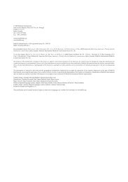
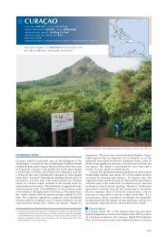
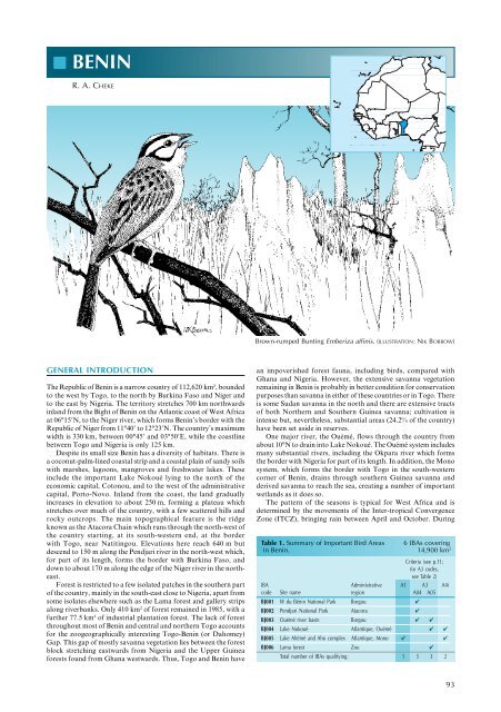
Brown-rumped Bunting Emberiza affinis. (ILLUSTRATION: NIK BORROW)<br />
an impoverished forest fauna, including birds, compared with<br />
Ghana and Nigeria. However, the extensive savanna vegetation<br />
remaining in Benin is probably in better condition for conservation<br />
purposes than savanna in either of these countries or in Togo. There<br />
is some Sudan savanna in the north and there are extensive tracts<br />
of both Northern and Southern Guinea savanna; cultivation is<br />
intense but, nevertheless, substantial areas (24.2% of the country)<br />
have been set aside in reserves.<br />
One major river, the Ouémé, flows through the country from<br />
about 10°N to drain into Lake Nokoué. The Ouémé system includes<br />
many substantial rivers, including the Okpara river which forms<br />
the border with Nigeria for part of its length. In addition, the Mono<br />
system, which forms the border with Togo in the south-western<br />
corner of Benin, drains through southern Guinea savanna and<br />
derived savanna to reach the sea, creating a number of important<br />
wetlands as it does so.<br />
The pattern of the seasons is typical for West Africa and is<br />
determined by the movements of the Inter-tropical Convergence<br />
Zone (ITCZ), bringing rain between April and October. During<br />
Table 1. Summary of Important Bird Areas 6 IBAs covering<br />
in Benin. 14,900 km 2<br />
Criteria (see p.11;<br />
for A3 codes,<br />
see Table 2)<br />
IBA Administrative A1 A3 A4i<br />
code Site name region A04 A05<br />
BJ001 W du Bénin National Park Borgou ✔<br />
BJ002 Pendjari National Park Atacora ✔<br />
BJ003 Ouémé river basin Borgou ✔ ✔<br />
BJ004 Lake Nokoué Atlantique, Ouémé ✔ ✔<br />
BJ005 Lake Ahémé and Aho complex Atlantique, Mono ✔ ✔<br />
BJ006 Lama forest Zou ✔<br />
Total number of IBAs qualifying: 1 3 3 2<br />
93
94<br />
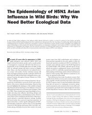
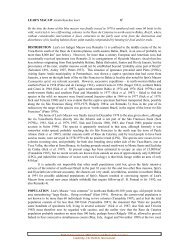
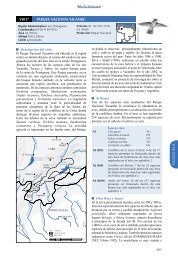
Map 1. Location and size of Important Bird Areas in Benin.<br />
BURKINA FASO<br />
0 75<br />
150<br />
TOGO<br />
km<br />
2<br />
the dry months, the Harmattan wind blows from the north, bringing<br />
hot, dry air almost to the coast.<br />
Much of the country, especially the coastal area, is densely<br />
populated (400 people/km² in parts of the south) but the north is<br />
only sparsely inhabited (up to 12 people/km²), with the country as<br />
a whole having 51 people/km². Administratively, the country is<br />
divided into 12 Départements and 77 Sous-préfectures. The<br />
population is increasing at 3% per annum and in 1992 numbered<br />
4,915,555, increasing to 5,786,000 by 1997. Staple foods include<br />
yams, cassava, beans, groundnuts, maize, sorghum, millet and rice.<br />
Much cotton is grown and there are some sugar plantations while<br />
coconuts and oil palms are cultivated on the coastal plain. Small<br />
quantities of coffee, cocoa and tobacco are also grown. Small<br />
ruminants and pigs are plentiful and there is some pastoralism with<br />
nomadic livestock in the north.<br />
ORNITHOLOGICAL IMPORTANCE<br />
5<br />
6<br />
There is, as yet, no definitive list of the birds of Benin, although a<br />
provisional one was published by Dowsett (1993) and another is in<br />
preparation by P. M. Claffey. Dowsett’s list rejected some<br />
apparently legitimate records and has been supplemented by more<br />
recent publications and unpublished data for the compilation of<br />
this account. Although it is a small country, and poorly studied<br />
ornithologically, at least 527 species of birds have been recorded.<br />
Four species of global conservation concern have been recorded,<br />
none of which is resident. Three, Circus macrourus (NT), Falco<br />
naumanni (VU) and Gallinago media (NT), are rare to uncommon<br />
Important Bird Areas in Africa and associated islands – Benin<br />
4<br />
3<br />
BIGHT OF <strong>BENIN</strong><br />
1<br />
NIGER<br />
NIGERIA<br />
Area of IBA (ha)<br />
100,000 to 999,999<br />
50,000 to 99,999<br />
10,000 to 49,999<br />
migrants from the Palearctic, while the fourth, Sterna balaenarum<br />
(NT), is a non-breeding visitor to the Benin coast from southern<br />
Africa. No species of restricted range have been recorded.<br />
Parts of two biomes occur in Benin. Almost all the country falls<br />
within the Sudan–Guinea Savanna biome (A04) and 34 species<br />
restricted to it have been recorded nationally. Small outliers,<br />
however, of the Guinea–Congo Forests biome (A05) are found in<br />
places, and 59 species of this biome are, so far, known to occur in<br />
the country. There are several wetlands important for waterbirds,<br />
mainly in coastal areas where several lakes are of significance for,<br />
in particular, migrant terns, e.g. Chlidonias niger.<br />
CONSERVATION INFRASTRUCTURE AND<br />
PROTECTED-AREA SYSTEM<br />
The first legislation covering protected zones was a French colonial<br />
decree of 1925, followed by forestry regulations defined by Decree<br />
no. 1704 AP of 1935 and Decree no. 1107/EFC of 1943, which<br />
provided for the establishment of classified forests and faunal<br />
reserves. These decrees were followed by Law no. 87-012 of 1987<br />
and Decree no. 89-385 of 1989. The bodies responsible for the<br />
administration of wildlife and environmental protection are the<br />
Direction des Forêts et des Ressources Naturelles (DFRN)<br />
(Department of Forests and Natural Resources), established in 1992<br />
by Decree no. 0020/MDR/DC/CC/CP, and the Centre National de<br />
Gestion des Réserves de Faune (CENAGREF) (National Centre<br />
for Wildlife Reserves Management), created in 1996 by Decree<br />
no. 96-73. The national legislative framework currently recognizes<br />
the following categories of protected area:<br />
•<br />
•<br />
•<br />
•<br />
Parc national—There are two National Parks covering<br />
843,500 ha, both well protected by legislation. The parks were<br />
created by Decree no. 009/SET of 1954 and supported by<br />
Ordinance no. 710141 of 1971, superseded by Law no. 87-014<br />
of 1987.<br />
Forêt classée—There are or were 45 Forest Reserves covering a<br />
total of 1,373,707 ha. Few Forest Reserves receive adequate<br />
protection and, currently, only 31 are believed extant.<br />
Zone de reboisement—There are seven Reforestation Zones,<br />
covering 2,567 ha.<br />
Zone cynégétique—Three Hunting Zones are currently<br />
recognized, totalling 510,00 ha. The regulation of hunting in<br />
sport hunting zones is covered by Decree no. 90-366, relating to<br />
the application of Law no. 87-014 concerning nature protection<br />
and hunting.<br />
INTERNATIONAL MEASURES RELEVANT TO THE<br />
CONSERVATION OF SITES<br />
Benin has ratified the Convention on Biological Diversity, the<br />
Ramsar Convention, the Convention on Migratory Species<br />
(including the African–Eurasian Waterbird Agreement), CITES,<br />
the World Heritage Convention, the Convention to Combat<br />
Desertification and the Convention on Climate Change. Benin also<br />
participates in UNESCO’s Man and Biosphere (MAB) programme,<br />
under which one site, the Boucle de la Pendjari National Park<br />
(275,500 ha), together with the Pendjari (200,000 ha) and Atakora<br />
(175,000 ha) Hunting Zones, has been declared a Biosphere Reserve.<br />
Regionally, Benin has also ratified the African Convention on the<br />
Conservation of Nature and Natural Resources.<br />
OVERVIEW OF THE INVENTORY<br />
This inventory identifies six Important Bird Areas (IBAs), covering<br />
14,900 km² or 13.2% of the land area of the country (Map 1,<br />
Table 1); all are protected to some degree. Most of the important<br />
habitat-types in Benin are included. All species of global<br />
conservation concern that are known from the country have been<br />
recorded at one or more of the sites, but only Sterna balaenarum is<br />
thought to occur in numbers sufficient to justify selection under<br />
the A1 criterion (Table 1).<br />
The sites include 29 of the 34 species of the Sudan–Guinea<br />
Savanna biome (A04) that are known from Benin and 47 of the
59 species of the Guinea–Congo Forests biome (A05) (Table 2).<br />
Most of Benin’s Guinea–Congo Forests biome species that are not<br />
included in the IBAs designated here were recorded by Brunel (1958)<br />
from Pobè forest, near the Nigerian border at 07°00’N 02°42’E;<br />
these records are supplemented by unpublished data from M. van<br />
den Akker. Pobè is a small forest remnant (150 ha) that includes<br />
35 ha reforested in 2000. It descends from a dry plateau to a lower<br />
more humid valley with its own water source forming a small stream.<br />
The forest belongs to an agricultural research station specializing<br />
in oil palms. Its vegetation includes Terminalia superba, Triplochiton<br />
scleroxylon, Chlorophora excelsa, Antiaris africana, Holoptelea<br />
Important Bird Areas in Africa and associated islands – Benin<br />
grandis and Piptadeniastrum africanum. This is an unprotected site,<br />
which has been recommended for reserve status. It is known to<br />
have suffered from poaching, timber clearance and conversion to<br />
exotic plantations, so further work is needed to determine whether<br />
it merits IBA status.<br />
The same applies to the equally small Niaouli forest (06°44’N<br />
02°09’E), which is in two distinct parts, the dry Plateau (90 ha plus<br />
20 ha reforestation) and the lower-lying Bas-fonds (25 ha plus 10 ha<br />
reforestation), where several springs form a small stream. Trees<br />
there include Musanga cecropioides, Ceiba pentandra, Antiaris<br />
toxicaria and Triplochiton scleroxylon, and Niaouli is one of the<br />
Table 2. The occurrence of biome-restricted species at Important Bird Areas in Benin. Sites that meet the A3 criterion are highlighted<br />
in bold.<br />
A04 – Sudan–Guinea Savanna biome (34 species in Benin; three sites meet the A3 criterion)<br />
IBA code: 001 002 003 004 005 006<br />
Falco alopex ✔<br />
Poicephalus senegalus ✔ ✔ ✔ ✔<br />
Musophaga violacea ✔ ✔ ✔<br />
Merops bulocki ✔ ✔ ✔<br />
Coracias cyanogaster ✔ ✔ ✔<br />
Lybius dubius ✔ ✔ ✔<br />
Galerida modesta<br />
Hirundo leucosoma ✔ ✔<br />
Corvinella corvina ✔ ✔ ✔ ✔ ✔<br />
Cossypha albicapilla ✔ ✔<br />
Myrmecocichla albifrons ✔<br />
Turdoides reinwardtii ✔ ✔<br />
Cisticola ruficeps<br />
Hypergerus atriceps ✔<br />
Eremomela pusilla ✔ ✔<br />
Anthoscopus parvulus ✔<br />
Nectarinia coccinigaster ✔ ✔ ✔ ✔<br />
Emberiza affinis<br />
A05 – Guinea–Congo Forests biome (59 species in Benin; three sites meet the A3 criterion)<br />
IBA code: 002 003 004 006 IBA No: 002 003 004 006<br />
Tigriornis leucolophus ✔<br />
Accipiter erythropus ✔ ✔<br />
Urotriorchis macrourus<br />
Francolinus ahantensis ✔ ✔<br />
Sarothrura pulchra ✔<br />
Columba iriditorques ✔<br />
Psittacus erithacus<br />
Tauraco persa ✔ ✔<br />
Merops malimbicus ✔ ✔<br />
Eurystomus gularis ✔<br />
Tockus albocristatus ✔<br />
Tockus fasciatus ✔ ✔ ✔<br />
Tockus camurus ✔<br />
Ceratogymna fistulator ✔<br />
Ceratogymna subcylindricus ✔<br />
Ceratogymna albotibialis ✔<br />
Pogoniulus scolopaceus<br />
Dendropicos pyrrhogaster ✔<br />
Hirundo nigrita<br />
Psalidoprocne obscura ✔ ✔<br />
Andropadus curvirostris ✔<br />
Chlorocichla simplex ✔<br />
Thescelocichla leucopleura<br />
Criniger calurus<br />
Phyllastrephus scandens ✔<br />
Phyllastrephus albigularis ✔ ✔<br />
Bleda syndactyla ✔<br />
Bleda canicapilla ✔<br />
Nicator chloris ✔ ✔<br />
Dryoscopus sabini<br />
IBA code: 001 002 003 004 005 006<br />
Nesocharis capistrata ✔<br />
Pytilia phoenicoptera ✔ ✔ ✔<br />
Pytilia hypogrammica ✔<br />
Lagonosticta rufopicta ✔ ✔<br />
Lagonosticta rara<br />
Lagonosticta larvata ✔<br />
Estrilda caerulescens ✔ ✔ ✔<br />
Estrilda troglodytes ✔ ✔<br />
Vidua interjecta ✔<br />
Vidua togoensis ✔<br />
Petronia dentata ✔ ✔<br />
Plocepasser superciliosus<br />
Ploceus heuglini ✔ ✔<br />
Lamprotornis purpureus ✔ ✔ ✔ ✔<br />
Lamprotornis chalcurus ✔<br />
Ptilostomus afer ✔ ✔ ✔ ✔ ✔<br />
Number of species recorded: 16 20 20 5 3 2<br />
Prionops caniceps ✔<br />
Stiphrornis erythrothorax ✔<br />
Illadopsis puveli ✔<br />
Illadopsis fulvescens ✔<br />
Phyllanthus atripennis ✔<br />
Apalis rufogularis ✔<br />
Camaroptera chloronota ✔<br />
Sylvietta virens ✔<br />
Macrosphenus concolor<br />
Hylia prasina ✔<br />
Fraseria ocreata ✔<br />
Muscicapa cassini ✔<br />
Bias flammulatus ✔<br />
Platysteira castanea ✔<br />
Terpsiphone rufiventer ✔ ✔<br />
Nectarinia fuliginosa<br />
Nectarinia adelberti<br />
Nigrita fusconota ✔<br />
Nigrita bicolor<br />
Spermophaga haematina ✔<br />
Ploceus nigerrimus ✔ ✔<br />
Ploceus tricolor ✔<br />
Malimbus scutatus ✔<br />
Malimbus nitens ✔<br />
Malimbus rubricollis ✔ ✔<br />
Onychognathus fulgidus ✔<br />
Lamprotornis purpureiceps ✔<br />
Oriolus brachyrhynchus ✔<br />
Oriolus nigripennis<br />
Number of species recorded: 2 16 7 34<br />
95
few remaining sites in Benin with Entandrophragma angolense. The<br />
forest is an ecological island surrounded by an intensively used<br />
agricultural landscape, posing threats given its high population<br />
density (274 people/km²). It retains many forest-biome species (van<br />
den Akker 2000, M. van den Akker in litt.). Other areas which may<br />
also deserve to become IBAs include Lokoli forest, the delta of the<br />
Mono river, which has sandbanks and mangrove habitats<br />
downstream of an extensive wetland area bordering the river, and<br />
the Forêt des Trois Rivières Classified Forest (10°31’N 03°15’E;<br />
259,500 ha). More detailed surveys of existing IBAs are also required.<br />
96<br />
■ SITE ACCOUNTS<br />
W du Bénin National Park BJ001<br />
Admin region Borgou<br />
Coordinates 11°55’N 02°45’E A3 (A04)<br />
Area 598,000 ha Altitude 160–320 m National Park<br />
■ Site description<br />
The W du Bénin National Park, in the extreme north of the country,<br />
is part of an extensive network of contiguous transboundary protected<br />
areas, including the W National Park in Niger (IBA NE001) and the<br />
Arli–W–Singou complex in Burkina Faso (BF008). The park includes<br />
extensive areas of Sudan savanna vegetation, and important riparian<br />
habitats along stretches of the Mékrou and Alibori rivers, both major<br />
tributaries of the Niger river, which form, respectively, the western<br />
and eastern boundaries of the park. There is a narrow neck of land<br />
outside the park separating its north-eastern boundary from the Niger<br />
river itself. This area is, however, included within the IBA, thereby<br />
capturing the perennial marshy areas that fringe the Niger. Both the<br />
Alibori and Mékrou rivers are seasonal, although some pools of<br />
stagnant water usually remain within the beds of both in the dry season.<br />
The Mékrou river, which also marks the international frontier with<br />
Burkina Faso for much of its length, is 10–20 m wide and 2–3 m deep<br />
at the height of the wet season, September, and usually dries up by<br />
December.<br />
Habitat includes riverine forest with a dense understorey and a nearly<br />
closed canopy, with patches of shrubland and woodland. Trees present<br />
include Diospyros mespiliformis, Ficus sp., Daniella sp., Cola sp. and<br />
scattered Borassus aethiopum palms. Mimosa pigra is common in the<br />
riverine scrub. The Sudan savanna includes Acacia spp., Terminalia sp.<br />
and Combretum spp. and grasslands of Hyparrhenia involucrata and<br />
Andropogon gayanus. There is a spectacular gorge through which the<br />
Mékrou runs near its confluence with the River Niger. The terrain of<br />
the northern part of the park is more broken with numerous outcrops,<br />
but the highest point of 320 m is in the south of the park.<br />
■ Birds<br />
See Box and Table 2 for key species. Falco naumanni has been recorded<br />
occasionally between January and March. The reserve harbours a<br />
representative community of Northern Guinea savanna and Sudan<br />
savanna species, while the course of the Niger river is important for<br />
wetland birds such as Ardea goliath, A. cinerea, Ciconia abdimii,<br />
Plegadis falcinellus and Balearica pavonina. Other species of note are<br />
Trigonoceps occipitalis (breeding), Terathopius ecaudatus, Scotopelia<br />
peli and, along the banks of the Mékrou, several large colonies of<br />
Merops nubicus, occupied during January and February.<br />
Key species<br />
A3 (A04) Sudan–Guinea Savanna biome: 16 of the 34 species of this biome that occur<br />
in Benin have been recorded at this site; see Table 2.<br />
■ Other threatened/endemic wildlife<br />
Among mammals, the park is host to the most important savanna<br />
population of Loxodonta africana (EN) in West Africa, as well as<br />
populations of Panthera leo (VU) and Acinonyx jubatus (VU). Damaliscus<br />
lunatus korrigum (LR/cd) has been seen in the park and Trichechus<br />
senegalensis (VU) may occur in the Niger close to or within the IBA.<br />
■ Conservation issues<br />
The park was established in 1936 and notified in 1954. Legitimate<br />
insecticide use (spraying with Endosulphan to control tsetse) was tested<br />
Important Bird Areas in Africa and associated islands – Benin<br />
ACKNOWLEDGEMENTS<br />
Patrick Claffey, Ward Hagemeijer and Dr J. Frank Walsh each supplied<br />
valuable information relevant to more than one of the proposed IBAs, and the<br />
Lama forest account is based on the work of M. Waltert and M. Muhlenberg.<br />
Maarten and Elizabeth van den Akker commented on early drafts and provided<br />
additional material, especially on the southern forest sites. M. Jacques Boco<br />
Adjakpa of the Centre de Recherche Ornithologique et de l’Environnement<br />
also commented on an early draft and provided extra data. I am also grateful<br />
to Dr L. D. C. Fishpool for his comments.<br />
in the late 1970s, with adverse effects on the fauna of the Mékrou<br />
river, which probably also affected birds. Poaching occurs. Plans for<br />
the possible construction of dams on the Niger and Mékrou rivers<br />
and for phosphate mining could, if implemented, have severe<br />
environmental consequences. There is continuous encroachment by<br />
subsistence farmers and nomadic pastoralists leading to vegetation<br />
degradation and competition for grazing between livestock and wild<br />
herbivores.<br />
■ Further reading<br />
Koster and Grettenberger (1983), Sayer and Green (1984), WCMC (1993).<br />
Pendjari National Park BJ002<br />
Admin region Atacora<br />
Coordinates 11°15’N 01°30’E A3 (A04)<br />
Area 275,500 ha National Park,<br />
Altitude 160–423 m Biosphere Reserve<br />
■ Site description<br />
The Boucle de Pendjari National Park is situated in the north-west of<br />
the country, against the international frontier with Burkina Faso,<br />
where it is contiguous with the Arli–W–Singou protected area complex<br />
(IBA BF008). The south-eastern boundary of the park is formed by<br />
the quartzite cliffs of the Atacora Hills. The park itself is flat (c.175 m),<br />
apart from the Buém hills in the east, which reach 423 m, and a second<br />
group of hills to the south-west. The park is bounded on three sides<br />
by the perennial Pendjari river, which rises in the Atacora Hills south<br />
of the park, before draining into the Oti river which flows into Togo<br />
and Ghana. The course of the Pendjari along the northern edge of the<br />
park forms the international border with Burkina Faso. The main<br />
habitats include Sudan and Northern Guinea savannas. There are<br />
extensive areas of open grasslands dominated by Acacia sieberiana<br />
and Mitragyna inermis or by Terminalia macroptera. There is good<br />
gallery forest, the Bondjago forest, beside the Pendjari river at the<br />
base of the Atacora Hills, and the river is fringed elsewhere by Parinari<br />
congensis, Cola laurifolia, Syzygium guineense and Pterocarpus<br />
santalinoides. Marshy areas occur next to the river where there are<br />
also stands of Borassus aethiopum, Daniella oliveri, Anogeissus<br />
leiocarpus and Terminalia spp. Average annual rainfall is c.1,100 mm.<br />
■ Birds<br />
See Box and Table 2 for key species. Circus macrourus and Falco<br />
naumanni are occasionally recorded and two species of the Guinea–<br />
Congo Forests biome (A05) also occur (see Table 2). Pendjari is<br />
notable for large, conspicuous species such as Anastomus lamelligerus,<br />
Ephippiorhynchus senegalensis, Ciconia abdimii, Neotis denhami and,<br />
seasonally, flocks of up to 60 Ciconia ciconia. In addition, Terathopius<br />
ecaudatus and Haliaeetus vocifer breed in trees along the Pendjari river,<br />
where Scotopelia peli has also been seen.<br />
Key species<br />
A3 (A04) Sudan–Guinea Savanna biome: 20 of the 34 species of this biome that occur<br />
in Benin have been recorded at this site; see Table 2.<br />
■ Other threatened/endemic wildlife<br />
Mammals of global conservation concern include Panthera leo (VU),<br />
Acinonyx jubatus (VU), Loxodonta africana (EN), Damaliscus lunatus<br />
korrigum (LR/cd) and Cephalophus rufilatus (LR/cd).
■ Conservation issues<br />
The Boucle de Pendjari National Park, created in 1961, is part of the<br />
Pendjari Biosphere Reserve (880,000 ha), which also includes the Pendjari<br />
and Atacora hunting zones, and Arli National Park in Burkina Faso.<br />
Although the terrestrial parts of the park are well protected, poachers<br />
have been known to poison waters with insecticides, such as Endrin, to<br />
obtain fish illegally. Fires and climatic desiccation have depleted animal<br />
populations in the past, as have hunting by poachers and encroachment<br />
by cattle-grazing, but park management has improved.<br />
■ Further reading<br />
Green and Sayer (1979), Sayer and Green (1984), Thonnerieux (1985), WCMC<br />
(1993).<br />
Ouémé river basin BJ003<br />
Admin region Borgou<br />
Coordinates 09º09’N 02º25’E A3 (A04, A05)<br />
Area 465,342 ha Altitude 150–620 m Forest Reserves<br />
■ Site description<br />
This site is a diverse area in the centre of the country, comprising the<br />
three contiguous forest reserves of the Forêt Classée de l’Ouémé<br />
Supérieur (09º35’N 02º30’E; 177,542 ha), the Forêt Classée de Ouari-<br />
Maro (09º09’N 02º25’E; 107,500 ha) and the Forêt Classée des Monts<br />
Kouffé (08º45’N 02º06’E; 180,300 ha). The former two straddle the<br />
Ouémé river west and south-west of the town of Parakou, and are<br />
separated from each other by the Parakou–Natitingou road, while the<br />
latter is to the south of these, with the Ouémé river forming its eastern<br />
boundary and the Adjiro river its southern and western borders.<br />
The area is within the Northern Guinea savanna zone and the main<br />
vegetation-types include savanna woodland up to 20 m high, with a<br />
dense understorey dominated by Afzelia africana, Daniella oliveri and<br />
Khaya senegalensis, and dense semi-deciduous forest, occurring in small<br />
patches in the western part of Monts Kouffé Forest Reserve towards<br />
the border with Togo and in the Monts Kouffé themselves in the centre<br />
of the reserve, and consisting of tall trees up to 40 m high (Antiaris<br />
africana, Ceiba pentandra, Cola cordifolia, Milicia excelsa and<br />
Ricinodendron heudelotii) over a subcanopy layer dominated by Dialium<br />
guineensis, Mimusops andongensis, Holarrhena floribunda, Drypetes<br />
floribunda and Malacantha alnifolia. Similar vegetation forms gallery<br />
forest along rivers and thinner riverine forest also occurs. In addition,<br />
the IBA encompasses rocky outcrops, small ponds and marshes next to<br />
the Ouémé river. Average annual rainfall is 1,200 mm, mostly falling<br />
between May and October.<br />
■ Birds<br />
See Box and Table 2 for key species. The area is important due to its<br />
large size and relatively undisturbed habitat. It is one of the few places<br />
in the country where Ceratogymna albotibialis occurs and is a refuge<br />
for many of the rarer birds of prey (e.g. Haliaeetus vocifer) and<br />
passerines. Circus macrourus has been recorded occasionally in January<br />
and November. The area has yet to be surveyed comprehensively.<br />
Key species<br />
A3 (A04) Sudan–Guinea Savanna biome: 20 of the 34 species of this biome that occur<br />
in Benin have been recorded at this site; see Table 2.<br />
A3 (A05) Guinea–Congo Forests biome: 16 of the 59 species of this biome that occur<br />
in Benin have been recorded at this site; see Table 2.<br />
■ Other threatened/endemic wildlife<br />
Mammals of global conservation concern include Cephalophus<br />
maxwelli (LR/nt), C. silvicultor (LR/nt) and C. rufilatus (LR/cd). The<br />
IBA includes the type-locality, and the only one known in Benin, for<br />
the grasshopper Truxaloides chekei.<br />
■ Conservation issues<br />
A recent influx of people is leading to encroachment by slash and<br />
burn farmers who are cutting savanna woodland; small logging<br />
companies are also working in the area. Agricultural intensification<br />
and use of fertilizers and pesticides are increasing.<br />
■ Further reading<br />
Claffey (1995, 1999a,b).<br />
Important Bird Areas in Africa and associated islands – Benin<br />
Lake Nokoué BJ004<br />
Admin region Atlantiqu, Ouémé<br />
Coordinates 06°45’N 02°23’E A3 (A05), A4i<br />
Area c.90,000 ha Altitude 0–10 m Ramsar Site (Unprotected)<br />
■ Site description<br />
Lake Nokoué is an extensive lagoon of c.16,000 ha extent, 20 km wide<br />
by 11 km long (north to south), immediately north of Cotonou. Its<br />
northern shore is formed by the deltas of the So and Ouémé rivers. It<br />
is connected to the sea not only via a channel through Cotonou, but<br />
also by another to the Lagune de Porto-Novo to the east and thence<br />
to the coast in Nigeria. On the western edge is the remarkable aquatic<br />
town of Ganvié, built on stilts made of bamboo or tree-trunks<br />
sunk into the water. The southern edge of the lake has the highest<br />
salinity, and is fringed with Typha australis as well as the ubiquitous<br />
grass Paspalum vaginatum. The proposed IBA includes not only<br />
the lake itself but also the seasonally inundated forest (Berlinia<br />
grandiflora and Dalium guineense), swamp-forest (Mitragyna inermis<br />
and Raphia hookeri), marshes and flood-plains of rivers north of it,<br />
up the Ouémé river as far as the village of Sagon, 10 km south-east of<br />
Zangnanado.<br />
■ Birds<br />
See Box and Table 2 for key species. Large populations of waterbirds<br />
use the lake and surrounding areas. These include, in addition to those<br />
listed below, Egretta ardesiaca, E. garzetta, Tringa glareola, T.<br />
stagnatilis, T. nebularia, T. erythropus and Chlidonias hybridus. There<br />
is also a record of Gallinago media. It is expected that more species of<br />
the Guinea–Congo Forests biome will be found to occur. In addition,<br />
five species of the Sudan–Guinea Savanna biome (A04) have been<br />
recorded; see Table 2.<br />
Key species<br />
A3 (A05) Guinea–Congo Forests biome: Seven of the 59 species of this biome that<br />
occur in Benin have been recorded at this site; see Table 2.<br />
A4i Breeding (pairs) Non-breeding<br />
Anastomus lamelligerus — 1,020 (1996)<br />
Chlidonias niger — 2,451 (1997)<br />
■ Other threatened/endemic wildlife<br />
Small numbers of Tragelaphus spekii (LR/nt) are thought to persist<br />
but hunting pressure is intense. There are also records of Cercopithecus<br />
erythrogaster (VU) and Trichechus senegalensis (VU).<br />
■ Conservation issues<br />
Much of the area was declared a Ramsar Site, known as Basse Vallée<br />
de l’Ouémé, Lagune de Porto-Novo, Lac Nokoué and covering<br />
91,600 ha, in January 2000. Threats include hunting, poaching,<br />
pollution, mangrove destruction and deforestation. Traditional fishing<br />
methods may, however, benefit birds. Fishermen plant branches in<br />
the muddy lagoon bottom, surrounded by platforms of bamboo sticks<br />
and palm-leaves. When the leaves on the branches start to decompose,<br />
fish congregate to feed at these sites, known as acadja, before boatmen<br />
(and birds) return to catch them.<br />
■ Further reading<br />
Brunel (1958), Hagemeijer et al. (2000a,b), Wetlands <strong>International</strong> (1997, 1998).<br />
Lake Ahémé and Aho complex BJ005<br />
Admin region Atlantiqu, Mono<br />
Coordinates 06°30’N 01°57’E A1, A4i<br />
Area 45,000 ha Altitude 0–10 m Ramsar Site (Unprotected)<br />
■ Site description<br />
This triangular area, in the south-west of the country, comprises the<br />
marshes of the lower Kouffo river, Lake Ahémé, into which the river<br />
drains, and the ‘Aho complex’ consisting of marshes beside the Aho<br />
river, which carries water from the lake to the sea, and the coastal<br />
strip between the towns of Grand-Popo to the west and Ouidah to the<br />
east. The south of Lake Ahémé is fringed with Typha australis and<br />
the Aho supports mangroves (Rhizophora sp. and Avicennia sp.),<br />
maintained by seasonal influxes of brackish water.<br />
97
■ Birds<br />
See Box for key species. The records of Sterna balaenarum come from<br />
the Bouche du Roi, part of the Aho delta where there is a channel to<br />
the sea. Large flocks of Chlidonias niger forage on the lake. In addition,<br />
three species of the Sudan–Guinea Savanna biome (A04) have also<br />
been recorded; see Table 2.<br />
Key species<br />
A1 Sterna balaenarum<br />
A4i Breeding (pairs) Non-breeding<br />
Sterna maxima — 502 (1996)<br />
Sterna balaenarum — 200<br />
■ Other threatened/endemic wildlife<br />
The fish Trichechus senegalensis (VU) was reported from Lake Ahémé<br />
in the mid-1970s.<br />
■ Conservation issues<br />
The area was declared a Ramsar Site in January 2000. Threats include<br />
hunting, pollution, mangrove destruction and deforestation but some<br />
human activities, particularly the building of platforms for fishing,<br />
are beneficial to many piscivorous birds.<br />
■ Further reading<br />
Hagemeijer et al. (2000a,b), Wetlands <strong>International</strong> (1998).<br />
Lama forest BJ006<br />
Admin region Zou<br />
Coordinates 06°57’N 02°08’E A3 (A05)<br />
Area 16,250 ha Altitude 50–60 m Forest Reserve<br />
■ Site description<br />
The Forêt Classée de la Lama (also known as the Forêt de Ko), in the<br />
centre-south of the country, south of the city of Abomey, used to<br />
BIBLIOGRAPHY<br />
BRUNEL, J. (1958) Observations sur les oiseaux du Bas-Dahomey. L’Oiseaux<br />
et R.F.O. 28: 1–38.<br />
CLAFFEY, P. M. (1995) Notes on the avifauna of the Bétérou area, Borgou<br />
Province, Republic of Benin. Malimbus 17: 63–84.<br />
CLAFFEY, P. M. (1999a) Crowned Eagle Stephanoaetus coronatus and Whitebreasted<br />
Negro-Finch Nigrita fusconota, new to the Benin list. Malimbus<br />
21: 51–53.<br />
CLAFFEY, P. M. (1999b) Occurrence of Red-billed Dwarf Hornbill Tockus<br />
camurus in the Republic of Benin. Bull. African Bird Club 6: 107–108.<br />
DOWSETT, R. J. (1993) Afrotropical avifaunas: annotated country checklists.<br />
Pp. 1–322 in R. J. Dowsett and F. Dowsett-Lemaire, eds. A contribution to<br />
the distribution and taxonomy of Afrotropical and Malagasy birds. Liège,<br />
Belgium: Tauraco (Research Report No. 5).<br />
GREEN, A. A. AND SAYER, J. (1979) The birds of Pendjari and Arli National<br />
Parks (Benin and Upper Volta). Malimbus 1: 14–28.<br />
HAGEMEIJER, E. J. M, POOT, M. J. M. AND ADJAKPA, J. B. (2000a) Waterbird<br />
survey of wetlands in south Benin, 1996, 1997 and 1998. SOVONonderzoeksrapport<br />
2000/03. Beek-Ubbergen, The Netherlands: SOVON<br />
Vogelonderzoek.<br />
HAGEMEIJER, E. J. M, VAN DER WINDEN, J., ADJAKPA, J. B. AND BOKO, G.<br />
(2000b) Black Terns Chlidonias niger in Benin: Mission in the framework<br />
of the support of SOVON for CEROE. SOVON-onderzoeksrapport<br />
2000/07. Beek-Ubbergen, The Netherlands: SOVON Vogelonderzoek.<br />
98<br />
Important Bird Areas in Africa and associated islands – Benin<br />
comprise 16,000 ha of natural forest but by 1986, when a core area<br />
was designated for special protection, the amount of intact forest had<br />
been reduced to 2,400 ha. This core area of 4,500 ha, known as the<br />
Noyau Central, includes within it the remaining dense forest (now<br />
only 1,800 ha) with Afzelia africana, Bombax buonopozense, Ceiba<br />
pentandra and Parinari excelsa. Lama forest lies in an east–west<br />
oriented depression, the clay soils of which permit flooding of extensive<br />
areas in the wet season. This flooding is inimical to some tree species<br />
and their absence may account for a scarcity of frugivorous bird species<br />
in the forest. The Noyau Central is an ecological island surrounded<br />
by degraded forest, plantations of teak (Tectonia grandis), tree-less<br />
bush dominated by Chromolaena odorata and farmland.<br />
■ Birds<br />
See Box and Table 2 for key species. To date, 106 species have been<br />
recorded, many of which are species of the Guinea–Congo Forests<br />
biome, such as Sarothrura pulchra, Phyllastrephus albigularis, Bleda<br />
syndactyla, B. canicapilla, Illadopsis puveli, Apalis rufogularis and<br />
Fraseria ocreata. The forest also supports a population of Guttera<br />
pucherani. Further surveys will undoubtedly lead to the discovery of<br />
more forest species. In addition, two species of the Sudan–Guinea<br />
Savanna biome (A04) have also been recorded; see Table 2.<br />
Key species<br />
A3 (A05) Guinea–Congo Forests biome: 34 of the 59 species of this biome that occur<br />
in Benin have been recorded at this site; see Table 2.<br />
■ Other threatened/endemic wildlife<br />
Cephalophus silvicultor (LR/cd) has been recorded.<br />
■ Conservation issues<br />
Threats include continuing degradation of the surrounding forest,<br />
encroaching farmland and, probably, poaching, burning and logging.<br />
■ Further reading<br />
Waltert and Mühlenberg (1999).<br />
IUCN (1991) Protected areas of the world. A review of national systems.<br />
Volume 3: Afrotropical. Gland, Switzerland: IUCN.<br />
KOSTER, S. H. AND GRETTENBERGER, J. F. (1983) A preliminary survey of<br />
birds in Park W, Niger. Malimbus 5: 62–72.<br />
MARTIN, C. (1991) The Rainforests of West Africa. Ecology—Threats—<br />
Conservation. Basle, Switzerland: Birkhäuser Verlag.<br />
SAYER, J. AND GREEN, A. A. (1984) The distribution and status of large<br />
mammals in Benin. Mammal Review 14: 37–50.<br />
THONNERIEUX, Y. (1985) Notes complémentaires sur l’avifaune des<br />
Parcs Nationaux de l’Arli (Burkina) et de la Pendjari (Benin). Malimbus 7:<br />
137–139.<br />
VAN DEN AKKER, M. (2000) Red-tailed Greenbul Criniger calurus and Chestnutbreasted<br />
Negrofinch Nigrita bicolor, new to Benin. Bull. African Bird Club 7:<br />
133.<br />
WALTERT, M. AND MUHLENBERG, M. (1999) Notes on the avifauna of the Noyau<br />
Central, Forêt Classée de la Lama, Republic of Benin. Malimbus 21: 82–92.<br />
WETLANDS INTERNATIONAL (1997) African Waterfowl Census 1996. Dakar,<br />
Senegal: Wetlands <strong>International</strong>.<br />
WETLANDS INTERNATIONAL (1998) African Waterfowl Census 1997. Dakar,<br />
Senegal: Wetlands <strong>International</strong>.<br />
WCMC [WORLD CONSERVATION MONITORING CENTRE] (1993) Ecologically<br />
sensitive sites in Africa. Vol. 1. Occidental and Central Africa.<br />
Washington, D.C.: The World Bank.