

Vegetation Classification and Mapping Project Report - USGS
Vegetation Classification and Mapping Project Report - USGS
Vegetation Classification and Mapping Project Report - USGS

Create successful ePaper yourself
Turn your PDF publications into a flip-book with our unique Google optimized e-Paper software.
National Park Service<br />
U.S. Department of the Interior<br />
Northeast Region<br />
Philadelphia, Pennsylvania<br />
<strong>Vegetation</strong> <strong>Classification</strong> <strong>and</strong> <strong>Mapping</strong> at<br />
Colonial National Historical Park, Virginia<br />
Technical <strong>Report</strong> NPS/NER/NRTR—2008/129
<strong>USGS</strong>-NPS <strong>Vegetation</strong> <strong>Mapping</strong> Program<br />
Colonial National Historical Park<br />
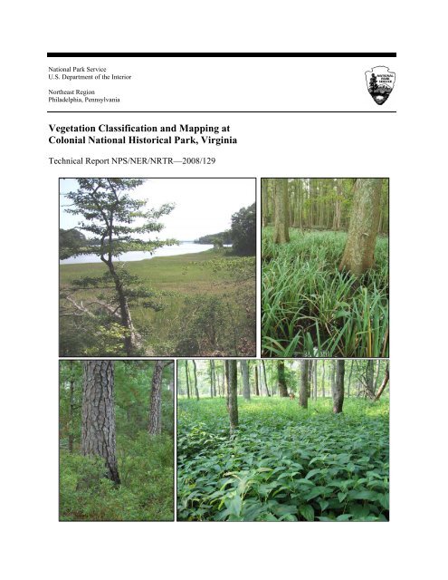
ON THE COVER<br />
Upper left: Tidal Mesohaline <strong>and</strong> Polyhaline Marsh; photograph by Karen D. Patterson. Upper right: Tidal Bald Cypress Forest<br />
/ Woodl<strong>and</strong>. Lower left: Coastal Plain Loblolly Pine – Oak Forest. Lower right: Coastal Plain / Piedmont Floodplain Swamp<br />
Forest (Green Ash – Red Maple Type). Photographs by Gary P. Fleming.<br />
2
<strong>USGS</strong>-NPS <strong>Vegetation</strong> <strong>Mapping</strong> Program<br />
Colonial National Historical Park<br />
<strong>Vegetation</strong> <strong>Classification</strong> <strong>and</strong> <strong>Mapping</strong> at<br />
Colonial National Historical Park, Virginia<br />
Technical <strong>Report</strong> NPS/NER/NRTR—2008/129<br />
Karen D. Patterson<br />
Virginia Department of Conservation <strong>and</strong> Recreation<br />
Division of Natural Heritage<br />
217 Governor Street, 3 rd Floor<br />
Richmond, VA 23219<br />
June 2008<br />
U.S. Department of the Interior<br />
National Park Service<br />
Northeast Region<br />
Philadelphia, Pennsylvania<br />
3
<strong>USGS</strong>-NPS <strong>Vegetation</strong> <strong>Mapping</strong> Program<br />
Colonial National Historical Park<br />
The Northeast Region of the National Park Service (NPS) comprises national parks <strong>and</strong> related areas in 13 New<br />
Engl<strong>and</strong> <strong>and</strong> mid-Atlantic states. The diversity of parks <strong>and</strong> their resources are reflected in their designations as<br />
national parks, seashores, historic sites, recreation<br />
areas, military parks, monuments <strong>and</strong> memorials, <strong>and</strong> rivers <strong>and</strong><br />
trails. Biological, physical, <strong>and</strong> social science research results, natural resource inventory <strong>and</strong> monitoring data,<br />
scientific literature reviews, bibliographies, <strong>and</strong> proceedings of technical workshops <strong>and</strong> conferences related to these<br />
park units are disseminated through the NPS/NER Technical <strong>Report</strong> (NRTR) <strong>and</strong> Natural Resources <strong>Report</strong> (NRR)<br />
series. The reports are a continuation of series with previous acronyms of NPS/PHSO, NPS/MAR, NPS/BSO-RNR,<br />
<strong>and</strong> NPS/NERBOST. Individual parks may also disseminate information through their own report series.<br />
Natural Resources <strong>Report</strong>s are the designated medium for information on technologies <strong>and</strong> resource management<br />
methods; "how to" resource management papers; proceedings of resource management workshops or conferences;<br />
<strong>and</strong> natural resource program descriptions <strong>and</strong> resource action plans.<br />
Technical <strong>Report</strong>s are the designated medium for initially disseminating data <strong>and</strong> results of biological, physical, <strong>and</strong><br />
social science research that addresses natural resource management issues; natural resource inventories <strong>and</strong><br />
monitoring activities; scientific literature reviews; bibliographies; <strong>and</strong> peer-reviewed proceedings of technical<br />
workshops, conferences, or symposia.<br />
Mention of trade names or commercial products does not constitute endorsement or recommendation for use by the<br />
National Park Service.<br />
This report was accomplished under Cooperative Agreement 400089027, Supplemental Agreement No. 5, with<br />
assistance from the NPS. The statements, findings, conclusions, recommendations, <strong>and</strong> data in this report are solely<br />
those of the author(s), <strong>and</strong> do not necessarily reflect the views of the U.S. Department of the Interior, National Park<br />
Service.<br />
Print copies of reports in these series, produced in limited quantity <strong>and</strong> only available as long as the supply lasts, or<br />
preferably, file copies on CD, may be obtained by sending a request to the address on the back cover. Print copies<br />
also may be requested from the NPS Technical Information Center (TIC), Denver Service Center, PO Box 25287,<br />
Denver, CO 80225-0287. A copy charge may be involved. To order from TIC, refer to document D-340<br />
This report may also be available as a downloadable portable document format file from the Internet at<br />
http://www.nps.gov/nero/science/.<br />
Please cite this publication as:<br />
Patterson, K. D. 2008. <strong>Vegetation</strong> <strong>Classification</strong> <strong>and</strong> <strong>Mapping</strong> at Colonial National Historical Park, Virginia.<br />
Technical <strong>Report</strong> NPS/NER/NRTR—2008/129. National Park Service. Philadelphia, PA.<br />
NPS D-340 June 2008<br />
4
<strong>USGS</strong>-NPS <strong>Vegetation</strong> <strong>Mapping</strong> Program<br />
Colonial National Historical Park<br />
Table of Contents<br />
Figures ............................................................................................................................................ 7<br />
Tables ............................................................................................................................................. 8<br />
Appendixes .................................................................................................................................. 10<br />
Contacts <strong>and</strong> Contributors ............................................................................................................ 11<br />
Acknowledgments ........................................................................................................................ 13<br />
Summary ...................................................................................................................................... 14<br />
Introduction .................................................................................................................................. 16<br />
Page<br />
General Background ........................................................................................................... 16<br />
Park-specific Information ................................................................................................... 19<br />
<strong>Project</strong> Area ................................................................................................................................. 21<br />
Location <strong>and</strong> Regional Setting ............................................................................................ 21<br />
Park Environmental Attributes ............................................................................................ 24<br />
Methods ........................................................................................................................................ 26<br />
<strong>Project</strong> Scoping <strong>and</strong> Planning ............................................................................................. 26<br />
Preliminary Data Collection <strong>and</strong> Review of Existing Information ..................................... 26<br />
Aerial Photography Acquisition <strong>and</strong> Processing ................................................................ 27<br />
Preliminary Photointerpretation .......................................................................................... 27<br />
Field Data Collection .......................................................................................................... 28<br />
<strong>Vegetation</strong> <strong>Classification</strong> <strong>and</strong> Characterization .................................................................. 32<br />
<strong>Vegetation</strong> Map Preparation ............................................................................................... 38<br />
Accuracy Assessment ......................................................................................................... 39<br />
Metadata Preparation .......................................................................................................... 47<br />
5
<strong>USGS</strong>-NPS <strong>Vegetation</strong> <strong>Mapping</strong> Program<br />
Colonial National Historical Park<br />
Table of Contents (continued)<br />
Results .......................................................................................................................................... 50<br />
Page<br />
Field Surveys ....................................................................................................................... 50<br />
<strong>Vegetation</strong> <strong>Classification</strong> <strong>and</strong> Characterization .................................................................. 50<br />
<strong>Vegetation</strong> Community Descriptions <strong>and</strong> Map Classes ...................................................... 59<br />
Accuracy Assessment ......................................................................................................... 62<br />
<strong>Vegetation</strong> Map Production ................................................................................................ 67<br />
<strong>Project</strong> Deliverables ............................................................................................................ 67<br />
Discussion .................................................................................................................................... 75<br />
<strong>Vegetation</strong> <strong>Classification</strong> <strong>and</strong> Characterization .................................................................. 75<br />
<strong>Vegetation</strong> Map Production ................................................................................................ 83<br />
Recommendations for Future <strong>Project</strong>s ................................................................................ 83<br />
Literature Cited ............................................................................................................................ 85<br />
6
<strong>USGS</strong>-NPS <strong>Vegetation</strong> <strong>Mapping</strong> Program<br />
Colonial National Historical Park<br />
Figures<br />
Figure 1. Location of Colonial National Historical Park (COLO),<br />
Virginia. ....................................................................................................................................... 20<br />
Figure 2. Physiographic provinces of Virginia showing the location of<br />
Colonial National Historical Park. ............................................................................................... 22<br />
Figure 3. Location of Colonial National Historical Park (COLO),<br />
Virginia, on seven 1:24000 <strong>USGS</strong> topographic quadrangle maps. ............................................. 23<br />
Figure 4. Ground control points used to calculate horizontal positional<br />
accuracy of the Colonial National Historical Park leaf-on (fall) mosaics. .................................. 40<br />
Figure 5. Ground control points used to calculate horizontal positional<br />
accuracy of the Colonial National Historical Park leaf-off (spring)<br />
mosaics. ........................................................................................................................................ 41<br />
Figure 6. Locations of thematic accuracy assessment sampling points in<br />
the eastern half of Colonial National Historical Park. ................................................................. 45<br />
Figure 7. Locations of thematic accuracy assessment sampling points in<br />
the western half of Colonial National Historical Park. ................................................................ 46<br />
Figure 8. Locations of quantitative vegetation plots in the eastern half of<br />
Colonial National Historical Park. ............................................................................................... 51<br />
Figure 9. Locations of quantitative vegetation plots in the western half of<br />
Colonial National Historical Park. ............................................................................................... 52<br />
Figure 10. <strong>Vegetation</strong> <strong>and</strong> Anderson Level II classes for Colonial<br />
National Historical Park, Yorktown Battlefield north to Bellfield<br />
Plantation. .................................................................................................................................... 68<br />
Figure 11. <strong>Vegetation</strong> <strong>and</strong> Anderson Level II classes for Colonial<br />
National Historical Park, Poley Point to College Creek. ............................................................. 69<br />
Figure 12. <strong>Vegetation</strong> <strong>and</strong> Anderson Level II classes for Colonial<br />
National Historical Park, Jamestown Isl<strong>and</strong>, Swanns Point, <strong>and</strong> Green<br />
Spring. .......................................................................................................................................... 70<br />
Figure 13. Distribution of wetl<strong>and</strong> vegetation-map classes in the eastern<br />
half of Colonial National Historical Park. ................................................................................... 72<br />
Figure 14. Distribution of wetl<strong>and</strong> vegetation-map classes in the western<br />
half of Colonial National Historical Park. ................................................................................... 73<br />
Page<br />
7
<strong>USGS</strong>-NPS <strong>Vegetation</strong> <strong>Mapping</strong> Program<br />
Colonial National Historical Park<br />
Tables<br />
Table 1. United States National <strong>Vegetation</strong> <strong>Classification</strong> System<br />
physiognomic-floristic hierarchy for terrestrial vegetation (from Grossman<br />
et al. 1998). .................................................................................................................................. 18<br />
Table 2. Cover-class scores used in field sampling <strong>and</strong> data analysis. ....................................... 29<br />
Table 3. Topographic / hydrologic environmental data recorded at each<br />
plot sample location. .................................................................................................................... 31<br />
Table 4. Ordinal values for topographic position <strong>and</strong> slope inclination<br />
used in data analysis. .................................................................................................................... 33<br />
Table 5. Environmental variables used in ordination joint plots. ............................................... 37<br />
Table 6. Recommended sample size for accuracy assessment points based<br />
on the stratified r<strong>and</strong>om sampling process (TNC <strong>and</strong> ESRI 1994c). ........................................... 42<br />
Table 7. Thematic accuracy assessment (AA) strategy for Colonial<br />
National Historical Park, showing number of polygons, mapped hectares,<br />
<strong>and</strong> number of AA points sampled for each vegetation-map class. ............................................. 44<br />
Table 8. Summary of key information for Colonial National Historical<br />
Park leaf-on (fall) mosaics. .......................................................................................................... 48<br />
Table 9. Summary of key information for Colonial National Historical<br />
Park leaf-off (spring) mosaics. ..................................................................................................... 49<br />
Table 10. Proportion of variance represented by each axis, based on<br />
coefficients of determination (r 2 ) between ordination distances <strong>and</strong><br />
distances in the original n-dimensional space for the major vegetation<br />
groups at Colonial National Historical Park. ............................................................................... 53<br />
Table 11. <strong>Vegetation</strong>-map classes <strong>and</strong> corresponding USNVC<br />
associations or other classification for Colonial National Historical Park. ................................. 60<br />
Table 12. Contingency matrix <strong>and</strong> calculated errors for the thematic<br />
accuracy assessment of the original vegetation map for Colonial National<br />
Historical Park. ............................................................................................................................ 64<br />
Page<br />
8
<strong>USGS</strong>-NPS <strong>Vegetation</strong> <strong>Mapping</strong> Program<br />
Colonial National Historical Park<br />
Tables (continued)<br />
Table 13. Contingency matrix <strong>and</strong> calculated errors for the thematic<br />
accuracy assessment of the final edited vegetation map for Colonial<br />
National Historical Park. .............................................................................................................. 65<br />
Table 14. Number of polygons, total mapped hectares (acres), <strong>and</strong> number<br />
of quantitative plots sampled for 40 vegetation-map classes at Colonial<br />
National Historical Park. .............................................................................................................. 71<br />
Table 15. Summary of products resulting from the classification <strong>and</strong><br />
mapping of vegetation at Colonial National Historical Park. ...................................................... 74<br />
Page<br />
9
<strong>USGS</strong>-NPS <strong>Vegetation</strong> <strong>Mapping</strong> Program<br />
Colonial National Historical Park<br />
Appendixes<br />
Appendix A. Quantitative vegetation plot sampling form. ......................................................... 92<br />
Appendix B. Accuracy assessment data form for the vegetation map of<br />
Colonial National Historical Park. ............................................................................................... 95<br />
Appendix C. Vascular plants observed in quantitative vegetation plots <strong>and</strong><br />
accuracy assessment observation points in Colonial National Historical<br />
Park during 2003–2005. ............................................................................................................... 99<br />
Appendix D. Distribution of vegetation classes, derived from the analysis<br />
of regional quantitative plot data, across seven national parks in Virginia. .............................. 108<br />
Appendix E. Definitions of global <strong>and</strong> subnational (state) conservation<br />
ranks. .......................................................................................................................................... 111<br />
Appendix F. Environmental variable averages for associations derived<br />
from the analysis of regional quantitative plot data. .................................................................. 116<br />
Appendix G. Cluster dendrograms, ordination scatterplots, <strong>and</strong> joint plots<br />
resulting from quantitative analysis of regional plot data for 11 major<br />
vegetation groups present at Colonial National Historical Park. ............................................... 121<br />
Appendix H. Compositional summary statistics for vegetation<br />
associations within Colonial National Historical Park derived from the<br />
analysis of regional quantitative plot data. ................................................................................ 152<br />
Appendix I. Local <strong>and</strong> global descriptions of vegetation associations <strong>and</strong><br />
other vegetation-map classes for Colonial National Historical Park. ........................................ 175<br />
Appendix J. Field definitions for local <strong>and</strong> global descriptions of<br />
vegetation assocations <strong>and</strong> other map classes. ........................................................................... 348<br />
Appendix K. Key to the vegetation classes at Colonial National Historical<br />
Park. ........................................................................................................................................... 360<br />
Page<br />
10
<strong>USGS</strong>-NPS <strong>Vegetation</strong> <strong>Mapping</strong> Program<br />
Colonial National Historical Park<br />
Virginia Department of Conservation <strong>and</strong> Recreation<br />
Division of Natural Heritage<br />
Governor Street, 3rd Floor<br />
Richmond, VA 23219<br />
www.dcr.virginia.gov/dnh/index.html<br />
Karen D. Patterson<br />
<strong>Vegetation</strong> Ecologist, <strong>Project</strong> Manager<br />
(804) 786-5990<br />
karen.patterson@dcr.virginia.gov<br />
J. Christopher Ludwig<br />
Chief Biologist, Inventory Manager<br />
(804) 371-6206<br />
chris.ludwig@dcr.virginia.gov<br />
Contacts <strong>and</strong> Contributors<br />
Contributors: Philip Coulling, Gary P. Fleming, Barbara Gregory, Kristin Taverna, John Townsend, Nancy<br />
VanAlstine, Joe Weber.<br />
Cente r for Earth Observation<br />
North Carolina State University<br />
5112 Jordan Hall, Box<br />
7106<br />
Raleigh, NC 27695<br />
http://www.ceo.ncsu.edu/<br />
Hugh A. Devine<br />
Associate Director / Professor<br />
(919) 515-3682<br />
hugh_devine@ncsu.edu<br />
Contributors: Bill Millinor, Beth Eastman.<br />
11
<strong>USGS</strong>-NPS <strong>Vegetation</strong> <strong>Mapping</strong> Program<br />
Colonial National Historical Park<br />
1101 Wilson Boulevard<br />
15th Floor<br />
Arlington, VA 22209<br />
www.natureserve.org<br />
Lesley Sneddon<br />
Senior Regional Ecologist<br />
(617) 542-1908 x245<br />
lesley_sneddon@natureserve.org<br />
Boston Office:<br />
11 Avenue de Lafayette<br />
5th Floor<br />
Boston, MA 02111<br />
National Park Service<br />
Northeast Region (NER)<br />
www.nps.gov/nero/science/<br />
NER Natural Resources Stewardship <strong>and</strong> Science<br />
John F. Karish<br />
Chief Scientist<br />
(814) 865-7974<br />
John_Karish@nps.gov<br />
Beth Johnson<br />
Research Biologist<br />
(401) 874-7060<br />
Beth_Johnson@nps.gov<br />
Colonial National Historical Park<br />
Tom C. Nash<br />
Chief Resource Manager<br />
(757) 898-2425<br />
Tom_C_Nash@nps.gov<br />
12
<strong>USGS</strong>-NPS <strong>Vegetation</strong> <strong>Mapping</strong> Program<br />
Colonial National Historical Park<br />
Acknowledgments<br />
This project was completed with help <strong>and</strong> support from many individuals from many<br />
organizations. Chuck Rafkind, the former Natural Resource Manager at Colonial National<br />
Historical Park, provided on-site logistical assistance <strong>and</strong> expertise on park resources. Many<br />
former <strong>and</strong> current Virginia Division of Natural Heritage employees conducted or assisted me<br />
with fieldwork for this project, including Dean Walton, Joe Weber, Philip Coulling, Gary<br />
Fleming, Kristin Taverna, Mark Hall, Nancy VanAlstine, Kathleen McCoy, <strong>and</strong> Rhonda Houser.<br />
Donna Ware <strong>and</strong> Leah McDonald volunteered their time to assist with fieldwork. Jim Drake <strong>and</strong><br />
Rickie White, both of NatureServe, provided advice on National <strong>Vegetation</strong> <strong>Mapping</strong> Program<br />
protocols <strong>and</strong> st<strong>and</strong>ards <strong>and</strong> a sounding board for ideas on mapping <strong>and</strong> accuracy assessment<br />
procedures. Greg Podniesinski <strong>and</strong> Stephanie Perles both provided advice on accuracy<br />
assessment procedures <strong>and</strong> analysis. Joe Weber provided GIS technical assistance in developing<br />
<strong>and</strong> implementing the accuracy assessment sampling design. He also served as johnboat captain<br />
during fieldwork in tidal marshes. My colleagues Gary Fleming, Kristin Taverna, <strong>and</strong> Philip<br />
Coulling were responsible for much of the data preparation <strong>and</strong> analysis of the regional dataset.<br />
John Townsend <strong>and</strong> Gary Fleming provided assistance with plant identification. Barbie Gregory<br />
helped in making edits to the final vegetation map <strong>and</strong> figures for the report. Mary Russo <strong>and</strong><br />
Kristin Snow of NatureServe provided valuable feedback <strong>and</strong> assistance with report formats, <strong>and</strong><br />
Lesley Sneddon wrote the first draft of the vegetation key <strong>and</strong> assisted with crosswalking<br />
problematic map classes to the USNVC. Kristina Callahan, of the National Park Service<br />
Mid-Atlantic Inventory <strong>and</strong> Monitoring Network, <strong>and</strong> our colleague Kirsten Hazler helped us<br />
wade through the wilderness of metadata creation. My colleague Kristin Taverna was a critical<br />
partner in this project <strong>and</strong> helped with every step, providing excellent ideas <strong>and</strong> solutions<br />
throughout the project. John Karish <strong>and</strong> Beth Johnson of the National Park Service, Northeast<br />
Region, provided funding <strong>and</strong> contractual oversight for all cooperators in this project.<br />
This project would not have been possible without funding from the National Park Service,<br />
Northeast Region.<br />
A large thank you to all involved, both those listed <strong>and</strong> those unacknowledged.<br />
13
<strong>USGS</strong>-NPS <strong>Vegetation</strong> <strong>Mapping</strong> Program<br />
Colonial National Historical Park<br />
Summary<br />
Accurate <strong>and</strong> up-to-date vegetation maps are recognized by the National Park Service (NPS)<br />
Inventory <strong>and</strong> Monitoring Program as one of twelve basic data sets for every national park with<br />
significant natural resources. The National Park Service (NPS) <strong>and</strong> the U.S. Geological Survey<br />
(<strong>USGS</strong>) have put forth st<strong>and</strong>ards <strong>and</strong> protocols for classification <strong>and</strong> mapping of vegetation<br />
communities on NPS l<strong>and</strong>s. The <strong>USGS</strong>-NPS <strong>Vegetation</strong> <strong>Mapping</strong> Program recognizes the<br />
United States National <strong>Vegetation</strong> <strong>Classification</strong> (USNVC) as the st<strong>and</strong>ard vegetation<br />
classification to be used in these mapping projects.<br />
<strong>Vegetation</strong> data collected from seven national parks in Virginia were combined with over 2,000<br />
existing plot samples from throughout the Mid-Atlantic Piedmont <strong>and</strong> Coastal Plain <strong>and</strong> used to<br />
refine the USNVC for the mid-Atlantic region. This classification was used to map <strong>and</strong> describe<br />
the vegetation at the seven national parks in Virginia.<br />
This report documents the classification <strong>and</strong> mapping of vegetation at Colonial National<br />
Historical Park. Forty map classes representing 31 USNVC associations, seven nonst<strong>and</strong>ard,<br />
park-specific vegetation classes, <strong>and</strong> seven Anderson Level II l<strong>and</strong>-use categories were used to<br />
map the 3,452-ha (8,529-ac) park. <strong>Vegetation</strong> map classes were determined through extensive<br />
field reconnaissance, data collection, <strong>and</strong> analysis. Leaf-off aerial photography from 2002<br />
served as the base map, <strong>and</strong> field sampling was conducted from 2003–2005. Spatial data were<br />
digitized onscreen over digital orthophoto mosaics created from scanned color infrared, stereo<br />
pair 1:6,000 scale aerial photography using a 0.5 hectare minimum mapping unit.<br />
The vegetation map for Colonial National Historical Park covers 3498 ha (8644 ac) in <strong>and</strong><br />
around the park. Transitional vegetation covers 37.4% of the l<strong>and</strong> in the park (1,308.4 ha<br />
[3,233.0 ac]). Cultural map classes cover 19.3% (676.6 ha [1671.9 ac]) of the park <strong>and</strong> include<br />
the Anderson l<strong>and</strong>-use categories <strong>and</strong> other man-made or maintained areas in the park. Tidal<br />
wetl<strong>and</strong>s account for approximately 16.3% (568.5 ha [1404.7 ac]) of the park, <strong>and</strong> nontidal<br />
wetl<strong>and</strong>s cover 4.9% (171.9 ha [424.7 ac]). Open water accounts for 2% of the area on the<br />
vegetation map. The remaining 20.1% (702.5 ha [1,736.0 ac]) of the park l<strong>and</strong> is mapped as later<br />
successional, upl<strong>and</strong> forests.<br />
A vegetation map of Colonial National Historical Park was created following the <strong>USGS</strong>-NPS<br />
<strong>Vegetation</strong> <strong>Mapping</strong> Program protocols. <strong>Vegetation</strong> map classes were crosswalked to the<br />
Natural Communities of Virginia <strong>and</strong> to the USNVC in order to provide a regional <strong>and</strong> global<br />
context for the park’s vegetation. One hundred <strong>and</strong> eighty-three r<strong>and</strong>omly selected accuracy<br />
assessment sampling points were collected throughout the park <strong>and</strong> used to assess the thematic<br />
accuracy of the map. The Kappa Index for the final vegetation map was 83.8 ± 4.7%, with an<br />
overall accuracy of 84.7%.<br />
A field key to the vegetation classes, <strong>and</strong> detailed descriptions for map classes, or associations<br />
within a map class, were developed to assist with field recognition <strong>and</strong> classification. Additional<br />
products associated with this project include leaf-on <strong>and</strong> leaf-off orthophoto mosaics, a database<br />
of vegetation plot data <strong>and</strong> accuracy assessment data, digital photos of vegetation associations,<br />
14
<strong>USGS</strong>-NPS <strong>Vegetation</strong> <strong>Mapping</strong> Program<br />
Colonial National Historical Park<br />
<strong>and</strong> spatial data files for the vegetation map, plot sample points, <strong>and</strong> accuracy assessment sample<br />
points with associated Federal Geographic Data Committee (FGDC)-compliant metadata.<br />
Products for Colonial National Historical Park <strong>and</strong> similar national park vegetation mapping<br />
projects can be accessed at the <strong>USGS</strong>-NPS <strong>Vegetation</strong> <strong>Mapping</strong> Program website:<br />
http://biology.usgs.gov/npsveg/.<br />
Keywords: vegetation association, vegetation classification, vegetation mapping, Colonial<br />
National Historical Park.<br />
15
<strong>USGS</strong>-NPS <strong>Vegetation</strong> <strong>Mapping</strong> Program<br />
Colonial National Historical Park<br />
General Background<br />
Introduction<br />
Effective management of natural resources in our national parks depends on park managers<br />
having access to comprehensive, scientifically credible information on species <strong>and</strong> habitats found<br />
in their parks. Accurate <strong>and</strong> up-to-date vegetation maps can form the foundation for resource<br />
management activities in the national parks <strong>and</strong> are recognized by the National Park Service<br />
(NPS) Inventory <strong>and</strong> Monitoring Program as one of twelve basic data sets for every park with<br />
significant natural resources (NPS 2003). Activities as diverse as park planning, fire<br />
management, wildlife research, habitat conservation/restoration, <strong>and</strong> visitor interpretation all can<br />
be informed by current maps of vegetation distribution. Additionally, a vegetation map<br />
attributed to a st<strong>and</strong>ard, nationally used classification system provides a way to assess how an<br />
individual park’s biodiversity fits into the context of the entire region.<br />
Since the early 1990’s, the National Park Service <strong>and</strong> the U.S. Geological Survey (<strong>USGS</strong>) have<br />
worked cooperatively to classify, describe, <strong>and</strong> map vegetation communities in more than 250<br />
national parks across the United States. At its inception, the <strong>USGS</strong>-NPS <strong>Vegetation</strong> <strong>Mapping</strong><br />
Program (<strong>USGS</strong>-NPS VMP) put forth st<strong>and</strong>ards <strong>and</strong> protocols for classification <strong>and</strong> mapping of<br />
vegetation communities on NPS l<strong>and</strong>s. These st<strong>and</strong>ards are outlined in four documents written<br />
by The Nature Conservancy <strong>and</strong> Environmental Systems Research Institute (TNC <strong>and</strong> ESRI<br />
1994a, b, c, d) <strong>and</strong> available at http://biology.usgs.gov/npsveg/st<strong>and</strong>ards.html.<br />
Products produced as part of the <strong>USGS</strong>-NPS VMP must meet Federal Geographic Data<br />
Committee (FGDC) st<strong>and</strong>ards for vegetation classification <strong>and</strong> metadata, <strong>and</strong> national st<strong>and</strong>ards<br />
for spatial accuracy <strong>and</strong> data transfer. St<strong>and</strong>ard spatial data products include aerial photography,<br />
map classification, a spatial database of vegetation communities, hardcopy maps of vegetation<br />
communities, metadata for spatial databases, <strong>and</strong> a complete accuracy assessment of the<br />
vegetation map. <strong>Vegetation</strong> information includes vegetation classification, dichotomous field<br />
key of vegetation classes, formal description of each vegetation class, ground photos of<br />
vegetation classes, <strong>and</strong> field data in database format. <strong>Mapping</strong> st<strong>and</strong>ards include a minimum<br />
mapping unit of 0.5 hectares (ha) <strong>and</strong> classification accuracy of 80% for each map class. The<br />
spatial databases are required to have a horizontal positional accuracy that meets National Map<br />
Accuracy St<strong>and</strong>ards at the 1:24,000 scale. This means that each well-defined object in the<br />
spatial database will be within 1/50 of an inch of its actual location on the map or 12.2 m (40 ft)<br />
on the ground.<br />
The FGDC st<strong>and</strong>ard for vegetation classification is the United States National <strong>Vegetation</strong><br />
<strong>Classification</strong> (USNVC). Over the past twenty years, the USNVC has been developed <strong>and</strong><br />
implemented by The Nature Conservancy (TNC), the network of Natural Heritage Programs, <strong>and</strong><br />
more recently, NatureServe. The USNVC is a subset of the larger International <strong>Vegetation</strong><br />
<strong>Classification</strong> (IVC). In North America, the IVC consists of the U.S. National <strong>Vegetation</strong><br />
<strong>Classification</strong> (USNVC) <strong>and</strong> the Canadian National <strong>Vegetation</strong> <strong>Classification</strong> (CNVC). The<br />
IVC has also been developed for the Caribbean region. Further developments are under way<br />
through various Latin American projects.<br />
16
<strong>USGS</strong>-NPS <strong>Vegetation</strong> <strong>Mapping</strong> Program<br />
Colonial National Historical Park<br />
The USNVC is currently maintained <strong>and</strong> updated by NatureServe. Additional support has come<br />
from federal agencies, the FGDC, <strong>and</strong> the Ecological Society of America. Refinements to the<br />
classification occur in the process of application, leading to ongoing proposed revisions that are<br />
reviewed both locally <strong>and</strong> nationally. A two volume publication (Grossman et al. 1998)<br />
presenting the st<strong>and</strong>ardized classification, <strong>and</strong> providing a thorough introduction to the<br />
classification, its structure, <strong>and</strong> the list of vegetation types found across the United States as of<br />
April 1997 can be found on the Internet at: http://www.NatureServe.org/publications/library.jsp.<br />
Volume II of this publication (the classification listing) has been superceded by the online<br />
database server, NatureServe Explorer®, http://www.NatureServe.org/explorer 1 , which provides<br />
regular updates to ecological communities in the United States <strong>and</strong> Canada.<br />
The USNVC is a hierarchical system that classifies vegetation using physiognomic (structural)<br />
features at the highest levels of the hierarchy <strong>and</strong> floristic features at the lower levels. The<br />
physiognomic units have a broad geographic perspective <strong>and</strong> the floristic units have local <strong>and</strong><br />
site-specific perspectives (The Nature Conservancy <strong>and</strong> Environmental Systems Research<br />
Institute 1994a; Grossman et al. 1998). The USNVC includes most existing vegetation, whether<br />
natural or cultural, but attention is focused on natural vegetation types. Natural vegetation, as<br />
defined in The Nature Conservancy <strong>and</strong> Environmental Systems Research Institute (1994a),<br />
includes types that “occur spontaneously without regular management, maintenance, or planting<br />
<strong>and</strong> have a strong component of native species”. Cultural vegetation includes planted/cultivated<br />
vegetation types such as orchards, pastures, forestry plantations, <strong>and</strong> vineyards.<br />
The physiognomic-floristic classification includes all upl<strong>and</strong> terrestrial vegetation <strong>and</strong> all<br />
wetl<strong>and</strong> vegetation with rooted vascular plants. The hierarchy has five physiognomic levels <strong>and</strong><br />
two floristic levels (Table 1). The basic unit of the physiognomic portion of the classification is<br />
the formation, a type defined by dominance of a given growth form in the uppermost stratum <strong>and</strong><br />
characteristics of the environment (e.g., cold-deciduous alluvial forests). The physiognomic<br />
portion of the classification is based upon the United Nations Educational, Scientific, <strong>and</strong><br />
Cultural Organization world physiognomic classification of vegetation, which was modified to<br />
provide greater consistency at all hierarchical levels <strong>and</strong> to include additional types (UNESCO<br />
1973).<br />
The floristic levels include alliances <strong>and</strong> associations. The alliance is a physiognomically<br />
uniform group of plant associations that share dominant or diagnostic species, usually found in<br />
the uppermost strata of the vegetation. The association is the finest level of the USNVC. An<br />
association is defined as a plant community type that is relatively homogeneous in composition<br />
<strong>and</strong> structure <strong>and</strong> occurs in a uniform habitat. For example, Mid-Atlantic Mesic Mixed<br />
Hardwood Forest (Fagus gr<strong>and</strong>ifolia - Quercus (alba, rubra) - Liriodendron tulipifera / (Ilex<br />
opaca var. opaca) / Polystichum acrostichoides Forest) is a common forest type on well drained,<br />
acidic midslopes in the Piedmont <strong>and</strong> Coastal Plain of Virginia. Associations are also assigned<br />
global rarity ranks that indicate their conservation status <strong>and</strong> relative risk of extirpation<br />
(Grossman et al. 1998). Associations from the USNVC are cross-referenced to communities in<br />
1 As of this writing, cultural, early successional / ruderal, <strong>and</strong> exotic (i.e. nonnative plot species)<br />
dominated vegetation units defined in the USNVC are not served on NatureServe Explorer. Additional<br />
information on these types can be obtained from a NatureServe regional or national vegetation ecologist.<br />
17
<strong>USGS</strong>-NPS <strong>Vegetation</strong> <strong>Mapping</strong> Program<br />
Colonial National Historical Park<br />
Table 1. United States National <strong>Vegetation</strong> <strong>Classification</strong> System physiognomic-floristic<br />
hierarchy for terrestrial vegetation (from Grossman et al. 1998).<br />
Level Primary Basis For <strong>Classification</strong> Example<br />
Class Growth form <strong>and</strong> structure of vegetation Forest<br />
Subclass Growth form characteristics (e.g., leaf<br />
phenology)<br />
Deciduous forest<br />
Group Leaf types, corresponding to climate Cold-deciduous forest<br />
Subgroup Relative human impact (natural/seminatural<br />
or cultural)<br />
Natural/semi-natural<br />
Formation Additional physiognomic <strong>and</strong><br />
Lowl<strong>and</strong> or submontane cold-deciduous<br />
environmental factors, including<br />
hydrology<br />
forest<br />
Alliance Dominant/diagnostic species of uppermost White Oak - (Northern Red Oak, Hickory<br />
or dominant stratum species) Forest Alliance<br />
Association Additional dominant/diagnostic species Northern Red Oak / Umbrella Magnolia -<br />
from any strata Eastern Redbud / Black Cohosh -<br />
Heartleaf Foamflower Forest<br />
state-specific vegetation classifications such as the Natural Communities of Virginia (Fleming et<br />
al. 2006), as well as to other regional <strong>and</strong> national classification systems.<br />
In 2001, the Northeast Region of NPS contracted separately with the Virginia Department of<br />
Conservation <strong>and</strong> Recreation, Division of Natural Heritage (VADNH), NatureServe, <strong>and</strong> North<br />
Carolina State University’s Center for Earth Observation (NCSU-CEO) to apply the <strong>USGS</strong>-NPS<br />
VMP st<strong>and</strong>ards to the vegetation in seven NPS units in Virginia. These parks are within two<br />
NPS Inventory <strong>and</strong> Monitoring networks: the Mid-Atlantic Network <strong>and</strong> the Northeast Coastal<br />
<strong>and</strong> Barrier Network.<br />
The goal of the study was to accurately map <strong>and</strong> classify, at least to the alliance level of the<br />
USNVC, the vegetation in Appomattox Court House National Historical Park, Booker T.<br />
Washington National Monument, Colonial National Historical Park, Fredericksburg <strong>and</strong><br />
Spotsylvania National Military Park, George Washington Birthplace National Monument,<br />
Petersburg National Battlefield, <strong>and</strong> Richmond National Battlefield Park. The classification used<br />
to map these parks was developed regionally, using quantitative data that was collected from all<br />
seven parks <strong>and</strong> combined with existing data from throughout the Mid-Atlantic Piedmont <strong>and</strong><br />
Coastal Plain.<br />
The goal of the mapping effort at Colonial National Historical Park was to produce an up-to-date<br />
digital geospatial vegetation database for the park <strong>and</strong> to provide a plant species list, a<br />
dichotomous key to the vegetation, <strong>and</strong> descriptions of the vegetation communities in the park.<br />
Baseline information on plant community composition <strong>and</strong> rarity is critical to developing desired<br />
conditions <strong>and</strong> park management goals relating to native plant communities, nonnative plant <strong>and</strong><br />
insect species, <strong>and</strong> effects of deer browse <strong>and</strong> other disturbances. Identification <strong>and</strong> description<br />
of plant communities also provide habitat information important to underst<strong>and</strong>ing associated<br />
18
<strong>USGS</strong>-NPS <strong>Vegetation</strong> <strong>Mapping</strong> Program<br />
Colonial National Historical Park<br />
organisms, including animals, protozoa, bacteria, <strong>and</strong> fungi. A vegetation map can also allow<br />
inferences about the location <strong>and</strong> abundance of species that are characteristic of each community.<br />
This report also describes the park’s vegetation in the context of a national <strong>and</strong> regional<br />
vegetation classification, the USNVC. Having the park’s vegetation mapped <strong>and</strong> attributed to<br />
this st<strong>and</strong>ard will facilitate the comparison of vegetation types among other NPS units in the<br />
region <strong>and</strong> throughout the United States.<br />
The success of this study depended on cooperative efforts of several government <strong>and</strong> private<br />
entities. VADNH <strong>and</strong> NatureServe worked cooperatively to develop the vegetation<br />
classification, the vegetation descriptions, <strong>and</strong> field keys to the vegetation classes, <strong>and</strong> to ensure<br />
that the vegetation units were properly crosswalked to the USNVC. NCSU-CEO produced the<br />
photo mosaics, assessed their positional accuracy, <strong>and</strong> developed preliminary vegetation maps.<br />
VADNH took lead responsibility for field validation of the preliminary maps, editing the<br />
vegetation maps <strong>and</strong> labeling features with USNVC units, vegetation data collection <strong>and</strong><br />
analysis, thematic accuracy assessment, <strong>and</strong> writing the final reports. The Northeast Region of<br />
NPS funded the project <strong>and</strong> provided technical specifications <strong>and</strong> guidance.<br />
Park-specific Information<br />
Colonial National Historical Park is located in eastern Virginia, between the James <strong>and</strong> York<br />
rivers, 72 km (45 mi) southeast of the City of Richmond. The 3452 ha (8529 ac) park is spread<br />
out over three counties <strong>and</strong> the City of Williamsburg (Figure 1). Established in 1930, Colonial<br />
National Historical Park preserves the historic resources of Yorktown Battlefield, scene of the<br />
culminating battle of the American Revolution in 1781, <strong>and</strong> Jamestown Isl<strong>and</strong>, the site of the<br />
first permanent English settlement in North America. The Colonial Parkway, a 24 mile scenic<br />
road, links Yorktown Battlefield with Jamestown Isl<strong>and</strong>, passing through the City of<br />
Williamsburg. Along the Colonial Parkway are park holdings such as picnic areas (many have<br />
been closed to visitor use) <strong>and</strong> overlook sites. In addition, the park maintains two l<strong>and</strong> holdings<br />
not directly connected to the Colonial Parkway. Green Springs is about 4.6 km (3 mi) northwest<br />
of Jamestown Isl<strong>and</strong> in James City County. Swanns Point is located across the James River<br />
about 2.4 km (1.5 mi) southwest of Jamestown Isl<strong>and</strong> in Surry County. Colonial National<br />
Historical Park provides a resource for interpretation of history from pre-colonial settlement<br />
through the American Civil War, as well as numerous opportunities for outdoor recreation. In<br />
2007 over 3.3 million people visited Colonial National Historical Park.<br />
19
<strong>USGS</strong>-NPS <strong>Vegetation</strong> <strong>Mapping</strong> Program<br />
Colonial National Historical Park<br />
Figure 1. Location of Colonial National Historical Park (COLO), Virginia.<br />
20
<strong>USGS</strong>-NPS <strong>Vegetation</strong> <strong>Mapping</strong> Program<br />
Colonial National Historical Park<br />
Location <strong>and</strong> Regional Setting<br />
<strong>Project</strong> Area<br />
Colonial National Historical Park is located in the middle of Virginia’s Coastal Plain (Figure 2).<br />
This region is also known as the “The Peninsula” or the “Lower Peninsula”, one of three<br />
prominent peninsulas formed as four large tidal rivers dissect the Coastal Plain, draining into the<br />
Chesapeake Bay. The Lower Peninsula is bounded by the York River to the north, the<br />
Chesapeake Bay to the east, <strong>and</strong> the James River to the south. The park boundaries fall within<br />
seven <strong>USGS</strong> quadrangle maps: Clay Bank, Hog Isl<strong>and</strong>, Norge, Poquoson West, Surry,<br />
Williamsburg, <strong>and</strong> Yorktown (Figure 3). The majority of the park is in a portion of the Coastal<br />
Plain known as the Atlantic Southern Loam Hills subsection that is characterized by smooth<br />
plains ranging from 30 to 91 m (100 to 300 ft) (Keys et al. 1995). Jamestown Isl<strong>and</strong> is in the<br />
Chesapeake Bay subsection of the Atlantic Coastal Flatwoods section, <strong>and</strong> the eastern portion of<br />
Yorktown is in the Tidal Area subsection of the Atlantic Coastal Flatwoods section, an area of<br />
flat plains with elevations ranging from 0–30 m (0–100 ft) (Keys et al. 1995.) Historical climate<br />
data from Williamsburg, Virginia (37°18'N / 76°42'W) from the years 1948 through 2007 report<br />
the mean monthly minimum temperature as 8.6º C (47.5º F), <strong>and</strong> the mean monthly maximum<br />
temperature is 21.0º C (69.9º F). The mean January minimum temperature is –2.0º C (28.3º F),<br />
<strong>and</strong> the mean July maximum temperature is 31.4º C (88.5º F). Annual precipitation averages<br />
102.9 cm (47.63 in), with snowfall of 18.3 cm (7.2 in) (Southeast Regional Climate Center<br />
2008).<br />
The upl<strong>and</strong> forests that originally covered much of Virginia’s Coastal Plain have been<br />
extensively cleared or altered, so that it is now difficult to determine which species <strong>and</strong> natural<br />
communities were historically prevalent. Much of the contemporary forest consists of<br />
successional or silvicultural st<strong>and</strong>s of loblolly pine (Pinus taeda) <strong>and</strong> secondary pine-hardwood<br />
forests that have developed after repeated cutting or agricultural ab<strong>and</strong>onment. The most mature<br />
remnant st<strong>and</strong>s on mesic upl<strong>and</strong>s are characterized by associations of American beech (Fagus<br />
gr<strong>and</strong>ifolia), several oaks (Quercus spp.), <strong>and</strong> American holly (Ilex opaca var. opaca),<br />
representing what once was the common, matrix-forming forest type in region. Patches of drier<br />
oak-dominated forest <strong>and</strong> steep bluffs with forests of chestnut oak (Quercus prinus), American<br />
beech, <strong>and</strong> dense mountain laurel (Kalmia latifolia) are fairly common in the dissected inner<br />
Coastal Plain, especially north of the James River. South of the James River, fire-maintained<br />
forests <strong>and</strong> woodl<strong>and</strong>s dominated by longleaf pine (Pinus palustris) may have been prevalent<br />
prior to European settlement (Frost 1995), but little trace of these now remain. The Coastal Plain<br />
also supports terrestrial communities that are restricted to special habitats on ravine slopes <strong>and</strong><br />
estuarine-fronting bluffs that have down-cut into Tertiary shell deposits or limes<strong>and</strong>s. Soils of<br />
these forests <strong>and</strong> woodl<strong>and</strong>s have extraordinarily high levels of calcium <strong>and</strong> support a number of<br />
inl<strong>and</strong>, calciphilic species that are disjunct from the mountains. Wetl<strong>and</strong>s of the Coastal Plain<br />
are extensive <strong>and</strong> have fared somewhat better than the province’s upl<strong>and</strong> forests, supporting a<br />
great variety of natural communities. The diversity of wetl<strong>and</strong>s in this region spans a range of<br />
freshwater to saline, lunar-tidal estuaries; tidal <strong>and</strong> palustrine swamps; nonriverine, groundwatersaturated<br />
flats; seasonally flooded ponds <strong>and</strong> depressions; seepage slope wetl<strong>and</strong>s; <strong>and</strong> various<br />
tidal <strong>and</strong> non-tidal aquatic habitats.<br />
21
<strong>USGS</strong>-NPS <strong>Vegetation</strong> <strong>Mapping</strong> Program<br />
Colonial National Historical Park<br />
Figure 2. Physiographic provinces of Virginia showing the location of Colonial National Historical Park.<br />
22
<strong>USGS</strong>-NPS <strong>Vegetation</strong> <strong>Mapping</strong> Program<br />
Colonial National Historical Park<br />
Figure 3. Location of Colonial National Historical Park (COLO), Virginia, on seven 1:24000 <strong>USGS</strong> topographic quadrangle maps.<br />
23
<strong>USGS</strong>-NPS <strong>Vegetation</strong> <strong>Mapping</strong> Program<br />
Colonial National Historical Park<br />
Park Environmental Attributes<br />
Many environmental factors, such as geology, soils, hydrology <strong>and</strong> topography, affect the types<br />
<strong>and</strong> distribution of vegetation within Colonial National Historical Park. The majority of the park<br />
is underlain by six geologic units representing ancient marine <strong>and</strong> fluvial-estuarine deposits of<br />
s<strong>and</strong>s, silts, <strong>and</strong> clays: Bacons Castle Formation, Chesapeake Group, Chuckatuck Formation,<br />
Shirley Formation, Tabb Formation (Sedgefield member), <strong>and</strong> the Winsor Formation (Virginia<br />
Division of Mineral Resources 1993). Some marine formations contain strata rich in fossilized<br />
shells, which are locally exposed on the park’s steep slopes <strong>and</strong> have a pronounced influence on<br />
soil chemistry <strong>and</strong> vegetation composition.<br />
Two different soil surveys cover Colonial National Historical Park. The Soil Survey Geographic<br />
(SSURGO) databases for James City <strong>and</strong> York counties <strong>and</strong> the City of Williamsburg, Virginia<br />
(USDA, NRCS 2007a), <strong>and</strong> for Surry County, Virginia (USDA, NRCS 2007b) map 37 unique<br />
soil series within the boundary of Colonial National Historical Park.<br />
The soils in the park are primarily ultisols (57%), entisols (25%), <strong>and</strong> inceptisols (13%), with<br />
small areas mapped as alfisols <strong>and</strong> histosols. The upl<strong>and</strong> soils of the park are deep, well-drained<br />
to moderately well-drained soils that formed in interbedded layers of loamy <strong>and</strong> clayey fluvial or<br />
marine Coastal Plain sediments. These soils are typically very strongly to extremely acid in<br />
reaction (pH values less than 5.0). Common soils on upl<strong>and</strong> terraces, ridges, <strong>and</strong> side slopes in<br />
the park include the series Emporia, Craven, Slagle, <strong>and</strong> Uchee, or complexes of these soil series<br />
(all ultisols). Thirteen soil series are mapped on well-drained to somewhat poorly drained stream<br />
terraces in the park; the most common of these are State, Tetotum, Peawick, Dogue, Newflat (all<br />
ultisols), <strong>and</strong> Pamunkey (an alfisol). These soils are not considered hydric, but are found on<br />
low-lying stream terraces often associated with wetl<strong>and</strong> vegetation. Hydric soils are mapped on<br />
18% of the park. Hydric soil is a soil that formed under conditions of saturation, flooding, or<br />
ponding long enough during the growing season to develop anaerobic conditions in the upper<br />
portion. Soils along creeks <strong>and</strong> rivers in tidal marshes that are inundated twice daily by saline,<br />
brackish, or freshwater are very poorly drained entisols of the series Axis, Bohicket, Lawnes, <strong>and</strong><br />
Levey. Poorly drained to very poorly drained soils of non-tidal floodplains, swamps, <strong>and</strong><br />
bottoml<strong>and</strong>s are mapped as Chickahominy (ultisol), Johnston (inceptisol), Nawney (entisol), <strong>and</strong><br />
Matten (histosol) series. The Bethera series (an ultisol) is mapped on wet upl<strong>and</strong> flats <strong>and</strong><br />
depressions not associated with streams. Alluvial beach deposits occur along the James <strong>and</strong> York<br />
rivers.<br />
Colonial National Historical Park lies within the James River drainage basin, except for the very<br />
northern portion of Yorktown Battlefield <strong>and</strong> the Colonial Parkway from Yorktown to<br />
Williamsburg, which lie in the Lower York River watershed. More than 48 km (30 mi) of<br />
shoreline along the James <strong>and</strong> York rivers bounds Colonial National Historical Park <strong>and</strong><br />
approximately 38 km (24 mi) of perennial streams <strong>and</strong> 48 km (30 mi) of intermittent streams<br />
flow through the park. The entire park has a direct hydrological link to the Chesapeake Bay.<br />
Numerous streams, creeks, <strong>and</strong> ponds with major portions of their drainage basin upstream <strong>and</strong><br />
outside of park boundaries flow through the park <strong>and</strong> feed directly into the York River or James<br />
River. As freshwater tributaries flow through the park <strong>and</strong> approach the James <strong>and</strong> York rivers,<br />
they become tidally influenced, estuarine waters, <strong>and</strong> many support large estuarine wetl<strong>and</strong>s.<br />
Major tributaries that flow through the park into the York River include Felgates Creek, Indian<br />
24
<strong>USGS</strong>-NPS <strong>Vegetation</strong> <strong>Mapping</strong> Program<br />
Colonial National Historical Park<br />
Field Creek, King Creek, West Branch Wormley, <strong>and</strong> Yorktown Creek. Tributaries that flow<br />
through the park into the James River include Baptist Run Creek, Beaver Dam Creek, Black<br />
Duck Gut, College Creek, Great Run Creek, Half-Way Creek, Passamore Creek, <strong>and</strong> Powhatan<br />
Creek. The park has several large freshwater <strong>and</strong> brackish ponds formed by impoundments,<br />
including Bracken's Pond, Jones Mill Pond, <strong>and</strong> Wormley Pond. A freshwater spring <strong>and</strong> a<br />
small creek are found at Green Spring <strong>and</strong> a series of springs <strong>and</strong> seeps originate on Yorktown<br />
Battlefield. Numerous sinkholes that hold water for a portion of the year occur in the Yorktown<br />
Battlefield <strong>and</strong> along the Colonial Parkway between Yorktown <strong>and</strong> College creeks. These<br />
features have formed over the past several hundred thous<strong>and</strong> years due to the dissolution of the<br />
underlying carbonate-rich shell marl deposits.<br />
Topographic relief in the park is typical for the Coastal Plain, where broad upl<strong>and</strong>s are gently<br />
dissected by streams. Locally, the relief can be quite rugged where short, high gradient streams<br />
have incised steep ravine systems. Elevations range from sea level along the York <strong>and</strong> James<br />
rivers <strong>and</strong> along tidal tributaries, to 27 m (90 ft) at Swanns Point on the south slopes over the<br />
James River.<br />
25
<strong>USGS</strong>-NPS <strong>Vegetation</strong> <strong>Mapping</strong> Program<br />
Colonial National Historical Park<br />
<strong>Project</strong> Scoping <strong>and</strong> Planning<br />
Methods<br />
In early 2001, the Northeast Region of the National Park Service approached VADNH to help<br />
develop a vegetation classification <strong>and</strong> maps for seven NPS units in the Piedmont <strong>and</strong> Coastal<br />
Plain of Virginia (Appomattox Court House National Historical Park, Booker T. Washington<br />
National Monument, Colonial National Historical Park, Fredericksburg <strong>and</strong> Spotsylvania<br />
National Military Park, George Washington Birthplace National Monument, Petersburg National<br />
Battlefield, <strong>and</strong> Richmond National Battlefield Park). Later that year a meeting was convened<br />
with representatives from the NPS Northeast Region Inventory <strong>and</strong> Monitoring Program,<br />
NatureServe (then the Association of Biodiversity Information), NCSU-CEO, <strong>and</strong> VADNH to<br />
identify the scope of the project <strong>and</strong> clarify roles <strong>and</strong> responsibilities.<br />
The three entities <strong>and</strong> the NPS worked cooperatively to develop accurate vegetation maps <strong>and</strong> a<br />
regional vegetation classification to apply to the vegetation of all seven parks. Ecologists at<br />
VADNH took the primary role in field data collection, data analysis, regional classification<br />
development, map editing, <strong>and</strong> accuracy assessment. They developed the local association<br />
descriptions, finalized the field key to vegetation classes, <strong>and</strong> wrote the final reports.<br />
NatureServe reviewed the vegetation classification developed by VADNH <strong>and</strong> ensured that the<br />
USNVC st<strong>and</strong>ard was followed. They also took responsibility for entering all new information<br />
into the USNVC databases <strong>and</strong> completed global association descriptions. They developed the<br />
draft field key to the vegetation classes, <strong>and</strong> provided in-the-field consultation on problematic<br />
vegetation types. Researchers at NCSU-CEO were responsible for aerial photography<br />
acquisition <strong>and</strong> processing, <strong>and</strong> preliminary photo interpretation. They also wrote the<br />
corresponding sections of the final reports.<br />
Preliminary Data Collection <strong>and</strong> Review of Existing Information<br />
Previous studies conducted at Colonial National Historical Park were reviewed for information<br />
pertinent to the park’s vegetation. These studies included a series of tidal marsh inventories by<br />
the Virginia Institute of Marine Sciences (Silberhorn 1974, Moore 1980, Moore 1981) <strong>and</strong><br />
various inventories by VADNH (Ludwig et al. 1993, VanAlstine et al. 2001, Weber <strong>and</strong> Coulling<br />
2002). Existing aerial photography (Virginia Geographic Information Network 2002),<br />
topographic maps, digital raster graphics (DRGs), National Wetl<strong>and</strong> Inventory maps, the soil<br />
surveys for James City, Surry, <strong>and</strong> York counties, Virginia, <strong>and</strong> digital soil survey data<br />
(SSURGO) were gathered for use in planning fieldwork <strong>and</strong> to use as ancillary data layers.<br />
Additional spatial data was acquired from the park including a layer depicting an exotic species<br />
inventory (Gounaris <strong>and</strong> Grubbs 2000), locations of sinkhole ponds, <strong>and</strong> a vegetation coverage<br />
for Jamestown Isl<strong>and</strong> (Weber <strong>and</strong> Coulling 2002). <strong>Vegetation</strong> plot data collected during<br />
previous VADNH inventories in the park were reviewed prior to planning fieldwork. A<br />
preliminary classification of vegetation in Virginia's Piedmont <strong>and</strong> inner Coastal Plain (Fleming<br />
2001) was used to develop a list of vegetation associations likely to occur in the park. Lists of<br />
the USNVC formations <strong>and</strong> alliances likely to occur in the park were generated from<br />
NatureServe databases.<br />
26
<strong>USGS</strong>-NPS <strong>Vegetation</strong> <strong>Mapping</strong> Program<br />
Colonial National Historical Park<br />
Aerial Photography Acquisition <strong>and</strong> Processing<br />
Two sets of digital orthophoto mosaics, leaf-on (fall) <strong>and</strong> leaf-off (spring), were created for<br />
Colonial National Historical Park. To achieve manageable file sizes, each set is made up of five<br />
files that, together, cover the entire geographic extent of the park. Kucera International acquired<br />
color infrared, stereo pair 1:6,000 scale aerial photography for the leaf-on mosaics on October<br />
26, 2001 <strong>and</strong>, for the leaf-off mosaics on March 1, 2002. The photography was delivered to the<br />
National Park Service (NPS), quality checked, accepted as provided, <strong>and</strong> sent to NCSU-CEO.<br />
Upon receipt at NCSU-CEO, the air photos were counted to make sure that none were missing,<br />
scanned <strong>and</strong> saved in .tif format, <strong>and</strong> placed in the air photo archive maintained at NCSU-CEO<br />
for the NPS Northeast Region Inventory <strong>and</strong> Monitoring Program. Associated data <strong>and</strong><br />
information provided by Kucera International, <strong>and</strong> also stored in the air photo archive, include<br />
the airborne global positioning system (GPS) <strong>and</strong> inertial mapping unit (IMU) data files, the<br />
camera calibration certificates for the cameras, <strong>and</strong> the hardcopy flight reports for the<br />
photography that crosswalk the airborne GPS <strong>and</strong> IMU data to the photo frame numbers.<br />
The leaf-on <strong>and</strong> leaf-off mosaics were produced from 328 <strong>and</strong> 280 color infrared air photos,<br />
respectively, scanned at 600 dpi with 24-bit color depth. For each of the ten mosaics (five leafon<br />
<strong>and</strong> five leaf-off), scanned .tif images of the relevant air photos were imported into ERDAS<br />
Imagine (.img) format where a photo block was created using airborne GPS <strong>and</strong> IMU data that<br />
Kucera International supplied with the aerial photography. Each photo block was manipulated<br />
until it could be triangulated with a root mean square error of less than 1. At this point, single<br />
frame orthophotos (one for each air photo) were generated within Imagine <strong>and</strong> exported to<br />
Imagine .lan format. Then the .lan files were imported into ER Mapper’s native (.ers) format,<br />
<strong>and</strong> an ER Mapper algorithm was created which contains the color balancing information <strong>and</strong> the<br />
cutlines created for each of the final mosaics. In ER Mapper, b<strong>and</strong> interleaved by line (.bil)<br />
image <strong>and</strong> header files for each mosaic were generated, the .bil images were imported into<br />
Imagine .img format, <strong>and</strong>, finally, the .img images were compressed using MrSID software with<br />
a 20:1 compression ratio. The final mosaics, in both .img <strong>and</strong> MrSID formats, are stored in the<br />
NCSU-CEO data archive.<br />
Preliminary Photointerpretation<br />
A preliminary vegetation dataset for Colonial National Historical Park was created by<br />
interpreting the digital orthophoto mosaics to delineate vegetation polygons to the formation<br />
level defined in the USNVC (FGDC 1997, Grossman, et al. 1998). To create the formation level<br />
vegetation database, a photo interpreter, viewing the leaf-off <strong>and</strong> leaf-on mosaics in two<br />
dimensions, delineated visible areas of homogenous vegetation, l<strong>and</strong> cover, <strong>and</strong> l<strong>and</strong> use using<br />
ArcMap’s onscreen digitizing tools. The minimum mapping unit was 0.5 hectares (1.25 acres);<br />
however, the photo interpreter was able to delineate polygons as small as 0.2 hectares (0.5 acres).<br />
After polygons were delineated for the entire park area, the photo interpreter created <strong>and</strong><br />
populated three fields in the attribute table, entering a unique polygon identification number, the<br />
formation-level vegetation class or l<strong>and</strong> use/l<strong>and</strong> cover code, <strong>and</strong> notes if the interpreter was<br />
unsure of the appropriate code or could not assign a code. In accordance with <strong>USGS</strong>-NPS VMP<br />
protocols, the Level II l<strong>and</strong> use <strong>and</strong> l<strong>and</strong> cover classification system developed by Anderson, et<br />
al. (1976) was used to attribute urban <strong>and</strong> water dominated l<strong>and</strong> covers (<strong>USGS</strong> 1994). In<br />
addition, user-defined codes were used to attribute agricultural <strong>and</strong> beach areas. Next, the photo<br />
27
<strong>USGS</strong>-NPS <strong>Vegetation</strong> <strong>Mapping</strong> Program<br />
Colonial National Historical Park<br />
interpreter examined each polygon in three dimensions using ERDAS Imagine’s Stereo Analyst<br />
software, checked the vegetation class code entered in the attribute table, <strong>and</strong> entered a corrected<br />
vegetation class code if appropriate. The final formation-level vegetation database is archived in<br />
ESRI shapefile <strong>and</strong> geodatabase formats in the NCSU-CEO data archive.<br />
Field Data Collection<br />
Leaf-on <strong>and</strong> leaf-off photomosaics <strong>and</strong> the formation-level line work were obtained from NCSU<br />
CEO in May 2004. Ecologists from VADNH conducted field data collection in Colonial<br />
National Historical Park in May <strong>and</strong> June 2003, June through September 2004, <strong>and</strong> April <strong>and</strong><br />
May 2005. The objectives of the fieldwork were to evaluate the formation-level line work <strong>and</strong> to<br />
collect information to help attribute <strong>and</strong> edit the line work to reflect the alliance level of the<br />
USNVC. Additionally, detailed quantitative data from the least disturbed areas of the park were<br />
needed to augment data available for a regional vegetation classification.<br />
The evaluation <strong>and</strong> editing of the line work required extensive field reconnaissance throughout<br />
the park. Ecologists navigated to vegetation polygons represented on the formation-level map<br />
using a GarminMap76S GPS. Once within the target polygon, qualitative observations were<br />
made that described any variation of vegetation or environment within the polygon. The<br />
dominant vegetation class <strong>and</strong> any inclusion communities were noted following Fleming (2001).<br />
Dominant <strong>and</strong> characteristic vascular plant species were listed by strata with an indication of<br />
their prevalence in the st<strong>and</strong> (i.e. dominant, common, or rare). When possible, the entire polygon<br />
was traversed <strong>and</strong> additional GPS points were collected to mark significant vegetation change<br />
within a polygon. Only areas within the park boundary were surveyed.<br />
Additional detailed quantitative data were collected only in the highest quality st<strong>and</strong>s of<br />
floristically <strong>and</strong> structurally homogeneous vegetation. These were middle-to-late successional<br />
st<strong>and</strong>s with a composition of mostly native species <strong>and</strong> with a consistent environmental setting.<br />
Within these areas, specific plot locations were chosen subjectively in order to distribute plots<br />
across a range of site conditions <strong>and</strong> to capture vegetation types that were relatively dominant,<br />
homogenous, <strong>and</strong> covered at least the minimum mapping unit area of 0.5 ha (1.24 ac). An<br />
attempt was made to find at least one undisturbed sampling location for each mid-to-late<br />
successional community type in the park. Early-successional forests <strong>and</strong> heavily disturbed areas<br />
within the park were not sampled using quantitative methods. These areas are spatially,<br />
temporally, <strong>and</strong> compositionally dynamic. Since their floristics are often in flux <strong>and</strong> subject to<br />
stochastic factors, groups of plots of heavily modified vegetation (even groups dominated by the<br />
same species) usually lack the compositional consistency to allow for ecologically meaningful<br />
patterns to be found using quantitative data analysis. Thus, sample plots from these types often<br />
perform as statistical outliers in quantitative analyses <strong>and</strong> frequently fail to aggregate into<br />
convincing groups by accepted statistical st<strong>and</strong>ards. Instead, qualitative data collected from<br />
vegetation polygons were used to describe <strong>and</strong> map early-successional forests <strong>and</strong> heavily<br />
disturbed areas within the park.<br />
In order to be maximally compatible with existing regional plot data, plots were sampled using<br />
the relevé method (sensu Peet et al. 1998), following st<strong>and</strong>ard procedures employed by VADNH<br />
<strong>and</strong> modified slightly to accommodate entry into the PLOTS database (NatureServe 2004). As a<br />
rule, 100 m 2 plots with 10 x 10 m, or 5 x 20 m configurations were used to sample shrubl<strong>and</strong> or<br />
28
<strong>USGS</strong>-NPS <strong>Vegetation</strong> <strong>Mapping</strong> Program<br />
Colonial National Historical Park<br />
herbaceous vegetation <strong>and</strong> 400 m 2 plots were used to sample forested vegetation. The<br />
configuration of the plot was flexible (e.g. 20 x 20 m, 16 x 25m, 13.33 x 30 m, 10 x 40 m) to<br />
accommodate special site conditions <strong>and</strong> vegetation pattern. If a forest had particularly large<br />
diameter trees or a diverse canopy composition, a 1000 m 2 plot (20 x 50m) was used to fully<br />
capture tree species composition.<br />
Within each plot, the percent cover of each vascular plant taxon was visually estimated as a<br />
vertical projection of above-ground biomass onto the full plot area <strong>and</strong> assigned to one of nine<br />
numerical cover classes (Table 2). In addition to this total cover value, cover was estimated for<br />
each species in the following height/lifeform classes:<br />
herb (field) layer (all herbaceous plants, woody plants 1 to 6 m<br />
tree layer, >6 to 10 m<br />
tree layer, >10 to 20 m<br />
tree layer, >20 to 35 m<br />
tree layer, >35 m<br />
The overall cover of mosses, lichens, <strong>and</strong> liverworts was estimated, but the individual cover of<br />
non-vascular taxa was not estimated. The cover of vines climbing into the canopy or subcanopy<br />
was recorded in the maximum height stratum attained by the plant. Vascular plants thought to be<br />
characteristic of the sampled community, but located outside the plot, were recorded<br />
parenthetically if visible from the boundary, <strong>and</strong> assigned a cover class of 1.<br />
Additional vegetation information collected included the estimated height <strong>and</strong> total vegetative<br />
coverage of each stratum, the leaf type <strong>and</strong> leaf phenology of each stratum, <strong>and</strong> the<br />
physiognomic class represented by the st<strong>and</strong>. The maximum canopy height was measured using<br />
a clinometer.<br />
Table 2. Cover-class scores used in field sampling <strong>and</strong> data analysis.<br />
Area of Coverage<br />
Cover Class Percent Cover Range for a 400 m 2 Cover Class<br />
plot Percent Cover Midpoint<br />
1
<strong>USGS</strong>-NPS <strong>Vegetation</strong> <strong>Mapping</strong> Program<br />
Colonial National Historical Park<br />
A st<strong>and</strong>ard set of environmental data was measured or estimated at each plot (Table 3). Slope<br />
inclination was measured with a clinometer, <strong>and</strong> slope direction (aspect) was evaluated using a<br />
compass. Both measurements were taken to the nearest degree from the plot center. In plots<br />
with variable microtopography, slope was measured at several points <strong>and</strong> averaged. The percent<br />
cover of different surface substrates was estimated visually, with precision varying such that<br />
values sum to 100%. Topographic position, slope shape (both horizontally <strong>and</strong> vertically), soil<br />
drainage class, soil moisture regime, <strong>and</strong> inundation were assessed using scalar values.<br />
L<strong>and</strong>form was assessed at the l<strong>and</strong>scape level using a topographic map <strong>and</strong> assigned to values<br />
from a st<strong>and</strong>ard l<strong>and</strong>form classification (Driscoll et al. 1984). When conditions permitted, a<br />
digital photo was taken of each sampling location. Each vegetation sample was georeferenced<br />
using a GarminMap76s global positioning system (GPS), when possible. If a satellite reading<br />
could not be obtained, UTM coordinates were derived from the estimated position on a<br />
topographic quadrangle map. Elevation was also derived from the position on a topographic<br />
quadrangle map.<br />
When possible, soil samples were collected from the top 10 cm (4 in) of mineral soil (below the<br />
surficial litter <strong>and</strong> humus). Depth of surface duff, soil color, <strong>and</strong> texture were evaluated in the<br />
field <strong>and</strong> recorded on the plot forms.<br />
Evidence of any past or ongoing vegetation disturbance was carefully recorded at each sampling<br />
site. Other information was recorded in the form of a narrative qualitative assessment <strong>and</strong> notes.<br />
This narrative could include information concerning l<strong>and</strong>scape context, estimated size of st<strong>and</strong>,<br />
hydrologic condition, approximate distance <strong>and</strong> direction to proximate water sources, spatial<br />
variation of vegetation pattern, or any other unusual features of the vegetation.<br />
The plot survey form used to collect quantitative vegetation samples is provided in Appendix A.<br />
All field data for quantitative vegetation samples were entered into the PLOTS database version<br />
2.0 (NatureServe 2004) <strong>and</strong> are provided as a supplement to this report. Plot data collected in<br />
the park as part of previous studies from May 1997 through October 2001, using the same field<br />
methodology as in the current study, were also entered into the PLOTS database. Nomenclature<br />
follows the PLANTS 3.5 Database developed by the Natural Resource Conservation Service in<br />
cooperation with the Biota of North America Program (United States Department of Agriculture,<br />
National Resources Conservation Service 2004).<br />
In the context of this report, a nonnative species (sometimes referred to as an exotic or alien<br />
species) is a species that is not thought to be a native component of Virginia’s flora (Townsend<br />
2007). Native species are those that occur in the region in which they evolved, changing over<br />
time in response to physical <strong>and</strong> biotic processes characteristic of a region. Plants that exhibit<br />
invasive tendencies <strong>and</strong> threaten rare native plants <strong>and</strong> natural communities are referred to as<br />
invasive. For this report, invasive nonnative plant species include those on the VADNH list of<br />
Invasive Exotic Plant Species in Virginia (Heffernan et al. 2001, VADCR 2003).<br />
30
<strong>USGS</strong>-NPS <strong>Vegetation</strong> <strong>Mapping</strong> Program<br />
Colonial National Historical Park<br />
Table 3. Topographic / hydrologic environmental data recorded at each plot sample location.<br />
Topographic Position:<br />
crest<br />
upper slope<br />
middle slope<br />
lower slope<br />
toe slope<br />
plain/level/bottom<br />
basin/depression<br />
Surface Substrate (% cover):<br />
Soil Drainage Class:<br />
very poorly drained<br />
poorly drained<br />
somewhat poorly drained<br />
moderately well drained<br />
well drained<br />
rapidly drained<br />
Inundation:<br />
bedrock never<br />
boulders <strong>and</strong> stones infrequently<br />
gravel <strong>and</strong> cobbles<br />
regularly; for < 6 months<br />
litter / organic matter<br />
regularly; for > 6 months<br />
decaying wood always submerged by shallow water (< 30cm)<br />
water<br />
always submerged by deep water (>30 cm)<br />
mineral soil / s<strong>and</strong><br />
other<br />
Measured Aspect (degrees) Soil Moisture Regime:<br />
Measured Slope (degrees)<br />
very xeric (moist for negligible time after precipitation)<br />
Slope Shape:<br />
xeric (moist for brief time)<br />
vertical<br />
somewhat xeric (moist for short time)<br />
concave<br />
submesic (moist for moderately short time)<br />
convex<br />
mesic (moist for significant time)<br />
straight<br />
subhygric (wet for significant part of growing season; mottle<br />
horizontal<br />
<strong>USGS</strong>-NPS <strong>Vegetation</strong> <strong>Mapping</strong> Program<br />
Colonial National Historical Park<br />
<strong>Vegetation</strong> <strong>Classification</strong> <strong>and</strong> Characterization<br />
The vegetation classification used to map seven mid-Atlantic NPS units in Virginia was<br />
developed through successive approximations. The initial classification from 2001 (Fleming<br />
2001) was improved upon by two additional analyses, in 2003 <strong>and</strong> in 2006, each progressively<br />
using a larger regional dataset, with the objective of producing a more robust classification.<br />
All plot data collected in mid-Atlantic national parks as of November 2002 were combined into a<br />
regional data set of 1342 plots from throughout the Virginia Piedmont <strong>and</strong> Coastal Plain <strong>and</strong><br />
from selected NPS units in Maryl<strong>and</strong> <strong>and</strong> the District of Columbia. The resulting preliminary<br />
vegetation classification was reviewed by NPS ecologists <strong>and</strong> Natural Heritage Program<br />
ecologists from Virginia, Maryl<strong>and</strong>, <strong>and</strong> West Virginia. In December 2006, with the addition of<br />
plot data collected since 2002 from Virginia, Maryl<strong>and</strong>, <strong>and</strong> West Virginia, a regional dataset of<br />
2,250 plots was used to develop the final vegetation classification for the project.<br />
All data were examined using a combination of cluster analysis, ordination, <strong>and</strong> tabular<br />
(statistical) analysis. In general, the analytical process was designed to progressively fragment<br />
the large datasets into more workable subsets, using cluster analysis to identify groups, statistical<br />
analysis to validate those groups, <strong>and</strong> lastly ordination studies to examine compositional<br />
gradients between groups <strong>and</strong> correlations with important environmental gradients. In practice,<br />
the process was iterative as increasingly finer groups were identified <strong>and</strong> analyzed.<br />
The general steps included 1) data preparation <strong>and</strong> transformation, 2) numerical classification<br />
(cluster analysis), 3) summary statistics, 4) gradient analysis (ordination), <strong>and</strong> 5) assignment of<br />
classification units to the st<strong>and</strong>ard (crosswalking to USNVC). Each of these steps is outlined<br />
below.<br />
Data Preparation <strong>and</strong> Transformation<br />
Plot data collected during field work were combined with existing data from throughout the Mid-<br />
Atlantic Coastal Plain <strong>and</strong> Piedmont using databases created with Microsoft Access 2000. The<br />
final dataset consisted of 2,250 plots (1,452 upl<strong>and</strong> <strong>and</strong> palustrine wetl<strong>and</strong> plots; plus 798 tidal<br />
plots).<br />
Since individual plant taxa are not always identified to the same taxonomic level in plot<br />
sampling, botanical nomenclature for the whole analysis dataset was reviewed <strong>and</strong> st<strong>and</strong>ardized.<br />
As a rule, taxa were treated at the highest level of resolution possible, but treatment at the<br />
subspecific level was not always possible <strong>and</strong> a few groups of species had to be merged into<br />
"pseudospecies." For example, various plots had Polygonatum biflorum, Polygonatum biflorum<br />
var. biflorum, or Polygonatum biflorum var. commutatum; these were merged at the species<br />
level. Species richness was calculated for each plot using all taxa (including unidentified<br />
species) rooted within plot boundaries. However, taxa identified only at generic or higher levels<br />
(e.g., “Carex sp.” or “unidentified woody seedling”) were deleted from the dataset prior to<br />
analysis to eliminate "noise" <strong>and</strong> potentially erroneous correlations between generic entities.<br />
32
<strong>USGS</strong>-NPS <strong>Vegetation</strong> <strong>Mapping</strong> Program<br />
Colonial National Historical Park<br />
Prior to analysis, most environmental variables were transformed, either to normalize frequency<br />
distributions or to assign numeric values to categorical variables. Topographic position <strong>and</strong><br />
slope were converted to ordinal variables (Table 4). Aspect was transformed using the cosine<br />
method of Beers et al. (1966), using the formula A' = cos (45º - A) + 1, where A' = transformed<br />
aspect <strong>and</strong> A = aspect in degrees. The Beers transformation is a commonly used formula for the<br />
conversion of the circular measure of slope aspect in degrees into linear values that can be used<br />
in correlation <strong>and</strong> regression analysis. Beers transformation yields values between 0 <strong>and</strong> 2 that<br />
are used to relate aspect to topographic moisture <strong>and</strong> solar exposure. Drier, solar exposed slopes<br />
(SW, 225 o ) have the lowest values <strong>and</strong> moist, sheltered slopes (NE, 45 o ) the highest transformed<br />
values. Surface substrate values were converted to decimals <strong>and</strong> arcsine transformed to<br />
normalize their distributions.<br />
A synthetic Topographic Relative Moisture Index (TRMI) was calculated for each plot using a<br />
procedure modified from Parker (1982). TRMI is a scalar index ranging from 0 (lowest moisture<br />
potential) to 50 (highest moisture potential) <strong>and</strong> is computed by combining three topographic<br />
variables that potentially influence water runoff, evapotranspiration, <strong>and</strong> soil moisture retention:<br />
• Slope inclination (10-point scale; per Parker [1982])<br />
• Aspect (20-point scale) = Beers-transformed aspect X 10<br />
• Topographic position (20-point scale; per Parker [1982])<br />
Normally slope shape would be included as an additional 10-point scale but, unfortunately, data<br />
on slope shape were not consistently collected from the plots in this study. Because of this<br />
omission, as well as assumptions of the formula that may not apply as well to Piedmont <strong>and</strong><br />
Coastal Plain topography as to montane topography, TRMI as calculated for this study, should be<br />
regarded as strictly experimental.<br />
Soil samples collected from plots were oven-dried, sieved (2 mm), <strong>and</strong> analyzed for pH,<br />
estimated nitrogen release (ENR), phosphorus (P), soluble sulfur (S), exchangeable cations<br />
(calcium [Ca], magnesium [Mg], potassium [K], <strong>and</strong> sodium [Na] in ppm), extractable<br />
micronutrients (boron [B], iron [Fe], manganese [Mn], copper [Cu], zinc [Zn], <strong>and</strong> aluminum<br />
[Al], in ppm), cation exchange capacity (CEC; m.e.q./100g), total base saturation (%TBS), <strong>and</strong><br />
percent organic matter (%OM). Chemical analyses were conducted by Brookside Laboratories,<br />
Table 4. Ordinal values for topographic position <strong>and</strong> slope inclination used in data analysis.<br />
Topographic Position Slope Inclination<br />
basin/depression = -1 0–3º = 1 (flat)<br />
plain/level/bottom = 0 4–6º = 2 (gentle / undulating)<br />
toe slopes = 1 7–13º = 3 (sloping / rolling)<br />
lower slope = 2 14–20º = 4 (moderate / hilly)<br />
middle slope = 3 21–40º = 5 (steep)<br />
upper slope = 4 41º+ = 6 (very steep)<br />
crest = 5<br />
33
<strong>USGS</strong>-NPS <strong>Vegetation</strong> <strong>Mapping</strong> Program<br />
Colonial National Historical Park<br />
Inc., New Knoxville, Ohio. Extractions were carried out using the Mehlich III method (Mehlich<br />
1984) <strong>and</strong> percent organic matter was determined by loss on ignition. Values for all soil<br />
variables except pH were natural log-transformed to normalize their distributions <strong>and</strong> make the<br />
values more biologically interpretable (Palmer 1993). A calcium:magnesium ratio <strong>and</strong> a<br />
synthetic fertility index ([cation exchange capacity X total base saturation] / 100) were also<br />
calculated for each plot.<br />
Cluster Analysis<br />
In order to identify groups of compositionally similar plots samples, a hierarchical,<br />
agglomerative, polythetic, cluster analysis was implemented using the software program PC<br />
ORD (version 5.0; McCune <strong>and</strong> Mefford 1999). In this type of numerical classification, sample<br />
units (plots) are compared <strong>and</strong> joined into clusters based on their relative similarity. This type of<br />
cluster analysis results in a treelike diagram called a “dendrogram” that depicts the progressive<br />
joining of individual plots into larger <strong>and</strong> larger clusters. Ecologists can use the dendrogram to<br />
identify classes (subsets of plots) to subject to further analyses. In the context of this type of<br />
analysis, hierarchical means that large clusters are composed of smaller clusters. Agglomerative<br />
means that the analysis proceeds by joining clusters rather than by dividing clusters. Polythetic<br />
means that many attributes of the items are used to decide the optimum way to combine or divide<br />
clusters (McCune <strong>and</strong> Grace 2002).<br />
Plot by species matrices for cluster analysis were constructed using raw species cover class<br />
scores. The Lance-Williams Flexible-Beta linkage method (Lance <strong>and</strong> Williams 1966, 1967)<br />
<strong>and</strong> either the Bray-Curtis (Sorensen) dissimilarity measure (Bray <strong>and</strong> Curtis 1957) or Relative<br />
Euclidian distance were used to identify compositionally similar groups of plots. The Flexible-<br />
Beta method is a generalized sorting strategy, the performance of which varies with userspecified<br />
emphasis (beta) on different measures of between-group distance. In general, beta<br />
settings ranging from the default of –0.25 to –0.5 produce optimal results with vegetation data,<br />
performing very similarly to minimum-variance clustering, i.e., Ward’s method (Ward 1963).<br />
The Bray-Curtis coefficient (also known as the Sorensen coefficient) has been used with<br />
demonstrable success in a wide range of ecological studies (Beals 1984). Among available<br />
measures of ecological “distance,” represented as a mathematical dissimilarity between samples,<br />
the Bray-Curtis coefficient is a balanced measure that places some emphasis on dominant (i.e.,<br />
high-cover) species while still giving minor (i.e., low-cover) species considerable weight in the<br />
analysis (Gauch 1982). Relative Euclidian distance is conceptually similar, except that<br />
abundance values are relativized such that the total abundances for all plots are equal.<br />
Using these procedures, the 2,250-plot dataset was progressively fragmented by identifying one<br />
or more homogeneous subsets at each iteration, removing those subsets, <strong>and</strong> re-clustering the<br />
remaining plots. These data subsets were then subjected to more comprehensive cluster,<br />
statistical, <strong>and</strong> ordination analyses.<br />
34
<strong>USGS</strong>-NPS <strong>Vegetation</strong> <strong>Mapping</strong> Program<br />
Colonial National Historical Park<br />
Summary Statistics<br />
Summary tables of compositional statistics were calculated to evaluate the adequacy of groups<br />
recognized in cluster analysis <strong>and</strong> ultimately to assist in naming <strong>and</strong> describing the community<br />
types. Total mean cover <strong>and</strong> total frequency across all plots were determined for every taxon.<br />
To compute mean cover, cover class scores were converted to the midpoints of their respective<br />
percent ranges, the midpoints were averaged, <strong>and</strong> resulting values were back-transformed to<br />
cover class scores. For each taxon in each group under consideration, the following summary<br />
statistics were then calculated:<br />
• Frequency – the number of samples in a group in which a species occurs.<br />
• Mean Cover – back-transformed cover class value corresponding to mean percent cover<br />
calculated from midpoint values of cover class ranges. All samples assigned to a group were<br />
considered when calculating mean cover, not just those in which a taxon was present;<br />
absences were assigned a cover value of 0.<br />
• Relative Cover – the arithmetic difference between mean cover (for a given group of<br />
samples) <strong>and</strong> total mean cover (for the entire data set) (= Mean Cover – Total Mean Cover).<br />
Expressed by plus or minus symbols, this value provides a relative approximation of how<br />
much more, or less, abundant a particular species is in a community type compared to the<br />
overall data set.<br />
• Constancy – the proportion of samples in a group in which a species occurs, expressed as a<br />
percentage (= [Frequency / Number of samples in group]×100).<br />
• Fidelity – the degree to which a species is restricted to a group, expressed as proportion of<br />
total frequency that frequency in a given group constitutes (= [Frequency / Total Frequency]<br />
× 100). An accidental or nonnative species can have maximal (100) fidelity to a type if it<br />
occurs in only one sample in the entire data set. As a result, fidelity alone can perform<br />
poorly as a criterion for identifying characteristic species <strong>and</strong> distinguishing among types.<br />
• Diagnostic Value (DV) (= [Constancy × Fidelity] / 100). A synthetic value indicating<br />
species that are both frequent within <strong>and</strong> relatively restricted to a group of plots.<br />
• Diagnostic Value Adjusted by Cover, Scaled (Adj DV [scaled]) (= [Diagnostic Value ×<br />
Mean Cover] / 9). By dividing DV x Mean Cover by 9, the maximum possible cover value,<br />
this statistic synthesizes information about frequency, diagnostic value, <strong>and</strong> mean abundance.<br />
A species entirely restricted to a particular community type, occurring in every sample of that<br />
type, <strong>and</strong> attaining maximum mean cover will have a Scaled Adjusted DV of 100 for that<br />
type. Empirically, taxa most characteristic of a type will have a much lower Adjusted DV,<br />
although the exact range of values in any given type or data set may vary considerably.<br />
• Diagnostic Value Adjusted by Cover, Unscaled (Adj DV [unscaled]) (=Diagnostic Value X<br />
2 relative cover ). An alternative, unscaled synthetic measure of adjusted DV, using relative cover<br />
as the modifier of DV. Since cover classes form a logarithmic, rather than linear scale of<br />
values, Unscaled Adjusted DV is a statistically more legitimate means of incorporating<br />
35
<strong>USGS</strong>-NPS <strong>Vegetation</strong> <strong>Mapping</strong> Program<br />
Colonial National Historical Park<br />
information on cover, <strong>and</strong> has the advantage of not favoring only dominant species <strong>and</strong> better<br />
identifying species that are considerably more abundant within a given type than in the data<br />
set as a whole. This statistic is sensitive, however, to vegetation types containing few<br />
samples <strong>and</strong> to species with low overall frequency. Additionally, the following statistics<br />
were generated for each group:<br />
• Mean Species Richness – the average number of species present per plot; only species rooted<br />
inside plot boundaries were included in this calculation.<br />
• Homoteneity – the average constancy of the S-most constant species, where S = mean<br />
species richness for the type. This value (sensu Curtis 1959) can be considered an index of<br />
the relative uniformity of a group of plots; higher values for homoteneity indicate greater<br />
uniformity in species composition among plots. Although homoteneity is not independent of<br />
group size, often increasing as the number of group members decreases, it can be used to<br />
evaluate whether community types have been defined at an appropriate level.<br />
Environmental Summary Statistics<br />
Mean values for continuous <strong>and</strong> ordinal environmental variables were calculated for each group<br />
to aid in describing the units <strong>and</strong> identifying the differences between them. These calculations<br />
were performed with raw (untransformed) values, which were averaged across all plots<br />
representing a given group. Environmental variables were summarized only for groups with at<br />
least half the plots containing data. Mean aspect was calculated as the average position along an<br />
arc defined by the range of aspect values.<br />
Ordination<br />
The ordination method of non-metric multidimensional scaling (NMDS; Kruskal 1964) was used<br />
to examine classified units in a multidimensional space, detect compositional variation <strong>and</strong><br />
trends that are obscured in cluster analysis, <strong>and</strong> aid in identifying the environmental gradients<br />
along which vegetation classes <strong>and</strong> community types are distributed. NMDS is a type of indirect<br />
gradient analysis that assigns samples to coordinates in ordination space in a way that<br />
maximizes, to the extent possible, the rank-order (i.e., non-parametric) correlation between intersample<br />
distance in ordination space <strong>and</strong> inter-sample dissimilarity (i.e., ecological distance;<br />
Minchin 1987). A detailed discussion of NMDS <strong>and</strong> other ordination techniques can be found in<br />
McCune <strong>and</strong> Grace (2002).<br />
Ordination studies were conducted for each major compositional group identified in cluster<br />
analysis, as well as for selected smaller groups of closely related community types. The software<br />
program PC-ORD (version 5.0; McCune <strong>and</strong> Mefford 1999) was used to implement NMDS<br />
ordination analysis. The Bray-Curtis coefficient (Sorensen) or Relative Euclidean, the same<br />
measure used in cluster analysis, was used to calculate dissimilarity <strong>and</strong> VARIMAX rotation was<br />
employed to optimize axis placement in all ordination runs. Each ordination was computed<br />
using 100 r<strong>and</strong>om starting configurations, <strong>and</strong> configurations with the lowest stress levels were<br />
used for interpretation. Prior to running ordination analysis, outlier plots that would have<br />
undesirable effects on the ordination results were identified <strong>and</strong> removed using the outlier<br />
analysis function in PC-ORD.<br />
36
<strong>USGS</strong>-NPS <strong>Vegetation</strong> <strong>Mapping</strong> Program<br />
Colonial National Historical Park<br />
Based on preliminary plots of stress vs. dimensionality, most ordinations were extracted in three<br />
dimensions (some were in two dimensions). Pearson’s r 2 correlations between environmental<br />
variables <strong>and</strong> ordination axes were calculated, <strong>and</strong> significant correlations were displayed<br />
through joint plot overlays. A joint plot is a diagram that shows the relationship of a set of<br />
variables <strong>and</strong> ordination scores. Radiating lines (vectors) representing environmental variables<br />
are depicted within ordination space. The angles <strong>and</strong> lengths of the radiating lines indicate the<br />
direction <strong>and</strong> strength of the relationship between the variable <strong>and</strong> the ordination scores. The 19<br />
soil variables <strong>and</strong> 10 topographic variables used in ordination analyses are listed in Table 5.<br />
Table 5. Environmental variables used in ordination joint plots. Only variables correlated with<br />
plot ordination scores are shown in the joint plot diagrams.<br />
Topographic variables <strong>and</strong> percentage substrate<br />
Beers Aspect<br />
Slope Value<br />
Topo position<br />
TRMI<br />
Bedrock<br />
Boulders <strong>and</strong> Stones<br />
Gravel <strong>and</strong> Cobbles<br />
Decaying Wood<br />
Water<br />
Mineral Soil_S<strong>and</strong><br />
Soil chemistry variables<br />
Al<br />
B<br />
Base Saturation (%TBS)<br />
Ca<br />
CaMgRatio<br />
CEC<br />
Cu<br />
Fe<br />
Fertility<br />
K<br />
Mg<br />
Mn<br />
N<br />
Na<br />
OM<br />
P<br />
pH<br />
S<br />
Zn<br />
transformed aspect (Beers et al. 1966)<br />
ordinal value for slope<br />
ordinal value for topographic position<br />
Topographic Relative Moisture Index<br />
percentage cover by bedrock in plot<br />
percentage cover by rocks > 10 cm in plot<br />
percentage cover by rocks 0.2 - 10 cm in plot<br />
percentage cover by dead wood in plot<br />
percentage cover by water in plot<br />
percentage cover by bare s<strong>and</strong> or mineral soil in plot<br />
extractable aluminum (in parts-per-million)<br />
extractable boron (in parts-per-million)<br />
percent total base saturation<br />
exchangeable calcium (in parts-per-million)<br />
calcium:magnesium ratio<br />
cation exchange capacity (m.e.q. / 100 g)<br />
extractable copper (in parts-per-million)<br />
extractable iron (in parts-per-million)<br />
synthetic fertility index (= CEC X Base Saturation / 100)<br />
exchangeable potassium (in parts-per-million)<br />
exchangeable magnesium (in parts-per-million)<br />
extractable manganese (in parts-per-million)<br />
estimated nitrogen release (in lbs-per-acre)<br />
exchangeable sodium (in parts-per-million)<br />
% organic matter (by loss on ignition)<br />
phosphorus (in parts-per-million)<br />
measure of acidity based on the activity of hydrogen<br />
soluble sulpher (in parts-per-million)<br />
extractable zinc (in parts-per-million)<br />
37
<strong>USGS</strong>-NPS <strong>Vegetation</strong> <strong>Mapping</strong> Program<br />
Colonial National Historical Park<br />
Crosswalking classification units to the USNVC<br />
<strong>Vegetation</strong> classes developed through quantitative analysis were compared to existing units of<br />
the USNVC. All quantitatively-derived types were either assigned to a conceptually similar<br />
USNVC association, or used as the basis for a new USNVC association. In selecting nominals<br />
for new USNVC associations, high-constancy species (especially those with relatively high mean<br />
cover <strong>and</strong> high diagnostic value, if available) were favored to facilitate identification of the type<br />
in the field. A "constant" species was generally considered to be a species occurring in > 67% of<br />
plot samples within a classified association. In a few cases, species that were less constant in a<br />
type but had high mean cover <strong>and</strong> diagnostic value were selected as parenthetical nominals. The<br />
global USNVC descriptions for existing associations were edited, <strong>and</strong> global descriptions for<br />
new associations were drafted. All classifications, crosswalks, <strong>and</strong> new USNVC associations<br />
were reviewed by Natural Heritage Ecologists from Virginia, Maryl<strong>and</strong>, North Carolina, West<br />
Virginia <strong>and</strong> NatureServe.<br />
In addition to the vegetation classes derived from quantitative analysis, other vegetation classes<br />
used to describe the vegetation in the seven parks were developed from qualitative observations<br />
in the parks. Some of these qualitatively-derived units were crosswalked to the USNVC<br />
association level, while others (i.e. cultural or disturbed vegetation) were not appropriate for<br />
inclusion in the USNVC, <strong>and</strong> were described as nonst<strong>and</strong>ard, park-specific vegetation classes.<br />
Characterization of <strong>Vegetation</strong><br />
Once the regional vegetation classification was complete, vegetation classes across all seven<br />
parks were assigned a common name based on the Natural Communities of Virginia (Fleming et<br />
al. 2006) or, if no appropriate name existed in Fleming et al. (2006), the USNVC association<br />
common name was used, or a park-specific common name was assigned. Park-specific<br />
descriptions for all vegetation classes occurring at Colonial National Historical Park were drafted<br />
using data from field observation points <strong>and</strong> quantitative plots. A dichotomous key to the<br />
vegetation classes occurring in the park was created for use by park natural resource managers<br />
<strong>and</strong> others. A dichotomous key is a tool for identifying unknown entities, in this case, vegetation<br />
classes. It is structured by a series of couplets, two statements that describe different, mutually<br />
exclusive characteristics of the vegetation. Choosing the statement that best fits the vegetation in<br />
question leads the user to the correct vegetation class. The dichotomous key should be used in<br />
conjunction with the detailed vegetation class descriptions to confirm that the class selected with<br />
the key is appropriate.<br />
<strong>Vegetation</strong> Map Preparation<br />
Spatial data from field observation points <strong>and</strong> quantitative plots were used to edit the formationlevel<br />
maps of Colonial National Historical Park to better reflect vegetation classes. Using<br />
ArcView 3.3, polygon boundaries were revised onscreen over leaf-off photography. Units used<br />
to label polygons on the map (i.e. map classes) are equivalent to one or more vegetation classes<br />
from the regional vegetation classification, or to a l<strong>and</strong>-use class from the Anderson (Anderson<br />
et al. 1976) Level II classification system. Each polygon on the Colonial National Historical<br />
Park map was assigned to one of forty map classes based on plot data, field observations, aerial<br />
photography signatures, <strong>and</strong> topographic maps. The mapping boundary was based on park<br />
38
<strong>USGS</strong>-NPS <strong>Vegetation</strong> <strong>Mapping</strong> Program<br />
Colonial National Historical Park<br />
boundary data obtained Colonial National Historical Park in May 2003. The mapping boundary<br />
includes l<strong>and</strong>s under a scenic easement at Swanns Point <strong>and</strong> it excludes the Cheatham Annex, an<br />
area that returned to US Navy ownership in February 2004. The vegetation map was clipped at<br />
the park boundary because areas outside the park were not surveyed or included in the accuracy<br />
assessment.<br />
Accuracy Assessment<br />
Two sources of potential error in the vegetation map include: 1) horizontal positional accuracy,<br />
in which a location on the photomosaic does not accurately align with the same location on the<br />
ground due to errors in orthorectification or triangulation; <strong>and</strong> 2) thematic accuracy, in which the<br />
vegetation type assigned to a particular location on the map does not correctly represent the<br />
vegetation at the same location in the park due to mapping error. The <strong>USGS</strong>-NPS VMP protocols<br />
(The Nature Conservancy <strong>and</strong> Environmental Systems Research Institute 1994c) were followed<br />
to assess the horizontal positional accuracy of the digital photo mosaics (leaf-on <strong>and</strong> leaf-off) <strong>and</strong><br />
the thematic accuracy of the vegetation map.<br />
Positional Accuracy Assessment<br />
The horizontal positional accuracy of the leaf-on <strong>and</strong> leaf-off mosaics was assessed using<br />
guidelines of the <strong>USGS</strong>-NPS VMP (The Nature Conservancy <strong>and</strong> Environmental Systems<br />
Research Institute 1994c). For purposes of accuracy assessment, each set of mosaics (leaf-on<br />
<strong>and</strong> leaf-off) was treated as a single entity because the photography for each was acquired in a<br />
single flight, with the same camera, <strong>and</strong> with one set of airborne GPS <strong>and</strong> IMU data. Welldefined<br />
positional accuracy ground control points were placed throughout all quadrants of each<br />
set of mosaics in ArcMap. Ground control points <strong>and</strong> zoomed-in screenshots of each point were<br />
plotted on hard copy maps with the mosaic as a background. These maps <strong>and</strong> plots were used to<br />
locate the ground control points in the field. For each plotted ground control point, field staff<br />
noted any alterations to the locations in the field, <strong>and</strong> then recorded the coordinates with a<br />
Trimble Pro XR/XRS or GeoXT. Mapped ground control points that were physically<br />
inaccessible were also noted. The field crew correctly located <strong>and</strong> collected accuracy assessment<br />
data at 62 ground control points for the leaf-on mosaics <strong>and</strong> at 69 ground control points for the<br />
leaf-off mosaics. The coordinate data were collected with real time GPS <strong>and</strong> post processed with<br />
differential correction using Pathfinder Office software. Prior to calculating accuracy, five<br />
ground control points for the leaf-on mosaics <strong>and</strong> four ground control points for the leaf-off<br />
mosaics were identified as outliers with SAS’s JMP program <strong>and</strong> removed. The field-collected<br />
“true” or “reference” GPS coordinates for the remaining 57 points for the leaf-on mosaics <strong>and</strong> 65<br />
points for the leaf-off mosaics were compared to the coordinates obtained from each mosaic<br />
viewed in ArcMap. Both pairs of coordinates for each point were entered into a spreadsheet in<br />
order to calculate horizontal accuracy (in meters). The accuracy calculation formula is based on<br />
root mean square error (FGDC 1998b; Minnesota Governor’s Council on Geographic<br />
Information <strong>and</strong> Minnesota L<strong>and</strong> Management Information Center 1999). Figures 4 <strong>and</strong> 5 show<br />
the distribution of the ground control points for the leaf-on <strong>and</strong> leaf-off mosaics, respectively.<br />
39
<strong>USGS</strong>-NPS <strong>Vegetation</strong> <strong>Mapping</strong> Program<br />
Colonial National Historical Park<br />
Figure 4. Ground control points used to calculate horizontal positional accuracy of the Colonial National Historical Park leaf-on (fall)<br />
mosaics.<br />
40
<strong>USGS</strong>-NPS <strong>Vegetation</strong> <strong>Mapping</strong> Program<br />
Colonial National Historical Park<br />
Figure 5. Ground control points used to calculate horizontal positional accuracy of the Colonial National Historical Park leaf-off<br />
(spring) mosaics.<br />
41
<strong>USGS</strong>-NPS <strong>Vegetation</strong> <strong>Mapping</strong> Program<br />
Colonial National Historical Park<br />
Thematic Accuracy Assessment<br />
The Virginia Natural Heritage Program assessed the thematic accuracy of the vegetation map. A<br />
stratified r<strong>and</strong>om sampling approach was used, proportionally stratifying the samples among<br />
map classes representing natural or semi-natural vegetation. All polygons less then the minimum<br />
mapping unit (0.5 ha, 1.2 ac) were excluded from the sampling design. Sample size for each<br />
class was determined by class abundance <strong>and</strong> frequency as recommended in section 4.4.2 of the<br />
<strong>USGS</strong>-NPS VMP st<strong>and</strong>ards, with one “regional modification” (Table 6). Due to the fragmented<br />
nature of cultural parks, most map classes are rare <strong>and</strong> a modification of Scenario B was needed<br />
to accommodate the vegetation pattern seen in these parks. Polygons representing seven<br />
Anderson l<strong>and</strong>-use classes were not included in the sample design: Beaches; Industrial <strong>and</strong><br />
Commercial Complexes; Mixed Urban or Built-up L<strong>and</strong>; Other Urban or Built-up L<strong>and</strong>;<br />
Residential; Transportation, Communications, <strong>and</strong> Utilities; <strong>and</strong> Water. Four classes of cultural<br />
vegetation, Cultural Meadow, Dense Hardwood Regeneration, Mixed Successional Scrub, <strong>and</strong><br />
Semipermanent Impoundment were also excluded from the accuracy assessment. These classes<br />
represent very distinct, intensively managed features that were easily delinated from aerial<br />
photography, or a few, very small polygons that were completely surveyed on-the-ground during<br />
the mapping phase of the project. Additionally, five map classes that naturally occur in small<br />
patches <strong>and</strong> were mapped through chance encounters in the field rather than by photo<br />
interpretation, were excluded from the sampling design: Coastal Plain Depression Wetl<strong>and</strong> (Red<br />
Maple - Sweetgum - Willow Oak Type), Coastal Plain Depression Wetl<strong>and</strong> (Swamp Tupelo<br />
Type), Coastal Plain Dry Calcareous Forest, Piedmont / Low Elevation Mixed Oak / Heath<br />
Forest, <strong>and</strong> Successional Sweetgum Forest. These map classes had very few (1-8) polygons, <strong>and</strong><br />
the polygons were mostly below minimum mapping unit (0.5 ha) <strong>and</strong> were completely surveyed<br />
on-the-ground during the mapping phase of the project. Since these map classes were mapped<br />
only through chance encounters it is unlikely they are mapped consistantly<br />
Table 6. Recommended sample size for accuracy assessment points based on the stratified<br />
r<strong>and</strong>om sampling process (TNC <strong>and</strong> ESRI 1994c). Modification for Virginia cultural parks<br />
shown as senario B2.<br />
Area Recommended<br />
Polygons occupied number of<br />
Scenario Description in class by class samples in class<br />
A Abundant.<br />
Map class has many polygons that ≥30 ≥50 ha 30<br />
B<br />
cover a large area.<br />
Relatively abundant. Map class has few<br />
polygons that cover a large area.<br />
5, ≤20 ≥50 ha 10<br />
C Relatively rare. Map class has many polygons,<br />
but covers a small area.<br />
>30
<strong>USGS</strong>-NPS <strong>Vegetation</strong> <strong>Mapping</strong> Program<br />
Colonial National Historical Park<br />
across the l<strong>and</strong>scape <strong>and</strong> thus the errors of omission could be high. However, since polygons<br />
were surveyed completely on-the-ground there is a high probability that they are mapped<br />
correctly <strong>and</strong> comission errors would be low. Three map classes were created to indicate<br />
vegetation that may have formerly represented natural communities, but is now too altered to<br />
assign to a natural community classification. The polygons in these classes were mapped only<br />
due to chance encounters, were surveyed completely during the mapping phase of the project,<br />
<strong>and</strong> thus were excluded from the accuracy assessment: Disturbed Calcareous Forest, Disturbed<br />
Depressional Wetl<strong>and</strong>, Disturbed Seepage Swamp. Table 7 summarizes the thematic accuracy<br />
assessment sampling strategy, showing the allocation of the 183 accuracy assessment points<br />
among the map classes.<br />
Prior to selecting sampling locations, all points surveyed during the mapping phase of the project<br />
(qualitative observation points <strong>and</strong> quantitative plots) were buffered by 40 m (131 ft) <strong>and</strong><br />
excluded from the sampling universe, effectively excluding all areas that had already been<br />
observed <strong>and</strong> classified. The ArcView 3.3 extension, R<strong>and</strong>om Point Generator v. 1.3 (Jenness<br />
2005), was used to r<strong>and</strong>omly select polygons within each map class, then to r<strong>and</strong>omly select<br />
points within those polygons. This extension generates r<strong>and</strong>om points within a specified<br />
distance for a set of input theme features (e.g. polygons), producing a new ArcView shapefile<br />
<strong>and</strong>/or a results table. Where possible, accuracy assessment points were generated so that they<br />
were at least 40 m (131 ft) from polygon edges. The size <strong>and</strong> linearity of some polygons,<br />
however, made it impossible to meet these criteria for all polygons. Decreasing edge buffer<br />
distances 30 m, 20 m, or 10 m (98 ft, 66 ft, or 33 ft) were used as necessary based on polygon<br />
size <strong>and</strong> shape. Using these methods, three sets of 183 r<strong>and</strong>om points (primary, secondary, <strong>and</strong><br />
tertiary) were generated for each the r<strong>and</strong>om polygon in each map class. Primary points were<br />
reviewed over aerial photos <strong>and</strong> topographic maps, <strong>and</strong> secondary or tertiary points were<br />
substituted when there where access limitations or if the point fell on a road or outside the park<br />
boundary.<br />
Field staff were provided with maps showing the boundaries of the target polygons <strong>and</strong> the<br />
location of accuracy assessment points, as well as a GPS unit preloaded with all the accuracy<br />
assessment point locations. During August through October 2005, each accuracy assessment<br />
point was located in the field using a Garmin Map76 WAAS enabled GPS. A john boat was<br />
used to access remote marsh locations. Field staff determined the map class at the accuracy<br />
assessment point using a dichotomous key <strong>and</strong> detailed vegetation descriptions. Dominant <strong>and</strong><br />
characteristic vascular plant species were listed by strata with an indication of their prevalence in<br />
the st<strong>and</strong> (i.e. dominant, common, or rare). Qualitative observations were made that described<br />
any variation of vegetation or environment within the polygon, such as the inclusion of more<br />
than one class in a polygon. Field staff also estimated the percentage of the target polygon<br />
observed <strong>and</strong> any problems using the key or interpreting the vegetation type in the polygon. The<br />
minimum area of observation around the sampling point was 0.5 ha (1.2 ac) or a circle with a<br />
radius of approximately 40 m (131 ft). The accuracy assessment data form used in this study is<br />
shown in Appendix B. Figures 6 <strong>and</strong> 7 show the locations of the 183 accuracy assessment<br />
points. Accuracy assessment data collected from these 183 points were entered into the PLOTS<br />
database version 2.0 (NatureServe 2004) <strong>and</strong> are provided as a supplement to this report.<br />
43
<strong>USGS</strong>-NPS <strong>Vegetation</strong> <strong>Mapping</strong> Program<br />
Colonial National Historical Park<br />
Table 7. Thematic accuracy assessment (AA) strategy for Colonial National Historical Park,<br />
showing number of polygons, mapped hectares, <strong>and</strong> number of AA points sampled for each<br />
vegetation-map class.<br />
number of number of<br />
number of polygons mapped AA points<br />
Map class<br />
polygons > 0.5 ha hectares sampled<br />
Acidic Oak - Hickory Forest<br />
11 8 17.9 5<br />
Coastal Plain / Piedmont Floodplain Swamp Forest (Green<br />
Ash - Red Maple Type)<br />
3 3 50.0 3<br />
Coastal Plain / Piedmont Small-Stream Floodplain Forest 6 6 72.7 6<br />
Coastal Plain Calcareous Seepage Swamp<br />
11 8 19.5 5<br />
Coastal Plain Loblolly Pine - Oak Forest<br />
31 26 325.6 20<br />
Coastal Plain Mesic Calcareous Ravine Forest<br />
9 4 20.4 4<br />
Disturbed Tidal Hardwood Swamp<br />
3 3<br />
4.6 3<br />
Golden Bamboo Shrubl<strong>and</strong><br />
3 2<br />
2.1 2<br />
Loblolly Pine Plantation<br />
13 13 51.4 5<br />
Mesic Mixed Hardwood Forest<br />
58 49 351.6 30<br />
Non-Riverine Saturated Forest<br />
4 4 24.9 4<br />
Piedmont / Coastal Plain Oak - Beech / Heath Forest<br />
9 5<br />
5.4 5<br />
Salt Scrub<br />
10 5<br />
8.0 5<br />
Successional Black Walnut Forest<br />
5 4<br />
5.6 4<br />
Successional Tree-of-Heaven Forest<br />
1 1<br />
5.2 1<br />
Successional Tuliptree - Loblolly Pine Forest<br />
92 81 1228.0 30<br />
Tidal Bald Cypress Forest / Woodl<strong>and</strong><br />
7 5 10.8 5<br />
Tidal Freshwater Marsh<br />
17 15 124.8 10<br />
Tidal Mesohaline <strong>and</strong> Polyhaline Marsh<br />
18 6 10.3 5<br />
Tidal Oligohaline Marsh<br />
49 34 398.7 30<br />
Tidal Shrub Swamp (Wax Myrtle Type)<br />
5 1<br />
4.2 1<br />
Coastal Plain Depression Wetl<strong>and</strong> (Red Maple - Sweetgum -<br />
Willow Oak Type)<br />
5 2<br />
1.8 0<br />
Coastal Plain Depression Wetl<strong>and</strong> (Swamp Tupelo Type) 1 0<br />
0.3 0<br />
Coastal Plain Dry Calcareous Forest<br />
8 3<br />
5.3 0<br />
Disturbed Calcareous Forest<br />
6 6<br />
8.8 0<br />
Disturbed Depressional Wetl<strong>and</strong><br />
1 0<br />
1.5 0<br />
Disturbed Seepage Swamp<br />
6 4<br />
5.9 0<br />
Piedmont / Low Elevation Mixed Oak / Heath Forest<br />
1 1<br />
0.9 0<br />
Successional Sweetgum Forest<br />
3 1<br />
2.9 0<br />
Beaches<br />
25 3 11.4 0<br />
Cultural Meadow<br />
71 66 363.0 0<br />
Dense Hardwood Regeneration<br />
2 2 10.9 0<br />
Industrial <strong>and</strong> Commercial Complexes<br />
1 1<br />
3.8 0<br />
Successional Mixed Scrub<br />
7 5 11.6 0<br />
Mixed Urban or Built-up L<strong>and</strong><br />
3 3 109.7 0<br />
Other Urban or Built-up L<strong>and</strong><br />
24 12 38.8 0<br />
Residential<br />
4 3<br />
3.4 0<br />
Semipermanent Impoundment<br />
8 6 12.9 0<br />
Transportation, Communications, <strong>and</strong> Utilities<br />
14 10 93.5 0<br />
Water<br />
59 17 70.6 0<br />
TOTAL 3,498.3 183<br />
44
<strong>USGS</strong>-NPS <strong>Vegetation</strong> <strong>Mapping</strong> Program<br />
Colonial National Historical Park<br />
Figure 6. Locations of thematic accuracy assessment sampling points in the eastern half of Colonial National Historical Park.<br />
45
<strong>USGS</strong>-NPS <strong>Vegetation</strong> <strong>Mapping</strong> Program<br />
Colonial National Historical Park<br />
Figure 7. Locations of thematic accuracy assessment sampling points in the western half of Colonial National Historical Park.<br />
46
<strong>USGS</strong>-NPS <strong>Vegetation</strong> <strong>Mapping</strong> Program<br />
Colonial National Historical Park<br />
Data from 183 accuracy assessment points were entered into an Excel spreadsheet listing<br />
accuracy assessment point ID, vegetation map polygon ID, vegetation map class, <strong>and</strong> first <strong>and</strong><br />
second (if available) map class determination from accuracy assessment field observations. The<br />
thematic accuracy of the vegetation map was then tabulated using a contingency matrix that<br />
compares the map class observed on the ground (accuracy assessment observation) with the map<br />
class mapped at the same location on the final vegetation map (reference data). The contingency<br />
table lists reference data values in the columns <strong>and</strong> accuracy assessment observation values in<br />
the rows. The number of each reference data <strong>and</strong> accuracy assessment observation pair for all<br />
sampling locations is indicated at each row/column intersection in the matrix. Correct mappings<br />
are indicated on the table where the row <strong>and</strong> column values are the same <strong>and</strong> typically occur on<br />
the diagonal on the matrix. Overall percent accuracy <strong>and</strong> Kappa index were calculated for the<br />
map using equations from the <strong>USGS</strong>-NPS VMP accuracy assessment guidelines (The Nature<br />
Conservancy <strong>and</strong> Environmental Systems Research Institute 1994c). Overall percent accuracy<br />
was calculated by dividing the number of correctly classified accuracy assessment points by the<br />
total number of accuracy assessment points. The Kappa index is the preferred method of<br />
reporting overall thematic accuracy because it takes into account that a certain number of correct<br />
classifications will occur by chance (Foody 1992). The <strong>USGS</strong>-NPS VMP protocol requires that<br />
the Kappa index of vegetation maps exceed 80% (The Nature Conservancy <strong>and</strong> Environmental<br />
Systems Research Institute 1994c). To calculate the probability that a reference data observation<br />
has been correctly classified (producer’s accuracy or omission error), the number of reference<br />
data points correctly classified is divided by the total number of reference data points in that map<br />
class. To calculate the probability that the mapped vegetation classes represent the vegetation<br />
actually found on the ground (user’s accuracy or commission error), the number of correctly<br />
classified reference samples was divided by the total number of samples classified or mapped to<br />
that vegetation class. The errors of omission <strong>and</strong> errors of commission for mapped vegetation<br />
classes should exceed 80%, according to the <strong>USGS</strong>-NPS VMP protocol (The Nature<br />
Conservancy <strong>and</strong> Environmental Systems Research Institute 1994c).<br />
Metadata Preparation<br />
All map products are accompanied by detailed Federal Geographic Data Committee (FGDC)<br />
compliant metadata (FGDC 1998a). Metadata are data about data. They describe the content,<br />
quality, condition, <strong>and</strong> other characteristics of the data. Metadata are critical elements of each<br />
spatial dataset, allowing future users of the data to underst<strong>and</strong> how the dataset was developed, its<br />
appropriate uses, <strong>and</strong> to locate specific information within the spatial dataset. Metadata records<br />
were prepared for each mosaic, for the vegetation map, <strong>and</strong> for the all georeferenced plot data<br />
<strong>and</strong> accuracy assessment point data.<br />
A metadata record for each set of mosaics was prepared in accordance with the current Federal<br />
Geographic Data Committee st<strong>and</strong>ards (FGDC 1998a). Metadata were produced in notepad <strong>and</strong><br />
parsed using the <strong>USGS</strong> metadata compiler (<strong>USGS</strong> 2004). After all errors <strong>and</strong> omissions<br />
identified by the parser were corrected, the metadata compiler was used to generate final TXT,<br />
HTML, <strong>and</strong> XML versions of each metadata record which are stored in the data archive. Key<br />
information for the leaf-on (fall) <strong>and</strong> leaf-off (spring) mosaics <strong>and</strong> for the formation-level<br />
vegetation dataset is summarized in Tables 8 <strong>and</strong> 9, respectively.<br />
47
<strong>USGS</strong>-NPS <strong>Vegetation</strong> <strong>Mapping</strong> Program<br />
Colonial National Historical Park<br />
Table 8. Summary of key information for Colonial National Historical Park leaf-on (fall)<br />
mosaics.<br />
Title of metadata record: Colonial National Historical Park Color Infrared<br />
Orthorectified Photomosaic - Leaf-on (ERDAS<br />
IMAGINE .img <strong>and</strong> MrSID formats)<br />
Publication date of mosaics (from metadata): March 1, 2003<br />
Date aerial photography was acquired: October 26, 2001<br />
Vendor that provided aerial photography: Kucera International<br />
Scale of photography: 1:6,000<br />
Type of photography: Color infrared, stereo pairs<br />
Number of air photos delivered: 328<br />
Archive location of air photos, airborne GPS <strong>and</strong><br />
IMU files, <strong>and</strong> camera calibration certificate:<br />
Scanning specifications:<br />
North Carolina State University, Center for Earth<br />
Observation<br />
600 dpi, 24-bit color depth<br />
Horizontal positional accuracy of mosaics: 1.047 meters, meets Class 1 National MapAccuracy<br />
St<strong>and</strong>ard<br />
Number of ground control points upon which<br />
estimated accuracy is based:<br />
Method of calculating positional accuracy: Root mean square error (RMSE)<br />
Archive location of mosaics <strong>and</strong> metadata: North Carolina State University, Center for Earth<br />
Observation<br />
Formats of archived mosaics: .img (uncompressed)<br />
57<br />
<strong>and</strong> MrSID (20:1 compression)<br />
Metadata records for the vegetation map <strong>and</strong> for all georeferenced plot <strong>and</strong> accuracy assessment<br />
point data were created using a combination of the NPS Metadata Tools <strong>and</strong> Editor Version 1.1<br />
<strong>and</strong> NPS Database Metadata Extractor MS Access Add-in Version 1.0 (NPS 2006). Each file<br />
was parsed using the <strong>USGS</strong> metadata compiler Metaparser (MP) v. 2.8.25 (Schweitzer 1995) <strong>and</strong><br />
the Federal Geographic Data Committee (FGDC) configuration file. This process ensures that<br />
all elements required by the FGDC st<strong>and</strong>ard are included in the metadata files. All errors <strong>and</strong><br />
omissions identified by the parser were corrected.<br />
48
<strong>USGS</strong>-NPS <strong>Vegetation</strong> <strong>Mapping</strong> Program<br />
Colonial National Historical Park<br />
Table 9. Summary of key information for Colonial National Historical Park leaf-off (spring)<br />
mosaics.<br />
Title of metadata record: Colonial National Historical Park Color Infrared<br />
Orthorectified Photomosaic-Leaf-off (ERDAS<br />
IMAGINE .img <strong>and</strong> MrSID formats)<br />
Publication date of mosaics (from metadata): March 1, 2003<br />
Date aerial photography was acquired: March 1, 2002<br />
Vendor that provided aerial photography: Kucera International<br />
Scale of photography: 1:6,000<br />
Type of photography: Color infrared, stereo pairs<br />
Number of air photos delivered: 280<br />
Archive location of air photos, airborne GPS <strong>and</strong><br />
IMU files, <strong>and</strong> camera calibration certificate:<br />
Scanning specifications:<br />
North Carolina State University, Center for Earth<br />
Observation<br />
600 dpi, 24-bit color depth<br />
Horizontal positional accuracy of mosaics: 0.943 meters, meets Class 1 National Map<br />
Accuracy St<strong>and</strong>ard<br />
Number of ground control points upon which<br />
estimated accuracy is based:<br />
Method of calculating positional accuracy: Root mean square error (RMSE)<br />
Archive location of mosaics <strong>and</strong> metadata: North Carolina State University, Center for Earth<br />
Observation<br />
Formats of archived mosaics: .img (uncompressed) <strong>and</strong><br />
65<br />
MrSID (20:1 compression)<br />
49
<strong>USGS</strong>-NPS <strong>Vegetation</strong> <strong>Mapping</strong> Program<br />
Colonial National Historical Park<br />
Field Surveys<br />
Results<br />
Field work was completed in Colonial National Historical Park in 2005. Data were collected<br />
from 48 quantitative vegetation plots located throughout the park (Figures 8 <strong>and</strong> 9). One plot<br />
was sampled at Cheatham Annex, an area that has since returned to U.S. Navy ownership, <strong>and</strong><br />
thus appears outside the park boundary on Figure 8. Species observed during quantitative plot<br />
sampling <strong>and</strong> in accuracy assessment observation points are listed in Appendix C. This list<br />
should not be considered a comprehensive flora for the park, but could be added to existing<br />
vascular plant lists for the area. Of the 432 vascular plant taxa noted during fieldwork, 38 were<br />
nonnative species, <strong>and</strong>, of those, 20 are considered invasive by the Virginia Department of<br />
Conservation <strong>and</strong> Recreation (VADCR 2003). Three species noted in the park, pink<br />
thoroughwort (Fleischmannia incarnata = Eupatorium incarnatum), hoary skullcap (Scutellaria<br />
incana var. incana), <strong>and</strong> s<strong>and</strong>paper vervain (Verbena scabra), are considered imperiled in the<br />
state of Virginia (Townsend 2007). All three species have conservation ranks of G5S2, meaning<br />
that, while secure throughout their entire range, the species are at high risk of extirpation within<br />
the state of Virginia due to very restricted ranges, very few populations (often 20 or fewer), steep<br />
declines, or other factors. Seven species noted in the park are included on the Vascular Plant<br />
Watchlist of the Virginia Department of Conservation <strong>and</strong> Recreation, Division of Natural<br />
Heritage (Townsend 2007). Taxa on this list are decidedly uncommon in Virginia, but not scarce<br />
enough to merit inclusion on the Rare Vascular Plant List. Watchlist species are monitored to<br />
determine general population trends. Watchlist species noted in the park during fieldwork for<br />
this project include: rigid sedge (Carex tetanica), creeping burrhead (Echinodorus cordifolius),<br />
common spikerush (Eleocharis palustris), beaked spikerush (Eleocharis rostellata), hairy<br />
shadow witch (Ponthieva racemosa), drooping bulrush (Scirpus lineatus), <strong>and</strong> white crownbeard<br />
(Verbesina virginica var. virginica).<br />
<strong>Vegetation</strong> <strong>Classification</strong> <strong>and</strong> Characterization<br />
Initial cluster analysis of the 2,250 plot regional dataset divided the data into 3 major subsets,<br />
upl<strong>and</strong> forests (899 plots), non-tidal wetl<strong>and</strong>s (553 plots), <strong>and</strong> tidal wetl<strong>and</strong>s (798 plots).<br />
Subsequent cluster analysis divided these groups further into 22 subsets, each representing major<br />
branches on analysis dendrograms. More comprehensive cluster, statistical, <strong>and</strong> ordination<br />
analyses were conducted on these 22 subsets, resulting in a classification of over 100 vegetation<br />
associations. Over the course of the project, 20 new associations were described for the USNVC<br />
<strong>and</strong> 40 existing associations were revised.<br />
A reduced dataset representing 11 major groupings in the original 2,250 plot cluster analysis was<br />
extracted <strong>and</strong> used to illustrate results pertaining to the seven national parks in this study. A<br />
table showing the distribution of vegetation classes across all seven parks, including Colonial<br />
National Historical Park is presented in Appendix D. Quantitative analysis classified 35<br />
associations occurring in the seven national parks in Virginia. An additional 19 associations <strong>and</strong><br />
12 nonst<strong>and</strong>ard park-specific vegetation classes representing disturbed, cultural, or exotic<br />
vegetation were also recognized from the seven parks, but were not represented by quantitative<br />
plot data, <strong>and</strong> thus not included in the quantitative analyses. Global <strong>and</strong> subnational (state)<br />
50
<strong>USGS</strong>-NPS <strong>Vegetation</strong> <strong>Mapping</strong> Program<br />
Colonial National Historical Park<br />
Figure 8. Locations of quantitative vegetation plots in the eastern half of Colonial National Historical Park.<br />
51
<strong>USGS</strong>-NPS <strong>Vegetation</strong> <strong>Mapping</strong> Program<br />
Colonial National Historical Park<br />
Figure 9. Locations of quantitative vegetation plots in the western half of Colonial National Historical Park.<br />
52
<strong>USGS</strong>-NPS <strong>Vegetation</strong> <strong>Mapping</strong> Program<br />
Colonial National Historical Park<br />
conservation ranks used in Appendix D are defined in Appendix E, <strong>and</strong> a summary of select<br />
environmental variables for associations derived from the analysis of regional quantitative plot<br />
data is presented in Appendix F.<br />
All 11 major vegetation groups in the regional analysis are represented at Colonial National<br />
Historical Park. The groups are 1) oak / heath forests, 2) pine - oak forests, 3) mesic acidic<br />
forests, 4) oak - hickory forests, 5) basic mesic <strong>and</strong> calcareous forests, 6) seepage wetl<strong>and</strong>s, 7)<br />
alluvial forests, 8) swamp forests, 9) nonriverine forests, 10) tidal herbaceous marshes, <strong>and</strong><br />
11) tidal forests <strong>and</strong> shrubl<strong>and</strong>s. Cluster dendrograms, ordination scatterplots, <strong>and</strong> joint plots<br />
resulting from quantitative analysis of regional data from plots in these groups are presented in<br />
Appendix G. Compositional summary statistics for each association present in Colonial National<br />
Historical Park derived from the analysis of regional quantitative plot data are presented in<br />
Appendix H.<br />
The analysis results presented in Appendix G support the classification of plot samples into the<br />
11 major vegetation groups represented at Colonial National Historical Park. <strong>Classification</strong><br />
dendrograms illustrate the compositional similarity among each group of plots in a vegetation<br />
association. The classifications are further supported by the ordination diagrams, which show<br />
the same groups of plots in ordination space.<br />
The percentage variance represented by each ordination for the major vegetation groups in the<br />
park is presented in Table 10. Environmental variables significantly correlated with ordinations<br />
axes are illustrated with joint plot diagrams. All vegetation associations resulting from the<br />
regional analysis are shown in the dendrograms <strong>and</strong> ordination diagrams, even those not present<br />
in Colonial National Historical Park. In this way, species <strong>and</strong> environmental relationships<br />
among associations can be examined in a regional context.<br />
Table 10. Proportion of variance represented by each axis, based on coefficients of<br />
determination (r 2 ) between ordination distances <strong>and</strong> distances in the original n-dimensional space<br />
for the major vegetation groups at Colonial National Historical Park. Two-dimensional<br />
ordinations have "n/a" listed in Axis 3 column.<br />
<strong>Vegetation</strong> Group<br />
oak / heath forests<br />
pine - oak forests<br />
mesic acidic forests<br />
oak - hickory forests<br />
basic mesic <strong>and</strong> calcareous forests<br />
seepage wetl<strong>and</strong>s<br />
alluvial forests<br />
swamp forests<br />
nonriverine forests<br />
tidal herbaceous marshes<br />
tidal forests <strong>and</strong> shrubl<strong>and</strong>s<br />
Axis 1<br />
Increment<br />
Axis 2 Axis 3<br />
0.356 0.223 0.238<br />
0.602 0.312 n/a<br />
0.124 0.426 0.233<br />
0.083 0.155 0.543<br />
0.341 0.272 0.215<br />
0.329 0.531 n/a<br />
0.094 0.767 n/a<br />
0.369 0.189 0.244<br />
0.064 0.539 0.225<br />
0.291 0.220 0.214<br />
0.718 0.126 n/a<br />
Cumulative<br />
0.817<br />
0.914<br />
0.783<br />
0.781<br />
0.828<br />
0.860<br />
0.861<br />
0.802<br />
0.818<br />
0.725<br />
0.843<br />
53
<strong>USGS</strong>-NPS <strong>Vegetation</strong> <strong>Mapping</strong> Program<br />
Colonial National Historical Park<br />
The classification of 93 oak / heath forest sample plots is illustrated in Figures G1-G2 of<br />
Appendix G. Plot samples cluster into two compositionally distinct groups in both the<br />
dendrogram <strong>and</strong> the three-dimensional ordination (Appendix G, Figures G1 <strong>and</strong> G2). The two<br />
associations, Coastal Plain Mixed Oak / Heath Forest (CEGL006269) <strong>and</strong> Piedmont / Low<br />
Elevation Mixed Oak / Heath Forest (CEGL008521) separate along axis three of the ordination<br />
diagram. There were no environmental variables that were significantly correlated with the<br />
ordination axes. The single oak / heath sample plot from Colonial National Historical Park is<br />
classified as Piedmont / Low Elevation Mixed Oak / Heath Forest (CEGL008521).<br />
Environmental variables from plot samples classified as Piedmont / Low Elevation Mixed Oak /<br />
Heath Forest (CEGL008521) are summarized in Appendix F. A compositional summary based<br />
on 75 sample plots of this association is presented in Appendix H, Table H1. The plot sample<br />
from Colonial National Historical Park is fairly typical of the association, both compositionally<br />
<strong>and</strong> environmentally. The Colonial National Historical Park plot sample contained most of the<br />
constant species, but lacked common serviceberry (Amelanchier arborea), striped prince's pine<br />
(Chimaphila maculata), scarlet oak (Quercus coccinea), <strong>and</strong> sassafras (Sassafras albidum).<br />
Instead of pignut hickory (Carya glabra) or mockernut hickory (Carya alba), the Colonial<br />
National Historical Park example had s<strong>and</strong> hickory (Carya pallida). Piedmont / Low Elevation<br />
Mixed Oak / Heath Forest is found in three of the seven national parks included in this study<br />
(Appendix D).<br />
Figures G3 <strong>and</strong> G4 of Appendix G illustrate the classification of 25 plots of pine - oak forest into<br />
two compositionally distinct groups. Coastal Plain Loblolly Pine - Oak Forest (CEGL004766)<br />
was classified from eight plot samples from Colonial National Historical Park. Eastern White<br />
Pine – Hardwood Forest (CEGL008539) is an association found primarily in the Piedmont <strong>and</strong><br />
mountains, which was documented at Fredericksburg <strong>and</strong> Spotsylvania National Military Park.<br />
The two associations separate along axis 1 of the two-dimensional ordination, which represents<br />
60% of the variance in the data (Table 10). Although there were no significant environmental<br />
variables separating the associations in analysis, samples of Coastal Plain Loblolly Pine - Oak<br />
Forest occurred on flat topography over very infertile soils, while samples of Eastern White Pine<br />
– Hardwood Forest were found on moderately steep to steep rocky slopes with slightly more<br />
fertile soils (Appendix F). Coastal Plain Loblolly Pine - Oak Forest was only documented at<br />
Colonial National Historical Park <strong>and</strong> is not in any of the other parks in this study (Appendix D).<br />
<strong>Classification</strong> results for the mesic acidic forest group are presented in Appendix G, Figures G5<br />
G7. Plot samples cluster into two compositionally distinct groups in both the dendrogram <strong>and</strong><br />
the three-dimensional ordination (Appendix G, Figures G5 <strong>and</strong> G6). Axis three of the joint plot<br />
(Appendix G, Figure G7) is highly correlated with joint plot vectors representing pH, <strong>and</strong> the soil<br />
cations calcium, magnesium, manganese, <strong>and</strong> iron. The two associations classified within the<br />
mesic acidic forests group are Mesic Mixed Hardwood Forest (CEGL006075) <strong>and</strong> Piedmont /<br />
Coastal Plain Oak – Beech / Heath Forest (CEGL006919). Although both associations can occur<br />
in the same l<strong>and</strong>scape, Piedmont / Coastal Plain Oak – Beech / Heath Forest is found on steeper,<br />
more exposed slopes with less fertile soils than Mesic Mixed Hardwood Forest. A summary of<br />
environmental variables for the two associations is presented in Appendix F. Both associations<br />
occur at Colonial National Historical Park. Two plot samples from the park represent Piedmont /<br />
Coastal Plain Oak – Beech / Heath Forest <strong>and</strong> three represent Mesic Mixed Hardwood Forest. A<br />
compositional summary for 26 sample plots of Piedmont / Coastal Plain Oak – Beech / Heath<br />
Forest is presented in Appendix H, Table H4 <strong>and</strong> a compositional summary for 170 sample plots<br />
54
<strong>USGS</strong>-NPS <strong>Vegetation</strong> <strong>Mapping</strong> Program<br />
Colonial National Historical Park<br />
of Mesic Mixed Hardwood Forest is presented in Appendix H, Table H3. Plot samples of<br />
Piedmont / Coastal Plain Oak – Beech / Heath Forest from Colonial National Historical Park are<br />
fairly representative of the association. However, one sample lacked the nominal species<br />
American beech (Fagus gr<strong>and</strong>ifolia), <strong>and</strong> both plot samples lacked the parenthetical nominals<br />
chestnut oak (Quercus prinus) <strong>and</strong> black oak (Quercus velutina), although these species were<br />
seen in other examples in the park that were not quantitatively sampled. Colonial National<br />
Historical Park was the only park in this study where this community was documented<br />
(Appendix D). Plot samples of Mesic Mixed Hardwood Forest from Colonial National<br />
Historical Park are compositionally representative of the association, with all or most of the<br />
nominal <strong>and</strong> constant species. Mesic Mixed Hardwood Forest was documented in five of the<br />
seven national parks included in this study (Appendix D).<br />
The results of the regional analysis of the oak - hickory forest group are illustrated in Figures<br />
G8-G10 of Appendix G. Plot samples cluster into two compositionally distinct groups in both<br />
the dendrogram (Appendix G, Figure G8) <strong>and</strong> the three-dimensional ordination (Appendix G,<br />
Figure G9). Strong correlations of soil fertility variables with axis three of the ordination suggest<br />
that soil nutrients have an important influence on vegetation patterns within this group<br />
(Appendix G, Figure G10). Two associations, Acidic Oak-Hickory Forest (CEGL008475) <strong>and</strong><br />
Basic Oak - Hickory Forest (CEGL007232) were recognized from the analysis <strong>and</strong> there is much<br />
variation within each group of plot samples along a gradual cline of site conditions, soil<br />
chemistry, <strong>and</strong> floristic composition. Only Acidic Oak-Hickory Forest was classified from<br />
Colonial National Historical Park. The single plot sample from the park has somewhat typical<br />
species composition for the association (Appendix H, Table H5). It lacked the three nominal<br />
species northern red oak (Quercus rubra), deerberry (Vaccinium stamineum), <strong>and</strong> nakedflower<br />
ticktrefoil (Desmodium nudiflorum), but had many of the constant species. Examples of Acidic<br />
Oak - Hickory Forest from Colonial National Historical Park had greater than average cover for<br />
chestnut oak (Quercus prinus) <strong>and</strong> post oak (Quercus stellata). Acidic Oak-Hickory Forest is<br />
found on acidic soils that are common throughout the Piedmont. Acidic Oak-Hickory Forest<br />
occurs in six of the seven national parks included in this study (Appendix D). The other<br />
association classified within the oak - hickory forest group, Basic Oak – Hickory Forest<br />
(CEGL007232), is not present at Colonial National Historical Park. Compared to Acidic Oak -<br />
Hickory Forest, Basic Oak - Hickory Forest is associated with soils that are more alkaline <strong>and</strong><br />
characterized by high cation levels (Appendix F). This forest is the typical basic oak-hickory<br />
forest of the southern Virginia Piedmont <strong>and</strong>, although it is widely distributed in the Piedmont<br />
from Virginia to Alabama, it is an uncommon community type that is strongly restricted to mafic<br />
substrates <strong>and</strong> subject to ongoing threats from cutting <strong>and</strong> conversion of hardwood st<strong>and</strong>s to pine<br />
silvicultures.<br />
The classification of 77 basic mesic <strong>and</strong> calcareous forest sample plots is illustrated in Figures<br />
G11–G13 of Appendix G. Plot samples cluster into three compositionally similar groups in both<br />
the dendrogram <strong>and</strong> the three-dimensional ordination (Appendix G, Figures G11 <strong>and</strong> G12). Two<br />
associations in this group, Coastal Plain Dry Calcareous Forest (CEGL007748) <strong>and</strong> Coastal Plain<br />
Mesic Calcareous Ravine Forest (CEGL007181), are restricted to the Coastal Plain where they<br />
are found in association with Tertiary shell deposits. Coastal Plain Dry Calcareous Forest is<br />
represented in the analysis results by 24 sample plots, including six from Colonial National<br />
Historical Park. Coastal Plain Mesic Calcareous Ravine Forest is represented in the analysis<br />
results by 22 sample plots, including one from Colonial National Historical Park. The third<br />
55
<strong>USGS</strong>-NPS <strong>Vegetation</strong> <strong>Mapping</strong> Program<br />
Colonial National Historical Park<br />
association in this group, Inner Piedmont / Lower Blue Ridge Basic Mesic Forest<br />
(CEGL006186), is known from steep rocky sites of sub-montane l<strong>and</strong>scapes in the western <strong>and</strong><br />
northern Piedmont <strong>and</strong> on lower slopes of the Blue Ridge. All associations in this group have<br />
high soil fertility relative to all other upl<strong>and</strong> forest types (Appendix F), but even within this<br />
group, soil nutrients have a strong influence on vegetation pattern. Axis one of the joint plot<br />
(Appendix G, Figure G13) is highly correlated with the joint plot vectors representing pH,<br />
calcium:magnesium ratio, <strong>and</strong> fertility index. In the context of this ordination, plot samples<br />
representing the calcareous forests at Colonial National Historical Park are correlated with the<br />
highest soil fertility values <strong>and</strong> lower values of Topographic Relative Moisture Index (TRMI).<br />
Coastal Plain Dry Calcareous Forest is known from steep, usually south-facing, erosive ravine<br />
slopes that have cut down into deposits of shells <strong>and</strong> limes<strong>and</strong>s. Plots classified as this<br />
association have the highest average soil pH values (6.5) <strong>and</strong> soil calcium (4707 ppm) of any<br />
upl<strong>and</strong> forests in the study (Appendix F). A compositional summary of the association is<br />
presented in Appendix H, Table H7. The six plot samples from Colonial National Historical<br />
Park are compositionally representative examples of Coastal Plain Dry Calcareous Forest. This<br />
association is also found at George Washington Birthplace National Monument, but is not at any<br />
of the other parks included in this study (Appendix D). A compositional summary of Coastal<br />
Plain Mesic Calcareous Ravine Forest is presented in Appendix H, Table H6. Coastal Plain<br />
Mesic Calcareous Ravine Forest occurring on shell substrates may be confused with Coastal<br />
Plain Dry Calcareous Forest, <strong>and</strong> the two forests types may intergrade on the l<strong>and</strong>scape. Coastal<br />
Plain Mesic Calcareous Ravine Forest is distinguished by the closed forest canopy, the lush forbdominated<br />
herb layer, <strong>and</strong> by the presence of mesophytic species. The single plot from Colonial<br />
National Historical Park is very representative of the association, with all of the nominal species<br />
<strong>and</strong> many of the most-constant species. Coastal Plain Mesic Calcareous Ravine Forest has a very<br />
restricted range, known only from four counties around Colonial National Historical Park <strong>and</strong> the<br />
City of Suffolk in southeastern Virginia. The association is not in any other parks included in<br />
this study (Appendix D).<br />
<strong>Classification</strong> results for the seepage wetl<strong>and</strong> group are presented in Figures G14-G16 of<br />
Appendix G. Plot samples from 72 seepage wetl<strong>and</strong>s cluster into three compositionally distinct<br />
groupings in both the dendrogram <strong>and</strong> the two-dimensional ordination (Appendix G, Figures<br />
G14 <strong>and</strong> G15). Axis one of the joint plot (Appendix G, Figure G16) is highly correlated with the<br />
joint plot vectors representing pH, calcium:magnesium ratio, base saturation, <strong>and</strong> fertility index,<br />
while axis two is significantly correlated with percent cover of boulders. Together these axes<br />
represent 86% of the variance in the data (Table 10). The only seepage wetl<strong>and</strong> present in<br />
Colonial National Historical Park is Coastal Plain Calcareous Seepage Swamp (CEGL006413).<br />
Plots classified as this association have the highest average soil pH value in the group <strong>and</strong> very<br />
high levels of base cations (Appendix F). A compositional summary of the association is<br />
presented in Table H8 of Appendix H. The three plots from the park are very typical of the<br />
association, with all the nominal <strong>and</strong> most of the constant species. Coastal Plain Calcareous<br />
Seepage Swamp is restricted to the bottoms of highly calcareous, central Virginia Coastal Plain<br />
ravines that have cut into Tertiary shell deposits. This association is not found in any of the<br />
other national parks included in this study (Appendix D). The remaining two seepage wetl<strong>and</strong><br />
associations, Coastal Plain / Piedmont Acidic Seepage Swamp <strong>and</strong> Southern New Engl<strong>and</strong> Red<br />
Maple Seepage Swamp, occur at opposite ends the soil fertility gradient (Appendix G, Figure<br />
G16). All three seepage wetl<strong>and</strong> associations are considered either globally rare or uncommon<br />
in the state of Virginia (Appendix D).<br />
56
<strong>USGS</strong>-NPS <strong>Vegetation</strong> <strong>Mapping</strong> Program<br />
Colonial National Historical Park<br />
The regional analysis of alluvial forest sample plots is illustrated in Figures G17-G19 of<br />
Appendix G. Plot samples cluster into three compositionally distinct groups in both the<br />
dendrogram <strong>and</strong> the two-dimensional ordination. Plot samples segregate along axis two, which<br />
represents 77% of the variance in the data (Table 10). The joint plot (Appendix G, Figure G19)<br />
shows the correlation of soil fertility variables with axis two of the ordination, suggesting that<br />
soil nutrients have an important influence on vegetation patterns within this group. The 48 plot<br />
samples representing the only alluvial forest association found at Colonial National Historical<br />
Park, Coastal Plain / Piedmont Small-Stream Floodplain Forest (CEGL004418), are at the low<br />
end of the soil fertility gradient (Appendix G, Figure G19) <strong>and</strong> have the lowest averages in the<br />
group for soil variables indicative of fertility (Appendix F, Table F2). Coastal Plain / Piedmont<br />
Small-Stream Floodplain Forest develops over acidic soils along small streams in the Coastal<br />
Plain of Maryl<strong>and</strong> <strong>and</strong> Virginia <strong>and</strong> west across the Virginia <strong>and</strong> North Carolina Piedmont to the<br />
Cumberl<strong>and</strong> Plateau <strong>and</strong> Ridge <strong>and</strong> Valley. Piedmont / Mountain Alluvial Forest<br />
(CEGL006492) is found on small to medium sized streams over more fertile alluvium, while<br />
Piedmont / Mountain Floodplain Forest (CEGL006217) is found on the large floodplains of<br />
major mid-Atlantic rivers over the most fertile alluvium (Appendix F). A compositional<br />
summary of Coastal Plain / Piedmont Small-Stream Floodplain Forest is presented in Appendix<br />
H, Table H9. The single plot sample from Colonial National Historical Park is representative of<br />
the association, with all the nominal species <strong>and</strong> many of the constant species. This association<br />
is found in four of the seven national parks in this study (Appendix D).<br />
The classification of 70 swamp forest sample plots is illustrated in Figures G20-G22 of<br />
Appendix G. Plot samples cluster into two compositionally distinct groups in the dendrogram<br />
<strong>and</strong> into two less distinct groupings in the three-dimensional ordination (Appendix G, Figures<br />
G20 <strong>and</strong> G21). The joint plot shows strong correlations of soil fertility variables with axis three<br />
of the ordination, suggesting that soil nutrients have an important influence on vegetation<br />
patterns within this group (Appendix G, Figure G22). Plot samples classed as the only swamp<br />
forest association present at Colonial National Historical Park, Coastal Plain / Piedmont<br />
Floodplain Swamp Forest (Green Ash - Red Maple Type) (CEGL006606), are at the high end of<br />
the soil fertility gradient (Appendix G, Figure G22) <strong>and</strong> have the highest averages in the group<br />
for soil variables indicative of fertility (Appendix F, Table F2). These forests also tend to have<br />
longer hydroperiods <strong>and</strong> deeper flooding than forests classed as Coastal Plain / Piedmont<br />
Floodplain Swamp Forest (Mixed Oak - Red Maple Type) (CEGL006605), although these<br />
variables were not measured directly. The two plot samples from Colonial National Historical<br />
Park are compositionally typical of the association (Appendix H, Table H10), with all nominal<br />
species <strong>and</strong> many of the constant species. In this study, Coastal Plain / Piedmont Floodplain<br />
Swamp Forest (Green Ash - Red Maple Type) was only found at Colonial National Historical<br />
Park.<br />
The nonriverine forest group is presented in Appendix G, Figures G23–G25. Plot samples from<br />
62 nonriverine forest plots cluster into four compositionally distinct groups in the dendrogram,<br />
the two-dimensional ordination, <strong>and</strong> the three-dimensional ordination (Appendix G, Figures<br />
G23–G24). In terms of species composition, the associations show the greatest separation along<br />
axis two of the ordinations (Table 10; Appendix G, Figure G25). Ordination scores were not<br />
significantly correlated with available environmental data; however, as a group, these forests<br />
have low values for soil chemistry variables, indicating acid soils with low fertility (Appendix<br />
F). Three of the four associations occur at Colonial National Historical Park, Coastal Plain<br />
57
<strong>USGS</strong>-NPS <strong>Vegetation</strong> <strong>Mapping</strong> Program<br />
Colonial National Historical Park<br />
Depression Wetl<strong>and</strong> (Red Maple - Sweetgum - Willow Oak Type) (CEGL006110), Coastal Plain<br />
Depression Wetl<strong>and</strong> (Swamp Tupelo Type) (CEGL006223), <strong>and</strong> Non-Riverine Saturated Forest<br />
(CEGL004644). The fourth association, Upl<strong>and</strong> Depression Swamp (CEGL007403) is an<br />
isolated wetl<strong>and</strong> association found in the Piedmont of Virginia <strong>and</strong> the Carolinas. Compositional<br />
summaries for all three associations found in Colonial National Historical Park are presented in<br />
Appendix H. One example of Coastal Plain Depression Wetl<strong>and</strong> (Red Maple - Sweetgum -<br />
Willow Oak Type) was sampled in Colonial National Historical Park <strong>and</strong> it is compositionally<br />
representative of the association, but lacks one nominal, swamp doghobble (Leucothoe<br />
racemosa). Coastal Plain Depression Wetl<strong>and</strong> (Swamp Tupelo Type) was not plot sampled in<br />
Colonial National Historical Park. The two plot samples of Non-Riverine Saturated Forest from<br />
the park are compositionally representative of the association, containing all but one of the<br />
nominal species <strong>and</strong> all of the most-constant species. The plots in Colonial National Historical<br />
Park lack coastal sweetpepperbush (Clethra alnifolia), but have higher than average species<br />
richness (51 <strong>and</strong> 62 species per 400 m 2 ). Coastal Plain Depression Wetl<strong>and</strong> (Red Maple -<br />
Sweetgum - Willow Oak Type) was also documented in Fredericksburg <strong>and</strong> Spotsylvania<br />
National Military Park. Coastal Plain Depression Wetl<strong>and</strong> (Swamp Tupelo Type) was only<br />
documented in Colonial National Historical Park. Non-Riverine Saturated Forest occurs in four<br />
of the seven national parks included in this study. All four of the nonriverine forest associations<br />
recognized in this analysis are uncommon to rare in the mid-Atlantic region <strong>and</strong> three are<br />
globally rare (Appendix D).<br />
<strong>Classification</strong> of 129 tidal herbaceous marsh plots is illustrated in Appendix G, Figure G26. The<br />
dendrogram shows eight distinct compositional groups that correspond to eight tidal marsh<br />
associations. The ordination of the tidal herbaceous plots does not show a clear separation of<br />
associations along the three ordination axes (Appendix G, Figure G27). The eight associations<br />
were grouped into three units used to map tidal herbaceous marshes (see next section of report);<br />
Tidal Freshwater Marsh, Tidal Oligohaline Marsh, <strong>and</strong> Tidal Mesohaline <strong>and</strong> Polyhaline Marsh.<br />
Figure G28 illustrates how these three groups separate along all three ordination axes.<br />
Environmental relationships were not explored due to a lack of environmental data for the<br />
majority of the tidal herbaceous plot samples. All eight associations illustrated in the<br />
dendrogram (Appendix G, Figure G26) are found at Colonial National Historical Park, <strong>and</strong> ten<br />
quantitative plot samples from the park were included in the regional analysis. Compositional<br />
summaries for the eight associations are presented in Appendix H, Tables H14 - H21. These<br />
eight tidal marsh associations are considered common in the mid-Atlantic region, but have not<br />
yet been assigned conservation ranks. Four of the associations are also found at George<br />
Washington Birthplace National Monument, while the other four were only documented at<br />
Colonial National Historical Park in this study (Appendix D).<br />
Figure G29 in Appendix G illustrates the classification of 94 tidal forest <strong>and</strong> shrubl<strong>and</strong> plot<br />
samples. The groups segregate on axis one of the two-dimensional ordination (Figure G30)<br />
which represents 72% of the variance in the compositional data (Table 10). Environmental<br />
relationships were not explored due to lack of environmental data for the tidal forest <strong>and</strong><br />
shrubl<strong>and</strong> plot samples. Three of the four associations classified in this group are present at<br />
Colonial National Historical Park, Salt Scrub (CEGL003921), Tidal Shrub Swamp (Wax Myrtle<br />
Type) (CEGL004656), <strong>and</strong> Tidal Bald Cypress Forest / Woodl<strong>and</strong> (CEGL004654). A<br />
compositional summary of each association is presented in Appendix H, Tables H22-H24. The<br />
fourth association, Tidal Shrub Swamp (Iva Type) was identified only from George Washington<br />
58
<strong>USGS</strong>-NPS <strong>Vegetation</strong> <strong>Mapping</strong> Program<br />
Colonial National Historical Park<br />
Birthplace National Monument. The three tidal forest <strong>and</strong> shrubl<strong>and</strong> associations identified from<br />
Colonial National Historical Park were not found in the other six national parks in this study<br />
(Appendix D). All are common tidal communities in the mid-Atlantic region except for the<br />
globally rare Tidal Bald Cypress Forest / Woodl<strong>and</strong>, which is found only in Virginia <strong>and</strong><br />
Maryl<strong>and</strong> in very specific environmental settings.<br />
In addition to the vegetation classes derived from quantitative analysis, other vegetation classes<br />
used to describe the vegetation in the seven parks were developed from qualitative observations<br />
in the parks. Many of these qualitatively-derived units were crosswalked to the USNVC<br />
association level, while others were not appropriate for inclusion in the USNVC, <strong>and</strong> were<br />
described as nonst<strong>and</strong>ard, park-specific vegetation classes. Nineteen associations <strong>and</strong> 12<br />
nonst<strong>and</strong>ard park-specific vegetation classes representing disturbed or cultural vegetation were<br />
recognized from the seven parks. Colonial National Historical Park has 14 of these cultural or<br />
disturbed vegetation classes. Seven of these vegetation classes were crosswalked to the<br />
association level of the USNVC <strong>and</strong> seven represented vegetation that had no defined<br />
classification in the USNVC. These seven vegetation classes were given nonst<strong>and</strong>ard, parkspecific<br />
names to describe the vegetation in Colonial National Historical Park. All vegetation<br />
classes from the regional classification, their relationship to the USNVC, <strong>and</strong> their distribution<br />
across all seven parks in this study are shown in Appendix D.<br />
<strong>Vegetation</strong> Community Descriptions <strong>and</strong> Map Classes<br />
Forty map classes were used in the vegetation map for Colonial National Historical Park. Map<br />
classes are equivalent to one or more vegetation classes from the regional vegetation<br />
classification, or to a l<strong>and</strong>-use class from the Anderson (Anderson et al. 1976) Level II<br />
classification system. Table 11 lists the 40 map classes used to map the park <strong>and</strong> shows the<br />
relationships to st<strong>and</strong>ard classifications <strong>and</strong> to the regional vegetation classes developed for the<br />
seven parks in this study. Twenty-six of the 40 map classes were crosswalked to the finest level<br />
of the USNVC (association). Seven of the 40 map classes were described as nonst<strong>and</strong>ard, parkspecific<br />
vegetation classes, <strong>and</strong> seven were crosswalked to the Anderson (Anderson et al. 1976)<br />
Level II classification. Detailed local descriptions for each USNVC association or other map<br />
class present at Colonial National Historical Park were written based on information collected<br />
within the park boundary. Two map classes, Tidal Mesohaline <strong>and</strong> Polyhaline Marsh, <strong>and</strong> Tidal<br />
Oligohaline Marsh, are crosswalked to multiple USNVC associations. Polygons mapped as<br />
Tidal Mesohaline <strong>and</strong> Polyhaline Marsh represent vegetation belonging to one or two<br />
associations. Polygons mapped as Tidal Oligohaline Marsh represent one to five associations,<br />
occurring individually or as a complex of multiple associations. A detailed local description was<br />
written for each association within both of these map classes. All map classes crosswalked to the<br />
association level of the USNVC include range wide descriptions (i.e. global descriptions). Global<br />
descriptions of the USNVC associations were extracted from the September 27, 2007 version of<br />
the USNVC (NatureServe 2007).<br />
Detailed local <strong>and</strong> global descriptions of the USNVC associations are contained in Appendix I.<br />
Local descriptions for other map classes (nonst<strong>and</strong>ard, park-specific vegetation classes <strong>and</strong> l<strong>and</strong>use<br />
classes) are also provided. The descriptions are indexed by the regional vegetation class or<br />
59
<strong>USGS</strong>-NPS <strong>Vegetation</strong> <strong>Mapping</strong> Program<br />
Colonial National Historical Park<br />
Table 11. <strong>Vegetation</strong>-map classes <strong>and</strong> corresponding USNVC associations (NatureServe 2007) or other classification for Colonial<br />
National Historical Park.<br />
Map Class USNVC Association (association code)<br />
Regional <strong>Vegetation</strong> or L<strong>and</strong>-use Class * (name source)<br />
Acidic Oak - Hickory Forest Quercus alba - Quercus rubra - Carya alba / Cornus florida /<br />
Vaccinium stamineum / Desmodium nudiflorum Piedmont Forest<br />
(CEGL008475)<br />
Acidic Oak – Hickory Forest (Fleming et al. 2006)<br />
Beaches Not defined - Anderson l<strong>and</strong>-use class Beaches (72) (Anderson et al. 1976)<br />
Coastal Plain / Piedmont Floodplain Swamp Acer rubrum - Fraxinus pennsylvanica / Saururus cernuus Forest Coastal Plain / Piedmont Floodplain Swamp Forest (Green Ash -<br />
Forest (Green Ash - Red Maple Type)<br />
(CEGL006606)<br />
Red Maple Type) (Fleming et al. 2006)<br />
Coastal Plain / Piedmont Small-Stream Liquidambar styraciflua - Liriodendron tulipifera / Lindera benzoin / Coastal Plain / Piedmont Small-Stream Floodplain Forest (park-<br />
Floodplain Forest<br />
Arisaema triphyllum Forest (CEGL004418)<br />
specific name)<br />
Coastal Plain Calcareous Seepage Swamp Acer rubrum - Fraxinus pennsylvanica / Packera aurea - Carex<br />
bromoides - Pilea fontana - Bidens laevis Forest (CEGL006413)<br />
Coastal Plain Calcareous Seepage Swamp (NatureServe 2007)<br />
Coastal Plain Depression Wetl<strong>and</strong> (Red Maple - Liquidambar styraciflua - Acer rubrum - Quercus phellos / Leucothoe Coastal Plain Depression Wetl<strong>and</strong> (Red Maple - Sweetgum -<br />
Sweetgum - Willow Oak Type)<br />
racemosa Forest (CEGL006110)<br />
Willow Oak Type) (Fleming et al. 2006)<br />
Coastal Plain Depression Wetl<strong>and</strong> (Swamp Liquidambar styraciflua - Acer rubrum - Nyssa biflora / Carex joorii Coastal Plain Depression Wetl<strong>and</strong> (Swamp Tupelo Type)<br />
Tupelo Type)<br />
Forest (CEGL006223)<br />
(Fleming et al. 2006)<br />
Coastal Plain Dry Calcareous Forest Quercus muehlenbergii / Cercis canadensis / Dichanthelium boscii -<br />
Bromus pubescens - Erigeron pulchellus var. pulchellus - Aquilegia<br />
canadensis Forest (CEGL007748)<br />
Coastal Plain Dry Calcareous Forest (Fleming et al. 2006)<br />
Coastal Plain Loblolly Pine - Oak Forest Pinus taeda - Quercus (alba, falcata, stellata) Southeastern Interior<br />
Forest (CEGL004766)<br />
Coastal Plain Loblolly Pine - Oak Forest (park-specific name)<br />
Coastal Plain Mesic Calcareous Ravine Forest Fagus gr<strong>and</strong>ifolia - Acer barbatum - Quercus muehlenbergii / Coastal Plain Mesic Calcareous Ravine Forest (Fleming et al.<br />
Sanguinaria canadensis Forest (CEGL007181)<br />
2006)<br />
Cultural Meadow<br />
Dactylis glomerata - Phleum pratense - Festuca spp. - Solidago spp.<br />
Herbaceous <strong>Vegetation</strong> (CEGL006107)<br />
Cultural Meadow (park-specific name)<br />
Dense Hardwood Regeneration Not defined - nonst<strong>and</strong>ard, park-specific vegetation class<br />
Dense Hardwood Regeneration (park-specific name)<br />
Disturbed Calcareous Forest<br />
Not defined - nonst<strong>and</strong>ard, park-specific vegetation class Disturbed Calcareous Forest (park-specific name)<br />
Disturbed Depressional Wetl<strong>and</strong><br />
Not defined - nonst<strong>and</strong>ard, park-specific vegetation class Disturbed Depressional Wetl<strong>and</strong> (park-specific name)<br />
Disturbed Seepage Swamp<br />
Not defined - nonst<strong>and</strong>ard, park-specific vegetation class Disturbed Seepage Swamp (park-specific name)<br />
Disturbed Tidal Hardwood Swamp<br />
Not defined - nonst<strong>and</strong>ard, park-specific vegetation class<br />
Disturbed Tidal Hardwood Swamp (park-specific name)<br />
Golden Bamboo Shrubl<strong>and</strong><br />
Phyllostachys aurea Shrubl<strong>and</strong> (CEGL008560) Golden Bamboo Shrubl<strong>and</strong> (NatureServe 2007)<br />
Industrial <strong>and</strong> Commercial Complexes Not defined - Anderson l<strong>and</strong>-use class Industrial <strong>and</strong> Commercial Complexes (15) (Anderson et al. 1976)<br />
Loblolly Pine Plantation<br />
Pinus taeda Planted Forest (CEGL007179) Loblolly Pine Plantation (NatureServe 2007)<br />
Mesic Mixed Hardwood Forest Fagus gr<strong>and</strong>ifolia - Quercus (alba, rubra) - Liriodendron tulipifera /<br />
(Ilex opaca var. opaca) / Polystichum acrostichoides Forest<br />
(CEGL006075)<br />
Mesic Mixed Hardwood Forest (Fleming et al. 2006)<br />
Mixed Urban or Built-up L<strong>and</strong><br />
Not defined - Anderson l<strong>and</strong>-use class<br />
Mixed Urban or Built-up L<strong>and</strong> (16) (Anderson et al. 1976)<br />
Non-Riverine Saturated Forest<br />
Quercus (phellos, pagoda, michauxii) / Ilex opaca var. opaca / Clethra Non-Riverine Saturated Forest (Fleming et al. 2006)<br />
alnifolia / Woodwardia areolata Forest (CEGL004644)<br />
60
<strong>USGS</strong>-NPS <strong>Vegetation</strong> <strong>Mapping</strong> Program<br />
Colonial National Historical Park<br />
Table 11. <strong>Vegetation</strong>-map classes <strong>and</strong> corresponding USNVC associations (NatureServe 2007) or other classification for Colonial<br />
National Historical Park (continued).<br />
Map Class USNVC Association (association code) Regional <strong>Vegetation</strong> or L<strong>and</strong>-use Class * (name source)<br />
Other Urban or Built-up L<strong>and</strong> Not defined - Anderson l<strong>and</strong>-use class Other Urban or Built-up L<strong>and</strong> (17) (Anderson et al. 1976)<br />
Piedmont / Coastal Plain Oak - Beech / Heath Fagus gr<strong>and</strong>ifolia - Quercus (alba, velutina, prinus) / Kalmia latifolia Piedmont / Coastal Plain Oak - Beech / Heath Forest (Fleming et<br />
Forest<br />
Forest (CEGL006919)<br />
al. 2006)<br />
Piedmont / Low Elevation Mixed Oak / Heath Quercus alba - Quercus (coccinea, velutina, prinus) / Gaylussacia Piedmont / Low Elevation Mixed Oak / Heath Forest (Fleming et<br />
Forest<br />
baccata Forest (CEGL008521)<br />
al. 2006)<br />
Residential Not defined - Anderson l<strong>and</strong>-use class Residential (11) (Anderson et al. 1976)<br />
Salt Scrub Iva frutescens / Spartina patens Shrubl<strong>and</strong> (CEGL003921) Salt Scrub (Fleming et al. 2006)<br />
Semipermanent Impoundment Not defined - nonst<strong>and</strong>ard, park-specific vegetation class Semipermanent Impoundment (park-specific name)<br />
Successional Black Walnut Forest Juglans nigra / Verbesina alternifolia Forest (CEGL007879) Successional Black Walnut (NatureServe 2007)<br />
Successional Mixed Scrub Not defined - nonst<strong>and</strong>ard, park-specific vegetation class Successional Mixed Scrub (park-specific name)<br />
Successional Sweetgum Forest Liquidambar styraciflua Forest (CEGL007216) Successional Sweetgum Forest (NatureServe 2007)<br />
Successional Tree-of-Heaven Forest Ailanthus altissima Forest (CEGL007191) Successional Tree-of-Heaven Forest (NatureServe 2007)<br />
Successional Tuliptree - Loblolly Pine Forest Liriodendron tulipifera - Pinus taeda Forest (CEGL007521) Successional Tuliptree - Loblolly Pine Forest (NatureServe 2007)<br />
Tidal Bald Cypress Forest / Woodl<strong>and</strong> Taxodium distichum / Carex hyalinolepis Woodl<strong>and</strong> (CEGL004654) Tidal Bald Cypress Forest / Woodl<strong>and</strong> (Fleming et al. 2006)<br />
Tidal Freshwater Marsh Pelt<strong>and</strong>ra virginica - Pontederia cordata Tidal Herbaceous <strong>Vegetation</strong> Tidal Freshwater Marsh (Fleming et al. 2006)<br />
(CEGL004706)<br />
Spartina alterniflora - Distichlis spicata Tidal Herbaceous <strong>Vegetation</strong> Tidal Mesohaline <strong>and</strong> Polyhaline Marsh (Low Salt Marsh) (park-<br />
(CEGL006586)<br />
specific name)<br />
Tidal Mesohaline <strong>and</strong> Polyhaline Marsh<br />
OR<br />
Tidal Mesohaline <strong>and</strong> Polyhaline Marsh (Transitional Marsh)<br />
Spartina alterniflora - Polygonum punctatum - Amaranthus<br />
cannabinus Herbaceous <strong>Vegetation</strong> (CEGL006418)<br />
(park-specific name)<br />
Phragmites australis Tidal Herbaceous <strong>Vegetation</strong> (CEGL004187) Tidal Oligohaline Marsh (Common Reed Tidal Marsh) (park-<br />
OR<br />
specific name)<br />
Spartina cynosuroides Herbaceous <strong>Vegetation</strong> (CEGL004195) Tidal Oligohaline Marsh (Big Cordgrass Type) (Fleming et al.<br />
OR<br />
2006)<br />
Tidal Oligohaline Marsh<br />
Hibiscus moscheutos - Polygonum punctatum - Pelt<strong>and</strong>ra virginica<br />
Tidal Herbaceous <strong>Vegetation</strong> (CEGL006181)<br />
OR<br />
Pelt<strong>and</strong>ra virginica - Schoenoplectus (pungens, tabernaemontani)<br />
Tidal Herbaceous <strong>Vegetation</strong> (CEGL006578)<br />
OR<br />
Schoenoplectus americanus - Spartina patens Herbaceous <strong>Vegetation</strong><br />
(CEGL006612)<br />
Tidal Oligohaline Marsh (Mixed Forbs Type) (Fleming et al.<br />
2006)<br />
Tidal Oligohaline Marsh (Interior Depression Marsh) (parkspecific<br />
name)<br />
Tidal Oligohaline Marsh (Saltmeadow Cordgrass - Olney Three-<br />
Square Low Interior Marsh Type) (Fleming et al. 2006)<br />
Tidal Shrub Swamp (Wax Myrtle Type) Morella cerifera - Rosa palustris / Thelypteris palustris var. pubescens Tidal Shrub Swamp (Wax Myrtle Type) (park-specific name)<br />
Shrubl<strong>and</strong> (CEGL004656)<br />
Transportation, Communications, <strong>and</strong> Utilities Not defined - Anderson l<strong>and</strong>-use class Transportation, Communications, <strong>and</strong> Utilities (14) (Anderson et<br />
al. 1976)<br />
Water Not defined - Anderson l<strong>and</strong>-use class Water (5) (Anderson et al. 1976)<br />
* Equivalent to the Common name (Park-specific) as used in detailed descriptions in Appendix I.<br />
61
<strong>USGS</strong>-NPS <strong>Vegetation</strong> <strong>Mapping</strong> Program<br />
Colonial National Historical Park<br />
l<strong>and</strong>-use class name. Representative photographs of most of the vegetation classes are provided<br />
after the descriptions.<br />
Photographs were taken by VADNH staff unless otherwise indicated. A bibliography for the<br />
sources cited in the global vegetation descriptions from the USNVC is also provided in<br />
Appendix I.<br />
Fields used in the local <strong>and</strong> global descriptions are defined in Appendix J. Each USNVC<br />
association is also crosswalked to the state classification for Virginia (Fleming et. al 2006). The<br />
state conservation rank (S Rank), global conservation rank (G Rank), <strong>and</strong> classification<br />
confidence for state <strong>and</strong> global classifications are included in the descriptions. Definitions of the<br />
conservation ranks are listed in Appendix E.<br />
The dichotomous key to the vegetation classes of Colonial National Historical Park is presented<br />
in Appendix K. The dichotomous key should be used in conjunction with the detailed vegetation<br />
descriptions.<br />
Accuracy Assessment<br />
Positional Accuracy<br />
The final horizontal positional accuracies of the leaf-on <strong>and</strong> leaf-off mosaics are 1.047 meters<br />
<strong>and</strong> 0.943 meters, respectively, both of which meet Class 1 National Map Accuracy St<strong>and</strong>ards<br />
(FGDC 1998b). A copy of each spreadsheet, containing the x <strong>and</strong> y coordinates for each ground<br />
control point <strong>and</strong> the accuracy calculation formula, is included in the NCSU-CEO data archive.<br />
Thematic Accuracy<br />
The results of thematic accuracy assessment for the original vegetation map were calculated with<br />
a contingency matrix (Table 12). The Kappa Index for the original vegetation map was 72.8% ±<br />
5.7%, with an overall accuracy of 74.3%. This accuracy falls below the <strong>USGS</strong>-NPS VMP<br />
requirement of 80%. Nine classes have errors of omission that fall below 80%, <strong>and</strong> six classes<br />
have errors of commission that fall below 80%. Errors of omission are errors in classifying the<br />
accuracy assessment observation <strong>and</strong> represent the probability that the ground samples have been<br />
classed correctly. Errors of commission are map errors <strong>and</strong> denote the probability that the<br />
mapped vegetation associations represent the associations actually found on the ground<br />
Since the overall thematic accuracy did not meet the 80% <strong>USGS</strong>-NPS VMP st<strong>and</strong>ard, all cases<br />
where accuracy assessment observations differed from the mapped data were reviewed to<br />
determine which errors were acceptable or underst<strong>and</strong>able <strong>and</strong> which errors could be easily<br />
corrected to increase the accuracy of the map. Examination of the errors associated with each<br />
observation shows that they can be attributed to below minimum mapping unit inclusions of<br />
other vegetation types within the target polygons, problems with field keys <strong>and</strong>/or descriptions<br />
that lead to user error, accuracy assessment points falling within ecotones or transitional areas,<br />
seasonal constraints on vegetation identification, compositional similarities among map classes<br />
making them difficult to discern in the field, or to the misclassification of polygons during initial<br />
photo interpretation.<br />
62
<strong>USGS</strong>-NPS <strong>Vegetation</strong> <strong>Mapping</strong> Program<br />
Colonial National Historical Park<br />
Problems with the field keys were addressed by modifying the keys to better help the user make<br />
distinctions between similar vegetation types. Descriptions of map classes were modified, where<br />
needed, to include comments about similar vegetation classes or seasonal constraints on<br />
vegetation identification. Polygons that could be confidently reclassified using accuracy<br />
assessment data were reattributed in the final version of the map <strong>and</strong> minor refinements to the<br />
map were made using information collected during accuracy assessment.<br />
The following revisions were made to the vegetation map:<br />
• The ecotonal area between two polygons mapped as Coastal Plain / Piedmont Small-<br />
Stream Floodplain Forest <strong>and</strong> Coastal Plain / Piedmont Floodplain Swamp Forest (Green<br />
Ash – Red Maple Type) was edited to better reflect what was observed on the ground.<br />
• Two polygons initially mapped as Coastal Plain / Piedmont Floodplain Swamp Forest<br />
(Green Ash – Red Maple Type) were reclassified as Non-Riverine Saturated Forest based<br />
on accuracy assessment data <strong>and</strong> the l<strong>and</strong>scape position.<br />
• Three polygons initially mapped as Coastal Plain Loblolly Pine - Oak Forest were<br />
reclassified as Successional Tuliptree – Loblolly Pine Forest.<br />
• A 0.6 hectare inclusion of Tidal Bald Cypress Forest / Woodl<strong>and</strong> was split out of a<br />
polygon initially mapped as Coastal Plain Loblolly Pine - Oak Forest.<br />
• Three polygons initially mapped as Mesic Mixed Hardwood Forest were reclassified as<br />
Acidic Oak – Hickory Forest, Piedmont / Coastal Plain Oak - Beech / Heath Forest, <strong>and</strong><br />
Successional Tuliptree - Loblolly Pine Forest.<br />
• The boundary between a polygon mapped as Mesic Mixed Hardwood Forest <strong>and</strong> the<br />
adjacent Coastal Plain / Piedmont Small-Stream Floodplain Forest was refined to better<br />
reflect what was observed on the ground.<br />
• One polygon initially mapped as Non-Riverine Saturated Forest was reclassified to<br />
Successional Tuliptree - Loblolly Pine Forest.<br />
• One polygon initially mapped as Salt Scrub was reclassified to Coastal Plain Loblolly<br />
Pine - Oak Forest .<br />
• A 1.2 ha inclusion of Tidal Oligohaline Marsh was split out of a polygon initially mapped<br />
as Coastal Plain Loblolly Pine - Oak Forest .<br />
• A portion of the single polygon mapped as Successional Tree-of-Heaven Forest was<br />
remapped to split out an area of Sucessional Tuliptree – Loblolly Pine Forest.<br />
• Seven polygons initially mapped as Tidal Oligohaline Marsh were reclassified to the map<br />
class Tidal Mesohaline <strong>and</strong> Polyhaline Marsh.<br />
• A new polygon of Coastal Plain Dry Calcareous Forest encountered during accuracy<br />
assessment, in transit between sampling points, was split out of an area initially mapped<br />
as Mesic Mixed Hardwood Forest.<br />
A second contingency matrix was constructed using the revised vegetation map as reference<br />
data. The final contingency matrix based on the revised vegetation map is presented in Table 13.<br />
The Kappa Index for the final vegetation map was 83.8% ± 4.7%, with an overall accuracy of<br />
84.7%. Errors of omission in the final vegetation map equal or exceed 80% for all but five map<br />
classes: Coastal Plain Loblolly Pine – Oak Forest (76%), Coastal Plain Mesic Calcareous<br />
Ravine Forest (25%), Successional Black Walnut Forest (75%), Successional<br />
63
<strong>USGS</strong>-NPS <strong>Vegetation</strong> <strong>Mapping</strong> Program<br />
Colonial National Historical Park<br />
Table 12. Contingency matrix <strong>and</strong> calculated errors for the thematic accuracy assessment of the original vegetation map for Colonial National Historical Park. Cells highlighted in gray show the number of sampling points<br />
that were correct.<br />
Accuracy Assessment Observation<br />
Acidic Oak - Hickory Forest<br />
Coastal Plain / Piedmont Floodplain Swamp<br />
Forest (Green Ash - Red Maple Type)<br />
Coastal Plain / Piedmont Small-Stream<br />
Floodplain Forest<br />
Coastal Plain Calcareous Seepage Swamp<br />
Coastal Plain Loblolly Pine - Oak Forest<br />
Mapped <strong>Vegetation</strong> Class (Reference Data)<br />
Acidic Oak - Hickory Forest 5 2 7 71%<br />
Coastal Plain / Piedmont Floodplain Swamp Forest (Green Ash - Red Maple Type) 1 2 1 4 25%<br />
Coastal Plain / Piedmont Small-Stream Floodplain Forest 4 4 100%<br />
Coastal Plain Calcareous Seepage Swamp 5 5 100%<br />
Coastal Plain Loblolly Pine - Oak Forest 12 1 1 14 86%<br />
Coastal Plain Mesic Calcareous Ravine Forest 1 1 100%<br />
Disturbed Tidal Hardwood Swamp 3 3 100%<br />
Golden Bamboo Shrubl<strong>and</strong> 2 2 100%<br />
Loblolly Pine Plantation 4 4 100%<br />
Mesic Mixed Hardwood Forest 3 24 1 3 31 77%<br />
Non-Riverine Saturated Forest 2 2 4 50%<br />
Piedmont / Coastal Plain Oak - Beech / Heath Forest 1 4 5 80%<br />
Salt Scrub 4 4 100%<br />
Semipermanent Impoundment 1 1 NA<br />
Successional Black Walnut Forest 3 3 100%<br />
Successional Mixed Scrub 1 1 1 3 NA<br />
Successional Tuliptree - Loblolly Pine Forest 6 1 3 1 1 25 37 68%<br />
Tidal Bald Cypress Forest / Woodl<strong>and</strong> 1 5 6 83%<br />
Tidal Freshwater Marsh 6 7 86%<br />
Tidal Mesohaline <strong>and</strong> Polyhaline Marsh 1 4 7 12 33%<br />
Tidal Oligohaline Marsh 3 1 21 25 84%<br />
Tidal Shrub Swamp (Wax Myrtle Type) 1 1 100%<br />
Gr<strong>and</strong> Total 5 3 6 5 20 4 3 2 5 30 4 5 5 4 1 30 5 10 5 30 1 183<br />
Error of Omission (Percent Correct) 100% 33% 67% 100% 60% 25% 100% 100% 80% 80% 50% 80% 80% 75% 0% 83% 100% 60% 80% 70% 100%<br />
Total points correct 136<br />
Overall Accuracy 74.3%<br />
Kappa Index<br />
72.8%<br />
90% Confidence Interval 5.7%<br />
Coastal Plain Mesic Calcareous Ravine<br />
Forest<br />
Disturbed Tidal Hardwood Swamp<br />
Golden Bamboo Shrubl<strong>and</strong><br />
Loblolly Pine Plantation<br />
Mesic Mixed Hardwood Forest<br />
Non-Riverine Saturated Forest<br />
Piedmont / Coastal Plain Oak - Beech /<br />
Heath Forest<br />
Salt Scrub<br />
Successional Black Walnut Forest<br />
Successional Tree-of-Heaven Forest<br />
Successional Tuliptree - Loblolly Pine Forest<br />
Tidal Bald Cypress Forest / Woodl<strong>and</strong><br />
Tidal Freshwater Marsh<br />
Tidal Mesohaline <strong>and</strong> Polyhaline Marsh<br />
Tidal Oligohaline Marsh<br />
Tidal Shrub Swamp (Wax Myrtle Type)<br />
Gr<strong>and</strong> Total<br />
Error of Commission (Percent Correct)<br />
64
<strong>USGS</strong>-NPS <strong>Vegetation</strong> <strong>Mapping</strong> Program<br />
Colonial National Historical Park<br />
Table 13. Contingency matrix <strong>and</strong> calculated errors for the final edited vegetation map for Colonial National Historic Park. Cells highlighted in gray show the number of sampling points that were correct.<br />
Accuracy Assessment Observation<br />
Acidic Oak - Hickory Forest<br />
Acidic Oak - Hickory<br />
Forest<br />
6<br />
Coastal Plain / Piedmont Floodplain Swamp<br />
Forest (Green Ash<br />
- Red Maple Type)<br />
Coastal Plain / Piedmont Small-Stream<br />
Floodplain Forest<br />
Coastal Plain Calcareous Seepage<br />
Swamp<br />
Coastal Plain Loblolly<br />
Pine - Oak Forest<br />
Mapped <strong>Vegetation</strong> Class (Reference Data)<br />
Coastal Plain / Piedmont Floodplain Swamp Forest (Green Ash - Red Maple Type) 2 1 1 4 50%<br />
Coastal Plain / Piedmont Small-Stream Floodplain Forest 5 5 100%<br />
Coastal Plain Calcareous Seepage Swamp 5 5 100%<br />
Coastal Plain Loblolly Pine - Oak Forest 13 1 14 93%<br />
Coastal Plain Mesic Calcareous Ravine Forest 1 1 100%<br />
Disturbed Tidal Hardwood Swamp 3 3 100%<br />
Golden Bamboo Shrubl<strong>and</strong> 2 2 100%<br />
Loblolly Pine Plantation 4 4 100%<br />
Mesic Mixed Hardwood Forest 3 23 1 3 30 77%<br />
Non-Riverine Saturated Forest 4 4 100%<br />
Piedmont / Coastal Plain Oak - Beech / Heath Forest 5 5 100%<br />
Salt Scrub 4 4 100%<br />
Semipermanent Impoundment 1 1 N/A<br />
Successional Black Walnut Forest 3 3 100%<br />
Successional Mixed Scrub 1 1 1 3 N/A<br />
Successional Tuliptree - Loblolly Pine Forest 3 1 2 1 30 37 81%<br />
Tidal Bald Cypress Forest / Woodl<strong>and</strong> 6 6 100%<br />
Tidal Freshwater Marsh 6 1 7 86%<br />
Tidal Mesohaline <strong>and</strong> Polyhaline Marsh 1 11 12 92%<br />
Tidal Oligohaline Marsh 3 1 21 25 84%<br />
Tidal Shrub Swamp (Wax Myrtle Type) 1 1 100%<br />
Gr<strong>and</strong> Total 6 2 6 5 17 4 3 2 5 26 5 6 4 4 1 35 6 10 12 23 1 183<br />
Error of Omission (Percent Correct) 100% 100% 83% 100% 76% 25% 100% 100% 80% 88% 80% 83% 100% 75% 0% 86% 100% 60% 92% 91% 100%<br />
Total points correct 155<br />
Overall Accuracy 84.7%<br />
Kappa Index 83.8%<br />
90% Confidence Interval 4.7%<br />
Coastal Plain Mesic Calcareous Ravine Forest<br />
Disturbed Tidal Hardwood<br />
Swamp<br />
Golden Bamboo Shrubl<strong>and</strong><br />
Loblolly Pine Plantation<br />
Mesic Mixed Hardwood Forest<br />
1<br />
Non-Riverine Saturated<br />
Forest<br />
Piedmont / Coastal Plain Oak<br />
- Beech / Heath<br />
Forest<br />
Salt Scrub<br />
Successional Black<br />
Walnut Forest<br />
Successional Tree-of-Heaven Forest<br />
Successional Tuliptree - Loblolly Pine Forest<br />
Tidal Bald Cypress<br />
Forest / Woodl<strong>and</strong><br />
Tidal Freshwater Marsh<br />
Tidal Mesohaline <strong>and</strong><br />
Po lyhaline Marsh<br />
Tidal Oligohaline Marsh<br />
Tidal Shrub Swamp ( Wax<br />
Myrtle Type)<br />
Gr<strong>and</strong> Total<br />
7<br />
Error of Co mmission (Percent<br />
Correct)<br />
86%<br />
65
<strong>USGS</strong>-NPS <strong>Vegetation</strong> <strong>Mapping</strong> Program<br />
Colonial National Historical Park<br />
Tree-of-Heaven Forest (0%), <strong>and</strong> Tidal Freshwater Marsh (60%). Four accuracy assessment<br />
points that fell in areas mapped as Coastal Plain Loblolly Pine – Oak Forest were not<br />
classified in agreement with the map. These errors can be attributed to below minimum<br />
mapping unit inclusions of other vegetation types within the target polygons <strong>and</strong> incomplete<br />
inspection of polygons. Since the compositional data collected in accuracy assessment<br />
support the original mapped class, a misunderst<strong>and</strong>ing of the key or descriptions seems a<br />
likely cause of error. Only 25% of the accuracy assessment points that fell into Coastal Plain<br />
Calcareous Ravine Forest were in agreement with the map. This is an underst<strong>and</strong>able error<br />
since confirmation of this vegetation in the field can depend on the visibility of several<br />
indicator species that are only apparent early in the growing season. Modifications were<br />
made to the local descriptions noting that, late in the season when some herb species are not<br />
evident, Coastal Plain Mesic Calcareous Ravine Forest may be confused with Mesic Mixed<br />
Hardwood Forest. The one polygon of Successional Black Walnut Forest that was classified<br />
as Successional Mixed Scrub was transitional in composition <strong>and</strong> structure <strong>and</strong> could not be<br />
confidently reclassified based on accuracy assessment data. The error of omission for<br />
Successional Tree-of-Heaven Forest is 0% since it is mapped as only one polygon <strong>and</strong> the<br />
polygon was identified as Successional Tuliptree - Loblolly Pine Forest during accuracy<br />
assessment. Examination of accuracy assessment data revealed that only a small portion of<br />
the polygon was observed <strong>and</strong> that tree of heaven (Ailanthus altissima) may have been<br />
misidentified as black walnut (Juglans nigra). Four polygons mapped as Tidal Freshwater<br />
Marsh were identified as other tidal marsh map classes in accuracy assessment. <strong>Vegetation</strong> at<br />
some of these locations was transitional between concepts <strong>and</strong> difficult to classify from<br />
accuracy assessment data.<br />
The error of commission exceeds 80% for all classes in the final vegetation map except<br />
Coastal Plain / Piedmont Floodplain Swamp Forest (Green Ash - Red Maple Type) (50%) <strong>and</strong><br />
Mesic Mixed Hardwood Forest (77%). One area mapped as Coastal Plain / Piedmont Small-<br />
Stream Floodplain Forest <strong>and</strong> one area mapped as Non-Riverine Saturated Forest were<br />
incorrectly identified as Coastal Plain / Piedmont Floodplain Swamp Forest (Green Ash – Red<br />
Maple Type) in the accuracy assessment. These map classes can be difficult to distinguish in<br />
the field, particularly in ecotonal or disturbed areas, <strong>and</strong> on photography since all are<br />
deciduous wetl<strong>and</strong> forests that have similar photosignatures. Three areas mapped as Coastal<br />
Plain Mesic Calcareous Ravine Forest <strong>and</strong> three areas mapped as Successional Tuliptree –<br />
Loblolly Pine Forest were identified as Mesic Mixed Hardwood Forest in accuracy<br />
assessment. On the ground, Coastal Plain Mesic Calcareous Ravine Forest may be confused<br />
with Mesic Mixed Hardwood Forest, particularly late in the growing season when some of the<br />
indicator species are not visible. The two map classes are both deciduous upl<strong>and</strong> forests with<br />
similar canopy composition <strong>and</strong> similar l<strong>and</strong>scape positions, <strong>and</strong> thus could easily be<br />
confused in photo interpretation. Confusion between Successional Tuliptree - Loblolly Pine<br />
Forest <strong>and</strong> Mesic Mixed Hardwood Forest both on the ground <strong>and</strong> in photointerpretation is<br />
also underst<strong>and</strong>able since some st<strong>and</strong>s of these map classes can be compositionally similar,<br />
<strong>and</strong> both map classes can have virtually identical photo signatures. The error of commission<br />
could not be calculated for Semipermanent Impoundment or Sucessional Mixed Scrub since<br />
these classes were not included in the accuracy assessment. Both classes are present in the<br />
contingency matrix to indicate when accuracy assessment observations identified sample<br />
points as these classes.<br />
66
<strong>USGS</strong>-NPS <strong>Vegetation</strong> <strong>Mapping</strong> Program<br />
Colonial National Historical Park<br />
<strong>Vegetation</strong> Map Production<br />
The final vegetation map for Colonial National Historical Park is shown in Figures 10, 11,<br />
<strong>and</strong> 12 <strong>and</strong> a summary of the map class distribution <strong>and</strong> abundance is provided in Table 14.<br />
The mapping boundary was based on park boundary data obtained from Colonial National<br />
Historical Park in May 2003. The mapping boundary includes l<strong>and</strong>s under a scenic easement<br />
at Swanns Point <strong>and</strong> it excludes the Cheatham Annex, an area that returned to US Navy<br />
ownership in February 2004. The vegetation map was clipped at the park boundary because<br />
areas outside the park were not surveyed or included in the accuracy assessment. The original<br />
vegetation map was revised based on the accuracy assessment sampling data to correct certain<br />
map class errors <strong>and</strong> create a more accurate map. Specific map edits are listed in the<br />
Accuracy Assessment results section of ths report.<br />
Polygons that are attributed with Anderson Level II class 14 (Transportation, Communication,<br />
<strong>and</strong> Utilities) are further attributed in the comment field of the vegetation map attribute table<br />
to identify what finer feature they represent (transportation or utilities). The map class<br />
Cultural Meadow includes mowed roadsides larger than 0.5 ha. Those polygons representing<br />
mowed roadsides are indicated as such in the comment field of the map attribute table.<br />
Mowed roadsides smaller than 0.5 hectare are included either with the adjacent road<br />
(Anderson Level II class 14 - Transportation, Communication, <strong>and</strong> Utilities) or the adjacent<br />
vegetation polygon. Cultural Meadow polygons not representing mowed roadsides are<br />
indicated with the term “field” in the map attribute table. Other Urban or Built-up L<strong>and</strong><br />
polygons are further distinguished in the comment field of the map attribute table if they<br />
represent a golf course, riprap, or a spillway. Disturbed examples of Non-Riverine Saturated<br />
Forest that do not have the typical species composition are labeled as "disturbed" in the<br />
comment field of the vegetation map attribute table.<br />
A field was included in the map attribute table to indicate which United States Fish <strong>and</strong><br />
Wildlife Service (USFWS) wetl<strong>and</strong> system (sensu Cowardin et al. 1979) a map class<br />
represents. Polygons representing wetl<strong>and</strong> formations (i.e. those with temporarily flooded,<br />
seasonally flooded, saturated, semipermanently flooded, or tidal hydrologic modifiers) are<br />
tagged to the appropriate system in the USFWS wetl<strong>and</strong> classification. Polygons representing<br />
vegetation that is not classed as a wetl<strong>and</strong> have the value of “upl<strong>and</strong>” in this field. Polygons<br />
representing deepwater areas without emergent vegetation are labeled as “open water” in this<br />
field. Maps of polygons representing the wetl<strong>and</strong> map classes are shown in Figures 13 <strong>and</strong><br />
14. These maps do not show jurisdictional wetl<strong>and</strong>s, but rather the distribution of wetl<strong>and</strong><br />
map classes with USNVC formations containing wetl<strong>and</strong> modifers. The hydrology of the<br />
map class may not represent the hydrology on the ground <strong>and</strong> small areas of wetl<strong>and</strong>s may be<br />
included within polygons classed as “upl<strong>and</strong>”.<br />
<strong>Project</strong> Deliverables<br />
Final products of the vegetation mapping project are shown in Table 15. All products have<br />
been delivered to the National Park Service by the Virginia Department of Conservation <strong>and</strong><br />
Recreation, Division of Natural Heritage with this report or at an earlier date by NCSU-CEO.<br />
67
<strong>USGS</strong>-NPS <strong>Vegetation</strong> <strong>Mapping</strong> Program<br />
Colonial National Historical Park<br />
Figure 10. <strong>Vegetation</strong> <strong>and</strong> Anderson Level II map classes for Colonial National Historical Park, Yorktown Battlefield north to Bellfield Plantation .<br />
68
<strong>USGS</strong>-NPS <strong>Vegetation</strong> <strong>Mapping</strong> Program<br />
Colonial National Historical Park<br />
Figure 11. <strong>Vegetation</strong> <strong>and</strong> Anderson Level II map classes for Colonial National Historical Park, Poley Point to College Creek.<br />
69
<strong>USGS</strong>-NPS <strong>Vegetation</strong> <strong>Mapping</strong> Program<br />
Colonial National Historical Park<br />
Figure 12. <strong>Vegetation</strong> <strong>and</strong> Anderson Le vel II map classes for Colonial National Historical Park, Jamestown Isl<strong>and</strong>, Swanns Point, <strong>and</strong> Green Spring.<br />
70
<strong>USGS</strong>-NPS <strong>Vegetation</strong> <strong>Mapping</strong> Program<br />
Colonial National Historical Park<br />
Table 14. Number of polygons, total mapped hectares (acres), <strong>and</strong> number of quantitative plots<br />
sampled for 40 vegetation-map classes at Colonial National Historical Park.<br />
Number Total Total Number<br />
of mapped mapped of plots<br />
Map class<br />
polygons hectares acres sampled<br />
Acidic Oak - Hickory Forest 12 18.9 46.8 1<br />
Beaches 25 11.4 28.2 0<br />
Coastal Plain / Piedmont Floodplain Swamp Forest (Green Ash - Red Maple Type) 1 30.9 76.4 2<br />
Coastal Plain / Piedmont Small-Stream Floodplain Forest 7 65.9 162.9 1<br />
Coastal Plain Calcareous Seepage Swamp 11 19.5 48.3 3<br />
Coastal Plain Depression Wetl<strong>and</strong> (Red Maple - Sweetgum - Willow Oak Type) 5 1.8 4.4 1<br />
Coastal Plain Depression Wetl<strong>and</strong> (Swamp Tupelo Type) 1 0.3 0.7 0<br />
Coastal Plain Dry Calcareous Forest 9 5.8 14.4 6<br />
Coastal Plain Loblolly Pine - Oak Forest 29 310.7 767.8 8<br />
Coastal Plain Mesic Calcareous Ravine Forest 9 20.4 50.3 2<br />
Cultural Meadow 71 363.0 897.0 0<br />
Dense Hardwood Regeneration 2 10.9 26.9 0<br />
Disturbed Calcareous Forest 6 8.8 21.7 1<br />
Disturbed Depressional Wetl<strong>and</strong> 1 1.5 3.7 0<br />
Disturbed Seepage Swamp 6 5.9 14.7 0<br />
Disturbed Tidal Hardwood Swamp 3 4.6 11.4 1<br />
Golden Bamboo Shrubl<strong>and</strong> 3 2.1 5.3 0<br />
Industrial <strong>and</strong> Commercial Complexes 1 3.8 9.4 0<br />
Loblolly Pine Plantation 13 51.4 127.1 0<br />
Mesic Mixed Hardwood Forest 55 338.2 835.8 3<br />
Mixed Urban or Built-up L<strong>and</strong> 3 109.7 271.1 0<br />
Non-Riverine Saturated Forest 5 53.4 132.0 2<br />
Other Urban or Built-up L<strong>and</strong><br />
24 38.8 95.8 0<br />
Piedmont / Coastal Plain Oak - Beech / Heath Forest 10 7.6 18.7 2<br />
Piedmont / Low Elevation Mixed Oak / Heath Forest 1 0.9 2.2 1<br />
Residential 4 3.4 8.3 0<br />
Salt Scrub 9 5.5 13.6 0<br />
Semipermanent Impoundment 8 12.9 31.9 0<br />
Successional Black Walnut Forest 5 5.6 13.8 0<br />
Successional Mixed Scrub 7 11.6 28.6 0<br />
Successional Sweetgum Forest 3 2.9 7.1 0<br />
Successional Tree-of-Heaven Forest 1 4.0 10.0 0<br />
Successional Tuliptree - Loblolly Pine Forest 98 1250.5 3090.0 0<br />
Tidal Bald Cypress Forest / Woodl<strong>and</strong> 9 12.0 29.6 3<br />
Tidal Freshwater Marsh 17 124.8 308.4 2<br />
Tidal Mesohaline <strong>and</strong> Polyhaline Marsh 24 42.7 105.6 1<br />
Tidal Oligohaline Marsh 43 367.8 908.9 8<br />
Tidal Shrub Swamp (Wax Myrtle Type) 5 4.2 10.4 0<br />
Transportation, Communications, <strong>and</strong> Utilities 14 93.5 231.1 0<br />
Water 59 70.6 174.3 0<br />
TOTAL 619 3498.4 8644.5 48<br />
71
<strong>USGS</strong>-NPS <strong>Vegetation</strong> <strong>Mapping</strong> Program<br />
Colonial National Historical Park<br />
Figure 13. Distribution of wetl<strong>and</strong> vegetation-map classes in the eastern half of Colonial Nationa l Historical Park.<br />
72
<strong>USGS</strong>-NPS <strong>Vegetation</strong> <strong>Mapping</strong> Program<br />
Colonial National Historical Park<br />
Figure 14. Distribution of wetl<strong>and</strong> vegetation-map classes in the western half of Colonial National Historical Park.<br />
73
<strong>USGS</strong>-NPS <strong>Vegetation</strong> <strong>Mapping</strong> Program<br />
Colonial National Historical Park<br />
Table 15. Summary of products resulting from the classification <strong>and</strong> mapping of vegetation at<br />
Colonial National Historical Park.<br />
FGCD-complaint<br />
Product spatial metadata<br />
Park orthophoto mosaics (leaf-on <strong>and</strong> leaf-off) Yes<br />
<strong>Vegetation</strong> plot sampling data in the PLOTS 2.0 database Not applicable<br />
<strong>Vegetation</strong> plot point data (ArcView shapefile) Yes<br />
Thematic accuracy assessment sampling points (ArcView shapefile) Yes<br />
Digital photos representative of vegetation types Not applicable<br />
Association-level vegetation polygon map Yes<br />
Final report with vegetation keys <strong>and</strong> descriptions in digital <strong>and</strong> hardcopy format Not applicable<br />
74
<strong>USGS</strong>-NPS <strong>Vegetation</strong> <strong>Mapping</strong> Program<br />
Colonial National Historical Park<br />
<strong>Vegetation</strong> <strong>Classification</strong> <strong>and</strong> Characterization<br />
Discussion<br />
A comprehensive regional analysis resulted in the classification of over 100 USNVC<br />
associations, spanning nearly all major physiographic provinces in the region. Thirty-five of the<br />
associations are represented in the seven national parks included in this study. An additional 19<br />
associations <strong>and</strong> 12 nonst<strong>and</strong>ard, park-specific classes representing disturbed, cultural, or exotic<br />
vegetation were also recognized from the seven parks. This study at Colonial National Historical<br />
Park identified <strong>and</strong> characterized 40 map classes, representing 31 USNVC associations, seven<br />
Anderson Level II l<strong>and</strong>-use classes (Anderson et al. 1976), <strong>and</strong> seven nonst<strong>and</strong>ard, park-specific<br />
vegetation classes (Table 11). The diversity seen in the vegetation map reflects the varied<br />
environmental settings of Colonial National Historical Park, as well as the park’s location in the<br />
midst a rapidly developing urban/suburban area, <strong>and</strong> its m<strong>and</strong>ate to preserve historic <strong>and</strong> cultural<br />
features.<br />
Transitional vegetation <strong>and</strong> cultural map classes cover 56.7% of the l<strong>and</strong> in Colonial National<br />
Historical Park. Transitional vegetation alone covers 37.4% of the l<strong>and</strong> in the park (1308.4 ha<br />
[3233.0 ac]). This vegetation is the result of relatively recent (20-80 years) ab<strong>and</strong>onment of pine<br />
plantations <strong>and</strong> fields, or tree canopy removal by disturbances such as pine bark beetle<br />
infestation, wind, beaver activity, <strong>and</strong> timber harvests or other silvicultural practices.<br />
Transitional upl<strong>and</strong>s are dominated by early successional, weedy tree species in the canopy <strong>and</strong><br />
subcanopy, <strong>and</strong> can have high cover of nonnative plants in the shrub <strong>and</strong> herbaceous layers.<br />
Transitional vegetation is also found fringing roadways <strong>and</strong> parking areas where upl<strong>and</strong> <strong>and</strong><br />
wetl<strong>and</strong> vegetation has been disturbed or fragmented by road construction. Beaver-disturbed<br />
areas, or areas artificially impounded, typically occur as semipermanently flooded habitats<br />
variously dominated by trees, shrubs, herbs, or open water. Where roads or berms have altered<br />
the natural tidal flooding regime of formerly tidal vegetation, disturbed wetl<strong>and</strong>s exist that are<br />
transitional between oligohaline <strong>and</strong> freshwater systems. Each of these map classes are rapidly<br />
changing in species composition <strong>and</strong> vegetation structure. In the absence of beaver <strong>and</strong><br />
nonnative plant species invasions, some of these st<strong>and</strong>s would eventually succeed into one of the<br />
later successional forest types mapped in the park. Map classes representing transitional<br />
vegetation include: Disturbed Calcareous Forest, Disturbed Depressional Wetl<strong>and</strong>, Disturbed<br />
Seepage Swamp, Disturbed Tidal Hardwood Swamp, Semipermanent Impoundment,<br />
Successional Black Walnut Forest, Successional Mixed Scrub, Successional Sweetgum Forest,<br />
Successional Tree-of-Heaven Forest, <strong>and</strong> Successional Tuliptree - Loblolly Pine Forest. These<br />
map classes are described in Appendix I.<br />
Cultural map classes cover 19.3% of the park’s acreage (676.6 ha [1671.9 ac]). Cultural map<br />
classes include Anderson l<strong>and</strong>-use classes as well as vegetation resulting from planting or active<br />
cultivation. Cultural Meadow is the most common cultural map class in the park, covering 363.0<br />
ha (897.0 ac). Cultural Meadow includes all mowed or maintained fields <strong>and</strong> agricultural leases<br />
in the park, as well as mowed roadsides over 0.5 ha in size. Most of the Cultural Meadow areas<br />
are managed to keep an open l<strong>and</strong>scape similar to the open farml<strong>and</strong> conditions found during the<br />
18th century. Other cultural map classes include Dense Hardwood Regeneration, Golden<br />
Bamboo Shrubl<strong>and</strong>, Loblolly Pine Plantation, Industrial <strong>and</strong> Commercial Complexes, Mixed<br />
75
<strong>USGS</strong>-NPS <strong>Vegetation</strong> <strong>Mapping</strong> Program<br />
Colonial National Historical Park<br />
Urban or Built-up L<strong>and</strong>, Other Urban or Built-up L<strong>and</strong>, Residential, <strong>and</strong> Transportation,<br />
Communications, <strong>and</strong> Utilities. These map classes are described in Appendix I.<br />
Wetl<strong>and</strong> map classes account for 23.8% of the park area or about 835.9 ha (2065.4 ac). These<br />
map classes include areas of open water on the coastline where the park boundary falls within<br />
large water bodies. Open water is also found on larger tidal creeks in <strong>and</strong> around Jamestown<br />
Isl<strong>and</strong>, <strong>and</strong> in ponds, <strong>and</strong> is mapped as a total of 70.6 ha (174.3 ac). Wetl<strong>and</strong> map classes also<br />
include tidal wetl<strong>and</strong>s (568.5 ha [1404.7 ac]), nontidal wetl<strong>and</strong>s (171.9 ha [424.7 ac]), <strong>and</strong> other<br />
transitional or disturbed wetl<strong>and</strong> vegetation as described above (25.0 ha [61.7 ac]). Tidal<br />
wetl<strong>and</strong>s (including intertidal beaches) cover 16.3% of the park area. Tidal vegetation is<br />
represented by the map classes Salt Scrub, Tidal Bald Cypress Forest / Woodl<strong>and</strong>, Tidal<br />
Freshwater Marsh, Tidal Mesohaline <strong>and</strong> Polyhaline Marsh, Tidal Oligohaline Marsh, <strong>and</strong> Tidal<br />
Shrub Swamp (Wax Myrtle Type).<br />
Tidal Oligohaline Marsh is the most common tidal vegetation in the park (367.8 ha [908.9 ac])<br />
<strong>and</strong> occurs at Swanns Point, Jamestown Isl<strong>and</strong>, Kingsmill / College Creek, <strong>and</strong> as small patches<br />
along King Creek. It is dominated by species indicative of oligohaline conditions, where salt<br />
concentrations are between 0.5 <strong>and</strong> 5 ppt. This map class includes five associations which can<br />
occur singly or in a complex. Much of the vegetation mapped as Tidal Oligohaline Marsh is<br />
either the association Tidal Oligohaline Marsh (Mixed Forbs Type) or Tidal Oligohaline Marsh<br />
(Big Cordgrass Type). Tidal Oligohaline Marsh (Mixed Forbs Type) is dominated by variable<br />
mixtures of tidal forbs such as dotted smartweed (Polygonum punctatum), green arrow arum<br />
(Pelt<strong>and</strong>ra virginica), crimsoneyed rosemallow (Hibiscus moscheutos ssp. moscheutos), <strong>and</strong><br />
narrowleaf cattail (Typha angustifolia). It is currently documented from Virginia, Maryl<strong>and</strong>, <strong>and</strong><br />
New Jersey. Tidal Oligohaline Marsh (Big Cordgrass Type) is dominated by big cordgrass<br />
(Spartina cynosuroides), <strong>and</strong> often forms tall, extensive, nearly monospecific st<strong>and</strong>s, particularly<br />
along edges of the main tidal channels. It is a common marsh association, ranging from Georgia<br />
north to New Jersey. Other associations included in areas mapped as Tidal Oligohaline Marsh<br />
include dense st<strong>and</strong>s of the invasive, nonnative grass, common reed (Phragmites australis), <strong>and</strong><br />
less common associations that occur on the interior of larger marshes. Tidal Oligohaline Marsh<br />
(Common Reed Tidal Marsh) ranges from Texas to Florida <strong>and</strong> north to Canada. Tidal<br />
Oligohaline Marsh (Interior Depression Marsh) is currently only documented from Virginia.<br />
Tidal Oligohaline Marsh (Saltmeadow Cordgrass - Olney Three-Square Low Interior Marsh<br />
Type) has been documented from Virginia to New Jersey, but may extend south to Georgia. Due<br />
to the difficulty of delineating the five associations separately over large areas, these associations<br />
were combined into a single map class that was used in all parks in this study.<br />
Tidal Freshwater Marsh is mapped as 124.8 ha (308.4 ac) <strong>and</strong> is found at Jamestown Isl<strong>and</strong> in<br />
the vicinity of S<strong>and</strong>y Bay <strong>and</strong> the upper portions of the Back River, at Papermill Creek, <strong>and</strong> at<br />
College Creek / Kingsmill along Halfway Creek. Tidal Freshwater Marsh is distinguished from<br />
other tidal marsh vegetation in Colonial National Historical Park by occurring in areas where<br />
there is enough freshwater input to influence the vegetation composition so that the dominant<br />
species include green arrow arum (Pelt<strong>and</strong>ra virginica) <strong>and</strong> annual wildrice (Zizania aquatica<br />
var. aquatica). This association is found on the Atlantic Coast from Maine to Virginia,<br />
excluding New Hampshire <strong>and</strong> Rhode Isl<strong>and</strong>, <strong>and</strong> occupies a relatively uncommon, specialized<br />
habitat. Many examples have been impacted by the damming of tidal rivers <strong>and</strong> by pollution in<br />
urban areas. It is estimated that less than 200 high quality examples remain throughout its range.<br />
76
<strong>USGS</strong>-NPS <strong>Vegetation</strong> <strong>Mapping</strong> Program<br />
Colonial National Historical Park<br />
Tidal Mesohaline <strong>and</strong> Polyhaline Marsh covers 42.7 ha (105.6 ac) in the park <strong>and</strong> is found as<br />
small pocket marshes along the York River from Ringfield / King Creek to Yorktown Creek <strong>and</strong><br />
in the vicinity of College Creek / Kingsmill. This tidal vegetation is characterized by plants<br />
associated with mesohaline or polyhaline conditions, where salt concentrations are between 5<br />
<strong>and</strong> 18 ppt or 18 to 30 ppt, respectively. Tidal Mesohaline <strong>and</strong> Polyhaline Marsh can be one of<br />
two associations, but were combined into one map class since they cannot be mapped separately<br />
based on photo signatures. Tidal Mesohaline <strong>and</strong> Polyhaline Marsh (Low Salt Marsh) is the<br />
more common of the two associations <strong>and</strong> is distinguished by the dominance of smooth<br />
cordgrass (Spartina alterniflora) occurring with species indicative of mesohaline conditions such<br />
as saltmeadow cordgrass (Spartina patens) <strong>and</strong> inl<strong>and</strong> saltgrass (Distichlis spicata). Tidal<br />
Mesohaline <strong>and</strong> Polyhaline Marsh (Transitional Marsh) is distinguished by the dominance of<br />
smooth cordgrass (Spartina alterniflora) occurring with species indicative of more oligohaline or<br />
freshwater conditions such as big cordgrass (Spartina cynosuroides), green arrow arum<br />
(Pelt<strong>and</strong>ra virginica), <strong>and</strong> annual wildrice (Zizania aquatica var. aquatica). Little is known<br />
about the conservation status of these associations. They have been documented from Virgina,<br />
Maryl<strong>and</strong>, <strong>and</strong> Delaware.<br />
Tidal Bald Cypress Forest / Woodl<strong>and</strong> (12.0 ha [29.6 ac]) is found along the James River at<br />
Swanns Point with small, disturbed examples mapped at Jamestown Isl<strong>and</strong>. This forest forms a<br />
fringe between open tidal water <strong>and</strong> tidal marsh, <strong>and</strong> can occur along the riverfront or on<br />
protected shorelines. This globally rare association occupies very specialized habitats in<br />
Maryl<strong>and</strong> <strong>and</strong> Virginia. Salt Scrub (5.5 ha [13.6 ac]) occurs as small, linear patches along the<br />
York River north of Yorktown, <strong>and</strong> along the James River in the vicinity of Kingsmill. This<br />
s<strong>and</strong>y, tidal shrubl<strong>and</strong> is often found in a complex with tidal herbaceous vegetation. Salt Scrub<br />
is a common coastal association found from South Carolina to Massachusetts. Tidal Shrub<br />
Swamp (Wax Myrtle Type) covers only 4.2 ha (10.4 ac) in the park <strong>and</strong> is found in small patches<br />
in the vicinity of Yorktown, along Colonial Parkway, Ringfield / King Creek, <strong>and</strong> at College<br />
Creek / Kingsmill. These dense shrubl<strong>and</strong>s occur adjacent to tidal marshes <strong>and</strong> are dominated by<br />
the shrub wax myrtle (Morella cerifera) in association with narrowleaf cattail (Typha<br />
angustifolia). Tidal Shrub Swamp (Wax Myrtle Type) is known from North Carolina, Virginia,<br />
<strong>and</strong> Maryl<strong>and</strong>.<br />
Nontidal forested wetl<strong>and</strong>s include six map classes that cover 171.9 ha (424.7 ac) in the park.<br />
Coastal Plain / Piedmont Small-Stream Floodplain Forest (65.9 ha [162.9 ac]) <strong>and</strong> Coastal Plain /<br />
Piedmont Floodplain Swamp Forest (Green Ash - Red Maple Type) (30.9 ha [76.4 ac]) are found<br />
on the floodplains of small streams in the park. The majority of Coastal Plain / Piedmont Small-<br />
Stream Floodplain Forest is mapped in Yorktown Battlefield where it is found along Baptist Run<br />
<strong>and</strong> Great Run over deep, s<strong>and</strong>y alluvial soils that are subject to occasional, brief flooding,<br />
typically once or twice a year. Small areas classed as Coastal Plain / Piedmont Small-Stream<br />
Floodplain Forest are also found along Colonial Parkway, just north of Jones Millpond. Coastal<br />
Plain / Piedmont Small-Stream Floodplain Forest is characterized by species adapted to welldrained<br />
alluvial soils such as tuliptree (Liriodendron tulipifera), American sycamore (Platanus<br />
occidentalis), New York fern (Thelypteris noveboracensis), Christmas fern (Polystichum<br />
acrostichoides), <strong>and</strong> nodding fescue (Festuca subverticillata). The deep, moist, well drained<br />
soils of Coastal Plain / Piedmont Small-Stream Floodplain Forest are highly susceptible to<br />
nonnative species invasion, <strong>and</strong> thus it is important not to site trails <strong>and</strong> roads in the active<br />
floodplain <strong>and</strong> to mitigate impacts from surrounding development. Coastal Plain / Piedmont<br />
77
<strong>USGS</strong>-NPS <strong>Vegetation</strong> <strong>Mapping</strong> Program<br />
Colonial National Historical Park<br />
Small-Stream Floodplain Forest is a relatively common association (G4), but high quality,<br />
undisturbed examples are rare. It is widespread from the Coastal Plain of Maryl<strong>and</strong> <strong>and</strong> Virginia<br />
through the Piedmont of Virginia <strong>and</strong> North Carolina to the Cumberl<strong>and</strong> Plateau. Coastal Plain /<br />
Piedmont Small-Stream Floodplain Forest was mapped in four of the seven parks included in this<br />
study. Along Beaverdam Creek in Yorktown Battlefield, Coastal Plain / Piedmont Small-Stream<br />
Floodplain Forest grades into Coastal Plain / Piedmont Floodplain Swamp (Green Ash – Red<br />
Maple Type), which is found on poorly drained portions of the floodplain, with pronounced<br />
seasonal flooding. Coastal Plain / Piedmont Floodplain Swamp (Green Ash – Red Maple Type)<br />
typically has high cover of green ash (Fraxinus pennsylvanica) <strong>and</strong>/or red maple (Acer rubrum)<br />
<strong>and</strong> more cover by species favoring longer hydroperiods <strong>and</strong> poorly drained, mucky soils such as<br />
lizard's tail (Saururus cernuus) <strong>and</strong> threeway sedge (Dulichium arundinaceum). Much of the<br />
area mapped as Coastal Plain / Piedmont Floodplain Swamp (Green Ash – Red Maple Type) has<br />
been altered by beaver activity, which threatens to convert this area to Semipermanent<br />
Impoundment. Coastal Plain / Piedmont Floodplain Swamp (Green Ash – Red Maple Type) is<br />
known from the Chesapeake Bay region from Virginia north through Deleware, <strong>and</strong> into the<br />
Coastal Plain of New Jersey. Colonial National Historical Park is the only park in this study<br />
where this association was documented.<br />
The four remaining nontidal wetl<strong>and</strong> map classes are considered non-alluvial wetl<strong>and</strong>s. Non-<br />
Riverine Saturated Forest is mapped as 53.4 ha (132.0 ac) on a nearly flat, broad stream terrace<br />
in the vicinity of Powhatan Creek <strong>and</strong> Green Spring. This wetl<strong>and</strong> forest is distinguished by its<br />
l<strong>and</strong>scape position in an inactive floodplain <strong>and</strong> the high frequency of hydric oaks <strong>and</strong> other<br />
characteristic herbaceous species. Most of the area mapped as Non-Riverine Saturated Forest at<br />
Green Spring is regeneration of sweetgum (Liquidambar styraciflua) codominating with loblolly<br />
pine (Pinus taeda), but there are a few patches of more mature hydric oaks scattered throughout<br />
the st<strong>and</strong>, representing the historic condition of the forest. Non-Riverine Saturated Forest is<br />
restricted to extensive, flat terraces <strong>and</strong> very wide, ancient floodplains that are no longer subject<br />
to alluvial processes, but are saturated or seasonally flooded due to a high water table. These<br />
specialized wetl<strong>and</strong> habitats were probably never common on the l<strong>and</strong>scape, <strong>and</strong> mature,<br />
undisturbed examples of this globally rare association are quite rare. Non-Riverine Saturated<br />
Forest is only known from about 25 sites in 13 counties in Virginia <strong>and</strong> it may range into<br />
Maryl<strong>and</strong>. Much of the suitable habitat for the association has been lost to agriculture,<br />
hydrologic alterations, <strong>and</strong> conversion of hardwood forests to silvicultural pine plantations.<br />
The non-alluvial wetl<strong>and</strong> Coastal Plain Calcareous Seepage Swamp forms over moderately to<br />
highly base-rich substrates in the bottoms of ravines that have downcut into Tertiary shell<br />
deposits or limes<strong>and</strong>s. The association is endemic to the central Virginia Coastal Plain <strong>and</strong> is<br />
known only from ravines within the James <strong>and</strong> York River drainages in James City, Surry, <strong>and</strong><br />
York counties, Virginia. In Colonial National Historical Park, this vegetation covers 30.9 ha<br />
(76.3 ac) <strong>and</strong> is mapped at Swanns Point, along Colonial Parkway near Papermill Creek, <strong>and</strong> in<br />
various ravine bottoms in the vicinity of Yorktown Battlefield. Coastal Plain Calcareous<br />
Seepage Swamp is easily recognized in the field by its occurrence in narrow ravine bottoms <strong>and</strong><br />
the characteristic canopy <strong>and</strong> herbaceous flora. The examples mapped at Swanns Point represent<br />
a unique variant of this association that is codominated by bald cypress (Taxodium distichum).<br />
High-quality examples of Coastal Plain Calcareous Seepage Swamp are uncommon throughout<br />
the range of this globally rare association. Areas of Coastal Plain Calcareous Seepage Swamp<br />
are relatively small in size <strong>and</strong> threatened by beaver activities, agricultural pollutants, hydrologic<br />
78
<strong>USGS</strong>-NPS <strong>Vegetation</strong> <strong>Mapping</strong> Program<br />
Colonial National Historical Park<br />
disturbances, <strong>and</strong> logging. Because of their isolated hydrology <strong>and</strong> small size, these forested<br />
wetl<strong>and</strong>s are often exempt from protective wetl<strong>and</strong> regulations <strong>and</strong> much of the habitat<br />
throughout its range is vulnerable to destruction by indirect development impacts such as<br />
siltation, canopy removal, <strong>and</strong> subsequent nonnative species invasions. Despite considerable<br />
efforts to inventory this community over the years, fewer than 50 patches of this vegetation are<br />
known, covering an aggregate area of perhaps 121 ha (300 ac). In Colonial National Historical<br />
Park, wetl<strong>and</strong>s mapped as Disturbed Seepage Swamp may have once been this association, but<br />
now lack the species composition to confidently classify them as Coastal Plain Calcareous<br />
Seepage Swamp.<br />
Two associations representing non-alluvial, coastal plain depression wetl<strong>and</strong>s are mapped as<br />
small, isolated features in the vicinity of Yorktown Battlefield <strong>and</strong> together cover 2.0 ha (4.9 ac).<br />
Coastal Plain Depression Wetl<strong>and</strong> (Red Maple - Sweetgum - Willow Oak Type) <strong>and</strong> Coastal<br />
Plain Depression Wetl<strong>and</strong> (Swamp Tupelo Type) occur as seasonally flooded, deciduous forests<br />
in an otherwise upl<strong>and</strong> l<strong>and</strong>scape. These wetl<strong>and</strong>s have fluctuating, seasonally perched water<br />
tables, <strong>and</strong> are believed to be sinkhole features that formed through dissolution of underlying<br />
carbonate-rich, shell marl deposits. The marl deposits are too deep to influence soil or water<br />
chemistry of the depressions, which are strongly acidic. Coastal Plain Depression Wetl<strong>and</strong><br />
(Swamp Tupelo Type) is subject to deeper flooding <strong>and</strong> has a longer hydroperiod than Coastal<br />
Plain Depression Wetl<strong>and</strong> (Red Maple - Sweetgum - Willow Oak Type). Coastal Plain<br />
depression wetl<strong>and</strong>s are known from the Coastal Plain of Virginia north to New York, <strong>and</strong> can<br />
range into the eastern edge of the Piedmont in Virginia. Coastal Plain Depression Wetl<strong>and</strong><br />
(Swamp Tupelo Type) is the less common of the two associations, known only from Virginia<br />
<strong>and</strong> Delaware. These associations are naturally small in size, occurring in complexes over no<br />
more than 10 ha (25 ac) <strong>and</strong>, on average, covering much smaller areas. The greatest threat to this<br />
vegetation is incompatible human use of surrounding l<strong>and</strong>s, generally agriculture with<br />
insufficient buffers to protect from pesticide <strong>and</strong> fertilizer use. Since these associations depend<br />
on intact hydrology, another major threat is altered hydrology from ditching or over-pumping of<br />
groundwater.<br />
Seven upl<strong>and</strong> forest map classes that represent later successional vegetation cover 702.5 ha<br />
(1,736.0 ac) or just over 20% of park l<strong>and</strong> in upl<strong>and</strong> areas that have not been converted to pine<br />
forests or other transitional vegetation. The most common upl<strong>and</strong> forest map class is Mesic<br />
Mixed Hardwood Forest which covers almost 10% (338.2 ha [835.8 ac]) of the park l<strong>and</strong> <strong>and</strong> is<br />
found on mesic lower slopes <strong>and</strong> ravines. Some of the forested areas in Colonial National<br />
Historical Park that are mapped as Successional Tuliptree - Loblolly Pine Forest may have been<br />
Mesic Mixed Hardwood Forest prior to canopy removal. Mesic Mixed Hardwood Forest is a<br />
common <strong>and</strong> widespread community in the Mid-Atlantic Piedmont <strong>and</strong> Coastal Plain <strong>and</strong> was<br />
documented in five of the seven parks in this study. Coastal Plain Loblolly Pine - Oak Forest is<br />
the matrix forest of Jamestown Isl<strong>and</strong> <strong>and</strong> the surrounding area, covering 310.7 ha (767.8 ac). It<br />
is found in low-lying areas or s<strong>and</strong>y interfluves surrounded by tidal wetl<strong>and</strong>s, <strong>and</strong> is<br />
distinguished by the presence of oaks <strong>and</strong> coastal shrubs such as as wax myrtle (Morella<br />
cerifera) <strong>and</strong> swamp bay (Persea palustris). Coastal Plain Loblolly Pine - Oak Forest was only<br />
documented at Colonial National Historical Park <strong>and</strong> is not in any of the other parks in this<br />
study. It is a middle to late successional forest found over s<strong>and</strong>y soils in the Coastal Plain of<br />
Virginia <strong>and</strong> Maryl<strong>and</strong>. It is thought to follow l<strong>and</strong> clearing or cessation of agriculture in nearcoastal<br />
areas.<br />
79
<strong>USGS</strong>-NPS <strong>Vegetation</strong> <strong>Mapping</strong> Program<br />
Colonial National Historical Park<br />
The five remaining upl<strong>and</strong> associations occur as small patches in specialized habitats. Two<br />
associations, Coastal Plain Mesic Calcareous Ravine Forest (20.4 ha [50.3 ac]) <strong>and</strong> Coastal Plain<br />
Dry Calcareous Forest (5.8 ha [14.3 ac]), are found on slopes of ravines that cut into Tertiary<br />
shell deposits or limes<strong>and</strong>s, including the Pliocene marine shell deposits of the calcium-rich<br />
Yorktown Formation. Coastal Plain Mesic Calcareous Ravine Forest is on more mesic, north- to<br />
northwest-facing slopes <strong>and</strong> was mapped at College Creek / Kingsmill, as small patches on the<br />
ravine slopes of Yorktown Creek <strong>and</strong> its tributary, <strong>and</strong> on the slopes over Wormley Pond.<br />
Coastal Plain Dry Calcareous Forest is on dry, convex, southeast- to southwest-facing slopes <strong>and</strong><br />
is mapped in the vicinity of Yorktown Battlefield on the ravine slopes of Ballard Creek, around<br />
Wormley Pond, <strong>and</strong> at King Creek / Ringfield. Coastal Plain Dry Calcareous Forest is<br />
distinguished from Coastal Plain Mesic Calcareous Ravine Forest by its more open canopy<br />
structure, more graminoid species cover, the occurrence of eastern redcedar (Juniperus<br />
virginiana var. virginiana), <strong>and</strong> the general absence of mesophytic species that characterize<br />
Coastal Plain Mesic Calcareous Ravine Forest such as pawpaw (Asimina triloba), northern<br />
spicebush (Lindera benzoin), bloodroot (Sanguinaria canadensis), northern maidenhair<br />
(Adiantum pedatum), <strong>and</strong> black bugbane (Cimicifuga racemosa). Also, Coastal Plain Mesic<br />
Calcareous Ravine Forest tends to have a better developed herbaceous strata with upwards of 50<br />
75% coverage. Both communities have very restricted ranges, <strong>and</strong> high quality examples are<br />
uncommon. Coastal Plain Mesic Calcareous Ravine Forest is endemic to the southeastern<br />
Virginia Coastal Plain, <strong>and</strong> Coastal Plain Dry Calcareous Forest is only known from fewer than<br />
30 scattered locations in the Coastal Plain of Virginia <strong>and</strong> Maryl<strong>and</strong>. Timber harvest or other<br />
canopy disturbances degrade this community by allowing additional light <strong>and</strong> aggressive growth<br />
of invasive, nonnative plants which thrive in well-lit, calcareous situations <strong>and</strong> compete with the<br />
native flora. The examples of these communities in Colonial National Historical Park represent<br />
some of the few protected examples in the world. Areas mapped as the transitional vegetation<br />
class Disturbed Calcareous Forest (see above) may have formerly been either Coastal Plain<br />
Mesic Calcareous Ravine Forest or Coastal Plain Dry Calcareous Forest, but now have a species<br />
composition too altered to assign them a natural community classification.<br />
Acidic Oak - Hickory Forest, Piedmont / Coastal Plain Oak - Beech / Heath Forest, <strong>and</strong><br />
Piedmont / Low Elevation Mixed Oak / Heath Forest are three upl<strong>and</strong> forest classes that occur<br />
over acidic, nutrient-poor soils. Acidic Oak - Hickory Forest is mapped on short, steep slopes<br />
<strong>and</strong> associated flat areas above tidal marshes at Ringfield / King Creek <strong>and</strong> at College Creek /<br />
Kingsmill, covering a total area of 18.9 ha (46.8 ac) in 12 patches. Acidic Oak - Hickory Forest<br />
ranges through the Piedmont of the Carolinas <strong>and</strong> Virginia, north into south-central Maryl<strong>and</strong>,<br />
extending into the inner Coastal Plain in parts of Virginia. Throughout most of its range, it is a<br />
matrix or large-patch forest. However, on inner Coastal Plain l<strong>and</strong>scapes, such as Colonial<br />
National Historical Park, Acidic Oak-Hickory Forest is often found as a small patch forest. It is<br />
not a rare community type (G4G5), but extensive st<strong>and</strong>s <strong>and</strong> st<strong>and</strong>s older than about 80 years old<br />
are uncommon, since most of the rolling upl<strong>and</strong> l<strong>and</strong>scapes of the Piedmont have been logged<br />
repeatedly since European settlement or converted to pine plantations. Acidic Oak – Hickory<br />
Forest was mapped in six of the seven parks included in this study. Piedmont / Coastal Plain<br />
Oak - Beech / Heath Forest is mapped on a total of 7.6 ha (18.7 ac) at College Creek / Kingsmill,<br />
Papermill Creek, <strong>and</strong> on the ravine slopes of Ballard Creek <strong>and</strong> Yorktown Creek in the vicinity<br />
of Yorktown Battlefield. It is distinguished from other forests by its occurrence on steep slopes<br />
<strong>and</strong> the presence of a dense shrub layer of mountain laurel (Kalmia latifolia). Some polygons<br />
mapped as this type may be similar to Mesic Mixed Hardwood Forest, but usually occupy drier,<br />
80
<strong>USGS</strong>-NPS <strong>Vegetation</strong> <strong>Mapping</strong> Program<br />
Colonial National Historical Park<br />
steeper sites that support fewer mesophytic plants <strong>and</strong> a greater abundance of heath shrubs.<br />
Colonial National Historical Park was the only park in this study where this community was<br />
documented. In Virginia, Piedmont / Coastal Plain Oak - Beech Heath Forest is common in the<br />
fall-line zone of the Piedmont <strong>and</strong> adjacent inner Coastal Plain, but is also found on dissected<br />
l<strong>and</strong>scapes in the outer Piedmont <strong>and</strong> the northern Coastal Plain north of James River <strong>and</strong><br />
occasionally on short, steep bluffs bordering outer Coastal Plain estuaries. It ranges north to<br />
New Jersey. Piedmont / Low Elevation Mixed Oak / Heath Forest is found on xeric sites over<br />
well-drained, s<strong>and</strong>y soils derived from fluvial terrace gravels. It is mapped as a single polygon<br />
in the College Creek / Kingsmill area of Colonial National Historical Park, where it covers 0.9 ha<br />
(2.2 ac). The vegetation in Colonial National Historical Park was classified as this association<br />
because of the dominance of black huckleberry (Gaylussacia baccata) <strong>and</strong> presence of chestnut<br />
oak (Quercus prinus), two species more typical of oak / heath forests in the Piedmont <strong>and</strong> low<br />
elevations of the Central Appalachians. Piedmont / Low Elevation Mixed Oak / Heath Forest is<br />
found in three of the seven national parks included in this study. It is a widespread, matrixforming<br />
forest community known from nutrient-poor upl<strong>and</strong>s of Virginia’s Piedmont <strong>and</strong> inner<br />
Coastal Plain, <strong>and</strong> at low elevations in the northern Blue Ridge <strong>and</strong> Ridge <strong>and</strong> Valley. It also<br />
extends north into Maryl<strong>and</strong> <strong>and</strong> south to low elevations of Tennessee’s Cumberl<strong>and</strong> Plateau.<br />
Of the 40 map classes used to map the vegetation at Colonial National Historical Park, eighteen<br />
are equal to natural communities as defined in the Natural Communities of Virginia<br />
(http://www.dcr.virginia.gov/natural_heritage/nctoc.shtml). Exemplary occurrences of these<br />
communities are tracked by Virginia’s Department of Conservation <strong>and</strong> Recreation, Division of<br />
Natural Heritage. In order to be considered an exemplary occurrence, st<strong>and</strong>s have to meet strict<br />
type-specific criteria of size, condition, <strong>and</strong> l<strong>and</strong>scape context. Examples of seven natural<br />
communities mapped at Colonial National Historical Park met the criteria to be considered<br />
Natural Heritage exemplary natural community occurrences. A portion of the area mapped as<br />
Non-Riverine Saturated Forest at Green Spring met the criteria to be considered a Natural<br />
Heritage exemplary natural community occurrence. Examples of Coastal Plain Calcareous<br />
Seepage Swamp mapped at Swanns Point, in a ravine system in the northern portion of<br />
Yorktown Battlefield, <strong>and</strong> in a ravine south of Wormley pond, met the criteria to be considered<br />
Natural Heritage exemplary natural community occurrences. The other areas mapped as Coastal<br />
Plain Calcareous Seepage Swamp were too disturbed to be considered viable exemplary<br />
occurrences. The globally rare community Coastal Plain Depression Wetl<strong>and</strong> (Swamp Tupelo<br />
Type), mapped in the southern portion of Yorktown Battlefield, met the criteria to be considered<br />
a Natural Heritage exemplary natural community occurrence, <strong>and</strong> is part of the larger Grafton<br />
Pond depression pond complex that extends onto property adjacent to Colonial National<br />
Historical Park. The example of Tidal Bald Cypress Forest / Woodl<strong>and</strong> mapped at Swanns Point<br />
is a Natural Heritage exemplary natural community occurrence. Small areas of Tidal Bald<br />
Cypress Forest / Woodl<strong>and</strong> mapped at Jamestown Isl<strong>and</strong> are disturbed <strong>and</strong> have been cut off<br />
from natural tidal flooding regimes <strong>and</strong> do not meet the criteria to be considered exemplary<br />
occurrences. The Coastal Plain Mesic Calcareous Ravine Forests mapped at Wormley Pond, in<br />
the ravine system north of Hickory Hill, <strong>and</strong> at Kingsmill are considered Natural Heritage<br />
exemplary natural community occurrences. The other areas mapped as this association were<br />
either not confirmed in the field or are too disturbed to be considered viable exemplary<br />
occurrences. All areas mapped as the globally rare community Coastal Plain Dry Calcareous<br />
Forest met the criteria to be considered Natural Heritage exemplary natural community<br />
occurrences. The Tidal Oligohaline Marsh around Jamestown Isl<strong>and</strong> is documented as a Natural<br />
81
<strong>USGS</strong>-NPS <strong>Vegetation</strong> <strong>Mapping</strong> Program<br />
Colonial National Historical Park<br />
Heritage exemplary natural community occurrence because of its large size <strong>and</strong> overall high<br />
quality. Areas representing the other 11 natural communities mapped in Colonial National<br />
Historical Park do not meet the criteria to be considered Natural Heritage exemplary natural<br />
community occurrences, but these native plant associations are an important part of the park’s<br />
natural resources <strong>and</strong> should be targets for conservation <strong>and</strong> management.<br />
Invasive nonnative plant species are one of the main threats to the native vegetation associations<br />
at Colonial National Historical Park. Thirty-eight nonnative plant species were noted in the<br />
quantitative plots <strong>and</strong> accuracy assessment observations. The fertile, eroding soils of Coastal<br />
Plain Dry Calcareous Forest supported the greatest diversity of nonnative plant species, where 16<br />
nonnative species were noted. Of the other map classes, wetl<strong>and</strong>s <strong>and</strong> transitional vegetation had<br />
the highest cover by invasive, nonnative species. The most common <strong>and</strong> problematic species<br />
include Japanese honeysuckle (Lonicera japonica), Nepalese browntop (Microstegium<br />
vimineum), <strong>and</strong> common reed (Phragmites australis). Japanese honeysuckle <strong>and</strong> Nepalese<br />
browntop are particularly troublesome because of their shade tolerance <strong>and</strong> aggressive growth<br />
habits. These species can be opportunistic invaders of the older, more intact forest communities,<br />
getting a foothold where roads, trails, tip-up mounds, downfalls, <strong>and</strong> other gap-disturbances have<br />
disturbed mineral soil. Once established, colonies are able to more easily exp<strong>and</strong> or spread into<br />
nearby microhabitats. Common reed is an aggressive, invasive perennial grass that invades tidal<br />
wetl<strong>and</strong>s.<br />
Japanese honeysuckle is especially destructive to native vegetation because of its rapid, twining<br />
growth <strong>and</strong> dense, semi-evergreen foliage that shades out competitors. The vines frequently<br />
strangle shrubs <strong>and</strong> tree saplings, <strong>and</strong> over-grow more delicate herbs in a variety of settings.<br />
Nepalese browntop is the fastest spreading, most problematic exotic everywhere in Virginia<br />
today. Within the past two decades, it has abundantly invaded moist, openly shaded habitats<br />
throughout the mid-Atlantic region, forming monospecific carpets of tangled culms that tend to<br />
crowd out competing herbaceous species (Tu 2000). A recent study strongly suggests that<br />
Nepalese browntop responds to forest canopy disturbances with a sudden increase in biomass<br />
that impedes woody regeneration <strong>and</strong> lowers overall species diversity <strong>and</strong> stem densities (Oswalt<br />
et al. 2007). Other studies have demonstrated that once established, Nepalese browntop overruns<br />
native herbaceous competitors <strong>and</strong> leads to dramatic declines of herb richness within a few<br />
years (Barden 1987, Hunt <strong>and</strong> Zaremba 1992). Common reed (Phragmites australis) is an<br />
aggressive wetl<strong>and</strong> invader that out-competes native plant species, eliminates diverse wetl<strong>and</strong><br />
plant communities, <strong>and</strong> provides little food or shelter for wildlife. It grows in dense singlespecies<br />
st<strong>and</strong>s <strong>and</strong> forms a thick mat of roots <strong>and</strong> rhizomes, spreading by seed <strong>and</strong> rhizomes.<br />
Common reed becomes established in areas where soil is exposed through natural (storms, wave<br />
action) or anthropogenic disturbances (construction, ditching).<br />
Other highly invasive, nonnative species noted in the park include tree of heaven (Ailanthus<br />
altissima), autumn olive (Elaeagnus umbellata var. parvifolia), <strong>and</strong> Chinese lespedeza<br />
(Lespedeza cuneata). Species noted that are considered moderately invasive by the Virginia<br />
Department of Conservation <strong>and</strong> Recreation (VADCR 2003) include English Ivy (Hedera helix),<br />
golden bamboo (Phyllostachys aurea), princesstree (Paulownia tomentosa)Canada bluegrass<br />
(Poa compressa), rough bluegrass (Poa trivialis), white poplar (Populus alba), curley dock<br />
(Rumex crispus), <strong>and</strong> Chinese wisteria (Wisteria sinensis). Species considered occasionally<br />
invasive include orchardgrass (Dactylis glomerata), <strong>and</strong> common periwinkle (Vinca minor).<br />
82
<strong>USGS</strong>-NPS <strong>Vegetation</strong> <strong>Mapping</strong> Program<br />
Colonial National Historical Park<br />
<strong>Vegetation</strong> Map Production<br />
The final map for Colonial National Historical Park depicts 40 map classes. Twenty-six map<br />
classes are crosswalked to USNVC vegetation associations, seven are nonst<strong>and</strong>ard, park-specific<br />
vegetation classes, <strong>and</strong> seven are Anderson l<strong>and</strong>-use classes. Because of the difficulty of<br />
distinguishing certain associations on aerial photography, two map classes, Tidal Oligohaline<br />
Marsh <strong>and</strong> Tidal Mesohaline <strong>and</strong> Polyhaline Marsh, represent more than one USNVC<br />
association. Polygons mapped as Tidal Mesohaline <strong>and</strong> Polyhaline Marsh represent vegetation<br />
belonging to one or two associations. Polygons mapped as Tidal Oligohaline Marsh represent<br />
one to five associations, occurring singly or as a complex. Polygons representing multiple<br />
associations were not labeled to the association level. Each polygon representing a single<br />
USNVC association was attributed with the appropriate USNVC formation <strong>and</strong> alliance based on<br />
the hierarchy of the USNVC. Polygons mapped as nonst<strong>and</strong>ard classes were also attributed to<br />
USNVC formations when possible. The final map table includes 14 formations, 33 alliances,<br />
<strong>and</strong> 24 associations.<br />
The Kappa index for the final vegetation map exceeds the <strong>USGS</strong>-NPS VMP protocol<br />
requirement of 80%. Errors of commission <strong>and</strong> omission reported for seven map classes fall<br />
below the <strong>USGS</strong>-NPS VMP protocol requirement of 80%. Examination of the errors associated<br />
with each observation shows they can be attributed to below minimum mapping unit inclusions<br />
of other vegetation types within the target polygons, to the incomplete survey of target polygons,<br />
to seasonal constraints in identifying certain associations in the field, or to observations made in<br />
ecotonal areas transitional to other vegetation types. Additionally, some of the mapping errors<br />
were due to the difficulty of distinguishing deciduous associations on aerial photography, since<br />
many deciduous signatures are virtually identical.<br />
Aerial photography flown in March 2002 served as the base map for the final vegetation map.<br />
Since that time, the vegetation in the park has continued to change. In September 2003,<br />
Hurricane Isabel altered the mapped vegetation in many areas of the park. The temporal<br />
progression of transitional vegetation <strong>and</strong> the natural dynamics of coastal areas will continue to<br />
alter the mapped vegetation, as will the park’s ongoing management of invasive species. Despite<br />
these changes, the vegetation map produced by this project provides crucial baseline data for the<br />
park resource managers.<br />
Recommendations for Future <strong>Project</strong>s<br />
Invasive nonnative plant species are the main threat to the native vegetation associations at<br />
Colonial National Historical Park. Continued monitoring <strong>and</strong> management of invasive species in<br />
<strong>and</strong> around all the natural communities in the park should be a priority for the park’s resource<br />
managers. Early detection <strong>and</strong> control of invasive nonnative species on forest edges <strong>and</strong> along<br />
trails <strong>and</strong> roads can help prevent new invasions. The most common <strong>and</strong> problematic species<br />
include Japanese honeysuckle, Nepalese browntop, <strong>and</strong> common reed. Dormant season herbicide<br />
application can be effective in treating Japanese honeysuckle infestations, but timing is critical. As<br />
a rule, foliar application of 1.5% glyphosate (e.g., Roundup) after the first killing frost <strong>and</strong> before<br />
the first hard frost is most effective (Nuzzo 1997). The annual, Nepalese browntop is a prolific<br />
seed-producer, <strong>and</strong> seed banks can persist for at least five years (Tu 2000). Control of the<br />
species can be very labor intensive (i.e., h<strong>and</strong>-pulling) or destructive to non-target plants (i.e.,<br />
83
<strong>USGS</strong>-NPS <strong>Vegetation</strong> <strong>Mapping</strong> Program<br />
Colonial National Historical Park<br />
herbicide application). Since the species can germinate following early-season removal, removal<br />
two or more times a season to more quickly deplete the seed bank has shown promise as a<br />
technique for discrete, high-priority sites (The Nature Conservancy, Maryl<strong>and</strong> Field Office,<br />
Invasive Species Biologist, Mary Travaglini, pers. comm. 2007). Twelve species of fungi <strong>and</strong><br />
eight arthropod species are reported as natural enemies of Nepalese browntop in Asia, but no<br />
biological controls are currently available in the United States (Zheng et al. 2006). Eradication<br />
of the species from large sites where it is well established is not a realistic goal with the tools<br />
now available. However, reducing populations to manageable or non-invasive levels, especially<br />
in rare habitats <strong>and</strong> vegetation types, should be a high priority for the National Park Service.<br />
While not a long-term solution, keeping Nepalese browntop in check while more effective<br />
biological controls are developed is the best strategy available at present <strong>and</strong> is critical to<br />
avoiding drastic declines in biodiversity <strong>and</strong> forest health in the near future. Both mechanical<br />
<strong>and</strong> chemical controls may be used to combat infestations of common reed. Mowing, flooding,<br />
<strong>and</strong> prescribed fire in combination with successive herbicide treatments have all been shown to<br />
be effective against this invasive perennial grass (Thompson et al. 1984, Caffrey 1996, Kay<br />
1995, Monteiro et al. 1999). European insects that feed exclusively on common reed are being<br />
evaluated for their potential as biological control agents, but any practical tools are years away<br />
from being available (Tewksbury 2002). Herbicides that contain glyphosate or imazapyr, applied<br />
to actively growing plants, are the most effective method for controlling extensive invasions of<br />
common reed. Both chemicals are available in formulations that are approved for use in wetl<strong>and</strong><br />
habitats.<br />
Small patch communities occurring over fertile, calcareous substrates are the most susceptible to<br />
exotic species invasions. Coastal Plain Calcareous Seepage Swamp, Coastal Plain Mesic<br />
Calcareous Ravine Forest, <strong>and</strong> Coastal Plain Dry Calcareous Forest are some of the rarest natural<br />
communities in the mid-Atlantic region <strong>and</strong> should be targeted for monitoring <strong>and</strong> control of<br />
invasive, nonnative species. Future invasions may be controlled by ensuring that there are<br />
adequate, undisturbed woodl<strong>and</strong> buffers surrounding occurrences of these communities.<br />
The significant wetl<strong>and</strong> community at Green Spring is saturated by groundwater discharged from<br />
the base of slopes on the north edge of the wetl<strong>and</strong>. Maintenance of requisite habitat conditions<br />
requires protection of upslope hydrologic recharge zones <strong>and</strong> sufficient buffer to ensure the<br />
quality <strong>and</strong> quantity of both groundwater seepage <strong>and</strong> surface water. Clearcutting, site clearing,<br />
road construction, <strong>and</strong> other development actions are potential sources of groundwater<br />
perturbation, erosion, run-off, <strong>and</strong> siltation which could threaten this community Protection of<br />
the l<strong>and</strong> upslope of this community <strong>and</strong> south of Monticello Avenue should be a priority for park<br />
managers. Nepalese browntop was observed with low cover in the Non-Riverine Saturated<br />
Forest at Green Spring. Monitoring <strong>and</strong> control of this invasive grass should be a priority in this<br />
rare <strong>and</strong> threatened wetl<strong>and</strong> community.<br />
84
<strong>USGS</strong>-NPS <strong>Vegetation</strong> <strong>Mapping</strong> Program<br />
Colonial National Historical Park<br />
Literature Cited<br />
Anderson, J. R., E.E . Hardy, <strong>and</strong> J. T. Roach. 1976. L<strong>and</strong> use <strong>and</strong> l<strong>and</strong> cover classification<br />
system for use with remote sensing data. Geological Survey Professional Paper 964.<br />
United States Government Printing Office. Washington, DC.<br />
Anderson, L. E. 1990. A checklist of Sphagnum in North America north of Mexico. The<br />
Bryologist 93:500–501.<br />
Anderson, L. E., H. A. Crum, <strong>and</strong> W. R. Buck. 1990. List of mosses of North America north of<br />
Mexico. The Bryologist 93:448–499.<br />
Barden. L. S. 1987. Invasion of Microstegium vimineum (Poaceae), an exotic, annual, shadetolerant,<br />
C4 grass, into a North Carolina floodplain. American Midl<strong>and</strong> Naturalist<br />
118:40–45.<br />
Beals, E. W. 1984. Bray-Curtis ordination: an effective strategy for analysis of multivariate<br />
ecological data. Advances in Ecological Research 14:1–55.<br />
Beers, T. W., P. E. Dress, <strong>and</strong> L. C. Wensel. 1966. Aspect transformation in site productivity<br />
research. Journal of Forestry 64:691–692.<br />
Bray, J. R., <strong>and</strong> J. T. Curtis. 1957. An ordination of the upl<strong>and</strong> forest communities of southern<br />
Wisconsin. Ecological Monographs 27:325–349.<br />
Caffrey, J. M. 1996. Glyphosate in fisheries management. Hydrobiologia 340:259–263.<br />
College of William <strong>and</strong> Mary. 2007. The Geology of Virginia – A resource for information,<br />
photographs, maps <strong>and</strong> diagrams of the geology of the Commonwealth. Retrieved March<br />
2007 from http://www.wm.edu/geology/virginia/.<br />
Cowardin, L. M., V. Carter, F. C. Golet, <strong>and</strong> E. T. LaRoe. 1979. <strong>Classification</strong> of wetl<strong>and</strong>s <strong>and</strong><br />
deepwater habitats of the United States. U.S. Fish <strong>and</strong> Wildlife Service. FWS/OBS<br />
79/31. 103 pp.<br />
Curtis, J. T. 1959. The vegetation of Wisconsin: an ordination of plant communities.<br />
University of Wisconsin Press. Madison, WI. 657 pp.<br />
Driscoll, R. S., D. L. Merkel, D. L. Radloff, E. E. Snyder, <strong>and</strong> J. S. Hagihara. 1984. An<br />
Ecological L<strong>and</strong> <strong>Classification</strong> Framework for the United States. USDA Forest Service<br />
Miscellaneous Publication # 1439. United States Government Printing Office.<br />
Washington, DC. 32–48.<br />
Egan, R. S. 1987. A fifth checklist of the lichen-forming, lichenicolous <strong>and</strong> allied fungi of the<br />
continental United States <strong>and</strong> Canada. The Bryologist 90:77–173.<br />
85
<strong>USGS</strong>-NPS <strong>Vegetation</strong> <strong>Mapping</strong> Program<br />
Colonial National Historical Park<br />
Egan, R. S. 1989. Changes to the "Fifth checklist of the lichen-forming, lichenicolous <strong>and</strong> allied<br />
fungi of the continental United States <strong>and</strong> Canada, edition I. The Bryologist 92:68–72.<br />
Egan, R. S. 1990. Changes to the "Fifth checklist of the lichen-forming, lichenicolous <strong>and</strong> allied<br />
fungi of the continental United States <strong>and</strong> Canada," edition II. The Bryologist 93:211–<br />
219.<br />
Egan, R. S. 1991. Changes to the "Fifth checklist of the lichen-forming, lichenicolous <strong>and</strong> allied<br />
fungi of the continental United States <strong>and</strong> Canada," edition III. The Bryologist 94:396–<br />
400.<br />
Esslinger, T. L., <strong>and</strong> R. S. Egan. 1995. A sixth checklist of the lichen-forming, lichenicolous,<br />
<strong>and</strong> allied fungi of the continental United States <strong>and</strong> Canada. The Bryologist 98:467–<br />
549.<br />
Federal Geographic Data Committee (FGDC). 1997. <strong>Vegetation</strong> classification st<strong>and</strong>ard (FGDC<br />
STD-005). Retrieved October 2001 from<br />
http://www.fgdc.gov/st<strong>and</strong>ards/status/sub2_1.html.<br />
Federal Geographic Data Committee (FGDC). 1998a. Content st<strong>and</strong>ard for digital geospatial<br />
metadata (FGDC-STD-001-1998). Retrieved March 2007 from<br />
http://www.fgdc.gov/metadata/contstan.html.<br />
Federal Geographic Data Committee (FGDC). 1998b. Geospatial positioning accuracy<br />
st<strong>and</strong>ards, Part 3: National St<strong>and</strong>ard for Spatial Data Accuracy. (FGDC-STD-007.3<br />
1998). Retrieved March 2007 from http://www.fgdc.gov/st<strong>and</strong>ards/status/sub1_3.html.<br />
Fleming, G. P. 2001. Preliminary <strong>Classification</strong> of Piedmont <strong>and</strong> Inner Coastal Plain <strong>Vegetation</strong><br />
Types in Virginia. Virginia Department of Conservation <strong>and</strong> Recreation, Division of<br />
Natural Heritage. Natural Heritage Technical <strong>Report</strong> 02-14. Richmond, VA. 29 pp.<br />
Fleming, G. P., P. P. Coulling, K. D. Patterson, <strong>and</strong> K. Taverna. 2006. The natural communities<br />
of Virginia: classification of ecological community groups. Second approximation.<br />
Version 2.2. Virginia Department of Conservation <strong>and</strong> Recreation, Division of Natural<br />
Heritage. Richmond, VA. http://www.dcr.virginia.gov/natural_heritage/ncintro.shtml.<br />
Foody, G. M. 1992. On the compensation for chance agreement in image classification<br />
accuracy assessment. Photogrammetric Engineering <strong>and</strong> Remote Sensing. 58(10):1459–<br />
1460.<br />
Frost, C. C. 1995. Presettlement fire regimes in southeastern marshes, peatl<strong>and</strong>s, <strong>and</strong> swamps.<br />
Pages 39–60 in S. I. Cerulean <strong>and</strong> R. T. Engstrom, eds. Proceedings of the Tall Timbers<br />
Fire Ecology Conference, No. 19. Tall Timbers Research Station. Tallahassee, FL.<br />
Gauch, H. G. 1982. Multivariate analysis in community ecology. Cambridge University Press.<br />
NY. 298 pp.<br />
86
<strong>USGS</strong>-NPS <strong>Vegetation</strong> <strong>Mapping</strong> Program<br />
Colonial National Historical Park<br />
Gounaris, K., <strong>and</strong> H. Grubbs. 2000. Invasive <strong>Vegetation</strong> Monitoring in Colonial National<br />
Historic Park. National Park Service. Colonial National Historical Park, Natural<br />
Resource Office.<br />
Grossman, D. H., D. Faber-Langendoen, A. S. Weakley, M. Anderson, P. Bourgeron, R.<br />
Crawford, K. Goodin, S. L<strong>and</strong>aal, K. Metzler, K. D. Patterson, M. Pyne, M. Reid, <strong>and</strong> L.<br />
Sneddon. 1998. International classification of ecological communities: terrestrial<br />
vegetation of the United States. Volume I. The National <strong>Vegetation</strong> <strong>Classification</strong><br />
System: development, status, <strong>and</strong> applications. The Nature Conservancy. Arlington,<br />
VA.<br />
Heffernan, K.E., P.P. Coulling, J.F. Townsend, <strong>and</strong> C.J. Hutto. 2001. Ranking invasive exotic<br />
plant species in Virginia. Natural Heritage Technical <strong>Report</strong> 01-13. Virginia Dept. of<br />
Conservation <strong>and</strong> Recreation, Division of Natural Heritage, Richmond. 27 pp. plus<br />
appendices.<br />
Hunt, D. M., <strong>and</strong> R. E. Zaremba. 1992. The northeastward spread of Microstegium vimineum<br />
(Poaceae) into New York <strong>and</strong> adjacent states. Rhodora 94:167–170.<br />
Jenness, J. 2005. R<strong>and</strong>om Point Generator, version 1.3. Available at<br />
http://www.jennessent.com/arcview/r<strong>and</strong>om_points.htm.<br />
Kartesz, J. T. 1999. A Synonymized Checklist <strong>and</strong> Atlas with Biological Attributes for the<br />
Vascular Flora of the United States, Canada, <strong>and</strong> Greenl<strong>and</strong>. First Edition. In Kartesz, J.<br />
T., <strong>and</strong> C. A. Meacham. Synthesis of North American Flora, Version 1.0. North<br />
Carolina Botanical Garden. Chapel Hill, NC.<br />
Kay, S. H. 1995. Efficacy of wipe-on applications of glyphosate <strong>and</strong> imazapyr on common reed<br />
in aquatic sites. Journal of Aquatic Plant Management 33:25–26.<br />
Keys, J., Jr., C. Carpenter, S. Hooks, F. Koenig, W. H. McNab, W. E. Russell, <strong>and</strong> M. L. Smith.<br />
1995. Ecological units of the eastern United States - first approximation (map <strong>and</strong><br />
booklet of map unit tables). Atlanta, Georgia, U.S. Department of Agriculture, Forest<br />
Service, presentation scale 1:3,500,000, colored.<br />
Kruskal, J. B. 1964. Nonmetric multidimensional scaling: a numerical method. Psychometrika<br />
29:115–129.<br />
Lance, G. N., <strong>and</strong> W. T. Williams. 1966. A generalized sorting strategy for computer<br />
classifications. Nature 212:218.<br />
Lance, G. N., <strong>and</strong> W. T. Williams. 1967. A general theory of classification sorting strategies. I.<br />
Hierarchical systems. Computer Journal 9:373–380.<br />
Ludwig, J. C., <strong>and</strong> C. A. Pague. 1993. A natural heritage inventory of Mid-Atlantic National<br />
Parks in Virginia: Colonial National Historical Park. Virginia Department of<br />
Conservation <strong>and</strong> Recreation, Division of Natural Heritage. Natural Heritage Technical<br />
<strong>Report</strong> 93-06. Richmond, VA.<br />
87
<strong>USGS</strong>-NPS <strong>Vegetation</strong> <strong>Mapping</strong> Program<br />
Colonial National Historical Park<br />
McCune, B., <strong>and</strong> J. B. Grace. 2002. Analysis of Ecological Communities. Gleneden Beach,<br />
OR. 300 pp.<br />
McCune, B., <strong>and</strong> M. J. Mefford. 1999. PC-ORD. Multivariate analysis of ecological data.<br />
Version 5.04. MjM Software Design. Gleneden Beach, OR.<br />
Mehlich, A. 1984. Mehlich III soil test extraction modification of Mehlich II extractant.<br />
Communications in Soil Science <strong>and</strong> Plant Analysis 15:1409–1416.<br />
Minchin, P. R. 1987. An evaluation of the relative robustness of techniques for ecological<br />
ordination. Vegetatio 69:89–107.<br />
Minnesota Governor’s Council on Geographic Information <strong>and</strong> Minnesota L<strong>and</strong> Management<br />
Information Center. October 1999. Positional accuracy h<strong>and</strong>book, using the National<br />
St<strong>and</strong>ard for Spatial Data Accuracy to measure <strong>and</strong> report geographic data quality.<br />
Retrieved October 2001 from: http://server.admin.state.mn.us/resource.html?Id=1852.<br />
Monteiro, A., I. Moreira, <strong>and</strong> E. Sousa. 1999. Effect of prior common reed (Phragmites<br />
australis) cutting on herbicide efficacy. Hydrobiologia 415:305–308.<br />
Moore, K. A. 1980. James City County Tidal Marsh Inventory. Special <strong>Report</strong> No. 188 in<br />
Applied Marine Science <strong>and</strong> Ocean Engineering. Virginia Institute of Marine Science.<br />
School of Marine Science. College of William <strong>and</strong> Mary. Gloucester Point, VA.<br />
Moore, K. A. 1981. Surry County Tidal Marsh Inventory. Special <strong>Report</strong> No. 187 in Applied<br />
Marine Science <strong>and</strong> Ocean Engineering. Virginia Institute of Marine Science. School of<br />
Marine Science. College of William <strong>and</strong> Mary. Gloucester Point, VA.<br />
National Park Service (NPS). 2003. Resource Inventories. Retrieved December 2006 from<br />
http://www.nature.nps.gov/protectingrestoring/IM/resourceinventories.htm.<br />
National Park Service (NPS). 2006. NPS Metadata Tools <strong>and</strong> Editor 1.1. NPS NR-GIS<br />
Program. National Park Service. Retrieved March 2007 from<br />
http://science.nature.nps.gov/nrdata/tools/.<br />
NatureServe. 2003. A Working <strong>Classification</strong> of Terrestrial Ecological Systems in the<br />
Coterminous United States. International Terrestrial Ecological Systems <strong>Classification</strong>.<br />
NatureServe. Arlington, VA. 61 pp. + appendices.<br />
NatureServe. 2004. NPS PLOTS Database Version 2.0, incorporating USDA, NCRS, 2004, The<br />
PLANTS Database, Version 3.5. NatureServe, Arlington, VA.<br />
http://biology.usgs.gov/npsveg/tools/plotsdatabase.html.<br />
NatureServe. 2007. International Ecological <strong>Classification</strong> St<strong>and</strong>ard: Terrestrial Ecological<br />
<strong>Classification</strong>s. NatureServe Central Databases. Arlington, VA. Data current as of<br />
September 27, 2007.<br />
88
<strong>USGS</strong>-NPS <strong>Vegetation</strong> <strong>Mapping</strong> Program<br />
Colonial National Historical Park<br />
Nuzzo, V. 1997. Element stewardship abstract for Lonicera japonica, Japanese honeysuckle.<br />
The Nature Conservancy, Global Invasive Species Initiative. Arlington, VA. 23 pp.<br />
Oswalt, C. M., S. N. Oswalt, <strong>and</strong> W. K. Clatterbuck. 2007. Effects of Microstegium vimineum<br />
(Trin.) A. Camus on native woody species density <strong>and</strong> diversity in a productive mixedhardwood<br />
forest in Tennessee. Forest Ecology <strong>and</strong> Management 242:727–732.<br />
Palmer, M. W. 1993. Putting things in even better order: the advantages of canonical<br />
correspondence analysis. Ecology 74:2215–2230.<br />
Parker, A. J. 1982. The topographic relative moisture index: an approach to soil-moisture<br />
assessment in mountain terrain. Physical Geography 3:160–168.<br />
Peet, R. K., T. R. Wentworth, <strong>and</strong> P. S.White. 1998. A Flexible, Multipurpose Method for<br />
Recording <strong>Vegetation</strong> Composition <strong>and</strong> Structure. Castanea 63:262–274.<br />
Rice, K. C., R. M. Moberg, K. G. Allen, <strong>and</strong> D. L. Vana-Miller. 2003. Water Resources<br />
Management Plan: Richmond National Battlefield, Virginia. <strong>USGS</strong> <strong>and</strong> NPS.<br />
Richmond, VA.<br />
Schweitzer, P. N. 1995. MP: A compiler for formal metadata 2.9.3. U.S. Geological Survey.<br />
Reston, VA. Retrieved March 2007 from http://geology.usgs.gov/tools/metadata/.<br />
Silberhorn, G. M. 1974. York County <strong>and</strong> Town of Poquoson Tidal Marsh Inventory. Special<br />
<strong>Report</strong> No. 53. in Applied Marine Science <strong>and</strong> Ocean Engineering. Virginia Institute of<br />
Marine Science. School of Marine Science. College of William <strong>and</strong> Mary. Gloucester<br />
Point, VA.<br />
Southeast Regional Climate Center. 2008. Historical Climate Summaries for Virginia.<br />
accessed 14 March 2008.<br />
Stotler, R., <strong>and</strong> B. Cr<strong>and</strong>all-Stotler. 1977. A checklist of liverworts <strong>and</strong> hornworts of North<br />
America. The Bryologist 80:405–428.<br />
Tewksbury L., R. Casagr<strong>and</strong>e, B. Blossey, P. Hafliger, <strong>and</strong> M. Schwarzl<strong>and</strong>er. 2002. Potential<br />
for Biological Control of Phragmites australis in North America. Biological Control<br />
3:191–212.<br />
Thompson, D. J,. <strong>and</strong>, J. M. Shay. 1984. The effects of fire on Phragmites australis in the Delta<br />
Marsh, Manitoba. Canadian Journal of Botany 63:1864–1869.<br />
Townsend, J. F. 2007. Natural Heritage Resources of Virginia: Rare Plants.Natural Heritage<br />
Technical <strong>Report</strong> 07-13. Virginia Department of Conservation <strong>and</strong> Recreation, Division<br />
of Natural Heritage. Richmond. Unpublished report. May 2007.<br />
89
<strong>USGS</strong>-NPS <strong>Vegetation</strong> <strong>Mapping</strong> Program<br />
Colonial National Historical Park<br />
The Nature Conservancy <strong>and</strong> Environmental Systems Research Institute (TNC <strong>and</strong> ESRI).<br />
1994a. NBS/NPS <strong>Vegetation</strong> <strong>Mapping</strong> Program: St<strong>and</strong>ardized National <strong>Vegetation</strong><br />
<strong>Classification</strong> System. 188 pp. <strong>Report</strong> to the National Biological Survey <strong>and</strong> the<br />
National Park Service. Arlington, VA <strong>and</strong> Redl<strong>and</strong>s, CA. Retrieved March 2005 from<br />
http://biology.usgs.gov/npsveg/st<strong>and</strong>ards.html.<br />
The Nature Conservancy <strong>and</strong> Environmental Systems Research Institute (TNC <strong>and</strong> ESRI).<br />
1994b. NBS/NPS <strong>Vegetation</strong> <strong>Mapping</strong> Program: Field Methods for <strong>Vegetation</strong> <strong>Mapping</strong>.<br />
92 pp. <strong>Report</strong> to the National Biological Survey <strong>and</strong> the National Park Service.<br />
Arlington, VA <strong>and</strong> Redl<strong>and</strong>s, CA. Retrieved March 2005 from<br />
http://biology.usgs.gov/npsveg/st<strong>and</strong>ards.html.<br />
The Nature Conservancy <strong>and</strong> Environmental Systems Research Institute (TNC <strong>and</strong> ESRI).<br />
1994c. NBS/NPS <strong>Vegetation</strong> <strong>Mapping</strong> Program: Accuracy Assessment Procedures. 71<br />
pp. <strong>Report</strong> to the National Biological Survey <strong>and</strong> the National Park Service. Arlington,<br />
VA <strong>and</strong> Redl<strong>and</strong>s, CA. Retrieved February 2007 from<br />
http://biology.usgs.gov/npsveg/st<strong>and</strong>ards.html.<br />
The Nature Conservancy <strong>and</strong> Environmental Systems Research Institute (TNC <strong>and</strong> ESRI).<br />
1994d. NBS/NPS <strong>Vegetation</strong> <strong>Mapping</strong> Program: Methodology for Assessing the Utility<br />
of Data for <strong>Vegetation</strong> <strong>Mapping</strong>. <strong>Report</strong> to the National Biological Survey <strong>and</strong> the<br />
National Park Service. Arlington, VA <strong>and</strong> Redl<strong>and</strong>s, CA. Retrieved March 2005 from<br />
http://biology.usgs.gov/npsveg/st<strong>and</strong>ards.html.<br />
Tu, M. 2000. Element stewardship abstract for Microstegium vimineum: Japanese stilt grass,<br />
Nepalese browntop, Chinese packing grass. The Nature Conservancy, Global Invasive<br />
Species Initiative. Arlington, VA. 8 p.<br />
United Nations Educational, Scientific, <strong>and</strong> Cultural Organization (UNESCO). 1973.<br />
International <strong>Classification</strong> <strong>and</strong> <strong>Mapping</strong> of <strong>Vegetation</strong>, Series 6, Ecology <strong>and</strong><br />
conservation. Paris, France. United Nations Educational, Scientific <strong>and</strong> Cultural<br />
Organization. 32 pp.<br />
United States Department of Agriculture, National Resources Conservation Service (USDA,<br />
NRCS). 2004. The PLANTS Database, Version 3.5 . (http://plants.usda.gov). Data<br />
compiled from various sources by Mark W. Skinner. National Plant Data Center, Baton<br />
Rouge, LA.<br />
United States Department of Agriculture, Natural Resources Conservation Service (USDA,<br />
NRCS). 2007a. Soil Survey Geographic (SSURGO) database database for James City<br />
<strong>and</strong> York Counties <strong>and</strong> the City of Williamsburg, Virginia. Fort Worth, TX. Retrieved<br />
March 11 2008 from http://SoilDataMart.nrcs.usda.gov/.<br />
United States Department of Agriculture, Natural Resources Conservation Service (USDA,<br />
NRCS). 2007b. Soil Survey Geographic (SSURGO) database Surry County, Virginia.<br />
Fort Worth, TX. Retrieved March 11 2008 from http://SoilDataMart.nrcs.usda.gov/.<br />
90
<strong>USGS</strong>-NPS <strong>Vegetation</strong> <strong>Mapping</strong> Program<br />
Colonial National Historical Park<br />
United States Geological Survey (<strong>USGS</strong>). 2004. Tools for creation of formal metadata, a<br />
compiler for formal metadata. Retrieved June 2004 from<br />
http://geology.usgs.gov/tools/metadata/tools/doc/mp.html.<br />
Van Alstine, N. E., A. C. Chazel, <strong>and</strong> K. M. McCoy. 2001. A biological survey of the coastal<br />
plain depression ponds (sinkholes) of Colonial National Historical Park, Yorktown,<br />
Virginia. Natural Heritage Technical <strong>Report</strong> 01-9. Virginia Department of Conservation<br />
<strong>and</strong> Recreation, Division of Natural Heritage. Richmond, VA. 56 pp plus appendices.<br />
Virginia Department of Conservation <strong>and</strong> Recreation (VADCR). 2003. List of Invasive Alien<br />
Plant Species in Virginia. Virginia Department of Conservation <strong>and</strong> Recreation, Division<br />
of Natural Heritage. Richmond, VA.<br />
http://www.dcr.virginia.gov/natural_heritage/invsppdflist.shtml.<br />
Virginia Division of Mineral Resources (VADMR). 1993. Geologic Map of Virginia. Virginia<br />
Division of Mineral Resources. Scale 1:500,000.<br />
Virginia Geographic Information Network. Spring 2002. Virginia Base <strong>Mapping</strong> Program<br />
Digital Orthophotography. 1:1200 to 1:4800. Department of Technology Planning,<br />
Commonwealth of Virginia.<br />
Ward, J. H. 1963. Hierarchical groupings to optimise an objective function. Journal of the<br />
American Statistical Association 58:236–244.<br />
Weber, J. T., <strong>and</strong> P. P. Coulling. 2002. Ecological communities of the Jamestown Isl<strong>and</strong> 400th<br />
Anniversary Planning <strong>Project</strong> Area, Colonial National Historical Park, Virginia. Natural<br />
Heritage Technical <strong>Report</strong> 02-07. Virginia Department of Conservation <strong>and</strong> Recreation,<br />
Division of Natural Heritage. Richmond. 42 pp. plus appendices.<br />
Wishart, D. 1979. An algorithm for hierarchical classifications. Biometrics 22:165–170.<br />
Zheng, H., Y. Wu, J. Ding, D. Binion, W. Fu, <strong>and</strong> R. Reardon. 2006. Invasive plants of Asian<br />
origin established in the United States <strong>and</strong> their natural enemies. Vol. 1. 2nd Ed.<br />
Chinese Academy of Agricultural Sciences <strong>and</strong> USDA Forest Service, Forest Health<br />
Technology Enterprise Team. Morgantown, WV. 147 pp.<br />
91
<strong>USGS</strong>-NPS <strong>Vegetation</strong> <strong>Mapping</strong> Program<br />
Colonial National Historical Park<br />
Appendix A. Quantitative vegetation plot sampling form.<br />
92
<strong>USGS</strong>-NPS <strong>Vegetation</strong> <strong>Mapping</strong> Program<br />
Colonial National Historical Park<br />
93
<strong>USGS</strong>-NPS <strong>Vegetation</strong> <strong>Mapping</strong> Program<br />
Colonial National Historical Park<br />
94
<strong>USGS</strong>-NPS <strong>Vegetation</strong> <strong>Mapping</strong> Program<br />
Colonial National Historical Park<br />
Appendix B. Accuracy assessment data form for the vegetation map of Colonial National<br />
Historical Park.<br />
I. IDENTIFIERS AND LOCATION DATA<br />
1. AA Point Code _AA______________ 2. Park Code: COLO 3. Date (y/m/d): 2006 /<br />
4. Observer(s) _________________________________________________________________________________<br />
5. GPS unit (circle): Garmin GPSMap76 / Garmin GPSMap76s<br />
6. DATUM (circle): WGS84 / other (specify _______________) 7. GPS file name ______________<br />
8. Estimated accuracy ____________ m 9. Number of points averaged<br />
____________________<br />
10. Receiver status (circle): 2D / 3D / 2D WAAS / 3D WAAS / no signal (estimated location marked on DRG)<br />
11. Field UTM X ___ ___ ___ ___ ___ ___ m E Y ___ ___ ___ ___ ___ ___ ___ m N<br />
OR Lat ___________________________ Long __________________________<br />
II. ENVIRONMENTAL / SITE DESCRIPTION<br />
1. Environmental Comments (if site is a wetl<strong>and</strong>, indicate type of hydrology, e.g., seepage wetl<strong>and</strong>, temporarily<br />
flooded stream bottom, seasonally flooded pond, etc.)<br />
III. VEGETATION DESCRIPTION (observation is within a 0.5 ha area – approx. a 40 m radius circle)<br />
1. Prevalent vegetation association within 0.5 ha of observation area, based on field key:<br />
2. Other vegetation associations present within 0.5 ha observation area:<br />
3. Representativeness: is the vegetation within the 0.5 ha observation area representative of vegetation in the<br />
surrounding mapped polygon? If vegetation of the AA point is an anomalous inclusion in the polygon, please note<br />
4. Approximately what percentage of the mapped polygon did you observe? OR approximate size of area observed?<br />
(This may be also be drawn on a map. Include<br />
with form)<br />
95
<strong>USGS</strong>-NPS <strong>Vegetation</strong> <strong>Mapping</strong> Program<br />
Colonial National Historical Park<br />
COLO AA DATA FORM, p.2 AA POINT CODE ________________<br />
IV. VEGETATION STRUCTURE (check maximum cover class in each stratum):<br />
Stratum / max. ht. 1-25% cover 26-50% cover 51-75% cover 76-100% cover<br />
35 m<br />
20 m<br />
10 m<br />
6 m<br />
2 m<br />
0.5 m + herbs<br />
V. VEGETATION COMPOSITION (list characteristic species <strong>and</strong> indicate dominant by a “D,”<br />
present by a “P,” <strong>and</strong> rare by “R” in the appropriate strata).<br />
SPECIES Canopy<br />
layer<br />
Sub-canopy<br />
layer<br />
Shrub<br />
layer<br />
Herb<br />
layer<br />
VI. ADDITIONAL COMMENTS (use this space to provide additional comments about vegetation structure<br />
or composition)<br />
VII. CLASSIFICATION COMMENTS (use this space to provide additional comments about problems or<br />
ease in applying the vegetation key at this site, rationale for choice of association if there was doubt, etc. Comments<br />
for modifying the key are welcome)<br />
96
<strong>USGS</strong>-NPS <strong>Vegetation</strong> <strong>Mapping</strong> Program<br />
Colonial National Historical Park<br />
INSTRUCTIONS FOR COLONIAL NATIONAL HISTORICAL PARK<br />
VEGETATION MAP ACCURACY ASSESSEMENT<br />
This observation point field form was developed for the Mid-Atlantic <strong>Vegetation</strong> mapping project. Its purpose is to<br />
generate record observations at vegetation polygons <strong>and</strong> compare them to the mapped data. The general procedure<br />
you will follow is to navigate to the pre-selected point using a Garmin GPSMap76 or GPSMap76s GPS unit. Try to<br />
navigate as close as possible to the pre-selected point. The species list is collected at that point <strong>and</strong> the 0.5 ha<br />
surrounding the point. Comments re: the vegetation within the entire polygon are also recorded on this form. Once<br />
at the pre-selected observation point, you will record your location by collecting a waypoint with the GPS unit <strong>and</strong><br />
record the required data in the order that it appears on the field form.<br />
The materials you should have before you begin are 1) plots of the 7.5’ DRG (<strong>and</strong> photos if helpful) showing the<br />
polygon boundaries, but no information about polygon attributes; 2) pre-selected AA point coordinates loaded into<br />
your GPS unit; 3) the field key to vegetation types, <strong>and</strong> 4) vegetation type descriptions. You should also carry a<br />
compass. A measure tape may help for distances <strong>and</strong> heights. Once you have navigated to an observation point,<br />
you should closely observe the vegetation within the prescribed data collection area, which in most cases will be a<br />
approximated circular 0.5 ha area (radius = ca. 40 m). You can simply pace one or more radii of 40 meters from the<br />
point to assist in gauging the extent of the observation area. Keep the observations within the defined polygon <strong>and</strong><br />
adjust the area surveyed accordingly (i.e. if the polygon is linear or less than 0.5 ha, keep the observation within the<br />
polygon)<br />
In cases where an observation point falls in an ecotone, or contains two distinctly different vegetation types, describe<br />
the type that covers the larger area <strong>and</strong> provide notes (see section III3) on the second type. In the rare instance<br />
where an observation area is equally divided between two vegetation types, you will have to complete observation<br />
point field forms for each type. During navigation to <strong>and</strong> from a point, generally observe the vegetation in the<br />
mapped polygon so that you can answer section III2 (see below).<br />
Specific Instructions for completing the AA field form:<br />
I.1-4. Self explanatory<br />
I.5-11. Indicate GPS unit used <strong>and</strong> record the file name for the location data that you collect. Record the number of<br />
points averaged, accuracy, <strong>and</strong> either UTM or Lat/Long coordinates displayed by the GPS unit. In the event that<br />
GPS locational data cannot be obtained, mark your estimated location on a 7.5’ <strong>USGS</strong> quad or DRG.<br />
II.1. Make note of any other environmental characteristics that might assist in interpreting the site. Also use this<br />
space to record general information on hydrology, if the site is a wetl<strong>and</strong>.<br />
III.1. Use the field key to determine the vegetation type prevalent at the site.<br />
III.2. If one or more additional vegetation types occur within the sample site, record them.<br />
III.3. To the extent possible, <strong>and</strong> based on general observations made navigating to <strong>and</strong> from the point, note whether<br />
the prevalent vegetation of the sample site is representative of the larger polygon in which it is located. It is<br />
especially important to note instances where the vegetation of the site is an anomaly or local inclusion within the<br />
polygon.<br />
III.4. Provide a rough estimate of the percentage of the larger polygon that you observed (e.g., 10%, 20%, etc.). or<br />
draw the area on your map <strong>and</strong> include with this form.<br />
IV. Check the maximum cover class for each vertical vegetation stratum indicated on the table. The heights in the<br />
left column indicate the maximum height of each stratum. The lowest stratum contains all woody plants < 0.5 m tall<br />
<strong>and</strong> all herbaceous plants, regardless of height.<br />
V. List species you would consider to be characteristic of the vegetation at the site. These generally include<br />
dominant species <strong>and</strong> less abundant species that are indicative of specific site conditions such as soil chemistry or<br />
97
<strong>USGS</strong>-NPS <strong>Vegetation</strong> <strong>Mapping</strong> Program<br />
Colonial National Historical Park<br />
hydrologic regime. Write the species in the left column <strong>and</strong> note its status in the appropriate layer(s) using the<br />
symbols “D” for dominant, “P” for present, <strong>and</strong> “R” for rare (1-3 individuals).<br />
VI. Use this space to record any additional information or comments about vegetation structure or composition that<br />
would assist in interpreting this site.<br />
VII. Use this space to record any additional information about vegetation classification. It is especially important to<br />
note if problems were encountered applying the field key or interpreting the vegetation.<br />
98
<strong>USGS</strong>-NPS <strong>Vegetation</strong> <strong>Mapping</strong> Program<br />
Colonial National Historical Park<br />
Appendix C. Vascular plants observed in quantitative vegetation plots <strong>and</strong> accuracy assessment<br />
observation points in Colonial National Historical Park in 2003–2005.<br />
Nomenclature follows the PLANTS 3.5 Database developed by the Natural Resource<br />
Conservation Service in cooperation with the Biota of North America Program (USDA, NRCS<br />
2004).<br />
Family<br />
Acanthaceae<br />
Aceraceae<br />
Alismataceae<br />
Amaranthaceae<br />
Anacardiaceae<br />
Annonaceae<br />
Apiaceae<br />
Apocynaceae<br />
Aquifoliaceae<br />
Araceae<br />
Araliaceae<br />
Aristolochiaceae<br />
Asclepiadaceae<br />
Aspleniaceae<br />
Asteraceae<br />
Scientific Name Common Name<br />
Ruellia caroliniensis<br />
Acer barbatum<br />
Acer rubrum<br />
Echinodorus cordifolius<br />
Sagittaria lancifolia ssp. media<br />
Sagittaria subulata<br />
Amaranthus cannabinus<br />
Rhus copallinum<br />
Toxicodendron radicans<br />
Asimina triloba<br />
Cicuta maculata var. maculata<br />
Cryptotaenia canadensis<br />
Daucus carota<br />
Eryngium aquaticum var. aquaticum<br />
Hydrocotyle americana<br />
Hydrocotyle verticillata var. verticillata<br />
Ligusticum canadense<br />
Osmorhiza sp.<br />
Sanicula canadensis<br />
Trachelospermum difforme<br />
Vinca minor<br />
Ilex decidua<br />
Ilex opaca var. opaca<br />
Ilex verticillata<br />
Arisaema triphyllum<br />
Orontium aquaticum<br />
Pelt<strong>and</strong>ra virginica<br />
Aralia spinosa<br />
Hedera helix<br />
Aristolochia serpentaria<br />
Hexastylis virginica<br />
Matelea carolinensis<br />
Asplenium platyneuron<br />
Ageratina altissima<br />
Ageratina aromatica<br />
Ambrosia artemisiifolia<br />
Antennaria plantaginifolia<br />
Antennaria solitaria<br />
Arnoglossum atriplicifolium<br />
Baccharis halimifolia<br />
Bidens bipinnata<br />
Bidens coronata<br />
Bidens laevis<br />
Conoclinium coelestinum<br />
Carolina wild petunia<br />
southern sugar maple<br />
red maple<br />
creeping burrhead<br />
bulltongue arrowhead<br />
awl-leaf arrowhead<br />
tidalmarsh amaranth<br />
flameleaf sumac<br />
eastern poison ivy<br />
pawpaw<br />
spotted water hemlock<br />
Canadian honewort<br />
e<br />
Queen Anne's lace<br />
rattlesnakemaster<br />
American marshpennywort<br />
whorled marshpennywort<br />
Canadian licorice-root<br />
a sweetroot<br />
Canadian blacksnakeroot<br />
climbing dogbane<br />
e#<br />
common periwinkle<br />
possumhaw<br />
American holly<br />
common winterberry<br />
Jack in the pulpit<br />
goldenclub<br />
green arrow arum<br />
devil's walkingstick<br />
e#<br />
English ivy<br />
Virginia snakeroot<br />
Virginia heartleaf<br />
maroon Carolina milkvine<br />
ebony spleenwort<br />
white snakeroot<br />
lesser snakeroot<br />
annual ragweed<br />
woman's tobacco<br />
singlehead pussytoes<br />
pale Indian plaintain<br />
eastern baccharis<br />
Spanish needles<br />
crowned beggarticks<br />
smooth beggartick<br />
blue mistflower<br />
99
<strong>USGS</strong>-NPS <strong>Vegetation</strong> <strong>Mapping</strong> Program<br />
Colonial National Historical Park<br />
Family<br />
Scientific Name Common Name<br />
Asteraceae (cont.) Conyza canadensis Canadian horseweed<br />
Elephantopus carolinianus<br />
Carolina elephantsfoot<br />
Erechtites hieraciifolia var. hieraciifolia American burnweed<br />
Erigeron pulchellus var. pulchellus<br />
robin's plantain<br />
Eupatorium capillifolium dogfennel<br />
Eupatorium hyssopifolium var. laciniatum<br />
hyssopleaf thoroughwort<br />
Eupatorium serotinum<br />
lateflowering thoroughwort<br />
Fleischmannia incarnata<br />
pink thoroughwort<br />
Hieracium gronovii<br />
queendevil<br />
Hieracium venosum<br />
rattlesnakeweed<br />
Hypochaeris radicata<br />
hairy catsear e<br />
Iva frutescens Jesuit's bark<br />
Lactuca canadensis Canada lettuce<br />
Leucanthemum vulgare<br />
e<br />
oxeye daisy<br />
Mikania sc<strong>and</strong>ens climbing hempvine<br />
Packera anonyma Small's ragwort<br />
Packera aurea golden ragwort<br />
Pityopsis graminifolia narrowleaf silkgrass<br />
Pluchea odorata sweetscent<br />
Prenanthes altissima tall rattlesnakeroot<br />
Prenanthes trifoliolata<br />
gall of the earth<br />
Pseudognaphalium obtusifolium rabbittobacco<br />
Rudbeckia laciniata cutleaf coneflower<br />
Silphium trifoliatum whorled rosinweed<br />
Smallanthus uvedalius hairy leafcup<br />
Solidago caesia wreath goldenrod<br />
Solidago rugosa wrinkleleaf goldenrod<br />
Solidago sempervirens seaside goldenrod<br />
Solidago ulmifolia var. ulmifolia elmleaf goldenrod<br />
Sonchus asper<br />
spiny sowthistle e<br />
Symphyotrichum lanceolatum ssp. lanceolatum white panicle aster<br />
Symphyotrichum lateriflorum calico aster<br />
Symphyotrichum novi-belgii var. elodes New York aster<br />
Symphyotrichum subulatum<br />
eastern annual saltmarsh aster<br />
Symphyotrichum tenuifolium perennial saltmarsh aster<br />
Symphyotrichum undulatum waxyleaf aster<br />
Taraxacum officinale<br />
e<br />
common d<strong>and</strong>elion<br />
Verbesina alternifolia<br />
wingstem<br />
Verbesina occidentalis<br />
yellow crownbeard<br />
Verbesina virginica var. virginica white crownbeard<br />
Vernonia noveboracensis New York ironweed<br />
Azollaceae Azolla caroliniana<br />
Carolina mosquitofern<br />
Balsaminaceae Impatiens capensis jewelweed<br />
Berberidaceae Podophyllum peltatum mayapple<br />
Betulaceae Carpinus caroliniana<br />
American hornbeam<br />
Ostrya virginiana<br />
hophornbeam<br />
Bignoniaceae Bignonia capreolata crossvine<br />
Campsis radicans<br />
trumpet creeper<br />
Blechnaceae Woodwardia areolata netted chainfern<br />
Boraginaceae Cynoglossum virginianum var. virginianum wild comfrey<br />
Myosotis macrosperma largeseed forget-me-not<br />
Brassicaceae Arabis laevigata var. laevigata smooth rockcress<br />
100
<strong>USGS</strong>-NPS <strong>Vegetation</strong> <strong>Mapping</strong> Program<br />
Colonial National Historical Park<br />
Family<br />
Brassicaceae (cont.)<br />
Campanulaceae<br />
Caprifoliaceae<br />
Caryophyllaceae<br />
Celastraceae<br />
Ceratophyllaceae<br />
Clethraceae<br />
Clusiaceae<br />
Commelinaceae<br />
Cornaceae<br />
Cupressaceae<br />
Cuscutaceae<br />
Cyperaceae<br />
Scientific Name Common Name<br />
Cardamine pensylvanica<br />
Pennsylvania bittercress<br />
Lobelia cardinalis<br />
cardinalflower<br />
Lonicera japonica<br />
e#<br />
Japanese honeysuckle<br />
Sambucus nigra ssp. canadensis<br />
common elderberry<br />
Symphoricarpos orbiculatus<br />
coralberry<br />
Viburnum nudum<br />
possumhaw<br />
Viburnum prunifolium<br />
blackhaw<br />
Viburnum rufidulum<br />
rusty blackhaw<br />
Cerastium fontanum ssp. vulgare<br />
big chickweed<br />
Stellaria pubera<br />
Euonymus americana<br />
Ceratophyllum demersum<br />
Clethra alnifolia<br />
Hypericum hypericoides ssp. hypericoides<br />
Hypericum hypericoides ssp. multicaule<br />
Hypericum mutilum<br />
Triadenum walteri<br />
Commelina communis<br />
Commelina erecta<br />
Murdannia keisak<br />
Cornus florida<br />
Cornus foemina<br />
Juniperus virginiana var. virginiana<br />
Cuscuta sp.<br />
Carex aggregata<br />
Carex albicans<br />
Carex amphibola<br />
Carex bl<strong>and</strong>a<br />
Carex bromoides<br />
Carex cephalophora<br />
Carex crinita<br />
Carex debilis<br />
Carex digitalis<br />
Carex festucacea<br />
Carex glaucescens<br />
Carex gracillima<br />
Carex granularis<br />
Carex hirsutella<br />
Carex hyalinolepis<br />
Carex intumescens<br />
Carex joorii<br />
Carex laevivaginata<br />
Carex laxiculmis var. laxiculmis<br />
Carex laxiflora var. laxiflora<br />
Carex lupulina<br />
Carex lurida<br />
Carex nigromarginata<br />
Carex oxylepis<br />
Carex pensylvanica<br />
Carex radiata<br />
Carex rosea<br />
Carex stipata var. maxima<br />
e<br />
star chickweed<br />
strawberry bush<br />
coon's tail<br />
coastal sweetpepperbush<br />
St. Andrew's cross<br />
St. Andrew's cross<br />
dwarf St. Johnswort<br />
greater marsh St. Johnswort<br />
e#<br />
Asiatic dayflower<br />
whitemouth dayflower<br />
wartremoving herb e#<br />
flowering dogwood<br />
stiff dogwood<br />
eastern redcedar<br />
a dodder<br />
glomerate sedge<br />
whitetinge sedge<br />
eastern narrowleaf sedge<br />
eastern woodl<strong>and</strong> sedge<br />
bromelike sedge<br />
oval-leaf sedge<br />
fringed sedge<br />
white edge sedge<br />
slender woodl<strong>and</strong> sedge<br />
fescue sedge<br />
southern waxy sedge<br />
graceful sedge<br />
limestone meadow sedge<br />
fuzzy wuzzy sedge<br />
shoreline sedge<br />
greater bladder sedge<br />
cypress swamp sedge<br />
smoothsheath sedge<br />
spreading sedge<br />
broad looseflower sedge<br />
hop sedge<br />
shallow sedge<br />
black edge sedge<br />
sharpscale sedge<br />
Pennsylvania sedge<br />
eastern star sedge<br />
rosy sedge<br />
stalkgrain sedge<br />
101
<strong>USGS</strong>-NPS <strong>Vegetation</strong> <strong>Mapping</strong> Program<br />
Colonial National Historical Park<br />
Family<br />
Scientific Name Common Name<br />
Cyperaceae (cont.) Carex stipata var. stipata owlfruit sedge<br />
Carex styloflexa<br />
bent sedge<br />
Carex striata var. brevis<br />
*<br />
Walter’s sedge<br />
Carex swanii Swan's sedge<br />
Carex tetanica rigid sedge<br />
Carex tonsa shaved sedge<br />
Carex tribuloides blunt broom sedge<br />
Cyperus filicinus fern flatsedge<br />
Cyperus odoratus fragrant flatsedge<br />
Dulichium arundinaceum threeway sedge<br />
Eleocharis obtusa blunt spikerush<br />
Eleocharis palustris common spikerush<br />
Eleocharis parvula dwarf spikerush<br />
Eleocharis rostellata beaked spikerush<br />
Fimbristylis castanea<br />
marsh fimbry<br />
Schoenoplectus americanus chairmaker's bulrush<br />
Schoenoplectus pungens var. pungens common threesquare<br />
Schoenoplectus robustus<br />
sturdy bulrush<br />
Schoenoplectus tabernaemontani<br />
softstem bulrush<br />
Scirpus lineatus drooping bulrush<br />
Scirpus polyphyllus<br />
leafy bulrush<br />
Scleria oligantha littlehead nutrush<br />
Dioscoreaceae Dioscorea oppositifolia<br />
Chinese yam<br />
Dryopteridaceae Polystichum acrostichoides<br />
Christmas fern<br />
Ebenaceae Diospyros virginiana<br />
common persimmon<br />
Elaeagnaceae Elaeagnus umbellata var. parvifolia<br />
e#<br />
autumn olive<br />
Ericaceae<br />
Epigaea repens trailing arbutus<br />
Gaylussacia baccata black huckleberry<br />
Gaylussacia frondosa<br />
blue huckleberry<br />
Kalmia latifolia<br />
mountain laurel<br />
Leucothoe racemosa<br />
swamp doghobble *<br />
Oxydendrum arboreum<br />
sourwood<br />
Rhododendron periclymenoides pink azalea<br />
Vaccinium corymbosum<br />
highbush blueberry<br />
Vaccinium formosum<br />
southern blueberry<br />
Vaccinium fuscatum<br />
black highbush blueberry<br />
Vaccinium pallidum<br />
Blue Ridge blueberry<br />
Vaccinium stamineum deerberry<br />
Euphorbiaceae Acalypha virginica Virginia threeseed mercury<br />
Fabaceae Amphicarpaea bracteata American hogpeanut<br />
Apios americana<br />
groundnut<br />
Baptisia tinctoria horseflyweed<br />
Cercis canadensis var. canadensis eastern redbud<br />
Clitoria mariana Atlantic pigeonwings<br />
Desmodium nudiflorum nakedflower ticktrefoil<br />
Desmodium paniculatum var. paniculatum panicledleaf ticktrefoil<br />
Desmodium perplexum<br />
perplexed ticktrefoil<br />
Desmodium rotundifolium prostrate ticktrefoil<br />
Galactia volubilis downy milkpea<br />
Gymnocladus dioicus<br />
e<br />
Kentucky coffeetree<br />
Kummerowia striata<br />
Lespedeza cuneata<br />
e<br />
Japanese clover<br />
e#<br />
Chinese lespedeza<br />
102
<strong>USGS</strong>-NPS <strong>Vegetation</strong> <strong>Mapping</strong> Program<br />
Colonial National Historical Park<br />
Family<br />
Scientific Name Common Name<br />
Fabaceae (cont.) Robinia pseudoacacia black locust<br />
Vicia caroliniana Carolina vetch<br />
Wisteria sinensis<br />
Chinese wisteria e#<br />
Fagaceae<br />
Fagus gr<strong>and</strong>ifolia American beech<br />
Quercus alba white oak<br />
Quercus coccinea scarlet oak<br />
Quercus falcata southern red oak<br />
Quercus laurifolia laurel oak<br />
Quercus lyrata<br />
overcup oak<br />
Quercus maril<strong>and</strong>ica<br />
blackjack oak *<br />
Quercus michauxii swamp chestnut oak<br />
Quercus muehlenbergii chinkapin oak<br />
Quercus nigra water oak<br />
Quercus pagoda cherrybark oak<br />
Quercus palustris pin oak<br />
Quercus phellos willow oak<br />
Quercus prinus chestnut oak<br />
Quercus rubra northern red oak<br />
Quercus stellata post oak<br />
Quercus velutina black oak<br />
Gentianaceae Sabatia angularis rosepink<br />
Haloragaceae Myriophyllum sibiricum shortspike watermilfoil<br />
Hamamelidaceae Liquidambar styraciflua<br />
sweetgum<br />
Hydrangeaceae Decumaria barbara<br />
woodvamp<br />
Hydrangea arborescens wild hydrangea<br />
Iridaceae<br />
Iris virginica var. virginica Virginia iris<br />
Sisyrinchium angustifolium narrowleaf blue-eyed grass<br />
Jugl<strong>and</strong>aceae Carya alba mockernut hickory<br />
Carya cordiformis bitternut hickory<br />
Carya glabra<br />
pignut hickory<br />
Carya pallida<br />
s<strong>and</strong> hickory<br />
Juglans nigra<br />
black walnut<br />
Juncaceae Juncus coriaceus<br />
leathery rush<br />
Juncus dichotomus forked rush<br />
Juncus effusus common rush<br />
Juncus tenuis poverty rush<br />
Luzula acuminata hairy woodrush<br />
Lamiaceae Ajuga chamaepitys<br />
yellow bugle e<br />
Lycopus virginicus<br />
Virginia water horehound<br />
Mentha arvensis<br />
wild mint<br />
Prunella vulgaris ssp. vulgaris common selfheal e<br />
Salvia lyrata lyreleaf sage<br />
Scutellaria incana var. incana<br />
hoary skullcap<br />
Teucrium canadense Canada germ<strong>and</strong>er<br />
Lauraceae Lindera benzoin northern spicebush<br />
Persea palustris<br />
swamp bay<br />
Sassafras albidum sassafras<br />
Lemna minor common duckweed<br />
Liliaceae Allium canadense var. canadense<br />
meadow garlic<br />
Allium ampeloprasum var. atroviolaceum broadleaf wild leek e *<br />
Maianthemum racemosum ssp. racemosum feathery false lily of the vally<br />
Polygonatum biflorum<br />
smooth Solomon's seal<br />
103
<strong>USGS</strong>-NPS <strong>Vegetation</strong> <strong>Mapping</strong> Program<br />
Colonial National Historical Park<br />
Family<br />
Scientific Name Common Name<br />
Liliaceae (cont.) Uvularia perfoliata perfoliate bellwort<br />
Uvularia sessilifolia sessileleaf bellwort<br />
Lycopodiaceae Lycopodium digitatum fan clubmoss<br />
Lythraceae Decodon verticillatus swamp loosestrife<br />
Lythrum lineare<br />
w<strong>and</strong> lythrum<br />
Magnoliaceae Liriodendron tulipifera tuliptree<br />
Magnolia virginiana sweetbay<br />
Malvaceae Hibiscus moscheutos ssp. moscheutos crimsoneyed rosemallow<br />
Kosteletzkya virginica Virginia saltmarsh mallow<br />
Menispermaceae Menispermum canadense common moonseed<br />
Monotropaceae Monotropa uniflora Indianpipe<br />
Moraceae<br />
Morus rubra<br />
red mulberry<br />
Myricaceae Morella cerifera wax myrtle<br />
Nyssaceae Nyssa biflora swamp tupelo<br />
Nyssa sylvatica<br />
blackgum<br />
Oleaceae Fraxinus americana<br />
white ash<br />
Fraxinus pennsylvanica<br />
green ash<br />
Ligustrum sinense<br />
Chinese privet e#<br />
Onagraceae Circaea lutetiana ssp. canadensis broadleaf enchanter's nightshade<br />
Ludwigia palustris<br />
marsh seedbox<br />
Ophioglossaceae Botrychium biternatum sparselobe grapefern<br />
Botrychium virginianum rattlesnake fern<br />
Ophioglossum vulgatum southern adderstongue<br />
Orchidaceae Cypripedium acaule moccasin flower<br />
Goodyera pubescens<br />
downy rattlesnake plantain<br />
Liparis liliifolia brown widelip orchid<br />
Ponthieva racemosa<br />
hairy shadow witch<br />
Tipularia discolor crippled cranefly<br />
Orobanchaceae Epifagus virginiana beechdrops<br />
Osmundaceae Osmunda cinnamomea var. cinnamomea<br />
cinnamon fern<br />
Osmunda regalis var. spectabilis<br />
royal fern<br />
Oxalidaceae Oxalis stricta<br />
common yellow oxalis<br />
Oxalis violacea<br />
violet woodsorrel<br />
Papaveraceae Sanguinaria canadensis<br />
bloodroot<br />
Passifloraceae Passiflora lutea yellow passionflower<br />
Phytolaccaceae Phytolacca americana American pokeweed<br />
Pinaceae Pinus taeda loblolly pine<br />
Pinus virginiana Virginia pine<br />
Platanaceae Platanus occidentalis American sycamore<br />
Poaceae Agrostis perennans upl<strong>and</strong> bentgrass<br />
Andropogon virginicus<br />
broomsedge bluestem<br />
Brachyelytrum erectum bearded shorthusk<br />
Bromus pubescens hairy woodl<strong>and</strong> brome<br />
Chasmanthium latifolium<br />
Indian woodoats<br />
Chasmanthium laxum slender woodoats<br />
Chasmanthium sessiliflorum longleaf woodoats<br />
Cinna arundinacea<br />
sweet woodreed<br />
Dactylis glomerata<br />
e#<br />
orchardgrass<br />
Danthonia spicata poverty oatgrass<br />
Dichanthelium acuminatum<br />
tapered rosette grass<br />
Dichanthelium boscii Bosc's panicgrass<br />
Dichanthelium cl<strong>and</strong>estinum deertongue<br />
104
<strong>USGS</strong>-NPS <strong>Vegetation</strong> <strong>Mapping</strong> Program<br />
Colonial National Historical Park<br />
Family<br />
Scientific Name Common Name<br />
Poaceae (cont.) Dichanthelium commutatum variable panicgrass<br />
Dichanthelium dichotomum cypress panicgrass<br />
Dichanthelium sphaerocarpon var. isophyllum roundseed panicgrass<br />
Dichanthelium sphaerocarpon var. sphaerocarpon roundseed panicgrass<br />
Distichlis spicata inl<strong>and</strong> saltgrass<br />
Echinochloa muricata rough barnyardgrass<br />
Echinochloa walteri coast cockspur grass<br />
Elymus hystrix var. hystrix eastern bottlebrush grass<br />
Elymus villosus hairy wildrye<br />
Elymus virginicus var. halophilus Virginia wildrye<br />
Elymus virginicus var. virginicus Virginia wildrye<br />
Festuca subverticillata<br />
nodding fescue<br />
Glyceria septentrionalis floating mannagrass<br />
Glyceria striata fowl mannagrass<br />
Leersia oryzoides rice cutgrass<br />
Leersia virginica whitegrass<br />
Lolium pratense<br />
e<br />
meadow ryegrass<br />
Melica mutica<br />
twoflower melicgrass<br />
Microstegium vimineum<br />
Nepalese browntop e#<br />
Muhlenbergia sp.<br />
a muhly<br />
Panicum anceps beaked panicgrass<br />
Panicum virgatum var. virgatum<br />
switchgrass<br />
Phragmites australis<br />
Phyllostachys aurea<br />
common reed e# e#<br />
golden bamboo<br />
Piptochaetium avenaceum blackseed speargrass<br />
Poa autumnalis<br />
Poa compressa<br />
autumn bluegrass<br />
e#<br />
Canada bluegrass<br />
Poa cuspidata<br />
Poa trivialis<br />
early bluegrass<br />
e#<br />
rough bluegrass<br />
Saccharum giganteum sugarcane plumegrass<br />
Schizachyrium scoparium little bluestem<br />
Setaria magna giant bristlegrass<br />
Sorghastrum elliottii slender Indiangrass<br />
Spartina alterniflora smooth cordgrass<br />
Spartina cynosuroides big cordgrass<br />
Spartina patens saltmeadow cordgrass<br />
Sphenopholis intermedia slender wedgescale<br />
Sphenopholis nitida shiny wedgescale<br />
Sphenopholis pensylvanica swamp wedgescale<br />
Tridens flavus purpletop tridens<br />
Zizania aquatica var. aquatica annual wildrice<br />
Polygalaceae Polygala sp. a polygala<br />
Polygonaceae Polygonum arifolium<br />
halberdleaf tearthumb<br />
Polygonum caespitosum var. longisetum<br />
oriental ladysthumb e#<br />
Polygonum punctatum dotted smartweed<br />
Polygonum sagittatum arrowleaf tearthumb<br />
Polygonum setaceum bog smartweed<br />
Polygonum virginianum<br />
Jumpseed<br />
Rumex crispus<br />
curly dock e#<br />
Rumex verticillatus swamp dock<br />
Pontederiaceae Pontederia cordata<br />
pickerelweed<br />
Portulacaceae Claytonia virginica Virginia springbeauty<br />
105
<strong>USGS</strong>-NPS <strong>Vegetation</strong> <strong>Mapping</strong> Program<br />
Colonial National Historical Park<br />
Family<br />
Scientific Name Common Name<br />
Primulaceae Samolus valer<strong>and</strong>i ssp. parviflorus seaside brookweed<br />
Pteridaceae Adiantum pedatum northern maidenhair<br />
Pyrolaceae Chimaphila maculata striped prince's pine<br />
Ranunculaceae Anemone virginiana var. virginiana tall thimbleweed<br />
Aquilegia canadensis<br />
Cimicifuga racemosa<br />
red columbine<br />
*<br />
black bugbane<br />
Hepatica nobilis var. obtusa roundlobe hepatica<br />
Ranunculus abortivus<br />
littleleaf buttercup<br />
Ranunculus bulbosus St. Anthony's turnip e<br />
Ranunculus recurvatus Blisterwort<br />
Rhamnaceae Berchemia sc<strong>and</strong>ens Alabama supplejack<br />
Rosaceae Agrimonia rostellata<br />
beaked agrimony<br />
Amelanchier arborea common serviceberry<br />
Duchesnea indica<br />
e<br />
Indian strawberry<br />
Geum canadense white avens<br />
Geum virginianum cream avens<br />
Potentilla canadensis<br />
dwarf cinquefoil<br />
Prunus serotina var. serotina black cherry<br />
Rosa palustris<br />
swamp rose<br />
Rubus flagellaris<br />
northern dewberry<br />
Rubiaceae<br />
Cephalanthus occidentalis common buttonbush<br />
Rubiaceae Galium aparine stickywilly<br />
Galium circaezans<br />
licorice bedstraw<br />
Galium obtusum ssp. filifolium bluntleaf bedstraw<br />
Galium obtusum ssp. obtusum bluntleaf bedstraw<br />
Galium pilosum<br />
hairy bedstraw<br />
Galium triflorum fragrant bedstraw<br />
Galium uniflorum oneflower bedstraw<br />
Houstonia caerulea<br />
azure bluet<br />
Mitchella repens<br />
partridgeberry<br />
Salicaceae<br />
Populus alba<br />
e#<br />
white poplar<br />
Populus heterophylla swamp cottonwood<br />
Salix nigra black willow<br />
Saururaceae Saururus cernuus lizard's tail<br />
Saxifragaceae Heuchera americana American alumroot<br />
Scrophulariaceae Chelone glabra<br />
white turtlehead<br />
Mimulus sp. a monkeyflower<br />
Penstemon laevigatus<br />
eastern smooth beardtongue<br />
Paulownia tomentosa<br />
princesstree e#*<br />
Verbascum thapsus<br />
common mullein e<br />
Veronica arvensis<br />
corn speedwell e<br />
Selaginellaceae Selaginella apoda<br />
meadow spikemoss<br />
Simaroubaceae Ailanthus altissima<br />
tree of heaven e#<br />
Smilacaceae Smilax bona-nox saw greenbrier<br />
Smilax glauca cat greenbrier<br />
Smilax herbacea smooth carrionflower<br />
Smilax rotundifolia roundleaf greenbrier<br />
Smilax walteri coral greenbrier<br />
Solanaceae Physalis heterophylla clammy groundcherry<br />
Sparganiaceae Sparganium americanum American bur-reed<br />
Taxodiaceae Taxodium distichum bald cypress<br />
106
<strong>USGS</strong>-NPS <strong>Vegetation</strong> <strong>Mapping</strong> Program<br />
Colonial National Historical Park<br />
Family<br />
Thelypteridaceae<br />
Typhaceae<br />
Ulmaceae<br />
Urticaceae<br />
Valerianaceae<br />
Verbenaceae<br />
Violaceae<br />
Viscaceae<br />
Vitaceae<br />
Scientific Name Common Name<br />
Phegopteris hexagonoptera<br />
Thelypteris noveboracensis<br />
Thelypteris palustris var. pubescens<br />
Typha ×glauca<br />
Typha angustifolia<br />
Typha latifolia<br />
Celtis laevigata<br />
Celtis occidentalis<br />
Ulmus americana<br />
Ulmus rubra<br />
Boehmeria cylindrica<br />
Pilea fontana<br />
Pilea pumila<br />
Valerianella radiata<br />
Callicarpa americana<br />
Phryma leptostachya<br />
Phyla lanceolata<br />
Verbena scabra<br />
Viola arvensis<br />
Viola cucullata<br />
Viola sororia<br />
Phoradendron leucarpum<br />
Parthenocissus quinquefolia<br />
Vitis aestivalis<br />
Vitis rotundifolia<br />
Vitis vulpina<br />
broad beechfern<br />
New York fern<br />
eastern marsh fern<br />
hybrid cattail<br />
narrowleaf cattail<br />
broadleaf cattail<br />
sugarberry<br />
common hackberry<br />
American elm<br />
slippery elm<br />
smallspike false nettle<br />
lesser clearweed<br />
Canadian clearweed<br />
beaked cornsalad<br />
American beautyberry<br />
American lopseed<br />
lanceleaf fogfruit<br />
s<strong>and</strong>paper vervain<br />
European field pansy<br />
marsh blue violet<br />
common blue violet<br />
oak mistletoe<br />
Virginia creeper<br />
summer grape<br />
muscadine<br />
frost grape<br />
e Species not native to Virginia.<br />
# Species considered to be invasive nonnative species by the VADCR (VADCR 2003).<br />
* Species not measured in quantitative plots or accuracy assessment observations, but noted during<br />
fieldwork <strong>and</strong> used to characterize a vegetation class in Appendix I.<br />
e*<br />
107
<strong>USGS</strong>-NPS <strong>Vegetation</strong> <strong>Mapping</strong> Program<br />
Colonial National Historical Park<br />
Appendix D. Distribution of vegetation classes, derived from the analysis of regional<br />
quantitative plot data, across seven national parks in Virginia.<br />
<strong>Vegetation</strong> was classified <strong>and</strong> mapped in seven national park units in Virginia: Appomattox<br />
Court House National Historical Park (APCO), Booker T. Washington National Monument<br />
(BOWA), Colonial National Historical Park (COLO), Fredericksburg <strong>and</strong> Spotsylvania National<br />
Military Park (FRSP), George Washington Birthplace National Monument (GEWA), Petersburg<br />
National Battlefield (PETE), <strong>and</strong> Richmond National Battlefield Park (RICH). The classification<br />
used to map these parks was developed regionally, using quantitative data that were collected<br />
from all seven parks <strong>and</strong> combined with existing data from throughout the Mid-Atlantic<br />
Piedmont <strong>and</strong> Coastal Plain. Quantitative analysis classified 35 associations occurring in the<br />
seven parks. An additional 19 associations <strong>and</strong> 12 nonst<strong>and</strong>ard, park-specific vegetation classes<br />
representing disturbed, cultural, or exotic vegetation were also recognized from the seven parks,<br />
but were not represented by quantitative data. The relationship of all vegetation classes to the<br />
map classes used to map Colonial National Historical Park can be found in Table 11 of the main<br />
report. <strong>Vegetation</strong> classes listed with USNVC codes are equivalent to associations in the United<br />
States National <strong>Vegetation</strong> <strong>Classification</strong> (NatureServe 2007). Global <strong>and</strong> State conservation<br />
ranks are defined in Appendix E.<br />
108
<strong>USGS</strong>-NPS <strong>Vegetation</strong> <strong>Mapping</strong> Program<br />
Colonial National Historical Park<br />
Appendix D. Distribution of vegetation classes across seven national parks in Virginia.<br />
USNVC code<br />
Global/State<br />
Conservation<br />
Ranks BOWA<br />
APCO<br />
FRSP<br />
RICH<br />
PETE<br />
COLO<br />
GEWA<br />
Plots in<br />
regional<br />
analysis<br />
<br />
UPLAND FORESTS<br />
Oak / Heath Forests 93<br />
Coastal Plain Mixed Oak / Heath Forest CEGL006269 G4G5/S4 x x x 18<br />
Piedmont / Low Elevation Mixed Oak / Heath Forest CEGL008521 G5/S5 x x x 75<br />
Pine - Oak Forests 25<br />
Coastal Plain Loblolly Pine - Oak Forest CEGL004766 GNR/SNR x 8<br />
Eastern White Pine - Hardwood Forest CEGL008539 G4/S4? x 17<br />
Mesic Acidic Forests 196<br />
Mesic Mixed Hardwood Forest CEGL006075 G5/S5 x x x x x 170<br />
Piedmont / Coastal Plain Oak - Beech / Heath Forest CEGL006919 GNR/SNR x 26<br />
Oak - Hickory Forests 137<br />
Acidic Oak - Hickory Forest CEGL008475 G4G5/S4 x x x x x x 121<br />
Basic Oak - Hickory Forest CEGL007232 G3G4/S3 x 16<br />
Basic Mesic <strong>and</strong> Calcareous Forests 77<br />
Inner Piedmont / Lower Blue Ridge Basic Mesic Forest CEGL006186 G4?/S4 x x 31<br />
Coastal Plain Mesic Calcareous Ravine Forest CEGL007181 G2?/S2 x 22<br />
Coastal Plain Dry Calcareous Forest<br />
NON-TIDAL WETLANDS<br />
CEGL007748 G1/S1 x x 24<br />
Seepage Wetl<strong>and</strong>s 72<br />
Coastal Plain / Piedmont Acidic Seepage Swamp CEGL006238 G3?/S3? x x x x 39<br />
Northern Piedmont / Lower New Engl<strong>and</strong> Basic Seepage<br />
Swamp<br />
CEGL006406 G4G5/S2? x 18<br />
Coastal Plain Calcareous Seepage Swamp CEGL006413 G2/S1S2 x 15<br />
Alluvial Forests 100<br />
Coastal Plain / Piedmont Small-Stream Floodplain Forest CEGL004418 G4/S4 x x x x 48<br />
Piedmont / Mountain Alluvial Forest CEGL006492 G4/S4 x x 14<br />
Piedmont / Mountain Floodplain Forest CEGL006217 G4/S4 x 38<br />
Swamp Forests 70<br />
Coastal Plain / Piedmont Floodplain Swamp Forest (Mixed<br />
Oak - Red Maple Type)<br />
CEGL006605 G3G4/S3 x x 47<br />
Coastal Plain / Piedmont Floodplain Swamp Forest (Green<br />
Ash - Red Maple Type)<br />
CEGL006606 GNR/SNR x 23<br />
Nonriverine Forests 62<br />
Upl<strong>and</strong> Depression Swamp CEGL007403 G2G3/S2 x 9<br />
Coastal Plain Depression Wetl<strong>and</strong> (Red Maple - Sweetgum<br />
Willow Oak Type)<br />
CEGL006110 G4G5/S3 x x 14<br />
Coastal Plain Depression Wetl<strong>and</strong> (Swamp Tupelo Type) CEGL006223 G2S2 x 18<br />
Non-Riverine Saturated Forest<br />
TIDAL WETLANDS<br />
CEGL004644 G2?/S2 x x x x 21<br />
Tidal Herbaceous Marshes 133<br />
Tidal Freshwater Marsh CEGL004706 G3G4/SNR x 18<br />
Tidal Mesohaline <strong>and</strong> Polyhaline Marsh (Low Salt Marsh) CEGL006586 GNR/SNR x x 13<br />
Tidal Mesohaline <strong>and</strong> Polyhaline Marsh (Transitional Marsh) CEGL006418 GNR/SNR x 18<br />
Tidal Oligohaline Marsh (Common Reed Tidal Marsh) CEGL004187 GNA/SNA x x 7<br />
Tidal Oligohaline Marsh (Interior Depression Marsh) CEGL006578 GNR/SNR x 13<br />
Tidal Oligohaline Marsh (Big Cordgrass Type) CEGL004195 G4/SNR x x 18<br />
Tidal Oligohaline Marsh (Mixed Forbs Type) CEGL006181 GNR/SNR x x 32<br />
Tidal Oligohaline Marsh (Saltmeadow Cordgrass - Olney<br />
Three-Square Low Interior Marsh Type)<br />
CEGL006612 GNR/SNR x 14<br />
Tidal Forests <strong>and</strong> Shrubl<strong>and</strong>s 97<br />
Salt Scrub CEGL003921 G5/SNR x 13<br />
Tidal Shrub Swamp (Iva Type) CEGL006848 G5/SNR x 30<br />
Tidal Shrub Swamp (Wax Myrtle Type) CEGL004656 G4/SNR x 49<br />
Tidal Bald Cypress Forest / Woodl<strong>and</strong> CEGL004654 G2S2 x 5<br />
109
<strong>USGS</strong>-NPS <strong>Vegetation</strong> <strong>Mapping</strong> Program<br />
Colonial National Historical Park<br />
USNVC code<br />
Global/State<br />
Conservation<br />
Ranks BOWA<br />
DISTURBED, CULTURAL, EXOTIC VEGETATION<br />
Upl<strong>and</strong> Forests <strong>and</strong> Shrubl<strong>and</strong>s<br />
Dense Hardwood Regeneration nonst<strong>and</strong>ard x x x 0<br />
Disturbed Acidic Slope Forest CEGL007726 GNA/SNA x 0<br />
Disturbed Calcareous Forest nonst<strong>and</strong>ard x x x 0<br />
Early-Successional Loblolly Pine Forest CEGL006011 GNA/SNA x x 0<br />
Golden Bamboo Shrubl<strong>and</strong> CEGL008560 GNA/SNA x 0<br />
Loblolly Pine - Hardwood Forest CEGL008462 GNA/SNA x x x 0<br />
Loblolly Pine Plantation CEGL007179 GNA/SNA x x x x x x 0<br />
Successional Black Locust Forest CEGL007279 GNA/SNA x 0<br />
Successional Black Walnut Forest CEGL007879 GNA/SNA x x x 0<br />
Successional Mixed Scrub nonst<strong>and</strong>ard x x x x 0<br />
Successional Red-cedar Forest CEGL006024 GNA/SNA x x x x 0<br />
Successional Sweetgum Forest CEGL007216 GNA/SNA x x x 0<br />
Successional Tree-of-Heaven Forest CEGL007191 GNA/SNA x x 0<br />
Successional Tuliptree - Loblolly Pine Forest CEGL007521 GNA/SNA x 0<br />
Successional Tuliptree Forest CEGL007221 GNA/SNA x x x x x 0<br />
Successional Virginia Pine Forest CEGL002591 GNA/SNA x x x 0<br />
Virginia Pine Plantation CEGL004730 GNA/SNA x 0<br />
White Pine Plantation<br />
Wetl<strong>and</strong> <strong>Vegetation</strong><br />
CEGL007178 GNA/SNA x 0<br />
Beaver Wetl<strong>and</strong> Complex CEGL005082 G4G5/SNR x x x x 0<br />
Successional River Birch - Red Maple Floodplain Forest CEGL006976 GNR/SNR x 0<br />
Successional Tuliptree Floodplain Forest CEGL007330 GNA/SNA x 0<br />
Disturbed Depressional Wetl<strong>and</strong> nonst<strong>and</strong>ard x 0<br />
Disturbed Seepage Swamp nonst<strong>and</strong>ard x 0<br />
Disturbed Tidal Hardwood Swamp nonst<strong>and</strong>ard x 0<br />
Non-Riverine Saturated Forest - pine subtype nonst<strong>and</strong>ard x 0<br />
Successional Shrub Swamp<br />
Cultural <strong>Vegetation</strong><br />
nonst<strong>and</strong>ard x 0<br />
Cultural Meadow CEGL006107 GNA/SNA x x x x x x x 0<br />
Forested Earthworks nonst<strong>and</strong>ard x x 0<br />
Grazed Woodlot nonst<strong>and</strong>ard x 0<br />
Open Earthworks nonst<strong>and</strong>ard x x 0<br />
Semipermanent Impoundment<br />
Nonst<strong>and</strong>ard x x x x 0<br />
APCO<br />
FRSP<br />
RICH<br />
PETE<br />
COLO<br />
GEWA<br />
Plots in<br />
regional<br />
analysis<br />
110
<strong>USGS</strong>-NPS <strong>Vegetation</strong> <strong>Mapping</strong> Program<br />
Colonial National Historical Park<br />
Appendix E. Definitions of global <strong>and</strong> subnational (state) conservation ranks.<br />
NatureServe <strong>and</strong> the Network of Natural Heritage Programs <strong>and</strong> Conservation Data Centers<br />
work together to assign conservation status ranks to elements of biodiversity (plants, animals,<br />
<strong>and</strong> ecological communities). These ranks have been developed using range-wide data collected<br />
by the Natural Heritage Network for nearly three decades <strong>and</strong> are critical in setting conservation<br />
priorities. Community types are ranked on a global (G), national (N), <strong>and</strong> subnational (S) scale<br />
of 1 to 5, with 1 indicating critical imperilment due to rarity, endemism, <strong>and</strong>/or threats, <strong>and</strong> 5<br />
indicating little or no risk of extirpation or elimination.<br />
The primary ranking factors used in assessing the appropriate conservation status rank for an<br />
ecological community element are: (1) the total number of occurrences, <strong>and</strong> (2) the total area<br />
(acreage) of the element. Secondary ranking factors, such as the geographic range over which<br />
the element occurs, the threats to the occurrences, <strong>and</strong> the viability of the occurrences, also affect<br />
the rank.<br />
Additional factors that have been used in arriving at an assessment of a community’s range-wide<br />
(global) rank include the geographic range over which the type occurs, the long term decline of<br />
the type across this range, the degree of site specificity exhibited by the type, <strong>and</strong> the rarity<br />
across the range based on state ranks assigned by state Natural Heritage Programs.<br />
To learn more about Natural Heritage Methodology, go to<br />
http://www.natureserve.org/prodServices/heritagemethodology.jsp.<br />
111
<strong>USGS</strong>-NPS <strong>Vegetation</strong> <strong>Mapping</strong> Program<br />
Colonial National Historical Park<br />
Global Rank Codes <strong>and</strong> Definitions<br />
Global ranks (i.e. range-wide conservation status ranks) are assigned at NatureServe’s<br />
Headquarters or by a designated lead office in the Heritage/Conservation Data Center Network.<br />
GX - Extirpated - Eliminated throughout its range, with no restoration potential due to<br />
extinction of dominant or characteristic species.<br />
GH - Historical - Presumed eliminated throughout its range, with no, or virtually no, likelihood<br />
that it will be rediscovered, but with potential for restoration (e.g., Castanea dentata Forest).<br />
G1 - Critically Imperiled - Critically imperiled globally. Generally 5 or fewer occurrences<br />
<strong>and</strong>/or very few remaining acres or very vulnerable to elimination throughout its range due to<br />
other factor(s).<br />
G2 - Imperiled - Imperiled globally. Generally 6–20 occurrences <strong>and</strong>/or few remaining acres or<br />
very vulnerable to elimination throughout its range due to other factor(s).<br />
G3 - Vulnerable - Rare or uncommon. Generally 21–100 occurrences; either very rare <strong>and</strong> local<br />
throughout its range or found locally, even abundantly, within a restricted range or vulnerable to<br />
elimination throughout its range due to specific factor(s).<br />
G4 - Apparently Secure - Uncommon but not rare. Apparently secure, but with cause for<br />
long-term concern. May be quite rare in parts of its range, especially at the periphery; apparently<br />
not vulnerable in most of its range<br />
G5 - Secure - Demonstrably widespread, abundant, <strong>and</strong> secure. Common, widespread, <strong>and</strong><br />
abundant, although it may be quite rare in parts of its range, especially at the periphery; not<br />
vulnerable in most of its range.<br />
GNA - Rank not applicable - Common cultural, ruderal, planted, modified, managed, invasive,<br />
<strong>and</strong>/or non-natural type that is not a suitable target for conservation activities.<br />
GNR - Not Yet Ranked - Status has not yet been assessed.<br />
GU - Unrankable - Status cannot be determined at this time.<br />
G#G# - Rank Range - The actual rank of the element is within the range specified by the<br />
numbers; however, the exact status of the rarity of the element is uncertain. For example, G2G3<br />
indicates that the rank may be either G2 or G3.<br />
112
<strong>USGS</strong>-NPS <strong>Vegetation</strong> <strong>Mapping</strong> Program<br />
Colonial National Historical Park<br />
State Rank Codes <strong>and</strong> Definitions<br />
State ranks are assigned by the Virginia Division of Natural Heritage <strong>and</strong> apply to an element<br />
only as it exists in each state, regardless of its range-wide status.<br />
SX - Extirpated - Presumed extirpated from the state. Not located despite intensive searches of<br />
historical sites <strong>and</strong> other appropriate habitat, <strong>and</strong> virtually no likelihood that it will be<br />
rediscovered.<br />
SH - Historical - Possibly extirpated (Historical). Historically known from the state, but not<br />
verified for an extended period, usually >15 years; this rank is used primarily when inventory has<br />
been attempted recently.<br />
S1 - Critically Imperiled - Critically imperiled in the state because of extreme rarity or because<br />
of some factor(s) making it especially vulnerable to extirpation from the state; generally with 5<br />
or fewer occurrences state-wide, <strong>and</strong>/or covering less than 50 ha (124 ac) in aggregate; or<br />
covering a larger area but highly threatened with destruction or modification.<br />
S2 - Imperiled - Imperiled in the state because of rarity or because of some factor(s) making it<br />
very vulnerable to extirpation from the state. Generally with 6–20 occurrences state-wide,<br />
<strong>and</strong>/or covering less than 250 ha (618 ac) in aggregate; or covering a larger area but threatened<br />
with destruction or modification.<br />
S3 - Vulnerable - Vulnerable in the state either because rare <strong>and</strong> uncommon, or found only in a<br />
restricted range (even if abundant at some locations), or because of other factors making it<br />
vulnerable to extirpation. Generally with 21–100 occurrences state-wide; or with a larger<br />
number of occurrences subject to relatively high levels of threat; may be of relatively frequent<br />
occurrence in specific localities or geographic parts of the state.<br />
S4 - Apparently Secure - Uncommon but not rare, <strong>and</strong> usually widespread in the state. Some<br />
cause for long-term concern due to declines or other factors.<br />
S5 - Secure - Demonstrably widespread, abundant, <strong>and</strong> secure in the state, <strong>and</strong> essentially<br />
ineradicable under present conditions.<br />
SNA - Rank not applicable - Common cultural, ruderal, planted, modified, managed, invasive,<br />
<strong>and</strong>/or non-natural type that is not a suitable target for conservation activities.<br />
SNR - Not Ranked - Status has not yet been assessed. As the state vegetation classifications are<br />
further revised by additional information, the SNR will be changed to a numeric rank based on<br />
available data.<br />
SU - Unrankable - Currently unrankable due to lack of information or due to substantially<br />
conflicting information about status or trends.<br />
113
<strong>USGS</strong>-NPS <strong>Vegetation</strong> <strong>Mapping</strong> Program<br />
Colonial National Historical Park<br />
S#S# - Rank Range - The actual rank of the element is within the range specified by the<br />
numbers; however, the exact status of the rarity of the element is uncertain. For example, S1S3<br />
indicates that the rank may be either S1, S2, or S3.<br />
114
<strong>USGS</strong>-NPS <strong>Vegetation</strong> <strong>Mapping</strong> Program<br />
Colonial National Historical Park<br />
Global <strong>and</strong> State Rank Qualifier Codes <strong>and</strong> Definitions<br />
? - Inexact or Uncertain - A question mark added to a rank expresses an uncertainty about the<br />
rank in the range of 1 in either way on the 1–5 scale; for example, a G2? rank indicates that the<br />
rank is thought to be G2, but could be G1 or G3.<br />
Q - Questionable taxonomy - A “Q” added to a rank denotes questionable taxonomy; it<br />
modifies the degree of imperilment <strong>and</strong> is only used in cases where the type would have a less<br />
imperiled rank if it were not recognized as a valid type (i.e., if it were combined with a more<br />
common type); a GUQ rank often indicates that the type is unrankable because of daunting<br />
taxonomic questions.<br />
115
<strong>USGS</strong>-NPS <strong>Vegetation</strong> <strong>Mapping</strong> Program<br />
Colonial National Historical Park<br />
Appendix F. Environmental variable averages for associations derived from the analysis of<br />
regional quantitative plot data.<br />
Mean values for selected continuous <strong>and</strong> ordinal environmental variables were calculated for the<br />
35 associations occurring in seven national parks in Virginia that were derived from the analysis<br />
of quantitative plot data. Calculations were performed with raw (untransformed) values by<br />
taking the average across all plots representing a given association. Environmental variables<br />
were only summarized if at least half the plots in a given association contained data; otherwise<br />
the table cells are shaded. Mean aspect was calculated as the average position along an arc<br />
defined by the range of aspect values. Topographic variables <strong>and</strong> percentage substrate are<br />
presented in a separate table from soil chemistry variables.<br />
Column headings are as follows:<br />
Topographic variables<br />
Aspect<br />
Slope Inclination (see Table 4)<br />
Topographic Position (see Table 4)<br />
TRMI = Topographic Relative Moisture Index<br />
Percentage substrate<br />
%Bedrock = percentage cover by bedrock in plot<br />
%Large Rocks = percentage cover by boulders <strong>and</strong> stones (rocks > 10 cm) in plot<br />
%Small Rocks = percentage cover by gravel <strong>and</strong> cobble (rocks 0.2–10 cm) in plot<br />
%Min. Soil = percentage cover by bare s<strong>and</strong> or mineral soil in plot<br />
%Litter&Duff = percentage cover by leaf litter <strong>and</strong> duff in plot<br />
%Wood = percentage cover by dead wood in plot<br />
%Water = percentage cover by water in plot<br />
%NonVasc = percentage cover by nonvascular plants in plot<br />
Soil chemistry variables are as defined in Table 5.<br />
Associations present in Colonial National Historical Park are listed in bold font.<br />
116
<strong>USGS</strong>-NPS <strong>Vegetation</strong> <strong>Mapping</strong> Program<br />
Colonial National Historical Park<br />
Table F1. Environmental variable averages by association – topographic variables <strong>and</strong> percentage substrate.<br />
USNVC<br />
Code Aspect<br />
Oak / Heath Forests<br />
Coastal Plain Mixed Oak / Heath Forest CEGL006269 flat to<br />
SW<br />
Slope<br />
Inclination<br />
Toporaphic<br />
Position TRMI %Bedrock<br />
%Large Rocks<br />
%Small Rocks<br />
%Min. Soil<br />
%Litter & Duff<br />
%Wood<br />
%Water<br />
%NonVasc<br />
gentle to moderate lower to middle slope 26.7 0 0 0 6 91 3 0 1<br />
Piedmont / Low Elevation Mixed Oak / Heath Forest CEGL008521 S gentle upper slope 24.6 0 0 1 1 94 4 0 0<br />
Pine - Oak Forests<br />
Coastal Plain Loblolly Pine - Oak Forest CEGL004766 flat level to gentle plain/level/bottom -<br />
lower slope<br />
31.5 0 0 0 1<br />
96 4 0 1<br />
Eastern White Pine - Hardwood Forest<br />
Mesic Acidic Forests<br />
CEGL008539 NNW moderate to steep middle slope 25.9
<strong>USGS</strong>-NPS <strong>Vegetation</strong> <strong>Mapping</strong> Program<br />
Colonial National Historical Park<br />
Table F1. Environmental variable averages by association – topographic variables <strong>and</strong> percentage substrate (continued).<br />
USNVC<br />
Code Aspect<br />
Slope<br />
Inclination<br />
Nonriverine Forests<br />
Upl<strong>and</strong> Depression Swamp CEGL007403 flat level to basin /<br />
Toporaphic<br />
Position TRMI %Bedrock<br />
%Large Rocks<br />
%Small Rocks<br />
%Min. Soil<br />
%Litter & Duff<br />
%Wood<br />
%Water<br />
%NonVasc<br />
various 35.1 1 0 0 1 92 5 2 3<br />
Coastal Plain Depression Wetl<strong>and</strong> (Red Maple – CEGL006110 flat<br />
depression<br />
level to basin / various 37.1 0 0 0 4 86 4 6 16<br />
Sweetgum – Willow Oak Type)<br />
depression<br />
Coastal Plain Depression Wetl<strong>and</strong> (Swamp Tupelo Type) CEGL006223 flat level to basin /<br />
depression<br />
basin/depression 40.0 0 0 0 1 98 2 0 0<br />
Non-Riverine Saturated Forest<br />
Tidal Herbaceous Marshes<br />
CEGL004644 flat level plain/level/bottom 40.0 0 0 0 1 89 7 3 4<br />
Tidal Freshwater Marsh CEGL004706 flat level to gentle plain/level/bottom 40.0 0 0 0 62 19 0 19 0<br />
Tidal Mesohaline <strong>and</strong> Polyhaline Marsh (Low Salt<br />
Marsh)<br />
CEGL006586 flat level plain/level/bottom 40.0 0 0 0 14 17 0 69 0<br />
Tidal Mesohaline <strong>and</strong> Polyhaline Marsh (Transitional<br />
Marsh)<br />
CEGL006418 flat level to gentle plain/level/bottom 40.0 0 0 0 43 28 0 28 0<br />
Tidal Oligohaline Marsh (Common Reed Tidal Marsh) CEGL004187 flat level plain/level/bottom 40.0<br />
Tidal Oligohaline Marsh (Interior Depression Marsh) CEGL006578 flat level plain/level/bottom 40.0 0 0 0 25 67 0 8 0<br />
Tidal Oligohaline Marsh (Big Cordgrass Type) CEGL004195 flat level plain/level/bottom 40.0<br />
Tidal Oligohaline Marsh (Mixed Forbs Type) CEGL006181 flat level plain/level/bottom 40.0 0 0 0 20 53 0 27 0<br />
Tidal Oligohaline Marsh (Saltmeadow Cordgrass – Olney CEGL006612<br />
Three-Square Low Interior Marsh Type)<br />
Tidal Forests <strong>and</strong> Shrubl<strong>and</strong>s<br />
flat level to gentle plain/level/bottom 40.0 0 0 0 5 71 0 24 0<br />
Salt Scrub CEGL003921 flat level plain/level/bottom 40.0<br />
Tidal Shrub Swamp (Iva Type) CEGL006848 flat level plain/level/bottom 40.0<br />
Tidal Shrub Swamp (Wax Myrtle Type) CEGL004656 flat level plain/level/bottom 40.0<br />
Tidal Bald Cypress Forest/Woodl<strong>and</strong> CEGL004654 flat level plain/level/bottom 40.0 0 0 0 0 9 1 90 0<br />
118
<strong>USGS</strong>-NPS <strong>Vegetation</strong> <strong>Mapping</strong> Program<br />
Colonial National Historical Park<br />
Table F2. Environmental variable averages by association – soil chemistry variables.<br />
USNVC<br />
Code pH N P S Ca Mg K Na B Fe Mn Cu Zn Al CEC TBS OM CaMgRatio Fertility<br />
Oak / Heath Forests<br />
Coastal Plain Mixed Oak / Heath Forest CEGL006269 4.2 79 31 31 132 31 28 12 0.60 282 10 0.41 1.1 634 8.1 19.2 3.3 4.3 1.0<br />
Piedmont / Low Elevation Mixed Oak /<br />
Heath Forest<br />
Pine – Oak Forests<br />
CEGL008521 4.2 90 14 31 135 28 35 12 0.41 295 14 0.57 1.4 764 10.3 12.1 4.6 4.7 1.1<br />
Coastal Plain Loblolly Pine – Oak<br />
Forest<br />
CEGL004766 4.1 90 25 40 165 52 34 11 0.80 324 64 0.59 1.5 697 12.1 13.5 4.1 3.3 1.4<br />
Eastern White Pine – Hardwood Forest<br />
Mesic Acidic Forests<br />
CEGL008539 4.2 95 13 35 205 44 47 12 0.5 297 43 0.6 1.6 852 14.4 10.2 6.1 5.0 1.5<br />
Mesic Mixed Hardwood Forest CEGL006075 4.4 92 28 34 303 68 55 14 0.46 186 66 0.90 2.3 776 11.4 23.3 4.6 4.9 2.3<br />
Piedmont / Coastal Plain Oak – Beech /<br />
Heath Forest<br />
Oak – Hickory Forests<br />
CEGL006919 4.2 88 19 29 155 39 39 12 0.40 279 9 0.53 1.3 746 11.2 15.2 4.2 5.6 1.2<br />
Acidic Oak – Hickory Forest CEGL008475 4.6 99 18 33 320 80 60 13 0.39 204 80 1.69 2.4 908 10.1 27.1 5.6 4.3 2.5<br />
Basic Oak – Hickory Forest<br />
Basic Mesic <strong>and</strong> Calcareous Forests<br />
CEGL007232 5.3 106 32 29 1508 241 108 12 0.62 175 215 2.03 3.0 740 14.3 63.5 6.4 7.3 9.9<br />
Inner Piedmont / Lower Blue Ridge Basic CEGL006186<br />
Mesic Forest<br />
5.5 110 29 30 1712 281 139 11 0.72 149 172 2.24 4.0 774 15.2 69.9 8.9 6.0 11.2<br />
Coastal Plain Mesic Calcareous Ravine CEGL007181<br />
Forest<br />
5.7 93 34 34 2246 96 75 18 0.76 131 78 0.86 2.9 538 14.7 81.5 4.5 24.1 12.3<br />
Coastal Plain Dry Calcareous Forest<br />
Seepage Wetl<strong>and</strong>s<br />
CEGL007748 6.5 100 40 39 4707 116 113 31 1.10 158 67 1.10 3.7 403 27.4 86.3 5.9 40.7 24.9<br />
Coastal Plain / Piedmont Acidic Seepage<br />
Swamp<br />
CEGL006238 4.6 96 19 45 318 90 38 30 0.52 343 13 0.95 3.6 470 34.1 34.0 8.0 4.0 2.5<br />
Northern Piedmont / Lower New Engl<strong>and</strong><br />
Basic Seepage Swamp<br />
CEGL006406 5.2 110 24 88 1071 195 58 33 0.74 417 64 2.50 7.1 425 13.0 56.5 7.3 6.4 7.3<br />
Coastal Plain Calcareous Seepage<br />
Swamp<br />
Alluvial Forests<br />
CEGL006413 6.1 114 29 104 3327 93 56 52 1.23 554 31 1.29 9.82 222 21.4 83.5 15 46.6 17.8<br />
Coastal Plain / Piedmont Small-Stream<br />
Floodplain Forest<br />
CEGL004418 4.5 88 20 35 603 119 62 25 0.54 264 82 1.51 3.7 585 10.9 42.4 4.4 5.5 4.1<br />
Piedmont / Mountain Alluvial Forest CEGL006492 5.3 94 32 23 1127 180 62 25 0.67 204 119 3.02 5.8 520 11.1 69.0 4.8 6.3 7.4<br />
Piedmont / Mountain Floodplain Forest<br />
Swamp Forests<br />
CEGL006217 6.7 79 44 42 2570 169 63 19 0.8 242 106 3.0 14.4 309 14.9 97.8 3.8 16.8 14.2<br />
Coastal Plain / Piedmont Floodplain<br />
Swamp Forest (Mixed Oak – Red<br />
Maple Type)<br />
CEGL006605 4.5 91 27 47 388 82 53 18 0.57 381 67 1.57 4.5 668 11.6 27.3 4.7 5.5 2.8<br />
Coastal Plain / Piedmont Floodplain<br />
Swamp Forest (Green Ash – Red<br />
Maple Type)<br />
CEGL006606 5.2 101 28 99 1471 155 55 44 0.58 343 70 1.87 7.2 447 14.1 62.8 6.6 11.9 9.0<br />
119
<strong>USGS</strong>-NPS <strong>Vegetation</strong> <strong>Mapping</strong> Program<br />
Colonial National Historical Park<br />
Table F2. Environmental variable averages by association – soil chemistry variables (continued).<br />
USNVC<br />
Code pH N P S Ca Mg K Na B Fe Mn Cu Zn Al CEC TBS OM CaMgRatio Fertility<br />
Nonriverine Forests<br />
Upl<strong>and</strong> Depression Swamp CEGL007403 4.3 110 47 61 501 130 55 39 0.52 395 23 1.29 4.3 1052 16.0 29.2 7.3 3.8 3.0<br />
Coastal Plain Depression Wetl<strong>and</strong> (Red CEGL006110<br />
Maple – Sweetgum – Willow Oak<br />
Type)<br />
4.1 109 48 56 193 68 53 17 0.53 297 30 0.90 2.4 890 17.3 10.9 7.0 3.1 1.7<br />
Coastal Plain Depression Wetl<strong>and</strong><br />
(Swamp Tupelo Type)<br />
CEGL006223<br />
Non-Riverine Saturated Forest<br />
Tidal Herbaceous Marshes<br />
CEGL004644 4.3 99 32 53 288 62 43 26 0.72 333 6 0.60 2.0 614 14.3 17.8 4.3 6.1 2.3<br />
Tidal Freshwater Marsh CEGL004706<br />
Tidal Mesohaline <strong>and</strong> Polyhaline Marsh CEGL006586<br />
(Low Salt Marsh)<br />
Tidal Mesohaline <strong>and</strong> Polyhaline Marsh CEGL006418<br />
(Transitional Marsh)<br />
Tidal Oligohaline Marsh (Common<br />
Reed Tidal Marsh)<br />
CEGL004187<br />
Tidal Oligohaline Marsh (Interior<br />
Depression Marsh)<br />
CEGL006578 4.5 126 33 1189 986 990 249 1504 1.25 507 100 2.41 29.6 523 31.2 63.3 15.9 1.4 20.4<br />
Tidal Oligohaline Marsh (Big<br />
Cordgrass Type)<br />
CEGL004195<br />
Tidal Oligohaline Marsh (Mixed Forbs<br />
Type)<br />
CEGL006181 4.6 128 27 906 937 930 206 1845 1.3 560 162 1.29 14.9 487 32.5 65.3 20.7 1.1 21.0<br />
Tidal Oligohaline Marsh (Saltmeadow<br />
Cordgrass – Olney Three-Square<br />
Low Interior Marsh Type)<br />
Tidal Forests <strong>and</strong> Shrubl<strong>and</strong>s<br />
CEGL006612<br />
Salt Scrub CEGL003921<br />
Tidal Shrub Swamp (Iva Type) CEGL006848<br />
Tidal Shrub Swamp (Wax Myrtle Type) CEGL004656<br />
Tidal Bald Cypress Forest/Woodl<strong>and</strong> CEGL004654<br />
120
<strong>USGS</strong>-NPS <strong>Vegetation</strong> <strong>Mapping</strong> Program<br />
Colonial National Historical Park<br />
Appendix G. Cluster dendrograms, ordination scatterplots, <strong>and</strong> joint plots resulting from<br />
quantitative analysis of regional plot data for 11 major vegetation groups present at Colonial<br />
National Historical Park.<br />
Major vegetation groups are presented as follows:<br />
Oak / Heath Forests (Figures G1–G2)<br />
Pine - Oak Forests (Figures G3–G4)<br />
Mesic Acidic Forests (Figures G5–G7)<br />
Oak - Hickory Forests (Figures G8–G10)<br />
Basic Mesic <strong>and</strong> Calcarous Forests (Figures G11–G13)<br />
Seepage Wetl<strong>and</strong>s (Figures G14–G16)<br />
Alluvial Forests (Figures G17–G19)<br />
Swamp Forests (Figures G20–G22)<br />
Nonriverine Forests (Figures G23–G25)<br />
Tidal Herbaceous Marshes (Figures G26–G28)<br />
Tidal Forests <strong>and</strong> Shrubl<strong>and</strong>s (Figures G29–G30)<br />
121
<strong>USGS</strong>-NPS <strong>Vegetation</strong> <strong>Mapping</strong> Program<br />
Colonial National Historical Park<br />
ABSF002<br />
ABSF013<br />
ABSF012<br />
ABSF006<br />
ABSF009<br />
FBMR061<br />
PWFP035<br />
PHWM007<br />
PWFP040<br />
LOUD008<br />
PHWM003<br />
PWFP041<br />
WTFP002<br />
CHOH.69<br />
CHOH.74<br />
GJNF345<br />
SHNP679<br />
ABSF015<br />
PGSF004<br />
APPO001<br />
SHNP581<br />
BUCK001<br />
SHNP089<br />
SHNP646<br />
SHNP672<br />
APCO.5<br />
GJNF348<br />
APPO002<br />
GFNP012<br />
DCRC2<br />
COAVA.1<br />
COAVA.3<br />
UPAN.4<br />
ROCR.4<br />
UPAN.8<br />
DCRC48<br />
ROCR.1<br />
DCRC49<br />
ABSF014<br />
SHNP084<br />
SHNP083<br />
FRSP.3<br />
PGSF003<br />
PWFP037<br />
SHNP091<br />
BESP002<br />
FRSP.20<br />
LEMP002<br />
NACE.1<br />
NACE.2<br />
COAVA.2<br />
CUSF020<br />
PNWM001<br />
FLUV001<br />
FLUV002<br />
FLUV005<br />
CHES002<br />
FRSP.15<br />
FRSP.6<br />
DGPT001<br />
FBMR047<br />
GFNP018<br />
GWMP013<br />
DGPT243<br />
KERR032<br />
COLO.23<br />
MDTS501<br />
PAMR088<br />
MDTS431<br />
MDTS602<br />
FBMR049<br />
MDTS131<br />
MDTS601<br />
MDTS402<br />
MDTS422<br />
MDTS412<br />
CHOT008p<br />
RICH.8<br />
YNWS010<br />
GRAF202p<br />
LEMP001<br />
POSP006<br />
SUFC009<br />
SUFC001<br />
FRSP.19<br />
PETE.1<br />
RICH.3<br />
PETE.5<br />
POSP009<br />
HICK003P<br />
HICK004P<br />
ZOSF001<br />
ZOSF003<br />
Distance (Objective Function)<br />
9.1E-02 1.2E+01 2.4E+01 3.6E+01<br />
Information Remaining (%)<br />
100 75 50 25<br />
Group<br />
CEGL006269<br />
CEGL008521<br />
Figure G1. Dendrogram resulting from cluster analysis of species coverage data from 93 oak /<br />
heath forest plots. Plot membership in two oak / heath forest associations is shown.<br />
CEGL006269 = Coastal Plain Mixed Oak / Heath Forest; CEGL008521 = Piedmont Low<br />
Elevation Mixed Oak / Heath Forest. Distance on the dendrogram scale is Wishart’s objective<br />
function (Wishart 1979).<br />
4.8E+01<br />
0<br />
122
<strong>USGS</strong>-NPS <strong>Vegetation</strong> <strong>Mapping</strong> Program<br />
Colonial National Historical Park<br />
Axis 3<br />
FRSP.3<br />
FRSP.20<br />
PETE.1<br />
FRSP.6<br />
APCO.5<br />
PETE.5<br />
FRSP.19<br />
FRSP.15<br />
RICH.3<br />
Axis 1<br />
COLO.23<br />
RICH.8<br />
Group<br />
CEGL006269<br />
CEGL008521<br />
Figure G2. Scatterplot diagram for three-dimensional NMDS ordination of 92 oak/heath forest<br />
plots, showing Axis 1 <strong>and</strong> 3. Plot membership in two oak/heath forest associations is based on<br />
cluster analysis. CEGL006269 = Coastal Plain Mixed Oak / Heath Forest; CEGL008521 =<br />
Piedmont Low Elevation Mixed Oak / Heath Forest. Plots from the seven Virginia national<br />
parks are labeled to the right of or below the symbol. One plot was determined to be an outlier<br />
<strong>and</strong> eliminated from the dataset prior to ordination.<br />
123
<strong>USGS</strong>-NPS <strong>Vegetation</strong> <strong>Mapping</strong> Program<br />
Colonial National Historical Park<br />
BLRP024<br />
BLRP078<br />
MNBP018<br />
BLRP077<br />
CHOH.41<br />
SHNP614<br />
SHNP635<br />
SHNP674<br />
SHNP676<br />
CUSF015<br />
FLUV004<br />
FRSP.16<br />
JGNF509<br />
MNBP019<br />
CHOH.622<br />
CHOH.77<br />
CHOH.73<br />
COLO.101<br />
COLO.102<br />
COLO.105<br />
COLO.104<br />
COLO.106<br />
COLO.107<br />
COLO.109<br />
COLO.25<br />
5.3E-02<br />
100<br />
1.9E+00<br />
75<br />
Distance (Objective Function)<br />
3.8E+00<br />
Information Remaining (%)<br />
50<br />
5.7E+00<br />
25<br />
7.6E+00<br />
Group<br />
0<br />
CEGL004766<br />
CEGL008539<br />
Figure G3. Dendrogram resulting from cluster analysis of species coverage data from 25 pine <br />
oak forest plots. Plot membership in two pine - oak forest associations is shown. CEGL004766<br />
= Coastal Plain Loblolly Pine - Oak Forest; CEGL008539 = Eastern White Pine - Hardwood<br />
Forest. Distance on the dendrogram scale is Wishart’s objective function (Wishart 1979).<br />
124
<strong>USGS</strong>-NPS <strong>Vegetation</strong> <strong>Mapping</strong> Program<br />
Colonial National Historical Park<br />
Axis 2<br />
COLO.25<br />
COLO.107 COLO.102 Group<br />
COLO.109<br />
COLO.106<br />
COLO.101<br />
COLO.104<br />
COLO.105<br />
Axis 1<br />
FRSP.16<br />
CEGL004766<br />
CEGL008539<br />
Figure G4. Scatterplot diagram for two-dimensional NMDS ordination of 25 pine - oak forest<br />
plots. Plot membership in two pine - oak forest associations is based on cluster analysis.<br />
CEGL004766 = Coastal Plain Loblolly Pine - Oak Forest; CEGL008539 = Eastern White Pine -<br />
Hardwood Forest. Plots from the seven national parks are labeled to the right of or below the<br />
symbol.<br />
125
<strong>USGS</strong>-NPS <strong>Vegetation</strong> <strong>Mapping</strong> Program<br />
Colonial National Historical Park<br />
AMHE001<br />
AMHE002<br />
APCO.7<br />
PWFP010P<br />
APCO.12<br />
CUSF007<br />
KERR024<br />
KERR036<br />
COLO.2<br />
POSP008<br />
GLOU003<br />
GLOU004<br />
JAME001<br />
JAME002<br />
JAME003<br />
CHES001<br />
FBMR056<br />
PGSF005<br />
PHWM004<br />
PWFP039<br />
FHMR013<br />
FHMR014<br />
MDTS401<br />
MDTS411<br />
CUSF017<br />
RICH.10<br />
KERR038<br />
SOUT007<br />
WEST001<br />
FHMR012<br />
FRSP.24<br />
HANO004<br />
MDTS301<br />
MDTS311<br />
MDTS322<br />
FAIR037<br />
KERR002<br />
FHRP001<br />
PHWM006<br />
PWFP032<br />
PWFP033<br />
FRSP.10<br />
PETE.7<br />
FRSP.25<br />
LASP002<br />
POSP003<br />
POSP002<br />
CHIR016<br />
PAMR055<br />
CPSP011<br />
MDFG14<br />
GROC010<br />
COLO.19<br />
COLO.22<br />
YNWS008<br />
YNWS009<br />
YNWS012<br />
YNWS013<br />
GLOU002<br />
PAMR078<br />
SUFC002<br />
SUFC016<br />
SUFC003<br />
MATH002<br />
PAMR071<br />
MATH003<br />
NEWK003<br />
CHOT009p<br />
PAMR068<br />
FBMR009<br />
MATH001<br />
RICH.4<br />
CROW003<br />
FBMR050<br />
GWMP012<br />
FBMR029<br />
PHWM002<br />
COLO.20<br />
COLO.21<br />
CROW004<br />
YRSP007<br />
FBMR036<br />
FBMR042<br />
FBMR043<br />
FAIR038<br />
FLUV007<br />
FBMR034<br />
KERR033<br />
CUSF010<br />
HANO003<br />
HRWM004<br />
MOTT002<br />
PHWM005<br />
FHRP002<br />
PWFP045<br />
KERR007<br />
LEMP003<br />
PAMR087<br />
4.2E-02<br />
100<br />
5.9E+00<br />
75<br />
Distance (Objective Function)<br />
1.2E+01<br />
Information Remaining (%)<br />
50<br />
1.8E+01<br />
25<br />
Group<br />
CEGL006075<br />
CEGL006919<br />
Figure G5. Dendrogram resulting from cluster analysis of species coverage data from 98 mesic acidic<br />
forest plots. Plot membership in two mesic acidic forest associations is shown. CEGL006075 = Mesic<br />
Mixed Hardwood Forest; CEGL006919 = Piedmont / Coastal Plain Oak - Beech / Heath Forest. Distance<br />
on the dendrogram scale is Wishart’s objective function (Wishart 1979). 196 plots of this type were<br />
originally identified in the regional analysis. A reduced dataset is used here for graphical depiction.<br />
2.3E+01<br />
0<br />
126
<strong>USGS</strong>-NPS <strong>Vegetation</strong> <strong>Mapping</strong> Program<br />
Colonial National Historical Park<br />
Axis 2<br />
COLO.20<br />
RICH.4 FRSP.10<br />
PETE.7<br />
COLO.21<br />
COLO.19<br />
COLO.22<br />
FRSP.25<br />
Axis 1<br />
RICH.10<br />
APCO.7<br />
COLO.2<br />
APCO.12 FRSP.24<br />
Group<br />
CEGL006075<br />
CEGL006919<br />
Figure G6. Scatterplot diagram for three-dimensional NMDS ordination of 98 mesic acidic<br />
forest plots, showing Axis 1 <strong>and</strong> 2. Plot membership in two mesic acidic forest associations is<br />
based on cluster analysis CEGL006075 = Mesic Mixed Hardwood Forest; CEGL006919 =<br />
Piedmont / Coastal Plain Oak – Beech / Heath Forest. Plots from the seven Virginia national<br />
parks are labeled to the right of or below the symbol.<br />
127
<strong>USGS</strong>-NPS <strong>Vegetation</strong> <strong>Mapping</strong> Program<br />
Colonial National Historical Park<br />
Axis 3<br />
FRSP.10<br />
PETE.7<br />
APCO.7<br />
APCO.12<br />
COLO.20<br />
Fe<br />
COLO.19<br />
RICH.10<br />
COLO.21<br />
COLO.22<br />
FRSP.25<br />
pH Ca<br />
Mg<br />
Mn<br />
Axis 1<br />
RICH.4<br />
FRSP.24<br />
COLO.2<br />
Group<br />
CEGL006075<br />
CEGL006919<br />
Figure G7. Joint plot showing significant correlations (r 2 = 0.20) of 19 soil variables with<br />
ordination scores for 87 mesic acidic forest plots on Axis 1 <strong>and</strong> Axis 3 of the NMDS ordination.<br />
The angles <strong>and</strong> lengths of the radiating lines indicate the direction <strong>and</strong> strength of the<br />
relationship. Environmental variables used in joint plots are listed in Table 5. Only the 87 plots<br />
in this group with complete soil chemistry data were included in the ordination. Plots from the<br />
seven Virginia national parks are labeled to the right of or below the symbol.<br />
128
<strong>USGS</strong>-NPS <strong>Vegetation</strong> <strong>Mapping</strong> Program<br />
Colonial National Historical Park<br />
ABSF003<br />
ABSF008<br />
ABSF007<br />
ABSF010<br />
ABSF011<br />
BULL054<br />
LOUD007<br />
ALBE003<br />
BOWA.1<br />
AMWM003<br />
PNWM003<br />
PGSF002<br />
PWFP034<br />
APCO.10<br />
APCO.13<br />
CUSF014<br />
MNBP009<br />
MNBP020<br />
MNBP030<br />
MNBP023<br />
CUSF016<br />
FRSP.8<br />
FRSP.1<br />
FRSP.4<br />
HANO005<br />
MNBP033<br />
ABSF004<br />
ALBE001<br />
MOTT001<br />
POSP007<br />
PNWM002<br />
POSP005<br />
CAMP003<br />
SCRU023<br />
CUSF009<br />
LUNE005<br />
PGSF006<br />
LOUD016<br />
BOWA.2<br />
BOWA.6<br />
CHAR002<br />
PGSF001<br />
AMWM005<br />
AMWM006<br />
COLO.24<br />
KERR030<br />
KERR040<br />
PITT006<br />
LUNE002<br />
PETE.3<br />
RICH.1<br />
PETE.6<br />
RICH.9<br />
BULL016P<br />
BULL038P<br />
WATM044<br />
WATM056<br />
WATM058<br />
BULL052P<br />
FAIR031<br />
GFNP011<br />
MNBP026<br />
CRSF001<br />
MNBP021<br />
CUSF021<br />
WATM035<br />
FAIR025<br />
FAIR028<br />
LOUD012<br />
GFNP043<br />
GFNP044<br />
GFNP037<br />
GFNP046<br />
FRSP.2<br />
FRSP.21<br />
HANO006<br />
PWFP025<br />
FRSP.23<br />
PWFP044<br />
GFNP042<br />
RIVB014<br />
PWFP027<br />
PWFP038<br />
AMWM002<br />
CUSF004<br />
AMWM004<br />
PNWM005<br />
SPOT001<br />
SPOT002<br />
KERR027<br />
SRSP003<br />
HRWM003<br />
WENT001<br />
APCO.1<br />
APCO.2<br />
APCO.9<br />
CUSF001<br />
CUSF008<br />
KERR013<br />
Distance (Objective Function)<br />
3.9E-02 5.3E+00 1.1E+01 1.6E+01 2.1E+01<br />
Information Remaining (%)<br />
100 75 50 25 0<br />
Group<br />
CEGL007232<br />
CEGL008475<br />
Figure G8. Dendrogram resulting from cluster analysis of species coverage data from 99 oak <br />
hickory forest plots. Plot membership in two oak - hickory forest associations is shown.<br />
CEGL007232 = Basic Oak - Hickory Forest; CEGL008475 = Acidic Oak - Hickory Forest.<br />
Distance on the dendrogram scale is Wishart’s objective function (Wishart 1979). 137 plots of<br />
this type were originally identified in the regional analysis. A reduced dataset is used here for<br />
graphical depiction.<br />
129
<strong>USGS</strong>-NPS <strong>Vegetation</strong> <strong>Mapping</strong> Program<br />
Colonial National Historical Park<br />
Figure G9. Scatterplot diagram for three-dimensional NMDS ordination of 98 oak - hickory<br />
forest plots. Plot membership in two oak - hickory forest associations is based on cluster<br />
analysis. CEGL007232 = Basic Oak - Hickory Forest; CEGL008475= Acidic Oak - Hickory<br />
Forest. One plot was determined to be an outlier <strong>and</strong> eliminated from the dataset prior to<br />
ordination.<br />
130
<strong>USGS</strong>-NPS <strong>Vegetation</strong> <strong>Mapping</strong> Program<br />
Colonial National Historical Park<br />
Axis 3<br />
PETE.6<br />
RICH.9<br />
FRSP.2<br />
PETE.3<br />
FRSP.23<br />
K<br />
BOWA.1<br />
Mg<br />
Ca<br />
BOWA.6<br />
RICH.1<br />
FRSP.4<br />
FRSP.1<br />
Axis 1<br />
Fertility<br />
Base Saturation<br />
pH<br />
FRSP.8<br />
COLO.24<br />
BOWA.2<br />
FRSP.21<br />
APCO.13<br />
APCO.10<br />
APCO.1<br />
APCO.9<br />
APCO.2<br />
Group<br />
CEGL007232<br />
CEGL008475<br />
Figure G10. Joint plot showing significant correlations (r 2 = 0.20) of environmental variables<br />
with ordination scores for 98 oak - hickory forest plots on Axis 1 <strong>and</strong> Axis 3 of the NMDS<br />
ordination. The angles <strong>and</strong> lengths of the radiating lines indicate the direction <strong>and</strong> strength of the<br />
relationship. Environmental variables used in joint plots are listed in Table 5. Plots from the<br />
seven Virginia national parks are labeled to the right of or below the symbol.<br />
131
<strong>USGS</strong>-NPS <strong>Vegetation</strong> <strong>Mapping</strong> Program<br />
Colonial National Historical Park<br />
ABSF005<br />
WATM011<br />
BULL059P<br />
MONF002<br />
BULL062<br />
BULL063<br />
WATM034<br />
BULL008<br />
BULL009<br />
MNBP031<br />
WATM002<br />
WATM013<br />
AMHE004<br />
BLRP080<br />
BLRP018<br />
SHNP097<br />
SHNP099<br />
APCO.4<br />
APCO.6<br />
BOWA.4<br />
BOWA.5<br />
FRAN006<br />
MDGM12<br />
MDGM90<br />
BULL004<br />
BULL007P<br />
PWFP023<br />
PWFP031<br />
GFNP034<br />
GFNP035<br />
GFNP036<br />
ANDE001<br />
CODJ1<br />
COLO.16<br />
COLO.29<br />
GEWA.3<br />
GEWA.6<br />
CROW005<br />
CROW006<br />
SURR001<br />
SURR004<br />
COLO.13<br />
COLO.14<br />
GROC006<br />
GROC009<br />
GROC008<br />
COLO.15<br />
YNWS005<br />
YNWS014<br />
JAME004<br />
JAME005<br />
CPSP003<br />
CPSP004<br />
CPSP005<br />
COLO.3<br />
SUFC019<br />
YNWS011<br />
GLOU001<br />
GROC007<br />
GLOU007<br />
YNWS015<br />
COLO.6<br />
GROC002<br />
YNWS002<br />
YNWS003<br />
CPSP002<br />
JAME006<br />
GROC001<br />
GROC003<br />
GROC004<br />
GROC005<br />
ISLE007<br />
SUFC017<br />
SUFC018<br />
SUFC020<br />
SUFC022<br />
SUFC023<br />
4.8E-02<br />
100<br />
5.2E+00<br />
75<br />
Distance (Objective Function)<br />
1E+01<br />
Information Remaining (%)<br />
50<br />
1.6E+01<br />
25<br />
Group<br />
CEGL006186<br />
CEGL007181<br />
CEGL007748<br />
Figure G11. Dendrogram resulting from cluster analysis of species coverage data from 77 basic<br />
mesic <strong>and</strong> calcareous forest plots. Plot membership in three basic mesic <strong>and</strong> calcareous forest<br />
associations is shown. CEGL006186 = Inner Piedmont / Lower Blue Ridge Basic Mesic Forest;<br />
CEGL007181 = Coastal Plain Mesic Calcareous Ravine Forest; CEGL007748 = Coastal Plain<br />
Dry Calcareous Forest. Distance on the dendrogram scale is Wishart’s objective function<br />
(Wishart 1979).<br />
2.1E+01<br />
0<br />
132
<strong>USGS</strong>-NPS <strong>Vegetation</strong> <strong>Mapping</strong> Program<br />
Colonial National Historical Park<br />
Figure G12. Scatterplot diagram for three-dimensional NMDS ordination of 76 basic mesic <strong>and</strong><br />
calcareous forest plots. Plot membership in three basic mesic <strong>and</strong> calcareous forest associations<br />
is based on cluster analysis. CEGL006186 = Inner Piedmont / Lower Blue Ridge Basic Mesic<br />
Forest; CEGL007181 = Coastal Plain Mesic Calcareous Ravine Forest; CEGL007748 = Coastal<br />
Plain Dry Calcareous Forest. One plot was determined to be an outlier <strong>and</strong> eliminated from the<br />
dataset prior to ordination.<br />
133
<strong>USGS</strong>-NPS <strong>Vegetation</strong> <strong>Mapping</strong> Program<br />
Colonial National Historical Park<br />
Axis 3<br />
COLO.13<br />
COLO.16<br />
COLO.14<br />
GEWA.6<br />
CaMgRatio<br />
Fertility<br />
pH<br />
COLO.15<br />
COLO.6<br />
GEW A.3<br />
COLO.3<br />
APCO.6<br />
Axis 1<br />
N<br />
OM<br />
APCO.4<br />
COLO.29<br />
BOWA.5<br />
Mg<br />
Boulders<br />
TRMI<br />
Al<br />
BOWA.4<br />
Group<br />
CEGL006186<br />
CEGL007181<br />
CEGL007748<br />
Figure G13. Joint plot showing significant correlations (r 2 = 0.290) of environmental variables with ordination scores for 73 basic<br />
mesic <strong>and</strong> calcareous forest plots on Axis 1 <strong>and</strong> Axis 3 of the NMDS ordination. The angles <strong>and</strong> lengths of the radiating lines indicate<br />
the direction <strong>and</strong> strength of the relationship. Boron <strong>and</strong> Na were also significantly correlated in the same direction as pH <strong>and</strong> Fertility,<br />
but were removed from the graphic for clarity. Environmental variables used in joint plots are listed in Table 5. Plots from the seven<br />
Virginia national parks are labeled to the right of or below the symbol. Only the 73 plots in this group with complete environmental<br />
data were included in the ordination.<br />
134
<strong>USGS</strong>-NPS <strong>Vegetation</strong> <strong>Mapping</strong> Program<br />
Colonial National Historical Park<br />
APCO.8<br />
HICK001P<br />
PWFP049<br />
GFNP003<br />
GFNP005<br />
ROCR.2<br />
TURK011<br />
CHOH.202<br />
GFNP041<br />
GFNP004<br />
MON_NRA1<br />
WTFP001<br />
FOXV237<br />
GFSP235<br />
GFSP236<br />
PVSP229<br />
PVSP234<br />
PVSP230<br />
COLO.4<br />
COLO.8<br />
COLO.5<br />
YNWS001<br />
YNWS004<br />
CPSP008<br />
CPSP010<br />
SURR002<br />
SURR003<br />
CPSP009<br />
YRSP005<br />
YRSP009<br />
YRSP010<br />
YRSP006<br />
YRSP008<br />
BARC.2<br />
FHMR015<br />
MDZW33<br />
RICH.2<br />
MDZW22<br />
MDZW47<br />
RICH.6<br />
FHMR005<br />
NEWK001<br />
MDZW8<br />
FHMR006<br />
FHMR007<br />
FHMR018<br />
CHAR001<br />
FRSP.27<br />
FHMR009<br />
FHMR010<br />
FHMR019<br />
FHMR016<br />
FHMR017<br />
FRSP.14<br />
PETE.8<br />
FRSP.17<br />
FRSP.7<br />
FRSP.22<br />
PETE.4<br />
NACE.13<br />
NACE.14<br />
FBMR010<br />
FBMR014<br />
FBMR066<br />
FBMR068<br />
PWFP016C<br />
PWFP046<br />
PWFP048<br />
PWFP050<br />
GEWA.2<br />
MDTS221<br />
MDTS321<br />
4.4E-02<br />
100<br />
5.8E+00<br />
75<br />
Distance (Objective Function)<br />
1.2E+01<br />
Information Remaining (%)<br />
50<br />
1.7E+01<br />
25<br />
Group<br />
CEGL006238<br />
CEGL006406<br />
CEGL006413<br />
Figure G14. Dendrogram resulting from cluster analysis of species coverage data from 72 seepage<br />
wetl<strong>and</strong> plots. Plot membership in three seepage wetl<strong>and</strong> associations is shown. CEGL006238 = Coastal<br />
Plain / Piedmont Acidic Seepage Swamp; CEGL006406 = Northern Piedmont / Lower New Engl<strong>and</strong><br />
Basic Seepage Swamp; CEGL006413 = Coastal Plain Calcareous Seepage Swamp. Distance on the<br />
dendrogram scale is Wishart’s objective function (Wishart 1979).<br />
2.3E+01<br />
0<br />
135
<strong>USGS</strong>-NPS <strong>Vegetation</strong> <strong>Mapping</strong> Program<br />
Colonial National Historical Park<br />
Axis 2<br />
FRSP.27 Group<br />
CEGL006238<br />
FRSP.22 CEGL006406<br />
CEGL006413<br />
FRSP.7<br />
RICH.2<br />
FRSP.17<br />
RICH.6<br />
PETE.4<br />
PETE.8<br />
FRSP.14<br />
Axis 1<br />
Figure G15. Scatterplot diagram for two-dimensional NMDS ordination of 71 seepage wetl<strong>and</strong><br />
plots. Plot membership in three seepage wetl<strong>and</strong> associations is based on cluster analysis.<br />
CEGL006238 = Coastal Plain / Piedmont Acidic Seepage Swamp; CEGL006406 = Northern<br />
Piedmont / Lower New Engl<strong>and</strong> Basic Seepage Swamp; CEGL006413 = Coastal Plain<br />
Calcareous Seepage Swamp. Plots from the seven Virginia national parks are labeled to the right<br />
of or below the symbol. One plot was determined to be an outlier <strong>and</strong> was eliminated from the<br />
dataset prior to ordination.<br />
GEWA.2<br />
APCO.8<br />
COLO.4<br />
COLO.8<br />
COLO.5<br />
136
<strong>USGS</strong>-NPS <strong>Vegetation</strong> <strong>Mapping</strong> Program<br />
Colonial National Historical Park<br />
Axis 2<br />
FRSP.27 Group<br />
CEGL006238<br />
CEGL006406<br />
FRSP.22<br />
FRSP.7<br />
PETE.4<br />
GEWA.2<br />
CEGL006413<br />
RICH.2<br />
FRSP.17<br />
RICH.6<br />
PETE.8<br />
FRSP.14<br />
Boulders<br />
Mg<br />
Axis 1<br />
Base Saturation<br />
Mn<br />
APCO.8<br />
B<br />
pH<br />
CaMgRatio<br />
Fertility<br />
Figure G16. Joint plot showing significant correlations (r 2 = 0.290) of environmental variables<br />
with ordination scores for 56 seepage wetl<strong>and</strong> plots on Axis 1 <strong>and</strong> Axis 2 of the NMDS<br />
ordination. The angles <strong>and</strong> lengths of the radiating lines indicate the direction <strong>and</strong> strength of the<br />
relationship. Environmental variables used in joint plots are listed in Table 5. Plots from the<br />
seven Virginia national parks are labeled to the right of or below the symbol. Only the 56 plots<br />
in this group with complete environmental data were included in the ordination.<br />
Ca<br />
COLO.4<br />
COLO.8<br />
COLO.5<br />
137
<strong>USGS</strong>-NPS <strong>Vegetation</strong> <strong>Mapping</strong> Program<br />
Colonial National Historical Park<br />
ABSF001<br />
FRSP.13<br />
HANO007<br />
PNWM004<br />
MDTS222<br />
NACE.11<br />
NACE.12<br />
PETE.2<br />
PWFP030<br />
COLO.11<br />
PWFP001P<br />
PWFP024<br />
PWFP042<br />
MDTS302<br />
MDTS502<br />
MDTS511<br />
MDTS421<br />
FBMR053<br />
FBMR064<br />
FBMR058<br />
LANS005<br />
MDZW21<br />
MDZW23<br />
MDFC12<br />
MDZW17<br />
MDFC21<br />
MDFC22<br />
MDFC31<br />
MDFC36<br />
MDFC34<br />
MDFC24<br />
MDFC28<br />
MDFC32<br />
MDZW45<br />
MDZW7<br />
MDFC33<br />
MDZW46<br />
MDFC39<br />
MDZW2<br />
MDFC18<br />
MDFC7<br />
MDFC29<br />
MDFC5<br />
MDFC19<br />
MDFC8<br />
MDFP17<br />
MDTS312<br />
PAMR090<br />
APCO.11<br />
BOWA.3<br />
HRWM005<br />
MNBP039<br />
MNBP040<br />
CHOH.231<br />
CHOH.236<br />
FAIR033<br />
TURK045<br />
TURK053<br />
DCRC65<br />
DCRC7<br />
ROCR.3<br />
DCRC67<br />
BLRP081<br />
JGNF741<br />
LOUD006<br />
POTO23_1<br />
CLAR006<br />
WARR001<br />
GLNF005<br />
CUMB002<br />
HRWM001<br />
ROCB006<br />
CLAR004<br />
HFHP005<br />
RIVB001<br />
RIVB003<br />
RIVB015<br />
POTO18_1<br />
POTO20_3<br />
POTO18_5<br />
POTO27_7<br />
TURK036<br />
POTO41_4<br />
POTO45_2<br />
MADS005<br />
POTO41_2<br />
POTO49_4<br />
POTO49_2<br />
POTO49_3<br />
MADS021<br />
POTO27_2<br />
POTO12_7<br />
SCRU017<br />
TURK034<br />
SCRU015<br />
SCRU016<br />
POTO14_4<br />
POTO29_3<br />
POTO19_1<br />
POTO26_2<br />
3.6E-02<br />
100<br />
8.8E+00<br />
75<br />
Distance (Objective Function)<br />
1.7E+01<br />
Information Remaining (%)<br />
50<br />
2.6E+01<br />
25<br />
Group<br />
CEGL004418<br />
CEGL006217<br />
CEGL006492<br />
Figure G17. Dendrogram resulting from cluster analysis of species coverage data from 100<br />
alluvial forest plots. Plot membership in three alluvial forest associations is shown.<br />
CEGL004418 = Coastal Plain / Piedmont Small-Stream Floodplain Forest; CEGL006217=<br />
Piedmont / Mountain Floodplain Forest; CEGL006492= Piedmont / Mountain Alluvial Forest.<br />
Distance on the dendrogram scale is Wishart’s objective function (Wishart 1979).<br />
3.5E+01<br />
0<br />
138
<strong>USGS</strong>-NPS <strong>Vegetation</strong> <strong>Mapping</strong> Program<br />
Colonial National Historical Park<br />
Axis 2<br />
FRSP.13<br />
COLO.11<br />
APCO.11<br />
PETE.2<br />
BOWA.3<br />
Axis 1<br />
Group<br />
CEGL004418<br />
CEGL006217<br />
CEGL006492<br />
Figure G18. Scatterplot diagram for two-dimensional NMDS ordination of 97 alluvial forest<br />
plots. Plot membership in three alluvial forest associations is based on cluster analysis.<br />
CEGL004418 = Coastal Plain / Piedmont Small-Stream Floodplain Forest; CEGL006217=<br />
Piedmont / Mountain Floodplain Forest; CEGL006492 = Piedmont / Mountain Alluvial Forest.<br />
Three plots were determined to be outliers <strong>and</strong> eliminated from the dataset prior to ordination.<br />
Plots from the seven Virginia national parks are labeled to the right of or below the symbol.<br />
139
<strong>USGS</strong>-NPS <strong>Vegetation</strong> <strong>Mapping</strong> Program<br />
Colonial National Historical Park<br />
Axis 2<br />
COLO.11<br />
APCO.11<br />
FRSP.13<br />
CaMgRatio<br />
Ca<br />
B<br />
PETE.2<br />
P<br />
pH<br />
Al<br />
BOWA.3<br />
Zn<br />
Axis 1<br />
Group<br />
CEGL004418<br />
CEGL006217<br />
CEGL006492<br />
Figure G19. Joint plot showing significant correlations (r 2 = 0.20) of environmental variables<br />
with ordination scores for 50 alluvial forest plots on Axis 1 <strong>and</strong> Axis 2 of the NMDS ordination.<br />
The angles <strong>and</strong> lengths of the radiating lines indicate the direction <strong>and</strong> strength of the<br />
relationship. Environmental variables used in joint plots are listed in Table 5. Plots from the<br />
seven Virginia national parks are labeled to the right of the symbol. Only the 50 plots with<br />
complete environmental data were included in the ordination.<br />
140
<strong>USGS</strong>-NPS <strong>Vegetation</strong> <strong>Mapping</strong> Program<br />
Colonial National Historical Park<br />
COLO.12<br />
COLO.17<br />
JAME008<br />
PAMR064<br />
NACE218<br />
NACE225<br />
MDFC2<br />
MDFC6<br />
MDFC3<br />
FBMR002<br />
FBMR003<br />
FBMR004<br />
FBMR006<br />
DRGS006<br />
DRGS007<br />
MDZW44<br />
MDZW39<br />
MDZW40<br />
ZOSF005<br />
MDZW1<br />
MDZW41<br />
MDZW27<br />
MDZW28<br />
FBMR005<br />
MDFC4<br />
FBMR051<br />
NACE215<br />
FRSP.12<br />
PWFP047<br />
POSP001<br />
PETE.9<br />
POSP004<br />
FRSP.9<br />
MDFP16<br />
MDZW15<br />
MDZW16<br />
PAMR158<br />
NACE216<br />
NACE217<br />
MDFC13<br />
PAMR034<br />
MDFC14<br />
MDFC15<br />
MDZW10<br />
MDZW34<br />
MDZW38<br />
MDZW18<br />
MDZW19<br />
MDZW48<br />
MDZW49<br />
MDZW12<br />
MDZW50<br />
MDZW26<br />
MDZW51<br />
MDFC16<br />
MDZW30<br />
MDZW29<br />
MDZW43<br />
MDZW11<br />
MDZW35<br />
MDZW36<br />
MDZW13<br />
MDZW25<br />
MDZW20<br />
MDZW9<br />
MDZW42<br />
MDZW3<br />
MDZW5<br />
MDZW4<br />
MDZW6<br />
4.4E-02<br />
100<br />
4.7E+00<br />
75<br />
Distance (Objective Function)<br />
9.3E+00<br />
Information Remaining (%)<br />
50<br />
1.4E+01<br />
25<br />
Group<br />
CEGL006605<br />
CEGL006606<br />
Figure G20. Dendrogram resulting from cluster analysis of species coverage data from 70<br />
swamp forest plots. Plot membership in two swamp forest associations is shown. CEGL006605<br />
= Coastal Plain / Piedmont Floodplain Swamp Forest (Mixed Oak - Red Maple Type);<br />
CEGL006606 = Coastal Plain / Piedmont Floodplain Swamp Forest (Green Ash - Red Maple<br />
Type). Distance on the dendrogram scale is Wishart’s objective function (Wishart 1979).<br />
1.9E+01<br />
0<br />
141
<strong>USGS</strong>-NPS <strong>Vegetation</strong> <strong>Mapping</strong> Program<br />
Colonial National Historical Park<br />
Axis 2<br />
COLO.17<br />
Axis 1<br />
COLO.12<br />
FRSP.9<br />
PETE.9<br />
FRSP.12<br />
Group<br />
CEGL006605<br />
CEGL006606<br />
Figure G21. Scatterplot diagram for NMDS ordination of 70 swamp forest plots. Axis 1 <strong>and</strong> 2<br />
are shown from a three-dimensional ordination. Plot membership in two swamp forest<br />
associations is based on cluster analysis. CEGL006605 = Coastal Plain / Piedmont Floodplain<br />
Swamp Forest (Mixed Oak – Red Maple Type); CEGL006606 = Coastal Plain / Piedmont<br />
Floodplain Swamp Forest (Green Ash – Red Maple Type). Plots from the seven Virginia<br />
national parks are labeled to the right of or below the symbol.<br />
142
<strong>USGS</strong>-NPS <strong>Vegetation</strong> <strong>Mapping</strong> Program<br />
Colonial National Historical Park<br />
Axis 3<br />
Al<br />
FRSP.9<br />
FRSP.12<br />
Mg<br />
Na Base Saturation<br />
pH<br />
Axis 1<br />
Ca<br />
PETE.9<br />
Fertility COLO.17<br />
CaMgRatio<br />
COLO.12<br />
Group<br />
CEGL006605<br />
CEGL006606<br />
Figure G22. Joint plot showing significant correlations (r 2 = 0.290) of environmental variables<br />
with ordination scores for 70 swamp forest plots on Axis 1 <strong>and</strong> Axis 3 of the NMDS ordination.<br />
The angles <strong>and</strong> lengths of the radiating lines indicate the direction <strong>and</strong> strength of the<br />
relationship. Environmental variables used in joint plots are listed in Table 5. Plots from the<br />
seven Virginia national parks are labeled to the right of or below the symbol. Only the 24 plots<br />
in this group with complete environmental data were included in the ordination.<br />
143
<strong>USGS</strong>-NPS <strong>Vegetation</strong> <strong>Mapping</strong> Program<br />
Colonial National Historical Park<br />
ACCO012<br />
ACCO013<br />
ACCO014<br />
CHOT004p<br />
RICH.7<br />
COLO.18<br />
COLO.28<br />
GEWA.1<br />
NORH006<br />
YORK003<br />
YORK004<br />
FLMR001<br />
NEWK004<br />
NEWK006<br />
HENR001<br />
ZOSF006<br />
HENR002<br />
RICH.5<br />
RICH.11<br />
FRSP.18<br />
FRSP.28<br />
AMHE006<br />
FRSP.11<br />
FRSP.26<br />
FRSP.5<br />
BESP001<br />
LUNE004<br />
CHOT005p<br />
NACE205<br />
FBMR060<br />
COLO.7<br />
YNWS006<br />
FBMR027<br />
NACE239<br />
MDFC30<br />
MDFC35<br />
APCO.14<br />
PWFP026<br />
APCO.3<br />
CHOH.205<br />
CUSF003<br />
CUSF018<br />
KERR025<br />
LUNE003<br />
GRAF030<br />
GRAF034<br />
GRAF099<br />
GRAF146<br />
GRAF105<br />
GRAF085<br />
GRAF051<br />
GRAF129<br />
GRAF083<br />
GRAF092<br />
GRAF097<br />
GRAF133<br />
GRAF123<br />
GRAF142<br />
GRAF064<br />
GRAF109<br />
GRAF116<br />
GRAF153<br />
8.6E-02<br />
100<br />
1.2E+01<br />
75<br />
Distance (Objective Function)<br />
2.3E+01<br />
Information Remaining (%)<br />
50<br />
3.5E+01<br />
Figure G23. Dendrogram resulting from cluster analysis of species coverage data from 62<br />
nonriverine forest plots. Plot membership in four nonriverine forest associations is shown.<br />
CEGL004644 = Non-Riverine Saturated Forest; CEGL006110 = Coastal Plain Depression<br />
Wetl<strong>and</strong> (Red Maple – Sweetgum – Willow Oak Type); CEGL006223 = Coastal Plain<br />
Depression Wetl<strong>and</strong> (Swamp Tupelo Type); CEGL007403 = Upl<strong>and</strong> Depression Swamp.<br />
Distance on the dendrogram scale is Wishart’s objective function (Wishart 1979).<br />
25<br />
4.6E+01<br />
0<br />
Group<br />
CEGL004644<br />
CEGL006110<br />
CEGL006223<br />
CEGL007403<br />
144
<strong>USGS</strong>-NPS <strong>Vegetation</strong> <strong>Mapping</strong> Program<br />
Colonial National Historical Park<br />
Axis 2<br />
APCO.3<br />
APCO.14<br />
FRSP.11<br />
FRSP.5<br />
COLO.7<br />
COLO.18<br />
RICH.5<br />
FRSP.26<br />
RICH.7 FRSP.28<br />
RICH.11<br />
Axis 1<br />
COLO.28<br />
FRSP.18<br />
GEWA.1<br />
Group<br />
CEGL004644<br />
CEGL006110<br />
CEGL006223<br />
CEGL007403<br />
Figure G24. Scatterplot diagram for two-dimensional NMDS ordination of 62 nonriverine forest<br />
plots. Plot membership in four nonriverine forest associations is based on cluster analysis.<br />
CEGL004644 = Non-Riverine Saturated Forest; CEGL006110 = Coastal Plain Depression<br />
Wetl<strong>and</strong> (Red Maple – Sweetgum – Willow Oak Type); CEGL006223 = Coastal Plain<br />
Depression Wetl<strong>and</strong> (Swamp Tupelo Type); CEGL007403 = Upl<strong>and</strong> Depression Swamp. Plots<br />
from the seven Virginia national parks are labeled to the right of or below the symbol.<br />
145
<strong>USGS</strong>-NPS <strong>Vegetation</strong> <strong>Mapping</strong> Program<br />
Colonial National Historical Park<br />
Figure G25. Scatterplot diagram for three-dimensional NMDS ordination of 62 nonriverine<br />
forest plots. Plot membership in four nonriverine forest associations is based on cluster analysis.<br />
CEGL004644 = Non-Riverine Saturated Forest; CEGL006110 = Coastal Plain Depression<br />
Wetl<strong>and</strong> (Red Maple - Sweetgum - Willow Oak Type); CEGL006223 = Coastal Plain<br />
Depression Wetl<strong>and</strong> (Swamp Tupelo Type); CEGL007403 = Upl<strong>and</strong> Depression Swamp.<br />
146
<strong>USGS</strong>-NPS <strong>Vegetation</strong> <strong>Mapping</strong> Program<br />
Colonial National Historical Park<br />
Information Remaining (%)<br />
0 25 50 75 100<br />
Group<br />
CEGL004187<br />
CEGL004195<br />
CEGL004706<br />
CEGL006181<br />
CEGL006418<br />
CEGL006586<br />
CEGL006578<br />
CEGL006612<br />
CHIR003<br />
CHIR004<br />
CHIR005<br />
CHIR007<br />
COLO.119<br />
PAMR097<br />
COLO.111<br />
PAMR113<br />
PAMR119<br />
WTCR002M<br />
CHIR001<br />
CHIR011<br />
CHIR008<br />
MACR020M<br />
CHIR010<br />
PAMR101<br />
MATR076<br />
PAMR141<br />
PAMR028<br />
PAMR010<br />
PAMR156<br />
PAMR102<br />
PAMR202<br />
PAMR107<br />
PAMR152<br />
COLO.108<br />
PAMR098<br />
COLO.113<br />
COLO.118<br />
COLO.114<br />
YORR003<br />
PAMR108<br />
PAMR110<br />
PAMR103<br />
MATR117<br />
MATR012<br />
CPSP007<br />
MATR011<br />
COLO.112<br />
RAPR005<br />
MATR126<br />
MATR124<br />
MATR123<br />
MATR118<br />
PRSF033M<br />
PRSF032M<br />
PAMR123<br />
PAMR134<br />
PAMR122<br />
MATR039<br />
CHIR014<br />
CHIR013<br />
MATR203<br />
RAPR004<br />
LANS001<br />
CHIR006<br />
CHIR002<br />
PAMR115<br />
MATR120<br />
MATR202<br />
COLO.110<br />
PAMR124<br />
BUSH002P<br />
NLAR022P<br />
COPT009M<br />
PAMR105<br />
MATR017<br />
MOCR005M<br />
MATR013<br />
BBNR109<br />
NLAR108<br />
BBNR111<br />
BBNR110<br />
BBNR106<br />
BBNR104<br />
BBNR102<br />
BUSH001P<br />
CHOT001P<br />
BBNR101<br />
CHOT007P<br />
CHOT002P<br />
COLO.115<br />
CHOP010M<br />
COLO.116<br />
GEWA.4<br />
BETH001P<br />
HUGH006P<br />
NEWP001P<br />
DAME002P<br />
FISH001M<br />
GEWA.5<br />
DEAL005M<br />
JISP003M<br />
RIMA002M<br />
CHNR033<br />
CHNR043<br />
PAMR162<br />
PAMR204<br />
YORR007<br />
WECR003M<br />
PAMR150<br />
PAMR133<br />
PAMR127<br />
CPSP006<br />
MATR026<br />
MATR006<br />
MATR007<br />
MATR010<br />
PAMR116<br />
PAMR118<br />
KING001M<br />
YORR004<br />
PAMR163<br />
YORR005<br />
MATR002<br />
MATR008<br />
PAMR128<br />
PAMR130<br />
MATR005<br />
MATR014<br />
MATR009<br />
MATR028<br />
MATR019<br />
MATR025<br />
MATR034<br />
MATR042<br />
MATR047<br />
PAMR201<br />
MOCR004M<br />
Tidal Freshwater Marshes<br />
CEGL004706 – Tidal Freshwater Marsh<br />
Tidal Oligohaline Marshes<br />
CEGL006578 –Tidal Oligohaline Marsh (Interior Depression<br />
Marsh)<br />
CEGL006181 –Tidal Oligohaline Marsh (Mixed Forbs Type)<br />
CEGL004187 –Tidal Oligohaline Marsh (Common Reed Tidal<br />
Marsh)<br />
CEGL006612 –Tidal Oligohaline Marsh (Saltmeadow Cordgrass –<br />
Olney Three-Square Low Interior Marsh Type)<br />
CEGL004195 –Tidal Oligohaline Marsh (Big Cordgrass Type)<br />
Tidal Mesohaline <strong>and</strong> Polyhaline Marshes<br />
CEGL006586 –Tidal Mesohaline <strong>and</strong> Polyhaline Marsh (Low Salt<br />
Marsh)<br />
CEGL006418 –Tidal Mesohaline <strong>and</strong> Polyhaline Marsh<br />
(Transitional Marsh)<br />
Figure G26. Dendrogram resulting from cluster analysis of species coverage data from 129 tidal<br />
herbaceous marsh plots. Plot membership in eight tidal herbaceous marsh associations is shown.<br />
Tidal herbaceous marsh map classes are color coded <strong>and</strong> represent groupings of associations<br />
with similar ecological contexts used to map herbaceous tidal vegetation. Distance on the<br />
dendrogram scale is Wishart’s objective function (Wishart 1979).<br />
147
<strong>USGS</strong>-NPS <strong>Vegetation</strong> <strong>Mapping</strong> Program<br />
Colonial National Historical Park<br />
Axis 3<br />
GEWA.5<br />
GEWA.4<br />
Axis 1<br />
COLO.113<br />
COLO.108 COLO.110<br />
COL O.115<br />
COLO.116<br />
COLO.114<br />
COL O.118<br />
COLO.112<br />
COLO.111<br />
COL O.119<br />
Group<br />
CEGL004187<br />
CEGL004195<br />
CEGL004706<br />
CEGL006181<br />
CEGL006418<br />
CEGL006586<br />
CEGL006578<br />
CEGL006612<br />
Figure G27. Scatterplot diagram for three-dimensional NMDS ordination of 129 tidal<br />
herbaceous marsh plots, showing Axis 1 <strong>and</strong> 3. Plot membership in eight tidal herbaceous marsh<br />
associations is based on cluster analysis. CEGL004187 = Tidal Oligohaline Marsh (Common<br />
Reed Tidal Marsh); CEGL004195 = Tidal Oligohaline Marsh (Big Cordgrass Type);<br />
CEGL004706 = Tidal Freshwater Marsh; CEGL006181 = Tidal Oligohaline Marsh (Mixed<br />
Forbs Type); CEGL006418 = Tidal Mesohaline <strong>and</strong> Polyhaline Marsh (Transitional Marsh);<br />
CEGL006578 = Tidal Oligohaline Marsh (Interior Depression Marsh); CEGL006586 = Tidal<br />
Mesohaline <strong>and</strong> Polyhaline Marsh (Low Salt Marsh); CEGL006612 = Tidal Oligohaline Marsh<br />
(Saltmeadow Cordgrass – Olney Three-Square Low Interior Marsh Type). Plots from the seven<br />
Virginia national parks are labeled to the right of or below the symbol.<br />
148
<strong>USGS</strong>-NPS <strong>Vegetation</strong> <strong>Mapping</strong> Program<br />
Colonial National Historical Park<br />
Figure G28. Scatterplot diagram for three-dimensional NMDS ordination of 129 tidal<br />
herbaceous marsh plots. Plot membership in three tidal marsh map classes is shown.<br />
149
<strong>USGS</strong>-NPS <strong>Vegetation</strong> <strong>Mapping</strong> Program<br />
Colonial National Historical Park<br />
Information Remaining (%)<br />
0 25 50 75 100<br />
Group<br />
CEGL003921<br />
CEGL004654<br />
CEGL004656<br />
CEGL006848<br />
COLO.103<br />
COLO.26<br />
COLO.27<br />
PRSF009M<br />
PRSF027M<br />
CHES006M<br />
KRWN001M<br />
NWMA002M<br />
CHRI001M<br />
CHRI002M<br />
CHRI004M<br />
LBLA001M<br />
LBLA007M<br />
PRSF028M<br />
PATU004M<br />
ACCO002<br />
CHRI003M<br />
NLAR031P<br />
NLAR017P<br />
NLAR035P<br />
NLAR118<br />
NWER007P<br />
NWER009P<br />
NWER010P<br />
NWER027P<br />
NWER030P<br />
BACR004M<br />
MACR015M<br />
BICR003M<br />
BICR004M<br />
BRCR001M<br />
CHES003M<br />
CHES004M<br />
CHOP003M<br />
NANT003M<br />
NANT004M<br />
NANT005M<br />
LBLA005M<br />
LBLA006M<br />
CHRI009M<br />
PRSF022M<br />
PRSF020M<br />
PRSF021M<br />
KICR001M<br />
MATR052<br />
LBLA002M<br />
LBLA003M<br />
LBLA004M<br />
LMCR001M<br />
LMCR002M<br />
PRSF026M<br />
PRSF023M<br />
PRSF024M<br />
PRSF025M<br />
BAIS001M<br />
CHNR030<br />
HONG001M<br />
CHNR038<br />
HUGH012P<br />
RIMA007M<br />
KRWN002M<br />
MBAY001M<br />
MBAY002M<br />
CHES005M<br />
RIMA001M<br />
EBAY001M<br />
BIGA002M<br />
GOCR001M<br />
GOCR002M<br />
GOCR004M<br />
BIGA003M<br />
SPCR001M<br />
HONG002M<br />
EAVA001M<br />
DEAL001M<br />
WYER002M<br />
GOCR003M<br />
POCO008M<br />
EAVA002M<br />
RIMA006M<br />
YORR006<br />
DEAL002M<br />
DEAL007M<br />
PATU001M<br />
PATU005M<br />
DEAL006M<br />
PATU006M<br />
WYER001M<br />
WYER004M<br />
WYER003M<br />
HACR001M<br />
HACR002M<br />
GICR001M<br />
GICR002M<br />
Figure G29. Dendrogram resulting from cluster analysis of species coverage data from 94 tidal<br />
forest <strong>and</strong> shrubl<strong>and</strong> plots. Plot membership in four tidal forest <strong>and</strong> shrubl<strong>and</strong> associations is<br />
shown. CEGL003921 = Salt Scrub; CEGL004654 = Tidal Bald Cypress Forest / Woodl<strong>and</strong>;<br />
CEGL004656 = Tidal Shrub Swamp (Wax Myrtle Type); CEGL006848 = Tidal Shrub Swamp<br />
(Iva Type). Distance on the dendrogram scale is Wishart’s objective function (Wishart 1979).<br />
Two plots were determined to be outliers <strong>and</strong> were eliminated from the dataset prior to<br />
ordination.<br />
150
<strong>USGS</strong>-NPS <strong>Vegetation</strong> <strong>Mapping</strong> Program<br />
Colonial National Historical Park<br />
Axis 2<br />
COLO.27<br />
COLO.26<br />
COLO.103<br />
Axis 1<br />
Group<br />
CEGL003921<br />
CEGL004654<br />
CEGL004656<br />
CEGL006848<br />
Figure G30. Scatterplot diagram for two-dimensional NMDS ordination of 94 tidal forest <strong>and</strong> shrubl<strong>and</strong> plots. Plot membership in four tidal forest<br />
<strong>and</strong> shrubl<strong>and</strong> associations is based on cluster analysis results. CEGL003921 = Salt Scrub; CEGL004654 = Tidal Bald Cypress Forest / Woodl<strong>and</strong>;<br />
CEGL004656 = Tidal Shrub Swamp (Wax Myrtle Type); CEGL006848 = Tidal Shrub Swamp (Iva Type). Plots from seven Virginia national<br />
parks are labeled to the right of or below the symbol. Two plots were determined to be outliers <strong>and</strong> were eliminated from the dataset prior to<br />
ordination.<br />
151
<strong>USGS</strong>-NPS <strong>Vegetation</strong> <strong>Mapping</strong> Program<br />
Colonial National Historical Park<br />
Appendix H. Compositional summary statistics for vegetation associations within Colonial<br />
National Historical Park derived from the analysis of regional quantitative plot data.<br />
Compositional statistics were calculated to evaluate the adequacy of groups recognized in cluster<br />
analysis <strong>and</strong> ultimately to assist in naming <strong>and</strong> describing vegetation associations. Only<br />
associations derived from quantitative analysis of the regional plot data are shown. Total mean<br />
cover <strong>and</strong> total frequency were determined for every taxon across the entire dataset.<br />
Compositional statistics are shown only for prevalent species in each vegetation association,<br />
except for those associations where mean species richness is less than or equal to 10 species.<br />
Prevalence is an attribute assigned to a portion of the species within a vegetation type (Curtis<br />
1959). Prevalence is determined by ranking the species of a vegetation type in order of<br />
descending constancy then, beginning with the most constant species, selecting as prevalent, a<br />
number of species equal to the mean species richness for the vegetation type. Species shaded in<br />
green were chosen as primary nominals in the association name, while those in blue are<br />
parenthetical nominals.<br />
See Methods - <strong>Vegetation</strong> <strong>Classification</strong> <strong>and</strong> Characterization - Summary Statistics section for an<br />
explanation of variables shown in each table.<br />
<strong>Vegetation</strong> associations are presented as follows:<br />
Acidic Oak - Hickory Forest .......................................................................................................... Table H5<br />
Coastal Plain / Piedmont Floodplain Swamp Forest (Green Ash - Red Maple<br />
Type) ..................................................................................................................................... Table H10<br />
Coastal Plain / Piedmont Small-Stream Floodplain Forest ............................................................ Table H9<br />
Coastal Plain Calcareous Seepage Swamp .................................................................................... Table H8<br />
Coastal Plain Depression Wetl<strong>and</strong> (Red Maple - Sweetgum - Willow Oak Type) ..................... Table H11<br />
Coastal Plain Depression Wetl<strong>and</strong> (Swamp Tupelo Type) .......................................................... Table H12<br />
Coastal Plain Dry Calcareous Forest ............................................................................................. Table H7<br />
Coastal Plain Loblolly Pine - Oak Forest ....................................................................................... Table H2<br />
Coastal Plain Mesic Calcareous Ravine Forest .............................................................................. Table H6<br />
Mesic Mixed Hardwood Forest ...................................................................................................... Table H3<br />
Non-Riverine Saturated Forest .................................................................................................... Table H13<br />
Piedmont / Coastal Plain Oak - Beech / Heath Forest ................................................................... Table H4<br />
Piedmont / Low Elevation Mixed Oak / Heath Forest ................................................................... Table H1<br />
Salt Scrub ..................................................................................................................................... Table H22<br />
Tidal Bald Cypress Forest / Woodl<strong>and</strong> ........................................................................................ Table H24<br />
Tidal Freshwater Marsh Table H14<br />
Tidal Mesohaline <strong>and</strong> Polyhaline Marsh (Low Salt Marsh) ........................................................ Table H15<br />
Tidal Mesohaline <strong>and</strong> Polyhaline Marsh (Transitional Marsh) ................................................... Table H16<br />
Tidal Oligohaline Marsh (Big Cordgrass Type) .......................................................................... Table H19<br />
Tidal Oligohaline Marsh (Common Reed Tidal Marsh) .............................................................. Table H17<br />
Tidal Oligohaline Marsh (Interior Depression Marsh) ................................................................ Table H18<br />
Tidal Oligohaline Marsh (Mixed Forbs Type) ............................................................................. Table H20<br />
Tidal Oligohaline Marsh (Saltmeadow Cordgrass - Olney Three-Square Low<br />
Interior Marsh Type) ............................................................................................................. Table H21<br />
Tidal Shrub Swamp (Wax Myrtle Type) ..................................................................................... Table H23<br />
152
<strong>USGS</strong>-NPS <strong>Vegetation</strong> <strong>Mapping</strong> Program<br />
Colonial National Historical Park<br />
Table H1. Compositional summary statistics from the regional analysis of Piedmont / Low<br />
Elevation Mixed Oak / Heath Forest (CEGL008521).<br />
Mean Species Richness 25<br />
Homoteneity 0.663<br />
Number of Plots 75<br />
ve<br />
TOTAL<br />
TOTAL<br />
MEAN<br />
SPECIES FREQ COVER<br />
Nyssa sylvatica<br />
810 5 6 + 99 9 9 6 18<br />
Vaccinium pallidum<br />
528 4 6 ++ 97 14 13 9 53<br />
Acer rubrum<br />
1090 6 6 0 97 7 6 4 6<br />
Quercus alba 721 6 7 + 93 10 9 7 18<br />
Gaylussacia baccata<br />
225 4 7 +++ 89 29 26 20 209<br />
Sassafras albidum<br />
521 3 4 + 85 12 10 5 21<br />
Vaccinium stamineum 373 2 5 +++ 82 16 13 7 108<br />
Quercus velutina 429 4 5 + 82 14 12 7 23<br />
Chimaphila maculata<br />
412 2 2 0 74 13 10 2 10<br />
Quercus coccinea<br />
212 4 6 ++ 70 25 17 11 69<br />
Quercus prinus<br />
396 5 7 ++ 69 13 9 7 36<br />
Smilax glauca<br />
528 2 2 0 66 9 6 1 6<br />
Amelanchier arborea<br />
388 2 4 ++ 61 12 7 3 28<br />
Pinus virginiana<br />
182 2 4 ++ 59 24 14 6 57<br />
Carya glabra<br />
437 4 4 0 58 10 6 3 6<br />
Smilax rotundifolia<br />
798 3 2 - 54 5 3 1 1<br />
Carya alba<br />
411 4 4 0 50 9 5 2 5<br />
Prunus serotina var. serotina<br />
620 2 2 0 50 6 3 1 3<br />
Ilex opaca var. opaca<br />
576 4 4 0 47 6 3 1 3<br />
Fagus gr<strong>and</strong>ifolia<br />
631 6 4 - - 47 6 3 1 1<br />
Rhododendron periclymenoides<br />
275 2 3 + 46 12 6 2 11<br />
Cornus florida<br />
627 4 3 - 46 5 2 1 1<br />
Diospyros virginiana<br />
293 2 2 0 46 12 5 1 5<br />
Quercus falcata<br />
178 3 4 + 45 19 8 4 17<br />
Kalmia latifolia 281 4 4 0 42 11 5 2 5<br />
Mean<br />
Cover<br />
Relati<br />
Cover<br />
Constancy<br />
Fidelity<br />
Diagnostic<br />
Value<br />
Adj<br />
DV<br />
(scaled)<br />
Adj<br />
DV<br />
(unscaled) 153
<strong>USGS</strong>-NPS <strong>Vegetation</strong> <strong>Mapping</strong> Program<br />
Colonial National Historical Park<br />
Table H2. Compositional summary statistics from the regional analysis of Coastal Plain<br />
Loblolly Pine - Oak Forest (CEGL004766).<br />
Mean Species Richness 21<br />
Homoteneity 0.714<br />
Number of Plots 8<br />
ve<br />
TOTAL<br />
TOTAL<br />
MEAN<br />
SPECIES FREQ COVER<br />
Liquidambar styraciflua<br />
472 4 6 ++ 100 2 2 1 7<br />
Smilax bona-nox<br />
87 1 2 + 100 9 9 2 18<br />
Smilax rotundifolia 797 3 2 - 100 1 1 0 1<br />
Pinus taeda 112 2 6 ++++ 88 6 5 4 88<br />
Ilex opaca var. opaca<br />
575 4 4 0 88 1 1 0 1<br />
Chasmanthium laxum<br />
76 2 2 0 88 9 8 2 8<br />
Juniperus virginiana var. virginiana 353 2 2 0 88 2 2 0 2<br />
Sassafras albidum<br />
520 3 2 - 88 1 1 0 1<br />
Toxicodendron radicans 747 3 1 - - 88 1 1 0 0<br />
Microstegium vimineum<br />
255 2 2 0 75 2 2 0 2<br />
Quercus alba<br />
720 6 6 0 63 1 0 0 0<br />
Nyssa sylvatica<br />
810 5 5 0 63 1 0 0 0<br />
Quercus stellata<br />
85 2 4 ++ 63 6 4 2 15<br />
Prunus serotina var. serotina 619 2 3 + 63 1 1 0 1<br />
Acer rubrum 1090 6 1 - - - - 63 0 0 0 0<br />
Quercus velutina 428 4 6 ++ 50 1 0 0 2<br />
Danthonia spicata<br />
255 2 2 0 50 2 1 0 1<br />
Carex hirsutella<br />
98 1 1 0 50 4 2 0 2<br />
Dichanthelium dichotomum 270 2 1 - 50 1 1 0 0<br />
Parthenocissus quinquefolia<br />
899 2 1 - 50 0 0 0 0<br />
Quercus pagoda<br />
39 2 6 ++++ 38 8 3 2 46<br />
Quercus falcata<br />
178 3 5 ++ 38 2 1 0 3<br />
Mean<br />
Cover<br />
Relati<br />
Cover<br />
Constancy<br />
Fidelity<br />
Diagnostic<br />
Value<br />
Adj<br />
DV<br />
(scaled)<br />
Adj<br />
DV<br />
(unscaled)<br />
154
<strong>USGS</strong>-NPS <strong>Vegetation</strong> <strong>Mapping</strong> Program<br />
Colonial National Historical Park<br />
Table H3. Compositional summary statistics from the regional analysis of Mesic Mixed<br />
Hardwood Forest (CEGL006075).<br />
Mean Species Richness 42<br />
Homoteneity 0.573<br />
Number of Plots 170<br />
ve<br />
TOTAL<br />
TOTAL<br />
MEAN<br />
SPECIES FREQ COVER<br />
Fagus gr<strong>and</strong>ifolia<br />
630 6 7 + 97 26 25 20 51<br />
Acer rubrum<br />
1090 6 6 0 92 14 13 9 13<br />
Liriodendron tulipifera<br />
753 5 6 + 92 21 19 13 38<br />
Parthenocissus quinquefolia<br />
899 2 2 0 89 17 15 3 15<br />
Quercus alba<br />
720 6 6 0 84 20 16 11 16<br />
Cornus florida 626 4 5 + 82 22 18 10 37<br />
Quercus rubra 668 5 6 + 77 20 15 10 30<br />
Nyssa sylvatica<br />
810 5 5 0 77 16 12 7 12<br />
Prunus serotina var. serotina<br />
619 2 2 0 75 21 15 3 15<br />
Toxicodendron radicans 747 3 2 - 75 17 13 3 6<br />
Ilex opaca var. opaca<br />
575 4 5 + 73 22 16 9 31<br />
Polystichum acrostichoides<br />
414 3 4 + 71 29 20 9 41<br />
Maianthemum racemosum ssp. racemosum 481 2 2 0 64 23 15 3 15<br />
Polygonatum biflorum<br />
462 2 2 0 63 23 15 3 15<br />
Smilax rotundifolia<br />
797 3 2 - 62 13 8 2 4<br />
Asimina triloba 519 5 4 - 61 20 12 5 6<br />
Euonymus americanus<br />
433 2 2 0 61 24 15 3 15<br />
Smilax glauca<br />
528 2 2 0 60 19 12 3 12<br />
Carya alba<br />
410 4 4 0 58 24 14 6 14<br />
Carpinus caroliniana<br />
497 4 4 0 58 20 12 5 12<br />
Mitchella repens<br />
395 2 2 0 55 24 13 3 13<br />
Vaccinium pallidum<br />
527 4 2 - - 52 17 9 2 2<br />
Carya glabra<br />
437 4 4 0 51 20 10 5 10<br />
Carex digitalis<br />
268 2 2 0 51 32 16 4 16<br />
Chimaphila maculata<br />
412 2 2 0 49 20 10 2 10<br />
Sassafras albidum<br />
520 3 2 - 49 16 8 2 4<br />
Desmodium nudiflorum 307 2 2 0 48 27 13 3 13<br />
Viburnum acerifolium 319 2 3 + 46 24 11 4 22<br />
Galium circaezans 384 2 2 0 45 20 9 2 9<br />
Dioscorea quaternata<br />
339 2 2 0 45 22 10 2 10<br />
Fraxinus americana<br />
509 4 2 - - 45 15 7 1 2<br />
Lonicera japonica<br />
516 2 2 0 44 14 6 1 6<br />
Liquidambar styraciflua<br />
472 4 4 0 42 15 6 3 6<br />
Quercus velutina<br />
428 4 4 0 42 17 7 3 7<br />
Vitis vulpina<br />
384 2 2 0 40 18 7 2 7<br />
Lindera benzoin<br />
456 4 3 - 39 14 6 2 3<br />
Amelanchier arborea 387 2 2 0 36 16 6 1 6<br />
Quercus prinus<br />
396 5 5 0 34 15 5 3 5<br />
Epifagus virginiana<br />
107 1 2 + 34 54 18 4 37<br />
Carex albicans<br />
290 2 2 0 33 19 6 1 6<br />
Medeola virginiana<br />
175 1 2 + 29 28 8 2 16<br />
Eurybia divaricata<br />
236 2 2 0 28 20 6 1 6<br />
Mean<br />
Cover<br />
Relati<br />
Cover<br />
Constancy<br />
Fidelity<br />
Diagnostic<br />
Value<br />
Adj<br />
DV<br />
(scaled)<br />
Adj<br />
DV<br />
(unscaled)<br />
155
<strong>USGS</strong>-NPS <strong>Vegetation</strong> <strong>Mapping</strong> Program<br />
Colonial National Historical Park<br />
Table H4. Compositional summary statistics from the regional analysis of Piedmont / Coastal<br />
Plain Oak - Beech / Heath Forest (CEGL006919).<br />
Mean Species Richness 27<br />
Homoteneity 0.610<br />
Number of Plots 26<br />
ve<br />
TOTAL<br />
TOTAL<br />
MEAN<br />
SPECIES FREQ COVER<br />
Acer rubrum 1090 6 6 0 100 2 2 2 2<br />
Kalmia latifolia 281 4 7 +++ 96 9 9 7 68<br />
Fagus gr<strong>and</strong>ifolia<br />
630 6 7 + 96 4 4 3 8<br />
Nyssa sylvatica<br />
810 5 5 0 88 3 3 1 3<br />
Liriodendron tulipifera<br />
753 5 3 - - 85 3 2 1 1<br />
Ilex opaca var. opaca<br />
575 4 5 + 77 3 3 1 5<br />
Sassafras albidum<br />
520 3 4 + 77 4 3 1 6<br />
Quercus alba 720 6 6 0 73 3 2 1 2<br />
Vaccinium pallidum<br />
527 4 4 0 73 4 3 1 3<br />
Rhododendron periclymenoides<br />
275 2 4 ++ 65 6 4 2 16<br />
Cornus florida<br />
626 4 4 0 65 3 2 1 2<br />
Chimaphila maculata<br />
412 2 2 0 65 4 3 1 3<br />
Liquidambar styraciflua<br />
472 4 3 - 58 3 2 1 1<br />
Smilax glauca<br />
528 2 2 0 58 3 2 0 2<br />
Quercus prinus<br />
396 5 6 + 54 4 2 1 4<br />
Quercus rubra<br />
668 5 5 0 54 2 1 1 1<br />
Amelanchier arborea 387 2 2 0 50 3 2 0 2<br />
Quercus velutina 428 4 4 0 46 3 1 1 1<br />
Carya glabra<br />
437 4 4 0 46 3 1 1 1<br />
Epifagus virginiana<br />
107 1 2 + 46 11 5 1 10<br />
Prunus serotina var. serotina<br />
619 2 2 0 46 2 1 0 1<br />
Smilax rotundifolia 797 3 2 - 46 2 1 0 0<br />
Mitchella repens<br />
395 2 2 0 42 3 1 0 1<br />
Viburnum acerifolium<br />
319 2 3 + 35 3 1 0 2<br />
Hexastylis virginica<br />
46 1 2 + 35 20 7 2 14<br />
Desmodium nudiflorum<br />
307 2 2 0 35 3 1 0 1<br />
Juniperus virginiana var. virginiana 353 2 2 0 35 3 1 0 1<br />
Mean<br />
Cover<br />
Relati<br />
Cover<br />
Constancy<br />
Fidelity<br />
Diagnostic<br />
Value<br />
Adj<br />
DV<br />
(scaled)<br />
Adj<br />
DV<br />
(unscaled)<br />
156
<strong>USGS</strong>-NPS <strong>Vegetation</strong> <strong>Mapping</strong> Program<br />
Colonial National Historical Park<br />
Table H5. Compositional summary statistics from the regional analysis of Acidic Oak - Hickory<br />
Forest (CEGL008475).<br />
Mean Species Richness 53<br />
Homoteneity 0.598<br />
Number of Plots 121<br />
ve<br />
(s<br />
TOTAL<br />
TOTAL<br />
MEAN<br />
SPECIES<br />
Quercus alba<br />
FREQ<br />
720<br />
COVER<br />
6 7 + 98 16 16 13 32<br />
Acer rubrum 1090 6 6 0 96 11 10 7 10<br />
Cornus florida 626 4 6 ++ 94 18 17 11 68<br />
Parthenocissus quinquefolia<br />
899 2 2 0 90 12 11 2 11<br />
Nyssa sylvatica<br />
810 5 5 0 88 13 11 6 11<br />
Vaccinium pallidum<br />
527 4 4 0 87 20 17 8 17<br />
Polygonatum biflorum<br />
462 2 2 0 85 22 19 4 19<br />
Quercus rubra<br />
668 5 6 + 83 15 12 8 25<br />
Vaccinium stamineum 373 2 4 ++ 83 27 22 10 88<br />
Maianthemum racemosum ssp. racemosum 481 2 2 0 81 20 16 4 16<br />
Prunus serotina var. serotina<br />
619 2 2 0 80 16 12 3 12<br />
Liriodendron tulipifera<br />
753 5 5 0 79 13 10 6 10<br />
Desmodium nudiflorum<br />
307 2 4 ++ 79 31 24 11 98<br />
Chimaphila maculata<br />
412 2 2 0 79 23 18 4 18<br />
Carya alba<br />
410 4 6 ++ 78 23 18 12 72<br />
Fraxinus americana<br />
509 4 4 0 77 18 14 6 14<br />
Quercus velutina 428 4 5 + 76 21 16 9 32<br />
Sassafras albidum 520 3 3 0 76 18 13 4 13<br />
Galium circaezans 384 2 2 0 71 22 16 3 16<br />
Carya glabra<br />
437 4 5 + 66 18 12 7 24<br />
Juniperus virginiana var. virginiana<br />
353 2 2 0 65 22 14 3 14<br />
Carex albicans<br />
290 2 2 0 61 25 15 3 15<br />
Vitis vulpina<br />
384 2 2 0 61 19 12 3 12<br />
Smilax glauca<br />
528 2 2 0 61 14 8 2 8<br />
Amelanchier arborea<br />
387 2 3 + 59 18 11 4 22<br />
Rubus flagellaris<br />
329 2 2 0 56 20 11 3 11<br />
Fagus gr<strong>and</strong>ifolia<br />
630 6 5 - 53 10 5 3 3<br />
Danthonia spicata<br />
255 2 2 0 53 25 13 3 13<br />
Viburnum prunifolium<br />
361 2 2 0 52 17 9 2 9<br />
Toxicodendron radicans<br />
747 3 2 - 52 8 4 1 2<br />
Viburnum acerifolium 319 2 4 ++ 51 19 10 4 39<br />
Dioscorea quaternata<br />
339 2 2 0 51 18 9 2 9<br />
Smilax rotundifolia<br />
797 3 2 - 48 7 3 1 2<br />
Solidago caesia<br />
232 2 2 0 47 24 11 3 11<br />
Euonymus americanus<br />
433 2 2 0 47 13 6 1 6<br />
Carya ovalis<br />
160 4 5 + 43 33 14 8 28<br />
Dichanthelium boscii<br />
248 2 3 + 43 21 9 3 18<br />
Uvularia perfoliata<br />
219 2 2 0 43 24 10 2 10<br />
Carex digitalis<br />
268 2 2 0 43 19 8 2 8<br />
Dichanthelium dichotomum<br />
270 2 2 0 43 19 8 2 8<br />
Rhododendron periclymenoides<br />
275 2 2 0 43 19 8 2 8<br />
Diospyros virginiana<br />
292 2 2 0 43 18 8 2 8<br />
Carpinus caroliniana<br />
497 4 4 0 42 10 4 2 4<br />
Quercus prinus<br />
396 5 5 0 41 12 5 3 5<br />
Rosa carolina var. carolina<br />
138 1 2 + 39 34 13 3 27<br />
Quercus coccinea 212 4 4 0 38 21 8 4 8<br />
Mean<br />
Cover<br />
Relati<br />
Cover<br />
Constancy<br />
Fidelity<br />
Diagnostic<br />
Value<br />
Adj DV<br />
caled)<br />
Adj DV<br />
(unscaled)<br />
157
<strong>USGS</strong>-NPS <strong>Vegetation</strong> <strong>Mapping</strong> Program<br />
Colonial National Historical Park<br />
Table H5. Compositional summary statistics from the regional analysis of Acidic Oak - Hickory<br />
Forest (CEGL008475) (continued).<br />
ve<br />
(s<br />
TOTAL<br />
TOTAL<br />
MEAN<br />
SPECIES<br />
Polystichum acrostichoides<br />
FREQ<br />
414<br />
COVER<br />
3 2 - 38 11 4 1 2<br />
Cercis canadensis var. canadensis 248 3 3 0 36 17 6 2 6<br />
Houstonia purpurea var. purpurea 125 1 2 + 36 34 12 3 25<br />
Scutellaria elliptica 135 1 2 + 36 32 11 3 23<br />
Ilex opaca var. opaca 575 4 2 - - 36 7 3 1 1<br />
Gaylussacia baccata 224 4 3 - 34 18 6 2 3<br />
Aristolochia serpentaria 153 1 2 + 33 26 9 2 17<br />
Vitis aestivalis 151 2 2 0 33 26 9 2 9<br />
Mean<br />
Cover<br />
Relati<br />
Cover<br />
Constancy<br />
Fidelity<br />
Diagnostic<br />
Value<br />
Adj<br />
DV<br />
caled)<br />
Adj<br />
DV<br />
(unscaled)<br />
158
<strong>USGS</strong>-NPS <strong>Vegetation</strong> <strong>Mapping</strong> Program<br />
Colonial National Historical Park<br />
Table H6. Compositional summary statistics from the regional analysis of Coastal Plain Mesic<br />
Calcareous Ravine Forest (CEGL007181).<br />
Mean Species Richness 60<br />
Homoteneity 0.655<br />
Number of Plots 22<br />
TOTAL<br />
MEAN<br />
Mean<br />
SPECIES<br />
Fagus gr<strong>and</strong>ifolia<br />
TOTAL<br />
FREQ<br />
630<br />
COVER<br />
6 7 + 100 3 3 3 7<br />
Ilex opaca var. opaca 575 4 3 - 100 4 4 1 2<br />
Polystichum acrostichoides 414 3 6 +++ 95 5 5 3 39<br />
Liriodendron tulipifera 753 5 6 + 95 3 3 2 5<br />
Carya cordiformis 289 3 6 +++ 91 7 6 4 50<br />
Toxicodendron radicans 747 3 3 0 91 3 2 1 2<br />
Galium triflorum 258 2 2 0 91 8 7 2 7<br />
Mitchella repens 395 2 2 0 91 5 5 1 5<br />
Prunus serotina var. serotina 619 2 2 0 91 3 3 1 3<br />
Lonicera japonica 516 2 3 + 86 4 3 1 6<br />
Galium circaezans 384 2 2 0 86 5 4 1 4<br />
Vitis vulpina 384 2 2 0 86 5 4 1 4<br />
Cornus florida 626 4 5 + 82 3 2 1 5<br />
Arisaema triphyllum 405 2 4 ++ 82 4 4 2 15<br />
Euonymus americanus 433 2 2 0 82 4 3 1 3<br />
Parthenocissus quinquefolia 899 2 2 0 82 2 2 0 2<br />
Ulmus rubra 189 2 4 ++ 77 9 7 3 28<br />
Sanicula canadensis 307 2 2 0 77 6 4 1 4<br />
Quercus muhlenbergii 65 3 6 +++ 73 25 18 12 143<br />
Liquidambar styraciflua 472 4 4 0 73 3 2 1 2<br />
Viola sororia 252 2 2 0 73 6 5 1 5<br />
Maianthemum racemosum ssp. racemosum 481 2 2 0 73 3 2 1 2<br />
Acer barbatum 56 3 7 ++++ 68 27 18 14 292<br />
Carpinus caroliniana 497 4 5 + 68 3 2 1 4<br />
Circaea lutetiana ssp. canadensis 247 2 4 ++ 68 6 4 2 17<br />
Cercis canadensis var. canadensis 248 3 4 + 68 6 4 2 8<br />
Acer rubrum 1090 6 3 - - - 68 1 1 0 0<br />
Botrychium virginianum 206 1 2 + 68 7 5 1 10<br />
Geum canadense 170 2 2 0 68 9 6 1 6<br />
Polygonum virginianum 203 2 2 0 68 7 5 1 5<br />
Festuca subverticillata 268 2 2 0 68 6 4 1 4<br />
Asimina triloba 519 5 6 + 64 3 2 1 3<br />
Polygonatum biflorum 462 2 2 0 64 3 2 0 2<br />
Sanguinaria canadensis 115 2 4 ++ 59 11 7 3 27<br />
Phegopteris hexagonoptera 81 2 3 + 59 16 9 3 19<br />
Phryma leptostachya 149 1 2 + 59 9 5 1 10<br />
Carex albicans 290 2 2 0 59 4 3 1 3<br />
Smilax rotundifolia 797 3 2 - 59 2 1 0 0<br />
Lindera benzoin 456 4 4 0 55 3 1 1 1<br />
Fraxinus americana 509 4 4 0 55 2 1 1 1<br />
Dichanthelium boscii 248 2 3 + 55 5 3 1 5<br />
Sassafras albidum 520 3 2 - 55 2 1 0 1<br />
Quercus alba 720 6 5 - 50 2 1 0 0<br />
Cynoglossum virginianum var. virginianum 50 1 4 +++ 50 22 11 5 88<br />
Carex rosea 152 1 2 + 50 7 4 1 7<br />
Carex digitalis 268 2 2 0 50 4 2 0 2<br />
Podophyllum peltatum 207 2 5 +++ 45 5 2 1 18<br />
Quercus velutina 428 4 4 0 45 2 1 0 1<br />
Luzula acuminata var. carolinae 32 1 2 + 45 31 14 3 28<br />
Hepatica americana 81 1 2 + 45 12 6 1 11<br />
Cover<br />
Relative<br />
Cover<br />
Constancy<br />
Fidelity<br />
Diagnostic<br />
Value<br />
Adj DV<br />
(scaled)<br />
Adj DV<br />
(unscaled)<br />
159
<strong>USGS</strong>-NPS <strong>Vegetation</strong> <strong>Mapping</strong> Program<br />
Colonial National Historical Park<br />
Table H6. Compositional summary statistics from the regional analysis of Coastal Plain Mesic<br />
Calcareous Ravine Forest (CEGL007181) (continued).<br />
ve<br />
Ad<br />
TOTAL<br />
TOTAL<br />
MEAN<br />
SPECIES<br />
Asarum canadense<br />
FREQ<br />
53<br />
COVER<br />
2 2 0 45 19 9 2 9<br />
Morus rubra 120 1 2 + 45 8 4 1 8<br />
Carex bl<strong>and</strong>a 156 2 2 0 45 6 3 1 3<br />
Vitis rotundifolia 169 2 2 0 45 6 3 1 3<br />
Brachyelytrum erectum 156 2 4 ++ 41 6 2 1 9<br />
Quercus rubra 668 5 4 - 41 1 1 0 0<br />
Nyssa sylvatica 810 5 3 - - 41 1 0 0 0<br />
Smilax bona-nox 87 1 2 + 41 10 4 1 8<br />
Galearis spectabilis 41 1 2 + 36 20 7 2 14<br />
Prenanthes altissima 74 1 2 + 36 11 4 1 8<br />
Mean<br />
Cover<br />
Relati<br />
Cover<br />
Constancy<br />
Fidelity<br />
Diagnostic<br />
Value<br />
j DV<br />
(scaled)<br />
Ad<br />
(uns aled)<br />
j DV<br />
c<br />
160
<strong>USGS</strong>-NPS <strong>Vegetation</strong> <strong>Mapping</strong> Program<br />
Colonial National Historical Park<br />
Table H7. Compositional summary statistics from the regional analysis of Coastal Plain Dry<br />
Calcareous Forest (CEGL007748).<br />
Mean Species Richness 67<br />
Homoteneity 0.595<br />
Number of Plots 24<br />
SPECIES<br />
Quercus muhlenbergii<br />
Cornus florida<br />
Juniperus virginiana var. virginiana<br />
Toxicodendron radicans<br />
Ilex opaca var. opaca<br />
Parthenocissus quinquefolia<br />
Prunus serotina var. serotina<br />
Carya cordiformis<br />
Cercis canadensis var. canadensis<br />
Liriodendron tulipifera<br />
Asimina triloba<br />
Liquidambar styraciflua<br />
Lonicera japonica<br />
Sanicula canadensis<br />
Galium circaezans<br />
Smilax rotundifolia<br />
Dichanthelium boscii<br />
Carex albicans<br />
Campsis radicans<br />
Celtis occidentalis<br />
Diospyros virginiana<br />
Fagus gr<strong>and</strong>ifolia<br />
Viburnum prunifolium<br />
Phryma leptostachya<br />
Vitis vulpina<br />
Smilax bona-nox<br />
Geum virginianum<br />
Erigeron pulchellus var. pulchellus<br />
Ulmus rubra<br />
Carex bl<strong>and</strong>a<br />
Bromus pubescens<br />
Agrimonia rostellata<br />
Carex laxiflora var. laxiflora<br />
Aristolochia serpentaria<br />
Vitis rotundifolia<br />
Polygonatum biflorum<br />
Acer rubrum<br />
Carpinus caroliniana<br />
Fraxinus americana<br />
Polystichum acrostichoides<br />
Salvia lyrata<br />
Asplenium platyneuron<br />
Mitchella repens<br />
Sassafras albidum<br />
Arisaema triphyllum<br />
TOTAL<br />
FREQ<br />
66<br />
627<br />
354<br />
748<br />
576<br />
900<br />
620<br />
289<br />
249<br />
754<br />
519<br />
473<br />
517<br />
308<br />
385<br />
798<br />
249<br />
291<br />
209<br />
205<br />
293<br />
631<br />
362<br />
150<br />
385<br />
88<br />
101<br />
35<br />
190<br />
156<br />
103<br />
124<br />
141<br />
154<br />
170<br />
463<br />
1090<br />
498<br />
510<br />
415<br />
38<br />
156<br />
396<br />
521<br />
405<br />
TOTAL<br />
MEAN<br />
COVER Mean<br />
3<br />
4<br />
2<br />
3<br />
4<br />
2<br />
2<br />
3<br />
3<br />
5<br />
5<br />
4<br />
2<br />
2<br />
2<br />
3<br />
2<br />
2<br />
2<br />
2<br />
2<br />
6<br />
2<br />
1<br />
2<br />
1<br />
1<br />
1<br />
2<br />
2<br />
2<br />
1<br />
1<br />
1<br />
2<br />
2<br />
6<br />
4<br />
4<br />
3<br />
1<br />
1<br />
2<br />
3<br />
2<br />
Cover<br />
7<br />
6<br />
4<br />
4<br />
4<br />
3<br />
2<br />
6<br />
5<br />
5<br />
6<br />
4<br />
3<br />
2<br />
2<br />
2<br />
5<br />
4<br />
2<br />
2<br />
2<br />
5<br />
4<br />
2<br />
2<br />
2<br />
2<br />
4<br />
3<br />
2<br />
4<br />
2<br />
2<br />
2<br />
2<br />
2<br />
2<br />
5<br />
4<br />
3<br />
2<br />
2<br />
2<br />
2<br />
4<br />
Relative<br />
Cover<br />
++++<br />
++<br />
++<br />
+<br />
0<br />
+<br />
0<br />
+++<br />
++<br />
0<br />
+<br />
0<br />
+<br />
0<br />
0<br />
-<br />
+++<br />
++<br />
0<br />
0<br />
0<br />
-<br />
++<br />
+<br />
0<br />
+<br />
+<br />
+++<br />
+<br />
0<br />
++<br />
+<br />
+<br />
+<br />
0<br />
0<br />
- - - -<br />
+<br />
0<br />
0<br />
+<br />
+<br />
0<br />
-<br />
++<br />
Constancy<br />
100<br />
96<br />
96<br />
92<br />
88<br />
88<br />
88<br />
83<br />
83<br />
83<br />
79<br />
79<br />
79<br />
79<br />
79<br />
79<br />
75<br />
75<br />
75<br />
71<br />
71<br />
67<br />
67<br />
67<br />
67<br />
63<br />
63<br />
58<br />
58<br />
58<br />
54<br />
54<br />
54<br />
54<br />
54<br />
54<br />
54<br />
50<br />
50<br />
50<br />
50<br />
50<br />
50<br />
50<br />
46<br />
Fidelity<br />
36<br />
4<br />
6<br />
3<br />
4<br />
2<br />
3<br />
7<br />
8<br />
3<br />
4<br />
4<br />
4<br />
6<br />
5<br />
2<br />
7<br />
6<br />
9<br />
8<br />
6<br />
3<br />
4<br />
11<br />
4<br />
17<br />
15<br />
40<br />
7<br />
9<br />
13<br />
10<br />
9<br />
8<br />
8<br />
3<br />
1<br />
2<br />
2<br />
3<br />
32<br />
8<br />
3<br />
2<br />
3<br />
Diagnostic<br />
Value<br />
36<br />
4<br />
6<br />
3<br />
3<br />
2<br />
3<br />
6<br />
7<br />
2<br />
3<br />
3<br />
3<br />
5<br />
4<br />
2<br />
5<br />
5<br />
6<br />
6<br />
4<br />
2<br />
3<br />
7<br />
3<br />
11<br />
9<br />
23<br />
4<br />
5<br />
7<br />
6<br />
5<br />
5<br />
4<br />
2<br />
1<br />
1<br />
1<br />
1<br />
16<br />
4<br />
2<br />
1<br />
1<br />
Adj DV<br />
(scaled)<br />
28<br />
2<br />
3<br />
1<br />
1<br />
1<br />
1<br />
4<br />
4<br />
1<br />
2<br />
1<br />
1<br />
1<br />
1<br />
0<br />
3<br />
2<br />
1<br />
1<br />
1<br />
1<br />
1<br />
2<br />
1<br />
2<br />
2<br />
10<br />
1<br />
1<br />
3<br />
1<br />
1<br />
1<br />
1<br />
0<br />
0<br />
1<br />
1<br />
0<br />
4<br />
1<br />
0<br />
0<br />
1<br />
Adj DV<br />
(unscaled)<br />
582<br />
14<br />
25<br />
5<br />
3<br />
4<br />
3<br />
46<br />
27<br />
2<br />
6<br />
3<br />
6<br />
5<br />
4<br />
1<br />
43<br />
19<br />
6<br />
6<br />
4<br />
1<br />
12<br />
14<br />
3<br />
21<br />
19<br />
187<br />
9<br />
5<br />
27<br />
11<br />
10<br />
9<br />
4<br />
2<br />
0<br />
2<br />
1<br />
1<br />
32<br />
8<br />
2<br />
1<br />
5<br />
161
<strong>USGS</strong>-NPS <strong>Vegetation</strong> <strong>Mapping</strong> Program<br />
Colonial National Historical Park<br />
Table H7. Compositional summary statistics from the regional analysis of Coastal Plain Dry<br />
Calcareous Forest (CEGL007748) (continued).<br />
SPECIES<br />
Arnoglossum atriplicifolium<br />
Aquilegia canadensis<br />
Cynoglossum virginianum var. virginianum<br />
Galium triflorum<br />
Symphyotrichum lateriflorum<br />
Smallanthus uvedalius<br />
Dichanthelium commutatum<br />
Sanguinaria canadensis<br />
Ageratina altissima var. altissima<br />
Solidago caesia<br />
Amphicarpaea bracteata<br />
Chimaphila maculata<br />
Euonymus americanus<br />
Quercus velutina<br />
Quercus rubra<br />
Anemone virginiana var. virginiana<br />
Desmodium pauciflorum<br />
Ruellia caroliniensis<br />
Oxalis dillenii<br />
Packera aurea<br />
Juglans nigra<br />
Viola sororia<br />
TOTAL<br />
FREQ<br />
14<br />
24<br />
50<br />
258<br />
309<br />
12<br />
113<br />
116<br />
128<br />
233<br />
262<br />
412<br />
434<br />
429<br />
669<br />
16<br />
18<br />
31<br />
120<br />
68<br />
98<br />
253<br />
TOTAL<br />
MEAN<br />
COVER Mean<br />
1<br />
1<br />
1<br />
2<br />
2<br />
1<br />
1<br />
2<br />
2<br />
2<br />
2<br />
2<br />
2<br />
4<br />
5<br />
1<br />
1<br />
1<br />
1<br />
2<br />
2<br />
2<br />
Cover<br />
2<br />
2<br />
2<br />
2<br />
2<br />
3<br />
2<br />
2<br />
2<br />
2<br />
2<br />
2<br />
2<br />
2<br />
4<br />
2<br />
2<br />
2<br />
2<br />
2<br />
2<br />
2<br />
Relative<br />
Cover<br />
+<br />
+<br />
+<br />
0<br />
0<br />
++<br />
+<br />
0<br />
0<br />
0<br />
0<br />
0<br />
0<br />
- -<br />
-<br />
+<br />
+<br />
+<br />
+<br />
0<br />
0<br />
0<br />
Constancy<br />
46<br />
46<br />
46<br />
46<br />
46<br />
42<br />
42<br />
42<br />
42<br />
42<br />
42<br />
42<br />
42<br />
42<br />
38<br />
38<br />
38<br />
38<br />
38<br />
38<br />
38<br />
38<br />
Fidelity<br />
79<br />
46<br />
22<br />
4<br />
4<br />
83<br />
9<br />
9<br />
8<br />
4<br />
4<br />
2<br />
2<br />
2<br />
1<br />
56<br />
50<br />
29<br />
8<br />
13<br />
9<br />
4<br />
Diagnostic<br />
Value<br />
36<br />
21<br />
10<br />
2<br />
2<br />
35<br />
4<br />
4<br />
3<br />
2<br />
2<br />
1<br />
1<br />
1<br />
1<br />
21<br />
19<br />
11<br />
3<br />
5<br />
3<br />
1<br />
Adj DV<br />
(scaled)<br />
8<br />
5<br />
2<br />
0<br />
0<br />
12<br />
1<br />
1<br />
1<br />
0<br />
0<br />
0<br />
0<br />
0<br />
0<br />
5<br />
4<br />
2<br />
1<br />
1<br />
1<br />
0<br />
Adj DV<br />
(unscaled)<br />
72<br />
42<br />
20<br />
2<br />
2<br />
139<br />
7<br />
4<br />
3<br />
2<br />
2<br />
1<br />
1<br />
0<br />
0<br />
42<br />
38<br />
22<br />
6<br />
5<br />
3<br />
1<br />
162
<strong>USGS</strong>-NPS <strong>Vegetation</strong> <strong>Mapping</strong> Program<br />
Colonial National Historical Park<br />
Table H8. Compositional summary statistics from the regional analysis of Coastal Plain<br />
Calcareous Seepage Swamp (CEGL006413).<br />
Mean Species Richness 49<br />
Homoteneity 0.690<br />
Number of Plots 15<br />
SPECIES<br />
Fraxinus pennsylvanica<br />
Acer rubrum<br />
Saururus cernuus<br />
Decumaria barbara<br />
Cinna arundinacea<br />
Cicuta maculata var. maculata<br />
Boehmeria cylindrica<br />
Galium triflorum<br />
Impatiens capensis<br />
Pilea fontana<br />
Ulmus americana<br />
Glyceria striata<br />
Toxicodendron radicans<br />
Geum canadense<br />
Ilex opaca var. opaca<br />
Packera aurea<br />
Lindera benzoin<br />
Leersia virginica<br />
Symphyotrichum lateriflorum<br />
Carex bromoides ssp. bromoides<br />
Bidens laevis<br />
Cornus foemina<br />
Amphicarpaea bracteata<br />
Arisaema triphyllum<br />
Smilax rotundifolia<br />
Ranunculus recurvatus<br />
Juncus effusus<br />
Lonicera japonica<br />
Scirpus lineatus<br />
Thelypteris palustris var. pubescens<br />
Liquidambar styraciflua<br />
Poa autumnalis<br />
Sanicula canadensis<br />
Carpinus caroliniana<br />
Microstegium vimineum<br />
Polygonum setaceum<br />
Carex bl<strong>and</strong>a<br />
Asimina triloba<br />
Myrica cerifera var. cerifera<br />
Carex laevivaginata<br />
Polygonum virginianum<br />
Campsis radicans<br />
Mitchella repens<br />
Parthenocissus quinquefolia<br />
Nyssa biflora<br />
Rudbeckia laciniata<br />
Carex styloflexa<br />
Carex crinita<br />
Taxodium distichum<br />
TOTAL<br />
FREQ<br />
238<br />
1090<br />
91<br />
27<br />
229<br />
47<br />
226<br />
258<br />
203<br />
25<br />
238<br />
152<br />
747<br />
170<br />
575<br />
68<br />
456<br />
201<br />
308<br />
38<br />
16<br />
33<br />
261<br />
405<br />
797<br />
101<br />
121<br />
516<br />
9<br />
45<br />
472<br />
70<br />
307<br />
497<br />
255<br />
12<br />
156<br />
519<br />
29<br />
46<br />
203<br />
208<br />
395<br />
899<br />
12<br />
35<br />
39<br />
85<br />
11<br />
TOTAL<br />
MEAN<br />
COVER Mean<br />
4<br />
6<br />
2<br />
1<br />
3<br />
2<br />
2<br />
2<br />
2<br />
1<br />
3<br />
2<br />
3<br />
2<br />
4<br />
2<br />
4<br />
2<br />
2<br />
2<br />
2<br />
1<br />
2<br />
2<br />
3<br />
1<br />
1<br />
2<br />
1<br />
1<br />
4<br />
2<br />
2<br />
4<br />
2<br />
1<br />
2<br />
5<br />
1<br />
1<br />
2<br />
2<br />
2<br />
2<br />
2<br />
1<br />
1<br />
1<br />
2<br />
Cover<br />
7<br />
7<br />
6<br />
4<br />
4<br />
5<br />
3<br />
2<br />
6<br />
5<br />
5<br />
4<br />
3<br />
2<br />
2<br />
6<br />
5<br />
4<br />
2<br />
6<br />
5<br />
4<br />
2<br />
2<br />
2<br />
2<br />
2<br />
2<br />
4<br />
3<br />
3<br />
2<br />
2<br />
6<br />
4<br />
2<br />
2<br />
4<br />
3<br />
2<br />
2<br />
2<br />
2<br />
2<br />
6<br />
2<br />
2<br />
2<br />
6<br />
Relative<br />
Cover<br />
+++<br />
+<br />
++++<br />
+++<br />
+<br />
+++<br />
+<br />
0<br />
++++<br />
++++<br />
++<br />
++<br />
0<br />
0<br />
- -<br />
++++<br />
+<br />
++<br />
0<br />
++++<br />
+++<br />
+++<br />
0<br />
0<br />
-<br />
+<br />
+<br />
0<br />
+++<br />
++<br />
-<br />
0<br />
0<br />
++<br />
++<br />
+<br />
0<br />
-<br />
++<br />
+<br />
0<br />
0<br />
0<br />
0<br />
++++<br />
+<br />
+<br />
+<br />
++++<br />
Constancy<br />
100<br />
100<br />
100<br />
100<br />
100<br />
93<br />
93<br />
93<br />
87<br />
87<br />
87<br />
87<br />
87<br />
87<br />
87<br />
80<br />
80<br />
80<br />
80<br />
73<br />
73<br />
73<br />
73<br />
73<br />
73<br />
67<br />
67<br />
67<br />
60<br />
60<br />
60<br />
60<br />
60<br />
53<br />
53<br />
53<br />
53<br />
47<br />
47<br />
47<br />
47<br />
47<br />
47<br />
47<br />
40<br />
40<br />
40<br />
40<br />
33<br />
Fidelity<br />
6<br />
1<br />
16<br />
56<br />
7<br />
30<br />
6<br />
5<br />
6<br />
52<br />
5<br />
9<br />
2<br />
8<br />
2<br />
18<br />
3<br />
6<br />
4<br />
29<br />
69<br />
33<br />
4<br />
3<br />
1<br />
10<br />
8<br />
2<br />
100<br />
20<br />
2<br />
13<br />
3<br />
2<br />
3<br />
67<br />
5<br />
1<br />
24<br />
15<br />
3<br />
3<br />
2<br />
1<br />
50<br />
17<br />
15<br />
7<br />
45<br />
Diagnostic<br />
Value<br />
6<br />
1<br />
16<br />
56<br />
7<br />
28<br />
6<br />
5<br />
6<br />
45<br />
5<br />
7<br />
2<br />
7<br />
2<br />
14<br />
2<br />
5<br />
3<br />
21<br />
50<br />
24<br />
3<br />
2<br />
1<br />
7<br />
6<br />
1<br />
60<br />
12<br />
1<br />
8<br />
2<br />
1<br />
2<br />
36<br />
3<br />
1<br />
11<br />
7<br />
2<br />
2<br />
1<br />
0<br />
20<br />
7<br />
6<br />
3<br />
15<br />
Adj DV<br />
(scaled)<br />
5<br />
1<br />
11<br />
25<br />
3<br />
15<br />
2<br />
1<br />
4<br />
25<br />
3<br />
3<br />
1<br />
1<br />
0<br />
9<br />
1<br />
2<br />
1<br />
14<br />
28<br />
11<br />
1<br />
0<br />
0<br />
1<br />
1<br />
0<br />
27<br />
4<br />
0<br />
2<br />
0<br />
1<br />
1<br />
8<br />
1<br />
0<br />
4<br />
2<br />
0<br />
0<br />
0<br />
0<br />
13<br />
2<br />
1<br />
1<br />
10<br />
Adj DV<br />
(unscaled)<br />
50<br />
3<br />
264<br />
444<br />
13<br />
222<br />
12<br />
5<br />
89<br />
721<br />
19<br />
30<br />
2<br />
7<br />
0<br />
226<br />
4<br />
19<br />
3<br />
340<br />
403<br />
196<br />
3<br />
2<br />
1<br />
13<br />
11<br />
1<br />
480<br />
48<br />
1<br />
8<br />
2<br />
3<br />
7<br />
71<br />
3<br />
0<br />
45<br />
14<br />
2<br />
2<br />
1<br />
0<br />
320<br />
14<br />
12<br />
6<br />
242<br />
163
<strong>USGS</strong>-NPS <strong>Vegetation</strong> <strong>Mapping</strong> Program<br />
Colonial National Historical Park<br />
Table H9. Compositional summary statistics from the regional analysis of Coastal Plain /<br />
Piedmont Small-Stream Floodplain Forest (CEGL004418).<br />
Mean Species Richness 45<br />
Homoteneity 0.527<br />
Number of Plots 48<br />
SPECIES<br />
Liriodendron tulipifera<br />
Lindera benzoin<br />
Toxicodendron radicans<br />
Liquidambar styraciflua<br />
Parthenocissus quinquefolia<br />
Ilex opaca var. opaca<br />
Smilax rotundifolia<br />
Acer rubrum<br />
Arisaema triphyllum<br />
Asimina triloba<br />
Thelypteris noveboracensis<br />
Carpinus caroliniana<br />
Euonymus americanus<br />
Polystichum acrostichoides<br />
Mitchella repens<br />
Fagus gr<strong>and</strong>ifolia<br />
Lonicera japonica<br />
Boehmeria cylindrica<br />
Carex debilis<br />
Nyssa sylvatica<br />
Athyrium filix-femina var. asplenioides<br />
Cinna arundinacea<br />
Platanus occidentalis<br />
Cornus florida<br />
Onoclea sensibilis<br />
Polygonum virginianum<br />
Circaea lutetiana ssp. canadensis<br />
Carex intumescens var. intumescens<br />
Carex radiata<br />
Festuca subverticillata<br />
Impatiens capensis<br />
Viburnum dentatum<br />
Smilax glauca<br />
Carya cordiformis<br />
Medeola virginiana<br />
Amphicarpaea bracteata<br />
Betula nigra<br />
Lycopus virginicus<br />
Sanicula canadensis<br />
Ulmus americana<br />
Sambucus nigra ssp. canadensis<br />
Carex swanii<br />
Woodwardia areolata<br />
Campsis radicans<br />
Galium triflorum<br />
TOTAL<br />
FREQ<br />
753<br />
456<br />
747<br />
472<br />
899<br />
575<br />
797<br />
1090<br />
405<br />
519<br />
157<br />
497<br />
433<br />
414<br />
395<br />
630<br />
516<br />
226<br />
130<br />
810<br />
157<br />
229<br />
85<br />
626<br />
95<br />
203<br />
247<br />
111<br />
146<br />
268<br />
203<br />
236<br />
528<br />
289<br />
175<br />
261<br />
60<br />
179<br />
307<br />
238<br />
94<br />
124<br />
73<br />
208<br />
258<br />
TOTAL<br />
MEAN<br />
COVER Mean<br />
5<br />
4<br />
3<br />
4<br />
2<br />
4<br />
3<br />
6<br />
2<br />
5<br />
3<br />
4<br />
2<br />
3<br />
2<br />
6<br />
2<br />
2<br />
2<br />
5<br />
2<br />
3<br />
2<br />
4<br />
1<br />
2<br />
2<br />
2<br />
2<br />
2<br />
2<br />
2<br />
2<br />
3<br />
1<br />
2<br />
2<br />
1<br />
2<br />
3<br />
1<br />
1<br />
2<br />
2<br />
2<br />
Cover<br />
7<br />
6<br />
4<br />
6<br />
4<br />
5<br />
3<br />
6<br />
4<br />
5<br />
6<br />
5<br />
2<br />
3<br />
2<br />
5<br />
3<br />
3<br />
2<br />
5<br />
4<br />
3<br />
4<br />
4<br />
2<br />
2<br />
2<br />
2<br />
2<br />
2<br />
2<br />
2<br />
2<br />
3<br />
2<br />
2<br />
5<br />
2<br />
2<br />
3<br />
2<br />
2<br />
2<br />
2<br />
2<br />
Relative<br />
Cover<br />
++<br />
++<br />
+<br />
++<br />
++<br />
+<br />
0<br />
0<br />
++<br />
0<br />
+++<br />
+<br />
0<br />
0<br />
0<br />
-<br />
+<br />
+<br />
0<br />
0<br />
++<br />
0<br />
++<br />
0<br />
+<br />
0<br />
0<br />
0<br />
0<br />
0<br />
0<br />
0<br />
0<br />
0<br />
+<br />
0<br />
+++<br />
+<br />
0<br />
0<br />
+<br />
+<br />
0<br />
0<br />
0<br />
Constancy<br />
96<br />
94<br />
94<br />
92<br />
92<br />
90<br />
88<br />
85<br />
81<br />
73<br />
71<br />
71<br />
69<br />
65<br />
56<br />
54<br />
54<br />
52<br />
48<br />
46<br />
46<br />
46<br />
44<br />
42<br />
42<br />
42<br />
42<br />
40<br />
40<br />
40<br />
38<br />
38<br />
38<br />
33<br />
33<br />
33<br />
31<br />
31<br />
31<br />
29<br />
29<br />
29<br />
29<br />
29<br />
29<br />
Fidelity<br />
6<br />
10<br />
6<br />
9<br />
5<br />
7<br />
5<br />
4<br />
10<br />
7<br />
22<br />
7<br />
8<br />
7<br />
7<br />
4<br />
5<br />
11<br />
18<br />
3<br />
14<br />
10<br />
25<br />
3<br />
21<br />
10<br />
8<br />
17<br />
13<br />
7<br />
9<br />
8<br />
3<br />
6<br />
9<br />
6<br />
25<br />
8<br />
5<br />
6<br />
15<br />
11<br />
19<br />
7<br />
5<br />
Diagnostic<br />
Value<br />
6<br />
9<br />
6<br />
9<br />
4<br />
7<br />
5<br />
3<br />
8<br />
5<br />
15<br />
5<br />
5<br />
5<br />
4<br />
2<br />
3<br />
6<br />
8<br />
1<br />
6<br />
4<br />
11<br />
1<br />
9<br />
4<br />
3<br />
7<br />
5<br />
3<br />
3<br />
3<br />
1<br />
2<br />
3<br />
2<br />
8<br />
3<br />
2<br />
2<br />
4<br />
3<br />
6<br />
2<br />
2<br />
Adj DV<br />
(scaled)<br />
5<br />
6<br />
3<br />
6<br />
2<br />
4<br />
2<br />
2<br />
3<br />
3<br />
10<br />
3<br />
1<br />
2<br />
1<br />
1<br />
1<br />
2<br />
2<br />
1<br />
3<br />
1<br />
5<br />
1<br />
2<br />
1<br />
1<br />
2<br />
1<br />
1<br />
1<br />
1<br />
0<br />
1<br />
1<br />
0<br />
4<br />
1<br />
0<br />
1<br />
1<br />
1<br />
1<br />
0<br />
0<br />
Adj DV<br />
(unscaled)<br />
23<br />
37<br />
11<br />
34<br />
18<br />
13<br />
5<br />
3<br />
31<br />
5<br />
123<br />
10<br />
5<br />
5<br />
4<br />
1<br />
5<br />
12<br />
8<br />
1<br />
26<br />
4<br />
43<br />
1<br />
18<br />
4<br />
3<br />
7<br />
5<br />
3<br />
3<br />
3<br />
1<br />
2<br />
6<br />
2<br />
63<br />
5<br />
2<br />
2<br />
9<br />
7<br />
6<br />
2<br />
2<br />
164
<strong>USGS</strong>-NPS <strong>Vegetation</strong> <strong>Mapping</strong> Program<br />
Colonial National Historical Park<br />
Table H10. Compositional summary statistics from the regional analysis of Coastal Plain /<br />
Piedmont Floodplain Swamp Forest (Green Ash - Red Maple Type) (CEGL006606).<br />
Mean Species Richness 38<br />
Homoteneity 0.532<br />
Number of Plots 23<br />
SPECIES<br />
Fraxinus pennsylvanica<br />
Saururus cernuus<br />
Boehmeria cylindrica<br />
Pelt<strong>and</strong>ra virginica<br />
Acer rubrum<br />
Cinna arundinacea<br />
Toxicodendron radicans<br />
Impatiens capensis<br />
Smilax rotundifolia<br />
Parthenocissus quinquefolia<br />
Ilex verticillata<br />
Viburnum dentatum<br />
Lindera benzoin<br />
Glyceria striata<br />
Symphyotrichum lateriflorum<br />
Carex crinita<br />
Polygonum arifolium<br />
Ulmus americana<br />
Triadenum walteri<br />
Lobelia cardinalis<br />
Lycopus virginicus<br />
Campsis radicans<br />
Liquidambar styraciflua<br />
Leucothoe racemosa<br />
Pilea pumila<br />
Carex lurida<br />
Carex tribuloides<br />
Polygonum punctatum<br />
Betula nigra<br />
Lonicera japonica<br />
Ilex opaca var. opaca<br />
Asimina triloba<br />
Quercus lyrata<br />
Carpinus caroliniana<br />
Nyssa sylvatica<br />
Quercus michauxii<br />
Cornus amomum ssp. amomum<br />
Galium obtusum<br />
TOTAL<br />
FREQ<br />
238<br />
91<br />
226<br />
52<br />
1090<br />
229<br />
748<br />
203<br />
798<br />
900<br />
194<br />
236<br />
456<br />
152<br />
309<br />
85<br />
55<br />
238<br />
20<br />
55<br />
179<br />
209<br />
473<br />
88<br />
106<br />
60<br />
90<br />
55<br />
60<br />
517<br />
576<br />
519<br />
33<br />
498<br />
810<br />
91<br />
26<br />
69<br />
TOTAL<br />
MEAN<br />
COVER Mean<br />
4<br />
2<br />
2<br />
1<br />
6<br />
3<br />
3<br />
2<br />
3<br />
2<br />
2<br />
2<br />
4<br />
2<br />
2<br />
1<br />
2<br />
3<br />
1<br />
1<br />
1<br />
2<br />
4<br />
2<br />
2<br />
1<br />
2<br />
2<br />
2<br />
2<br />
4<br />
5<br />
2<br />
4<br />
5<br />
2<br />
1<br />
1<br />
Cover<br />
7<br />
6<br />
4<br />
3<br />
6<br />
5<br />
4<br />
3<br />
4<br />
2<br />
5<br />
3<br />
4<br />
3<br />
2<br />
3<br />
3<br />
4<br />
2<br />
2<br />
2<br />
2<br />
5<br />
4<br />
3<br />
2<br />
2<br />
4<br />
4<br />
2<br />
2<br />
2<br />
5<br />
4<br />
4<br />
3<br />
2<br />
2<br />
Relative<br />
Cover<br />
+++<br />
++++<br />
++<br />
++<br />
0<br />
++<br />
+<br />
+<br />
+<br />
0<br />
+++<br />
+<br />
0<br />
+<br />
0<br />
++<br />
+<br />
+<br />
+<br />
+<br />
+<br />
0<br />
+<br />
++<br />
+<br />
+<br />
0<br />
++<br />
++<br />
0<br />
- -<br />
- - -<br />
+++<br />
0<br />
-<br />
+<br />
+<br />
+<br />
Constancy<br />
95<br />
91<br />
91<br />
91<br />
82<br />
82<br />
82<br />
82<br />
73<br />
68<br />
59<br />
59<br />
55<br />
55<br />
55<br />
50<br />
50<br />
45<br />
45<br />
45<br />
45<br />
45<br />
41<br />
41<br />
41<br />
41<br />
41<br />
36<br />
36<br />
36<br />
36<br />
36<br />
32<br />
32<br />
32<br />
32<br />
32<br />
32<br />
Fidelity<br />
9<br />
22<br />
9<br />
38<br />
2<br />
8<br />
2<br />
9<br />
2<br />
2<br />
7<br />
6<br />
3<br />
8<br />
4<br />
13<br />
20<br />
4<br />
50<br />
18<br />
6<br />
5<br />
2<br />
10<br />
8<br />
15<br />
10<br />
15<br />
13<br />
2<br />
1<br />
2<br />
21<br />
1<br />
1<br />
8<br />
27<br />
10<br />
ostic<br />
Diagn<br />
Value<br />
8<br />
20<br />
8<br />
35<br />
1<br />
6<br />
2<br />
7<br />
1<br />
1<br />
4<br />
3<br />
1<br />
4<br />
2<br />
6<br />
10<br />
2<br />
23<br />
8<br />
3<br />
2<br />
1<br />
4<br />
3<br />
6<br />
4<br />
5<br />
5<br />
1<br />
1<br />
1<br />
7<br />
0<br />
0<br />
2<br />
9<br />
3<br />
Adj DV<br />
(scaled)<br />
7<br />
13<br />
4<br />
12<br />
1<br />
4<br />
1<br />
2<br />
1<br />
0<br />
2<br />
1<br />
1<br />
1<br />
0<br />
2<br />
3<br />
1<br />
5<br />
2<br />
1<br />
0<br />
0<br />
2<br />
1<br />
1<br />
1<br />
2<br />
2<br />
0<br />
0<br />
0<br />
4<br />
0<br />
0<br />
1<br />
2<br />
1<br />
Adj DV<br />
(unscaled)<br />
67<br />
320<br />
32<br />
140<br />
1<br />
26<br />
4<br />
15<br />
3<br />
1<br />
32<br />
7<br />
1<br />
9<br />
2<br />
26<br />
20<br />
4<br />
45<br />
17<br />
5<br />
2<br />
2<br />
17<br />
7<br />
12<br />
4<br />
21<br />
19<br />
1<br />
0<br />
0<br />
54<br />
0<br />
0<br />
5<br />
17<br />
6<br />
165
<strong>USGS</strong>-NPS <strong>Vegetation</strong> <strong>Mapping</strong> Program<br />
Colonial National Historical Park<br />
Table H11. Compositional summary statistics from the regional analysis of Coastal Plain<br />
Depression Wetl<strong>and</strong> (Red Maple - Sweetgum - Willow Oak Type) (CEGL006110).<br />
Mean Species Richness 28<br />
Homoteneity 0.526<br />
Number of Plots 14<br />
ve<br />
Ad<br />
TOTAL<br />
TOTAL<br />
MEAN<br />
Species FREQ COVER<br />
Quercus phellos 238 4 7 +++ 100 6 6 5 50<br />
Liquidambar styraciflua 472 4 6 ++ 100 3 3 2 13<br />
Nyssa sylvatica 810 5 6 + 100 2 2 1 4<br />
Acer rubrum 1090 6 6 0 100 1 1 1 1<br />
Smilax rotundifolia 797 3 5 ++ 100 2 2 1 8<br />
Toxicodendron radicans 747 3 2 - 67 1 1 0 0<br />
Chasmanthium laxum 76 2 5 +++ 60 12 7 4 57<br />
Ilex opaca var. opaca 575 4 3 - 60 2 1 0 0<br />
Mitchella repens 395 2 2 0 60 2 1 0 1<br />
Juncus effusus 121 1 2 + 53 7 4 1 7<br />
Leucothoe racemosa 88 2 4 ++ 47 8 4 2 15<br />
Vaccinium corymbosum 136 2 3 + 47 5 2 1 5<br />
Liriodendron tulipifera 753 5 3 - - 47 1 0 0 0<br />
Parthenocissus quinquefolia 899 2 2 0 47 1 0 0 0<br />
Quercus palustris 126 4 4 0 40 5 2 1 2<br />
Carex albolutescens 31 1 2 + 40 19 8 2 15<br />
Euonymus americanus 433 2 2 0 40 1 1 0 1<br />
Quercus alba 720 6 2 - - - - 40 1 0 0 0<br />
Carex debilis 130 2 4 ++ 33 4 1 1 5<br />
Betula nigra 60 2 3 + 33 8 3 1 6<br />
Pinus taeda 112 2 3 + 33 4 1 0 3<br />
Cinna arundinacea 229 3 3 0 33 2 1 0 1<br />
Osmunda regalis var. spectabilis 78 2 2 0 33 6 2 0 2<br />
Magnolia virginiana 87 2 2 0 33 6 2 0 2<br />
Carex intumescens var. intumescens 111 2 2 0 33 5 2 0 2<br />
Dichanthelium dichotomum 270 2 2 0 33 2 1 0 1<br />
Fraxinus pennsylvanica 238 4 2 - - 33 2 1 0 0<br />
Carex joorii 5 1 4 +++ 27 80 21 9 171<br />
Mean<br />
Cover<br />
Relati<br />
Cover<br />
Constancy<br />
Fidelity<br />
Diagnostic<br />
Value<br />
j DV<br />
(scaled)<br />
Adj<br />
DV<br />
(unscaled)<br />
166
<strong>USGS</strong>-NPS <strong>Vegetation</strong> <strong>Mapping</strong> Program<br />
Colonial National Historical Park<br />
Table H12. Compositional summary statistics from the regional analysis of Coastal Plain<br />
Depression Wetl<strong>and</strong> (Swamp Tupelo Type) (CEGL006223).<br />
Mean Species Richness 12<br />
Homoteneity 0.588<br />
Number of Plots 18<br />
Mean<br />
Cover<br />
Relati<br />
Cover<br />
Constancy<br />
Fidelity<br />
Diagnostic<br />
Value<br />
j DV<br />
(scaled)<br />
Adj<br />
DV<br />
(unscaled)<br />
ve<br />
Ad<br />
TOTAL<br />
TOTAL<br />
MEAN<br />
SPECIES<br />
Nyssa biflora<br />
FREQ<br />
114<br />
COVER<br />
3 7 ++++ 100 16 16 12 253<br />
Liquidambar styraciflua 514 4 6 ++ 94 3 3 2 12<br />
Leucothoe racemosa 141 2 3 + 78 10 8 3 15<br />
Smilax rotundifolia 697 3 2 - 78 2 2 0 1<br />
Acer rubrum 861 6 6 0 67 1 1 1 1<br />
Carex joorii 100 2 5 +++ 50 9 5 3 36<br />
Vaccinium corymbosum 193 3 5 ++ 50 5 2 1 9<br />
Diospyros virginiana 314 2 4 ++ 44 3 1 1 5<br />
Clethra alnifolia 93 2 2 0 44 9 4 1 4<br />
Pinus taeda 154 3 4 + 33 4 1 1 3<br />
Ilex opaca var. opaca 441 4 2 - - 33 1 0 0 0<br />
Asimina triloba 506 5 2 - - - 33 1 0 0 0<br />
167
<strong>USGS</strong>-NPS <strong>Vegetation</strong> <strong>Mapping</strong> Program<br />
Colonial National Historical Park<br />
Table H13. Compositional summary statistics from the regional analysis of Non-Riverine<br />
Saturated Forest (CEGL004644).<br />
Mean Species Richness 35<br />
Homoteneity 0.574<br />
Number of Plots 21<br />
TOTAL<br />
MEAN<br />
COVER Mean<br />
SPECIES<br />
TOTAL<br />
FREQ<br />
Liquidambar styraciflua 472 4 6 ++ 100 4 4 3 18<br />
Acer rubrum 1090 6 6 0 100 2 2 1 2<br />
Nyssa sylvatica 810 5 5 0 90 2 2 1 2<br />
Smilax rotundifolia 797 3 4 + 90 2 2 1 4<br />
Quercus phellos 238 4 6 ++ 86 8 6 4 26<br />
Ilex opaca var. opaca 575 4 6 ++ 81 3 2 2 10<br />
Mitchella repens 395 2 2 0 76 4 3 1 3<br />
Toxicodendron radicans 747 3 2 - 76 2 2 0 1<br />
Woodwardia areolata 73 2 5 +++ 71 21 15 8 117<br />
Quercus michauxii<br />
91 2 6 ++++ 67 15 10 7 164<br />
Pinus taeda<br />
112 2 4 ++ 67 13 8 4 33<br />
Clethra alnifolia<br />
52 2 6 ++++ 62 25 15 10 248<br />
Quercus pagoda 39 2 6 ++++ 57 31 18 12 281<br />
Carex debilis 130 2 4 ++ 57 9 5 2 21<br />
Magnolia virginiana 87 2 3 + 57 14 8 3 16<br />
Vitis rotundifolia 169 2 2 0 57 7 4 1 4<br />
Viburnum nudum 73 2 4 ++ 52 15 8 4 32<br />
Parthenocissus quinquefolia 899 2 2 0 52 1 1 0 1<br />
Chasmanthium laxum 76 2 4 ++ 48 13 6 3 25<br />
Leucothoe racemosa 88 2 3 + 48 11 5 2 11<br />
Euonymus americanus 433 2 2 0 48 2 1 0 1<br />
Quercus alba 720 6 5 - 43 1 1 0 0<br />
Osmunda regalis var. spectabilis 78 2 4 ++ 43 12 5 2 20<br />
Osmunda cinnamomea 129 2 4 ++ 43 7 3 1 12<br />
Vaccinium corymbosum 136 2 4 ++ 43 7 3 1 11<br />
Carex intumescens var. intumescens 111 2 3 + 43 8 3 1 7<br />
Ilex verticillata 194 2 2 0 43 5 2 0 2<br />
Liriodendron tulipifera 753 5 2 - - - 43 1 1 0 0<br />
Carex seorsa 38 2 5 +++ 38 21 8 4 64<br />
Carpinus caroliniana 497 4 5 + 38 2 1 0 1<br />
Fraxinus pennsylvanica 238 4 4 0 38 3 1 1 1<br />
Vaccinium fuscatum 134 2 3 + 38 6 2 1 5<br />
Campsis radicans 208 2 2 0 38 4 1 0 1<br />
Viburnum dentatum 236 2 2 0 38 3 1 0 1<br />
Fagus gr<strong>and</strong>ifolia 630 6 2 - - - - 38 1 0 0 0<br />
Cover<br />
Relative<br />
Cover<br />
ancy<br />
Const<br />
ty<br />
Fideli<br />
Diagnostic<br />
Value<br />
Adj DV<br />
(scaled)<br />
Adj DV<br />
(unscaled)<br />
168
<strong>USGS</strong>-NPS <strong>Vegetation</strong> <strong>Mapping</strong> Program<br />
Colonial National Historical Park<br />
Table H14. Compositional summary statistics from the regional analysis of Tidal Freshwater<br />
Marsh (CEGL004706).<br />
Mean Species Richness 5<br />
Homoteneity 0.589<br />
Number of Plots 18<br />
Mean<br />
Cover<br />
Relati<br />
Cover<br />
Constancy<br />
Fidelity<br />
Diagnostic<br />
Value<br />
j DV<br />
(scaled)<br />
Adj<br />
DV<br />
(unscaled)<br />
ve<br />
Ad<br />
TOTAL<br />
TOTAL<br />
MEAN<br />
SPECIES<br />
Pelt<strong>and</strong>ra virginica<br />
FREQ<br />
444<br />
COVER<br />
5 7 ++ 94 4 4 3 14<br />
Zizania aquatica var. aquatica 229 4 5 + 78 6 5 3 10<br />
Pontederia cordata 253 4 6 ++ 56 4 2 1 9<br />
Polygonum punctatum 401 4 2 - - 39 2 1 0 0<br />
Amaranthus cannabinus 193 2 2 0 28 3 1 0 1<br />
Table H15. Compositional summary statistics from the regional analysis of Tidal Mesohaline<br />
<strong>and</strong> Polyhaline Marsh (Low Salt Marsh) (CEGL006586).<br />
Mean Species Richness 4<br />
Homoteneity 0.688<br />
Number of Plots 13<br />
Mean<br />
Cover<br />
Relati<br />
Cover<br />
Constancy<br />
Fidelity<br />
Diagnostic<br />
Value<br />
ve<br />
Ad<br />
TOTAL<br />
TOTAL<br />
MEAN<br />
SPECIES FREQ COVER<br />
Spartina alterniflora 108 4 7 +++ 100 11 11 9 89<br />
Distichlis spicata 102 4 6 ++ 92 11 10 7 40<br />
Spartina patens 142 5 5 0 50 4 2 1 2<br />
Limonium carolinianum 28 1 2 + 33 14 5 1 10<br />
j DV<br />
(scaled)<br />
Table H16. Compositional summary statistics from the regional analysis of Tidal Mesohaline<br />
<strong>and</strong> Polyhaline Marsh (Transitional Marsh) (CEGL006418).<br />
Mean Species Richness 5<br />
Homoteneity 0.600<br />
Number of Plots 18<br />
ve<br />
Ad<br />
TOTAL<br />
TOTAL<br />
MEAN<br />
SPECIES<br />
Spartina alterniflora<br />
FREQ<br />
108<br />
COVER<br />
4 8 ++++ 100 17 17 15 267<br />
Spartina cynosuroides 156 4 4 0 83 10 8 4 8<br />
Polygonum punctatum 401 4 4 0 44 2 1 0 1<br />
Schoenoplectus robustus 60 3 3 0 39 12 5 2 5<br />
Pelt<strong>and</strong>ra virginica 444 5 4 - 33 1 0 0 0<br />
Amaranthus cannabinus 193 2 2 0 28 3 1 0 1<br />
Mean<br />
Cover<br />
Relati<br />
Cover<br />
Constancy<br />
Fidelity<br />
Diagnostic<br />
Value<br />
j DV<br />
(scaled)<br />
Adj<br />
DV<br />
(unscaled)<br />
Adj<br />
DV<br />
(unscaled)<br />
169
<strong>USGS</strong>-NPS <strong>Vegetation</strong> <strong>Mapping</strong> Program<br />
Colonial National Historical Park<br />
Table H17. Compositional summary statistics from the regional analysis of Tidal Oligohaline<br />
Marsh (Common Reed Tidal Marsh) (CEGL004187).<br />
Mean Species Richness 6<br />
Homoteneity 0.405<br />
Number of Plots 7<br />
ve<br />
Ad<br />
TOTAL<br />
TOTAL<br />
MEAN<br />
SPECIES FREQ COVER<br />
Phragmites australis 84 3 9 ++++++ 100 8 8 8 533<br />
Hibiscus moscheutos ssp. moscheutos 298 3 2 - 43 1 0 0 0<br />
Phyla lanceolata 36 2 2 0 29 6 2 0 2<br />
Amaranthus cannabinus 193 2 2 0 29 1 0 0 0<br />
Pelt<strong>and</strong>ra virginica 444 5 2 - - - 29 0 0 0 0<br />
Ammannia latifolia 7 1 1 0 14 14 2 0 2<br />
Mean<br />
Cover<br />
Relati<br />
Cover<br />
Constancy<br />
Fidelity<br />
Diagnostic<br />
Value<br />
j DV<br />
(scaled)<br />
Table H18. Compositional summary statistics from the regional analysis of Tidal Oligohaline<br />
Marsh (Interior Depression Marsh) (CEGL006578).<br />
Mean Species Richness 11<br />
Homoteneity 0.559<br />
Number of Plots 13<br />
Mean<br />
Cover<br />
Relati<br />
Cover<br />
Constancy<br />
Fidelity<br />
Diagnostic<br />
Value<br />
j DV<br />
(scaled)<br />
Adj<br />
DV<br />
(unscaled)<br />
Adj<br />
DV<br />
(unscaled)<br />
ve<br />
Ad<br />
TOTAL<br />
TOTAL<br />
MEAN<br />
SPECIES<br />
Pelt<strong>and</strong>ra virginica<br />
FREQ<br />
444<br />
COVER<br />
5 6 + 100 3 3 2 6<br />
Polygonum punctatum 401 4 4 0 77 2 2 1 2<br />
Zizania aquatica var. aquatica 229 4 5 + 69 4 3 2 5<br />
Schoenoplectus pungens var. pungens 54 2 6 ++++ 62 15 9 6 146<br />
Echinochloa walteri 84 2 4 ++ 62 10 6 3 23<br />
Schoenoplectus tabernaemontani 80 2 4 ++ 46 8 3 2 14<br />
Hibiscus moscheutos ssp. moscheutos 298 3 4 + 46 2 1 0 2<br />
Leersia oryzoides 287 4 2 - - 46 2 1 0 0<br />
Pluchea odorata 70 2 2 0 38 7 3 1 3<br />
Amaranthus cannabinus 193 2 1 - 38 3 1 0 0<br />
Rumex verticillatus 71 2 1 - 31 6 2 0 1<br />
170
<strong>USGS</strong>-NPS <strong>Vegetation</strong> <strong>Mapping</strong> Program<br />
Colonial National Historical Park<br />
Table H19. Compositional summary statistics from the regional analysis of Tidal Oligohaline<br />
Marsh (Big Cordgrass Type) (CEGL004195).<br />
Mean Species Richness 5<br />
Homoteneity 0.578<br />
Number of Plots 18<br />
Mean<br />
Cover<br />
Relati<br />
Cover<br />
Constancy<br />
Fidelity<br />
Diagnostic<br />
Value<br />
ve<br />
Ad<br />
TOTAL<br />
TOTAL MEAN<br />
SPECIES FREQ COVER<br />
Spartina cynosuroides 156 4 9 +++++ 100 12 12 12 369<br />
Pelt<strong>and</strong>ra virginica 444 5 3 - - 67 3 2 1 0<br />
Polygonum punctatum 401 4 3 - 50 2 1 0 1<br />
Hibiscus moscheutos ssp. moscheutos 298 3 3 0 39 2 1 0 1<br />
Polygonum arifolium 329 4 2 - - 33 2 1 0 0<br />
j DV<br />
(scaled)<br />
Table H20. Compositional summary statistics from the regional analysis of Tidal Oligohaline<br />
Marsh (Mixed Forbs Type) (CEGL006181).<br />
Mean Species Richness 15<br />
Homoteneity 0.546<br />
Number of Plots 32<br />
Mean<br />
Cover<br />
Relati<br />
Cover<br />
Constancy<br />
Fidelity<br />
Diagnostic<br />
Value<br />
ve<br />
Ad<br />
TOTAL<br />
TOTAL MEAN<br />
SPECIES FREQ COVER<br />
Polygonum punctatum 401 4 6 ++ 89 8 7 5 28<br />
Pelt<strong>and</strong>ra virginica 444 5 6 + 83 7 6 4 11<br />
Hibiscus moscheutos ssp. moscheutos 298 3 5 ++ 83 10 8 5 34<br />
Polygonum arifolium 329 4 4 0 72 8 6 3 6<br />
Leersia oryzoides 287 4 5 + 64 8 5 3 10<br />
Typha angustifolia 181 4 6 ++ 61 12 7 5 30<br />
Spartina cynosuroides 156 4 6 ++ 58 13 8 5 31<br />
Pontederia cordata 253 4 4 0 53 8 4 2 4<br />
Amaranthus cannabinus 193 2 2 0 53 10 5 1 5<br />
Mikania sc<strong>and</strong>ens 215 2 3 + 44 7 3 1 7<br />
Kosteletzkya virginica 88 2 3 + 42 17 7 2 14<br />
Schoenoplectus robustus 60 3 5 ++ 31 18 6 3 22<br />
Echinochloa walteri 84 2 3 + 31 13 4 1 8<br />
Thelypteris palustris var. pubescens 160 2 3 + 28 6 2 1 3<br />
Asclepias incarnata 82 1 2 + 28 12 3 1 7<br />
j DV<br />
(scaled)<br />
Adj<br />
DV<br />
(unscaled)<br />
Adj<br />
DV<br />
(unscaled)<br />
171
<strong>USGS</strong>-NPS <strong>Vegetation</strong> <strong>Mapping</strong> Program<br />
Colonial National Historical Park<br />
Table H21. Compositional summary statistics from the regional analysis of Tidal Oligohaline<br />
Marsh (Saltmeadow Cordgrass – Olney Three-Square Low Interior Marsh Type)<br />
(CEGL006612).<br />
Mean Species Richness 13<br />
Homoteneity 0.621<br />
Number of Plots 14<br />
ve<br />
Ad<br />
TOTAL<br />
TOTAL<br />
MEAN<br />
SPECIES<br />
Schoenoplectus americanus<br />
FREQ<br />
108<br />
COVER<br />
4 7 +++ 100 13 13 10 104<br />
Hibiscus moscheutos ssp. moscheutos 298 3 5 ++ 100 5 5 3 19<br />
Spartina patens 142 5 7 ++ 86 8 7 6 29<br />
Polygonum punctatum 401 4 6 ++ 79 3 2 1 9<br />
Typha angustifolia 181 4 6 ++ 64 5 3 2 13<br />
Kosteletzkya virginica 88 2 4 ++ 64 10 7 3 26<br />
Amaranthus cannabinus 193 2 2 0 64 5 3 1 3<br />
Eleocharis fallax 111 4 5 + 50 6 3 2 6<br />
Schoenoplectus tabernaemontani 80 2 3 + 43 8 3 1 6<br />
Juncus roemerianus 58 4 3 - 43 10 4 1 2<br />
Spartina alterniflora 108 4 3 - 43 6 2 1 1<br />
Sagittaria lancifolia ssp. media 82 2 5 +++ 36 6 2 1 17<br />
Lythrum lineare 40 1 2 + 36 13 4 1 9<br />
Mean<br />
Cover<br />
Relati<br />
Cover<br />
Constancy<br />
Fidelity<br />
Diagnostic<br />
Value<br />
Table H22. Compositional summary statistics from the regional analysis of Salt Scrub<br />
(CEGL003921).<br />
Mean Species Richness 12<br />
Homoteneity 0.679<br />
Number of Plots 13<br />
ve<br />
Ad<br />
TOTAL<br />
TOTAL<br />
MEAN<br />
SPECIES<br />
Iva frutescens<br />
FREQ<br />
94<br />
COVER<br />
4 7 +++ 100 14 14 11 111<br />
Toxicodendron radicans 253 3 5 ++ 100 5 5 3 21<br />
Spartina patens 142 5 7 ++ 85 8 7 5 26<br />
Baccharis halimifolia 71 3 6 +++ 85 15 13 9 105<br />
Distichlis spicata 102 4 6 ++ 77 10 8 5 30<br />
Myrica cerifera var. cerifera 158 4 5 + 77 6 5 3 10<br />
Panicum virgatum var. virgatum 78 2 3 + 62 10 6 2 13<br />
Solidago sempervirens 61 2 2 0 62 13 8 2 8<br />
Juniperus virginiana var. virginiana 36 2 4 ++ 46 17 8 3 31<br />
Hibiscus moscheutos ssp. moscheutos 298 3 4 + 46 2 1 0 2<br />
Pinus taeda 64 2 4 ++ 38 8 3 1 12<br />
Schoenoplectus americanus 108 4 2 - - 38 5 2 0 0<br />
Mean<br />
Cover<br />
Relati<br />
Cover<br />
Constancy<br />
Fidelity<br />
Diagnostic<br />
Value<br />
j DV<br />
(scaled)<br />
j DV<br />
(scaled)<br />
Adj<br />
DV<br />
(unscaled)<br />
Adj<br />
DV<br />
(unscaled)<br />
172
<strong>USGS</strong>-NPS <strong>Vegetation</strong> <strong>Mapping</strong> Program<br />
Colonial National Historical Park<br />
Table H23. Compositional summary statistics from the regional analysis of Tidal Shrub Swamp<br />
(Wax Myrtle Type) (CEGL004656).<br />
Mean Species Richness 27<br />
Homoteneity 0.518<br />
Number of Plots 49<br />
SPECIES<br />
Rosa palustris<br />
Morella cerifera<br />
Acer rubrum<br />
Osmunda regalis var. spectabilis<br />
Toxicodendron radicans<br />
Hibiscus moscheutos ssp. moscheutos<br />
Thelypteris palustris var. pubescens<br />
Polygonum arifolium<br />
Mikania sc<strong>and</strong>ens<br />
Leersia oryzoides<br />
Polygonum punctatum<br />
Pelt<strong>and</strong>ra virginica<br />
Smilax rotundifolia<br />
Apios americana<br />
Boehmeria cylindrica<br />
Galium obtusum<br />
Cuscuta gronovii var. gronovii<br />
Baccharis halimifolia<br />
Carex stricta<br />
Typha angustifolia<br />
Decodon verticillatus<br />
Symphyotrichum novi-belgii<br />
Thalictrum pubescens<br />
Cinna arundinacea<br />
Viburnum recognitum<br />
Ptilimnium capillaceum<br />
Sium suave<br />
TOTAL<br />
FREQ<br />
183<br />
158<br />
206<br />
172<br />
253<br />
298<br />
160<br />
329<br />
215<br />
287<br />
401<br />
444<br />
143<br />
163<br />
172<br />
137<br />
132<br />
71<br />
105<br />
181<br />
99<br />
80<br />
99<br />
149<br />
106<br />
71<br />
103<br />
TOTAL<br />
MEAN<br />
COVER Mean<br />
3<br />
4<br />
4<br />
4<br />
3<br />
3<br />
2<br />
4<br />
2<br />
4<br />
4<br />
5<br />
2<br />
2<br />
2<br />
2<br />
2<br />
3<br />
2<br />
4<br />
2<br />
1<br />
1<br />
2<br />
3<br />
1<br />
1<br />
Cover<br />
6<br />
6<br />
5<br />
6<br />
5<br />
4<br />
3<br />
4<br />
3<br />
4<br />
4<br />
4<br />
4<br />
2<br />
2<br />
2<br />
2<br />
5<br />
4<br />
4<br />
3<br />
2<br />
2<br />
2<br />
3<br />
2<br />
2<br />
Relative<br />
Cover<br />
+++<br />
++<br />
+<br />
++<br />
++<br />
+<br />
+<br />
0<br />
+<br />
0<br />
0<br />
-<br />
++<br />
0<br />
0<br />
0<br />
0<br />
++<br />
++<br />
0<br />
+<br />
+<br />
+<br />
0<br />
0<br />
+<br />
+<br />
Constancy<br />
86<br />
86<br />
86<br />
82<br />
82<br />
76<br />
76<br />
63<br />
63<br />
59<br />
57<br />
57<br />
53<br />
43<br />
43<br />
39<br />
37<br />
35<br />
33<br />
33<br />
33<br />
33<br />
31<br />
31<br />
29<br />
29<br />
29<br />
Fidelity<br />
23<br />
27<br />
20<br />
23<br />
16<br />
12<br />
23<br />
9<br />
14<br />
10<br />
7<br />
6<br />
18<br />
13<br />
12<br />
14<br />
14<br />
24<br />
15<br />
9<br />
16<br />
20<br />
15<br />
10<br />
13<br />
20<br />
14<br />
Diagnostic<br />
Value<br />
20<br />
23<br />
17<br />
19<br />
13<br />
9<br />
17<br />
6<br />
9<br />
6<br />
4<br />
4<br />
10<br />
6<br />
5<br />
5<br />
5<br />
8<br />
5<br />
3<br />
5<br />
7<br />
5<br />
3<br />
4<br />
6<br />
4<br />
Adj DV<br />
(scaled)<br />
13<br />
15<br />
10<br />
13<br />
7<br />
4<br />
6<br />
3<br />
3<br />
3<br />
2<br />
2<br />
4<br />
1<br />
1<br />
1<br />
1<br />
5<br />
2<br />
1<br />
2<br />
1<br />
1<br />
1<br />
1<br />
1<br />
1<br />
Adj DV<br />
(unscaled)<br />
157<br />
91<br />
35<br />
76<br />
52<br />
19<br />
35<br />
6<br />
18<br />
6<br />
4<br />
2<br />
39<br />
6<br />
5<br />
5<br />
5<br />
33<br />
20<br />
3<br />
11<br />
13<br />
9<br />
3<br />
4<br />
11<br />
8<br />
173
<strong>USGS</strong>-NPS <strong>Vegetation</strong> <strong>Mapping</strong> Program<br />
Colonial National Historical Park<br />
Table H24. Compositional summary statistics from the regional analysis of Tidal Bald Cypress<br />
Forest / Woodl<strong>and</strong> (CEGL004654).<br />
Mean Species Richness 33<br />
Homoteneity 0.570<br />
Number of Plots 5<br />
ve<br />
Ad<br />
TOTAL<br />
TOTAL<br />
MEAN<br />
SPECIES<br />
Carex hyalinolepis<br />
FREQ<br />
36<br />
COVER<br />
3 7 ++++ 100 14 14 11 222<br />
Taxodium distichum 52 3 7 ++++ 100 10 10 7 154<br />
Toxicodendron radicans 253 3 2 - 100 2 2 0 1<br />
Pelt<strong>and</strong>ra virginica 444 5 2 - - - 100 1 1 0 0<br />
Myrica cerifera var. cerifera 158 4 5 + 80 3 2 1 4<br />
Acer rubrum 206 4 3 - 80 2 2 1 1<br />
Polygonum punctatum 401 4 2 - - 80 1 1 0 0<br />
Nyssa biflora 106 3 4 + 60 3 2 1 3<br />
Liquidambar styraciflua 47 2 3 + 60 6 4 1 8<br />
Fraxinus pennsylvanica 64 2 3 + 60 5 3 1 6<br />
Thelypteris palustris var. pubescens 160 2 3 + 60 2 1 0 2<br />
Leersia oryzoides 287 4 3 - 60 1 1 0 0<br />
Elymus virginicus 24 1 2 + 60 13 8 2 15<br />
Saururus cernuus 79 2 2 0 60 4 2 1 2<br />
Smilax rotundifolia 143 2 2 0 60 2 1 0 1<br />
Cinna arundinacea 149 2 2 0 60 2 1 0 1<br />
Polygonum arifolium 329 4 2 - - 60 1 1 0 0<br />
Fraxinus profunda 77 4 4 0 40 3 1 0 1<br />
Boehmeria cylindrica 172 2 3 + 40 1 0 0 1<br />
Teucrium canadense 17 1 2 + 40 12 5 1 9<br />
Campsis radicans 21 1 2 + 40 10 4 1 8<br />
Vernonia noveboracensis 24 1 2 + 40 8 3 1 7<br />
Pilea pumila 28 1 2 + 40 7 3 1 6<br />
Osmunda cinnamomea var. cinnamomea 31 1 2 + 40 6 3 1 5<br />
Triadenum walteri 42 1 2 + 40 5 2 0 4<br />
Carex bromoides ssp. bromoides 24 2 2 0 40 8 3 1 3<br />
Hydrocotyle verticillata 44 2 2 0 40 5 2 0 2<br />
Thalictrum pubescens 99 1 2 + 40 2 1 0 2<br />
Viburnum nudum 52 2 2 0 40 4 2 0 2<br />
Clethra alnifolia 62 2 2 0 40 3 1 0 1<br />
Rumex verticillatus 71 2 2 0 40 3 1 0 1<br />
Panicum virgatum var. virgatum 78 2 2 0 40 3 1 0 1<br />
Lonicera japonica 98 2 2 0 40 2 1 0 1<br />
Parthenocissus quinquefolia 111 2 2 0 40 2 1 0 1<br />
Mean<br />
Cover<br />
Relati<br />
Cover<br />
Constancy<br />
Fidelity<br />
Diagnostic<br />
Value<br />
j DV<br />
(scaled)<br />
Adj<br />
DV<br />
(unscaled)<br />
174
<strong>USGS</strong>-NPS <strong>Vegetation</strong> <strong>Mapping</strong> Program<br />
Colonial National Historical Park<br />
Appendix I. Local <strong>and</strong> global descriptions of vegetation associations <strong>and</strong> other vegetation-map<br />
classes for Colonial National Historical Park.<br />
This appendix contains detailed local descriptions for vegetation associations <strong>and</strong> other<br />
vegetation-map classes present at Colonial National Historical Park based on information<br />
collected within the park boundary. Of the 40 map classes used to map Colonial National<br />
Historical Park, twenty-six were crosswalked to the finest level of the USNVC (association),<br />
seven were described as nonst<strong>and</strong>ard, park-specific classes, <strong>and</strong> seven were crosswalked to<br />
Anderson (Anderson et al. 1976) level II classification. Two map classes are crosswalked to<br />
more than one association <strong>and</strong> all associations are described in this appendix.<br />
All map classes crosswalked to the association level of the USNVC also include range-wide<br />
descriptions (i.e. global descriptions). Information in the global descriptions of the associations<br />
was extracted from the September 27, 2007 version of the NatureServe central databases<br />
(NatureServe 2007). A copywrite notice precedes the report.<br />
Fields used in the local <strong>and</strong> global descriptions are defined in Appendix J. Vascular plant<br />
species nomenclature within the local <strong>and</strong> global descriptions follows the nationally st<strong>and</strong>ardized<br />
list of Kartesz (1999), with very few exceptions. This nomenclature differs from PLANTS 3.5 in<br />
only a very few cases, <strong>and</strong> when this difference occurs, synonymy is indicated parenthetically in<br />
the local description information. Nomenclature for nonvascular plants follows Anderson (1990)<br />
<strong>and</strong> Anderson et al. (1990) for mosses, Egan (1987, 1989, 1990, 1991) <strong>and</strong> Esslinger <strong>and</strong> Egan<br />
(1995) for lichens, <strong>and</strong> Stotler <strong>and</strong> Cr<strong>and</strong>all-Stotler (1977) for liverworts/hornworts. English<br />
names for associations <strong>and</strong> alliances use NatureServe Central Ecology-accepted names <strong>and</strong> may<br />
differ slightly from PLANTS 3.5 common names that are used within the local description<br />
information <strong>and</strong> throughout the rest of the report. Sources cited in the local <strong>and</strong> global<br />
vegetation descriptions are included in the literature section at the end of this appendix.<br />
Representative photographs of the vegetation types are provided after the descriptions.<br />
Photographs were taken by VADNH staff unless otherwise indicated.<br />
Each association is crosswalked to the Ecological Group level of the state classification for<br />
Virginia (Fleming et. al 2006), which is the level that is currently tracked in the NatureServe<br />
databases from which this appendix was created. Ecological Groups contain multiple<br />
associations, some rare <strong>and</strong> some common, so a state rank is not appropriate for this level of<br />
classification. The state name (Sname) field within "Subnational Distribution with Crosswalk<br />
Data" crosswalks the USNVC association to the Ecological Group level of the Virginia<br />
<strong>Classification</strong> of Ecological Communities <strong>and</strong> the subnational ranking information is qualified<br />
with a * , indicating that the ranking information is not at the association level. State ranks for<br />
USNVC associations are managed within the Virginia Division of Natural Heritage <strong>and</strong> the<br />
state/subnational conservation rank (SRank) <strong>and</strong> global conservation rank (GRank) for all<br />
associations are provided in Appendix D. Definitions of the conservation ranks are in Appendix<br />
E. Values for the relationship (Rel) <strong>and</strong> crosswalk confidence (Conf) are defined in Appendix J.<br />
The dichotomous key to the Colonial National Historical Park vegetation classes is presented in<br />
Appendix K. The key should be used in conjunction with the detailed descriptions.<br />
175
<strong>USGS</strong>-NPS <strong>Vegetation</strong> <strong>Mapping</strong> Program<br />
Colonial National Historical Park<br />
Copyright © 2007 NatureServe, 1101 Wilson Blvd, 15 th floor<br />
Arlington, VA 22209, U.S.A. All Rights Reserved.<br />
Citations:<br />
The following citation should be used in any published materials which reference ecological system <strong>and</strong>/or<br />
International <strong>Vegetation</strong> <strong>Classification</strong> (IVC hierarchy) <strong>and</strong> association data:<br />
NatureServe. 2007. International Ecological <strong>Classification</strong> St<strong>and</strong>ard: Terrestrial Ecological <strong>Classification</strong>s.<br />
NatureServe Central Databases. Arlington, VA. U.S.A. Data current as of 27 September 2007.<br />
Restrictions on Use: Permission to use, copy <strong>and</strong> distribute these data is hereby granted under the following<br />
conditions:<br />
1. The above copyright notice must appear in all documents <strong>and</strong> reports;<br />
2. Any use must be for informational purposes only <strong>and</strong> in no instance for commercial purposes;<br />
3. Some data may be altered in format for analytical purposes, however the data should still be referenced using<br />
the citation above.<br />
Any rights not expressly granted herein are reserved by NatureServe. Except as expressly provided above, nothing<br />
contained herein shall be construed as conferring any license or right under any NatureServe copyright.<br />
Information Warranty Disclaimer: All data are provided as is without warranty as to the currentness,<br />
completeness, or accuracy of any specific data. The absence of data in any particular geographic area does not<br />
necessarily mean that species or ecological communities of concern are not present. NatureServe hereby disclaims<br />
all warranties <strong>and</strong> conditions with regard to these data, including but not limited to all implied warranties <strong>and</strong><br />
conditions of merchantability, fitness for a particular purpose, <strong>and</strong> non-infringement. In no event shall NatureServe<br />
be liable for any special, indirect, incidental, consequential damages, or for damages of any kind arising out of or in<br />
connection with the use of these data. Because the data in the NatureServe Central Databases are continually being<br />
updated, it is advisable to refresh data at least once a year after receipt.<br />
NatureServe<br />
1101 Wilson Blvd, 15 th floor<br />
Arlington, VA 22209<br />
______________________________________________________________________________________________________________<br />
These data are extracted from:<br />
NatureServe. 2007. International Ecological <strong>Classification</strong> St<strong>and</strong>ard: Terrestrial Ecological <strong>Classification</strong>s.<br />
NatureServe Central Databases. Arlington, VA. U.S.A. Data current as of 27 September 2007.<br />
_______________________________________________________________________<br />
176
<strong>USGS</strong>-NPS <strong>Vegetation</strong> <strong>Mapping</strong> Program<br />
Colonial National Historical Park<br />
UPLAND FORESTS AND WOODLANDS<br />
Acidic Oak - Hickory Forest ...................................................................................................... 214<br />
Coastal Plain Dry Calcareous Forest ......................................................................................... 220<br />
Coastal Plain Loblolly Pine - Oak Forest .................................................................................. 263<br />
Coastal Plain Mesic Calcareous Ravine Forest ......................................................................... 185<br />
Mesic Mixed Hardwood Forest ................................................................................................ 191<br />
Piedmont / Coastal Plain Oak - Beech / Heath Forest ............................................................... 198<br />
Piedmont / Low Elevation Mixed Oak / Heath Forest ............................................................... 227<br />
NONTIDAL WETLAND VEGETATION<br />
Coastal Plain Calcareous Seepage Swamp ................................................................................ 258<br />
Coastal Plain / Piedmont Small-Stream Floodplain Forest ........................................................ 232<br />
Coastal Plain / Piedmont Floodplain Swamp Forest (Green Ash - Red<br />
Maple Type) ............................................................................................................................... 238<br />
Coastal Plain Depression Wetl<strong>and</strong> (Red Maple - Sweetgum - Willow Oak<br />
Type) .......................................................................................................................................... 247<br />
Coastal Plain Depression Wetl<strong>and</strong> (Swamp Tupelo Type) ........................................................ 243<br />
Non-Riverine Saturated Forest .................................................................................................. 252<br />
TIDAL WETLAND VEGETATION<br />
Salt Scrub ................................................................................................................................... 279<br />
Tidal Bald Cypress Forest / Woodl<strong>and</strong> ...................................................................................... 267<br />
Tidal Freshwater Marsh ............................................................................................................. 309<br />
Tidal Mesohaline <strong>and</strong> Polyhaline Marsh (Low Salt Marsh) ...................................................... 294<br />
Tidal Mesohaline <strong>and</strong> Polyhaline Marsh (Transitional Marsh) ................................................. 297<br />
Tidal Oligohaline Marsh (Big Cordgrass Type) ........................................................................ 301<br />
Tidal Oligohaline Marsh (Common Reed Tidal Marsh) ............................................................ 287<br />
Tidal Oligohaline Marsh (Interior Depression Marsh) .............................................................. 313<br />
Tidal Oligohaline Marsh (Mixed Forbs Type) ........................................................................... 305<br />
Tidal Oligohaline Marsh (Saltmeadow Cordgrass - Olney Three-Square<br />
Low Interior Marsh Type) ......................................................................................................... 290<br />
Page<br />
177
<strong>USGS</strong>-NPS <strong>Vegetation</strong> <strong>Mapping</strong> Program<br />
Colonial National Historical Park<br />
Tidal Shrub Swamp (Wax Myrtle Type) ................................................................................... 275<br />
SUCCESSIONAL / TRANSITIONAL / DISTURBED VEGETATION<br />
Disturbed Calcareous Forest ...................................................................................................... 318<br />
Disturbed Depressional Wetl<strong>and</strong> ............................................................................................... 320<br />
Disturbed Seepage Swamp ........................................................................................................ 322<br />
Disturbed Tidal Hardwood Swamp ........................................................................................... 324<br />
Semipermanent Impoundment ................................................................................................... 326<br />
Successional Black Walnut Forest ............................................................................................. 202<br />
Sucessional Mixed Scrub ........................................................................................................... 328<br />
Successional Sweetgum Forest .................................................................................................. 206<br />
Successional Tree-of-Heaven Forest ......................................................................................... 183<br />
Successional Tuliptree - Loblolly Pine Forest ........................................................................... 209<br />
CULTURAL AND LAND-USE (ANDERSON ET AL. 1976) MAP<br />
CLASSES<br />
Beaches ...................................................................................................................................... 330<br />
Cultural Meadow ....................................................................................................................... 283<br />
Dense Hardwood Regeneration ................................................................................................. 317<br />
Golden Bamboo Shrubl<strong>and</strong> ........................................................................................................ 272<br />
Industrial <strong>and</strong> Commercial Complexes ...................................................................................... 331<br />
Loblolly Pine Plantation ............................................................................................................ 179<br />
Mixed Urban or Built-Up L<strong>and</strong> ................................................................................................. 334<br />
Other Urban or Built-Up L<strong>and</strong> ................................................................................................... 332<br />
Residential .................................................................................................................................. 333<br />
Transportation, Communications, <strong>and</strong> Utilities ......................................................................... 335<br />
Water .......................................................................................................................................... 336<br />
178
<strong>USGS</strong>-NPS <strong>Vegetation</strong> <strong>Mapping</strong> Program<br />
Colonial National Historical Park<br />
COMMON NAME (PARK-SPECIFIC): LOBLOLLY PINE PLANTATION<br />
SYNONYMS<br />
USNVC English Name: Loblolly Pine Planted Forest<br />
USNVC Scientific Name: Pinus taeda Planted Forest<br />
USNVC Identifier: CEGL007179<br />
LOCAL INFORMATION<br />
Environmental Description: Loblolly Pine Plantation occurs on areas where Pinus taeda<br />
(loblolly pine) has been planted or areas that have been cleared <strong>and</strong> naturally regenerated as<br />
dense, scrubby Pinus taeda (loblolly pine). In Colonial National Historical Park, these forests<br />
occur on upl<strong>and</strong> flats over various soil types.<br />
<strong>Vegetation</strong> Description: Loblolly Pine Plantations are evergreen forests that result from<br />
planting Pinus taeda (loblolly pine). They can occur as perfect rows of planted Pinus taeda<br />
(loblolly pine) or as dense, young st<strong>and</strong>s. These st<strong>and</strong>s support almost no other tree species in the<br />
overstory <strong>and</strong> typically very little understory <strong>and</strong> no herbaceous species. Typical associates<br />
include Liquidambar styraciflua (sweetgum), Lonicera japonica (Japanese honeysuckle),<br />
Microstegium vimineum (Nepalese browntop), <strong>and</strong> Toxicodendron radicans (eastern poison ivy).<br />
The ground usually has a dense cover of pine needles.<br />
Most Abundant Species:<br />
Stratum Lifeform<br />
Species<br />
Tree canopy<br />
Needle-leaved tree Pinus taeda (loblolly pine)<br />
Characteristic Species: Lonicera japonica (Japanese honeysuckle), Microstegium vimineum<br />
(Nepalese browntop), Pinus taeda (loblolly pine).<br />
Other Noteworthy Species: Information not available.<br />
Subnational Distribution with Crosswalk Data:<br />
State SRank Rel Conf SName<br />
Reference<br />
VA<br />
SNA . .<br />
[not crosswalked] .<br />
Local Range: Loblolly Pine Plantation is mapped as small areas throughout Colonial National<br />
Historical Park. It is mapped as 13 polygons, covering 51.4 hectares (127.1 acres).<br />
<strong>Classification</strong> Comments: Loblolly Pine Plantations are distinguished from other vegetation in<br />
Colonial National Historical Park by being dominated by Pinus taeda (loblolly pine) with little<br />
or no other tree or shrub species.<br />
Other Comments: Information not available.<br />
Local Description Authors: K. D. Patterson.<br />
Plots: None.<br />
Colonial National Historical Park Inventory Notes: Information not available.<br />
GLOBAL INFORMATION<br />
USNVC CLASSIFICATION<br />
Physiognomic Class Forest (I)<br />
Physiognomic Subclass Evergreen forest (I.A.)<br />
Physiognomic Group Temperate or subpolar needle-leaved evergreen forest (I.A.8.)<br />
Physiognomic Subgroup Planted/Cultivated temperate or subpolar needle-leaved evergreen forest<br />
(I.A.8.C.)<br />
Formation Planted/cultivated temperate or subpolar needle-leaved evergreen forest<br />
(I.A.8.C.x.)<br />
179
<strong>USGS</strong>-NPS <strong>Vegetation</strong> <strong>Mapping</strong> Program<br />
Colonial National Historical Park<br />
Alliance Pinus taeda Planted Forest Alliance (A.99)<br />
Alliance (English name) Loblolly Pine Planted Forest Alliance<br />
Association Pinus taeda Planted Forest<br />
Association (English name) Loblolly Pine Planted Forest<br />
Ecological System(s): Information not available.<br />
GLOBAL DESCRIPTION<br />
Concept Summary: This association represents young, monospecific planted st<strong>and</strong>s of Pinus<br />
taeda (loblolly pine). Due to the commercial value of this species, this type is widely distributed<br />
across much of the southeastern United States from the Interior Highl<strong>and</strong>s to the Coastal Plain,<br />
including areas outside the natural range of the species. The core concept of st<strong>and</strong>s attributable to<br />
this type are those which support dense, often perfect rows of planted Pinus taeda (loblolly pine)<br />
or otherwise dense, young st<strong>and</strong>s which are established, managed, <strong>and</strong>/or maintained for the<br />
extraction of forest products (usually pulpwood). In most cases these st<strong>and</strong>s support almost no<br />
other tree species in the overstory. Understory composition <strong>and</strong> density can vary widely<br />
depending upon location, management history, <strong>and</strong> st<strong>and</strong> age. St<strong>and</strong>s are typically established<br />
with mechanical planting, but may also be established through other means. This association<br />
rarely exceeds 20-40 years of age on most timberl<strong>and</strong>s. Excluded from this association are<br />
plantation st<strong>and</strong>s which have "broken up" with age or thinning to approximate a more natural<br />
structure. Dense planting in rows, if successful, tends to result in nearly complete canopy closure<br />
which persists until the st<strong>and</strong> has either been regenerated or transitions into a different<br />
association. Herbaceous ground cover of any kind tends to be sparse due to reduction during site<br />
preparation, the typically dense canopy cover, <strong>and</strong> to the fact that many young plantations are<br />
infrequently burned at best.<br />
Environmental Description: Environmental setting varies widely by site. St<strong>and</strong>s often occur<br />
on level to gently sloping areas, on soils that range from dry to poorly drained.<br />
<strong>Vegetation</strong> Description: There is considerable local variation among st<strong>and</strong>s of this planted<br />
vegetation type across its broad range (from the Interior Highl<strong>and</strong>s to the Coastal Plain,<br />
including areas outside the natural range of the species). In the Ouachita Mountains planted<br />
loblolly is found with a variable amount of Quercus alba (white oak), Quercus falcata (southern<br />
red oak), Quercus maril<strong>and</strong>ica (blackjack oak), Quercus stellata (post oak), <strong>and</strong> Quercus<br />
velutina (black oak); on drier sites Pinus echinata (shortleaf pine), Carya alba (mockernut<br />
hickory), <strong>and</strong> Carya texana (black hickory); <strong>and</strong> Acer rubrum (red maple), Liquidambar<br />
styraciflua (sweetgum), <strong>and</strong> Quercus nigra (water oak) on wetter sites. The understory can be<br />
thick especially after thinning <strong>and</strong>/or burning. Common understory species are Vaccinium<br />
pallidum (Blue Ridge blueberry), Vaccinium arboreum (farkleberry), Vaccinium stamineum<br />
(deerberry), Cornus florida (flowering dogwood), Ulmus alata (winged elm), <strong>and</strong> others. Vines<br />
are an important component, including Berchemia sc<strong>and</strong>ens (Alabama supplejack), Lonicera<br />
japonica (Japanese honeysuckle), Parthenocissus quinquefolia (Virginia creeper), Vitis spp.<br />
(grapes), Smilax spp. (greenbriers), <strong>and</strong> Toxicodendron radicans (eastern poison ivy). In dense<br />
st<strong>and</strong>s the herbaceous layer is suppressed by dense needle litter. In thinned <strong>and</strong> burned st<strong>and</strong>s the<br />
plantations are often grazed. Herbaceous species can include Solidago ulmifolia (elmleaf<br />
goldenrod), Chasmanthium sessiliflorum (longleaf woodoats), Schizachyrium scoparium (little<br />
bluestem), Danthonia spicata (poverty oatgrass), Tephrosia virginiana (Virginia tephrosia),<br />
Lespedeza spp. (lespedezas), Symphyotrichum patens (late purple aster), Eupatorium spp.<br />
(thoroughworts), <strong>and</strong> others. In Oklahoma, associates include Rhus copallinum (flameleaf<br />
sumac), Hypericum densiflorum (bushy St. Johnswort), Liquidambar styraciflua (sweetgum) <strong>and</strong><br />
180
<strong>USGS</strong>-NPS <strong>Vegetation</strong> <strong>Mapping</strong> Program<br />
Colonial National Historical Park<br />
Toxicodendron radicans (eastern poison ivy) (Hoagl<strong>and</strong> 2000). Additional data on several st<strong>and</strong>s<br />
on the Croatan National Forest can be found in Doyle <strong>and</strong> Allard (1990).<br />
Most Abundant Species: Information not available.<br />
Characteristic Species: Information not available.<br />
Other Noteworthy Species: Information not available.<br />
USFWS Wetl<strong>and</strong> System: Not applicable.<br />
DISTRIBUTION<br />
Range: This association is found throughout the southeastern United States.<br />
States/Provinces: AL, AR, DE, FL, GA, KY, LA, MD, MS, NC, OK, SC, TN, TX, VA<br />
Federal L<strong>and</strong>s: DOD (Arnold, Fort Benning, Fort Bragg, Fort Gordon, Fort Stewart); DOE<br />
(Savannah River Site); NPS (Appomattox Court House, Chickamauga-Chattanooga?, Colonial,<br />
Fredericksburg-Spotsylvania, George Washington Birthplace, Natchez Trace, Obed, Petersburg,<br />
Richmond, Vicksburg); USFS (Angelina, Bankhead?, Bienville, Cherokee, Conecuh, Croatan,<br />
Davy Crockett, De Soto, Delta, Francis Marion, Holly Springs, Kisatchie, L<strong>and</strong> Between the<br />
Lakes, Oconee, Ouachita, Ouachita (Coastal Plain), Ouachita (Mountains), Ozark, Sabine, Sam<br />
Houston, St. Francis?, Sumter, Sumter (Mountains), Sumter (Piedmont), Talladega, Talladega<br />
(Oakmulgee), Talladega (Talladega), Tombigbee, Tuskegee); USFWS (Blackwater, Chesapeake<br />
Marshl<strong>and</strong>s, Eufaula, Prime Hook).<br />
CONSERVATION STATUS<br />
Rank: GNA (cultural) (8-Aug-2000).<br />
Reasons: This community represents vegetation which has been planted in its current location<br />
by humans <strong>and</strong>/or is treated with annual tillage, a modified conservation tillage, or other<br />
intensive management or manipulation. It is not a conservation priority <strong>and</strong> does not receive a<br />
conservation rank.<br />
CLASSIFICATION INFORMATION<br />
Status: St<strong>and</strong>ard.<br />
Confidence: 2 - Moderate.<br />
Comments: At Arnold Air Force Base, Coffee <strong>and</strong> Franklin counties, Tennessee, Pinus taeda<br />
(loblolly pine) is near the edge of its putative natural range <strong>and</strong> was apparently absent prior to<br />
being planted there between 1945 <strong>and</strong> 1950 on ab<strong>and</strong>oned agricultural l<strong>and</strong> <strong>and</strong> along roadsides.<br />
Older plantings have not been intensively managed, <strong>and</strong> many have become "modified"<br />
vegetation (e.g., CEGL007109) <strong>and</strong> are no longer regarded as plantations. More recently (1998<br />
2001) some of these older pine st<strong>and</strong>s have been harvested <strong>and</strong> replaced with true Pinus taeda<br />
(loblolly pine) plantations. Pinus taeda (loblolly pine) also invades seasonally wet hardwood<br />
depressions, but these st<strong>and</strong>s remain recognizable as to their natural identity (e.g.,<br />
CEGL007364). Associations occur as plantations <strong>and</strong> on old fields on Kisatchie <strong>and</strong> Sumter<br />
national forests <strong>and</strong> after blowdowns on the Kisatchie. South Carolina information after Jones et<br />
al. (1981). In the Coastal Plain of South Carolina, there are mature loblolly plantations, often<br />
with Prunus serotina var. serotina (black cherry) in the understory, that have been prescribed<br />
burned (based on seven plots at Savannah River Site) - such st<strong>and</strong>s are presumably better<br />
covered under Pinus taeda (loblolly pine) Forest Alliance (A.130). Plantations occur in obvious<br />
rows in the aerial photos of the Delmarva Peninsula in Maryl<strong>and</strong>.<br />
181
<strong>USGS</strong>-NPS <strong>Vegetation</strong> <strong>Mapping</strong> Program<br />
Colonial National Historical Park<br />
Similar Associations:<br />
• Pinus taeda - Liriodendron tulipifera / Acer saccharum Successional Forest (CEGL007105).<br />
• Pinus taeda - Quercus (falcata, hemisphaerica, nigra) - Liquidambar styraciflua / Rhus copallinum - Vaccinium<br />
stamineum Forest (CEGL008450).<br />
• Pinus taeda / Liquidambar styraciflua - Acer rubrum var. rubrum / Vaccinium stamineum Forest<br />
(CEGL006011)--develops when st<strong>and</strong>s develop typical two-layered structure with well-developed subcanopy.<br />
• Pinus taeda / Rhus copallinum Managed Forest (CEGL007108)--may replace this association as st<strong>and</strong>s mature.<br />
• Pinus taeda / Saccharum alopecuroidum - (Andropogon spp.) Forest (CEGL007109).<br />
Related Concepts:<br />
• Loblolly Pine: 81 (Eyre 1980) B<br />
SOURCES<br />
Description Authors: A. S. Weakley, mod. L. A. Sneddon.<br />
References: ALNHP 2002, Doyle <strong>and</strong> Allard 1990, Eyre 1980, Hoagl<strong>and</strong> 1998, Hoagl<strong>and</strong> 2000,<br />
Jones et al. 1981, Schotz pers. comm., Southeastern Ecology Working Group n.d., TDNH<br />
unpubl. data, TNC 1998.<br />
Figure I1. Loblolly Pine Plantation at Colonial National Historical Park. August 2003. NAD<br />
1983 / UTM easting 343329, northing 4120950. Photo by NCSU-CEO.<br />
182
<strong>USGS</strong>-NPS <strong>Vegetation</strong> <strong>Mapping</strong> Program<br />
Colonial National Historical Park<br />
COMMON NAME (PARK-SPECIFIC): SUCCESSIONAL TREE-OF-HEAVEN FOREST<br />
SYNONYMS<br />
USNVC English Name: Tree-of-Heaven Forest<br />
USNVC Scientific Name: Ailanthus altissima Forest<br />
USNVC Identifier: CEGL007191<br />
LOCAL INFORMATION<br />
Environmental Description: These forests occur on rich substrates, in disturbed situations, on<br />
gently sloping upl<strong>and</strong>s.<br />
<strong>Vegetation</strong> Description: Successional Tree-of-Heaven Forest includes st<strong>and</strong>s dominated by the<br />
alien tree Ailanthus altissima (tree of heaven). These forests occur on rich substrates, highly<br />
disturbed situations on slopes <strong>and</strong> in urban or developed areas. In Colonial National Historical<br />
Park, these st<strong>and</strong>s may have a mix of Pinus taeda (loblolly pine) with an herb layer dominated<br />
by Microstegium vimineum (Nepalese browntop).<br />
Most Abundant Species:<br />
Stratum Lifeform<br />
Species<br />
Tree canopy<br />
Broad-leaved deciduous tree<br />
Ailanthus altissima (tree of heaven)<br />
Characteristic Species: Ailanthus altissima (tree of heaven).<br />
Other Noteworthy Species: Information not available.<br />
Subnational Distribution with Crosswalk Data:<br />
State SRank Rel Conf SName<br />
Reference<br />
VA SNA . .<br />
[not crosswalked] .<br />
Local Range: Successional Tree-of-Heaven Forest is mapped as a single polygon in Yorktown<br />
Battlefield, just north of Wormley Pond. It covers 4.0 hectares (10.0 acres).<br />
<strong>Classification</strong> Comments: This mapping unit is distinguished by the dominance of Ailanthus<br />
altissima (tree of heaven).<br />
Other Comments: Information not available.<br />
Local Description Authors: K. D. Patterson.<br />
Plots: None.<br />
Colonial National Historical Park Inventory Notes: Information not available.<br />
GLOBAL INFORMATION<br />
USNVC CLASSIFICATION<br />
Physiognomic Class Forest (I)<br />
Physiognomic Subclass Deciduous forest (I.B.)<br />
Physiognomic Group Cold-deciduous forest (I.B.2.)<br />
Physiognomic Subgroup Natural/Semi-natural cold-deciduous forest (I.B.2.N.)<br />
Formation Lowl<strong>and</strong> or submontane cold-deciduous forest (I.B.2.N.a.)<br />
Alliance Ailanthus altissima Forest Alliance (A.221)<br />
Alliance (English name) Tree-of-Heaven Forest Alliance<br />
Association Ailanthus altissima Forest<br />
Association (English name) Tree-of-Heaven Forest<br />
Ecological System(s): Central Appalachian Alkaline Glade <strong>and</strong> Woodl<strong>and</strong> (CES202.602).<br />
183
<strong>USGS</strong>-NPS <strong>Vegetation</strong> <strong>Mapping</strong> Program<br />
Colonial National Historical Park<br />
GLOBAL DESCRIPTION<br />
Concept Summary: This southeastern forest association, strongly dominated by the alien<br />
Ailanthus altissima (tree of heaven), occurs generally on nutrient-rich substrates, in disturbed<br />
situations on slopes, urban ab<strong>and</strong>oned l<strong>and</strong>s, <strong>and</strong> on rocky limestone slopes.<br />
Environmental Description: Information not available.<br />
<strong>Vegetation</strong> Description: Information not available.<br />
Most Abundant Species:<br />
Stratum Lifeform<br />
Species<br />
Tree canopy<br />
Broad-leaved deciduous tree<br />
Characteristic Species: Ailanthus altissima (tree of heaven).<br />
Other Noteworthy Species: Information not available.<br />
USFWS Wetl<strong>and</strong> System: Not applicable.<br />
Ailanthus altissima (tree of heaven)<br />
DISTRIBUTION<br />
Range: Ailanthus altissima (tree of heaven) Forest occurs throughout the Appalachians, the<br />
Piedmont, the Interior Low Plateau, eastern Kentucky, <strong>and</strong> in the Ozarks <strong>and</strong> Ouachita<br />
Mountains, <strong>and</strong> probably other areas in the northeastern United States.<br />
States/Provinces: AR, KY, NC, PA, TN, VA, WV.<br />
Federal L<strong>and</strong>s: NPS (Appomattox Court House, Colonial, Great Smoky Mountains, Natchez<br />
Trace); USFS (Ouachita (Mountains)?, Ouachita?, Ozark?).<br />
CONSERVATION STATUS<br />
Rank: GNA (invasive) (4-Jan-2000).<br />
Reasons: This vegetation is dominated by an invasive, alien species <strong>and</strong> is thus not a<br />
conservation priority.<br />
CLASSIFICATION INFORMATION<br />
Status: St<strong>and</strong>ard.<br />
Confidence: 1 - Strong.<br />
Comments: Information not available.<br />
Similar Associations: Information not available.<br />
Related Concepts: Information not available.<br />
SOURCES<br />
Description Authors: A. S. Weakley.<br />
References: Patterson 1976, Southeastern Ecology Working Group n.d., TDNH unpubl. data.<br />
184
<strong>USGS</strong>-NPS <strong>Vegetation</strong> <strong>Mapping</strong> Program<br />
Colonial National Historical Park<br />
COMMON NAME (PARK-SPECIFIC): COASTAL PLAIN MESIC CALCAREOUS<br />
RAVINE FOREST<br />
SYNONYMS<br />
USNVC English Name: American Beech - Southern Sugar Maple - Chinquapin Oak /<br />
Bloodroot Forest<br />
USNVC Scientific Name: Fagus gr<strong>and</strong>ifolia - Acer barbatum - Quercus muehlenbergii /<br />
Sanguinaria canadensis Forest<br />
USNVC Identifier: CEGL007181<br />
LOCAL INFORMATION<br />
Environmental Description: Coastal Plain Mesic Calcareous Ravine Forest occurs on ravine<br />
slopes <strong>and</strong> on fertile upl<strong>and</strong>s with soils high in base cations. This association is found on north-<br />
to northwest-facing slopes <strong>and</strong> adjacent low interfluves downcut into Tertiary shell deposits or<br />
lime s<strong>and</strong>s, including the Pliocene marine shell deposits of the calcium-rich Yorktown<br />
Formation.<br />
<strong>Vegetation</strong> Description: Coastal Plain Mesic Calcareous Ravine Forest is a mesic, closedcanopy,<br />
deciduous forest of mixed canopy composition. The canopy can be variously dominated<br />
by Quercus muehlenbergii (chinkapin oak), Liriodendron tulipifera (tuliptree), Carya<br />
cordiformis (bitternut hickory), Quercus alba (white oak), <strong>and</strong>/or Liquidambar styraciflua<br />
(sweetgum). Other trees that are commonly present include Acer rubrum (red maple), Fagus<br />
gr<strong>and</strong>ifolia (American beech), Fraxinus americana (white ash), Juglans nigra (black walnut),<br />
Quercus rubra (northern red oak), <strong>and</strong> Ulmus rubra (slippery elm). The majority of st<strong>and</strong>s on the<br />
Peninsula of Virginia have Acer barbatum (southern sugar maple) as an important canopy or<br />
subcanopy component. St<strong>and</strong>s typically have dense shrub strata dominated by Asimina triloba<br />
(pawpaw) <strong>and</strong> Lindera benzoin (northern spicebush). Lush herb layers tend to be characterized<br />
by patch-dominance of clonal forbs <strong>and</strong> ferns. Arisaema triphyllum (Jack in the pulpit), Carex<br />
bl<strong>and</strong>a (eastern woodl<strong>and</strong> sedge), Circaea lutetiana ssp. canadensis (broadleaf enchanter's<br />
nightshade), Cynoglossum virginianum (wild comfrey), Podophyllum peltatum (mayapple), <strong>and</strong><br />
Polystichum acrostichoides (Christmas fern) are widespread <strong>and</strong> abundant herbs. More locally<br />
abundant herbs include Adiantum pedatum (northern maidenhair), Actaea racemosa<br />
(=Cimicifuga racemosa, black bugbane), Phegopteris hexagonoptera (broad beechfern), <strong>and</strong><br />
Verbesina virginica var. virginica (white crownbeard). These forests tend to be species-rich with<br />
many additional low-cover herbaceous species present such as Sanguinaria canadensis<br />
(bloodroot) <strong>and</strong> Hepatica nobilis var. obtusa (roundlobe hepatica).<br />
Most Abundant Species:<br />
Stratum Lifeform Species<br />
Tree canopy Broad-leaved deciduous tree Carya cordiformis (bitternut hickory),<br />
Quercus muehlenbergii (chinkapin oak)<br />
Tall shrub/sapling Broad-leaved deciduous shrub Asimina triloba (pawpaw)<br />
Characteristic Species: Acer barbatum (southern sugar maple), Carya cordiformis (bitternut<br />
hickory), Cercis canadensis var. canadensis (eastern redbud), Quercus muehlenbergii (chinkapin<br />
oak), Sanguinaria canadensis (bloodroot).<br />
Other Noteworthy Species:<br />
Species GRank Type Note<br />
Verbesina virginica var. virginica (white crownbeard) - plant VA State watchlist (S3)<br />
185
<strong>USGS</strong>-NPS <strong>Vegetation</strong> <strong>Mapping</strong> Program<br />
Colonial National Historical Park<br />
Subnational Distribution with Crosswalk Data:<br />
State SRank Rel Conf SName<br />
Reference<br />
VA SNR* B 1<br />
Basic Mesic Forest Fleming et al. 2001<br />
Local Range: In Colonial National Historical Park, Coastal Plain Mesic Calcareous Ravine<br />
Forest is mapped at College Creek / Kingsmill <strong>and</strong> as small patches on the ravine slopes of<br />
Yorktown Creek <strong>and</strong> its tributary, as well as on the slopes over Wormley Pond.<br />
<strong>Classification</strong> Comments: Coastal Plain Mesic Calcareous Ravine Forest occurring on shell<br />
substrates may be confused with Coastal Plain Dry Calcareous Forest, <strong>and</strong> the two forests types<br />
may intergrade on the l<strong>and</strong>scape. Coastal Plain Mesic Calcareous Ravine Forest is distinguished<br />
by the closed forest canopy <strong>and</strong> the lush forb-dominated herb layer <strong>and</strong> by the presence of mesic<br />
species Liriodendron tulipifera (tuliptree), Asimina triloba (pawpaw), Lindera benzoin (northern<br />
spicebush), Sanguinaria canadensis (bloodroot), Adiantum pedatum (northern maidenhair), <strong>and</strong><br />
Actaea racemosa (= Cimicifuga racemosa, black bugbane). Late in the season, when some herb<br />
species are not evident, Coastal Plain Mesic Calcareous Ravine Forest may be confused with<br />
Mesic Mixed Hardwood Forest. Disturbed st<strong>and</strong>s of this type may be confused with Successional<br />
Tuliptree - Loblolly Pine Forest. Quantitative analysis placed plot COLO.29 in the Coastal Plain<br />
Dry Calcareous Forest association, though the sample plot is compositionally intermediate<br />
between the two associations. Based on st<strong>and</strong> observations <strong>and</strong> photo interpretation, the sample<br />
was reclassified as Coastal Plain Mesic Calcareous Ravine Forest <strong>and</strong> the area including that plot<br />
was mapped as Coastal Plain Mesic Calcareous Ravine Forest.<br />
Other Comments: Late in the growing season, herb density <strong>and</strong> diversity may not be evident as<br />
many species are spring ephemerals or die back before the end of summer. Exotic plant species<br />
may quickly colonize these fertile areas, making disturbed examples of the association difficult<br />
to identify.<br />
This association has a very restricted range, being endemic to the southeastern Virginia Coastal<br />
Plain. High-quality examples are uncommon throughout the range of the association. Three<br />
examples of this association in Colonial National Historical Park meet the criteria to be<br />
considered Natural Heritage exemplary natural community occurrences, but all examples of this<br />
native plant association should be targets for conservation <strong>and</strong> management. Timber harvest<br />
degrades this community by allowing additional light <strong>and</strong> aggressive growth of invasive alien<br />
plants, which thrive in well-lit, calcareous situations <strong>and</strong> compete with the native flora. The<br />
examples in Colonial National Historical Park represent some of the few protected examples in<br />
the world.<br />
Local Description Authors: K. D. Patterson.<br />
Plots: COLO.6, COLO.29.<br />
Colonial National Historical Park Inventory Notes: Information not available.<br />
GLOBAL INFORMATION<br />
USNVC CLASSIFICATION<br />
Physiognomic Class Forest (I)<br />
Physiognomic Subclass Deciduous forest (I.B.)<br />
Physiognomic Group Cold-deciduous forest (I.B.2.)<br />
Physiognomic Subgroup Natural/Semi-natural cold-deciduous forest (I.B.2.N.)<br />
Formation Lowl<strong>and</strong> or submontane cold-deciduous forest (I.B.2.N.a.)<br />
Alliance Fagus gr<strong>and</strong>ifolia - Quercus alba Forest Alliance (A.228)<br />
Alliance (English name) American Beech - White Oak Forest Alliance<br />
186
<strong>USGS</strong>-NPS <strong>Vegetation</strong> <strong>Mapping</strong> Program<br />
Colonial National Historical Park<br />
Association Fagus gr<strong>and</strong>ifolia - Acer barbatum - Quercus muehlenbergii / Sanguinaria<br />
canadensis Forest<br />
Association (English name) American Beech - Southern Sugar Maple - Chinquapin Oak / Bloodroot Forest<br />
Ecological System(s): Atlantic Coastal Plain Mesic Hardwood Forest (CES203.242).<br />
Northern Atlantic Coastal Plain Calcareous Ravine (CES203.069).<br />
GLOBAL DESCRIPTION<br />
Concept Summary: These rich mesophytic to submesophytic forests of calcareous ravines are<br />
found in the southeastern Virginia Coastal Plain <strong>and</strong> possibly the adjacent Piedmont. Habitats are<br />
north- to east-facing slopes <strong>and</strong> adjacent low interfluves downcut into Tertiary shell deposits or<br />
lime s<strong>and</strong>s, including the Pliocene marine shell deposits of the calcium-rich Yorktown<br />
Formation. The canopies of st<strong>and</strong>s of this association are typically dominated by variable<br />
combinations of Fagus gr<strong>and</strong>ifolia (American beech), Acer barbatum (southern sugar maple),<br />
Quercus rubra (northern red oak), Quercus muehlenbergii (chinkapin oak), Tilia americana var.<br />
americana (American basswood), Liriodendron tulipifera (tuliptree), <strong>and</strong> Quercus alba (white<br />
oak). Although generally not as constant or abundant as Fagus gr<strong>and</strong>ifolia (American beech),<br />
Acer barbatum (southern sugar maple), <strong>and</strong> Quercus muehlenbergii (chinkapin oak) occur in<br />
over two-thirds of the plot samples <strong>and</strong> are good diagnostic species. Characteristic or locally<br />
important understory species include Asimina triloba (pawpaw), Magnolia tripetala (umbrellatree),<br />
Ulmus rubra (slippery elm), Ilex opaca var. opaca (American holly), Cornus alternifolia<br />
(alternateleaf dogwood), Cercis canadensis var. canadensis (eastern redbud), <strong>and</strong> Carpinus<br />
caroliniana (American hornbeam). Common herbs are Polystichum acrostichoides (Christmas<br />
fern), Asarum canadense (Canadian wildginger), Hepatica nobilis var. obtusa (roundlobe<br />
hepatica), Arisaema triphyllum (Jack in the pulpit), Actaea racemosa (=Cimicifuga racemosa,<br />
black bugbane), Cardamine concatenata (cutleaf toothwort), Sanguinaria canadensis<br />
(bloodroot), Adiantum pedatum (northern maidenhair), Packera aurea (golden ragwort), <strong>and</strong><br />
Luzula acuminata var. carolinae (Carolina woodrush). The grass Brachyelytrum erectum<br />
(bearded shorthusk) is abundant <strong>and</strong> characteristic of more submesic habitats (e.g., convex north<br />
slopes) occupied by the type. Related vegetation occurs in the southern Piedmont of Virginia<br />
(Charlotte County). More floristic information is available in Ware <strong>and</strong> Ware (1992).<br />
Environmental Description: These rich mesophytic to submesophytic forests of calcareous<br />
ravines are found in the southeastern Virginia Coastal Plain. Habitats are north- to east-facing<br />
slopes <strong>and</strong> adjacent low interfluves downcut into Tertiary shell deposits or limes<strong>and</strong>s, including<br />
the Pliocene marine shell deposits of the calcium-rich Yorktown Formation. Soils are highly<br />
calcareous, with mean calcium levels >2200 ppm in 22 analyzed samples.<br />
<strong>Vegetation</strong> Description: The canopies of st<strong>and</strong>s of this association are typically dominated by<br />
variable combinations of Fagus gr<strong>and</strong>ifolia (American beech), Acer barbatum (southern sugar<br />
maple), Quercus rubra (northern red oak), Quercus muehlenbergii (chinkapin oak), Tilia<br />
americana var. americana (American basswood), Liriodendron tulipifera (tuliptree), <strong>and</strong><br />
Quercus alba (white oak). Although generally not as constant or abundant as Fagus gr<strong>and</strong>ifolia<br />
(American beech), Acer barbatum (southern sugar maple), <strong>and</strong> Quercus muehlenbergii<br />
(chinkapin oak) occur in more than two-thirds of the plot samples <strong>and</strong> are good diagnostic<br />
species. Characteristic or locally important understory species include Asimina triloba (pawpaw),<br />
Magnolia tripetala (umbrella-tree), Ulmus rubra (slippery elm), Ilex opaca var. opaca<br />
(American holly), Cornus alternifolia (alternateleaf dogwood), Cercis canadensis var.<br />
canadensis (eastern redbud), <strong>and</strong> Carpinus caroliniana (American hornbeam). Common herbs<br />
are Polystichum acrostichoides (Christmas fern), Asarum canadense (Canadian wildginger),<br />
Hepatica nobilis var. obtusa (roundlobe hepatica), Arisaema triphyllum (Jack in the pulpit),<br />
187
<strong>USGS</strong>-NPS <strong>Vegetation</strong> <strong>Mapping</strong> Program<br />
Colonial National Historical Park<br />
Actaea racemosa (=Cimicifuga racemosa, black bugbane), Cardamine concatenata (cutleaf<br />
toothwort), Sanguinaria canadensis (bloodroot), Adiantum pedatum (northern maidenhair),<br />
Packera aurea (golden ragwort), <strong>and</strong> Luzula acuminata var. carolinae (Carolina woodrush). The<br />
grass Brachyelytrum erectum (bearded shorthusk) is abundant <strong>and</strong> characteristic of more<br />
submesic habitats (e.g., convex north slopes) occupied by the type. A number of herbaceous<br />
species found in this association are either at or near their northern range limit or are disjunct<br />
from a primary range farther west. Species in this group include Chasmanthium sessiliflorum<br />
(longleaf woodoats), Malaxis spicata (Florida adder's-mouth orchid), Ponthieva racemosa (hairy<br />
shadow witch), Panax quinquefolius (American ginseng), Actaea pachypoda (white baneberry),<br />
Solidago flexicaulis (zigzag goldenrod), Desmodium glutinosum (pointedleaf ticktrefoil), Mitella<br />
diphylla (twoleaf miterwort), Thalictrum dioicum (early meadow-rue), Prenanthes trifoliolata<br />
(gall of the earth), Aralia racemosa (American spikenard), Scutellaria ovata (heartleaf skullcap),<br />
Deparia acrostichoides (silver false spleenwort), <strong>and</strong> Diplazium pycnocarpon (glade fern). More<br />
floristic information is available in Ware <strong>and</strong> Ware (1992).<br />
Most Abundant Species:<br />
Stratum Lifeform Species<br />
Herb (field) Forb Actaea racemosa (= Cimicifuga racemosa, black<br />
bugbane), Arisaema triphyllum (Jack in the<br />
pulpit), Asarum canadense (Canadian<br />
wildginger), Cardamine concatenata (cutleaf<br />
toothwort), Hepatica nobilis var. obtusa<br />
(roundlobe hepatica), Packera aurea (golden<br />
ragwort), Sanguinaria canadensis (bloodroot)<br />
Herb (field) Graminoid Brachyelytrum erectum (bearded shorthusk)<br />
Herb (field) Fern or fern ally Adiantum pedatum (northern maidenhair)<br />
Characteristic Species: Acer barbatum (southern sugar maple), Asimina triloba (pawpaw),<br />
Brachyelytrum erectum (bearded shorthusk), Carpinus caroliniana (American hornbeam), Cercis<br />
canadensis var. canadensis (eastern redbud), Cornus alternifolia (alternateleaf dogwood), Fagus<br />
gr<strong>and</strong>ifolia (American beech), Ilex opaca var. opaca (American holly), Magnolia tripetala<br />
(umbrella-tree), Quercus muehlenbergii (chinkapin oak), Quercus rubra (northern red oak).<br />
Other Noteworthy Species: Information not available.<br />
USFWS Wetl<strong>and</strong> System: Not applicable.<br />
DISTRIBUTION<br />
Range: This community is known from Gloucester, Isle of Wight, James City, <strong>and</strong> York<br />
counties <strong>and</strong> the City of Suffolk in southeastern Virginia.<br />
States/Provinces: VA.<br />
Federal L<strong>and</strong>s: DOD (Yorktown); NPS (Colonial).<br />
CONSERVATION STATUS<br />
Rank: G2? (8-Jan-2001).<br />
Reasons: This association is restricted to the southeastern Virginia Coastal Plain, on north- to<br />
east-facing slopes <strong>and</strong> adjacent low interfluves downcut into Tertiary shell deposits or limes<strong>and</strong>s,<br />
including the Pliocene marine shell deposits of the calcium-rich Yorktown Formation. Many<br />
herbaceous species found in this association are either at or near their northern range limit or are<br />
disjunct from a primary range farther west. Some st<strong>and</strong>s have been impacted by removal of more<br />
valuable timber species (e.g., Acer barbatum (southern sugar maple), Quercus alba (white oak),<br />
Quercus muehlenbergii (chinkapin oak), Quercus rubra (northern red oak)). In addition, timber<br />
harvest degrades this community by allowing additional light <strong>and</strong> aggressive growth of invasive<br />
188
<strong>USGS</strong>-NPS <strong>Vegetation</strong> <strong>Mapping</strong> Program<br />
Colonial National Historical Park<br />
alien plants which thrive in well-lit, calcareous situations, including Lonicera japonica (Japanese<br />
honeysuckle). A few examples are protected in Colonial National Park, Virginia, but others<br />
(including the best examples) are highly threatened by timber removal <strong>and</strong> development.<br />
CLASSIFICATION INFORMATION<br />
Status: St<strong>and</strong>ard.<br />
Confidence: 2 - Moderate.<br />
Comments: <strong>Classification</strong> of this type is based on quantitative analysis of a 1250-plot regional<br />
dataset produced for the NCR <strong>and</strong> mid-Atlantic National Parks vegetation mapping project. In<br />
this analysis, this association was represented by 22 plots from the southeastern Virginia Coastal<br />
Plain <strong>and</strong> was distinct from the related Fagus gr<strong>and</strong>ifolia - Liriodendron tulipifera - Carya<br />
cordiformis / Lindera benzoin / Podophyllum peltatum Forest (CEGL006055) of the adjacent<br />
Piedmont <strong>and</strong> northern Coastal Plain from central Virginia north to New Jersey. Forests of rich<br />
ravines of the southern Virginia Piedmont have similar canopies, but their understories are<br />
dominated by Aesculus sylvatica (painted buckeye); based on limited data, these represent<br />
Fagus gr<strong>and</strong>ifolia - Quercus rubra / Acer barbatum - Aesculus sylvatica / Actaea racemosa -<br />
Adiantum pedatum Forest (CEGL008466). This association is mostly a small-patch vegetation<br />
type. See Quercus muehlenbergii / Cercis canadensis / Dichanthelium boscii - Bromus<br />
pubescens - Erigeron pulchellus var. pulchellus - Aquilegia canadensis Forest (CEGL007748)<br />
for related, more xerophytic forests of south-facing ravine slopes in the same region.<br />
Similar Associations:<br />
• Fagus gr<strong>and</strong>ifolia - Liriodendron tulipifera - Carya cordiformis / Lindera benzoin / Podophyllum peltatum<br />
Forest (CEGL006055)--lacks Acer barbatum, has a less diverse <strong>and</strong> rich herbaceous layer, <strong>and</strong> occurs more<br />
widely, north to New Jersey.<br />
• Fagus gr<strong>and</strong>ifolia - Quercus rubra / Acer barbatum - Aesculus sylvatica / Actaea racemosa - Adiantum pedatum<br />
Forest (CEGL008466)--a similar rich mesic forest of the southern Piedmont from Virginia to Georgia.<br />
• Quercus muehlenbergii / Cercis canadensis / Dichanthelium boscii - Bromus pubescens - Erigeron pulchellus<br />
var. pulchellus - Aquilegia canadensis Forest (CEGL007748)--is a much drier, open forest with considerably<br />
different floristic composition.<br />
Related Concepts:<br />
• Acer barbatum - Fagus gr<strong>and</strong>ifolia - Quercus muehlenbergii / Hepatica nobilis var. obtusa Forest (VDNH 2003)<br />
=<br />
• Fagus gr<strong>and</strong>ifolia - Acer barbatum - Quercus muhlenbergii / Sanguinaria canadensis Forest (Patterson pers.<br />
comm.) ?<br />
• Basic Mesic Forest, Coastal Plain Calcareous Ravine Type (Fleming pers. comm.) ?<br />
SOURCES<br />
Description Authors: G. P. Fleming, mod. L. A. Sneddon.<br />
References: Fleming et al. 2001, Fleming pers. comm., Patterson pers. comm., Southeastern<br />
Ecology Working Group n.d., VDNH 2003, Ware <strong>and</strong> Ware 1992.<br />
189
<strong>USGS</strong>-NPS <strong>Vegetation</strong> <strong>Mapping</strong> Program<br />
Colonial National Historical Park<br />
Figure I2. Coastal Plain Mesic Calcareous Ravine Forest (plot COLO.29) at Colonial National<br />
Historical Park. May 2005. NAD 1983 / UTM easting 349125, northing 4121319.<br />
190
<strong>USGS</strong>-NPS <strong>Vegetation</strong> <strong>Mapping</strong> Program<br />
Colonial National Historical Park<br />
COMMON NAME (PARK-SPECIFIC): MESIC MIXED HARDWOOD FOREST<br />
SYNONYMS<br />
USNVC English Name: American Beech - (White Oak, Northern Red Oak) - Tuliptree<br />
/ (American Holly) / Christmas Fern Forest<br />
USNVC Scientific Name: Fagus gr<strong>and</strong>ifolia - Quercus (alba, rubra) - Liriodendron<br />
tulipifera / (Ilex opaca var. opaca) / Polystichum acrostichoides<br />
Forest<br />
USNVC Identifier: CEGL006075<br />
LOCAL INFORMATION<br />
Environmental Description: This deciduous forest occurs on mesic, lower slopes <strong>and</strong> ravines<br />
over well-drained, acidic soils. It is occasionally found on upl<strong>and</strong> flats above ravine slopes.<br />
<strong>Vegetation</strong> Description: The canopy is composed of variable combinations of Fagus<br />
gr<strong>and</strong>ifolia (American beech), Quercus alba (white oak), Quercus rubra (northern red oak), <strong>and</strong><br />
Liriodendron tulipifera (tuliptree). Some st<strong>and</strong>s may be strongly dominated by a single tree,<br />
typically Fagus gr<strong>and</strong>ifolia (American beech), Quercus alba (white oak), or Liriodendron<br />
tulipifera (tuliptree). Other canopy associates include Carya alba (mockernut hickory),<br />
Liquidambar styraciflua (sweetgum), Quercus phellos (willow oak), <strong>and</strong> Pinus taeda (loblolly<br />
pine). The subcanopy <strong>and</strong> shrub layers are characterized by moderately to strongly abundant Ilex<br />
opaca var. opaca (American holly); Asimina triloba (pawpaw) is often locally dominant. Other<br />
common trees <strong>and</strong> shrubs can include Acer rubrum (red maple), Carpinus caroliniana (American<br />
hornbeam), Cornus florida (flowering dogwood), Euonymus americanus (strawberry bush),<br />
Kalmia latifolia (mountain laurel), Nyssa sylvatica (blackgum), <strong>and</strong> Oxydendrum arboreum<br />
(sourwood). Common woody vines in this forest are Parthenocissus quinquefolia (Virginia<br />
creeper), Toxicodendron radicans (eastern poison ivy), Vitis rotundifolia (muscadine), <strong>and</strong> the<br />
exotic vine Lonicera japonica (Japanese honeysuckle). The herbaceous stratum is sparse to<br />
absent, although the exotic grass Microstegium vimineum (Nepalese browntop) may form<br />
continuous cover in some st<strong>and</strong>s. The most constant species are Mitchella repens<br />
(partridgeberry) <strong>and</strong> Polystichum acrostichoides (Christmas fern). Other characteristic herbs<br />
include Carex albicans (whitetinge sedge), Carex digitalis (slender woodl<strong>and</strong> sedge), Carex<br />
laxiculmis var. laxiculmis, Chimaphila maculata (striped prince's pine), Hexastylis virginica<br />
(Virginia heartleaf), Luzula acuminata (hairy woodrush), Dichanthelium boscii (Bosc's<br />
panicgrass), Dichanthelium dichotomum (cypress panicgrass), Galium circaezans (licorice<br />
bedstraw), Houstonia purpurea (Venus' pride), Maianthemum racemosum ssp. racemosum<br />
(feathery false lily of the valley), Phegopteris hexagonoptera (broad beechfern), Polygonatum<br />
biflorum var. biflorum (smooth Solomon's-seal), <strong>and</strong> Uvularia perfoliata (perfoliate bellwort).<br />
The dominant canopy species may vary from st<strong>and</strong> to st<strong>and</strong>. The shrub stratum of some st<strong>and</strong>s<br />
may have scattered Kalmia latifolia (mountain laurel) or lack Ilex opaca var. opaca (American<br />
holly). The herbaceous stratum of some st<strong>and</strong>s may be dominated by the exotic Microstegium<br />
vimineum (Nepalese browntop).<br />
191
<strong>USGS</strong>-NPS <strong>Vegetation</strong> <strong>Mapping</strong> Program<br />
Colonial National Historical Park<br />
Most Abundant Species:<br />
Stratum Lifeform Species<br />
Tree canopy Broad-leaved deciduous tree Fagus gr<strong>and</strong>ifolia (American beech),<br />
Liriodendron tulipifera (tuliptree),<br />
Quercus alba (white oak)<br />
Tree subcanopy Broad-leaved evergreen tree Ilex opaca var. opaca (American holly)<br />
Herb (field) Fern or fern ally Polystichum acrostichoides (Christmas fern)<br />
Characteristic Species: Fagus gr<strong>and</strong>ifolia (American beech), Ilex opaca var. opaca (American<br />
holly), Liriodendron tulipifera (tuliptree), Mitchella repens (partridgeberry), Polystichum<br />
acrostichoides (Christmas fern), Quercus alba (white oak).<br />
Other Noteworthy Species: Information not available.<br />
Subnational Distribution with Crosswalk Data:<br />
State SRank Rel Conf SName Reference<br />
VA SNR* B 1 Mesic Mixed Hardwood Forest Fleming et al. 2001<br />
Local Range: Mesic Mixed Hardwood Forest occurs throughout Colonial National Historical<br />
Park. It is mapped as 55 polygons <strong>and</strong> covers a total of 338.2 hectares (835.8 acres).<br />
<strong>Classification</strong> Comments: Some st<strong>and</strong>s of Mesic Mixed Hardwood Forest may be confused<br />
with Piedmont / Coastal Plain Beech - Oak / Heath Forest, which occurs on steep slopes <strong>and</strong> has<br />
a shrub layer very strongly dominated by Kalmia latifolia (mountain laurel). While Mesic Mixed<br />
Hardwood Forest may share many species in common with st<strong>and</strong>s of Successional Tuliptree -<br />
Loblolly Pine Forest, it is distinguished by having a more diverse canopy <strong>and</strong> a less "weedy"<br />
herbaceous stratum, often with Fagus gr<strong>and</strong>ifolia (American beech) <strong>and</strong> Quercus spp. (oaks)<br />
dominant in the canopy. Mesic Mixed Hardwood Forest also tends to occur on slopes where<br />
Successional Tuliptree - Loblolly Pine Forest occurs on formerly disturbed upl<strong>and</strong> flats. Mesic<br />
Mixed Hardwood Forest is distinguished from Coastal Plain Mesic Calcareous Ravine Forest by<br />
lacking a lush, forb-rich herb layer with species more characteristic of high base status soils<br />
(Sanguinaria canadensis (bloodroot), Adiantum pedatum (northern maidenhair), Actaea<br />
racemosa (=Cimicifuga racemosa, black bugbane), Hepatica nobilis var. obtusa (roundlobe<br />
hepatica)). However, late in the growing season, st<strong>and</strong>s of Coastal Plain Mesic Calcareous<br />
Ravine Forest can be confused with Mesic Mixed Hardwood when certain diagnostic herbs have<br />
died back.<br />
Other Comments: St<strong>and</strong>s mapped as Mesic Mixed Hardwood Forest may have small disturbed<br />
areas that are better classed as Successional Tuliptree - Loblolly Pine Forest. Polygons mapped<br />
as this type may also contain small (
<strong>USGS</strong>-NPS <strong>Vegetation</strong> <strong>Mapping</strong> Program<br />
Colonial National Historical Park<br />
Association Fagus gr<strong>and</strong>ifolia - Quercus (alba, rubra) - Liriodendron tulipifera / (Ilex opaca<br />
var. opaca) / Polystichum acrostichoides Forest<br />
Association (English name) American Beech - (White Oak, Northern Red Oak) - Tuliptree / (American<br />
Holly) / Christmas Fern Forest<br />
Ecological System(s): Atlantic Coastal Plain Mesic Hardwood Forest (CES203.242).<br />
Northern Atlantic Coastal Plain Hardwood Forest (CES203.475).<br />
GLOBAL DESCRIPTION<br />
Concept Summary: This forest of mesic to submesic, well-drained soils occurs in the Piedmont<br />
<strong>and</strong> Coastal Plain of Virginia <strong>and</strong> Maryl<strong>and</strong>, extending north to southern New Engl<strong>and</strong> on the<br />
Coastal Plain. It also occurs occasionally at low elevations of the Blue Ridge <strong>and</strong> adjacent Ridge<br />
<strong>and</strong> Valley in Virginia <strong>and</strong> Maryl<strong>and</strong>. It is characteristically a mixed forest dominated by Fagus<br />
gr<strong>and</strong>ifolia (American beech), Quercus alba (white oak), Quercus rubra (northern red oak), <strong>and</strong><br />
Liriodendron tulipifera (tuliptree) in various proportions. Overstory associates over the range<br />
include Quercus velutina (black oak), Quercus falcata (southern red oak), Quercus coccinea<br />
(scarlet oak), Liquidambar styraciflua (sweetgum), Acer rubrum (red maple), Nyssa sylvatica<br />
(blackgum), Carya alba (mockernut hickory), Carya glabra (pignut hickory), <strong>and</strong> Fraxinus<br />
americana (white ash). The subcanopy is characterized by young Fagus gr<strong>and</strong>ifolia (American<br />
beech), Acer rubrum (red maple), Carpinus caroliniana (American hornbeam), Cornus florida<br />
(flowering dogwood), <strong>and</strong> Sassafras albidum (sassafras). Ilex opaca var. opaca (American holly)<br />
is particularly characteristic <strong>and</strong> abundant on the Coastal Plain. The shrub layer varies from very<br />
sparse to well-developed <strong>and</strong> can include Asimina triloba (pawpaw), Viburnum acerifolium<br />
(mapleleaf viburnum), Viburnum dentatum (southern arrowwood), <strong>and</strong> Euonymus americanus<br />
(strawberry bush). Heath shrubs, such as Vaccinium corymbosum (highbush blueberry) <strong>and</strong><br />
Vaccinium pallidum (Blue Ridge blueberry), may be common but not abundant. Vines are<br />
common, including Parthenocissus quinquefolia (Virginia creeper), Smilax glauca (cat<br />
greenbrier), <strong>and</strong> Toxicodendron radicans (eastern poison ivy). In the southern part of the range,<br />
Oxydendrum arboreum (sourwood) <strong>and</strong> Vitis rotundifolia (muscadine) may be conspicuous<br />
members of the understory. The herb layer is comprised of Polystichum acrostichoides<br />
(Christmas fern), Thelypteris noveboracensis (New York fern), Uvularia perfoliata (perfoliate<br />
bellwort), Cypripedium acaule (moccasin flower), Mitchella repens (partridgeberry), Tipularia<br />
discolor (crippled cranefly), Goodyera pubescens (downy rattlesnake plantain), Eurybia<br />
divaricata (white wood aster), Chimaphila maculata (striped prince's pine), Carex swanii<br />
(Swan's sedge), Medeola virginiana (Indian cucumber), Athyrium filix-femina (common<br />
ladyfern), Carex digitalis (slender woodl<strong>and</strong> sedge), Carex willdenowii (Willdenow's sedge),<br />
Epifagus virginiana (beechdrops), Maianthemum canadense (Canada mayflower), Desmodium<br />
nudiflorum (nakedflower ticktrefoil), Polygonatum biflorum (smooth Solomon's seal),<br />
Podophyllum peltatum (mayapple), Arisaema triphyllum (Jack in the pulpit), <strong>and</strong> Maianthemum<br />
racemosum (feathery false lily of the valley).<br />
Environmental Description: This forest association occurs on mesic to submesic slopes or<br />
gentle gradients. Ravines in dissected topography are particularly typical sites in the Piedmont<br />
<strong>and</strong> parts of the Inner Coastal Plain. The type also occupies rolling upl<strong>and</strong>s with deep soils. Soils<br />
are typically well-drained, acidic s<strong>and</strong>y <strong>and</strong> silt loams derived from parent material of low to<br />
moderate fertility. This association is found throughout the Piedmont from south-central Virginia<br />
to New Jersey <strong>and</strong> Pennsylvania, <strong>and</strong> on the Mid-Atlantic Coastal Plain from southeastern<br />
Virginia northward.<br />
<strong>Vegetation</strong> Description: Rangewide, this vegetation type is characteristically a mixed<br />
mesophytic forest dominated by Fagus gr<strong>and</strong>ifolia (American beech), Quercus alba (white oak),<br />
193
<strong>USGS</strong>-NPS <strong>Vegetation</strong> <strong>Mapping</strong> Program<br />
Colonial National Historical Park<br />
Quercus rubra (northern red oak), <strong>and</strong> Liriodendron tulipifera (tuliptree) in various proportions.<br />
Overstory associates over the range include Carya alba (mockernut hickory), Carya glabra<br />
(pignut hickory), Quercus velutina (black oak), Quercus falcata (southern red oak), Quercus<br />
coccinea (scarlet oak), Liquidambar styraciflua (sweetgum), Acer rubrum (red maple), Nyssa<br />
sylvatica (blackgum), <strong>and</strong> Fraxinus americana (white ash). The subcanopy is characterized by<br />
young Fagus gr<strong>and</strong>ifolia (American beech), Acer rubrum (red maple), Carpinus caroliniana<br />
(American hornbeam), Cornus florida (flowering dogwood), Ilex opaca var. opaca (American<br />
holly), <strong>and</strong> Sassafras albidum (sassafras). The shrub layer varies from very sparse to welldeveloped<br />
<strong>and</strong> can include Asimina triloba (pawpaw), Viburnum acerifolium (mapleleaf<br />
viburnum), Viburnum dentatum (southern arrowwood), <strong>and</strong> Euonymus americanus (strawberry<br />
bush). Heath shrubs, such as Vaccinium corymbosum (highbush blueberry) <strong>and</strong> Vaccinium<br />
pallidum (Blue Ridge blueberry), may be common but not abundant. Vines are common,<br />
including Parthenocissus quinquefolia (Virginia creeper), Smilax glauca (cat greenbrier), <strong>and</strong><br />
Toxicodendron radicans (eastern poison ivy). The herb layer is comprised of Polystichum<br />
acrostichoides (Christmas fern), Uvularia perfoliata (perfoliate bellwort), Cypripedium acaule<br />
(moccasin flower), Mitchella repens (partridgeberry), Tipularia discolor (crippled cranefly),<br />
Goodyera pubescens (downy rattlesnake plantain), Eurybia divaricata (white wood aster),<br />
Chimaphila maculata (striped prince's pine), Carex swanii (Swan's sedge), Medeola virginiana<br />
(Indian cucumber), Athyrium filix-femina (common ladyfern), Carex digitalis (slender woodl<strong>and</strong><br />
sedge), Carex willdenowii (Willdenow's sedge), Epifagus virginiana (beechdrops),<br />
Maianthemum canadense (Canada mayflower), Desmodium nudiflorum (nakedflower<br />
ticktrefoil), Polygonatum biflorum (smooth Solomon's seal). Podophyllum peltatum (mayapple),<br />
Arisaema triphyllum (Jack in the pulpit), <strong>and</strong> Maianthemum racemosum (feathery false lily of the<br />
valley).<br />
Several intergrading compositional variants have been noted in regional <strong>and</strong> local l<strong>and</strong>scape<br />
analyses. On more submesic, convex slopes, Fagus gr<strong>and</strong>ifolia (American beech), Quercus alba<br />
(white oak), Cornus florida (flowering dogwood), <strong>and</strong> Vaccinium pallidum (Blue Ridge<br />
blueberry) tend to be prominent, while pronounced mesophytes such as Carpinus caroliniana<br />
(American hornbeam) <strong>and</strong> herbaceous species in general are usually sparse. Coastal Plain st<strong>and</strong>s<br />
tend to have understories heavily dominated by Ilex opaca var. opaca (American holly), while<br />
Piedmont st<strong>and</strong>s generally have only scattered Ilex opaca var. opaca (American holly) as well as<br />
slightly higher herbaceous richness.<br />
Most Abundant Species:<br />
Stratum Lifeform Species<br />
Tree canopy Broad-leaved deciduous tree Fagus gr<strong>and</strong>ifolia (American beech),<br />
Liriodendron tulipifera (tuliptree),<br />
Quercus alba (white oak)<br />
Tree subcanopy Broad-leaved deciduous tree Cornus florida (flowering dogwood)<br />
Tree subcanopy Broad-leaved evergreen tree Ilex opaca var. opaca (American holly)<br />
Shrub/sapling (tall & short) Broad-leaved deciduous shrub Viburnum acerifolium (mapleleaf viburnum)<br />
Shrub/sapling (tall & short) Vine/Liana Parthenocissus quinquefolia (Virginia creeper)<br />
Herb (field) Forb Podophyllum peltatum (mayapple),<br />
Polygonatum biflorum (smooth Solomon's seal)<br />
Herb (field) Fern or fern ally Polystichum acrostichoides (Christmas fern)<br />
Characteristic Species: Carex laxiculmis var. laxiculmis, Fagus gr<strong>and</strong>ifolia (American beech),<br />
Ilex opaca var. opaca (American holly), Quercus alba (white oak), Viburnum acerifolium<br />
(mapleleaf viburnum).<br />
194
<strong>USGS</strong>-NPS <strong>Vegetation</strong> <strong>Mapping</strong> Program<br />
Colonial National Historical Park<br />
Other Noteworthy Species: Information not available.<br />
USFWS Wetl<strong>and</strong> System: Not applicable.<br />
DISTRIBUTION<br />
Range: This association is currently described from Virginia northward to Long Isl<strong>and</strong>, New<br />
York. The type is characteristic of the Coastal Plain throughout its range <strong>and</strong> of the Piedmont<br />
from south-central Virginia through much of Maryl<strong>and</strong>. Small outliers of this vegetation occur at<br />
low elevations on both flanks of the Blue Ridge in Virginia <strong>and</strong> Maryl<strong>and</strong>.<br />
States/Provinces: DC, DE:S5, MD, NJ:S3, NY, PA:S1, VA:S5.<br />
Federal L<strong>and</strong>s: DOD (Fort A.P. Hill, Fort Belvoir, Kerr Reservoir, Yorktown); NPS<br />
(Appomattox Court House, C&O Canal, Colonial, Fredericksburg-Spotsylvania, George<br />
Washington Parkway, National Capital-East, Petersburg, Prince William, Richmond, Rock<br />
Creek, Sagamore Hill, Shen<strong>and</strong>oah, Thomas Stone); USFWS (James River, Prime Hook).<br />
CONSERVATION STATUS<br />
Rank: G5 (31-Jan-2007).<br />
Reasons: This association is common <strong>and</strong> widespread on the northeastern Coastal Plain <strong>and</strong> the<br />
Piedmont in Virginia <strong>and</strong> Maryl<strong>and</strong>.<br />
CLASSIFICATION INFORMATION<br />
Status: St<strong>and</strong>ard.<br />
Confidence: 2 - Moderate.<br />
Comments: The regional circumscription of this type is very robust <strong>and</strong> supported by 170 plots<br />
from Virginia, Maryl<strong>and</strong>, <strong>and</strong> the District of Columbia. These were analyzed by VDNH with a<br />
1300-plot regional dataset compiled for the NCR <strong>and</strong> mid-Atlantic national parks vegetation<br />
mapping projects.<br />
Similar Associations:<br />
• Fagus gr<strong>and</strong>ifolia - Betula lenta - Quercus (alba, rubra) / Carpinus caroliniana Forest (CEGL006921).<br />
• Fagus gr<strong>and</strong>ifolia - Quercus alba - (Acer barbatum) / Mixed Herbs Forest (CEGL007206).<br />
• Fagus gr<strong>and</strong>ifolia - Quercus alba - Quercus rubra Forest (CEGL006377).<br />
• Fagus gr<strong>and</strong>ifolia - Quercus rubra / Cornus florida / Polystichum acrostichoides - Hexastylis virginica Forest<br />
(CEGL008465).<br />
• Quercus alba - Carya glabra / Mixed Herbs Coastal Plain Forest (CEGL007226).<br />
Related Concepts:<br />
• Fagus gr<strong>and</strong>ifolia - Liriodendron tulipifera - Quercus (alba, rubra) / Polystichum acrostichoides - Aster<br />
divaricatus Forest (Fleming 2001) ?<br />
• Fagus gr<strong>and</strong>ifolia - Quercus (alba, rubra) - Liriodendron tulipifera / Ilex opaca var. opaca - (Asimina triloba)<br />
Forest (Patterson pers. comm.) ?<br />
• Fagus gr<strong>and</strong>ifolia - Quercus alba - Liriodendron tulipifera - Liquidambar styraciflua Forest (Bartgis 1986) ?<br />
• Quercus spp. - Carya spp. / Cornus florida - Ilex opaca Mesic Forest (Clancy 1993) ?<br />
• CNE Mesic hardwood Forest on acidic bedrock / till (Rawinski 1984) ?<br />
• Coastal Plain Forest (Smith 1983) B<br />
• Maritime forest (Rawinski 1984) ?<br />
• Mesic Coastal Plain mixed oak forest, mixed oak - beech forest subtype (Breden 1989) ?<br />
• Mixed oak forest of the south Jersey mesic upl<strong>and</strong>s (Robichaud <strong>and</strong> Buell 1973) ?<br />
• Southern New Engl<strong>and</strong> oak / pine forest on s<strong>and</strong>y / gravelly soils (Rawinski 1984) ?<br />
SOURCES<br />
Description Authors: S. L. Neid, mod. G. Fleming <strong>and</strong> L. A. Sneddon.<br />
195
<strong>USGS</strong>-NPS <strong>Vegetation</strong> <strong>Mapping</strong> Program<br />
Colonial National Historical Park<br />
References: Bartgis 1986, Berdine 1998, Bernard <strong>and</strong> Bernard 1971, Bowman 2000, Breden<br />
1989, Breden et al. 2001, Clancy 1993, Clancy 1996, Davis et al. 1992, Eastern Ecology<br />
Working Group n.d., Edinger et al. 2002, Fleming 2001, Fleming et al. 2001, Fleming pers.<br />
comm., Harrison 2004, Lea 2003, McCoy <strong>and</strong> Fleming 2000, Metzler <strong>and</strong> Barrett 2001,<br />
Patterson pers. comm., Rawinski 1984, Robichaud <strong>and</strong> Buell 1973, Smith 1983, Soil<br />
Conservation Service 1987.<br />
Figure I3. Mesic Mixed Hardwood Forest (plot COLO.19) at Colonial National Historical Park.<br />
August 2004. NAD 1983 / UTM easting 367621, northing 4120331.<br />
196
<strong>USGS</strong>-NPS <strong>Vegetation</strong> <strong>Mapping</strong> Program<br />
Colonial National Historical Park<br />
Figure I4. Mesic Mixed Hardwood Forest (plot COLO.22) at Colonial National Historical Park.<br />
August 2004. NAD 1983 / UTM easting 348884, northing 4124256.<br />
197
<strong>USGS</strong>-NPS <strong>Vegetation</strong> <strong>Mapping</strong> Program<br />
Colonial National Historical Park<br />
COMMON NAME (PARK-SPECIFIC): PIEDMONT / COASTAL PLAIN OAK - BEECH<br />
/ HEATH FOREST<br />
SYNONYMS<br />
USNVC English Name: American Beech - (White Oak, Black Oak, Chestnut Oak) /<br />
Mountain Laurel Forest<br />
USNVC Scientific Name: Fagus gr<strong>and</strong>ifolia - Quercus (alba, velutina, prinus) / Kalmia<br />
latifolia Forest<br />
USNVC Identifier: CEGL006919<br />
LOCAL INFORMATION<br />
Environmental Description: This deciduous forest occurs in submesic habitats on west- to<br />
north-facing, steep ravine slopes <strong>and</strong> bluffs with acidic, nutrient-poor soils.<br />
<strong>Vegetation</strong> Description: Piedmont / Coastal Plain Oak - Beech / Heath Forest is characterized<br />
by very low species richness <strong>and</strong> evergreen shrub layers. The canopy is closed to very open.<br />
Fagus gr<strong>and</strong>ifolia (American beech) is usually the dominant overstory tree, with Quercus alba<br />
(white oak), Quercus prinus (chestnut oak), <strong>and</strong> other Quercus spp. (oaks) as associates. Fagus<br />
gr<strong>and</strong>ifolia (American beech) <strong>and</strong> Acer rubrum (red maple) usually dominate the small-tree<br />
layers. Ilex opaca var. opaca (American holly) is a common small tree/large shrub, along with<br />
Nyssa sylvatica (blackgum), Sassafras albidum (sassafras), <strong>and</strong> Oxydendrum arboreum<br />
(sourwood). Kalmia latifolia (mountain laurel) forms a dense to nearly continuous (usually<br />
>50% cover) tall-shrub layer. True herbs are very sparse <strong>and</strong> litter dominates the ground layer.<br />
Some st<strong>and</strong>s lack Fagus gr<strong>and</strong>ifolia (American beech) <strong>and</strong> are dominated by Quercus alba<br />
(white oak) or Quercus prinus (chestnut oak) <strong>and</strong> may have Pinus taeda (loblolly pine) in the<br />
canopy as a minor (
<strong>USGS</strong>-NPS <strong>Vegetation</strong> <strong>Mapping</strong> Program<br />
Colonial National Historical Park<br />
Local Description Authors: K. D. Patterson.<br />
Plots: COLO.20, COLO.21.<br />
Colonial National Historical Park Inventory Notes: Information not available.<br />
GLOBAL INFORMATION<br />
USNVC CLASSIFICATION<br />
Physiognomic Class Forest (I)<br />
Physiognomic Subclass Deciduous forest (I.B.)<br />
Physiognomic Group Cold-deciduous forest (I.B.2.)<br />
Physiognomic Subgroup Natural/Semi-natural cold-deciduous forest (I.B.2.N.)<br />
Formation Lowl<strong>and</strong> or submontane cold-deciduous forest (I.B.2.N.a.)<br />
Alliance Fagus gr<strong>and</strong>ifolia - Quercus rubra - Quercus alba Forest Alliance (A.229)<br />
Alliance (English name) American Beech - Northern Red Oak - White Oak Forest Alliance<br />
Association Fagus gr<strong>and</strong>ifolia - Quercus (alba, velutina, prinus) / Kalmia latifolia Forest<br />
Association (English name) American Beech - (White Oak, Black Oak, Chestnut Oak) / Mountain Laurel<br />
Forest<br />
Ecological System(s): Northern Atlantic Coastal Plain Hardwood Forest (CES203.475).<br />
GLOBAL DESCRIPTION<br />
Concept Summary: This mixed forest of beech <strong>and</strong> oaks occurs on the inner Coastal Plain <strong>and</strong><br />
outer Piedmont from New Jersey to southern Virginia. It is particularly common on steep ravine<br />
slopes <strong>and</strong> bluffs of dissected terrain with highly acidic soils. It occurs occasionally on short,<br />
steep bluffs of the outer Coastal Plain, <strong>and</strong> occasionally occurs on elevated swamp isl<strong>and</strong>s with<br />
s<strong>and</strong>y, oligotrophic soils. The overstory is composed of Fagus gr<strong>and</strong>ifolia (American beech)<br />
with variable codominance by several oaks, particularly Quercus prinus (chestnut oak), Quercus<br />
alba (white oak), <strong>and</strong> Quercus velutina (black oak). Minor associates include Quercus coccinea<br />
(scarlet oak), Acer rubrum (red maple), Carya spp. (hickories), <strong>and</strong> Liriodendron tulipifera<br />
(tuliptree). Typical subcanopy trees include Sassafras albidum (sassafras), Acer rubrum (red<br />
maple), Nyssa sylvatica (blackgum), Cornus florida (flowering dogwood), Amelanchier arborea<br />
(common serviceberry), <strong>and</strong> Ilex opaca var. opaca (American holly), the latter frequently<br />
dominating in Coastal Plain st<strong>and</strong>s. An evergreen shrub layer with strong dominance by Kalmia<br />
latifolia (mountain laurel) is characteristic, with low-cover associates of Rhododendron<br />
periclymenoides (pink azalea), Vaccinium spp. (blueberries), <strong>and</strong> Gaylussacia baccata (black<br />
huckleberry). Deciduous ericads alone are dominant in rare patches that lack Kalmia latifolia<br />
(mountain laurel). On northern exposures, Fagus gr<strong>and</strong>ifolia (American beech) tends to strongly<br />
dominate, <strong>and</strong> Kalmia latifolia (mountain laurel) may achieve >75% cover.<br />
Environmental Description: This association is characteristic of steep ravine slopes <strong>and</strong> bluffs<br />
in dissected terrain of the inner Coastal Plain <strong>and</strong> outer Piedmont. It also occurs occasionally on<br />
short, steep bluffs of the outer Coastal Plain, as well as on elevated swamp isl<strong>and</strong>s with s<strong>and</strong>y,<br />
oligotrophic soils. Sites are mesic to submesic, with extremely acidic, infertile soils. The type<br />
occurs on slopes of various aspects but tends to favor northerly ones. Soil samples collected from<br />
24 Virginia <strong>and</strong> Maryl<strong>and</strong> sites had a mean pH of 4.2 <strong>and</strong> very low cation <strong>and</strong> base saturation<br />
levels. In the southern part of the range, this association is fairly common in dissected l<strong>and</strong>scapes<br />
of the inner Coastal Plain <strong>and</strong> fall-line zone of the Piedmont, but occurs in progressively smaller<br />
<strong>and</strong> more isolated patches westward in the Piedmont, typically on steep cut-slopes on the outside<br />
of me<strong>and</strong>er bends in large creeks <strong>and</strong> small rivers.<br />
<strong>Vegetation</strong> Description: The overstory is composed of Fagus gr<strong>and</strong>ifolia (American beech)<br />
with variable codominance by several oaks, particularly Quercus prinus (chestnut oak), Quercus<br />
199
<strong>USGS</strong>-NPS <strong>Vegetation</strong> <strong>Mapping</strong> Program<br />
Colonial National Historical Park<br />
alba (white oak), <strong>and</strong> Quercus velutina (black oak). Minor associates include Quercus coccinea<br />
(scarlet oak), Acer rubrum (red maple), Carya spp. (hickories), <strong>and</strong> Liriodendron tulipifera<br />
(tuliptree). Typical subcanopy trees include Sassafras albidum (sassafras), Acer rubrum (red<br />
maple), Nyssa sylvatica (blackgum), Cornus florida (flowering dogwood), Amelanchier arborea<br />
(common serviceberry), <strong>and</strong> Ilex opaca var. opaca (American holly), the latter frequently<br />
dominating in Coastal Plain st<strong>and</strong>s. An evergreen shrub layer with strong dominance by Kalmia<br />
latifolia (mountain laurel) is characteristic, with low-cover associates of Rhododendron<br />
periclymenoides (pink azalea), Vaccinium spp. (blueberries), <strong>and</strong> Gaylussacia baccata (black<br />
huckleberry). Deciduous ericads alone are dominant in rare patches that lack Kalmia latifolia<br />
(mountain laurel). On northern exposures, Fagus gr<strong>and</strong>ifolia (American beech) tends to strongly<br />
dominate, <strong>and</strong> Kalmia latifolia (mountain laurel) may achieve >75% cover.<br />
Most Abundant Species:<br />
Stratum Lifeform Species<br />
Tree canopy Broad-leaved deciduous tree Quercus velutina (black oak)<br />
Tree subcanopy Broad-leaved deciduous tree Cornus florida (flowering dogwood)<br />
Tall shrub/sapling Broad-leaved evergreen shrub Kalmia latifolia (mountain laurel)<br />
Characteristic Species: Kalmia latifolia (mountain laurel), Quercus alba (white oak), Quercus<br />
prinus (chestnut oak).<br />
Other Noteworthy Species: Information not available.<br />
USFWS Wetl<strong>and</strong> System: Not applicable.<br />
DISTRIBUTION<br />
Range: This mixed forest of beech <strong>and</strong> oaks occurs on the inner Coastal Plain <strong>and</strong> outer<br />
Piedmont from New Jersey to southern Virginia.<br />
States/Provinces: DE, MD, NJ, VA.<br />
Federal L<strong>and</strong>s: DOD (Fort Belvoir, Fort Dix, Kerr Reservoir); NPS (Colonial, Prince William,<br />
Rock Creek); USFWS (Great Swamp).<br />
CONSERVATION STATUS<br />
Rank: GNR (7-Nov-2000).<br />
Reasons: Information not available.<br />
CLASSIFICATION INFORMATION<br />
Status: St<strong>and</strong>ard.<br />
Confidence: 2 - Moderate.<br />
Comments: A variant of this type was described by A. Windisch (OH1 or DOf1) at Fort Dix.<br />
This association is similar to Quercus velutina - Quercus coccinea - Quercus prinus / Kalmia<br />
latifolia Forest (CEGL006374), however, it lacks Fagus gr<strong>and</strong>ifolia (American beech),<br />
Liriodendron tulipifera (tuliptree), or Carya spp. (hickories).<br />
Similar Associations:<br />
• Fagus gr<strong>and</strong>ifolia - Quercus alba / Kalmia latifolia - (Symplocos tinctoria, Rhododendron catawbiense) / Galax<br />
urceolata Forest (CEGL004539).<br />
•<br />
Quercus velutina - Quercus coccinea - Quercus prinus / Kalmia latifolia Forest (CEGL006374).<br />
Related Concepts:<br />
• Beech - mixed oak forest (Windisch 1995) =<br />
SOURCES<br />
Description Authors: L. A. Sneddon, mod. G. P. Fleming.<br />
References: Eastern Ecology Working Group n.d., Windisch 1995.<br />
200
<strong>USGS</strong>-NPS <strong>Vegetation</strong> <strong>Mapping</strong> Program<br />
Colonial National Historical Park<br />
Figure I5. Piedmont / Coastal Plain Oak - Beech / Heath Forest (plot COLO.21) at Colonial<br />
National Historical Park. August 2004. NAD 1983 / UTM easting 348732, northing 4124305.<br />
201
<strong>USGS</strong>-NPS <strong>Vegetation</strong> <strong>Mapping</strong> Program<br />
Colonial National Historical Park<br />
COMMON NAME (PARK-SPECIFIC): SUCCESSIONAL BLACK WALNUT FOREST<br />
SYNONYMS<br />
USNVC English Name: Black Walnut / Wingstem Forest<br />
USNVC Scientific Name: Juglans nigra / Verbesina alternifolia Forest<br />
USNVC Identifier: CEGL007879<br />
LOCAL INFORMATION<br />
Environmental Description: Successional Black Walnut Forest is an open forest that often<br />
occurs around former homesites or on otherwise disturbed flats over calcareous or high base<br />
status soils.<br />
<strong>Vegetation</strong> Description: In Colonial National Historical Park, these forests have canopies with<br />
Juglans nigra (black walnut) sometimes mixed with Robinia pseudoacacia (black locust), Celtis<br />
laevigata (sugarberry), or Liriodendron tulipifera (tuliptree). Other trees <strong>and</strong> shrubs with minor<br />
cover can include Juniperus virginiana var. virginiana (eastern redcedar), Platanus occidentalis<br />
(American sycamore), or Quercus muehlenbergii (chinkapin oak). There is little to no shrub<br />
cover, but a continuous, lawn-like herbaceous stratum composed mainly of grasses. Both exotic<br />
<strong>and</strong> native grasses are characteristic, with Microstegium vimineum (Nepalese browntop) <strong>and</strong><br />
Lolium pratense (meadow ryegrass) typically dominant, <strong>and</strong> Danthonia spicata (poverty<br />
oatgrass) or Elymus villosus (hairy wildrye) forming more local patches.<br />
Most Abundant Species:<br />
Stratum Lifeform Species<br />
Tree canopy Broad-leaved deciduous tree Juglans nigra (black walnut)<br />
Herb (field) Graminoid Lolium pratense (meadow ryegrass),<br />
Microstegium vimineum (Nepalese browntop)<br />
Characteristic Species: Juglans nigra (black walnut)<br />
Other Noteworthy Species: Information not available.<br />
Subnational Distribution with Crosswalk Data:<br />
State SRank Rel Conf SName<br />
Reference<br />
VA<br />
SNA . .<br />
[not crosswalked] .<br />
Local Range: Successional Black Walnut Forest is mapped as five small polygons in the<br />
Ringfield / King Creek <strong>and</strong> Yorktown Battlefield areas of Colonial National Historical Park.<br />
<strong>Classification</strong> Comments: This type is distinguished by its dominance by Juglans nigra (black<br />
walnut) <strong>and</strong> its occurrence on disturbed sites, often former homesites or recreation areas.<br />
Other Comments: Information not available.<br />
Local Description Authors: K. D. Patterson.<br />
Plots: None.<br />
Colonial National Historical Park Inventory Notes: Information not available.<br />
GLOBAL INFORMATION<br />
USNVC CLASSIFICATION<br />
Physiognomic Class Forest (I)<br />
Physiognomic Subclass Deciduous forest (I.B.)<br />
Physiognomic Group Cold-deciduous forest (I.B.2.)<br />
Physiognomic Subgroup Natural/Semi-natural cold-deciduous forest (I.B.2.N.)<br />
Formation Lowl<strong>and</strong> or submontane cold-deciduous forest (I.B.2.N.a.)<br />
Alliance Juglans nigra Forest Alliance (A.1932)<br />
Alliance (English name) Black Walnut Forest Alliance<br />
202
<strong>USGS</strong>-NPS <strong>Vegetation</strong> <strong>Mapping</strong> Program<br />
Colonial National Historical Park<br />
Association Juglans nigra / Verbesina alternifolia Forest<br />
Association (English name) Black Walnut / Wingstem Forest<br />
Ecological System(s): South-Central Interior Large Floodplain (CES202.705).<br />
Southern Interior Low Plateau Dry-Mesic Oak Forest (CES202.898).<br />
GLOBAL DESCRIPTION<br />
Concept Summary: This successional black walnut forest of the Southeast, ranging from<br />
Virginia to Georgia, occurs largely on former homesites, usually on disturbed soils having a<br />
neutral to basic pH. The community was originally defined from former homesites in Great<br />
Smoky Mountains National Park, where this association is an open, successional forest. It has<br />
since been found on some old pasture sites, associated with former settlement, <strong>and</strong> is potentially<br />
a wide-ranging type. The canopy can be closed to somewhat open. Juglans nigra (black walnut)<br />
is often the sole canopy tree, though Liriodendron tulipifera (tuliptree), Juglans cinerea<br />
(butternut), Robinia pseudoacacia (black locust), Morus rubra (red mulberry), <strong>and</strong> Aesculus<br />
flava (yellow buckeye) are codominants in some examples. Associates can also include Platanus<br />
occidentalis (American sycamore), Fraxinus americana (white ash), <strong>and</strong> Ulmus rubra (slippery<br />
elm); Sassafras albidum (sassafras) may be present as a small tree. The herb stratum is<br />
dominated by Verbesina alternifolia (wingstem) <strong>and</strong>/or Ageratina altissima (white snakeroot).<br />
Other herbs include Amphicarpaea bracteata (American hogpeanut), Agrimonia pubescens (soft<br />
agrimony), Galium triflorum (fragrant bedstraw), Osmorhiza longistylis (longstyle sweetroot),<br />
Viola striata (striped cream violet), <strong>and</strong> Ambrosia trifida (great ragweed). The exotics Rosa<br />
multiflora (multiflora rose) <strong>and</strong> Microstegium vimineum (Nepalese browntop) can be common in<br />
this community.<br />
Environmental Description: This community often occurs on former homesites along streams<br />
or on slopes, possibly in association with circumneutral soils. It was originally defined from<br />
former homesites in Great Smoky Mountains National Park, where this association is an open,<br />
successional forest. This community was sampled on former homesites along streams, possibly<br />
in association with circumneutral soils, at 460-610 m (1500-2000 feet) elevation in the Smokies,<br />
as well as on ridgetops, slopes, <strong>and</strong> stream areas in the Cumberl<strong>and</strong>s <strong>and</strong> Alleghenies at 460<br />
1070 m (1500-3500 feet). In addition, the association was sampled from the Piedmont of South<br />
Carolina in low-lying, poor-drainage areas from approximately 170-200 m (550-650 feet) in<br />
elevation.<br />
<strong>Vegetation</strong> Description: Juglans nigra (black walnut) is often the sole canopy tree, though<br />
Liriodendron tulipifera (tuliptree), Juglans cinerea (butternut), Celtis laevigata (sugarberry), <strong>and</strong><br />
Aesculus flava (yellow buckeye) are dominant or codominant in some examples. Associates can<br />
also include Platanus occidentalis (American sycamore), Fraxinus americana (white ash), <strong>and</strong><br />
Ulmus rubra (slippery elm); Sassafras albidum (sassafras) or Cercis canadensis (eastern redbud)<br />
may be present as small trees. The herb stratum is highly variable, often dominated by Verbesina<br />
alternifolia (wingstem) <strong>and</strong>/or Verbesina alternifolia (wingstem). Other herbs include<br />
Amphicarpaea bracteata (American hogpeanut), Agrimonia pubescens (soft agrimony), Galium<br />
triflorum (fragrant bedstraw), Osmorhiza longistylis (longstyle sweetroot), Viola striata (striped<br />
cream violet), <strong>and</strong> Ambrosia trifida (great ragweed). The exotic Rosa multiflora (multiflora rose)<br />
can be common in this community.<br />
203
<strong>USGS</strong>-NPS <strong>Vegetation</strong> <strong>Mapping</strong> Program<br />
Colonial National Historical Park<br />
Most Abundant Species:<br />
Stratum Lifeform<br />
Species<br />
Tree canopy<br />
Broad-leaved deciduous tree Juglans nigra (black walnut)<br />
Herb (field) Forb Verbesina alternifolia (wingstem)<br />
Characteristic Species: Cercis canadensis (eastern redbud), Juglans nigra (black walnut), Rosa<br />
multiflora (multiflora rose), Verbesina alternifolia (wingstem).<br />
Other Noteworthy Species: Information not available.<br />
USFWS Wetl<strong>and</strong> System: Not applicable.<br />
DISTRIBUTION<br />
Range: This potentially widespread association is currently known from Tennessee <strong>and</strong><br />
Kentucky east to the Carolinas <strong>and</strong> north to Virginia <strong>and</strong> West Virginia. It may range into<br />
adjacent states.<br />
States/Provinces: GA, KY, NC, SC, TN, VA, WV.<br />
Federal L<strong>and</strong>s: DOD (Camp Dawson); NPS (Appomattox Court House, Big South Fork, Blue<br />
Ridge Parkway, Chickamauga-Chattanooga, Colonial, Cumberl<strong>and</strong> Gap, Great Smoky<br />
Mountains, Kings Mountain, Mammoth Cave, Ninety Six, Richmond).<br />
CONSERVATION STATUS<br />
Rank: GNA (ruderal) (2-Apr-2001).<br />
Reasons: This vegetation represents vegetation created by anthropogenic disturbance <strong>and</strong> is thus<br />
not a conservation priority. Grank changed from GW to GD 2001-04-02 MP.<br />
CLASSIFICATION INFORMATION<br />
Status: St<strong>and</strong>ard.<br />
Confidence: 3 - Weak.<br />
Comments: This association was originally described from Great Smoky Mountains National<br />
Park where this association can be distinguished with aerial photography.<br />
Similar Associations:<br />
• Prunus serotina - Liriodendron tulipifera - Acer rubrum - Fraxinus americana Forest (CEGL006599)--is a<br />
modified successional forest that may also have a large component of Juglans nigra <strong>and</strong> occurs on disturbed sites,<br />
but it is largely dominated by early-successional trees in the canopy.<br />
Related Concepts:<br />
• Successional black walnut forest (V<strong>and</strong>erhorst 2001) =<br />
SOURCES<br />
Description Authors: K. D. Patterson, mod. R. White <strong>and</strong> S. C. Gawler.<br />
References: NatureServe Ecology - Southeastern U.S. unpubl. data, Peet et al. unpubl. data<br />
2002, Southeastern Ecology Working Group n.d., TDNH unpubl. data, V<strong>and</strong>erhorst 2001.<br />
204
<strong>USGS</strong>-NPS <strong>Vegetation</strong> <strong>Mapping</strong> Program<br />
Colonial National Historical Park<br />
Figure I6. Successional Black Walnut Forest at Colonial National Historical Park. June 2004.<br />
NAD 1983 / UTM easting 359310, northing 4126731.<br />
205
<strong>USGS</strong>-NPS <strong>Vegetation</strong> <strong>Mapping</strong> Program<br />
Colonial National Historical Park<br />
COMMON NAME (PARK-SPECIFIC): SUCCESSIONAL SWEETGUM FOREST<br />
SYNONYMS<br />
USNVC English Name: Sweetgum Forest<br />
USNVC Scientific Name: Liquidambar styraciflua Forest<br />
USNVC Identifier: CEGL007216<br />
LOCAL INFORMATION<br />
Environmental Description: Successional Sweetgum Forest is an upl<strong>and</strong> forest resulting from<br />
succession following human activities such as logging <strong>and</strong> clearing.<br />
<strong>Vegetation</strong> Description: St<strong>and</strong>s are dominated by young, often shrubby Liquidambar<br />
styraciflua (sweetgum) often to the exclusion of other species. Pinus taeda (loblolly pine) may<br />
be a minor associate. Weedy or successional species make up the herb layer, Lespedeza sp. (a<br />
lespedeza).<br />
Successional Sweetgum Forest may range in physiognomy from short <strong>and</strong> shrubby to open,<br />
short-statured woodl<strong>and</strong>.<br />
Most Abundant Species:<br />
Stratum Lifeform<br />
Species<br />
Tree canopy<br />
Broad-leaved deciduous tree Liquidambar styraciflua (sweetgum)<br />
Characteristic Species: Liquidambar styraciflua (sweetgum).<br />
Other Noteworthy Species: Information not available.<br />
Subnational Distribution with Crosswalk Data:<br />
State SRank Rel Conf SName<br />
Reference<br />
VA SNA . .<br />
[not crosswalked] .<br />
Local Range: This association is mapped at Green Spring, where is occurs as three polygons<br />
covering 2.9 hectares (7.1 acres).<br />
<strong>Classification</strong> Comments: This forest is distinguished by being dominated by young, dense,<br />
shrubby Liquidambar styraciflua (sweetgum) occurring in association with Cultural Meadow.<br />
Other Comments: Information not available.<br />
Local Description Authors: K. D. Patterson.<br />
Plots: None.<br />
Colonial National Historical Park Inventory Notes: Information not available.<br />
GLOBAL INFORMATION<br />
USNVC CLASSIFICATION<br />
Physiognomic Class Forest (I)<br />
Physiognomic Subclass Deciduous forest (I.B.)<br />
Physiognomic Group Cold-deciduous forest (I.B.2.)<br />
Physiognomic Subgroup Natural/Semi-natural cold-deciduous forest (I.B.2.N.)<br />
Formation Lowl<strong>and</strong> or submontane cold-deciduous forest (I.B.2.N.a.)<br />
Alliance Liquidambar styraciflua Forest Alliance (A.234)<br />
Alliance (English name) Sweetgum Forest Alliance<br />
Association Liquidambar styraciflua Forest<br />
Association (English name) Sweetgum Forest<br />
Ecological System(s): Information not available.<br />
206
<strong>USGS</strong>-NPS <strong>Vegetation</strong> <strong>Mapping</strong> Program<br />
Colonial National Historical Park<br />
GLOBAL DESCRIPTION<br />
Concept Summary: This early-successional upl<strong>and</strong> forest of the southeastern U.S. occurs on a<br />
variety of environmental settings, resulting from succession following human activities such as<br />
logging <strong>and</strong> clearing or agriculture. St<strong>and</strong>s are dominated by Liquidambar styraciflua<br />
(sweetgum), sometimes to the exclusion of other species. Pinus taeda (loblolly pine) is a<br />
common associate. Other associated species are highly variable <strong>and</strong> depend on location <strong>and</strong> st<strong>and</strong><br />
history.<br />
Environmental Description: This association is found in upl<strong>and</strong>s that have been heavily<br />
impacted by agriculture or other severe disturbances <strong>and</strong> are recovering.<br />
<strong>Vegetation</strong> Description: St<strong>and</strong>s are dominated by Liquidambar styraciflua (sweetgum),<br />
sometimes to the exclusion of other species.<br />
Most Abundant Species:<br />
Stratum Lifeform<br />
Species<br />
Tree canopy<br />
Broad-leaved deciduous tree Liquidambar styraciflua (sweetgum)<br />
Shrub/sapling (tall & short)<br />
Broad-leaved deciduous tree Liquidambar styraciflua (sweetgum)<br />
Characteristic Species: Information not available.<br />
Other Noteworthy Species: Information not available.<br />
USFWS Wetl<strong>and</strong> System: Not applicable.<br />
DISTRIBUTION<br />
Range: This association may be found throughout the southeastern United States, in the coastal<br />
plains <strong>and</strong> interior ecoregions. It is also attributed to New Jersey with the merger of<br />
CEGL006927. The status in intervening states (e.g., Delaware, Maryl<strong>and</strong>) needs to be assessed.<br />
States/Provinces: AL, AR?, DE, GA, KY, LA, MD, MS, NC, NJ, OK, SC, TN, VA.<br />
Federal L<strong>and</strong>s: NPS (Big South Fork, Chickamauga-Chattanooga?, Colonial, Cowpens,<br />
George Washington Birthplace, Guilford Courthouse, Kings Mountain, Mammoth Cave,<br />
Natchez Trace, Ninety Six, Petersburg, Shiloh, Thomas Stone, Vicksburg); USFS (Cherokee?,<br />
Oconee?, St. Francis?); USFWS (Prime Hook).<br />
CONSERVATION STATUS<br />
Rank: GNA (modified/managed) (19-Aug-2002).<br />
Reasons: This is an upl<strong>and</strong> successional vegetation type composed of native species. Its<br />
conservation value is limited, but it may provide buffer for communities of greater conservation<br />
value.<br />
CLASSIFICATION INFORMATION<br />
Status: St<strong>and</strong>ard.<br />
Confidence: 3 - Weak.<br />
Comments: Information not available.<br />
Similar Associations:<br />
• Liquidambar styraciflua - Liriodendron tulipifera / Lindera benzoin / Arisaema triphyllum Forest<br />
(CEGL004418)--a later-successional bottoml<strong>and</strong> association.<br />
• Liquidambar styraciflua - Quercus (alba, falcata) Forest (CEGL007217)--of interior provinces.<br />
• Liquidambar styraciflua - Quercus (nigra, phellos) - Pinus taeda / Vaccinium elliottii - Morella cerifera Forest<br />
(CEGL007726)--a more diverse successional forest of the Coastal Plain.<br />
Related Concepts:<br />
• sweet gum successional forest (Collins <strong>and</strong> Anderson 1994) =<br />
207
<strong>USGS</strong>-NPS <strong>Vegetation</strong> <strong>Mapping</strong> Program<br />
Colonial National Historical Park<br />
SOURCES<br />
Description Authors: R. White, mod. M. Pyne.<br />
References: Collins <strong>and</strong> Anderson 1994, NatureServe Ecology - Southeastern U.S. unpubl.<br />
data, Schotz pers. comm., Southeastern Ecology Working Group n.d., TDNH unpubl. data.<br />
208
<strong>USGS</strong>-NPS <strong>Vegetation</strong> <strong>Mapping</strong> Program<br />
Colonial National Historical Park<br />
COMMON NAME (PARK-SPECIFIC): SUCCESSIONAL TULIPTREE - LOBLOLLY<br />
PINE FOREST<br />
SYNONYMS<br />
USNVC English Name: Tuliptree - Loblolly Pine Forest<br />
USNVC Scientific Name: Liriodendron tulipifera - Pinus taeda Forest<br />
USNVC Identifier: CEGL007521<br />
LOCAL INFORMATION<br />
Environmental Description: These second- or third-growth forests develop after agricultural<br />
ab<strong>and</strong>onment or other anthropogenic disturbances on upl<strong>and</strong> flat areas that formerly supported<br />
Mesic Mixed Hardwood Forest or Coastal Plain Mesic Calcareous Ravine Forest.<br />
<strong>Vegetation</strong> Description: The canopy can be dominated by Liriodendron tulipifera (tuliptree) or<br />
Pinus taeda (loblolly pine), either singly or in combination. Liquidambar styraciflua (sweetgum)<br />
<strong>and</strong> Acer rubrum (red maple) are also often in the canopy <strong>and</strong> commonly dominate the<br />
subcanopy. Other species that are less frequent but may be found in the canopy are Platanus<br />
occidentalis (American sycamore) <strong>and</strong> Quercus falcata (southern red oak). Other subcanopy <strong>and</strong><br />
shrub species vary but often include Cornus florida (flowering dogwood), Lindera benzoin<br />
(northern spicebush), Asimina triloba (pawpaw), <strong>and</strong> Ilex opaca var. opaca (American holly).<br />
The vines Lonicera japonica (Japanese honeysuckle), Toxicodendron radicans (eastern poison<br />
ivy), <strong>and</strong> Vitis spp. (grapes) can cover large areas in these forests. The ground layer is usually<br />
covered by pine litter with few herbs or covered by the exotic grass Microstegium vimineum<br />
(Nepalese browntop). Other common herbs include Erechtites hieraciifolia var. hieraciifolia<br />
(American burnweed), Cynoglossum virginianum var. virginianum (wild comfrey), <strong>and</strong><br />
Polystichum acrostichoides (Christmas fern). This is an early-successional type that persists for<br />
many decades because of the longevity of the nominal trees.<br />
Tree species dominance can vary within <strong>and</strong> among st<strong>and</strong>s of this association, <strong>and</strong> the phenology<br />
can vary from a predominantly deciduous to a predominantly evergreen forest. The structure can<br />
vary from a closed forest to an open woodl<strong>and</strong> with a heavy shrub / vine layer, particularly in<br />
areas that have sustained wind damage. In Colonial National Historical Park, this forest has<br />
developed on disturbed areas that once supported Mesic Mixed Hardwood Forest or Coastal<br />
Plain Mesic Calcareous Ravine Forest. The associated species of shrubs, herbs <strong>and</strong> occasional<br />
trees vary greatly with the type of forest that once occurred on the site.<br />
Most Abundant Species:<br />
Stratum Lifeform Species<br />
Tree canopy Needle-leaved tree Pinus taeda (loblolly pine)<br />
Tree canopy Broad-leaved deciduous tree Liriodendron tulipifera (tuliptree)<br />
Herb (field) Vine/Liana Lonicera japonica (Japanese honeysuckle)<br />
Herb (field) Graminoid Microstegium vimineum (Nepalese browntop)<br />
Characteristic Species: Liriodendron tulipifera (tuliptree), Lonicera japonica (Japanese<br />
honeysuckle), Microstegium vimineum (Nepalese browntop), Pinus taeda (loblolly pine).<br />
Other Noteworthy Species: Information not available.<br />
Subnational Distribution with Crosswalk Data:<br />
State SRank Rel Conf SName<br />
Reference<br />
VA SNA . .<br />
[not crosswalked] .<br />
209
<strong>USGS</strong>-NPS <strong>Vegetation</strong> <strong>Mapping</strong> Program<br />
Colonial National Historical Park<br />
Local Range: Successional Tuliptree - Loblolly Pine Forest covers the greatest area of any map<br />
class in Colonial National Historical Park. It is found in all areas of the park, covering a total of<br />
1250 hectares (3090 acres).<br />
<strong>Classification</strong> Comments: Some st<strong>and</strong>s of Successional Tuliptree - Loblolly Pine Forest may<br />
be similar to Mesic Mixed Hardwood Forest, but can be distinguished by the lack of dominant<br />
canopy oaks or Fagus gr<strong>and</strong>ifolia (American beech) <strong>and</strong> the overall more "weedy" successional<br />
structure <strong>and</strong> composition. St<strong>and</strong>s of Successional Tuliptree - Loblolly Pine Forest tend to be<br />
even-aged, whereas Mesic Mixed Hardwood Forest has mixed age class st<strong>and</strong>s. Additionally,<br />
Successional Tuliptree - Loblolly Pine Forest tends to occur on disturbed flats <strong>and</strong> gentle slopes.<br />
In general, Coastal Plain Loblolly Pine - Oak Forest has greater coverage of oak species <strong>and</strong><br />
coastal shrubs such as Morella cerifera (wax myrtle) <strong>and</strong> Persea palustris (swamp bay), <strong>and</strong><br />
lacks Liriodendron tulipifera (tuliptree). It is also found in a different l<strong>and</strong>scape context than<br />
Successional Tuliptree - Loblolly Pine Forest, on low lying areas or s<strong>and</strong>y interfluves,<br />
surrounded by tidal wetl<strong>and</strong>s.<br />
Other Comments: Information not available.<br />
Local Description Authors: K. D. Patterson.<br />
Plots: None.<br />
Colonial National Historical Park Inventory Notes: Information not available.<br />
GLOBAL INFORMATION<br />
USNVC CLASSIFICATION<br />
Physiognomic Class Forest (I)<br />
Physiognomic Subclass Deciduous forest (I.B.)<br />
Physiognomic Group Cold-deciduous forest (I.B.2.)<br />
Physiognomic Subgroup Natural/Semi-natural cold-deciduous forest (I.B.2.N.)<br />
Formation Lowl<strong>and</strong> or submontane cold-deciduous forest (I.B.2.N.a.)<br />
Alliance Liriodendron tulipifera Forest Alliance (A.236)<br />
Alliance (English name) Tuliptree Forest Alliance<br />
Association Liriodendron tulipifera - Pinus taeda Forest<br />
Association (English name) Tuliptree - Loblolly Pine Forest<br />
Ecological System(s): Information not available.<br />
GLOBAL DESCRIPTION<br />
Concept Summary: The initial USNVC description of this semi-natural tuliptree - loblolly<br />
pine forest was based on sites in the Piedmont of South Carolina, but it has since been<br />
documented in Virginia <strong>and</strong> Alabama, <strong>and</strong> is almost certainly present in other parts of the<br />
Piedmont. The vegetation develops on slopes following cropping. This forest is strongly<br />
dominated by Liriodendron tulipifera (tuliptree) <strong>and</strong> Pinus taeda (loblolly pine) which together<br />
contribute more than 75% canopy cover. Other canopy species include Liquidambar styraciflua<br />
(sweetgum) <strong>and</strong> Acer rubrum (red maple). Cornus florida (flowering dogwood) sometimes<br />
occurs in the subcanopy, <strong>and</strong> vines such as Lonicera japonica (Japanese honeysuckle), Smilax<br />
rotundifolia (roundleaf greenbrier) <strong>and</strong> Toxicodendron radicans (eastern poison ivy) may be<br />
abundant. The understory <strong>and</strong> ground layers are very sparse with much open ground present.<br />
Microstegium vimineum (Nepalese browntop) may dominated in the herbaceous layer.<br />
Environmental Description: This successional forest community develops on slopes following<br />
cropping. The specific documented occurrences on the Sumter National Forest, South Carolina,<br />
have developed on former cotton fields of lower to midslopes, where soils usually have 60-70%<br />
s<strong>and</strong>.<br />
210
<strong>USGS</strong>-NPS <strong>Vegetation</strong> <strong>Mapping</strong> Program<br />
Colonial National Historical Park<br />
<strong>Vegetation</strong> Description: St<strong>and</strong>s of this forest community are strongly dominated by<br />
Liriodendron tulipifera (tuliptree) <strong>and</strong> Pinus taeda (loblolly pine) which together contribute<br />
more than 75% canopy cover. Other canopy species include Liquidambar styraciflua (sweetgum)<br />
<strong>and</strong> Acer rubrum (red maple). The understory <strong>and</strong> ground layers are very sparse with much open<br />
ground present.<br />
Most Abundant Species:<br />
Stratum Lifeform<br />
Species<br />
Tree canopy<br />
Needle-leaved tree Pinus taeda (loblolly pine)<br />
Tree canopy<br />
Broad-leaved deciduous tree Acer rubrum (red maple),<br />
Liquidambar styraciflua (sweetgum),<br />
Liriodendron tulipifera (tuliptree)<br />
Tree subcanopy Broad-leaved deciduous tree Cornus florida (flowering dogwood)<br />
Shrub/sapling (tall & short) Vine/Liana Smilax rotundifolia (roundleaf greenbrier)<br />
Herb (field)<br />
Fern or fern ally Polystichum acrostichoides (Christmas fern)<br />
Characteristic Species: Carya alba (mockernut hickory), Cercis canadensis (eastern redbud),<br />
Quercus falcata (southern red oak).<br />
Other Noteworthy Species: Information not available.<br />
USFWS Wetl<strong>and</strong> System: Not applicable.<br />
DISTRIBUTION<br />
Range: This association is known from the Piedmont of South Carolina, but is likely to be<br />
found in the North Carolina <strong>and</strong> Georgia Piedmont, as well the coastal plains. It also occurs in<br />
Virginia <strong>and</strong> Alabama <strong>and</strong> is likely in Tennessee.<br />
States/Provinces: AL, FL?, GA?, MS?, NC?, SC, TN?, VA.<br />
Federal L<strong>and</strong>s: NPS (Colonial); USFS (Apalachicola?, Bankhead, Bienville?, Conecuh?, De<br />
Soto?, Oconee?, Sumter, Sumter (Piedmont), Tombigbee?, Tuskegee?).<br />
CONSERVATION STATUS<br />
Rank: GNA (ruderal) (11-May-2001).<br />
Reasons: A successional type, not of conservation value, but dominated by species native to<br />
North America (Grank changed from GW).<br />
CLASSIFICATION INFORMATION<br />
Status: St<strong>and</strong>ard.<br />
Confidence: 3 - Weak.<br />
Comments: Information not available.<br />
Similar Associations:<br />
• Liriodendron tulipifera - Acer negundo Forest (CEGL007184)--has a shrub stratum of Robinia pseudoacacia.<br />
• Liriodendron tulipifera / (Cercis canadensis) / (Lindera benzoin) Forest (CEGL007220).<br />
• Pinus taeda - Liquidambar styraciflua Semi-natural Forest (CEGL008462).<br />
Related Concepts:<br />
• IF3a. Recently Harvested Timber L<strong>and</strong> (Allard 1990) B<br />
• Loblolly Pine - Hardwood: 82 (Eyre 1980) B<br />
• Yellow poplar (50) (USFS 1988) ?<br />
• Yellow-Poplar: 57 (Eyre 1980) B<br />
SOURCES<br />
Description Authors: S. L<strong>and</strong>aal, mod. M. Pyne <strong>and</strong> L. A. Sneddon.<br />
References: Allard 1990, Eyre 1980, Schotz pers. comm., Southeastern Ecology Working<br />
Group n.d., TDNH unpubl. data, USFS 1988.<br />
211
<strong>USGS</strong>-NPS <strong>Vegetation</strong> <strong>Mapping</strong> Program<br />
Colonial National Historical Park<br />
Figure I7. Successional Tuliptree – Loblolly Pine Forest at Colonial National Historical Park.<br />
September 2004. NAD 1983 / UTM easting 361593, northing 4125905. Note: Microstegium<br />
vimineum (Nepalese browntop) dominates the herbaceous stratum.<br />
212
<strong>USGS</strong>-NPS <strong>Vegetation</strong> <strong>Mapping</strong> Program<br />
Colonial National Historical Park<br />
Figure I8. Successional Tuliptree – Loblolly Pine Forest at Colonial National Historical Park.<br />
June 2004. NAD 1983 / UTM easting 359222, northing 4126654. Wind damage from Hurricane<br />
Isabel.<br />
213
<strong>USGS</strong>-NPS <strong>Vegetation</strong> <strong>Mapping</strong> Program<br />
Colonial National Historical Park<br />
COMMON NAME (PARK-SPECIFIC): ACIDIC OAK - HICKORY FOREST<br />
SYNONYMS<br />
USNVC English Name: White Oak - Northern Red Oak - Mockernut Hickory /<br />
Flowering Dogwood / Deerberry / Naked-stem Tick-trefoil<br />
Piedmont Forest<br />
USNVC Scientific Name: Quercus alba - Quercus rubra - Carya alba / Cornus florida /<br />
Vaccinium stamineum / Desmodium nudiflorum Piedmont<br />
Forest<br />
USNVC Identifier: CEGL008475<br />
LOCAL INFORMATION<br />
Environmental Description: Acidic Oak - Hickory Forest occurs on submesic to subxeric<br />
upl<strong>and</strong>s on short, steep slopes <strong>and</strong> associated flat areas above tidal marshes. Slope aspects are<br />
northwest to south. Soils are strongly acidic <strong>and</strong> nutrient-poor, being weathered primarily from<br />
Pleistocene-aged fluvial deposits.<br />
<strong>Vegetation</strong> Description: The canopy is dominated by Quercus prinus (chestnut oak) <strong>and</strong> / or<br />
Quercus alba (white oak) in combination with other, less abundant, dry-site oaks <strong>and</strong> hickories<br />
like Quercus maril<strong>and</strong>ica (blackjack oak), Quercus stellata (post oak), Quercus falcata<br />
(southern red oak), (Carya pallida (s<strong>and</strong> hickory), Carya glabra (pignut hickory), <strong>and</strong> Carya<br />
alba (mockernut hickory). Small trees <strong>and</strong> saplings of the canopy species, as well as of Pinus<br />
virginiana (Virginia pine) <strong>and</strong> Ilex opaca var. opaca (American holly), are common in the<br />
subcanopy <strong>and</strong> tall shrub layer. The short-shrub layer is sparse to absent. The ground is covered<br />
with litter <strong>and</strong> mosses with sparse herbaceous cover composed primarily of graminoids with<br />
scattered forbs. The most abundant herbs are Danthonia spicata (poverty oatgrass) <strong>and</strong><br />
Dichanthelium dichotomum (cypress panicgrass). Other typical herbaceous species include<br />
Antennaria plantaginifolia (woman's tobacco), Carex albicans (whitetinge sedge), Chimaphila<br />
maculata (striped prince's pine), Erechtites hieraciifolia var. hieraciifolia (American burnweed),<br />
Galium circaezans (licorice bedstraw), Hieracium venosum (rattlesnakeweed), <strong>and</strong><br />
Schizachyrium scoparium (little bluestem).<br />
Some st<strong>and</strong>s may lack Quercus prinus (chestnut oak) entirely <strong>and</strong> have Quercus alba (white oak)<br />
dominating the canopy. Carya pallida (s<strong>and</strong> hickory) may be dominant in some st<strong>and</strong>s.<br />
Hickories may not be present in every st<strong>and</strong>. While most st<strong>and</strong>s lack a short-shrub layer,<br />
Gaylussacia frondosa (blue huckleberry) can occur locally in small patches, but does not<br />
dominate the shrub layer.<br />
Most Abundant Species:<br />
Stratum Lifeform Species<br />
Tree canopy Broad-leaved deciduous tree Quercus alba (white oak), Quercus prinus<br />
(chestnut oak)<br />
Characteristic Species: Dichanthelium dichotomum (cypress panicgrass), Ilex opaca var. opaca<br />
(American holly), Pinus virginiana (Virginia pine), Quercus alba (white oak), Quercus prinus<br />
(chestnut oak), Quercus stellata (post oak).<br />
Other Noteworthy Species: Information not available.<br />
Subnational Distribution with Crosswalk Data:<br />
State SRank Rel Conf SName<br />
Reference<br />
VA SNR* B 1<br />
Acidic Oak - Hickory Forest Fleming et al. 2006<br />
214
<strong>USGS</strong>-NPS <strong>Vegetation</strong> <strong>Mapping</strong> Program<br />
Colonial National Historical Park<br />
Local Range: In Colonial National Historical Park, Acidic Oak - Hickory Forest is mapped at<br />
Ringfield / King Creek <strong>and</strong> at College Creek / Kingsmill. It is mapped as 12 polygons, ranging in<br />
size from 0.3 to 3.3 hectares (0.8 to 8.1 acres) <strong>and</strong> covering a total l<strong>and</strong> area of 18.9 hectares<br />
(46.8 acres).<br />
<strong>Classification</strong> Comments: This forest is distinguished from Piedmont / Low Elevation Mixed<br />
Oak / Heath Forest by lacking a more-or-less continuous, dense ericaceous shrub layer. Acidic<br />
Oak - Hickory Forest is distinguished from Mesic Mixed Hardwood by occurring on xeric to<br />
submesic sites <strong>and</strong> having less species diversity in all strata. Mesic Mixed Hardwood Forest<br />
often has high cover of Liriodendron tulipifera (tuliptree) or Fagus gr<strong>and</strong>ifolia (American<br />
beech), two species absent to rare in Acidic Oak - Hickory Forest.<br />
Other Comments: Information not available.<br />
Local Description Authors: K. D. Patterson.<br />
Plots: COLO.24.<br />
Colonial National Historical Park Inventory Notes: Information not available.<br />
GLOBAL INFORMATION<br />
USNVC CLASSIFICATION<br />
Physiognomic Class Forest (I)<br />
Physiognomic Subclass Deciduous forest (I.B.)<br />
Physiognomic Group Cold-deciduous forest (I.B.2.)<br />
Physiognomic Subgroup Natural/Semi-natural cold-deciduous forest (I.B.2.N.)<br />
Formation Lowl<strong>and</strong> or submontane cold-deciduous forest (I.B.2.N.a.)<br />
Alliance Quercus alba - (Quercus rubra, Carya spp.) Forest Alliance (A.239)<br />
Alliance (English name) White Oak - (Northern Red Oak, Hickory species) Forest Alliance<br />
Association Quercus alba - Quercus rubra - Carya alba / Cornus florida / Vaccinium<br />
stamineum / Desmodium nudiflorum Piedmont Forest<br />
Association (English name) White Oak - Northern Red Oak - Mockernut Hickory / Flowering Dogwood /<br />
Deerberry / Naked-stem Tick-trefoil Piedmont Forest<br />
Ecological System(s): Northern Atlantic Coastal Plain Hardwood Forest (CES203.475).<br />
Northeastern Interior Dry-Mesic Oak Forest (CES202.592).<br />
Southern Piedmont Dry Oak-(Pine) Forest (CES202.339).<br />
Piedmont Hardpan Woodl<strong>and</strong> <strong>and</strong> Forest (CES202.268).<br />
GLOBAL DESCRIPTION<br />
Concept Summary: This forest is found on submesic to subxeric upl<strong>and</strong> sites throughout the<br />
Piedmont of the Carolinas, Virginia, south-central Maryl<strong>and</strong>, <strong>and</strong> possibly Georgia. It favors<br />
mid- to upper-slope positions with northerly or easterly aspects, or mid- to lower slopes with<br />
more southerly aspects. In drier l<strong>and</strong>scapes, this type occupies habitats considered relatively<br />
mesic (e.g., concave slopes, lower slopes, shallow ravines). These sites are described as dry to<br />
intermediate in soil moisture. The soils are moderately to strongly acidic <strong>and</strong> nutrient-poor, being<br />
weathered primarily from felsic metamorphic, metasedimentary, <strong>and</strong> sedimentary rocks, or<br />
composed of unconsolidated sediments. At some sites, soils are weathered from interbedded<br />
metasedimentary <strong>and</strong> mafic rocks, resulting in soil chemistry that is intermediate or slightly<br />
basic. St<strong>and</strong>s of this forest are closed to somewhat open <strong>and</strong> are dominated by mixtures of oaks<br />
<strong>and</strong> hickories, with Quercus alba (white oak) being most prevalent, along with Quercus rubra<br />
(northern red oak), Quercus coccinea (scarlet oak), Quercus velutina (black oak), Quercus<br />
falcata (southern red oak), Carya alba (mockernut hickory), Carya ovalis (red hickory), <strong>and</strong><br />
Carya glabra (pignut hickory). Carya spp. (hickories) are common in this type but often most<br />
abundant in the understory. In forests with a history of disturbance, such as selective logging or<br />
215
<strong>USGS</strong>-NPS <strong>Vegetation</strong> <strong>Mapping</strong> Program<br />
Colonial National Historical Park<br />
windstorms, early-successional species such as Liriodendron tulipifera (tuliptree) or Pinus sp. (a<br />
pine) may codominate. In Virginia examples, Quercus prinus (chestnut oak) is inconstant but<br />
sometimes important. In addition, Pinus spp. (pines), Liriodendron tulipifera (tuliptree),<br />
Liquidambar styraciflua (sweetgum), <strong>and</strong> Acer rubrum (red maple) may be common. Understory<br />
species include Acer rubrum (red maple), Cornus florida (flowering dogwood), Oxydendrum<br />
arboreum (sourwood), Ilex opaca var. opaca (American holly), <strong>and</strong> Nyssa sylvatica (blackgum).<br />
Shrubs include Vaccinium stamineum (deerberry), Vaccinium pallidum (Blue Ridge blueberry),<br />
Viburnum acerifolium (mapleleaf viburnum), Viburnum rafinesquianum (downy arrowwood),<br />
<strong>and</strong> Euonymus americanus (strawberry bush). The woody vines Vitis rotundifolia (muscadine)<br />
<strong>and</strong> Toxicodendron radicans (eastern poison ivy) often are present. Herbs vary from sparse to<br />
moderately dense, with dry-mesophytic, acid-tolerant species such as Hexastylis spp.<br />
(heartleafs), Goodyera pubescens (downy rattlesnake plantain), Chimaphila maculata (striped<br />
prince's pine), Desmodium nudiflorum (nakedflower ticktrefoil), Maianthemum racemosum<br />
(feathery false lily of the valley), Polygonatum biflorum (smooth Solomon's seal), Viola hastata<br />
(halberdleaf yellow violet), Tipularia discolor (crippled cranefly), <strong>and</strong> Hieracium venosum<br />
(rattlesnakeweed) prevalent. This association occupies less nutrient-rich habitats than Quercus<br />
rubra - Quercus alba - Carya glabra / Geranium maculatum Forest (CEGL007237).<br />
Environmental Description: The sites on which this vegetation is found are described as<br />
"intermediate" in soil moisture (Jones 1988a, 1988b). Soils are less nutrient-rich than Quercus<br />
alba - Quercus rubra - Carya (ovata, carolinae-septentrionalis) / Cercis canadensis Forest<br />
(CEGL007232). Virginia st<strong>and</strong>s occur on submesic to subxeric upl<strong>and</strong>s with acidic, moderately<br />
nutrient-poor soils weathered from felsic metamorphic, metasedimentary, <strong>and</strong> sedimentary rocks<br />
(especially Triassic siltstones), <strong>and</strong> unconsolidated sediments. However, Virginia soils<br />
supporting this type are demonstrably more fertile than those supporting very species-poor mixed<br />
oak forests with dense ericaceous shrub layers. At some sites, soils are weathered from<br />
interbedded metasedimentary <strong>and</strong> mafic rocks, resulting in soil chemistry that is intermediate or<br />
slightly basic. This type frequently occupies somewhat mesic habitats (e.g., concave slopes,<br />
lower slopes, shallow ravines) in dry l<strong>and</strong>scapes where mixed oak/heath types are prevalent. It is<br />
a large-patch or matrix type in some parts of Virginia but is not as abundant in the Piedmont as<br />
mixed oak/heath forests (G. Fleming pers. comm. 2001). In North Carolina, this is a matrix type,<br />
probably the most common forest type remaining in the Piedmont.<br />
<strong>Vegetation</strong> Description: St<strong>and</strong>s of this forest are closed to somewhat open, <strong>and</strong> are dominated<br />
by mixtures of oaks <strong>and</strong> hickories, with Quercus alba (white oak) being most prevalent, along<br />
with Quercus rubra (northern red oak), Quercus coccinea (scarlet oak), Quercus velutina (black<br />
oak), Carya alba (mockernut hickory), Carya ovalis (red hickory), <strong>and</strong> Carya glabra (pignut<br />
hickory). Carya spp. (hickories) are common in this type but often most abundant in the<br />
understory. In Virginia examples, Quercus prinus (chestnut oak) <strong>and</strong> Quercus falcata (southern<br />
red oak) are inconstant but sometimes important. In addition, Pinus spp. (pines), Liriodendron<br />
tulipifera (tuliptree), Liquidambar styraciflua (sweetgum), <strong>and</strong> Acer rubrum (red maple) may be<br />
common, especially in disturbed st<strong>and</strong>s. Understory species include Acer rubrum (red maple),<br />
Cornus florida (flowering dogwood), Oxydendrum arboreum (sourwood), Ilex opaca var. opaca<br />
(American holly), <strong>and</strong> Nyssa sylvatica (blackgum). Shrubs include Vaccinium stamineum<br />
(deerberry), Vaccinium pallidum (Blue Ridge blueberry), Viburnum acerifolium (mapleleaf<br />
viburnum), Viburnum rafinesquianum (downy arrowwood), <strong>and</strong> Euonymus americanus<br />
(strawberry bush). In Virginia, Vaccinium pallidum (Blue Ridge blueberry) <strong>and</strong> Vaccinium<br />
stamineum (deerberry) are the principal ericads of patchy low-shrub layers (G. Fleming pers.<br />
216
<strong>USGS</strong>-NPS <strong>Vegetation</strong> <strong>Mapping</strong> Program<br />
Colonial National Historical Park<br />
comm. 2004). The woody vines Vitis rotundifolia (muscadine) <strong>and</strong> Toxicodendron radicans<br />
(eastern poison ivy) often are present. Herbs vary from sparse to moderately dense, with drymesophytic<br />
species such as Hexastylis spp. (heartleafs), Goodyera pubescens (downy rattlesnake<br />
plantain), Chimaphila maculata (striped prince's pine), Desmodium nudiflorum (nakedflower<br />
ticktrefoil), Maianthemum racemosum (feathery false lily of the valley), Polygonatum biflorum<br />
(smooth Solomon's seal), Viola hastata (halberdleaf yellow violet), Tipularia discolor (crippled<br />
cranefly), Carex albicans (whitetinge sedge), <strong>and</strong> Hieracium venosum (rattlesnakeweed)<br />
prevalent (Schafale <strong>and</strong> Weakley 1990). Although not lush, these forests can be impressively<br />
species-rich, with high woody diversity <strong>and</strong> many low-cover herbaceous species occurring.<br />
Species richness of 116 Virginia plots averages 53 taxa per 400 square meters, varying from a<br />
low of 17 to a high of 114. Low species richness in this type is most often the result of long-term<br />
overgrazing by large deer populations. At least some of the st<strong>and</strong>s with high species richness are<br />
located on sites where deer populations are effectively controlled.<br />
Most Abundant Species:<br />
Stratum Lifeform<br />
Species<br />
Tree canopy<br />
Broad-leaved deciduous tree Carya alba (mockernut hickory),<br />
Carya glabra (pignut hickory),<br />
Carya ovalis (red hickory),<br />
Quercus alba (white oak),<br />
Quercus coccinea (scarlet oak),<br />
Quercus rubra (northern red oak),<br />
Quercus velutina (black oak)<br />
Tree subcanopy Broad-leaved deciduous tree Cornus florida (flowering dogwood),<br />
Nyssa sylvatica (blackgum),<br />
Oxydendrum arboreum (sourwood)<br />
Tree subcanopy Broad-leaved evergreen tree Ilex opaca var. opaca (American holly)<br />
Characteristic Species: Acer rubrum (red maple), Carya alba (mockernut hickory), Carya<br />
glabra (pignut hickory), Carya ovalis (red hickory), Chimaphila maculata (striped prince's pine),<br />
Cornus florida (flowering dogwood), Desmodium nudiflorum (nakedflower ticktrefoil),<br />
Euonymus americanus (strawberry bush), Goodyera pubescens (downy rattlesnake plantain),<br />
Hieracium venosum (rattlesnakeweed), Ilex opaca var. opaca (American holly), Liquidambar<br />
styraciflua (sweetgum), Liriodendron tulipifera (tuliptree), Maianthemum racemosum (feathery<br />
false lily of the valley), Nyssa sylvatica (blackgum), Oxydendrum arboreum (sourwood),<br />
Polygonatum biflorum (smooth Solomon's seal), Quercus alba (white oak), Quercus coccinea<br />
(scarlet oak), Quercus rubra (northern red oak), Quercus velutina (black oak), Tipularia discolor<br />
(crippled cranefly), Toxicodendron radicans (eastern poison ivy), Vaccinium pallidum (Blue<br />
Ridge blueberry), Vaccinium stamineum (deerberry), Viburnum acerifolium (mapleleaf<br />
viburnum), Viburnum rafinesquianum (downy arrowwood), Viola hastata (halberdleaf yellow<br />
violet), Vitis rotundifolia (muscadine).<br />
Other Noteworthy Species: Information not available.<br />
USFWS Wetl<strong>and</strong> System: Not applicable.<br />
DISTRIBUTION<br />
Range: This association occurs throughout the Piedmont of the Carolinas, Virginia, southcentral<br />
Maryl<strong>and</strong>, <strong>and</strong> possibly Georgia. In northern Virginia <strong>and</strong> Maryl<strong>and</strong>, it also occurs<br />
occasionally in the Coastal Plain.<br />
States/Provinces: GA?, MD, NC, SC, VA.<br />
Federal L<strong>and</strong>s: DOD (Fort Pickett, Kerr Reservoir); NPS (Appomattox Court House, Booker<br />
T. Washington, C&O Canal, Colonial, Fredericksburg-Spotsylvania, George Washington<br />
217
<strong>USGS</strong>-NPS <strong>Vegetation</strong> <strong>Mapping</strong> Program<br />
Colonial National Historical Park<br />
Parkway, Guilford Courthouse, Kings Mountain, Manassas, Ninety Six, Petersburg, Prince<br />
William, Richmond, Rock Creek); USFS (Oconee?, Uwharrie).<br />
CONSERVATION STATUS<br />
Rank: G4G5 (15-Feb-2007).<br />
Reasons: This is not a rare community type, although st<strong>and</strong>s older than about 80 years old are<br />
probably rare. Most of the rolling upl<strong>and</strong> l<strong>and</strong>scape of the Piedmont <strong>and</strong> other regions where this<br />
occurs have been logged more than once since European settlement. This is a large-patch or<br />
matrix type in some regions of Virginia (G. Fleming pers. comm. 2001). In North Carolina, this<br />
is a matrix type, probably the most common forest type remaining in the Piedmont.<br />
CLASSIFICATION INFORMATION<br />
Status: St<strong>and</strong>ard.<br />
Confidence: 1 - Strong.<br />
Comments: At the northern end of the range, the classification is supported by analysis of a<br />
1250-plot regional dataset assembled for the NCR <strong>and</strong> mid-Atlantic national parks vegetation<br />
mapping project. In that analysis, this association was represented by 116 Virginia plots <strong>and</strong><br />
several from Montgomery County, Maryl<strong>and</strong>.<br />
Similar Associations:<br />
• Quercus (alba, rubra, velutina) / Cornus florida / Viburnum acerifolium Forest (CEGL006336)--northern<br />
analogue from Maryl<strong>and</strong> to New Engl<strong>and</strong>.<br />
• Quercus alba - Carya alba / Euonymus americanus / Hexastylis arifolia Forest (CEGL006227)--similar with a<br />
more southerly range.<br />
• Quercus alba - Carya alba / Vaccinium elliottii Forest [Provisional] (CEGL007224)--of the Coastal Plain.<br />
• Quercus alba - Carya glabra / Mixed Herbs Coastal Plain Forest (CEGL007226)--of the Coastal Plain.<br />
• Quercus alba - Quercus nigra - Quercus falcata / Ilex opaca / Clethra alnifolia - Arundinaria gigantea ssp. tecta<br />
Forest (CEGL007862)--of the Coastal Plain.<br />
• Quercus alba - Quercus rubra - Carya (ovata, carolinae-septentrionalis) / Cercis canadensis Forest<br />
(CEGL007232)--occurs in the same region but on basic soils weathered from mafic rocks.<br />
• Quercus falcata - Quercus alba - Carya alba / Oxydendrum arboreum / Vaccinium stamineum Forest<br />
(CEGL007244)--is a drier community of similar substrates, with more Quercus falcata or Quercus stellata than<br />
Quercus rubra codominating with Quercus alba.<br />
• Quercus rubra - Quercus alba - Carya glabra / Geranium maculatum Forest (CEGL007237).<br />
• Quercus rubra / Magnolia tripetala - Cercis canadensis / Actaea racemosa - Tiarella cordifolia Forest<br />
(CEGL003949).<br />
Related Concepts:<br />
• Quercus alba - Quercus rubra - Carya (alba, glabra) / Cornus florida / Vaccinium stamineum Forest (VDNH<br />
2003) =<br />
• Quercus alba - Quercus rubra - Carya (alba, glabra) / Cornus florida / Vaccinium stamineum Forest (Fleming<br />
pers. comm.) ?<br />
• IA6i. Interior Upl<strong>and</strong> Dry-Mesic Oak - Hickory Forest (Allard 1990) B<br />
• Oak - Chestnut - Hickory Forest (Ambrose 1990) B<br />
• Piedmont Acidic Oak-Hickory Forest (Fleming et al. 2004) ?<br />
• White oak - northern red oak - false Solomon's seal (Quercus alba - Quercus rubra - Smilacina racemosa)<br />
community type (Jones 1988a) ?<br />
• White oak - northern red oak - false Solomon's seal (Quercus alba - Quercus rubra - Smilacina racemosa)<br />
community type (Jones 1988b) ?<br />
218
<strong>USGS</strong>-NPS <strong>Vegetation</strong> <strong>Mapping</strong> Program<br />
Colonial National Historical Park<br />
SOURCES<br />
Description Authors: M. P. Schafale <strong>and</strong> G. P. Fleming.<br />
References: Allard 1990, Ambrose 1990, Fleming et al. 2001, Fleming et al. 2004, Fleming<br />
pers. comm., Harrison 2004, Jones 1988a, Jones 1988b, NRCS 2006, Nelson 1986, Patterson<br />
pers. comm., Schafale <strong>and</strong> Weakley 1990, Skeen et al. 1980, Southeastern Ecology Working<br />
Group n.d., VDNH 2003.<br />
Figure I9. Acidic Oak - Hickory Forest (plot COLO.24) at Colonial National Historical Park.<br />
September 2004. NAD 1983 / UTM easting 349821, northing 4121229.<br />
219
<strong>USGS</strong>-NPS <strong>Vegetation</strong> <strong>Mapping</strong> Program<br />
Colonial National Historical Park<br />
COMMON NAME (PARK-SPECIFIC): COASTAL PLAIN DRY CALCAREOUS<br />
FOREST<br />
SYNONYMS<br />
USNVC English Name: Chinquapin Oak / Eastern Redbud / Bosc's Witchgrass -<br />
Common Eastern Brome - Robin's-plantain - Eastern<br />
Columbine Forest<br />
USNVC Scientific Name: Quercus muehlenbergii / Cercis canadensis / Dichanthelium<br />
boscii - Bromus pubescens - Erigeron pulchellus var. pulchellus<br />
- Aquilegia canadensis Forest<br />
USNVC Identifier: CEGL007748<br />
LOCAL INFORMATION<br />
Environmental Description: Coastal Plain Dry Calcareous Forest is found on xeric to subxeric,<br />
fertile habitats on southeast- to southwest-facing, usually convex slopes of deep ravines or<br />
stream-fronting bluffs that have downcut into Tertiary shell deposits. Shell fragments are often<br />
abundantly exposed by sheet erosion.<br />
<strong>Vegetation</strong> Description: Coastal Plain Dry Calcareous Forest is an open, deciduous forest or<br />
woodl<strong>and</strong>. Some st<strong>and</strong>s of this association tend toward a woodl<strong>and</strong> physiognomy, with lowstatured,<br />
gnarled trees. Quercus muehlenbergii (chinkapin oak) is a constant codominant or<br />
dominant overstory tree, occurring with a variety of associates, including Acer barbatum<br />
(southern sugar maple), Carya cordiformis (bitternut hickory), Fagus gr<strong>and</strong>ifolia (American<br />
beech), Juglans nigra (black walnut), Quercus alba (white oak), <strong>and</strong> Quercus falcata (southern<br />
red oak). Small tree <strong>and</strong> shrub associates include Cercis canadensis var. canadensis (eastern<br />
redbud), Celtis occidentalis (common hackberry), Cornus florida (flowering dogwood),<br />
Diospyros virginiana (common persimmon), Ilex opaca var. opaca (American holly), Ostrya<br />
virginiana (hophornbeam), <strong>and</strong> Juniperus virginiana var. virginiana (eastern redcedar). The herb<br />
layer is usually patchy but relatively species-rich with a mixture of mesophytic <strong>and</strong> xerophytic<br />
species. Graminoids species such as Dichanthelium commutatum (variable panicgrass),<br />
Sorghastrum elliottii (slender Indiangrass), Chasmanthium sessiliflorum (longleaf woodoats),<br />
Danthonia spicata (poverty oatgrass), Dichanthelium boscii (Bosc's panicgrass), Elymus villosus<br />
(hairy wildrye), <strong>and</strong> Schizachyrium scoparium (little bluestem) can occur as patch dominants<br />
with scattered, numerous forbs species. Other species typically found in the herb layer include<br />
Aquilegia canadensis (red columbine), Arabis laevigata var. laevigata (smooth rockcress),<br />
Arnoglossum atriplicifolium (pale Indian plaintain), Carex albicans var. australis (stellate<br />
sedge), Carex laxiflora var. laxiflora (broad looseflower sedge), Chasmanthium sessiliflorum<br />
(longleaf woodoats), Erigeron pulchellus var. pulchellus (robin's plantain), Galium circaezans<br />
(licorice bedstraw), Geum virginianum (cream avens), Polygonatum biflorum var. biflorum<br />
(smooth Solomon's-seal), Packera aurea (golden ragwort), Smallanthus uvedalius (hairy<br />
leafcup), Verbesina virginica (white crownbeard), <strong>and</strong> Verbesina occidentalis (yellow<br />
crownbeard).<br />
Disturbed st<strong>and</strong>s of this type may have high cover (25-50%) of Liriodendron tulipifera<br />
(tuliptree) in the canopy. Herb cover can range from 25-50%.<br />
220
<strong>USGS</strong>-NPS <strong>Vegetation</strong> <strong>Mapping</strong> Program<br />
Colonial National Historical Park<br />
Most Abundant Species:<br />
Stratum Lifeform Species<br />
Tree canopy Broad-leaved deciduous tree Quercus muehlenbergii (chinkapin oak)<br />
Characteristic Species: Cercis canadensis var. canadensis (eastern redbud), Dichanthelium<br />
boscii (Bosc's panicgrass), Juniperus virginiana var. virginiana (eastern redcedar), Quercus<br />
muehlenbergii (chinkapin oak).<br />
Other Noteworthy Species:<br />
Species GRank Type Note<br />
Fleischmannia incarnata (pink thoroughwort)<br />
- plant VA imperiled (S2)<br />
Ponthieva racemosa (hairy shadow witch) - plant VA watchlist (S3)<br />
Verbena scabra (s<strong>and</strong>paper vervain)<br />
- plant VA imperiled (S2)<br />
Verbesina virginica var. virginica (white crownbeard) - plant VA watchlist (S3)<br />
Viburnum rufidulum (rusty blackhaw)<br />
Subnational Distribution with Crosswalk Data:<br />
- plant VA watchlist (S3S4)<br />
State SRank Rel Conf SName<br />
Reference<br />
VA S1 = 1 Coastal Plain Dry Calcareous Fleming et al. 2006<br />
Forest / Woodl<strong>and</strong><br />
Local Range: This association is mapped in the vicinity of Yorktown Battlefield on the ravine<br />
slopes of Ballard Creek, a tributary of Yorktown Creek, <strong>and</strong> around Wormley Pond. It is also<br />
found at King Creek / Ringfield. Coastal Plain Dry Calcareous Forest is mapped as nine<br />
polygons in Colonial National Historical Park, covering a total of 5.8 hectares (14.9 acres).<br />
<strong>Classification</strong> Comments: This forest is distinguished from Coastal Plain Mesic Calcareous<br />
Ravine Forest by its more open canopy structure, more graminoid species cover, the occurrence<br />
of Juniperus virginiana var. virginiana (eastern redcedar), <strong>and</strong> general absence of the mesic<br />
species that characterize Coastal Plain Mesic Calcareous Ravine Forest like Asimina triloba<br />
(pawpaw), Lindera benzoin (northern spicebush), Sanguinaria canadensis (bloodroot), Adiantum<br />
pedatum (northern maidenhair), <strong>and</strong> Actaea racemosa (=Cimicifuga racemosa, black bugbane).<br />
Also, Coastal Plain Mesic Calcareous Ravine Forest tends to have a more lush <strong>and</strong> better<br />
developed herbaceous strata with upwards of 50-75% coverage.<br />
Other Comments: This community is restricted to dry, calcium-rich, shell-containing soils of<br />
the eastern Virginia <strong>and</strong> Maryl<strong>and</strong> Coastal Plain. This community is naturally rare <strong>and</strong> restricted<br />
to a specialized edaphic situation that is regionally restricted <strong>and</strong> extremely rare within this<br />
region. All examples of this native plant association in Colonial National Historical Park meet<br />
the criteria to be considered Natural Heritage exemplary natural community occurrences <strong>and</strong><br />
should be targets for conservation <strong>and</strong> management. All examples are subject to encroachment<br />
by invasive weeds. St<strong>and</strong>s are also subject to blowdowns <strong>and</strong> downfalls caused by soil slumping,<br />
especially where trees are rooted on very steep, erosive slopes.<br />
Local Description Authors: K. D. Patterson.<br />
Plots: COLO.1, COLO.3, COLO.13, COLO.14, COLO.15, COLO.16.<br />
Colonial National Historical Park Inventory Notes: Information not available.<br />
GLOBAL INFORMATION<br />
USNVC CLASSIFICATION<br />
Physiognomic Class Forest (I)<br />
Physiognomic Subclass Deciduous forest (I.B.)<br />
Physiognomic Group Cold-deciduous forest (I.B.2.)<br />
Physiognomic Subgroup Natural/Semi-natural cold-deciduous forest (I.B.2.N.)<br />
Formation Lowl<strong>and</strong> or submontane cold-deciduous forest (I.B.2.N.a.)<br />
Alliance Quercus muehlenbergii - (Acer saccharum) Forest Alliance (A.1912)<br />
221
<strong>USGS</strong>-NPS <strong>Vegetation</strong> <strong>Mapping</strong> Program<br />
Colonial National Historical Park<br />
Alliance (English name) Chinquapin Oak - (Sugar Maple) Forest Alliance<br />
Association Quercus muehlenbergii / Cercis canadensis / Dichanthelium boscii - Bromus<br />
pubescens - Erigeron pulchellus var. pulchellus - Aquilegia canadensis<br />
Forest<br />
Association (English name) Chinquapin Oak / Eastern Redbud / Bosc's Witchgrass - Common Eastern<br />
Brome - Robin's-plantain - Eastern Columbine Forest<br />
Ecological System(s): Atlantic Coastal Plain Mesic Hardwood Forest (CES203.242).<br />
Northern Atlantic Coastal Plain Calcareous Ravine (CES203.069).<br />
GLOBAL DESCRIPTION<br />
Concept Summary: This dry, open, calcareous forest of the Coastal Plain of Virginia <strong>and</strong><br />
Maryl<strong>and</strong> is restricted to subxeric to xeric, fertile habitats over unconsolidated, calcareous<br />
deposits. These localized habitats are found on southeast- to southwest-facing, usually convex<br />
slopes of deep ravines or stream-fronting bluffs that have downcut into Tertiary shell deposits or<br />
limes<strong>and</strong>s. Occurrences are small (typically
<strong>USGS</strong>-NPS <strong>Vegetation</strong> <strong>Mapping</strong> Program<br />
Colonial National Historical Park<br />
Ulmus rubra (slippery elm). Small tree <strong>and</strong> shrub associates include Cercis canadensis var.<br />
canadensis (eastern redbud), Cornus florida (flowering dogwood), Dirca palustris (eastern<br />
leatherwood), Ilex opaca var. opaca (American holly), Juniperus virginiana var. virginiana<br />
(eastern redcedar), Ostrya virginiana (hophornbeam), Sideroxylon lycioides (buckthorn bully),<br />
<strong>and</strong> Viburnum rufidulum (rusty blackhaw). The most characteristic or locally abundant herbs<br />
include Agrimonia rostellata (beaked agrimony), Aquilegia canadensis (red columbine), Arabis<br />
laevigata var. laevigata (smooth rockcress), Aristolochia serpentaria (Virginia snakeroot),<br />
Bromus pubescens (hairy woodl<strong>and</strong> brome), Carex albicans var. australis (stellate sedge), Carex<br />
laxiflora var. laxiflora (broad looseflower sedge), Dichanthelium boscii (Bosc's panicgrass),<br />
Elymus hystrix var. hystrix (eastern bottlebrush grass), Elymus villosus (hairy wildrye), Erigeron<br />
pulchellus var. pulchellus (robin's plantain), Phryma leptostachya (American lopseed), Solidago<br />
caesia (wreath goldenrod), <strong>and</strong> Solidago ulmifolia var. ulmifolia (elmleaf goldenrod). Herbs that<br />
are important in specific geographic parts of the range include Arnoglossum atriplicifolium (pale<br />
Indian plaintain), Asclepias verticillata (whorled milkweed), Chasmanthium sessiliflorum<br />
(longleaf woodoats), Desmodium pauciflorum (fewflower ticktrefoil), Fleischmannia incarnata<br />
(pink thoroughwort), Eupatorium sessilifolium (upl<strong>and</strong> boneset), Heuchera americana<br />
(American alumroot), Matelea carolinensis (maroon Carolina milkvine), Piptochaetium<br />
avenaceum (blackseed speargrass), Scleria oligantha (littlehead nutrush), Silphium trifoliatum<br />
(whorled rosinweed), Smallanthus uvedalius (hairy leafcup), Sorghastrum elliottii (slender<br />
Indiangrass), <strong>and</strong> Symphyotrichum patens var. patens (late purple aster). St<strong>and</strong>s of this<br />
community type also contain a number of species that are more-or-less strongly disjunct from<br />
primary ranges in the mountains <strong>and</strong> Piedmont, including Hexalectris spicata (spiked crested<br />
coralroot), Corallorhiza wisteriana (spring coralroot), Campanulastrum americanum (American<br />
bellflower), Celastrus sc<strong>and</strong>ens (American bittersweet), Muhlenbergia sobolifera (rock muhly),<br />
Muhlenbergia tenuiflora (slender muhly), Sanicula maril<strong>and</strong>ica (Maryl<strong>and</strong> sanicle), Arabis<br />
lyrata (lyrate rockcress), Packera obovata (roundleaf ragwort), Symphyotrichum laeve var. laeve,<br />
<strong>and</strong> Thalictrum revolutum (waxyleaf meadow-rue). Mean species richness of 24 plot samples<br />
analyzed by VDNH was 67 taxa per 400 square meters.<br />
Most Abundant Species:<br />
Stratum Lifeform Species<br />
Tree canopy Broad-leaved deciduous tree Quercus muehlenbergii (chinkapin oak)<br />
Characteristic Species: Agrimonia rostellata (beaked agrimony), Aquilegia canadensis (red<br />
columbine), Arabis laevigata (smooth rockcress), Aristolochia serpentaria (Virginia snakeroot),<br />
Bromus pubescens (hairy woodl<strong>and</strong> brome), Carex albicans var. australis (stellate sedge), Carex<br />
laxiflora (broad looseflower sedge), Cercis canadensis (eastern redbud), Dichanthelium boscii<br />
(Bosc's panicgrass), Elymus hystrix (eastern bottlebrush grass), Elymus villosus (hairy wildrye),<br />
Erigeron pulchellus (robin's plantain), Juniperus virginiana var. virginiana (eastern redcedar),<br />
Phryma leptostachya (American lopseed), Quercus muehlenbergii (chinkapin oak), Solidago<br />
caesia (wreath goldenrod), Solidago ulmifolia (elmleaf goldenrod).<br />
Other Noteworthy Species:<br />
Species GRank Type Note<br />
Hedera helix (English ivy) - plant invasive nonnative<br />
Lonicera japonica (Japanese honeysuckle) - plant invasive nonnative<br />
USFWS Wetl<strong>and</strong> System: Not applicable.<br />
223
<strong>USGS</strong>-NPS <strong>Vegetation</strong> <strong>Mapping</strong> Program<br />
Colonial National Historical Park<br />
DISTRIBUTION<br />
Range: This dry, open, calcareous forest is widely scattered in the Coastal Plain of Virginia <strong>and</strong><br />
Maryl<strong>and</strong>. Occurrences in Virginia are in highly dissected portions of the inner Coastal Plain in<br />
James City, Stafford, Surry, Westmorel<strong>and</strong>, <strong>and</strong> York counties. Occurrences in Maryl<strong>and</strong> are in<br />
the outer Coastal Plain in Kent County.<br />
States/Provinces: MD, VA.<br />
Federal L<strong>and</strong>s: DOD (Yorktown); NPS (Colonial, George Washington Birthplace).<br />
CONSERVATION STATUS<br />
Rank: G1 (15-Feb-2007).<br />
Reasons: This community is restricted to dry, calcium-rich, shell-containing soils of the eastern<br />
Virginia <strong>and</strong> Maryl<strong>and</strong> Coastal Plain. This community is naturally rare <strong>and</strong> restricted to a<br />
specialized edaphic situation that is regionally restricted <strong>and</strong> extremely rare within this region.<br />
Despite relatively intensive inventory, fewer than 30 scattered occurrences totaling less than 20<br />
hectares are known. About 25% of the known patches are located on public l<strong>and</strong>s, but many of<br />
these occur in a poor l<strong>and</strong>scape context <strong>and</strong> are subject to encroachment by invasive weeds.<br />
CLASSIFICATION INFORMATION<br />
Status: St<strong>and</strong>ard.<br />
Confidence: 2 - Moderate.<br />
Comments: <strong>Classification</strong> of this type is supported by analysis of a 1250-plot regional dataset<br />
for the NCR <strong>and</strong> mid-Atlantic national parks vegetation mapping projects. In that analysis, this<br />
association was represented by 22 plots from James City, Stafford, Surry, Westmorel<strong>and</strong>, <strong>and</strong><br />
York counties, Virginia, <strong>and</strong> two plots from Kent County, Maryl<strong>and</strong>. According to Rod<br />
Simmons, vegetation similar to the st<strong>and</strong>s of this type at Crow's Nest, Stafford County, Virginia,<br />
occurs across the Potomac River at Chapman's L<strong>and</strong>ing, Maryl<strong>and</strong>. It is likely that this<br />
community type is endemic to a narrow region of the Coastal Plain stretching from Charles<br />
County, Maryl<strong>and</strong>, south to Surry County, Virginia. Further inventory is required to determine<br />
whether it is present in Isle of Wight County <strong>and</strong> City of Suffolk, Virginia. This is a small-patch<br />
community type, usually occurring in patches of
<strong>USGS</strong>-NPS <strong>Vegetation</strong> <strong>Mapping</strong> Program<br />
Colonial National Historical Park<br />
Figure I10. Coastal Plain Dry Calcareous Forest (plot COLO.15) at Colonial National Historical<br />
Park. July 2004. NAD 1983 / UTM easting 365084, northing 4122417.<br />
225
<strong>USGS</strong>-NPS <strong>Vegetation</strong> <strong>Mapping</strong> Program<br />
Colonial National Historical Park<br />
Figure I11. Coastal Plain Dry Calcareous Forest at Colonial National Historical Park. July<br />
2004. NAD 1983 / UTM easting 358415, northing 4126410.<br />
226
<strong>USGS</strong>-NPS <strong>Vegetation</strong> <strong>Mapping</strong> Program<br />
Colonial National Historical Park<br />
COMMON NAME (PARK-SPECIFIC): PIEDMONT / LOW ELEVATION MIXED OAK /<br />
HEATH FOREST<br />
SYNONYMS<br />
USNVC English Name: White Oak - (Scarlet Oak, Black Oak, Chestnut Oak) / Black<br />
Huckleberry Forest<br />
USNVC Scientific Name: Quercus alba - Quercus (coccinea, velutina, prinus) /<br />
Gaylussacia baccata Forest<br />
USNVC Identifier: CEGL008521<br />
LOCAL INFORMATION<br />
Environmental Description: Piedmont / Low Elevation Mixed Oak / Heath Forest is found on<br />
xeric sites over well-drained, s<strong>and</strong>y soils derived from fluvial terrace gravels.<br />
<strong>Vegetation</strong> Description: This xeric deciduous oak forest has a canopy dominated by Quercus<br />
alba (white oak) occurring with Quercus prinus (chestnut oak) <strong>and</strong> Pinus virginiana (Virginia<br />
pine). Other canopy <strong>and</strong> subcanopy associates can include Quercus falcata (southern red oak),<br />
Quercus stellata (post oak), Quercus coccinea (scarlet oak), Nyssa sylvatica (blackgum), <strong>and</strong><br />
Acer rubrum (red maple). Oxydendrum arboreum (sourwood) <strong>and</strong> Ilex opaca var. opaca<br />
(American holly) are common in subcanopy or tall-shrub strata. Herbs such as Mitchella repens<br />
(partridgeberry), Monotropa uniflora (Indianpipe), <strong>and</strong> Chimaphila maculata (striped prince's<br />
pine) are absent to very sparse. Short ericaceous shrubs dominate the ground layer, most<br />
commonly Gaylussacia baccata (black huckleberry), but other common shrub species include<br />
Gaylussacia frondosa (blue huckleberry), Vaccinium pallidum (Blue Ridge blueberry), <strong>and</strong><br />
Vaccinium stamineum (deerberry).<br />
Most Abundant Species:<br />
Stratum Lifeform Species<br />
Tree canopy Broad-leaved deciduous tree Quercus alba (white oak),<br />
Quercus prinus (chestnut oak)<br />
Short shrub/sapling Broad-leaved deciduous shrub Gaylussacia baccata (black huckleberry)<br />
Characteristic Species: Gaylussacia baccata (black huckleberry), Quercus alba (white oak),<br />
Quercus prinus (chestnut oak).<br />
Other Noteworthy Species: Information not available.<br />
Subnational Distribution with Crosswalk Data:<br />
State SRank Rel Conf SName<br />
Reference<br />
VA SNR* B 1 Oak / Heath Forest Fleming et al. 2006<br />
Local Range: This association is mapped as a single polygon in the College Creek / Kingsmill<br />
area of Colonial National Historical Park.<br />
<strong>Classification</strong> Comments: This type is distinguished from Acidic Oak - Hickory Forest by the<br />
presence of a dense, almost continuous ericaceous shrub layer, the absence or lower frequency of<br />
Carya (hickory) species, <strong>and</strong> the absence or very low cover of herbaceous species.<br />
Other Comments: The vegetation in Colonial National Historical Park was classified as this<br />
association because of the dominance of Gaylussacia baccata (black huckleberry) <strong>and</strong> presence<br />
of Quercus prinus (chestnut oak). Despite the occurrence in the Coastal Plain, it is<br />
compositionally more similar to oak / heath forests of the Piedmont <strong>and</strong> low elevations of the<br />
Central Appalachians, than those classed as Coastal Plain Mixed Oak / Heath Forest<br />
(CEGL006269).<br />
Local Description Authors: K. D. Patterson.<br />
227
<strong>USGS</strong>-NPS <strong>Vegetation</strong> <strong>Mapping</strong> Program<br />
Colonial National Historical Park<br />
Plots: COLO.23.<br />
Colonial National Historical Park Inventory Notes: Information not available.<br />
GLOBAL INFORMATION<br />
USNVC CLASSIFICATION<br />
Physiognomic Class Forest (I)<br />
Physiognomic Subclass Deciduous forest (I.B.)<br />
Physiognomic Group Cold-deciduous forest (I.B.2.)<br />
Physiognomic Subgroup Natural/Semi-natural cold-deciduous forest (I.B.2.N.)<br />
Formation Lowl<strong>and</strong> or submontane cold-deciduous forest (I.B.2.N.a.)<br />
Alliance Quercus velutina - Quercus alba - (Quercus coccinea) Forest Alliance (A.1911)<br />
Alliance (English name) Black Oak - White Oak - (Scarlet Oak) Forest Alliance<br />
Association Quercus alba - Quercus (coccinea, velutina, prinus) / Gaylussacia baccata<br />
Forest<br />
Association (English name) White Oak - (Scarlet Oak, Black Oak, Chestnut Oak) / Black Huckleberry Forest<br />
Ecological System(s): Northern Atlantic Coastal Plain Hardwood Forest (CES203.475).<br />
Central Appalachian Dry Oak-Pine Forest (CES202.591).<br />
Allegheny-Cumberl<strong>and</strong> Dry Oak Forest <strong>and</strong> Woodl<strong>and</strong> (CES202.359).<br />
GLOBAL DESCRIPTION<br />
Concept Summary: This community is a matrix forest of dry, nutrient-poor upl<strong>and</strong>s of the<br />
Mid-Atlantic Piedmont Plateau, occurring locally in similar low-elevation l<strong>and</strong>scapes of the<br />
northern Blue Ridge <strong>and</strong> Ridge <strong>and</strong> Valley, Cumberl<strong>and</strong> Plateau <strong>and</strong> Mid-Atlantic Coastal Plain<br />
provinces. The type is well-documented across Virginia, <strong>and</strong> to a lesser extent in Tennessee <strong>and</strong><br />
Maryl<strong>and</strong>, but probably also occurs at similar sites in West Virginia <strong>and</strong> Pennsylvania. St<strong>and</strong>s<br />
are located between 30 <strong>and</strong> 700 m (100-2300 feet) elevation on rolling to sublevel sites of<br />
Piedmont <strong>and</strong> inner Coastal Plain upl<strong>and</strong>s, mountain valleys <strong>and</strong> lower mountain slope benches.<br />
In the mountains, many documented occurrences are located on ancient alluvial fan deposits,<br />
which are especially extensive along the western foot of the Blue Ridge. The vegetation is a<br />
closed to very open oak forest with mixed <strong>and</strong> variable canopy dominance by Quercus alba<br />
(white oak), Quercus velutina (black oak), Quercus coccinea (scarlet oak), <strong>and</strong> Quercus prinus<br />
(chestnut oak). Various Pinus spp. (pines), including Pinus virginiana (Virginia pine), Pinus<br />
echinata (shortleaf pine), Pinus strobus (eastern white pine), <strong>and</strong> Pinus rigida (pitch pine), are<br />
frequent overstory associates, particularly following fire or logging disturbances. Quercus<br />
falcata (southern red oak), Quercus stellata (post oak), Carya glabra (pignut hickory), <strong>and</strong><br />
Carya alba (mockernut hickory) are infrequent canopy trees. Nyssa sylvatica (blackgum),<br />
Amelanchier arborea (common serviceberry) <strong>and</strong>, in the southern part of the range, Oxydendrum<br />
arboreum (sourwood) attain exceptional abundance <strong>and</strong> stature in these forests, dominating the<br />
subcanopy layers <strong>and</strong> occasionally reaching the overstory. Acer rubrum (red maple) <strong>and</strong><br />
Sassafras albidum (sassafras) are other common understory trees. In typical st<strong>and</strong>s, the shrub<br />
layer is dominated by deciduous ericaceous species, herbaceous species are sparse, <strong>and</strong> speciesrichness<br />
is moderate to very low.<br />
Environmental Description: St<strong>and</strong>s are located between 30 <strong>and</strong> 700 m (100-2300 feet)<br />
elevation on rolling to sublevel sites of Piedmont <strong>and</strong> inner Coastal Plain upl<strong>and</strong>s, mountain<br />
valleys <strong>and</strong> lower mountain slope benches. The type is generally distributed in nutrient-poor soils<br />
of the Piedmont upl<strong>and</strong>s. In the mountains, many documented occurrences are located on ancient<br />
alluvial fan deposits, which are especially extensive along the western foot of the Blue Ridge<br />
from Page County south to Rockbridge County, Virginia. Similar but smaller fans are common<br />
228
<strong>USGS</strong>-NPS <strong>Vegetation</strong> <strong>Mapping</strong> Program<br />
Colonial National Historical Park<br />
where incising streams drain "piedmont" l<strong>and</strong>forms at the foot of Ridge <strong>and</strong> Valley strike ridges<br />
(Harbor 1996). Slopes of plot-sampled st<strong>and</strong>s range from 1-13 degrees (mean = 6 degrees), with<br />
aspects essentially flat to westerly. Soils of these sites are deep, very oligotrophic, gravelly loams<br />
with low pH <strong>and</strong> base status. Exposed rocks of any kind (outcrops, boulders, or stones) are<br />
usually sparse to absent. Most sites appear to have a history of fires.<br />
<strong>Vegetation</strong> Description: The vegetation is a closed to very open oak forest with mixed <strong>and</strong><br />
variable canopy dominance by Quercus alba (white oak), Quercus coccinea (scarlet oak), <strong>and</strong><br />
Quercus prinus (chestnut oak). Various Pinus spp. (pines), including Pinus virginiana (Virginia<br />
pine), Pinus echinata (shortleaf pine), Pinus strobus (eastern white pine), <strong>and</strong> Pinus rigida (pitch<br />
pine), are frequent overstory associates, particularly following fire or logging disturbances.<br />
Quercus falcata (southern red oak), Quercus stellata (post oak), Carya glabra (pignut hickory),<br />
<strong>and</strong> Carya alba (mockernut hickory) are infrequent canopy trees. Nyssa sylvatica (blackgum),<br />
Amelanchier arborea (common serviceberry) <strong>and</strong>, in the southern part of the range, Oxydendrum<br />
arboreum (sourwood) attain exceptional abundance <strong>and</strong> stature in these forests, dominating the<br />
subcanopy layers <strong>and</strong> occasionally reaching the overstory. Acer rubrum (red maple) <strong>and</strong><br />
Sassafras albidum (sassafras) are other common understory trees. The shrub layer is typically<br />
dominated by deciduous ericaceous species, with Gaylussacia baccata (black huckleberry),<br />
Vaccinium pallidum (Blue Ridge blueberry), <strong>and</strong>/or Vaccinium stamineum (deerberry)<br />
consistently forming dense colonies. Less abundant or constant shrubs <strong>and</strong> vines include<br />
Castanea pumila (chinkapin), Quercus ilicifolia (bear oak), Kalmia latifolia (mountain laurel),<br />
Rhododendron periclymenoides (pink azalea), Lyonia ligustrina (maleberry), Vaccinium<br />
stamineum (deerberry), Smilax glauca (cat greenbrier), Smilax rotundifolia (roundleaf<br />
greenbrier), <strong>and</strong> Cornus florida (flowering dogwood). Despite high shrub densities, a number of<br />
low-cover herbs <strong>and</strong> subshrubs occur in the type, including Chimaphila maculata (striped<br />
prince's pine), Isotria verticillata (purple fiveleaf orchid), Uvularia puberula (mountain<br />
bellwort), Epigaea repens (trailing arbutus), Pteridium aquilinum var. latiusculum (western<br />
brackenfern), Cypripedium acaule (moccasin flower), Gentiana villosa (striped gentian),<br />
Com<strong>and</strong>ra umbellata (bastard toadflax), Angelica venenosa (hairy angelica), <strong>and</strong> Iris verna<br />
(dwarf violet iris). Mean species richness of 54 Virginia, Maryl<strong>and</strong>, <strong>and</strong> District of Columbia<br />
plot samples is 25 taxa per 400 square meters.<br />
Most Abundant Species: Information not available.<br />
Characteristic Species: Amelanchier arborea (common serviceberry), Castanea pumila<br />
(chinkapin), Gaylussacia baccata (black huckleberry), Isotria verticillata (purple fiveleaf<br />
orchid), Nyssa sylvatica (blackgum), Oxydendrum arboreum (sourwood), Quercus alba (white<br />
oak), Quercus coccinea (scarlet oak), Quercus prinus (chestnut oak), Quercus velutina (black<br />
oak), Rhododendron periclymenoides (pink azalea).<br />
Other Noteworthy Species: Information not available.<br />
USFWS Wetl<strong>and</strong> System: Not applicable.<br />
DISTRIBUTION<br />
Range: This community is a matrix forest of dry, nutrient-poor upl<strong>and</strong>s of the Mid-Atlantic<br />
Piedmont Plateau, occurring locally in similar low-elevation l<strong>and</strong>scapes of the northern Blue<br />
Ridge <strong>and</strong> Ridge <strong>and</strong> Valley provinces of the Central Appalachians, <strong>and</strong> the Cumberl<strong>and</strong> Plateau<br />
in Tennessee. In Maryl<strong>and</strong> <strong>and</strong> northern Virginia, the type also occurs on upl<strong>and</strong>s of the<br />
dissected Inner Coastal Plain. The type is well-documented through quantitative analysis in<br />
Virginia, <strong>and</strong> qualitatively in Maryl<strong>and</strong>, but probably also occurs at similar sites in West Virginia<br />
<strong>and</strong> Pennsylvania.<br />
229
<strong>USGS</strong>-NPS <strong>Vegetation</strong> <strong>Mapping</strong> Program<br />
Colonial National Historical Park<br />
States/Provinces: KY?, MD, PA?, TN, VA:S5, WV?<br />
Federal L<strong>and</strong>s: DOD (Fort Belvoir, Kerr Reservoir); NPS (Appomattox Court House, Big<br />
South Fork, C&O Canal, Colonial, Fredericksburg-Spotsylvania, George Washington Parkway,<br />
National Capital-East, Obed, Prince William, Rock Creek, Shen<strong>and</strong>oah, Thomas Stone); USFS<br />
(Daniel Boone?, George Washington, Jefferson, Sumter (Piedmont)?, Sumter?).<br />
CONSERVATION STATUS<br />
Rank: G5 (24-Jan-2005).<br />
Reasons: This community is a matrix-forming vegetation type in the Virginia <strong>and</strong> Maryl<strong>and</strong><br />
Piedmont <strong>and</strong> is probably more widespread at low elevations of the central Appalachian<br />
Mountains than documentation indicates.<br />
CLASSIFICATION INFORMATION<br />
Status: St<strong>and</strong>ard.<br />
Confidence: 2 - Moderate.<br />
Comments: This unit is distinct among Virginia's oak/heath forests in its occurrence on lowelevation,<br />
rolling to sub-level, usually non-rocky terrain of the Piedmont <strong>and</strong> mountains.<br />
Quercus alba (white oak), normally a minor tree in montane oak/heath forests, is characteristic<br />
<strong>and</strong> usually codominant, while the prevalence of deciduous ericads <strong>and</strong> the presence of the lowelevation<br />
oaks Quercus falcata (southern red oak) <strong>and</strong> Quercus stellata (post oak) further<br />
distinguish the type. Quercus prinus (chestnut oak) <strong>and</strong> Kalmia latifolia (mountain laurel),<br />
although present <strong>and</strong> occasionally abundant, are not as important in this unit as in related Central<br />
Appalachian oak/heath vegetation types, particularly Quercus prinus - (Quercus coccinea,<br />
Quercus rubra) / Kalmia latifolia / Vaccinium pallidum Forest (CEGL006299). The latter is<br />
generally associated with relatively steep, often rocky terrain of the Central Appalachians <strong>and</strong><br />
dissected topography in the Piedmont. Originally, the concept of this type (CEGL008521) was<br />
restricted to "Piedmont"-like l<strong>and</strong>scapes in the mountains. However, additional quantitative data<br />
analysis of a statewide (Virginia) set of 180 oak/heath plots led to a broader conceptual<br />
interpretation that includes both montane <strong>and</strong> Piedmont st<strong>and</strong>s. The type is represented by 54<br />
plots from Virginia, <strong>and</strong> 20 from Maryl<strong>and</strong> <strong>and</strong> the District of Columbia. Attempts to split this<br />
unit based on the presence or absence of Quercus prinus (chestnut oak) have proven unworkable<br />
because significant environmental or floristic differences between the putative groups are<br />
lacking.<br />
Similar Associations:<br />
• Quercus (prinus, coccinea) / Kalmia latifolia / (Galax urceolata, Gaultheria procumbens) Forest<br />
(CEGL006271)--of southern Appalachians.<br />
• Quercus alba - Quercus falcata - (Carya pallida) / Gaylussacia frondosa Forest (CEGL006269)--of the Mid-<br />
Atlantic Coastal Plain.<br />
• Quercus alba - Quercus falcata / Vaccinium (arboreum, hirsutum, pallidum) Forest (CEGL008567)--described<br />
from southeastern Tennessee, with similar understory <strong>and</strong> associated species but with prominent Quercus falcata.<br />
• Quercus prinus - (Quercus coccinea, Quercus rubra) / Kalmia latifolia / Vaccinium pallidum Forest<br />
(CEGL006299)--of the Central Appalachians <strong>and</strong> northern Piedmont.<br />
Related Concepts:<br />
• Quercus alba - Quercus falcata - Carya tomentosa / Cornus florida Association (Rawinski et al. 1996) ?<br />
• Quercus coccinea - Quercus velutina - Quercus alba / Amelanchier arborea / Gaylussacia baccata Forest<br />
(Fleming <strong>and</strong> Coulling 2001) F<br />
• Quercus coccinea - Quercus velutina - Quercus alba / Amelanchier arborea / Gaylussacia baccata Forest<br />
(Fleming et al. 2004) =<br />
• White Oak - Black Oak - Northern Red Oak: 52 (Eyre 1980) B<br />
• White Oak - Scarlet Oak - Pine Type (Schmalzer <strong>and</strong> DeSelm 1982) =<br />
230
<strong>USGS</strong>-NPS <strong>Vegetation</strong> <strong>Mapping</strong> Program<br />
Colonial National Historical Park<br />
SOURCES<br />
Description Authors: G. P. Fleming <strong>and</strong> P. Coulling, mod. L. A. Sneddon.<br />
References: Eyre 1980, Fleming <strong>and</strong> Coulling 2001, Fleming et al. 2001, Fleming et al. 2004,<br />
Hall <strong>and</strong> Mathews 1974, Harbor 1996, Harrison 2004, Rawinski et al. 1996, Schmalzer <strong>and</strong><br />
DeSelm 1982, TDNH unpubl. data.<br />
Figure I12. Piedmont / Low Elevation Mixed Oak – Heath Forest (plot COLO.23) at Colonial<br />
National Historical Park. September 2004. NAD 1983 / UTM easting 348874, northing<br />
4121350.<br />
231
<strong>USGS</strong>-NPS <strong>Vegetation</strong> <strong>Mapping</strong> Program<br />
Colonial National Historical Park<br />
COMMON NAME (PARK-SPECIFIC): COASTAL PLAIN / PIEDMONT SMALL-<br />
STREAM FLOODPLAIN FOREST<br />
SYNONYMS<br />
USNVC English Name: Sweetgum - Tuliptree / Northern Spicebush / Jack-in-the-<br />
Pulpit Forest<br />
USNVC Scientific Name: Liquidambar styraciflua - Liriodendron tulipifera / Lindera<br />
benzoin / Arisaema triphyllum Forest<br />
USNVC Identifier: CEGL004418<br />
LOCAL INFORMATION<br />
Environmental Description: Coastal Plain / Piedmont Small-Stream Floodplain Forest is a<br />
deciduous forest occurring on temporarily flooded, well-drained alluvial floodplains of small<br />
streams.<br />
<strong>Vegetation</strong> Description: Liquidambar styraciflua (sweetgum) is usually the most abundant<br />
overstory tree in mixed st<strong>and</strong>s with Liriodendron tulipifera (tuliptree), Acer rubrum (red maple),<br />
Ulmus americana (American elm), <strong>and</strong> Platanus occidentalis (American sycamore). A number<br />
of other trees can occur as inconstant, low-cover associates, including Juglans nigra (black<br />
walnut), Celtis occidentalis (common hackberry), Fraxinus pennsylvanica (green ash), <strong>and</strong><br />
Carya cordiformis (bitternut hickory). Lindera benzoin (northern spicebush) often dominates the<br />
shrub layer with Ilex opaca var. opaca (American holly), Carpinus caroliniana (American<br />
hornbeam), <strong>and</strong> Asimina triloba (pawpaw). The vines Decumaria barbara (woodvamp) <strong>and</strong><br />
Toxicodendron radicans (eastern poison ivy) often climb into the canopy. In Colonial National<br />
Historical Park, the herb stratum is often a carpet formed by the exotic grass Microstegium<br />
vimineum (Nepalese browntop), but less degraded floodplains have a relatively diverse herb<br />
layer composed of both mesophytic <strong>and</strong> hydrophytic species. Characteristic species include<br />
Arisaema triphyllum (Jack in the pulpit), Amphicarpaea bracteata (American hogpeanut),<br />
Symphyotrichum lateriflorum var. lateriflorum (calico aster), Boehmeria cylindrica (smallspike<br />
false nettle), Carex intumescens (greater bladder sedge), Carex radiata (eastern star sedge),<br />
Cinna arundinacea (sweet woodreed), Festuca subverticillata (nodding fescue), Galium<br />
triflorum (fragrant bedstraw), Geum canadense (white avens), <strong>and</strong> Impatiens capensis<br />
(jewelweed). Ferns, especially Thelypteris noveboracensis (New York fern), may also form<br />
large dominance patches.<br />
Most Abundant Species:<br />
Stratum Lifeform<br />
Species<br />
Tree canopy<br />
Broad-leaved deciduous tree Liquidambar styraciflua (sweetgum)<br />
Shrub/sapling (tall & short)<br />
Broad-leaved deciduous shrub Lindera benzoin (northern spicebush)<br />
Characteristic Species: Cinna arundinacea (sweet woodreed), Geum canadense (white avens),<br />
Lindera benzoin (northern spicebush), Liquidambar styraciflua (sweetgum), Platanus<br />
occidentalis (American sycamore), Ulmus americana (American elm).<br />
Other Noteworthy Species: Information not available.<br />
Subnational Distribution with Crosswalk Data:<br />
State SRank Rel Conf SName Reference<br />
VA SNR* B 1 Coastal Plain / Piedmont Fleming et al. 2006<br />
Floodplain Forest<br />
Local Range: Coastal Plain / Piedmont Small-Stream Floodplain Forest is mapped mostly in<br />
Yorktown Battlefield where it is found along Baptist Run <strong>and</strong> Great Run. Along Beaverdam<br />
232
<strong>USGS</strong>-NPS <strong>Vegetation</strong> <strong>Mapping</strong> Program<br />
Colonial National Historical Park<br />
Creek, this forest is transitional to Coastal Plain / Piedmont Floodplain Swamp (Green Ash –<br />
Red Maple Type). There is a small area classed as Coastal Plain / Piedmont Small-Stream<br />
Floodplain Forest along Colonial Parkway, just north of Jones Millpond.<br />
<strong>Classification</strong> Comments: Coastal Plain / Piedmont Small-Stream Floodplain Forest often<br />
occurs adjacent to <strong>and</strong> grades into Coastal Plain / Piedmont Floodplain Swamp (Green Ash –<br />
Red Maple Type), which occupies poorly drained floodplain backswamps <strong>and</strong> has a seasonally<br />
flooded hydrology. In ecotonal areas these forests may be difficult to distinguish; however,<br />
Coastal Plain / Piedmont Floodplain Swamp (Green Ash – Red Maple Type) typically has high<br />
cover of Fraxinus pennsylvanica (green ash) <strong>and</strong>/or Acer rubrum (red maple) <strong>and</strong> more cover by<br />
species favoring longer hydroperiods <strong>and</strong> poorly drained, mucky soils, e.g., Saururus cernuus<br />
(lizard's tail), Leersia oryzoides (rice cutgrass), Carex tribuloides (blunt broom sedge),<br />
Triadenum walteri (greater marsh St. Johnswort), Dulichium arundinaceum (threeway sedge).<br />
Species that are found in Coastal Plain / Piedmont Small-Stream Floodplain Forest that are<br />
uncommon in Coastal Plain / Piedmont Floodplain Swamp (Green Ash – Red Maple Type)<br />
include Liriodendron tulipifera (tuliptree), Platanus occidentalis (American sycamore),<br />
Thelypteris noveboracensis (New York fern), Polystichum acrostichoides (Christmas fern), <strong>and</strong><br />
Festuca subverticillata (nodding fescue).<br />
Other Comments: Information not available.<br />
Local Description Authors: K. D. Patterson.<br />
Plots: COLO.11.<br />
Colonial National Historical Park Inventory Notes: Information not available.<br />
GLOBAL INFORMATION<br />
USNVC CLASSIFICATION<br />
Physiognomic Class Forest (I)<br />
Physiognomic Subclass Deciduous forest (I.B.)<br />
Physiognomic Group Cold-deciduous forest (I.B.2.)<br />
Physiognomic Subgroup Natural/Semi-natural cold-deciduous forest (I.B.2.N.)<br />
Formation Temporarily flooded cold-deciduous forest (I.B.2.N.d.)<br />
Alliance Liquidambar styraciflua - (Liriodendron tulipifera, Acer rubrum) Temporarily<br />
Flooded Forest Alliance (A.287)<br />
Alliance (English name) Sweetgum - (Tuliptree, Red Maple) Temporarily Flooded Forest Alliance<br />
Association Liquidambar styraciflua - Liriodendron tulipifera / Lindera benzoin / Arisaema<br />
triphyllum Forest<br />
Association (English name) Sweetgum - Tuliptree / Northern Spicebush / Jack-in-the-Pulpit Forest<br />
Ecological System(s): Northern Atlantic Coastal Plain Stream <strong>and</strong> River (CES203.070).<br />
Southern Piedmont Small Floodplain <strong>and</strong> Riparian Forest (CES202.323).<br />
GLOBAL DESCRIPTION<br />
Concept Summary: These low-elevation forests develop along relatively acidic soils on small<br />
streams in the Coastal Plain of Maryl<strong>and</strong> <strong>and</strong> Virginia, extending west across the Virginia <strong>and</strong><br />
North Carolina Piedmont to the Cumberl<strong>and</strong> Plateau <strong>and</strong> Ridge <strong>and</strong> Valley. The topographic<br />
features of floodplains can heavily influence the individual makeup of examples of this<br />
association. The canopy, subcanopy, shrub, <strong>and</strong> herbaceous layers often are well-developed.<br />
Dominant canopy species always include Liquidambar styraciflua (sweetgum) <strong>and</strong> Liriodendron<br />
tulipifera (tuliptree), while Acer barbatum (southern sugar maple) <strong>and</strong> Acer rubrum var. rubrum<br />
(red maple) may also make up significant amounts of the canopy. This community type exists as<br />
a continuum between two subtypes, i.e., the tuliptree subtype <strong>and</strong> the sweetgum subtype. In some<br />
233
<strong>USGS</strong>-NPS <strong>Vegetation</strong> <strong>Mapping</strong> Program<br />
Colonial National Historical Park<br />
examples, only one or the other dominates the canopy. However, in many examples, both are<br />
equally dominant. Common species in the canopy <strong>and</strong> understory include Ilex opaca var. opaca<br />
(American holly), Aesculus sylvatica (painted buckeye), Carpinus caroliniana ssp. caroliniana<br />
(American hornbeam), Cornus florida (flowering dogwood), Fagus gr<strong>and</strong>ifolia (American<br />
beech), Juglans nigra (black walnut), Morus rubra var. rubra (red mulberry), Ostrya virginiana<br />
var. virginiana (hophornbeam), Oxydendrum arboreum (sourwood), Pinus echinata (shortleaf<br />
pine), Prunus serotina var. serotina (black cherry), Quercus alba (white oak), Quercus rubra<br />
var. rubra (northern red oak), Ulmus rubra (slippery elm), Ulmus americana (American elm),<br />
Ulmus alata (winged elm), Juniperus virginiana var. virginiana (eastern redcedar), Nyssa<br />
sylvatica (blackgum), Fraxinus americana (white ash), Halesia tetraptera var. tetraptera<br />
(mountain silverbell), Arundinaria gigantea ssp. gigantea (giant cane), Cornus florida<br />
(flowering dogwood), Platanus occidentalis (American sycamore), Betula nigra (river birch),<br />
<strong>and</strong> Fraxinus pennsylvanica (green ash). Euonymus americanus (strawberry bush), Lindera<br />
benzoin var. benzoin (northern spicebush), <strong>and</strong> Corylus americana (American hazelnut) are<br />
common <strong>and</strong> dominant in the shrub layer. The herbaceous layer is species-rich <strong>and</strong> often has<br />
good sedge development. The exotics Microstegium vimineum (Nepalese browntop), Ligustrum<br />
sinense (Chinese privet), <strong>and</strong> Lonicera japonica (Japanese honeysuckle) are common in this<br />
community.<br />
Environmental Description: These forests develop along small streams. Soils are relatively<br />
acidic <strong>and</strong> relatively well-drained. Topographic differences from one floodplain to another, such<br />
as gradient <strong>and</strong> height above the creek, as well as floodplain microtopography (i.e., depositional<br />
l<strong>and</strong>forms such as natural levees <strong>and</strong> sloughs) may influence the variation of vegetation within<br />
this association. However, in most floodplains supporting this type, the distinct alluvial<br />
l<strong>and</strong>forms are poorly developed or occur at very small scales.<br />
<strong>Vegetation</strong> Description: The canopy, subcanopy, shrub, <strong>and</strong> herbaceous layers of st<strong>and</strong>s of this<br />
association are often well-developed. Dominant canopy species always include Liquidambar<br />
styraciflua (sweetgum) <strong>and</strong> Liriodendron tulipifera (tuliptree), while Acer barbatum (southern<br />
sugar maple) (in the southern part of the range) <strong>and</strong> Acer rubrum var. rubrum (red maple) may<br />
also make up significant amounts of the canopy. This community type exists as a continuum<br />
between two subtypes, i.e., the tuliptree subtype <strong>and</strong> the sweetgum subtype. In some examples,<br />
only one or the other dominates the canopy. However, in many examples, both are equally<br />
dominant. Other common species in the canopy <strong>and</strong> understory include Ilex opaca var. opaca<br />
(American holly), Aesculus sylvatica (painted buckeye), Carpinus caroliniana ssp. caroliniana<br />
(American hornbeam), Cornus florida (flowering dogwood), Fagus gr<strong>and</strong>ifolia (American<br />
beech), Juglans nigra (black walnut), Morus rubra var. rubra (red mulberry), Ostrya virginiana<br />
var. virginiana (hophornbeam), Oxydendrum arboreum (sourwood), Pinus echinata (shortleaf<br />
pine), Prunus serotina var. serotina (black cherry), Quercus alba (white oak), Quercus rubra<br />
var. rubra (northern red oak), Ulmus rubra (slippery elm), Ulmus americana (American elm),<br />
Ulmus alata (winged elm), Juniperus virginiana var. virginiana (eastern redcedar), Nyssa<br />
sylvatica (blackgum), Fraxinus americana (white ash), Halesia tetraptera var. tetraptera<br />
(mountain silverbell), Arundinaria gigantea ssp. gigantea (giant cane), <strong>and</strong> Fraxinus<br />
pennsylvanica (green ash). Scattered individuals of Platanus occidentalis (American sycamore)<br />
<strong>and</strong> Betula nigra (river birch) may also occur in some st<strong>and</strong>s. Euonymus americanus (strawberry<br />
bush), Lindera benzoin var. benzoin (northern spicebush), <strong>and</strong> Corylus americana (American<br />
hazelnut) are common <strong>and</strong> dominant in the shrub layer. Other shrub species that may be present<br />
include Viburnum acerifolium (mapleleaf viburnum), Viburnum nudum var. nudum<br />
234
<strong>USGS</strong>-NPS <strong>Vegetation</strong> <strong>Mapping</strong> Program<br />
Colonial National Historical Park<br />
(possumhaw), Viburnum prunifolium (blackhaw), Viburnum rufidulum (rusty blackhaw),<br />
Hamamelis virginiana (American witchhazel), Asimina triloba (pawpaw), <strong>and</strong> Ilex decidua<br />
(possumhaw), among others. On the most acidic sites of the Maryl<strong>and</strong> Coastal Plain, Clethra<br />
alnifolia (coastal sweetpepperbush), Vaccinium corymbosum (highbush blueberry), <strong>and</strong><br />
Magnolia virginiana (sweetbay) may be present. Vines are prominent <strong>and</strong> include Vitis<br />
rotundifolia (muscadine), Apios americana (groundnut), Campsis radicans (trumpet creeper),<br />
Aristolochia macrophylla (pipevine), Bignonia capreolata (crossvine), Dioscorea quaternata<br />
(fourleaf yam), Gelsemium sempervirens (evening trumpetflower), Parthenocissus quinquefolia<br />
(Virginia creeper), Campsis radicans (trumpet creeper), Passiflora lutea (yellow passionflower),<br />
Smilax bona-nox (saw greenbrier), Smilax glauca (cat greenbrier), Smilax hugeri (Huger's<br />
carrionflower), Smilax rotundifolia (roundleaf greenbrier), <strong>and</strong> Toxicodendron radicans ssp.<br />
radicans (eastern poison ivy). The herbaceous layer is species-rich <strong>and</strong> often has good sedge<br />
development. Common species in this layer include Thalictrum thalictroides (rue anemone),<br />
Trillium cuneatum (little sweet Betsy), Arisaema triphyllum (Jack in the pulpit), Asplenium<br />
platyneuron var. platyneuron (ebony spleenwort), Botrychium virginianum (rattlesnake fern),<br />
Carex spp. (sedges), Carex impressinervia (ravine sedge), Carex striatula (lined sedge), Cinna<br />
arundinacea (sweet woodreed), Elymus virginicus (Virginia wildrye), Galium circaezans<br />
(licorice bedstraw), Geum canadense (white avens), Medeola virginiana (Indian cucumber),<br />
Polystichum acrostichoides (Christmas fern), <strong>and</strong> Scutellaria integrifolia (helmet flower), among<br />
many others. Thelypteris noveboracensis (New York fern) is a common patch-dominant in the<br />
northern part of the range <strong>and</strong> the Uwharrie Mountains of North Carolina. The exotics<br />
Microstegium vimineum (Nepalese browntop), Ligustrum sinense (Chinese privet), <strong>and</strong> Lonicera<br />
japonica (Japanese honeysuckle) are common in this community. Other exotics that colonize<br />
quickly in disturbed <strong>and</strong> fragmented versions of this association include Wisteria sinensis<br />
(Chinese wisteria), Rosa multiflora (multiflora rose), Clematis terniflora (sweet autumn<br />
virginsbower), Hedera helix (English ivy), <strong>and</strong> Elaeagnus sp. (an elaeagnus).<br />
Most Abundant Species:<br />
Stratum Lifeform Species<br />
Tree canopy Broad-leaved deciduous tree Liquidambar styraciflua (sweetgum),<br />
Liriodendron tulipifera (tuliptree)<br />
Characteristic Species: Arisaema triphyllum (Jack in the pulpit), Asplenium platyneuron<br />
(ebony spleenwort), Botrychium virginianum (rattlesnake fern), Campsis radicans (trumpet<br />
creeper), Carex striatula (lined sedge), Cinna arundinacea (sweet woodreed), Corylus<br />
americana (American hazelnut), Elymus virginicus (Virginia wildrye), Euonymus americanus<br />
(strawberry bush), Galium circaezans (licorice bedstraw), Geum canadense (white avens),<br />
Lindera benzoin (northern spicebush), Liquidambar styraciflua (sweetgum), Liriodendron<br />
tulipifera (tuliptree), Medeola virginiana (Indian cucumber), Polystichum acrostichoides<br />
(Christmas fern), Scutellaria integrifolia (helmet flower), Smilax rotundifolia (roundleaf<br />
greenbrier), Thalictrum thalictroides (rue anemone), Toxicodendron radicans (eastern poison<br />
ivy), Trillium cuneatum (little sweet Betsy).<br />
Other Noteworthy Species:<br />
Species GRank Type Note<br />
Carex impressinervia (ravine sedge) G1G2 plant<br />
USFWS Wetl<strong>and</strong> System: Palustrine.<br />
235
<strong>USGS</strong>-NPS <strong>Vegetation</strong> <strong>Mapping</strong> Program<br />
Colonial National Historical Park<br />
DISTRIBUTION<br />
Range: This association is found in the Chesapeake Bay Lowl<strong>and</strong>s, the Piedmont, <strong>and</strong> other<br />
low-elevation interior ecoregions (e.g., parts of the Cumberl<strong>and</strong> Plateau <strong>and</strong> Ridge <strong>and</strong> Valley).<br />
It is defined as being absent from the Mid-Atlantic Coastal Plain of southeastern Virginia, the<br />
Carolinas, <strong>and</strong> Georgia. Its status in the Upper East Gulf Coastal Plain is unknown.<br />
States/Provinces: GA, MD, NC, SC?, TN, VA.<br />
Federal L<strong>and</strong>s: DOD (Fort Belvoir); NPS (Chickamauga-Chattanooga, Colonial, Cowpens,<br />
Fredericksburg-Spotsylvania, Guilford Courthouse, Kings Mountain, National Capital-East,<br />
Petersburg, Prince William, Richmond, Thomas Stone); USFS (Uwharrie).<br />
CONSERVATION STATUS<br />
Rank: G4 (15-Feb-2007).<br />
Reasons: This community is widespread from the Coastal Plain of Maryl<strong>and</strong> <strong>and</strong> Virginia<br />
through the Piedmont of Virginia <strong>and</strong> North Carolina to the Cumberl<strong>and</strong> Plateau. Very few<br />
streams supporting this type have impoundments or diversions, <strong>and</strong> most are protected by<br />
wetl<strong>and</strong> regulations. However, few, if any, pristine examples remain, <strong>and</strong> all are highly<br />
threatened by invasive exotic species that have colonized most of the remaining examples of this<br />
association.<br />
CLASSIFICATION INFORMATION<br />
Status: St<strong>and</strong>ard.<br />
Confidence: 3 - Weak.<br />
Comments: At Chickamauga-Chattanooga National Military Park, this association was<br />
observed on Lookout Creek, but no plot data were taken. Low-quality occurrences of this type<br />
may look very similar to some occurrences of Liquidambar styraciflua - (Liriodendron<br />
tulipifera) Temporarily Flooded Forest (CEGL007330). The presence of higher quality patches<br />
of native herbs <strong>and</strong> st<strong>and</strong>s of native shrubs such as Lindera benzoin (northern spicebush) is the<br />
best way to distinguish these two types. In addition, st<strong>and</strong>s of CEGL007330 will generally be<br />
more even-aged <strong>and</strong> single species-dominated than this association (CEGL004418).<br />
Similar Associations:<br />
• Liquidambar styraciflua - (Liriodendron tulipifera) Temporarily Flooded Forest (CEGL007330)--occurs in the<br />
same habitat but is a highly impacted version of this forest that occurs on old farm fields <strong>and</strong> other second-growth<br />
areas.<br />
• Liquidambar styraciflua Forest (CEGL007216).<br />
• Liriodendron tulipifera - Acer (rubrum, negundo) - (Platanus occidentalis) / Carpinus caroliniana / Polygonum<br />
virginianum Forest (CEGL006492).<br />
Related Concepts:<br />
• Liquidambar styraciflua - Quercus palustris / Carpinus caroliniana / Carex intumescens Forest (Meininger <strong>and</strong><br />
McCarthy 1998) ?<br />
• Maple-Gum Association of the Western Shore District (Shreve et al. 1910) B<br />
SOURCES<br />
Description Authors: R. K. Peet, mod. R. White, M. Pyne, G. P. Fleming.<br />
References: Fleming et al. 2001, Meininger <strong>and</strong> McCarthy 1998, Naczi et al. 2002, Peet et al.<br />
unpubl. data 2002, Schafale <strong>and</strong> Weakley 1990, Shreve et al. 1910, Southeastern Ecology<br />
Working Group n.d.<br />
236
<strong>USGS</strong>-NPS <strong>Vegetation</strong> <strong>Mapping</strong> Program<br />
Colonial National Historical Park<br />
Figure I13. Coastal Plain / Piedmont Small-Stream Floodplain Forest at Colonial National<br />
Historical Park. September 2004. NAD 1983 / UTM easting 365243, northing 4119396.<br />
237
<strong>USGS</strong>-NPS <strong>Vegetation</strong> <strong>Mapping</strong> Program<br />
Colonial National Historical Park<br />
COMMON NAME (PARK-SPECIFIC): COASTAL PLAIN / PIEDMONT FLOODPLAIN<br />
SWAMP FOREST (GREEN ASH - RED MAPLE<br />
TYPE)<br />
SYNONYMS<br />
USNVC English Name: Red Maple - Green Ash / Lizard's-tail Forest<br />
USNVC Scientific Name: Acer rubrum - Fraxinus pennsylvanica / Saururus cernuus<br />
Forest<br />
USNVC Identifier: CEGL006606<br />
LOCAL INFORMATION<br />
Environmental Description: Coastal Plain / Piedmont Floodplain Swamp (Green Ash – Red<br />
Maple Type) occurs on poorly drained areas along small streams <strong>and</strong> in backswamps along the<br />
outer edges of large floodplains.. These bottoml<strong>and</strong>s have pronounced seasonal flooding <strong>and</strong><br />
hummock-<strong>and</strong>-hollow microtopography.<br />
<strong>Vegetation</strong> Description: These broad-leaved deciduous forests are dominated by various<br />
combinations or pure st<strong>and</strong>s of Fraxinus pennsylvanica (green ash) <strong>and</strong>/or Acer rubrum (red<br />
maple). Other inconstant, low-frequency canopy trees may include Liquidambar styraciflua<br />
(sweetgum), Quercus michauxii (swamp chestnut oak), Pinus taeda (loblolly pine), <strong>and</strong> Platanus<br />
occidentalis (American sycamore). Shrub <strong>and</strong> understory strata can be sparse or moderately<br />
dense with species varying from site to site. Typical shrub layer species may include Fraxinus<br />
pennsylvanica (green ash) <strong>and</strong> Cornus foemina (stiff dogwood). Herbaceous composition varies<br />
with microhabitats. Hummocks usually support Boehmeria cylindrica (smallspike false nettle),<br />
Chasmanthium laxum (slender woodoats), Cinna arundinacea (sweet woodreed), Pilea pumila<br />
(Canadian clearweed), Glyceria striata (fowl mannagrass), Impatiens capensis (jewelweed), <strong>and</strong><br />
many Carex spp. (sedges) like Carex crinita (fringed sedge), Carex gracillima (graceful sedge),<br />
Carex granularis (limestone meadow sedge), Carex intumescens (greater bladder sedge), Carex<br />
laevivaginata (smoothsheath sedge), Carex lupulina (hop sedge), Carex lurida (shallow sedge),<br />
Carex oxylepis (sharpscale sedge), Carex stipata (owlfruit sedge), Carex styloflexa (bent sedge),<br />
<strong>and</strong> Carex tribuloides (blunt broom sedge). Hollows are usually dominated by Saururus cernuus<br />
(lizard's tail), with associates such as Pelt<strong>and</strong>ra virginica (green arrow arum), Rumex<br />
verticillatus (swamp dock), Triadenum walteri (greater marsh St. Johnswort), <strong>and</strong> in more<br />
disturbed areas, Juncus effusus (common rush) <strong>and</strong> Mikania sc<strong>and</strong>ens (climbing hempvine).<br />
Coastal Plain / Piedmont Floodplain Swamp (Green Ash – Red Maple Type) occurs on poorly<br />
drained areas along small streams, but some areas mapped may be cut off from former natural<br />
flooding regimes due to the presence of roads, ditching, or beaver activities. Disturbed st<strong>and</strong>s of<br />
Coastal Plain / Piedmont Floodplain Swamp (Green Ash – Red Maple Type) may have mostly<br />
coppice regeneration <strong>and</strong> little herb cover other than Lonicera japonica (Japanese honeysuckle)<br />
<strong>and</strong> Microstegium vimineum (Nepalese browntop), which occur on hummocks.<br />
Most Abundant Species:<br />
Stratum Lifeform Species<br />
Tree canopy Broad-leaved deciduous tree Acer rubrum (red maple),<br />
Fraxinus pennsylvanica (green ash)<br />
Herb (field) Forb Saururus cernuus (lizard's tail)<br />
238
<strong>USGS</strong>-NPS <strong>Vegetation</strong> <strong>Mapping</strong> Program<br />
Colonial National Historical Park<br />
Characteristic Species: Acer rubrum (red maple), Carex tribuloides (blunt broom sedge),<br />
Fraxinus pennsylvanica (green ash), Leersia oryzoides (rice cutgrass), Saururus cernuus (lizard's<br />
tail).<br />
Other Noteworthy Species: Information not available.<br />
Subnational Distribution with Crosswalk Data:<br />
State SRank Rel Conf SName<br />
Reference<br />
VA SNR* B 1<br />
Coastal Plain / Piedmont Swamp Forest Fleming et al. 2006<br />
Local Range: Coastal Plain / Piedmont Floodplain Swamp (Green Ash – Red Maple Type) is<br />
mapped as one polygon in Yorktown Battlefield where it occurs along Beaverdam Creek <strong>and</strong><br />
covers 30.9 hectares (76.4 acres).<br />
<strong>Classification</strong> Comments: Coastal Plain / Piedmont Floodplain Swamp (Green Ash – Red<br />
Maple Type) is distinguished from other wetl<strong>and</strong> forests by being seasonally flooded with deep<br />
muck <strong>and</strong> st<strong>and</strong>ing water prevalent <strong>and</strong> with canopies dominated by Fraxinus pennsylvanica<br />
(green ash) <strong>and</strong>/or Acer rubrum (red maple), <strong>and</strong> by occurring on the outer edges of large<br />
floodplains rather than in narrow ravine bottoms or as isolated wetl<strong>and</strong>s. Some disturbed st<strong>and</strong>s<br />
of Non-Riverine Saturated Forest may be similar to this mapping unit but are distinguished by<br />
the non-riverine l<strong>and</strong>scape position (on terraces well away from current or historic river<br />
channels) <strong>and</strong> by the greater frequency of Liquidambar styraciflua (sweetgum).<br />
Other Comments: The delineation of the boundary between this association <strong>and</strong> Coastal Plain /<br />
Piedmont Small-Stream Floodplain Forest is somewhat arbitrary. On the ground the transitions<br />
(ecotones) between the two associations may be quite broad, with hydrology <strong>and</strong> species<br />
composition changing gradually over a distance. These ecotonal areas may be transitional in<br />
species composition <strong>and</strong> concept.<br />
Areas heavily impacted by beavers may be transitional in concept to Semipermanent<br />
Impoundment<br />
Local Description Authors: K. D. Patterson.<br />
Plots: COLO.12, COLO.17.<br />
Colonial National Historical Park Inventory Notes: Information not available.<br />
GLOBAL INFORMATION<br />
USNVC CLASSIFICATION<br />
Physiognomic Class Forest (I)<br />
Physiognomic Subclass Deciduous forest (I.B.)<br />
Physiognomic Group Cold-deciduous forest (I.B.2.)<br />
Physiognomic Subgroup Natural/Semi-natural cold-deciduous forest (I.B.2.N.)<br />
Formation Seasonally flooded cold-deciduous forest (I.B.2.N.e.)<br />
Alliance Acer rubrum - Fraxinus pennsylvanica Seasonally Flooded Forest Alliance<br />
(A.316)<br />
Alliance (English name) Red Maple - Green Ash Seasonally Flooded Forest Alliance<br />
Association Acer rubrum - Fraxinus pennsylvanica / Saururus cernuus Forest<br />
Association (English name) Red Maple - Green Ash / Lizard's-tail Forest<br />
Ecological System(s): Northern Atlantic Coastal Plain Basin Swamp <strong>and</strong> Wet Hardwood Forest<br />
(CES203.520).<br />
Northern Atlantic Coastal Plain Stream <strong>and</strong> River (CES203.070).<br />
GLOBAL DESCRIPTION<br />
Concept Summary: This red maple swamp community of the Mid-Atlantic Coastal Plain of the<br />
Chesapeake Bay <strong>and</strong> Piedmont regions occurs on poorly drained to very poorly drained soils on<br />
239
<strong>USGS</strong>-NPS <strong>Vegetation</strong> <strong>Mapping</strong> Program<br />
Colonial National Historical Park<br />
flats <strong>and</strong> along watercourses that are seasonally to semipermanently flooded. The organic<br />
horizon is of variable depth <strong>and</strong> overlies s<strong>and</strong>y or silt clay loam soils. This swamp has<br />
pronounced hummock-<strong>and</strong>-hollow microtopography. The tree canopy is closed to partially open<br />
<strong>and</strong> dominated by Acer rubrum (red maple) <strong>and</strong> Fraxinus pennsylvanica (green ash). Other<br />
canopy associates may include Nyssa sylvatica (blackgum), Liquidambar styraciflua<br />
(sweetgum), Ulmus americana (American elm), Quercus lyrata (overcup oak), Quercus phellos<br />
(willow oak), Quercus lyrata (overcup oak), <strong>and</strong> Populus heterophylla (swamp cottonwood).<br />
The shrub layer includes Lindera benzoin (northern spicebush), Leucothoe racemosa (swamp<br />
doghobble), Ilex verticillata (common winterberry), Viburnum spp. (viburnums), <strong>and</strong> Fraxinus<br />
pennsylvanica (green ash) saplings. The herb layer is characterized by Saururus cernuus (lizard's<br />
tail), Pelt<strong>and</strong>ra virginica (green arrow arum), Boehmeria cylindrica (smallspike false nettle),<br />
Triadenum walteri (greater marsh St. Johnswort), Cinna arundinacea (sweet woodreed), Pilea<br />
pumila (Canadian clearweed), Impatiens capensis (jewelweed), Osmunda regalis (royal fern),<br />
Leersia oryzoides (rice cutgrass), Leersia virginica (whitegrass), Glyceria striata (fowl<br />
mannagrass), Rumex verticillatus (swamp dock), Carex spp. (sedges), <strong>and</strong> Polygonum arifolium<br />
(halberdleaf tearthumb).<br />
Environmental Description: This swamp forest occurs in backswamps, watercourses, flats <strong>and</strong><br />
depressions that are flooded for significant portions of the growing season. These areas receive<br />
some nutrient inputs from adjacent upl<strong>and</strong>s or overl<strong>and</strong> flooding <strong>and</strong> have soils that are<br />
moderately calcareous. The substrate is deep muck with a pronounced hummock-<strong>and</strong>-hollow<br />
microtopography.<br />
<strong>Vegetation</strong> Description: This forest type is characterized by a well-developed tree canopy<br />
codominated by Acer rubrum (red maple) <strong>and</strong> Fraxinus pennsylvanica (green ash) in variable<br />
proportions. Other canopy associates may include Nyssa sylvatica (blackgum), Quercus phellos<br />
(willow oak), Quercus lyrata (overcup oak), Ulmus americana (American elm), <strong>and</strong> Populus<br />
heterophylla (swamp cottonwood). At the southern end of the range, Nyssa biflora (swamp<br />
tupelo) <strong>and</strong> Taxodium distichum (bald cypress) may be minor associates. The shrub layer is of<br />
variable cover but usually not dense. The most common species are Lindera benzoin (northern<br />
spicebush), Leucothoe racemosa (swamp doghobble), Vaccinium corymbosum (highbush<br />
blueberry), Ilex verticillata (common winterberry), Carpinus caroliniana (American hornbeam),<br />
Rosa palustris (swamp rose), <strong>and</strong> Viburnum dentatum (southern arrowwood). Other shrub<br />
associates may include Rhododendron viscosum (swamp azalea), Cephalanthus occidentalis<br />
(common buttonbush), Alnus serrulata (hazel alder), <strong>and</strong> Cornus amomum (silky dogwood). The<br />
herb layer is diverse <strong>and</strong> generally characterized by abundant Saururus cernuus (lizard's tail),<br />
typically in hollows. Other associates are many <strong>and</strong> varied but generally include Pelt<strong>and</strong>ra<br />
virginica (green arrow arum), Impatiens capensis (jewelweed), Pontederia cordata<br />
(pickerelweed), Boehmeria cylindrica (smallspike false nettle), Glyceria spp. (mannagrasses),<br />
Cinna arundinacea (sweet woodreed), Bidens connata (purplestem beggarticks), Thelypteris<br />
palustris (eastern marsh fern), Onoclea sensibilis (sensitive fern), Osmunda regalis (royal fern),<br />
Carex stricta (upright sedge), Carex lurida (shallow sedge), Carex crinita (fringed sedge),<br />
Triadenum walteri (greater marsh St. Johnswort), Lobelia cardinalis (cardinalflower), Lycopus<br />
virginicus (Virginia water horehound), Pilea pumila (Canadian clearweed), Carex tribuloides<br />
(blunt broom sedge), Polygonum punctatum (dotted smartweed), Polygonum arifolium<br />
(halberdleaf tearthumb), Cicuta maculata (spotted water hemlock), Leersia oryzoides (rice<br />
cutgrass), Galium obtusum (bluntleaf bedstraw), <strong>and</strong> others. Vines may include Toxicodendron<br />
radicans (eastern poison ivy), Smilax rotundifolia (roundleaf greenbrier), Campsis radicans<br />
240
<strong>USGS</strong>-NPS <strong>Vegetation</strong> <strong>Mapping</strong> Program<br />
Colonial National Historical Park<br />
(trumpet creeper), <strong>and</strong> Parthenocissus quinquefolia (Virginia creeper). Mosses are generally<br />
sparse to absent, except on logs <strong>and</strong> tree bases above the high-water line.<br />
Most Abundant Species:<br />
Stratum Lifeform Species<br />
Tree canopy Broad-leaved deciduous tree Acer rubrum (red maple),<br />
Fraxinus pennsylvanica (green ash)<br />
Herb (field) Forb Saururus cernuus (lizard's tail)<br />
Characteristic Species: Acer rubrum (red maple), Bidens connata (purplestem beggarticks),<br />
Boehmeria cylindrica (smallspike false nettle), Carex crinita (fringed sedge), Carex lurida<br />
(shallow sedge), Carex stricta (upright sedge), Carex tribuloides (blunt broom sedge), Carpinus<br />
caroliniana (American hornbeam), Cicuta maculata (spotted water hemlock), Cinna<br />
arundinacea (sweet woodreed), Fraxinus pennsylvanica (green ash), Galium obtusum (bluntleaf<br />
bedstraw), Ilex verticillata (common winterberry), Impatiens capensis (jewelweed), Leersia<br />
oryzoides (rice cutgrass), Leucothoe racemosa (swamp doghobble), Lindera benzoin (northern<br />
spicebush), Lobelia cardinalis (cardinalflower), Lycopus virginicus (Virginia water horehound),<br />
Onoclea sensibilis (sensitive fern), Osmunda regalis (royal fern), Pelt<strong>and</strong>ra virginica (green<br />
arrow arum), Pilea pumila (Canadian clearweed), Polygonum arifolium (halberdleaf tearthumb),<br />
Polygonum punctatum (dotted smartweed), Pontederia cordata (pickerelweed), Rosa palustris<br />
(swamp rose), Saururus cernuus (lizard's tail), Thelypteris palustris (eastern marsh fern),<br />
Triadenum walteri (greater marsh St. Johnswort), Vaccinium corymbosum (highbush blueberry),<br />
Viburnum dentatum (southern arrowwood).<br />
Other Noteworthy Species: Information not available.<br />
USFWS Wetl<strong>and</strong> System: Palustrine.<br />
DISTRIBUTION<br />
Range: This red maple - green ash swamp community occurs in the Coastal Plain of the<br />
Chesapeake Bay region <strong>and</strong> rarely in the adjacent Piedmont from New Jersey to central Virginia.<br />
States/Provinces: DE, MD, NJ, VA.<br />
Federal L<strong>and</strong>s: DOD (Fort Belvoir); NPS (Colonial, National Capital-East); USFWS<br />
(Chesapeake Marshl<strong>and</strong>s, Great Swamp).<br />
CONSERVATION STATUS<br />
Rank: GNR (21-Mar-2000).<br />
Reasons: This association requires global ranking.<br />
CLASSIFICATION INFORMATION<br />
Status: St<strong>and</strong>ard.<br />
Confidence: 1 - Strong.<br />
Comments: <strong>Classification</strong> is supported by analysis of a 1250-plot regional dataset compiled for<br />
the NCR <strong>and</strong> MAR national parks vegetation mapping projects. In that analysis, this association<br />
was represented by 23 Maryl<strong>and</strong> <strong>and</strong> Virginia plots.<br />
Similar Associations:<br />
• Acer (rubrum, saccharinum) - Fraxinus pennsylvanica - Ulmus americana / Boehmeria cylindrica Forest<br />
(CEGL006548).<br />
Related Concepts:<br />
• Fraxinus pennsylvanica - Acer rubrum / Cinna arundinacea - Saururus cernuus - Boehmeria cylindrica Forest<br />
(VDNH 2003) =<br />
241
<strong>USGS</strong>-NPS <strong>Vegetation</strong> <strong>Mapping</strong> Program<br />
Colonial National Historical Park<br />
SOURCES<br />
Description Authors: D. Thompson, J. Meininger, L. A. Sneddon, mod. L. A. Sneddon <strong>and</strong> G.<br />
P. Fleming.<br />
References: Bowman 2000, Breden et al. 2001, Eastern Ecology Working Group n.d., Fleming<br />
2001, Harrison 2004, Harrison <strong>and</strong> Stango 2003, Meininger 1998, Thomson et al. 1999, VDNH<br />
2003.<br />
Figure I14. Coastal Plain / Piedmont Floodplain Swamp Forest (Green Ash – Red Maple Type)<br />
(plot COLO.17) at Colonial National Historical Park. July 2004. NAD 1983 / UTM easting<br />
365101, northing 4118166.<br />
242
<strong>USGS</strong>-NPS <strong>Vegetation</strong> <strong>Mapping</strong> Program<br />
Colonial National Historical Park<br />
COMMON NAME (PARK-SPECIFIC): COASTAL PLAIN DEPRESSION WETLAND<br />
(SWAMP TUPELO TYPE)<br />
SYNONYMS<br />
USNVC English Name: Sweetgum - Red Maple - Swamp Blackgum / Cypress Swamp<br />
Sedge Forest<br />
USNVC Scientific Name: Liquidambar styraciflua - Acer rubrum - Nyssa biflora / Carex<br />
joorii Forest<br />
USNVC Identifier: CEGL006223<br />
LOCAL INFORMATION<br />
Environmental Description: Coastal Plain Depression Wetl<strong>and</strong> (Swamp Tupelo Type) occurs<br />
as a seasonally flooded deciduous forest in an otherwise upl<strong>and</strong> l<strong>and</strong>scape. It includes poorly<br />
drained basin wetl<strong>and</strong>s occurring on nearly flat Coastal Plain terraces with fluctuating,<br />
seasonally perched water tables. Most of these wetl<strong>and</strong>s are seasonally flooded <strong>and</strong> are believed<br />
to be sinkhole features that formed through dissolution of underlying carbonate-rich, shell marl<br />
deposits. The marl deposits are too deep to influence soil or water chemistry of the depressions,<br />
which are strongly acidic in most examples. This association typically occupies the more deeply<br />
flooded ponds or pond centers that are flooded to depths > 50 cm (2 ft).<br />
<strong>Vegetation</strong> Description: In Colonial National Historical Park, Coastal Plain Depression<br />
Wetl<strong>and</strong> (Swamp Tupelo Type) includes forested ponds with Acer rubrum (red maple),<br />
Liquidambar styraciflua (sweetgum), <strong>and</strong> Nyssa biflora (swamp tupelo). Shrubs include<br />
Leucothoe racemosa (swamp doghobble) <strong>and</strong> Cephalanthus occidentalis (common buttonbush).<br />
During the winter <strong>and</strong> spring these ponds are often filled with water. When drawn down, these<br />
communities have very sparse herb strata with the ground covered in litter <strong>and</strong> bare soil. Herb<br />
species vary from site to site, but in general, herbs characteristic of these communities are welladapted<br />
to long periods of submersion. Some typical herbaceous species in park examples<br />
include Carex joorii (cypress swamp sedge) <strong>and</strong> Carex striata var. brevis (Walter's sedge).<br />
Most Abundant Species:<br />
Stratum Lifeform Species<br />
Tree canopy Broad-leaved deciduous tree Acer rubrum (red maple),<br />
Liquidambar styraciflua (sweetgum)<br />
Characteristic Species: Acer rubrum (red maple), Carex joorii (cypress swamp sedge),<br />
Liquidambar styraciflua (sweetgum), Nyssa biflora (swamp tupelo).<br />
Other Noteworthy Species: Information not available.<br />
Subnational Distribution with Crosswalk Data:<br />
State SRank Rel Conf SName<br />
Reference<br />
VA<br />
SNR*<br />
B .<br />
Coastal Plain Depression Pond<br />
Fleming et al. 2001<br />
Local Range: This association is mapped as a single polygon in the vicinity of Yorktown<br />
Battlefield.<br />
<strong>Classification</strong> Comments: This community is distinguished by occurring as small, isolated<br />
wetl<strong>and</strong>s in an otherwise upl<strong>and</strong> l<strong>and</strong>scape <strong>and</strong> by the presence of Nyssa biflora (swamp tupelo).<br />
It has a longer hydroperiod than Coastal Plain Depression Wetl<strong>and</strong> (Red Maple - Sweetgum -<br />
WIllow Oak Type).<br />
Other Comments: No information.<br />
Local Description Authors: K. D. Patterson.<br />
243
<strong>USGS</strong>-NPS <strong>Vegetation</strong> <strong>Mapping</strong> Program<br />
Colonial National Historical Park<br />
Plots: None.<br />
Colonial National Historical Park Inventory Notes: Information not available.<br />
GLOBAL INFORMATION<br />
USNVC CLASSIFICATION<br />
Physiognomic Class Forest (I)<br />
Physiognomic Subclass Deciduous forest (I.B.)<br />
Physiognomic Group Cold-deciduous forest (I.B.2.)<br />
Physiognomic Subgroup Natural/Semi-natural cold-deciduous forest (I.B.2.N.)<br />
Formation Seasonally flooded cold-deciduous forest (I.B.2.N.e.)<br />
Alliance Liquidambar styraciflua - (Acer rubrum) Seasonally Flooded Forest Alliance<br />
(A.321)<br />
Alliance (English name) Sweetgum - (Red Maple) Seasonally Flooded Forest Alliance<br />
Association Liquidambar styraciflua - Acer rubrum - Nyssa biflora / Carex joorii Forest<br />
Association (English name) Sweetgum - Red Maple - Swamp Blackgum / Cypress Swamp Sedge Forest<br />
Ecological System(s): Northern Atlantic Coastal Plain Basin Swamp <strong>and</strong> Wet Hardwood Forest<br />
(CES203.520).<br />
Northern Atlantic Coastal Plain Pondshore (CES203.518).<br />
GLOBAL DESCRIPTION<br />
Concept Summary: This seasonally flooded hardwood forest community occurs in<br />
groundwater basins on the Coastal Plain of Maryl<strong>and</strong> <strong>and</strong> Virginia. The canopy is of variable<br />
closure <strong>and</strong> is dominated by Liquidambar styraciflua (sweetgum), Acer rubrum (red maple), <strong>and</strong><br />
Nyssa biflora (swamp tupelo). Associated canopy species include Quercus lyrata (overcup oak),<br />
Quercus laurifolia (laurel oak) <strong>and</strong> Diospyros virginiana (common persimmon). The shrub layer<br />
is comprised of Leucothoe racemosa (swamp doghobble) <strong>and</strong> scattered Cephalanthus<br />
occidentalis (common buttonbush). The herbaceous layer is characterized by Carex joorii<br />
(cypress swamp sedge), Carex striata var. brevis (Walter's sedge), Panicum verrucosum (warty<br />
panicgrass), Fimbristylis autumnalis (slender fimbry), <strong>and</strong> others.<br />
Environmental Description: This seasonally flooded hardwood forest community occurs in<br />
seasonally flooded groundwater basins on the Coastal Plain of Maryl<strong>and</strong> <strong>and</strong> Virginia.<br />
<strong>Vegetation</strong> Description: The canopy of st<strong>and</strong>s of this type is of variable closure <strong>and</strong> is<br />
dominated by Liquidambar styraciflua (sweetgum), Acer rubrum (red maple), <strong>and</strong> Nyssa biflora<br />
(swamp tupelo). Associated canopy species include Quercus lyrata (overcup oak), Quercus<br />
laurifolia (laurel oak) <strong>and</strong> Diospyros virginiana (common persimmon). The shrub layer is<br />
comprised of Leucothoe racemosa (swamp doghobble) <strong>and</strong> scattered Cephalanthus occidentalis<br />
(common buttonbush). The herbaceous layer is characterized by Carex joorii (cypress swamp<br />
sedge), Carex striata (Walter's sedge), Panicum verrucosum (warty panicgrass), Fimbristylis<br />
autumnalis (slender fimbry), <strong>and</strong> others.<br />
Most Abundant Species: Information not available.<br />
Characteristic Species: Information not available.<br />
Other Noteworthy Species: Information not available.<br />
USFWS Wetl<strong>and</strong> System: Palustrine.<br />
DISTRIBUTION<br />
Range: This community is limited to small seasonally flooded depressions of the Coastal Plain<br />
of Maryl<strong>and</strong> <strong>and</strong> Virginia.<br />
States/Provinces: MD, VA.<br />
Federal L<strong>and</strong>s: NPS (Colonial); USFWS (Chesapeake Marshl<strong>and</strong>s).<br />
244
<strong>USGS</strong>-NPS <strong>Vegetation</strong> <strong>Mapping</strong> Program<br />
Colonial National Historical Park<br />
CONSERVATION STATUS<br />
Rank: G1G2 (20-Nov-1997).<br />
Reasons: This community is limited to small seasonally flooded depressions of the coastal plain<br />
of Maryl<strong>and</strong> <strong>and</strong> Virginia. The community is naturally small in size, reaching no more than 25<br />
acres <strong>and</strong> on average is less than this size. The greatest threat to this community is incompatible<br />
human use of surrounding l<strong>and</strong>s, generally agriculture with insufficient buffers to protect from<br />
pesticide <strong>and</strong> fertilizer use. Since this community depends on intact hydrology, another major<br />
threat is altered hydrology from ditching or over-pumping of groundwater.<br />
CLASSIFICATION INFORMATION<br />
Status: St<strong>and</strong>ard.<br />
Confidence: 2 - Moderate.<br />
Comments: Information not available.<br />
Similar Associations:<br />
• Acer rubrum - Nyssa biflora - (Liquidambar styraciflua, Fraxinus sp.) Maritime Swamp Forest (CEGL004082).<br />
Related Concepts: Information not available.<br />
SOURCES<br />
Description Authors: L. A. Sneddon.<br />
References: Eastern Ecology Working Group n.d., Fleming et al. 2001, Harrison 2004, J.<br />
Harrison pers. comm., Rawinski 1997, Sneddon et al. 1996.<br />
245
<strong>USGS</strong>-NPS <strong>Vegetation</strong> <strong>Mapping</strong> Program<br />
Colonial National Historical Park<br />
Figure I15. Coastal Plain Depression Wetl<strong>and</strong> (Swamp Tupelo Type) at Colonial National<br />
Historical Park. September 2004. NAD 1983 / UTM easting 366051, northing 4117556.<br />
246
<strong>USGS</strong>-NPS <strong>Vegetation</strong> <strong>Mapping</strong> Program<br />
Colonial National Historical Park<br />
COMMON NAME (PARK-SPECIFIC): COASTAL PLAIN DEPRESSION WETLAND<br />
(RED MAPLE - SWEETGUM - WILLOW OAK<br />
TYPE)<br />
SYNONYMS<br />
USNVC English Name: Sweetgum - Red Maple - Willow Oak / Swamp Doghobble<br />
Forest<br />
USNVC Scientific Name: Liquidambar styraciflua - Acer rubrum - Quercus phellos /<br />
Leucothoe racemosa Forest<br />
USNVC Identifier: CEGL006110<br />
LOCAL INFORMATION<br />
Environmental Description: Coastal Plain Depression Wetl<strong>and</strong> occurs as a seasonally flooded<br />
deciduous forest in an otherwise upl<strong>and</strong> l<strong>and</strong>scape. It includes poorly drained basin wetl<strong>and</strong>s<br />
occurring on nearly flat Coastal Plain terraces with fluctuating, seasonally perched water tables.<br />
Most of these wetl<strong>and</strong>s are seasonally flooded <strong>and</strong> are believed to be sinkhole features that<br />
formed through dissolution of underlying carbonate-rich, shell marl deposits. The marl deposits<br />
are too deep to influence soil or water chemistry of the depressions, which are strongly acidic in<br />
most examples. This community type typically occupies ponds that are flooded to depths < 50<br />
cm (2 ft).<br />
<strong>Vegetation</strong> Description: In Colonial National Historical Park, Coastal Plain Depression<br />
Wetl<strong>and</strong> (Red Maple - Sweetgum - Willow Oak Type) includes forested ponds with Acer rubrum<br />
(red maple), Liquidambar styraciflua (sweetgum), Nyssa sylvatica (blackgum), <strong>and</strong> Quercus<br />
phellos (willow oak) as typical canopy components. Shrubs that dominate some ponds include<br />
Ilex opaca var. opaca (American holly), Vaccinium corymbosum (highbush blueberry), <strong>and</strong><br />
Leucothoe racemosa (swamp doghobble). During the winter <strong>and</strong> spring these ponds are often<br />
filled with water. When drawn down, these communities have very sparse herb strata with the<br />
ground covered in litter <strong>and</strong> bare soil. Herb species vary from site to site, but in general, herbs<br />
characteristic of these communities are well-adapted to long periods of submersion. Some typical<br />
herbaceous species in Colonial National Historical Park examples include Carex joorii (cypress<br />
swamp sedge), Juncus effusus (common rush), Osmunda regalis var. spectabilis (royal fern),<br />
Thelypteris palustris var. pubescens (eastern marsh fern), <strong>and</strong> Woodwardia areolata (netted<br />
chainfern). Some examples may have cover by Sphagnum spp. (sphagnum mosses).<br />
Coastal Plain Depression Wetl<strong>and</strong> occurs in patches of 0.5 ha or less than. Disturbed ponds may<br />
have Pinus taeda (loblolly pine) as a component <strong>and</strong> less diverse vegetation strata. Many<br />
examples in the park have canopy wind damage from past hurricanes.<br />
Most Abundant Species:<br />
Stratum Lifeform Species<br />
Tree canopy Broad-leaved deciduous tree Acer rubrum (red maple),<br />
Liquidambar styraciflua (sweetgum)<br />
Characteristic Species: Acer rubrum (red maple), Carex joorii (cypress swamp sedge),<br />
Liquidambar styraciflua (sweetgum), Quercus phellos (willow oak).<br />
Other Noteworthy Species: Information not available.<br />
Subnational Distribution with Crosswalk Data:<br />
State SRank Rel Conf SName<br />
Reference<br />
VA SNR* B .<br />
Coastal Plain Depression Wetl<strong>and</strong> .<br />
247
<strong>USGS</strong>-NPS <strong>Vegetation</strong> <strong>Mapping</strong> Program<br />
Colonial National Historical Park<br />
Local Range: This association is mapped as five polygons in Yorktown Battlefield.<br />
<strong>Classification</strong> Comments: This community is distinguished by occurring as small, isolated<br />
wetl<strong>and</strong>s in an otherwise upl<strong>and</strong> l<strong>and</strong>scape. Coastal Plain Depression Wetl<strong>and</strong> (Red Maple -<br />
Sweetgum - Willow Oak Type) has a shorter hydroperiod (less deeply flooded) than the other<br />
association in the map class Coastal Plain Depression Wetl<strong>and</strong> (Swamp Tupelo Type).<br />
Other Comments: Information not available.<br />
Local Description Authors: K. D. Patterson.<br />
Plots: COLO.7.<br />
Colonial National Historical Park Inventory Notes: Information not available.<br />
GLOBAL INFORMATION<br />
USNVC CLASSIFICATION<br />
Physiognomic Class Forest (I)<br />
Physiognomic Subclass Deciduous forest (I.B.)<br />
Physiognomic Group Cold-deciduous forest (I.B.2.)<br />
Physiognomic Subgroup Natural/Semi-natural cold-deciduous forest (I.B.2.N.)<br />
Formation Seasonally flooded cold-deciduous forest (I.B.2.N.e.)<br />
Alliance Liquidambar styraciflua - (Acer rubrum) Seasonally Flooded Forest Alliance<br />
(A.321)<br />
Alliance (English name) Sweetgum - (Red Maple) Seasonally Flooded Forest Alliance<br />
Association Liquidambar styraciflua - Acer rubrum - Quercus phellos / Leucothoe racemosa<br />
Forest<br />
Association (English name) Sweetgum - Red Maple - Willow Oak / Swamp Doghobble Forest<br />
Ecological System(s): Northern Atlantic Coastal Plain Basin Swamp <strong>and</strong> Wet Hardwood Forest<br />
(CES203.520).<br />
Northern Atlantic Coastal Plain Pondshore (CES203.518).<br />
GLOBAL DESCRIPTION<br />
Concept Summary: This association is a seasonally flooded forest of shallow basins <strong>and</strong> other<br />
depressions of the Coastal Plain of the Chesapeake Bay region. The substrate is characterized by<br />
mineral soils, generally acidic, gleyed to mottled, s<strong>and</strong>y or clay loams. Characteristic tree species<br />
include Acer rubrum (red maple), Liquidambar styraciflua (sweetgum), <strong>and</strong> Nyssa sylvatica<br />
(blackgum), which are nearly constant in the canopy. Associates include Ilex opaca var. opaca<br />
(American holly), Magnolia virginiana (sweetbay), Nyssa biflora (swamp tupelo), Sassafras<br />
albidum (sassafras), Quercus palustris (pin oak), Pinus taeda (loblolly pine), <strong>and</strong> Quercus<br />
phellos (willow oak), <strong>and</strong> occasionally Quercus falcata (southern red oak), Quercus lyrata<br />
(overcup oak), or Betula nigra (river birch). The shrub layer is characterized by Leucothoe<br />
racemosa (swamp doghobble), Vaccinium corymbosum (highbush blueberry), Clethra alnifolia<br />
(coastal sweetpepperbush), Lindera benzoin (northern spicebush), Ilex verticillata (common<br />
winterberry), <strong>and</strong> Rhododendron viscosum (swamp azalea). Smilax rotundifolia (roundleaf<br />
greenbrier) is a particularly characteristic vine. The herbaceous layer is generally sparse but may<br />
include Mitchella repens (partridgeberry), Osmunda cinnamomea (cinnamon fern),<br />
Chasmanthium laxum (slender woodoats), Woodwardia areolata (netted chainfern), Onoclea<br />
sensibilis (sensitive fern), Osmunda regalis (royal fern), Carex albolutescens (greenwhite sedge),<br />
Carex debilis var. debilis (white edge sedge), Scirpus cyperinus (woolgrass), Juncus effusus<br />
(common rush), <strong>and</strong> Polygonum spp. (knotweeds). Carex joorii (cypress swamp sedge) is<br />
inconstant but locally abundant in some st<strong>and</strong>s in the southern part of the range.<br />
Environmental Description: This type occurs in seasonally flooded shallow basins or<br />
depressions. Substrates are acidic, gleyed to mottled, s<strong>and</strong>y or clay loams. Sites are commonly<br />
248
<strong>USGS</strong>-NPS <strong>Vegetation</strong> <strong>Mapping</strong> Program<br />
Colonial National Historical Park<br />
flooded by perched groundwater to depths up to about 50 cm during the winter <strong>and</strong> early part of<br />
the growing season, but commonly are drawn down by late summer. Soils collected from 12<br />
Virginia plot samples were extremely acidic (mean pH = 4.1) with very low cation levels <strong>and</strong><br />
total base saturation.<br />
<strong>Vegetation</strong> Description: Characteristic tree species include Acer rubrum (red maple),<br />
Liquidambar styraciflua (sweetgum), <strong>and</strong> Nyssa sylvatica (blackgum), which are nearly constant<br />
in the canopy. Quercus phellos (willow oak) is an important associate or codominant in many<br />
st<strong>and</strong>s. Other associates include Ilex opaca var. opaca (American holly), Magnolia virginiana<br />
(sweetbay), Nyssa biflora (swamp tupelo), Sassafras albidum (sassafras), Quercus palustris (pin<br />
oak), Pinus taeda (loblolly pine), <strong>and</strong> occasionally Quercus falcata (southern red oak), Quercus<br />
lyrata (overcup oak), or Betula nigra (river birch). The shrub layer is characterized by Leucothoe<br />
racemosa (swamp doghobble), Vaccinium corymbosum (highbush blueberry), Vaccinium<br />
fuscatum (black highbush blueberry), Vaccinium formosum (southern blueberry), Clethra<br />
alnifolia (coastal sweetpepperbush), Lindera benzoin (northern spicebush), Ilex verticillata<br />
(common winterberry), <strong>and</strong> Rhododendron viscosum (swamp azalea). Smilax rotundifolia<br />
(roundleaf greenbrier) is a particularly characteristic vine, often forming dense tangles among the<br />
shrubs. The herbaceous layer is generally sparse but may include Mitchella repens<br />
(partridgeberry), Osmunda cinnamomea (cinnamon fern), Chasmanthium laxum (slender<br />
woodoats), Woodwardia areolata (netted chainfern), Onoclea sensibilis (sensitive fern),<br />
Osmunda regalis (royal fern), Carex albolutescens (greenwhite sedge), Carex debilis var. debilis<br />
(white edge sedge), Scirpus cyperinus (woolgrass), Juncus effusus (common rush), <strong>and</strong><br />
Polygonum spp. (knotweeds). Carex joorii (cypress swamp sedge) is inconstant but locally<br />
abundant in some st<strong>and</strong>s in the southern part of the range.<br />
Most Abundant Species: Information not available.<br />
Characteristic Species: Information not available.<br />
Other Noteworthy Species: Information not available.<br />
USFWS Wetl<strong>and</strong> System: Palustrine.<br />
DISTRIBUTION<br />
Range: This association is a seasonally flooded forest of shallow basins <strong>and</strong> depressions in the<br />
Chesapeake Bay region. It is primarily associated with the Coastal Plain but occurs locally in<br />
gentle, highly acidic terrain of the eastern Piedmont in central <strong>and</strong> southern Virginia.<br />
States/Provinces: DE, MD, NJ:S3, NY:S1S2, PA, VA.<br />
Federal L<strong>and</strong>s: DOD (Fort Belvoir, Yorktown); NPS (Colonial, Fredericksburg-Spotsylvania,<br />
National Capital-East, Thomas Stone); USFWS (Chesapeake Marshl<strong>and</strong>s, Prime Hook).<br />
CONSERVATION STATUS<br />
Rank: G4G5 (31-Jan-2007).<br />
Reasons: Information not available.<br />
249
<strong>USGS</strong>-NPS <strong>Vegetation</strong> <strong>Mapping</strong> Program<br />
Colonial National Historical Park<br />
CLASSIFICATION INFORMATION<br />
Status: St<strong>and</strong>ard.<br />
Confidence: 1 - Strong.<br />
Comments: <strong>Classification</strong> of this type is supported by two regional analyses of Maryl<strong>and</strong> <strong>and</strong><br />
Virginia plot data conducted by VDNH for the NCR vegetation mapping project. It is<br />
represented by 15 plots from the greater NCR region <strong>and</strong> an additional 57 plots from The<br />
Peninsula in York County, Virginia (Grafton Ponds complex). Delaware examples contain<br />
Quercus spp. (oaks) <strong>and</strong> Magnolia virginiana (sweetbay). In Maryl<strong>and</strong>, Clethra<br />
(sweetpepperbush) is more prominent than Leucothoe (doghobble), Quercus phellos (willow<br />
oak) less characteristic than Nyssa sylvatica (blackgum).<br />
Similar Associations:<br />
• Acer rubrum / Lindera benzoin - Alnus serrulata Forest (CEGL006953).<br />
• Pinus serotina / Magnolia virginiana / Vaccinium corymbosum / Carex atlantica Woodl<strong>and</strong> (CEGL006470).<br />
• Populus heterophylla - Acer rubrum - Quercus palustris - Liquidambar styraciflua Forest (CEGL006469).<br />
• Quercus (phellos, pagoda, michauxii) / Ilex opaca var. opaca / Clethra alnifolia / Woodwardia areolata Forest<br />
(CEGL004644).<br />
• Quercus palustris - (Quercus bicolor) - Acer rubrum / Vaccinium corymbosum / Osmunda cinnamomea Forest<br />
(CEGL006240).<br />
• Quercus phellos / Carex (albolutescens, intumescens, joorii) / Climacium americanum Forest (CEGL007403)--of<br />
the Virginia Piedmont <strong>and</strong> more southerly areas, dominated by Quercus phellos.<br />
Related Concepts:<br />
• Acer rubrum - Liquidambar styraciflua - (Quercus phellos) / Vaccinium corymbosum Forest (VDNH 2003) =<br />
• Leucothoe racemosa communities (Tyndall et al. 1990) ?<br />
• Liquidambar-Acer hardwood swamp (Breden 1989) ?<br />
SOURCES<br />
Description Authors: L. A. Sneddon, mod. E. Largay <strong>and</strong> G. P. Fleming.<br />
References: Bowman 2000, Breden 1989, Breden et al. 2001, Brush et al. 1980, Clancy 1996,<br />
Eastern Ecology Working Group n.d., Edinger et al. 2002, Fleming et al. 2001, Harrison 2004,<br />
Harrison <strong>and</strong> Stango 2003, Hunt 1998, Sneddon <strong>and</strong> Anderson 1994, Sneddon et al. 1996,<br />
Thomson et al. 1999, Tyndall et al. 1990, VDNH 2003.<br />
250
<strong>USGS</strong>-NPS <strong>Vegetation</strong> <strong>Mapping</strong> Program<br />
Colonial National Historical Park<br />
Figure I16. Coastal Plain Depression Wetl<strong>and</strong> (Red Maple - Sweetgum - Willow Oak Type) at<br />
Colonial National Historical Park. July 2003. NAD 1983 / UTM easting 364330, northing<br />
4120404.<br />
251
<strong>USGS</strong>-NPS <strong>Vegetation</strong> <strong>Mapping</strong> Program<br />
Colonial National Historical Park<br />
COMMON NAME (PARK-SPECIFIC): NON-RIVERINE SATURATED FOREST<br />
SYNONYMS<br />
USNVC English Name: (Willow Oak, Cherrybark Oak, Swamp Chestnut Oak) /<br />
American Holly / Coastal Sweet-pepperbush / Netted<br />
Chainfern Forest<br />
USNVC Scientific Name: Quercus (phellos, pagoda, michauxii) / Ilex opaca var. opaca /<br />
Clethra alnifolia / Woodwardia areolata Forest<br />
USNVC Identifier: CEGL004644<br />
LOCAL INFORMATION<br />
Environmental Description: Non-Riverine Saturated Forest is a deciduous, seasonally<br />
saturated to shortly seasonally flooded forest occupying nearly flat, broad terraces, as well as old,<br />
very broad stream terraces that are no longer subject to overl<strong>and</strong> flooding. Habitats are nearly<br />
flat, with seasonally perched water tables. Some sites experience periodic sheetflows of<br />
anastomosing seepage from adjacent slope-base springs. Shallow, braided channels <strong>and</strong><br />
depressions which pond water intermittently are frequent habitat features. Soils are silt, s<strong>and</strong>, <strong>and</strong><br />
clay loams, sometimes with a thin (
<strong>USGS</strong>-NPS <strong>Vegetation</strong> <strong>Mapping</strong> Program<br />
Colonial National Historical Park<br />
Characteristic Species: Carex debilis (white edge sedge), Ilex decidua (possumhaw),<br />
Liquidambar styraciflua (sweetgum), Quercus michauxii (swamp chestnut oak), Quercus pagoda<br />
(cherrybark oak), Quercus phellos (willow oak).<br />
Other Noteworthy Species: Information not available.<br />
Subnational Distribution with Crosswalk Data:<br />
State SRank Rel Conf SName<br />
Reference<br />
VA<br />
SNR*<br />
B<br />
1<br />
Non-Riverine Saturated Forest<br />
Fleming et al. 2006<br />
Local Range: Non-Riverine Saturated Forest occurs on a broad terrace near Powhatan Creek<br />
<strong>and</strong> Green Spring. It is mapped as five polygons <strong>and</strong> covers a total of 53.4 hectares (132.0 acres).<br />
<strong>Classification</strong> Comments: This forest is distinguished by its non-riverine l<strong>and</strong>scape position<br />
<strong>and</strong> the high frequency of hydric oaks <strong>and</strong> other characteristic herbaceous species.<br />
Other Comments: Small areas of higher, drier forest may occur within areas mapped as Non-<br />
Riverine Saturated Forest. Mature, undisturbed examples of this globally rare association are<br />
uncommon. Only one polygon of this association in Colonial National Historical Park meets the<br />
criteria to be considered a Natural Heritage exemplary natural community occurrence. Polygons<br />
representing particularly disturbed examples are noted in the comment field of the map attribute<br />
table.<br />
Local Description Authors: K. D. Patterson.<br />
Plots: COLO.18, COLO.28.<br />
Colonial National Historical Park Inventory Notes: Information not available.<br />
GLOBAL INFORMATION<br />
USNVC CLASSIFICATION<br />
Physiognomic Class Forest (I)<br />
Physiognomic Subclass Deciduous forest (I.B.)<br />
Physiognomic Group Cold-deciduous forest (I.B.2.)<br />
Physiognomic Subgroup Natural/Semi-natural cold-deciduous forest (I.B.2.N.)<br />
Formation Seasonally flooded cold-deciduous forest (I.B.2.N.e.)<br />
Alliance Quercus phellos Seasonally Flooded Forest Alliance (A.330)<br />
Alliance (English name) Willow Oak Seasonally Flooded Forest Alliance<br />
Association Quercus (phellos, pagoda, michauxii) / Ilex opaca var. opaca / Clethra alnifolia<br />
/ Woodwardia areolata Forest<br />
Association (English name) (Willow Oak, Cherrybark Oak, Swamp Chestnut Oak) / American Holly /<br />
Coastal Sweet-pepperbush / Netted Chainfern Forest<br />
Ecological System(s): Northern Atlantic Coastal Plain Basin Swamp <strong>and</strong> Wet Hardwood Forest<br />
(CES203.520).<br />
GLOBAL DESCRIPTION<br />
Concept Summary: This association occurs in the central <strong>and</strong> northern Virginia Coastal Plain<br />
on extensive, flat terraces <strong>and</strong> very wide, ancient floodplains that are no longer subject to alluvial<br />
processes. Its hydrology is seasonally to nearly permanently saturated, with occasional ponding<br />
or groundwater sheetflows, <strong>and</strong> is maintained by a high water table rather than riverine or<br />
estuarine flooding. The overstory of relatively undisturbed examples contain variable mixtures of<br />
hydrophytic oaks, most commonly Quercus phellos (willow oak), Quercus pagoda (cherrybark<br />
oak), <strong>and</strong> Quercus michauxii (swamp chestnut oak). Associated canopy species varying from site<br />
to site can include Quercus alba (white oak), Quercus palustris (pin oak), Quercus lyrata<br />
(overcup oak), Liquidambar styraciflua (sweetgum), Acer rubrum (red maple), Pinus taeda<br />
(loblolly pine), Nyssa sylvatica (blackgum), <strong>and</strong> Fraxinus pennsylvanica (green ash). The<br />
subcanopy layers are usually dominated by Ilex opaca var. opaca (American holly) <strong>and</strong> also<br />
253
<strong>USGS</strong>-NPS <strong>Vegetation</strong> <strong>Mapping</strong> Program<br />
Colonial National Historical Park<br />
contain Magnolia virginiana (sweetbay) <strong>and</strong> recruitment of the overstory trees. The shrub layer<br />
varies from open to dense. <strong>and</strong> most characteristically contains Clethra alnifolia (coastal<br />
sweetpepperbush), Leucothoe racemosa (swamp doghobble), Ilex verticillata (common<br />
winterberry), Vaccinium corymbosum (highbush blueberry), Vaccinium fuscatum (black<br />
highbush blueberry), Vaccinium formosum (southern blueberry), Viburnum dentatum (southern<br />
arrowwood), Rhododendron viscosum (swamp azalea), <strong>and</strong> Viburnum nudum var. nudum<br />
(possumhaw). The herb layer is also highly variable. Some st<strong>and</strong>s have a rather sparse<br />
herbaceous flora, with scattered colonies <strong>and</strong> individuals of Woodwardia areolata (netted<br />
chainfern), Osmunda cinnamomea (cinnamon fern), Osmunda regalis var. spectabilis (royal<br />
fern), Woodwardia virginica (Virginia chainfern), Saururus cernuus (lizard's tail), <strong>and</strong> various<br />
sedges. Others have a relatively dense graminoid-dominated herb layer with variable patchdominance<br />
by Chasmanthium laxum (slender woodoats), Carex debilis var. debilis (white edge<br />
sedge), Carex intumescens (greater bladder sedge), Carex seorsa (weak stellate sedge), Carex<br />
lonchocarpa (southern long sedge), <strong>and</strong> more rarely, Carex bullata (button sedge) or Carex<br />
striata var. brevis (Walter's sedge). Many st<strong>and</strong>s of this association have been degraded by<br />
cutting or ditching, <strong>and</strong> extensive areas of suitable habitat have been lost to agriculture,<br />
hydrologic alterations, <strong>and</strong> conversion of hardwood forests to silvicultural pine plantations.<br />
Environmental Description: This association occurs on extensive, flat Coastal Plain terraces<br />
<strong>and</strong> very wide, ancient floodplains that are no longer subject to alluvial processes. Its hydrology<br />
is seasonally to nearly permanently saturated, with occasional ponding or groundwater<br />
sheetflows, <strong>and</strong> is maintained by a high water table rather than riverine or estuarine flooding.<br />
Shallow channels <strong>and</strong> streams are sometimes evident, <strong>and</strong> hummock <strong>and</strong> hollow<br />
microtopography may be present. On the Eastern Shore of Virginia (Accomack County), it is<br />
found in isolated <strong>and</strong> extensive but shallow upl<strong>and</strong> depressions. The st<strong>and</strong>s here cover many<br />
hectares <strong>and</strong> occur in slight depressions with drainage impeded by an impermeable clay layer<br />
about half a meter below the soil surface. The habitat apparently has a seasonally high water<br />
table but ponds water only intermittently or for short periods (G. Fleming pers. comm.). Surficial<br />
soils occupied by this forest are extremely acidic <strong>and</strong> infertile silt or silty-clay loams.<br />
<strong>Vegetation</strong> Description: The overstory of relatively undisturbed examples contain variable<br />
mixtures of hydrophytic oaks, most commonly Quercus phellos (willow oak), Quercus pagoda<br />
(cherrybark oak), <strong>and</strong> Quercus michauxii (swamp chestnut oak). Associated canopy species<br />
varying from site to site can include Quercus alba (white oak), Quercus palustris (pin oak),<br />
Quercus lyrata (overcup oak), Liquidambar styraciflua (sweetgum), Acer rubrum (red maple),<br />
Pinus taeda (loblolly pine), Nyssa sylvatica (blackgum), <strong>and</strong> Fraxinus pennsylvanica (green<br />
ash). Liquidambar styraciflua (sweetgum), Acer rubrum (red maple), <strong>and</strong> Pinus taeda (loblolly<br />
pine) are often abundant in st<strong>and</strong>s disturbed by cutting. The subcanopy layers are usually<br />
dominated by Ilex opaca var. opaca (American holly) <strong>and</strong> also contain Magnolia virginiana<br />
(sweetbay) <strong>and</strong> recruitment of the overstory trees. The shrub layer varies from open to dense, <strong>and</strong><br />
most characteristically contains Clethra alnifolia (coastal sweetpepperbush), Leucothoe<br />
racemosa (swamp doghobble), Ilex verticillata (common winterberry), Vaccinium corymbosum<br />
(highbush blueberry), Vaccinium fuscatum (black highbush blueberry), Vaccinium formosum<br />
(southern blueberry), Viburnum dentatum (southern arrowwood), Rhododendron viscosum<br />
(swamp azalea), <strong>and</strong> Viburnum nudum var. nudum (possumhaw). The herb layer is also highly<br />
variable. Some st<strong>and</strong>s have a rather sparse herbaceous flora, with scattered colonies <strong>and</strong><br />
individuals of Woodwardia areolata (netted chainfern), Osmunda cinnamomea (cinnamon fern),<br />
Osmunda regalis var. spectabilis (royal fern), Woodwardia virginica (Virginia chainfern),<br />
254
<strong>USGS</strong>-NPS <strong>Vegetation</strong> <strong>Mapping</strong> Program<br />
Colonial National Historical Park<br />
Saururus cernuus (lizard's tail), <strong>and</strong> various sedges. Others have a relatively dense graminoiddominated<br />
herb layer with variable patch-dominance by Chasmanthium laxum (slender<br />
woodoats), Carex debilis var. debilis (white edge sedge), Carex intumescens (greater bladder<br />
sedge), Carex seorsa (weak stellate sedge), Carex lonchocarpa (southern long sedge), <strong>and</strong> more<br />
rarely, Carex bullata (button sedge) or Carex striata var. brevis (Walter's sedge). Many other<br />
hydrophytic herbs occur at low constancy <strong>and</strong> cover. The composition of this community is<br />
something of a "hybrid," with an overstory similar to that of oak-dominated floodplain forests<br />
<strong>and</strong> lower strata resembling those of an acidic seepage swamp.<br />
Most Abundant Species:<br />
Stratum Lifeform Species<br />
Tree subcanopy Broad-leaved evergreen tree Ilex opaca var. opaca (American holly),<br />
Magnolia virginiana (sweetbay)<br />
Herb (field) Graminoid Carex debilis var. debilis (white edge sedge),<br />
Carex intumescens (greater bladder sedge),<br />
Carex lonchocarpa (southern long sedge),<br />
Carex seorsa (weak stellate sedge),<br />
Chasmanthium laxum (slender woodoats)<br />
Characteristic Species: Clethra alnifolia (coastal sweetpepperbush), Ilex verticillata (common<br />
winterberry), Leucothoe racemosa (swamp doghobble), Osmunda cinnamomea (cinnamon fern),<br />
Osmunda regalis var. spectabilis (royal fern), Quercus michauxii (swamp chestnut oak), Quercus<br />
pagoda (cherrybark oak), Quercus phellos (willow oak), Rhododendron viscosum (swamp<br />
azalea), Saururus cernuus (lizard's tail), Vaccinium corymbosum (highbush blueberry),<br />
Viburnum dentatum (southern arrowwood), Viburnum nudum var. nudum (possumhaw),<br />
Woodwardia areolata (netted chainfern), Woodwardia virginica (Virginia chainfern).<br />
Other Noteworthy Species: Information not available.<br />
USFWS Wetl<strong>and</strong> System: Palustrine.<br />
DISTRIBUTION<br />
Range: This association is known from about 25 sites in 13 counties of the Virginia central <strong>and</strong><br />
northern Coastal Plain. It is not currently documented in Maryl<strong>and</strong>, but requisite habitat<br />
conditions are present (J. Harrison pers. comm.).<br />
States/Provinces: VA.<br />
Federal L<strong>and</strong>s: DOD (Fort Lee); NPS (Colonial, Fredericksburg-Spotsylvania, George<br />
Washington Birthplace, Richmond).<br />
CONSERVATION STATUS<br />
Rank: G2? (15-Aug-1997).<br />
Reasons: This association is restricted to special wetl<strong>and</strong> habitats <strong>and</strong> was probably never<br />
common on the l<strong>and</strong>scape. However, extensive areas of suitable habitat have been lost to<br />
agriculture, hydrologic alterations, <strong>and</strong> conversion of hardwood forests to silvicultural pine<br />
plantations. The largest known remaining st<strong>and</strong>s are all on private l<strong>and</strong>s <strong>and</strong> are not protected.<br />
Mature, undisturbed examples of this type are rare.<br />
CLASSIFICATION INFORMATION<br />
Status: St<strong>and</strong>ard.<br />
Confidence: 2 - Moderate.<br />
Comments: <strong>Classification</strong> of this type is based on intensive field investigation by the Virginia<br />
Natural Heritage Program (VDNH) <strong>and</strong> analysis of a 1250-plot regional dataset assembled for<br />
the NCR <strong>and</strong> mid-Atlantic national parks vegetation mapping projects. In that analysis, this<br />
255
<strong>USGS</strong>-NPS <strong>Vegetation</strong> <strong>Mapping</strong> Program<br />
Colonial National Historical Park<br />
association was represented by 21 plots from the northern Coastal Plain of Virginia. The original<br />
concept of this vegetation was based on field work by Bill Moorhead (VDNH), who investigated<br />
several of the large, elliptical depressions that dot the flat l<strong>and</strong>scape in Accomack County. There<br />
are three plots that document this vegetation at two sites: "Dahl Swamp" <strong>and</strong> "The Lake" (G.<br />
Fleming pers. comm.). The st<strong>and</strong>s apparently cover many hectares <strong>and</strong> are associated with slight<br />
depressions with drainage impeded by an impermeable clay layer about half a meter below the<br />
soil surface. The habitat apparently has a seasonally high water table but ponds water only<br />
intermittently or for short periods. Most of the areas seen by Bill Moorhead had been logged<br />
some decades ago <strong>and</strong> had a very open (woodl<strong>and</strong>-like) physiognomy due to poor restocking of<br />
canopy trees. However, he also obtained information from local people that one of the areas was<br />
known historically as "savanna l<strong>and</strong>," suggesting that fire <strong>and</strong> hydrology maintained a woodl<strong>and</strong><br />
physiognomy in the depressions (G. Fleming pers. comm.).<br />
Similar Associations:<br />
• Carex striata var. brevis Herbaceous <strong>Vegetation</strong><br />
(CEGL004120).<br />
• Liquidambar styraciflua - Acer rubrum - Quercus phellos / Leucothoe racemosa Forest (CEGL006110)--is also<br />
found in Ecoregion 58.<br />
• Quercus michauxii - Quercus pagoda / Clethra alnifolia - Leucothoe axillaris Forest (CEGL007449)--southern<br />
analogue found on mineral soils near the edge of extensive peat flats on the outer Coastal Plain terraces of<br />
southeastern Virginia <strong>and</strong> North Carolina; compositionally very similar to CEGL004644 but contains southern<br />
species such as Quercus laurifolia, Leucothoe axillaris, Arundinaria gigantea ssp. tecta, <strong>and</strong> Sabal minor that are<br />
absent from CEGL004644.<br />
Related Concepts:<br />
• Quercus (michauxii, pagoda, phellos, alba) / Clethra alnifolia / Woodwardia virginica Forest (VDNH 2003) =<br />
SOURCES<br />
Description Authors: G. P. Fleming, mod. M. Pyne <strong>and</strong> G. P. Fleming.<br />
References: Fleming et al. 2001, Fleming pers. comm., J. Harrison pers. comm., Southeastern<br />
Ecology Working Group n.d., VDNH 2003.<br />
Figure I17. Non-Riverine Saturated Forest (plot COLO.18) at Colonial National Historical Park.<br />
July 2004. NAD 1983 / UTM easting 340914, northing 4124971.<br />
256
<strong>USGS</strong>-NPS <strong>Vegetation</strong> <strong>Mapping</strong> Program<br />
Colonial National Historical Park<br />
Figure I18. Non-Riverine Saturated Forest (plot COLO.28) at Colonial National Historical Park.<br />
May 2005. NAD 1983 / UTM easting 340770, northing 4124926.<br />
257
<strong>USGS</strong>-NPS <strong>Vegetation</strong> <strong>Mapping</strong> Program<br />
Colonial National Historical Park<br />
COMMON NAME (PARK-SPECIFIC): COASTAL PLAIN CALCAREOUS SEEPAGE<br />
SWAMP<br />
SYNONYMS<br />
USNVC English Name: Red Maple - Green Ash / Golden Groundsel - Bromelike Sedge<br />
- Lesser Clearweed - Smooth Beggarticks Forest<br />
USNVC Scientific Name: Acer rubrum - Fraxinus pennsylvanica / Packera aurea - Carex<br />
bromoides - Pilea fontana - Bidens laevis Forest<br />
USNVC Identifier: CEGL006413<br />
LOCAL INFORMATION<br />
Environmental Description: Coastal Plain Calcareous Seepage Swamp includes deciduous<br />
forests occurring on moderately to highly base-rich substrates in the bottoms of ravines that have<br />
downcut into Tertiary shell deposits or limes<strong>and</strong>s. Habitats consist of mucky, braided ravine<br />
bottoms saturated by constant groundwater seepage, <strong>and</strong> soils with high base status. Hummock<strong>and</strong>-hollow<br />
microtopography is prevalent, <strong>and</strong> exposed shells are common in springs <strong>and</strong> rills.<br />
<strong>Vegetation</strong> Description: Fraxinus pennsylvanica (green ash) <strong>and</strong> Acer rubrum (red maple) are<br />
common overstory trees in most st<strong>and</strong>s, but a subset of ravines on the south side of the James<br />
River features the unusual codominance of Taxodium distichum (bald cypress). Climbing lianas<br />
<strong>and</strong> seedlings of Decumaria barbara (woodvamp) are abundant. Small trees <strong>and</strong> shrubs include<br />
Fraxinus pennsylvanica (green ash), Ulmus americana (American elm), Liquidambar styraciflua<br />
(sweetgum), <strong>and</strong> Lindera benzoin (northern spicebush). Common or patch-dominant herbs on the<br />
better-drained hummocks include Packera aurea (golden ragwort), Scirpus lineatus (drooping<br />
bulrush), Carex bromoides (bromelike sedge), Thelypteris palustris var. pubescens (eastern<br />
marsh fern), Cicuta maculata var. maculata (spotted water hemlock), <strong>and</strong> Carex granularis<br />
(limestone meadow sedge). Mucky hollows <strong>and</strong> seepage rills support abundant Saururus cernuus<br />
(lizard's tail), Bidens laevis (smooth beggartick), Pilea fontana (lesser clearweed), Glyceria<br />
striata (fowl mannagrass), <strong>and</strong> Impatiens capensis (jewelweed).<br />
Disturbed st<strong>and</strong>s of this type may have Platanus occidentalis (American sycamore) in the<br />
canopy. Some st<strong>and</strong>s are codominated by Taxodium distichum (bald cypress).<br />
Most Abundant Species:<br />
Stratum Lifeform<br />
Species<br />
Tree canopy<br />
Broad-leaved deciduous tree Acer rubrum (red maple),<br />
Fraxinus pennsylvanica (green ash)<br />
Herb (field) Forb Packera aurea (golden ragwort),<br />
Saururus cernuus (lizard's tail)<br />
Herb (field)<br />
Graminoid Scirpus lineatus (drooping bulrush)<br />
Characteristic Species: Acer rubrum (red maple), Fraxinus pennsylvanica (green ash), Packera<br />
aurea (golden ragwort), Pilea fontana (lesser clearweed), Saururus cernuus (lizard's tail),<br />
Scirpus lineatus (drooping bulrush).<br />
Other Noteworthy Species:<br />
Species GRank Type Note<br />
Ponthieva racemosa (hairy shadow witch) - plant VA watchlist (S3)<br />
Scirpus lineatus (drooping bulrush)<br />
- plant VA watchlist (S3)<br />
258
<strong>USGS</strong>-NPS <strong>Vegetation</strong> <strong>Mapping</strong> Program<br />
Colonial National Historical Park<br />
Subnational Distribution with Crosswalk Data:<br />
State SRank Rel Conf SName Reference<br />
VA SNR* B 1 Coastal Plain / Piedmont Basic Fleming et al. 2006<br />
Seepage Swamp<br />
Local Range: Coastal Plain Calcareous Seepage Swamp is mapped at Swanns Point, along<br />
Colonial Parkway near Papermill Creek, <strong>and</strong> in various ravine bottoms in the vicinity of<br />
Yorktown Battlefield.<br />
<strong>Classification</strong> Comments: Coastal Plain Calcareous Seepage Swamp is easily recognized in the<br />
field by its occurrence in narrow ravine bottoms <strong>and</strong> the characteristic canopy <strong>and</strong> herbaceous<br />
flora. Some wetl<strong>and</strong>s mapped as Disturbed Seepage Swamp may have once been this<br />
association, but now lack the species composition to confidently classify them as this<br />
association.<br />
Other Comments: High-quality examples of Coastal Plain Calcareous Seepage Swamp are<br />
uncommon throughout the range of this globally rare association. Even though only three<br />
examples of this association in Colonial National Historical Park meet the criteria to be<br />
considered a Natural Heritage exemplary natural community occurrence, all examples of this<br />
native plant association should be targets for conservation <strong>and</strong> management. These habitats are<br />
generally wet <strong>and</strong> somewhat protected from fire. Several uncommon odonates (dragonflies <strong>and</strong><br />
damselflies) depend on forested seeps for breeding habitat. Coastal Plain Calcareous Seepage<br />
Swamps are relatively small in size <strong>and</strong> threatened by beaver activities, agricultural pollutants,<br />
hydrologic disturbances, <strong>and</strong> logging.<br />
Local Description Authors: K. D. Patterson.<br />
Plots: COLO.4, COLO.5, COLO.8.<br />
Colonial National Historical Park Inventory Notes: Information not available.<br />
GLOBAL INFORMATION<br />
USNVC CLASSIFICATION<br />
Physiognomic Class Forest (I)<br />
Physiognomic Subclass Deciduous forest (I.B.)<br />
Physiognomic Group Cold-deciduous forest (I.B.2.)<br />
Physiognomic Subgroup Natural/Semi-natural cold-deciduous forest (I.B.2.N.)<br />
Formation Saturated cold-deciduous forest (I.B.2.N.g.)<br />
Alliance Acer rubrum - Fraxinus pennsylvanica Saturated Forest Alliance (A.3035)<br />
Alliance (English name) Red Maple - Green Ash Saturated Forest Alliance<br />
Association Acer rubrum - Fraxinus pennsylvanica / Packera aurea - Carex bromoides -<br />
Pilea fontana - Bidens laevis Forest<br />
Association (English name) Red Maple - Green Ash / Golden Groundsel - Bromelike Sedge - Lesser<br />
Clearweed - Smooth Beggarticks Forest<br />
Ecological System(s): Northern Atlantic Coastal Plain Calcareous Ravine (CES203.069).<br />
GLOBAL DESCRIPTION<br />
Concept Summary: This calcareous seepage swamp occurs on the Virginia Coastal Plain on<br />
groundwater-saturated stream bottoms in ravines that have cut into Tertiary shell deposits or<br />
limes<strong>and</strong>s. Braided streams <strong>and</strong> hummock-<strong>and</strong>-hollow microtopography are characteristic of the<br />
environmental setting. Soils are highly calcareous with pH values up to 7.4 <strong>and</strong> calcium levels<br />
that range up to 6000 ppm. The tree canopy is consistently codominated by Fraxinus<br />
pennsylvanica (green ash) <strong>and</strong> Acer rubrum (red maple) with a few other species locally<br />
important. The shrub layer is typically open <strong>and</strong> contains Lindera benzoin (northern spicebush),<br />
Morella cerifera (wax myrtle), Carpinus caroliniana (American hornbeam), <strong>and</strong> Cornus foemina<br />
259
<strong>USGS</strong>-NPS <strong>Vegetation</strong> <strong>Mapping</strong> Program<br />
Colonial National Historical Park<br />
(stiff dogwood). Vines are often abundant, especially Decumaria barbara (woodvamp). The herb<br />
layer is dense, lush, <strong>and</strong> clearly divisible into two relatively discrete assemblages that occupy<br />
hummocks <strong>and</strong> mucky hollows, respectively. The most constant patch-dominants of the<br />
relatively well-drained hummocks are Packera aurea (golden ragwort) <strong>and</strong> Carex bromoides<br />
(bromelike sedge). Characteristic patch-dominants of the wet, mucky hollows are Pilea fontana<br />
(lesser clearweed), Bidens laevis (smooth beggartick), Saururus cernuus (lizard's tail), Cicuta<br />
maculata var. maculata (spotted water hemlock), Impatiens capensis (jewelweed), <strong>and</strong> Glyceria<br />
striata (fowl mannagrass). Other common or noteworthy herbs include Caltha palustris (yellow<br />
marsh marigold), Thelypteris palustris var. pubescens (eastern marsh fern), Carex granularis<br />
(limestone meadow sedge), Scirpus lineatus (drooping bulrush), Orontium aquaticum<br />
(goldenclub), Pedicularis lanceolata (swamp lousewort), Liparis loeselii (yellow widelip<br />
orchid), <strong>and</strong> Carex tetanica (rigid sedge).<br />
Environmental Description: This community type is confined to the groundwater-saturated<br />
bottoms of ravines that have cut into Tertiary shell deposits or limes<strong>and</strong>s. Braided streams <strong>and</strong><br />
pronounced hummock-<strong>and</strong>-hollow microtopography are characteristic of this habitat. Soil<br />
environments are somewhat heterogeneous, with deep organic muck in hollows <strong>and</strong> firm s<strong>and</strong>y<br />
substrates on hummocks. Samples collected from 15 plots were highly calcareous with pH values<br />
up to 7.4 <strong>and</strong> calcium levels up to 6000 ppm. Most sites for this community are in ravines that<br />
drain directly into tidal creeks.<br />
<strong>Vegetation</strong> Description: The overstory is consistently codominated by Fraxinus pennsylvanica<br />
(green ash) <strong>and</strong> Acer rubrum (red maple). In near-tidal situations, Nyssa biflora (swamp tupelo)<br />
<strong>and</strong> Taxodium distichum (bald cypress) are locally codominant. Ulmus americana (American<br />
elm), Liquidambar styraciflua (sweetgum), Liriodendron tulipifera (tuliptree), <strong>and</strong> Pinus taeda<br />
(loblolly pine) are minor overstory trees throughout the range. The understory <strong>and</strong> shrub layers<br />
are typically very open <strong>and</strong> contain young specimens of the overstory trees, Carpinus<br />
caroliniana (American hornbeam), Lindera benzoin (northern spicebush), Cornus foemina (stiff<br />
dogwood), <strong>and</strong> Morella cerifera (wax myrtle). Dirca palustris (eastern leatherwood) is a<br />
common shrub in a subset of ravines in the York River drainage. The climbing liana Decumaria<br />
barbara (woodvamp) is common, along with Toxicodendron radicans (eastern poison ivy). The<br />
herb layer is dense, lush, <strong>and</strong> clearly divisible into two relatively discrete assemblages that<br />
occupy hummocks <strong>and</strong> mucky hollows, respectively. The most constant patch-dominants of the<br />
relatively well-drained hummocks are Packera aurea (golden ragwort) <strong>and</strong> Carex bromoides<br />
(bromelike sedge), with Caltha palustris (yellow marsh marigold), Cinna arundinacea (sweet<br />
woodreed), Galium triflorum (fragrant bedstraw), Geum canadense (white avens), Thelypteris<br />
palustris var. pubescens (eastern marsh fern), Carex granularis (limestone meadow sedge),<br />
Leersia virginica (whitegrass), Amphicarpaea bracteata (American hogpeanut), Arisaema<br />
triphyllum (Jack in the pulpit), Carex laevivaginata (smoothsheath sedge), Carex styloflexa (bent<br />
sedge), Carex gracillima (graceful sedge), Rudbeckia laciniata (cutleaf coneflower), <strong>and</strong><br />
Polygonum setaceum (bog smartweed) occurring at lower cover <strong>and</strong>/or constancy. Characteristic<br />
patch-dominants of the wet, mucky hollows are Pilea fontana (lesser clearweed), Bidens laevis<br />
(smooth beggartick), Saururus cernuus (lizard's tail), Cicuta maculata var. maculata (spotted<br />
water hemlock), Impatiens capensis (jewelweed), <strong>and</strong> Glyceria striata (fowl mannagrass).<br />
Additional herbs associated with wetter microhabitats are Scirpus lineatus (drooping bulrush),<br />
Boehmeria cylindrica (smallspike false nettle), Orontium aquaticum (goldenclub), Polygonum<br />
arifolium (halberdleaf tearthumb), Viola cucullata (marsh blue violet), <strong>and</strong> Cardamine<br />
pensylvanica (Pennsylvania bittercress). St<strong>and</strong>s of this community contain a number of species<br />
260
<strong>USGS</strong>-NPS <strong>Vegetation</strong> <strong>Mapping</strong> Program<br />
Colonial National Historical Park<br />
disjunct from primary ranges inl<strong>and</strong> <strong>and</strong> farther west, including Caltha palustris (yellow marsh<br />
marigold), Pedicularis lanceolata (swamp lousewort), Liparis loeselii (yellow widelip orchid),<br />
<strong>and</strong> Carex tetanica (rigid sedge).<br />
Most Abundant Species:<br />
Stratum Lifeform Species<br />
Tree canopy Broad-leaved deciduous tree Acer rubrum (red maple),<br />
Fraxinus pennsylvanica (green ash)<br />
Characteristic Species: Acer rubrum (red maple), Bidens laevis (smooth beggartick), Carex<br />
bromoides (bromelike sedge), Carpinus caroliniana (American hornbeam), Cicuta maculata var.<br />
maculata (spotted water hemlock), Cornus foemina (stiff dogwood), Decumaria barbara<br />
(woodvamp), Fraxinus pennsylvanica (green ash), Glyceria striata (fowl mannagrass), Impatiens<br />
capensis (jewelweed), Lindera benzoin (northern spicebush), Morella cerifera (wax myrtle),<br />
Packera aurea (golden ragwort), Pilea fontana (lesser clearweed), Saururus cernuus (lizard's<br />
tail), Toxicodendron radicans (eastern poison ivy).<br />
Other Noteworthy Species: Information not available.<br />
USFWS Wetl<strong>and</strong> System: Palustrine.<br />
DISTRIBUTION<br />
Range: This calcareous seepage swamp occurs in dissected terrain in the central Virginia<br />
Coastal Plain. It is known only from calcareous ravines in the James <strong>and</strong> York river drainages, in<br />
James City, Surry, <strong>and</strong> York counties.<br />
States/Provinces: MD?, VA.<br />
Federal L<strong>and</strong>s: DOD (Yorktown); NPS (Colonial); USFWS (Great Swamp).<br />
CONSERVATION STATUS<br />
Rank: G2 (16-Feb-2007).<br />
Reasons: Despite considerable efforts to inventory this community over the years, fewer than<br />
50 patches of this vegetation are known covering an aggregate area of perhaps 300 acres. It is<br />
likely that quite a few additional patches have yet to be located, but patch-size is small (
<strong>USGS</strong>-NPS <strong>Vegetation</strong> <strong>Mapping</strong> Program<br />
Colonial National Historical Park<br />
Figure I19. Coastal Plain Calcareous Seepage Swamp (plot COLO.8) at Colonial National<br />
Historical Park. May 2003. NAD 1983 / UTM easting 367768, northing 4118887.<br />
262
<strong>USGS</strong>-NPS <strong>Vegetation</strong> <strong>Mapping</strong> Program<br />
Colonial National Historical Park<br />
COMMON NAME (PARK-SPECIFIC): COASTAL PLAIN LOBLOLLY PINE - OAK<br />
FOREST<br />
SYNONYMS<br />
USNVC English Name: Loblolly Pine - (White Oak, Southern Red Oak, Post Oak)<br />
Successional Coastal Plain Forest<br />
USNVC Scientific Name: Pinus taeda - Quercus (alba, falcata, stellata) Successional<br />
Coastal Plain Forest<br />
USNVC Identifier: CEGL004766<br />
LOCAL INFORMATION<br />
Environmental Description: This is a natural to semi-natural habitat type that has developed<br />
following anthropogenic disturbance. It is found in low-lying areas or s<strong>and</strong>y interfluves<br />
surrounded by tidal wetl<strong>and</strong>s.<br />
<strong>Vegetation</strong> Description: These forests are dominated by one or more species of Quercus (oak)<br />
occurring with varying amounts of Pinus taeda (loblolly pine). The most typical oaks in this<br />
habitat are Quercus alba (white oak), Quercus velutina (black oak), <strong>and</strong> Quercus falcata<br />
(southern red oak), but in areas with seasonally perched water tables or ephemeral seepage,<br />
Quercus pagoda (cherrybark oak) often dominates, <strong>and</strong> occasional individuals of Quercus<br />
laurifolia (laurel oak) can be found. On higher, drier sites, Quercus stellata (post oak) is a typical<br />
associate. Liquidambar styraciflua (sweetgum) can be important in some st<strong>and</strong>s. The understory<br />
of these forests can be open, but can often have a well-developed shrub stratum dominated by<br />
Ilex opaca var. opaca (American holly) or Persea palustris (swamp bay) or, in drier, s<strong>and</strong>ier<br />
sites, Morella cerifera (wax myrtle). Vines of Smilax bona-nox (saw greenbrier), Smilax<br />
rotundifolia (roundleaf greenbrier), Toxicodendron radicans (eastern poison ivy), <strong>and</strong> Vitis<br />
rotundifolia (muscadine) often climb into the shrub <strong>and</strong> tree strata. The ground layer is often<br />
covered with the exotic Microstegium vimineum (Nepalese browntop) or has sparse vegetation<br />
cover, dominated by pine litter with only scattered grasses <strong>and</strong> forbs.<br />
Canopy <strong>and</strong> shrub associates vary with the moisture regime of a site. Shrub density is also<br />
variable from site to site.<br />
Most Abundant Species:<br />
Stratum Lifeform Species<br />
Tree canopy Broad-leaved deciduous tree Pinus taeda (loblolly pine)<br />
Characteristic Species: Chasmanthium laxum (slender woodoats), Morella cerifera (wax<br />
myrtle), Pinus taeda (loblolly pine), Quercus falcata (southern red oak), Quercus pagoda<br />
(cherrybark oak), Quercus stellata (post oak).<br />
Other Noteworthy Species: Information not available.<br />
Subnational Distribution with Crosswalk Data:<br />
State SRank Rel Conf SName Reference<br />
VA SNR . . [not crosswalked] .<br />
Local Range: This forest type is the matrix forest of Jamestown Isl<strong>and</strong> <strong>and</strong> the surrounding<br />
area. It is found at Swanns Point <strong>and</strong> Jamestown Isl<strong>and</strong>, where it covers 311 hectares (768 acres).<br />
<strong>Classification</strong> Comments: This forest is distinguished from Successional Tuliptree - Loblolly<br />
Pine Forest by having greater coverage of oak species <strong>and</strong> less abundance or lack of<br />
Liriodendron tulipifera (tuliptree) <strong>and</strong> by the presence of such coastal shrubs as Morella cerifera<br />
(wax myrtle) <strong>and</strong> Persea palustris (swamp bay).<br />
263
<strong>USGS</strong>-NPS <strong>Vegetation</strong> <strong>Mapping</strong> Program<br />
Colonial National Historical Park<br />
Other Comments: Polygons mapped as this forest may contain inclusions of Disturbed Tidal<br />
Hardwood Swamp. Where there has been extensive wind damage, Successional Mixed Scrub<br />
can occur as inclusions in this forest.<br />
Local Description Authors: K. D. Patterson.<br />
Plots: COLO.25, COLO.101, COLO.102, COLO.104, COLO.105, COLO.106, COLO.107,<br />
COLO.109.<br />
Colonial National Historical Park Inventory Notes: Information not available.<br />
GLOBAL INFORMATION<br />
USNVC CLASSIFICATION<br />
Physiognomic Class Forest (I)<br />
Physiognomic Subclass Mixed evergreen-deciduous forest (I.C.)<br />
Physiognomic Group Mixed needle-leaved evergreen - cold-deciduous forest (I.C.3.)<br />
Physiognomic Subgroup Natural/Semi-natural mixed needle-leaved evergreen - cold-deciduous forest<br />
(I.C.3.N.)<br />
Formation Mixed needle-leaved evergreen - cold-deciduous forest (I.C.3.N.a.)<br />
Alliance Pinus taeda - Quercus (alba, falcata, stellata) Forest Alliance (A.404)<br />
Alliance (English name) Loblolly Pine - (White Oak, Southern Red Oak, Post Oak) Forest Alliance<br />
Association Pinus taeda - Quercus (alba, falcata, stellata) Successional Coastal Plain Forest<br />
Association (English name) Loblolly Pine - (White Oak, Southern Red Oak, Post Oak) Successional Coastal<br />
Plain Forest<br />
Ecological System(s): Information not available.<br />
GLOBAL DESCRIPTION<br />
Concept Summary: This successional loblolly pine - oak forest of the Maryl<strong>and</strong> <strong>and</strong> Virginia<br />
Coastal Plain occurs on coarse-textured, shallow dry soils. Ab<strong>and</strong>oned loblolly pine plantations<br />
or early-successional loblolly pine forests established following cessation of agriculture often<br />
succeed to this vegetation as oaks are recruited <strong>and</strong> form variable proportions of the canopy. The<br />
canopy is dominated by Pinus taeda (loblolly pine) with varying amounts of Quercus alba<br />
(white oak), Quercus falcata (southern red oak), Quercus velutina (black oak), <strong>and</strong> Quercus<br />
stellata (post oak). Liquidambar styraciflua (sweetgum) may be present but not generally in<br />
quantity. The shrub layer is of variable closure <strong>and</strong> is often characterized by Ilex opaca var.<br />
opaca (American holly), Morella cerifera (wax myrtle), or Persea palustris (swamp bay). Vines<br />
such as Smilax rotundifolia (roundleaf greenbrier), Vitis rotundifolia (muscadine), <strong>and</strong><br />
Toxicodendron radicans (eastern poison ivy) can contribute considerable cover in the tree<br />
canopy. The herbaceous layer is sparse to non-existent, or is made up of exotic species such as<br />
Microstegium vimineum (Nepalese browntop). This association is considered provisional because<br />
it has not been well-documented <strong>and</strong> plot data are limited. This association is somewhat similar<br />
to Pinus taeda / Liquidambar styraciflua - Acer rubrum / Vaccinium stamineum Forest<br />
(CEGL006011), <strong>and</strong> in fact may be preceded by it in successional sequence, but it has a higher<br />
component of hardwoods, especially oaks, in the canopy.<br />
Environmental Description: This association occurs on s<strong>and</strong>y soils on the Mid-Atlantic<br />
Coastal Plain. It is a mid- to late-successional mixed forest that generally follows plantation<br />
ab<strong>and</strong>onment or cessation of agriculture.<br />
<strong>Vegetation</strong> Description: Pinus taeda (loblolly pine) is a constant canopy species. Oaks are<br />
generally codominant <strong>and</strong> can include Quercus falcata (southern red oak), Quercus alba (white<br />
oak), Quercus stellata (post oak), or Quercus velutina (black oak). Liquidambar styraciflua<br />
(sweetgum) is a less prevalent associate. The shrub layer is of variable closure <strong>and</strong> is often<br />
264
<strong>USGS</strong>-NPS <strong>Vegetation</strong> <strong>Mapping</strong> Program<br />
Colonial National Historical Park<br />
characterized by Ilex opaca var. opaca (American holly), Morella cerifera (wax myrtle), or<br />
Persea palustris (swamp bay). Vines such as Smilax rotundifolia (roundleaf greenbrier), Vitis<br />
rotundifolia (muscadine), <strong>and</strong> Toxicodendron radicans (eastern poison ivy) can contribute<br />
considerable cover in the tree canopy. The herbaceous layer is sparse to non-existent, or is made<br />
up of exotic species such as Microstegium vimineum (Nepalese browntop).<br />
Most Abundant Species:<br />
Stratum Lifeform Species<br />
Tree canopy Needle-leaved tree Pinus taeda (loblolly pine)<br />
Shrub/sapling (tall & short) Vine/Liana Smilax rotundifolia (roundleaf greenbrier),<br />
Toxicodendron radicans (eastern poison ivy),<br />
Vitis rotundifolia (muscadine)<br />
Characteristic Species: Ilex opaca var. opaca (American holly), Morella cerifera (wax myrtle),<br />
Persea palustris (swamp bay), Pinus taeda (loblolly pine), Quercus alba (white oak), Quercus<br />
falcata (southern red oak), Quercus velutina (black oak), Smilax rotundifolia (roundleaf<br />
greenbrier), Toxicodendron radicans (eastern poison ivy), Vitis rotundifolia (muscadine).<br />
Other Noteworthy Species: Information not available.<br />
USFWS Wetl<strong>and</strong> System: Not applicable.<br />
DISTRIBUTION<br />
Range: This type could occur in the Piedmont or adjacent/related ecoregions (Atlantic Coastal<br />
Plain, Cumberl<strong>and</strong>s / Southern Ridge <strong>and</strong> Valley).<br />
States/Provinces: MD, VA.<br />
Federal L<strong>and</strong>s: NPS (Colonial, Rock Creek).<br />
CONSERVATION STATUS<br />
Rank: GNR (11-Sep-1997).<br />
Reasons: Information not available.<br />
CLASSIFICATION INFORMATION<br />
Status: Provisional.<br />
Confidence: 3 - Weak.<br />
Comments: <strong>Classification</strong> of this type is derived largely from Colonial National Historical Park.<br />
More data are needed to describe this type with greater confidence.<br />
Similar Associations:<br />
• Pinus taeda / Liquidambar styraciflua - Acer rubrum var. rubrum / Vaccinium stamineum Forest<br />
(CEGL006011)--has greater dominance by Pinus taeda in the canopy <strong>and</strong> has few to no oak species.<br />
Related Concepts: Information not available.<br />
SOURCES<br />
Description Authors: L. A. Sneddon.<br />
References: Eastern Ecology Working Group, n.d.<br />
265
<strong>USGS</strong>-NPS <strong>Vegetation</strong> <strong>Mapping</strong> Program<br />
Colonial National Historical Park<br />
Figure I20. Coastal Plain Loblolly Pine –<br />
Oak Forest at Colonial National Historical<br />
Park. July 2004. NAD 1983 / UTM easting<br />
344051, northing 4119080.<br />
Figure I21. Coastal Plain Loblolly Pine - Oak Forest (plot COLO.25) at Colonial National<br />
Historical Park. September 2004. NAD 1983 / UTM easting 343865, northing 4118691.<br />
266
<strong>USGS</strong>-NPS <strong>Vegetation</strong> <strong>Mapping</strong> Program<br />
Colonial National Historical Park<br />
COMMON NAME (PARK-SPECIFIC): TIDAL BALD CYPRESS FOREST /<br />
WOODLAND<br />
SYNONYMS<br />
USNVC English Name: Bald-cypress / Shoreline Sedge Woodl<strong>and</strong><br />
USNVC Scientific Name: Taxodium distichum / Carex hyalinolepis Woodl<strong>and</strong><br />
USNVC Identifier: CEGL004654<br />
LOCAL INFORMATION<br />
Environmental Description: Tidal Bald Cypress Forest / Woodl<strong>and</strong> occupies low tidal river<br />
shores, the upper reaches of tidal guts, <strong>and</strong> ecotones between tidal shore berms <strong>and</strong> tidal marshes.<br />
Soils are very poorly drained <strong>and</strong> always submerged by shallow water. These areas are regularly<br />
flooded by tidal water <strong>and</strong> are oligohaline to fresh in halinity.<br />
<strong>Vegetation</strong> Description: This tidally influenced, needle-leaved deciduous woodl<strong>and</strong> is<br />
dominated by Taxodium distichum (bald cypress) which dominates the open to very open<br />
overstory, with or without hardwood associates such as Fraxinus pennsylvanica (green ash),<br />
Acer rubrum (red maple), or Nyssa biflora (swamp tupelo). Shrub <strong>and</strong> herb layers are variable<br />
but generally contain a mixture of species characteristic of both marshes <strong>and</strong> swamps. Morella<br />
cerifera (wax myrtle) can form a dense to open shrub layer, <strong>and</strong> the herb layer is usually<br />
dominated by Carex hyalinolepis (shoreline sedge), often forming a continuous, nearly,<br />
monospecific stratum. Other typical herb associates include Polygonum punctatum (dotted<br />
smartweed), Pelt<strong>and</strong>ra virginica (green arrow arum), Panicum virgatum var. virgatum<br />
(switchgrass), Triadenum walteri (greater marsh St. Johnswort), Rumex verticillatus (swamp<br />
dock), Hibiscus moscheutos ssp. moscheutos (crimsoneyed rosemallow), Cinna arundinacea<br />
(sweet woodreed), <strong>and</strong> Saururus cernuus (lizard's tail). Submerged aquatic plants such as<br />
Ceratophyllum demersum (coon's tail) <strong>and</strong> floating aquatic species like Lemna minor (common<br />
duckweed), <strong>and</strong> Azolla caroliniana (Carolina mosquitofern)) can have high cover.<br />
St<strong>and</strong> structure <strong>and</strong> canopy cover range from closed forest to very open woodl<strong>and</strong>. St<strong>and</strong>s of this<br />
type that have been artificially cut off from regular tides may have species suggestive of a<br />
longer, non-tidal hydroperiod: species such as Cephalanthus occidentalis (common buttonbush),<br />
Fraxinus profunda (pumpkin ash), Populus heterophylla (swamp cottonwood), <strong>and</strong> Nyssa<br />
aquatica (water tupelo).<br />
Most Abundant Species:<br />
Stratum Lifeform Species<br />
Tree canopy Needle-leaved tree Taxodium distichum (bald cypress)<br />
Herb (field) Graminoid Carex hyalinolepis (shoreline sedge)<br />
Characteristic Species: Carex hyalinolepis (shoreline sedge), Fraxinus pennsylvanica (green<br />
ash), Morella cerifera (wax myrtle), Pelt<strong>and</strong>ra virginica (green arrow arum), Taxodium<br />
distichum (bald cypress).<br />
Other Noteworthy Species: Information not available.<br />
Subnational Distribution with Crosswalk Data:<br />
State SRank Rel Conf SName<br />
Reference<br />
VA SNR* B 1 Tidal Bald Cypress Forest / Woodl<strong>and</strong> Fleming et al. 2006<br />
Local Range: Tidal Bald Cypress Forest / Woodl<strong>and</strong> is found along the James River at Swanns<br />
Point with small, disturbed examples mapped at Jamestown Isl<strong>and</strong>. In total, it covers 12.0 hectare<br />
(29.6 acres).<br />
267
<strong>USGS</strong>-NPS <strong>Vegetation</strong> <strong>Mapping</strong> Program<br />
Colonial National Historical Park<br />
<strong>Classification</strong> Comments: Tidal Bald Cypress Forest / Woodl<strong>and</strong> is distinguished from most<br />
mapping units in Colonial National Historical Park by being dominated by Taxodium distichum<br />
(bald cypress). However, examples of Coastal Plain Calcareous Seepage Swamp at Swanns Point<br />
are also dominated by Taxodium distichum (bald cypress) <strong>and</strong> can have high coverage of Carex<br />
hyalinolepis (shoreline sedge) in areas ecotonal to tidal swamp. St<strong>and</strong>s of Coastal Plain<br />
Calcareous Seepage Swamp with Taxodium distichum (bald cypress) are distinguished from<br />
Tidal Bald Cypress Forest / Woodl<strong>and</strong> by their non-tidal hydrology <strong>and</strong> having more species<br />
diversity in all strata, with high cover of species such as Asimina triloba (pawpaw), Ilex opaca<br />
var. opaca (American holly), Carex bromoides (bromelike sedge), Lindera benzoin (northern<br />
spicebush), <strong>and</strong> Saururus cernuus (lizard's tail).<br />
Other Comments: Small areas within the map class Disturbed Tidal Hardwood Swamp may<br />
represent disturbed examples of Tidal Bald Cypress Forest / Woodl<strong>and</strong>. Tidal Bald Cypress<br />
Forest / Woodl<strong>and</strong> is a globally rare community with a restricted range. The example of this<br />
association at Swanns Point meets the criteria to be considered a Natural Heritage exemplary<br />
natural community occurrence.<br />
Local Description Authors: K. D. Patterson.<br />
Plots: COLO.26, COLO.27, COLO.103.<br />
Colonial National Historical Park Inventory Notes: Information not available.<br />
GLOBAL INFORMATION<br />
USNVC CLASSIFICATION<br />
Physiognomic Class Woodl<strong>and</strong> (II)<br />
Physiognomic Subclass Deciduous woodl<strong>and</strong> (II.B.)<br />
Physiognomic Group Cold-deciduous woodl<strong>and</strong> (II.B.2.)<br />
Physiognomic Subgroup Natural/Semi-natural cold-deciduous woodl<strong>and</strong> (II.B.2.N.)<br />
Formation Tidal cold-deciduous woodl<strong>and</strong> (II.B.2.N.f.)<br />
Alliance Taxodium distichum Tidal Woodl<strong>and</strong> Alliance (A.659)<br />
Alliance (English name) Bald-cypress Tidal Woodl<strong>and</strong> Alliance<br />
Association Taxodium distichum / Carex hyalinolepis Woodl<strong>and</strong><br />
Association (English name) Bald-cypress / Shoreline Sedge Woodl<strong>and</strong><br />
Ecological System(s): Northern Atlantic Coastal Plain Tidal Swamp (CES203.282).<br />
Southern Atlantic Coastal Plain Tidal Wooded Swamp (CES203.240).<br />
GLOBAL DESCRIPTION<br />
Concept Summary: This community occurs in narrow b<strong>and</strong>s along the fringes of wind-tidal<br />
marshes on the Northwest River <strong>and</strong> North L<strong>and</strong>ing River in southeastern Virginia, <strong>and</strong> likely<br />
occurs in northeastern North Carolina as well. It also occurs on the Pocomoke River of<br />
Maryl<strong>and</strong>, where it is influenced by lunar, rather than wind tides. Substrates are poorly<br />
decomposed to moderately decomposed, root-rich peats. These sites are frequently flooded by<br />
wind tides or lunar tides <strong>and</strong> have some st<strong>and</strong>ing water throughout the growing season. This<br />
community usually develops in narrow ecotones between water-fringing marshes <strong>and</strong> tidal<br />
swamp forests, but may also occur between marshes <strong>and</strong> upl<strong>and</strong> forests. Taxodium distichum<br />
(bald cypress) dominates the open to sparse canopy. Other less common tree species may include<br />
Nyssa biflora (swamp tupelo), Liquidambar styraciflua (sweetgum), <strong>and</strong> Acer rubrum (red<br />
maple). Fraxinus profunda (pumpkin ash) <strong>and</strong> occasional Chamaecyparis thyoides (Atlantic<br />
white cedar) also occur in Maryl<strong>and</strong> examples. The sparse to moderately dense shrub layer is<br />
dominated by Morella cerifera (wax myrtle), Clethra alnifolia (coastal sweetpepperbush), Rosa<br />
palustris (swamp rose), <strong>and</strong> Toxicodendron radicans ssp. radicans (eastern poison ivy). The<br />
268
<strong>USGS</strong>-NPS <strong>Vegetation</strong> <strong>Mapping</strong> Program<br />
Colonial National Historical Park<br />
herbaceous layer is very well-developed <strong>and</strong> is dominated by swards of Carex hyalinolepis<br />
(shoreline sedge). Despite the dense growth of this rhizomatous sedge, the herb layer is diverse.<br />
Herbaceous species include those more typical of forested swamps, such as Saururus cernuus<br />
(lizard's tail), Triadenum walteri (greater marsh St. Johnswort), <strong>and</strong> Woodwardia areolata<br />
(netted chainfern), <strong>and</strong> those typical of marshes, such as Eleocharis fallax (creeping spikerush),<br />
Typha angustifolia (narrowleaf cattail), Panicum virgatum (switchgrass), Leersia oryzoides (rice<br />
cutgrass), Polygonum arifolium (halberdleaf tearthumb), Polygonum punctatum (dotted<br />
smartweed), Osmunda cinnamomea (cinnamon fern), <strong>and</strong> Schoenoplectus americanus<br />
(chairmaker's bulrush). Some species, including the dominant Carex hyalinolepis (shoreline<br />
sedge), reach their nodal abundance in the l<strong>and</strong>scape in this community.<br />
Environmental Description: This association occurs on the slightly elevated alluvial<br />
floodplains on the oligohaline to freshwater tidal portions of tidal rivers. It forms a narrow b<strong>and</strong><br />
that is transitional to non-tidal wetl<strong>and</strong>s or to upl<strong>and</strong>s. In Virginia, wind tides are the prevalent<br />
dynamic, <strong>and</strong> in Maryl<strong>and</strong> the tidal regime is lunar. The substrate is relatively firm, exhibiting<br />
slight to moderate hummock-<strong>and</strong> hollow-microtopography. In Maryl<strong>and</strong> examples, salinity is<br />
typically less than 0.5 ppt but may be greater with storm tide salinity pulses or with lower river<br />
flow (Harrison et al. 2004).<br />
<strong>Vegetation</strong> Description: The open canopy is dominated by Taxodium distichum (bald cypress),<br />
with less common associates including Nyssa biflora (swamp tupelo), Liquidambar styraciflua<br />
(sweetgum), Acer rubrum (red maple), <strong>and</strong> in Maryl<strong>and</strong>, Fraxinus profunda (pumpkin ash) <strong>and</strong><br />
Chamaecyparis thyoides (Atlantic white cedar). The sparse to moderately dense shrub layer is<br />
dominated by Morella cerifera (wax myrtle), Clethra alnifolia (coastal sweetpepperbush), Rosa<br />
palustris (swamp rose), <strong>and</strong> Toxicodendron radicans ssp. radicans (eastern poison ivy). The<br />
herbaceous layer is very well-developed <strong>and</strong> is dominated by swards of Carex hyalinolepis<br />
(shoreline sedge). Despite the dense growth of this rhizomatous sedge, the herb layer is diverse.<br />
Herbaceous species include those more typical of forested swamps, such as Saururus cernuus<br />
(lizard's tail), Triadenum walteri (greater marsh St. Johnswort), <strong>and</strong> Woodwardia areolata<br />
(netted chainfern), <strong>and</strong> those typical of marshes, such as Eleocharis fallax (creeping spikerush),<br />
Typha angustifolia (narrowleaf cattail), Panicum virgatum (switchgrass), Leersia oryzoides (rice<br />
cutgrass), Polygonum arifolium (halberdleaf tearthumb), Polygonum punctatum (dotted<br />
smartweed), Osmunda cinnamomea (cinnamon fern), <strong>and</strong> Schoenoplectus americanus<br />
(chairmaker's bulrush). Some species, including the dominant Carex hyalinolepis (shoreline<br />
sedge), reach their nodal abundance in the l<strong>and</strong>scape in this community. Carex hyalinolepis<br />
(shoreline sedge) often forms dense patches reaching 80% cover, although the herbaceous layer<br />
can achieve high species diversity overall. Exotic species Lonicera japonica (Japanese<br />
honeysuckle) <strong>and</strong> Microstegium vimineum (Nepalese browntop) are reported from some st<strong>and</strong>s<br />
(Harrison et al. 2004).<br />
Most Abundant Species:<br />
Stratum Lifeform Species<br />
Tree canopy Needle-leaved tree Taxodium distichum (bald cypress)<br />
Herb (field) Graminoid Carex hyalinolepis (shoreline sedge)<br />
Characteristic Species: Carex hyalinolepis (shoreline sedge), Cinna arundinacea (sweet<br />
woodreed), Clethra alnifolia (coastal sweetpepperbush), Hibiscus moscheutos ssp. moscheutos<br />
(crimsoneyed rosemallow), Morella cerifera (wax myrtle), Panicum virgatum var. virgatum<br />
(switchgrass), Pelt<strong>and</strong>ra virginica (green arrow arum), Polygonum punctatum (dotted<br />
smartweed), Rosa palustris (swamp rose), Rumex verticillatus (swamp dock), Saururus cernuus<br />
269
<strong>USGS</strong>-NPS <strong>Vegetation</strong> <strong>Mapping</strong> Program<br />
Colonial National Historical Park<br />
(lizard's tail), Taxodium distichum (bald cypress), Toxicodendron radicans ssp. radicans (eastern<br />
poison ivy), Triadenum walteri (greater marsh St. Johnswort).<br />
Other Noteworthy Species: Information not available.<br />
USFWS Wetl<strong>and</strong> System: Estuarine.<br />
DISTRIBUTION<br />
Range: This association occurs on the Coastal Plain from Maryl<strong>and</strong> to Virginia, with a<br />
likelihood of occurrence in North Carolina.<br />
States/Provinces: MD:S1, NC?, VA.<br />
Federal L<strong>and</strong>s: NPS (Colonial).<br />
CONSERVATION STATUS<br />
Rank: G2? (25-Jun-1997).<br />
Reasons: Information not available.<br />
CLASSIFICATION INFORMATION<br />
Status: St<strong>and</strong>ard.<br />
Confidence: 2 - Moderate.<br />
Comments: This association was part an analysis of over 300 tidal arboreal vegetation plots<br />
from Virginia <strong>and</strong> Maryl<strong>and</strong>. It was classified based on five plots from Virginia <strong>and</strong> Maryl<strong>and</strong>.<br />
This community most likely occurs in North Carolina; it is known from Virginia within a<br />
kilometer of the North Carolina state line.<br />
Similar Associations: Information not available.<br />
Related Concepts: Information not available.<br />
SOURCES<br />
Description Authors: L. A. Sneddon.<br />
References: Coulling 2002, Fleming pers. comm., Harrison et al. 2004, Southeastern Ecology<br />
Working Group, n.d.<br />
270
<strong>USGS</strong>-NPS <strong>Vegetation</strong> <strong>Mapping</strong> Program<br />
Colonial National Historical Park<br />
Figure I22. Tidal Bald Cypress Forest / Woodl<strong>and</strong> (plot COLO.26) at Colonial National<br />
Historical Park. September 2004. NAD 1983 / UTM easting 339316, northing 4119161.<br />
Figure I23. Tidal Bald Cypress Forest /<br />
Woodl<strong>and</strong> (plot COLO.27) at Colonial<br />
National Historical Park. September 2004.<br />
NAD 1983 / UTM easting 338794, northing<br />
4119155.<br />
271
<strong>USGS</strong>-NPS <strong>Vegetation</strong> <strong>Mapping</strong> Program<br />
Colonial National Historical Park<br />
COMMON NAME (PARK-SPECIFIC): GOLDEN BAMBOO SHRUBLAND<br />
SYNONYMS<br />
USNVC English Name: Golden Bamboo Shrubl<strong>and</strong><br />
USNVC Scientific Name: Phyllostachys aurea Shrubl<strong>and</strong><br />
USNVC Identifier: CEGL008560<br />
LOCAL INFORMATION<br />
Environmental Description: This mapping class includes st<strong>and</strong>s of Phyllostachys aurea<br />
(golden bamboo) which have either been planted or naturalized. These st<strong>and</strong>s occur on disturbed<br />
l<strong>and</strong>s, often near creeks <strong>and</strong> other mesic areas.<br />
<strong>Vegetation</strong> Description: In Colonial National Historical Park, Golden Bamboo Shrubl<strong>and</strong> is a<br />
dense monoculture of the exotic Phyllostachys aurea (golden bamboo), 10-20 m tall, with no<br />
other developed vegetation strata.<br />
Most Abundant Species:<br />
Stratum Lifeform<br />
Species<br />
Tree canopy<br />
Bamboo<br />
Phyllostachys aurea (golden bamboo)<br />
Characteristic Species: Phyllostachys aurea (golden bamboo).<br />
Other Noteworthy Species: Information not available.<br />
Subnational Distribution with Crosswalk Data: Information not available.<br />
Local Range: Golden Bamboo Shrubl<strong>and</strong> is mapped as three polygons in Yorktown Battlefield.<br />
There may be other areas dominated by Phyllostachys aurea (golden bamboo) in the park that<br />
are below minimum mapping unit (0.5 ha).<br />
<strong>Classification</strong> Comments: Information not available.<br />
Other Comments: Information not available.<br />
Local Description Authors: K. D. Patterson.<br />
Plots: None.<br />
Colonial National Historical Park Inventory Notes: Information not available.<br />
GLOBAL INFORMATION<br />
USNVC CLASSIFICATION<br />
Physiognomic Class Shrubl<strong>and</strong> (III)<br />
Physiognomic Subclass Evergreen shrubl<strong>and</strong> (III.A.)<br />
Physiognomic Group Temperate broad-leaved evergreen shrubl<strong>and</strong> (III.A.2.)<br />
Physiognomic Subgroup Natural/Semi-natural temperate broad-leaved evergreen shrubl<strong>and</strong> (III.A.2.N.)<br />
Formation Temperate broad-leaved evergreen shrubl<strong>and</strong> with a sparse cold-deciduous tree<br />
layer (III.A.2.N.f.)<br />
Alliance Phyllostachys aurea Shrubl<strong>and</strong> Alliance (A.2010)<br />
Alliance (English name) Golden Bamboo Shrubl<strong>and</strong> Alliance<br />
Association Phyllostachys aurea Shrubl<strong>and</strong><br />
Association (English name) Golden Bamboo Shrubl<strong>and</strong><br />
Ecological System(s): Information not available.<br />
GLOBAL DESCRIPTION<br />
Concept Summary: This exotic bamboo association is comprised of upl<strong>and</strong>s dominated by the<br />
exotic Phyllostachys aurea (golden bamboo), where it has been planted or naturalized. This<br />
association is typically densely vegetated with tall woody stems, almost to the exclusion of all<br />
272
<strong>USGS</strong>-NPS <strong>Vegetation</strong> <strong>Mapping</strong> Program<br />
Colonial National Historical Park<br />
other species. The full range of this association is not well-documented, but it can potentially<br />
occur in most of the southeastern states north to southern New Engl<strong>and</strong>.<br />
Environmental Description: This association is found on disturbed l<strong>and</strong>s, often near creeks<br />
<strong>and</strong> other mesic areas.<br />
<strong>Vegetation</strong> Description: This shrubl<strong>and</strong> is usually a monoculture of Phyllostachys aurea<br />
(golden bamboo) with little light or resources reaching the understory.<br />
Most Abundant Species:<br />
Stratum Lifeform Species<br />
Tree canopy Bamboo Phyllostachys aurea (golden bamboo)<br />
Tall shrub/sapling Bamboo Phyllostachys aurea (golden bamboo)<br />
Characteristic Species: Phyllostachys aurea (golden bamboo).<br />
Other Noteworthy Species: Information not available.<br />
USFWS Wetl<strong>and</strong> System: Not applicable.<br />
DISTRIBUTION<br />
Range: This vegetation is possible throughout the southeastern United States.<br />
States/Provinces: AL?, AR?, FL, GA, LA?, MS?, NC?, SC, TN, TX, VA?<br />
Federal L<strong>and</strong>s: NPS (Chickamauga-Chattanooga?, Colonial, Cowpens, Kings Mountain?,<br />
Ninety Six, Vicksburg?).<br />
CONSERVATION STATUS<br />
Rank: GNA (invasive) (3-Oct-2001).<br />
Reasons: This shrubl<strong>and</strong> represents vegetation dominated by an invasive exotic <strong>and</strong> thus does<br />
not receive a conservation status rank.<br />
CLASSIFICATION INFORMATION<br />
Status: St<strong>and</strong>ard.<br />
Confidence: 1 - Strong.<br />
Comments: Information not available.<br />
Similar Associations: Information not available.<br />
Related Concepts: Information not available.<br />
SOURCES<br />
Description Authors: R. White, mod. L. A. Sneddon.<br />
References: NatureServe Ecology - Southeastern U.S. unpubl. data, Schotz pers. comm.,<br />
Southeastern Ecology Working Group, n.d., TDNH unpubl. data.<br />
273
<strong>USGS</strong>-NPS <strong>Vegetation</strong> <strong>Mapping</strong> Program<br />
Colonial National Historical Park<br />
Figure I24. Golden Bamboo Shrubl<strong>and</strong> at Colonial National Historical Park. July 2004. NAD<br />
1983 / UTM easting 365048, northing 4122439.<br />
274
<strong>USGS</strong>-NPS <strong>Vegetation</strong> <strong>Mapping</strong> Program<br />
Colonial National Historical Park<br />
COMMON NAME (PARK-SPECIFIC): TIDAL SHRUB SWAMP (WAX MYRTLE<br />
TYPE)<br />
SYNONYMS<br />
USNVC English Name: Wax-myrtle - Swamp Rose / Eastern Marsh Fern Shrubl<strong>and</strong><br />
USNVC Scientific Name: Morella cerifera - Rosa palustris / Thelypteris palustris var.<br />
pubescens Shrubl<strong>and</strong><br />
USNVC Identifier: CEGL004656<br />
LOCAL INFORMATION<br />
Environmental Description: Tidal Shrub Swamp (Wax Myrtle Type) includes tidally flooded<br />
shrubl<strong>and</strong>s of estuarine rivers <strong>and</strong> embayments. These shrub swamps frequently occur in fringes<br />
or ecotones between emergent tidal wetl<strong>and</strong>s <strong>and</strong> swamp forests or upl<strong>and</strong>s <strong>and</strong> typically contain<br />
species characteristic of both tidal marshes <strong>and</strong> swamp forests. The substrate is deep muck.<br />
<strong>Vegetation</strong> Description: Tidal Shrub Swamp (Wax Myrtle Type) may have a very dense to<br />
open shrub canopy dominated by Morella cerifera (wax myrtle) in association with Typha<br />
angustifolia (narrowleaf cattail). There may be scattered trees, but canopy cover is less than 25%<br />
cover. Acer rubrum (red maple) is typical. Seedlings <strong>and</strong> saplings from adjacent swamp forest or<br />
other species from tidal marsh communities may also occur with low cover.<br />
Most Abundant Species:<br />
Stratum Lifeform<br />
Species<br />
Shrub/sapling (tall & short)<br />
Broad-leaved evergreen shrub<br />
Morella cerifera (wax myrtle)<br />
Characteristic Species: Morella cerifera (wax myrtle).<br />
Other Noteworthy Species: Information not available.<br />
Subnational Distribution with Crosswalk Data:<br />
State SRank Rel Conf SName<br />
Reference<br />
VA SNR* B 1 Tidal Shrub Swamp<br />
Fleming et al. 2006<br />
Local Range: Tidal Shrub Swamp (Wax Myrtle Type) is found in small patches in the vicinity<br />
of Yorktown, along Colonial Parkway, Ringfield / King Creek, <strong>and</strong> at College Creek / Kingsmill.<br />
It covers a total of 4.2 hectares (10.4 acres).<br />
<strong>Classification</strong> Comments: Tidal Shrub Swamp (Wax Myrtle Type) is distinguished from Salt<br />
Scrub by occurring adjacent to tidal marsh <strong>and</strong> being swampy (wet <strong>and</strong> mucky) without the<br />
s<strong>and</strong>y shrubl<strong>and</strong> component found in Salt Scrub.<br />
Other Comments: Tidal Shrub Swamp (Wax Myrtle Type) occurs as very small areas in<br />
Colonial National Historical Park, often developing where the Colonial Parkway has cut across<br />
tidal marsh.<br />
Local Description Authors: K. D. Patterson.<br />
Plots: None.<br />
Colonial National Historical Park Inventory Notes: Information not available.<br />
GLOBAL INFORMATION<br />
USNVC CLASSIFICATION<br />
Physiognomic Class Shrubl<strong>and</strong> (III)<br />
Physiognomic Subclass Evergreen shrubl<strong>and</strong> (III.A.)<br />
Physiognomic Group Temperate broad-leaved evergreen shrubl<strong>and</strong> (III.A.2.)<br />
Physiognomic Subgroup Natural/Semi-natural temperate broad-leaved evergreen shrubl<strong>and</strong> (III.A.2.N.)<br />
Formation Tidal broad-leaved evergreen temperate shrubl<strong>and</strong> (III.A.2.N.l.)<br />
275
<strong>USGS</strong>-NPS <strong>Vegetation</strong> <strong>Mapping</strong> Program<br />
Colonial National Historical Park<br />
Alliance Morella cerifera - Rosa palustris Tidal Shrubl<strong>and</strong> Alliance (A.806)<br />
Alliance (English name) Wax-myrtle - Swamp Rose Tidal Shrubl<strong>and</strong> Alliance<br />
Association Morella cerifera - Rosa palustris / Thelypteris palustris var. pubescens<br />
Shrubl<strong>and</strong><br />
Association (English name) Wax-myrtle - Swamp Rose / Eastern Marsh Fern Shrubl<strong>and</strong><br />
Ecological System(s): Atlantic Coastal Plain Embayed Region Tidal Freshwater Marsh (CES203.259).<br />
GLOBAL DESCRIPTION<br />
Concept Summary: This shrub community occurs in ecotonal sites between tidal marshes <strong>and</strong><br />
tidal swamps in fresh to oligohaline portions of coastal rivers <strong>and</strong> embayments. It occupies soupy<br />
peats. It is a natural community, but likely has a long-term <strong>and</strong> complicated successional<br />
relationship with other (primarily marsh communities) in the l<strong>and</strong>scape in which it occurs,<br />
related to hydrology <strong>and</strong> fire. Morella cerifera (wax myrtle) is the characteristic dominant<br />
species (with 25-75% cover), with Rosa palustris (swamp rose), Salix caroliniana (coastal plain<br />
willow), <strong>and</strong> Toxicodendron radicans ssp. radicans (eastern poison ivy) as characteristic <strong>and</strong><br />
constant companion species. Other woody species include Persea palustris (swamp bay),<br />
Magnolia virginiana (sweetbay), Salix caroliniana (coastal plain willow), Vaccinium formosum<br />
(southern blueberry), Smilax walteri (coral greenbrier), <strong>and</strong> saplings of Acer rubrum (red maple),<br />
Pinus taeda (loblolly pine), Taxodium distichum (bald cypress), <strong>and</strong> Liquidambar styraciflua<br />
(sweetgum). Herbaceous composition is diverse <strong>and</strong> varied, with many species 'recruited' from<br />
adjacent marshes <strong>and</strong> swamps. Thelypteris palustris var. pubescens (eastern marsh fern) is highly<br />
characteristic <strong>and</strong> appears to reach its nodal distribution in this l<strong>and</strong>scape in this community.<br />
Other important species can include Juncus roemerianus (needlegrass rush), Cladium mariscus<br />
ssp. jamaicense (Jamaica swamp sawgrass), <strong>and</strong> Decodon verticillatus (swamp loosestrife).<br />
Murdannia keisak (wartremoving herb) is an aggressive alien weed.<br />
Environmental Description: This shrub community occurs in ecotonal sites between tidal<br />
marshes <strong>and</strong> tidal swamps. It occupies soupy peats. According to Fleming et al. (2001), this<br />
community is part of a large group of tidal shrubl<strong>and</strong>s which occupy tidally flooded <strong>and</strong> windtidally<br />
flooded areas of freshwater to oligohaline rivers <strong>and</strong> embayments. These are tidal<br />
shrubl<strong>and</strong>s of oligohaline conditions bordering middle to upper sections of Coastal Plain rivers<br />
<strong>and</strong> tributaries (in Maryl<strong>and</strong>). Salinity typically ranges from 0.5 to 5.0 ppt; however, pulses of<br />
higher salinity may occur during periods of spring high tides <strong>and</strong> low river discharge. Salinity<br />
data collected at time of study indicate a range of 0.5 to 11.0 ppt (mean ppt = 2.6) for 30 sample<br />
plots. These tidal shrubl<strong>and</strong>s form linear to irregular st<strong>and</strong>s along tidal channels usually<br />
positioned between adjacent tidal marshes <strong>and</strong> swamp forests. St<strong>and</strong>s of narrow floodplains most<br />
often occur along ecotones as "fringes" intergrading with adjacent tidal swamp forests. Such<br />
st<strong>and</strong>s are proximate to tidal channels <strong>and</strong> subject to regular tidal flooding. St<strong>and</strong>s occupying<br />
rather expansive marshes or large estuary me<strong>and</strong>ers on broader floodplains are commonly<br />
fronted or surrounded by emergent marshes forming depositional isl<strong>and</strong>s. Slightly elevated <strong>and</strong><br />
distanced from tidal influence, these st<strong>and</strong>s tend to be less frequently flooded (regularly, for
<strong>USGS</strong>-NPS <strong>Vegetation</strong> <strong>Mapping</strong> Program<br />
Colonial National Historical Park<br />
companion species. Other woody species include Persea palustris (swamp bay), Magnolia<br />
virginiana (sweetbay), Salix caroliniana (coastal plain willow), Vaccinium formosum (southern<br />
blueberry), Smilax walteri (coral greenbrier), <strong>and</strong> saplings of Acer rubrum (red maple), Pinus<br />
taeda (loblolly pine), Taxodium distichum (bald cypress), <strong>and</strong> Liquidambar styraciflua<br />
(sweetgum). Herbaceous composition is diverse <strong>and</strong> varied, with many species 'recruited' from<br />
adjacent marshes <strong>and</strong> swamps. Thelypteris palustris var. pubescens (eastern marsh fern) is highly<br />
characteristic <strong>and</strong> appears to reach its nodal distribution in this l<strong>and</strong>scape in this community.<br />
Other important species can include Juncus roemerianus (needlegrass rush), Cladium mariscus<br />
ssp. jamaicense (Jamaica swamp sawgrass), <strong>and</strong> Decodon verticillatus (swamp loosestrife).<br />
Murdannia keisak (wartremoving herb) is an aggressive alien weed.<br />
In Maryl<strong>and</strong>, these tidal oligohaline shrubl<strong>and</strong>s are characterized by a low (0.5-6 m tall), open<br />
(40-60% cover) to moderately dense (60-80% cover) shrub canopy dominated by Morella<br />
cerifera (wax myrtle) with Rosa palustris (swamp rose) as a frequent associate. Morella cerifera<br />
(wax myrtle) is most constant <strong>and</strong> typically occupies 25 to 50% of the shrub stratum. In general,<br />
Rosa palustris (swamp rose) is slightly less abundant (10-25% mean cover) than Morella<br />
cerifera (wax myrtle); however, it can occasionally be dominant (>75% cover) in some st<strong>and</strong>s.<br />
Other less frequent taxa in the shrub stratum include Acer rubrum (red maple), Viburnum<br />
recognitum (southern arrowwood), Baccharis halimifolia (eastern baccharis), <strong>and</strong> dense vine<br />
growth of Toxicodendron radicans (eastern poison ivy) <strong>and</strong> Mikania sc<strong>and</strong>ens (climbing<br />
hempvine). St<strong>and</strong>s along ecotones or in less frequently flooded situations may contain emergent<br />
individuals of Pinus taeda (loblolly pine), Liquidambar styraciflua (sweetgum), Fraxinus<br />
pennsylvanica (green ash), Fraxinus profunda (pumpkin ash), Nyssa biflora (swamp tupelo), <strong>and</strong><br />
Juniperus virginiana var. virginiana (eastern redcedar) in a scattered <strong>and</strong> very sparse (0-5%<br />
cover) overstory. Species richness in the herbaceous layer is very high <strong>and</strong> indicative of slight<br />
oligohaline conditions, species recruitment from adjacent communities, <strong>and</strong> considerable<br />
microtopographic variation. Osmunda regalis var. spectabilis (royal fern) is consistent <strong>and</strong><br />
dominant in the herbaceous layer, with Thelypteris palustris var. pubescens (eastern marsh fern)<br />
in close association although not as abundant. Associated species include species characteristic<br />
of freshwater marshes, such as Leersia oryzoides (rice cutgrass), Polygonum punctatum (dotted<br />
smartweed), <strong>and</strong> Pelt<strong>and</strong>ra virginica (green arrow arum), <strong>and</strong> species more tolerant of<br />
mesohaline conditions, such as Hibiscus moscheutos ssp. moscheutos (crimsoneyed rosemallow)<br />
<strong>and</strong> Carex hormathodes (marsh straw sedge). Other characteristic herbs include Apios americana<br />
(groundnut), Cuscuta gronovii (scaldweed), Sium suave (hemlock waterparsnip), Polygonum<br />
arifolium (halberdleaf tearthumb), Ptilimnium capillaceum (herbwilliam), Cinna arundinacea<br />
(sweet woodreed), Thalictrum pubescens (king of the meadow), Typha latifolia (broadleaf<br />
cattail), Cicuta maculata (spotted water hemlock), <strong>and</strong> Boehmeria cylindrica (smallspike false<br />
nettle).<br />
Most Abundant Species:<br />
Stratum Lifeform Species<br />
Tall shrub/sapling Broad-leaved deciduous shrub Rosa palustris (swamp rose),<br />
Salix caroliniana (coastal plain willow)<br />
Tall shrub/sapling Broad-leaved evergreen shrub Morella cerifera (wax myrtle)<br />
Characteristic Species: Morella cerifera (wax myrtle), Rosa palustris (swamp rose), Salix<br />
caroliniana (coastal plain willow), Thelypteris palustris var. pubescens (eastern marsh fern),<br />
Toxicodendron radicans ssp. radicans (eastern poison ivy).<br />
277
<strong>USGS</strong>-NPS <strong>Vegetation</strong> <strong>Mapping</strong> Program<br />
Colonial National Historical Park<br />
Other Noteworthy Species: Information not available.<br />
USFWS Wetl<strong>and</strong> System: Estuarine.<br />
DISTRIBUTION<br />
Range: This community occurs along the Atlantic Coast of Maryl<strong>and</strong>, Virginia <strong>and</strong> North<br />
Carolina.<br />
States/Provinces: MD:S4, NC, VA:SNR.<br />
Federal L<strong>and</strong>s: NPS (Colonial); USFWS (Back Bay, Chesapeake Marshl<strong>and</strong>s).<br />
CONSERVATION STATUS<br />
Rank: G4 (23-Jun-1997).<br />
Reasons: Information not available.<br />
CLASSIFICATION INFORMATION<br />
Status: St<strong>and</strong>ard.<br />
Confidence: 2 - Moderate.<br />
Comments: Information not available.<br />
Similar Associations:<br />
• Morella cerifera - Toxicodendron radicans / Spartina bakeri Shrubl<strong>and</strong> (CEGL004789).<br />
Related Concepts:<br />
• Morella cerifera - Rosa palustris / Thelypteris palustris var. palustris Tidal Shrubl<strong>and</strong> (Harrison <strong>and</strong> Stango<br />
2003) =<br />
•<br />
Morella cerifera - Salix caroliniana / Thelypteris palustris var. pubescens Tidal Shrubl<strong>and</strong> (VDNH 2003) =<br />
• Myrica cerifera - Salix caroliniana / Thelypteris palustris ssp. pubescens Tidally Flooded Shrubl<strong>and</strong> (Fleming<br />
1998) ?<br />
SOURCES<br />
Description Authors: G. Fleming, mod. J. Teague <strong>and</strong> E. Largay.<br />
References: Coulling 2002, Fleming 1998, Fleming et al. 2001, Harrison 2004, Harrison <strong>and</strong><br />
Stango 2003, Southeastern Ecology Working Group n.d., VDNH 2003.<br />
278
<strong>USGS</strong>-NPS <strong>Vegetation</strong> <strong>Mapping</strong> Program<br />
Colonial National Historical Park<br />
COMMON NAME (PARK-SPECIFIC): SALT SCRUB<br />
SYNONYMS<br />
USNVC English Name: Groundsel-tree - Maritime Marsh-elder / Switchgrass<br />
Shrubl<strong>and</strong><br />
USNVC Scientific Name: Baccharis halimifolia - Iva frutescens / Panicum virgatum<br />
Shrubl<strong>and</strong><br />
USNVC Identifier: CEGL003921<br />
LOCAL INFORMATION<br />
Environmental Description: Salt Scrub includes halophytic shrubl<strong>and</strong>s that form fringes along<br />
the lower James <strong>and</strong> York rivers. Salt Scrub occurs adjacent to the active river channel. In<br />
Colonial National Historical Park, this mapping unit commonly occupies high, only irregularly<br />
flooded l<strong>and</strong>scape positions in a mosaic with lower, diurnally flooded salt marsh or fringe beach.<br />
<strong>Vegetation</strong> Description: Baccharis halimifolia (eastern baccharis), Iva frutescens (Jesuit's<br />
bark), <strong>and</strong> Morella cerifera (wax myrtle) are the usual woody dominants, occurring singly or in<br />
combination. Other shrub species can include Juniperus virginiana var. virginiana (eastern<br />
redcedar) <strong>and</strong> Pinus taeda (loblolly pine). Tidal herbaceous vegetation <strong>and</strong> areas of bare s<strong>and</strong><br />
beach often form a complex with these shrubl<strong>and</strong>s. Distichlis spicata (inl<strong>and</strong> saltgrass), Panicum<br />
virgatum var. virgatum (switchgrass), Phragmites australis (common reed), Solidago<br />
sempervirens (seaside goldenrod), Spartina alterniflora (smooth cordgrass), Spartina<br />
cynosuroides (big cordgrass), Spartina patens (saltmeadow cordgrass), <strong>and</strong> Typha angustifolia<br />
(narrowleaf cattail) can occur as associates in Salt Scrub <strong>and</strong> even be locally dominant.<br />
Salt Scrub occurs in small, linear patches on the Colonial National Historical Park l<strong>and</strong>scape,<br />
often less than 0.5 ha in size, ranging to about 3 hectares.<br />
Most Abundant Species:<br />
Stratum Lifeform Species<br />
Shrub/sapling (tall & short) Broad-leaved deciduous shrub Baccharis halimifolia (eastern baccharis)<br />
Short shrub/sapling Broad-leaved deciduous shrub Iva frutescens (Jesuit's bark)<br />
Herb (field) Graminoid Spartina alterniflora (smooth cordgrass)<br />
Characteristic Species: Baccharis halimifolia (eastern baccharis), Iva frutescens (Jesuit's bark),<br />
Spartina alterniflora (smooth cordgrass).<br />
Other Noteworthy Species: Information not available.<br />
Subnational Distribution with Crosswalk Data:<br />
State SRank Rel Conf SName<br />
Reference<br />
VA SNR* B 1 Salt Scrub Fleming et al. 2006<br />
Local Range: Salt Scrub occurs along the York River, north of Yorktown <strong>and</strong> along the James<br />
River in the vicinity of Kingsmill.<br />
<strong>Classification</strong> Comments: This association is distinguished by being a tidal shrubl<strong>and</strong><br />
occurring as linear patches along rivers <strong>and</strong> having a complex of s<strong>and</strong>y shrubl<strong>and</strong>s <strong>and</strong> tidal<br />
herbaceous vegetation. A similar mapping unit, Tidal Shrub Swamp (Wax Myrtle Type), which<br />
always occurs adjacent to tidal marsh, is wet <strong>and</strong> mucky, not s<strong>and</strong>y.<br />
Other Comments: Information not available.<br />
Local Description Authors: K. D. Patterson.<br />
Plots: None.<br />
Colonial National Historical Park Inventory Notes: Information not available.<br />
279
<strong>USGS</strong>-NPS <strong>Vegetation</strong> <strong>Mapping</strong> Program<br />
Colonial National Historical Park<br />
GLOBAL INFORMATION<br />
USNVC CLASSIFICATION<br />
Physiognomic Class Shrubl<strong>and</strong> (III)<br />
Physiognomic Subclass Deciduous shrubl<strong>and</strong> (III.B.)<br />
Physiognomic Group Cold-deciduous shrubl<strong>and</strong> (III.B.2.)<br />
Physiognomic Subgroup Natural/Semi-natural cold-deciduous shrubl<strong>and</strong> (III.B.2.N.)<br />
Formation Tidal cold-deciduous shrubl<strong>and</strong> (III.B.2.N.h.)<br />
Alliance Baccharis halimifolia - Iva frutescens Tidal Shrubl<strong>and</strong> Alliance (A.1023)<br />
Alliance (English name) Groundsel-tree - Maritime Marsh-elder Tidal Shrubl<strong>and</strong> Alliance<br />
Association Baccharis halimifolia - Iva frutescens / Panicum virgatum Shrubl<strong>and</strong><br />
Association (English name) Groundsel-tree - Maritime Marsh-elder / Switchgrass Shrubl<strong>and</strong><br />
Ecological System(s): Atlantic Coastal Plain Embayed Region Tidal Salt <strong>and</strong> Brackish Marsh<br />
(CES203.260).<br />
Atlantic Coastal Plain Northern Salt Pond Marsh (CES203.892).<br />
Northern Atlantic Coastal Plain Tidal Salt Marsh (CES203.519).<br />
Central Atlantic Coastal Plain Salt <strong>and</strong> Brackish Tidal Marsh (CES203.270).<br />
GLOBAL DESCRIPTION<br />
Concept Summary: This maritime shrubl<strong>and</strong> of the eastern states occurs in association with<br />
salt marshes. Iva frutescens (Jesuit's bark) is the most characteristic <strong>and</strong> dominant shrub species,<br />
<strong>and</strong> Baccharis halimifolia (eastern baccharis) is a common associate. Other associated shrubs<br />
include Morella pensylvanica (northern bayberry) in the northern portion of the range, while<br />
Borrichia frutescens (bushy seaside tansy), Morella cerifera (wax myrtle), <strong>and</strong> Juniperus<br />
virginiana var. silicicola (southern redcedar) are frequent associates in the southern part of the<br />
range. Spartina patens (saltmeadow cordgrass) is a characteristic <strong>and</strong> usually abundant grass;<br />
other common herbaceous associates include Panicum virgatum (switchgrass), Distichlis spicata<br />
(inl<strong>and</strong> saltgrass), Hibiscus moscheutos ssp. moscheutos (crimsoneyed rosemallow),<br />
Toxicodendron radicans (eastern poison ivy), Teucrium canadense (Canada germ<strong>and</strong>er), Festuca<br />
rubra (red fescue), Limonium carolinianum (Carolina sealavender), Atriplex prostrata (triangle<br />
orache), Sabatia stellaris (rose of Plymouth), Sabatia dodec<strong>and</strong>ra (marsh rose gentian), <strong>and</strong> in<br />
the north Hierochloe odorata (vanilla grass) <strong>and</strong> Juncus gerardii (saltmeadow rush), <strong>and</strong> in the<br />
south Setaria parviflora (marsh bristlegrass). This community often forms an abrupt transition<br />
from salt marsh to upl<strong>and</strong> reflecting the relatively higher elevation <strong>and</strong> less frequent tidal<br />
flooding. Shrub cover in this situation tends to be fairly dense, <strong>and</strong> herbs are sparsely distributed.<br />
Storm-induced disturbance causes periodic die-back of the shrubs restricting the extent of their<br />
spread.<br />
Environmental Description: This maritime <strong>and</strong> estuarine shrubl<strong>and</strong> of the northeastern<br />
seaboard states occurs in association with salt marshes. It forms an ecotone between high salt<br />
marsh <strong>and</strong> adjacent upl<strong>and</strong> vegetation. This shrubl<strong>and</strong> occurs above mean high tide but can be<br />
flooded by storm tides. Substrate is organic peat over glacial till, s<strong>and</strong>, or s<strong>and</strong>y loam.<br />
<strong>Vegetation</strong> Description: This tidal shrubl<strong>and</strong> is dominated by Iva frutescens (Jesuit's bark) <strong>and</strong><br />
Baccharis halimifolia (eastern baccharis). Other associated shrubs include Morella pensylvanica<br />
(northern bayberry) in the northern portion of the range, while Borrichia frutescens (bushy<br />
seaside tansy), Morella cerifera (wax myrtle), <strong>and</strong> Juniperus virginiana var. silicicola (southern<br />
redcedar) are frequent associates in the southern part of the range. Panicum virgatum<br />
(switchgrass) is a characteristic <strong>and</strong> usually abundant grass; other common herbaceous associates<br />
include Distichlis spicata (inl<strong>and</strong> saltgrass), Hibiscus moscheutos ssp. moscheutos (crimsoneyed<br />
rosemallow), Toxicodendron radicans (eastern poison ivy), Teucrium canadense (Canada<br />
280
<strong>USGS</strong>-NPS <strong>Vegetation</strong> <strong>Mapping</strong> Program<br />
Colonial National Historical Park<br />
germ<strong>and</strong>er), Festuca rubra (red fescue), Limonium carolinianum (Carolina sealavender), <strong>and</strong> in<br />
the south Setaria parviflora (marsh bristlegrass). This community often forms an abrupt<br />
transition from salt marsh to upl<strong>and</strong> reflecting the relatively higher elevation <strong>and</strong> less frequent<br />
tidal flooding. Shrub cover in this situation tends to be fairly dense, <strong>and</strong> herbs are sparsely<br />
distributed.<br />
Most Abundant Species:<br />
Stratum<br />
Lifeform<br />
Species<br />
Short shrub/sapling Broad-leaved deciduous shrub Baccharis halimifolia (eastern baccharis),<br />
Iva frutescens (Jesuit's bark)<br />
Herb (field)<br />
Graminoid Panicum virgatum (switchgrass)<br />
Characteristic Species: Baccharis halimifolia (eastern baccharis), Iva frutescens (Jesuit's bark),<br />
Panicum virgatum (switchgrass).<br />
Other Noteworthy Species: Information not available.<br />
USFWS Wetl<strong>and</strong> System: Estuarine.<br />
DISTRIBUTION<br />
Range: This association ranges from Massachusetts to South Carolina.<br />
States/Provinces: CT, DE, MA, MD:S5, NC, NJ, NY, RI, SC, VA.<br />
Federal L<strong>and</strong>s: NPS (Assateague Isl<strong>and</strong>, Cape Cod, Colonial, Fire Isl<strong>and</strong>); USFWS (Back<br />
Bay?, Chesapeake Marshl<strong>and</strong>s, Chincoteague, Monomoy?, Parker River, Prime Hook).<br />
CONSERVATION STATUS<br />
Rank: G5 (1-Dec-1997).<br />
Reasons: Information not available.<br />
CLASSIFICATION INFORMATION<br />
Status: St<strong>and</strong>ard.<br />
Confidence: 2 - Moderate.<br />
Comments: As shrub cover decreases, the community often grades into high salt marsh<br />
associations such as Panicum virgatum - Spartina patens Herbaceous <strong>Vegetation</strong> (CEGL006150)<br />
or Spartina patens (saltmeadow cordgrass)-dominated high marsh associations. Southern analogs<br />
of this salt marsh-upl<strong>and</strong> border shrubl<strong>and</strong> include Baccharis halimifolia - Iva frutescens -<br />
Morella cerifera - (Ilex vomitoria) Shrubl<strong>and</strong> (CEGL003920) along the southern Atlantic Coast<br />
from the Carolinas to Florida west to Louisiana <strong>and</strong> Iva frutescens ssp. frutescens - Baccharis<br />
halimifolia / Spartina spartinae Shrubl<strong>and</strong> (CEGL004616) along the Texas Gulf Coast. This<br />
community is differentiated from Morella cerifera - Baccharis halimifolia / Spartina patens<br />
Shrubl<strong>and</strong> (CEGL003809) by the presence of Iva frutescens (Jesuit's bark) <strong>and</strong> by the influence<br />
of tidal flooding.<br />
Similar Associations:<br />
• Baccharis halimifolia - Iva frutescens - Morella cerifera - (Ilex vomitoria) Shrubl<strong>and</strong> (CEGL003920).<br />
• Eleocharis rostellata - Spartina patens Herbaceous <strong>Vegetation</strong> (CEGL006611).<br />
• Iva frutescens / Spartina cynosuroides Tidal Shrubl<strong>and</strong> (CEGL006847).<br />
• Iva frutescens / Spartina patens Shrubl<strong>and</strong> (CEGL006848)--has<br />
lower species diveristy, occurs at the borders of<br />
high salt marsh <strong>and</strong> often intergrades with it; tidal flooding is more regular than in CEGL003921.<br />
• Iva frutescens ssp. frutescens - Baccharis halimifolia / Spartina spartinae Shrubl<strong>and</strong> (CEGL004616).<br />
• Panicum virgatum - Spartina patens Herbaceous <strong>Vegetation</strong> (CEGL006150).<br />
Related Concepts:<br />
• Baccharis halimifolia - Iva frutescens / Panicum virgatum Herbaceous <strong>Vegetation</strong> (Harrison <strong>and</strong> Stango 2003) =<br />
• Baccharis halimifolia - Iva frutescens ssp. oraria / Spartina patens<br />
Shrubl<strong>and</strong> (Bartgis 1986) =<br />
• Iva frutescens - Baccharis halimifolia / Spartina patens - Panicum virgatum Tidal Shrubl<strong>and</strong> (VDNH 2003) =<br />
281
<strong>USGS</strong>-NPS <strong>Vegetation</strong> <strong>Mapping</strong> Program<br />
Colonial National Historical Park<br />
• Iva frutescens-Baccharis halimifolia (Good 1965) ?<br />
• Iva frutescens <strong>and</strong> Baccharis halimifolia (Klemas et al. 1973) =<br />
• Estuarine scrub-shrub wetl<strong>and</strong> (Tiner 1985a) =<br />
• Estuarine scrub-shrub wetl<strong>and</strong> (Tiner 1985b) =<br />
• Salt Marsh (Rawinski 1984) ?<br />
• Salt Marsh Complex, marsh-upl<strong>and</strong> border (Breden 1989) B<br />
• Salt Shrub (High Subtype) (Schafale 2000) ?<br />
• Salt bush - salt meadow marsh (Daiber et al. 1976) ?<br />
• Salt marsh <strong>and</strong> upper border (Barry 1980) B<br />
• Salt marsh community (Hill 1986) B<br />
• Salt shrub (Reschke 1990) B<br />
• Saltbush zone (Boule 1979) B<br />
• Shrub succession community (Higgins et al. 1971) B<br />
• Swamp thicket (Klotz 1986) B<br />
SOURCES<br />
Description Authors: L. A. Sneddon.<br />
References: Barry 1980, Bartgis 1986, Bell et al. 2002, Berdine 1998, Boule 1979, Bowman<br />
2000, Breden 1989, Breden et al. 2001, Clancy 1996, Coulling 2002, Coulling pers. comm.,<br />
Daiber et al. 1976, Dowhan <strong>and</strong> Rozsa 1989, Eastern Ecology Working Group n.d., Edinger et al.<br />
2002, Enser 1999, Fleming 2001, Fleming et al. 2001, Fleming pers. comm., Good 1965,<br />
Harrison 2004, Harrison <strong>and</strong> Stango 2003, Higgins et al. 1971, Hill 1986, J. Harrison pers.<br />
comm., Klemas et al. 1973, Klotz 1986, Martin 1959, Metzler <strong>and</strong> Barrett 2001, NRCS 2001,<br />
Rawinski 1984, Reschke 1990, Schafale 2000, Schafale <strong>and</strong> Weakley 1990, Sneddon et al. 1995,<br />
Swain <strong>and</strong> Kearsley 2001, TNC 1995, Tiner 1984, Tiner 1985a, Tiner 1985b, VDNH 2003.<br />
Figure I26. Salt Scrub at Colonial National Historical Park. September 2004. NAD 1983 /<br />
UTM easting 362308, northing 4125637.<br />
282
<strong>USGS</strong>-NPS <strong>Vegetation</strong> <strong>Mapping</strong> Program<br />
Colonial National Historical Park<br />
COMMON NAME (PARK-SPECIFIC): CULTURAL MEADOW<br />
SYNONYMS<br />
USNVC English Name: Orchard Grass - Timothy - Fescue species - Goldenrod species<br />
Herbaceous <strong>Vegetation</strong><br />
USNVC Scientific Name: Dactylis glomerata - Phleum pratense - Festuca spp. - Solidago<br />
spp. Herbaceous <strong>Vegetation</strong><br />
USNVC Identifier: CEGL006107<br />
LOCAL INFORMATION<br />
Environmental Description: This mapping unit includes herbaceous-dominated vegetation that<br />
is maintained as fields, lawns, <strong>and</strong> mowed roadsides throughout Colonial National Historical<br />
Park. These areas are vegetated by a mix of native <strong>and</strong> European grasses <strong>and</strong> forbs. Fields are<br />
maintained to keep an open l<strong>and</strong>scape similar to the open farml<strong>and</strong> conditions found during the<br />
18th century, <strong>and</strong> thus they are allowed to grow to a height of 50-75 cm (20-30 inches) before<br />
being mowed.<br />
<strong>Vegetation</strong> Description: Cultural Meadow includes both fields <strong>and</strong> mowed areas. The fields are<br />
dense st<strong>and</strong>s of sod-forming, mostly exotic grasses. Typical grasses in these fields include<br />
Lolium pratense (meadow ryegrass), Andropogon virginicus (broomsedge bluestem), <strong>and</strong><br />
Dactylis glomerata (orchardgrass). Mowed roadsides are highly maintained grass-dominated<br />
areas next to the Colonial Parkway. A variety of exotic plant species are common in these areas,<br />
including Viola arvensis (European field pansy), Taraxacum officinale (common d<strong>and</strong>elion),<br />
Allium ampeloprasum var. atroviolaceum (broadleaf wild leek) (locally known as "Yorktown<br />
onion"), Ranunculus bulbosus (St. Anthony's turnip), <strong>and</strong> Duchesnea indica (Indian strawberry).<br />
Areas mapped as Cultural Meadow may have below minimum mapping unit (
<strong>USGS</strong>-NPS <strong>Vegetation</strong> <strong>Mapping</strong> Program<br />
Colonial National Historical Park<br />
GLOBAL INFORMATION<br />
USNVC CLASSIFICATION<br />
Physiognomic Class Herbaceous <strong>Vegetation</strong> (V)<br />
Physiognomic Subclass Perennial graminoid vegetation (V.A.)<br />
Physiognomic Group Temperate or subpolar grassl<strong>and</strong> (V.A.5.)<br />
Physiognomic Subgroup Natural/Semi-natural temperate or subpolar grassl<strong>and</strong> (V.A.5.N.)<br />
Formation Medium-tall sod temperate or subpolar grassl<strong>and</strong> (V.A.5.N.c.)<br />
Alliance Dactylis glomerata - Rumex acetosella Herbaceous Alliance (A.1190)<br />
Alliance (English name) Orchard Grass - Common Sheep Sorrel Herbaceous Alliance<br />
Association Dactylis glomerata - Phleum pratense - Festuca spp. - Solidago spp.<br />
Herbaceous <strong>Vegetation</strong><br />
Association (English name) Orchard Grass - Timothy - Fescue species - Goldenrod species Herbaceous<br />
<strong>Vegetation</strong><br />
Ecological System(s): Information not available.<br />
GLOBAL DESCRIPTION<br />
Concept Summary: This broadly defined vegetation type includes pastures <strong>and</strong> postagricultural<br />
fields <strong>and</strong> is largely composed of nonnative cool-season grasses <strong>and</strong> herbs (generally<br />
of European origin) in the early stages of succession. The fields are typically mowed at least<br />
annually. Physiognomically, these grassl<strong>and</strong>s are generally comprised of mid-height (1-3 feet<br />
tall) grasses <strong>and</strong> forbs, with occasional scattered shrubs. Species composition varies from site to<br />
site, depending on l<strong>and</strong>-use history <strong>and</strong> perhaps soil type, but in general this vegetation is quite<br />
wide-ranging in northeastern <strong>and</strong> midwestern states <strong>and</strong> at higher elevations (610-1220 m [2000<br />
4000 feet]) in the southeastern states. Dominant grasses vary from site to site but generally<br />
feature the nominal species. Other graminoid associates may include Agrostis stolonifera<br />
(creeping bentgrass), Agrostis hyemalis (winter bentgrass), Elymus repens (quackgrass), Bromus<br />
inermis (smooth brome), Bromus tectorum (cheatgrass), Lolium perenne (perennial ryegrass),<br />
Poa pratensis (Kentucky bluegrass), Poa compressa (Canada bluegrass), Schizachyrium<br />
scoparium (little bluestem) (not in abundance), <strong>and</strong> Anthoxanthum odoratum (sweet vernalgrass).<br />
Forbs scattered among the grasses are varied but include Hieracium spp. (hawkweeds), Oxalis<br />
stricta (common yellow oxalis), Achillea millefolium (common yarrow), Asclepias syriaca<br />
(common milkweed), Solidago rugosa (wrinkleleaf goldenrod), Solidago nemoralis (gray<br />
goldenrod), Solidago juncea (early goldenrod), Solidago canadensis (Canada goldenrod),<br />
Solidago altissima (tall goldenrod), Euthamia graminifolia (flat-top goldentop), Cerastium<br />
arvense (field chickweed), Oenothera biennis (common evening-primrose), Potentilla simplex<br />
(common cinquefoil), Symphyotrichum lateriflorum (calico aster), Symphyotrichum novaeangliae<br />
(New Engl<strong>and</strong> aster), Symphyotrichum lanceolatum (white panicle aster), Daucus carota<br />
(Queen Anne's lace), Ambrosia artemisiifolia (annual ragweed), Vicia cracca (bird vetch),<br />
Trifolium spp. (clovers), <strong>and</strong> many others.<br />
Environmental Description: This association occurs on pastures <strong>and</strong> l<strong>and</strong> that has been tilled.<br />
Generally the fields are mowed at least annually.<br />
<strong>Vegetation</strong> Description: In addition to Dactylis glomerata (orchardgrass) <strong>and</strong> Phleum pratense<br />
(timothy), these grassy fields are characterized by graminoids including Agrostis stolonifera<br />
(creeping bentgrass), Agrostis hyemalis (winter bentgrass), Elymus repens (quackgrass), Bromus<br />
inermis (smooth brome), Bromus tectorum (cheatgrass), Lolium perenne (perennial ryegrass),<br />
Poa pratensis (Kentucky bluegrass), Poa compressa (Canada bluegrass), Schizachyrium<br />
scoparium (little bluestem) (not in abundance), <strong>and</strong> Anthoxanthum odoratum (sweet vernalgrass).<br />
Forbs scattered among the grasses are varied but include Hieracium spp. (hawkweeds), Oxalis<br />
284
<strong>USGS</strong>-NPS <strong>Vegetation</strong> <strong>Mapping</strong> Program<br />
Colonial National Historical Park<br />
stricta (common yellow oxalis), Achillea millefolium (common yarrow), Asclepias syriaca<br />
(common milkweed), Solidago rugosa (wrinkleleaf goldenrod), Solidago nemoralis (gray<br />
goldenrod), Solidago juncea (early goldenrod), Solidago canadensis (Canada goldenrod),<br />
Solidago altissima (tall goldenrod), Euthamia graminifolia (flat-top goldentop), Cerastium<br />
arvense (field chickweed), Oenothera biennis (common evening-primrose), Potentilla simplex<br />
(common cinquefoil), Symphyotrichum lateriflorum (calico aster), Symphyotrichum novaeangliae<br />
(New Engl<strong>and</strong> aster), Symphyotrichum lanceolatum (white panicle aster), Daucus carota<br />
(Queen Anne's lace), Ambrosia artemisiifolia (annual ragweed), Vicia cracca (bird vetch),<br />
Trifolium spp. (clovers), <strong>and</strong> many others.<br />
Most Abundant Species:<br />
Stratum Lifeform<br />
Species<br />
Herb (field) Forb Rumex acetosella (common sheep sorrel)<br />
Herb (field)<br />
Graminoid Dactylis glomerata (orchardgrass),<br />
Festuca rubra (red fescue),<br />
Phleum pratense (timothy)<br />
Characteristic Species: Achillea millefolium (common yarrow), Anthoxanthum odoratum<br />
(sweet vernalgrass), Dactylis glomerata (orchardgrass), Euthamia graminifolia (flat-top<br />
goldentop), Phleum pratense (timothy), Rumex acetosella (common sheep sorrel), Solidago<br />
altissima (tall goldenrod), Solidago canadensis (Canada goldenrod), Solidago rugosa<br />
(wrinkleleaf goldenrod).<br />
Other Noteworthy Species: Information not available.<br />
USFWS Wetl<strong>and</strong> System: Not applicable.<br />
DISTRIBUTION<br />
Range: This vegetation is quite wide-ranging in northeastern <strong>and</strong> midwestern states <strong>and</strong><br />
possibly occurs at higher elevations in the southeastern states.<br />
States/Provinces: CT, DE, KY, MA, MD, ME, NB?, NH, NJ, NS?, NY, PA, QC?, RI, TN, VA,<br />
VT, WV.<br />
Federal L<strong>and</strong>s: NPS (Allegheny Portage Railroad, Appomattox Court House, Booker T.<br />
Washington, Boston Harbor Isl<strong>and</strong>s, Cape Cod, Colonial, Delaware Water Gap, Fire Isl<strong>and</strong>, Fort<br />
Necessity, Fredericksburg-Spotsylvania, Friendship Hill, Gateway, George Washington<br />
Birthplace, Gettysburg, Johnstown Flood, Marsh-Billings-Rockefeller, Minute Man, Morristown,<br />
Petersburg, Richmond, Saint-Gaudens, Saratoga, Upper Delaware, Valley Forge, Weir Farm);<br />
USFWS (Aroostook, Assabet River, Carlton Pond, Erie, Great Meadows, Moosehorn, Nulhegan<br />
Basin, Oxbow, Parker River).<br />
CONSERVATION STATUS<br />
Rank: GNA (modified/managed) (8-Dec-2005).<br />
Reasons: This vegetation type includes pasture <strong>and</strong> post-agricultural fields <strong>and</strong> is largely<br />
composed of nonnative grasses <strong>and</strong> herbs (generally of European origin).<br />
CLASSIFICATION INFORMATION<br />
Status: St<strong>and</strong>ard.<br />
Confidence: 3 - Weak.<br />
Comments: Schizachyrium scoparium - (Andropogon virginicus) - Solidago spp. Herbaceous<br />
<strong>Vegetation</strong> (CEGL006333) is similar to this type but is dominated by warm-season grasses.<br />
285
<strong>USGS</strong>-NPS <strong>Vegetation</strong> <strong>Mapping</strong> Program<br />
Colonial National Historical Park<br />
Similar Associations:<br />
• Lolium (arundinaceum, pratense) Herbaceous <strong>Vegetation</strong> (CEGL004048).<br />
• Phleum pratense - Bromus pubescens - Helenium autumnale Herbaceous <strong>Vegetation</strong> (CEGL004018).<br />
• Schizachyrium scoparium - (Andropogon virginicus) - Solidago spp. Herbaceous <strong>Vegetation</strong> (CEGL006333)-has<br />
a greater component of native species <strong>and</strong> occurs on drier soils.<br />
Related Concepts: Information not available.<br />
SOURCES<br />
Description Authors: S. C. Gawler.<br />
References: Clark 1986, Dowhan <strong>and</strong> Rozsa 1989, Eastern Ecology Working Group n.d.,<br />
Edinger et al. 2002, Ehrenfeld 1977, Elliman 2003, Keever 1979, NRCS 2004, Newbold et al.<br />
1988, Perles et al. 2006a, Perles et al. 2006b, Perles et al. 2006c, Perles et al. 2007, Sneddon et<br />
al. 1995, TDNH unpubl. Data.<br />
Figure I27. Cultural Meadow at Colonial National Historical Park. September 2004. NAD<br />
1983 / UTM easting 364850, northing 4119073.<br />
286
<strong>USGS</strong>-NPS <strong>Vegetation</strong> <strong>Mapping</strong> Program<br />
Colonial National Historical Park<br />
COMMON NAME (PARK-SPECIFIC): TIDAL OLIGOHALINE MARSH (COMMON<br />
REED TIDAL MARSH)<br />
SYNONYMS<br />
USNVC English Name: Common Reed Tidal Herbaceous <strong>Vegetation</strong><br />
USNVC Scientific Name: Phragmites australis Tidal Herbaceous <strong>Vegetation</strong><br />
USNVC Identifier: CEGL004187<br />
LOCAL INFORMATION<br />
Environmental Description: This association is a dense, tall grassl<strong>and</strong> indicative of<br />
disturbance. It occurs on dredge spoils <strong>and</strong> other disturbed areas, generally in areas that are<br />
regularly flooded with tidal water. Species within <strong>and</strong> adjacent to this community are typical of<br />
oligohaline conditions where salt concentrations are between 0.5 <strong>and</strong> 5 ppt. Substrates range<br />
from muck or peat to s<strong>and</strong>.<br />
<strong>Vegetation</strong> Description: This vegetation is characterized by dense st<strong>and</strong>s of the invasive,<br />
nonnative grass Phragmites australis (common reed), typically to the exclusion of all other<br />
vascular plant species. Other species typical of oligohaline marsh may occur with low cover,<br />
such as Pelt<strong>and</strong>ra virginica (green arrow arum), Typha angustifolia (narrowleaf cattail), Spartina<br />
cynosuroides (big cordgrass), <strong>and</strong> Polygonum punctatum (dotted smartweed).<br />
Most Abundant Species:<br />
Stratum Lifeform<br />
Species<br />
Herb (field)<br />
Graminoid Phragmites australis (common reed)<br />
Characteristic Species: Phragmites australis (common reed).<br />
Other Noteworthy Species: Information not available.<br />
Subnational Distribution with Crosswalk Data:<br />
State SRank Rel Conf SName<br />
Reference<br />
VA SNR* B 1 Tidal Oligohaline Marsh<br />
Fleming et al. 2006<br />
Local Range: Tidal Oligohaline Marsh (Common Reed Tidal Marsh) was noted at College<br />
Creek / Kingsmill, Jamestown Isl<strong>and</strong>, <strong>and</strong> in other areas as small patches. It is one of five<br />
associations included in the map class Tidal Oligohaline Marsh. The five associations cannot be<br />
mapped separately based on photo signatures, <strong>and</strong> a combined map class was used the vegetation<br />
map. Polygons of Tidal Oligohaline Marsh may, in some cases, include several associations.<br />
<strong>Classification</strong> Comments: Tidal Oligohaline Marsh (Common Reed Tidal Marsh) is<br />
distinguished by being dominated by Phragmites australis (common reed).<br />
Other Comments: Information not available.<br />
Local Description Authors: K. D. Patterson.<br />
Plots: None.<br />
Colonial National Historical Park Inventory Notes: Information not available.<br />
GLOBAL INFORMATION<br />
USNVC CLASSIFICATION<br />
Physiognomic Class Herbaceous <strong>Vegetation</strong> (V)<br />
Physiognomic Subclass Perennial graminoid vegetation (V.A.)<br />
Physiognomic Group Temperate or subpolar grassl<strong>and</strong> (V.A.5.)<br />
Physiognomic Subgroup Natural/Semi-natural temperate or subpolar grassl<strong>and</strong> (V.A.5.N.)<br />
Formation Tidal temperate or subpolar grassl<strong>and</strong> (V.A.5.N.n.)<br />
Alliance Phragmites australis Tidal Herbaceous Alliance (A.1477)<br />
287
<strong>USGS</strong>-NPS <strong>Vegetation</strong> <strong>Mapping</strong> Program<br />
Colonial National Historical Park<br />
Alliance (English name) Common Reed Tidal Herbaceous Alliance<br />
Association Phragmites australis Tidal Herbaceous <strong>Vegetation</strong><br />
Association (English name) Common Reed Tidal Herbaceous <strong>Vegetation</strong><br />
Ecological System(s): Atlantic Coastal Plain Embayed Region Tidal Salt <strong>and</strong> Brackish Marsh<br />
(CES203.260).<br />
Central Atlantic Coastal Plain Salt <strong>and</strong> Brackish Tidal Marsh (CES203.270).<br />
Atlantic Coastal Plain Embayed Region Tidal Freshwater Marsh (CES203.259).<br />
Northern Atlantic Coastal Plain Tidal Salt Marsh (CES203.519).<br />
GLOBAL DESCRIPTION<br />
Concept Summary: This community is a dense tall grassl<strong>and</strong> indicative of disturbance. It<br />
occurs in a range of tidal wetl<strong>and</strong> habitats from fresh to brackish in salinity. It is characterized by<br />
dense st<strong>and</strong>s of Phragmites australis (common reed), a species which tends to grow in colonies<br />
of tall, stout, leafy plants often to the exclusion of all other vascular plant species. Associated<br />
species are highly variable, depending on the community that has been invaded. Spreading in<br />
large colonies, Phragmites (reed) eventually dominates disturbed areas at coverage up to 100%.<br />
More typically, though, scattered individuals of other species may occur, such as sparse Morella<br />
cerifera (wax myrtle) shrubs, Kosteletzkya virginica (Virginia saltmarsh mallow), Calystegia<br />
sepium (hedge false bindweed), Boehmeria cylindrica (smallspike false nettle), Typha<br />
angustifolia (narrowleaf cattail), Apocynum cannabinum (Indianhemp), Rosa palustris (swamp<br />
rose), Polygonum sp. (a knotweed), <strong>and</strong> Mikania sc<strong>and</strong>ens (climbing hempvine). Vines of<br />
Toxicodendron radicans (eastern poison ivy) are also frequent, but typically occur at low cover.<br />
This community has a broad geographic range, including coastal areas of the eastern <strong>and</strong><br />
southeastern United States <strong>and</strong> Canada.<br />
Environmental Description: This community is a dense tall grassl<strong>and</strong> indicative of<br />
disturbance. It occurs in a range of tidal wetl<strong>and</strong> habitats from fresh to brackish in salinity.<br />
<strong>Vegetation</strong> Description: This community is a broadly defined reed-grass marsh. It is<br />
characterized by dense st<strong>and</strong>s of Phragmites australis (common reed), a species which tends to<br />
grow in colonies of tall, stout, leafy plants often to the exclusion of all other vascular plant<br />
species. Associated species are highly variable, depending on the community that has been<br />
invaded. Spreading in large colonies, Phragmites (reed) eventually dominates disturbed areas at<br />
coverage up to 100%. More typically, though, scattered individuals of other species may occur,<br />
such as sparse Morella cerifera (wax myrtle) shrubs, Kosteletzkya virginica (Virginia saltmarsh<br />
mallow), Calystegia sepium (hedge false bindweed), Boehmeria cylindrica (smallspike false<br />
nettle), Typha angustifolia (narrowleaf cattail), Apocynum cannabinum (Indianhemp), Rosa<br />
palustris (swamp rose), Polygonum sp. (a knotweed), <strong>and</strong> Mikania sc<strong>and</strong>ens (climbing<br />
hempvine). Vines of Toxicodendron radicans (eastern poison ivy) are also frequent but typically<br />
occur at low cover.<br />
Most Abundant Species:<br />
Stratum Lifeform<br />
Species<br />
Herb (field)<br />
Graminoid Phragmites australis (common reed)<br />
Characteristic Species: Phragmites australis (common reed).<br />
Other Noteworthy Species: Information not available.<br />
USFWS Wetl<strong>and</strong> System: Estuarine.<br />
DISTRIBUTION<br />
Range: This community has a broad geographic range, including coastal areas of the eastern<br />
<strong>and</strong> southeastern United States <strong>and</strong> Canada.<br />
288
<strong>USGS</strong>-NPS <strong>Vegetation</strong> <strong>Mapping</strong> Program<br />
Colonial National Historical Park<br />
States/Provinces: AL, CT, DE, FL, GA, LA, LB?, MA, MD, ME, MS, NC, NF?, NH, NJ, NS?,<br />
NY, PA, PE?, QC?, RI, SC, TX, VA.<br />
Federal L<strong>and</strong>s: NPS (Assateague Isl<strong>and</strong>, Boston Harbor Isl<strong>and</strong>s, Cape Cod, Colonial, Fire<br />
Isl<strong>and</strong>, Gateway, George Washington Birthplace, Saugus Iron Works); USFWS (Back Bay, Bon<br />
Secour, Chesapeake Marshl<strong>and</strong>s).<br />
CONSERVATION STATUS<br />
Rank: GNA (invasive) (22-Nov-1997).<br />
Reasons: Information not available.<br />
CLASSIFICATION INFORMATION<br />
Status: St<strong>and</strong>ard.<br />
Confidence: 1 - Strong.<br />
Comments: Although Phragmites australis (common reed) rhizomes have been noted in salt<br />
marsh sediments exceeding three thous<strong>and</strong> years in age (Niering <strong>and</strong> Warren 1977) <strong>and</strong> is thus a<br />
native component of salt marshes in some areas in North America, the growth of the species in<br />
its native condition was likely to have been significantly different than the dense monotypic<br />
st<strong>and</strong>s that characterize this community in parts of its range today. The invasive, nonnative strain<br />
has been labeled haplotype M (Saltonstall 2002). The presence of the Phragmites australis<br />
(common reed) community in wetl<strong>and</strong>s today generally indicates human-induced disturbance,<br />
either through direct habitat manipulation or through passive introduction of reproductive<br />
material to naturally disturbed substrates. Historically, without alteration, these sites would<br />
generally be more saline. In New Engl<strong>and</strong>, Phragmites (reed) tends to invade behind<br />
artificial/man-made levees where regular salt input is blocked, making the sites more brackish<br />
<strong>and</strong> less saline than prior to levee construction <strong>and</strong> anthropogenic modification. In cases where<br />
Phragmites australis (common reed) is a significant component of the vegetation but the<br />
vegetation retains sufficient species composition to retain its identity, the site is considered an<br />
unhealthy or degraded example of that original community. Where Phragmites australis<br />
(common reed) cover is so high that native species have been excluded <strong>and</strong> the original<br />
community is no longer recognizable, the occurrence is then treated as an example of Phragmites<br />
australis (common reed) Tidal Herbaceous <strong>Vegetation</strong> (CEGL004187).<br />
Similar Associations:<br />
• Phragmites australis - (Sagittaria platyphylla, Vigna luteola) Tidal Herbaceous <strong>Vegetation</strong> (CEGL007891).<br />
• Phragmites australis Eastern North America Temperate Semi-natural Herbaceous <strong>Vegetation</strong> (CEGL004141).<br />
Related Concepts:<br />
• Phragmites australis Association (Fleming 1998) ?<br />
• Phragmites australis community (Metzler <strong>and</strong> Barrett 1992) ?<br />
• Phragmites australis tidal marsh association (Clancy 1993) ?<br />
• Brackish Tidal Marsh (Rawinski 1984) ?<br />
• Salt Marsh Complex (Breden 1989) B<br />
SOURCES<br />
Description Authors: R. E. Zaremba.<br />
References: Bell et al. 2002, Bowman 2000, Breden 1989, Clancy 1993, Edinger et al. 2002,<br />
Fleming 1998, Harrison 2001, Metzler <strong>and</strong> Barrett 1992, Metzler <strong>and</strong> Barrett 1996, Metzler <strong>and</strong><br />
Barrett 2001, NRCS 2001, Nelson 1986, Niering <strong>and</strong> Warren 1977, Odum et al. 1984, Rawinski<br />
1984, Saltonstall 2002, Schafale <strong>and</strong> Weakley 1990, Schotz pers. comm., Southeastern Ecology<br />
Working Group n.d., Swain <strong>and</strong> Kearsley 2001.<br />
289
<strong>USGS</strong>-NPS <strong>Vegetation</strong> <strong>Mapping</strong> Program<br />
Colonial National Historical Park<br />
COMMON NAME (PARK-SPECIFIC): TIDAL OLIGOHALINE MARSH<br />
(SALTMEADOW CORDGRASS - OLNEY<br />
THREE-SQUARE LOW INTERIOR MARSH<br />
TYPE)<br />
SYNONYMS<br />
USNVC English Name: Chairmaker's Bulrush - Saltmeadow Cordgrass Herbaceous<br />
<strong>Vegetation</strong><br />
USNVC Scientific Name: Schoenoplectus americanus - Spartina patens Herbaceous<br />
<strong>Vegetation</strong><br />
USNVC Identifier: CEGL006612<br />
LOCAL INFORMATION<br />
Environmental Description: This oligohaline marsh association is found on the upper reaches<br />
of tidal creeks where the hydrologic regime is primarily lunar tidal. The substrate is<br />
characterized by an unusual floating mat of partially decomposed organic matter, fine roots, <strong>and</strong><br />
Schoenoplectus (bulrush) rhizomes to a depth of >40 cm. This vegetation may form extensive<br />
(>1000-square-meter) patches in the interior of marshes <strong>and</strong> is typically absent from a 20- to 50m<br />
edge zone along tidal channels.<br />
<strong>Vegetation</strong> Description: This species-diverse, relatively short-statured marsh contains a<br />
mixture of characteristically oligohaline <strong>and</strong> mesohaline species. This association is dominated<br />
by Schoenoplectus americanus (chairmaker's bulrush), occurring with Spartina patens<br />
(saltmeadow cordgrass). Other typical associates include Amaranthus cannabinus (tidalmarsh<br />
amaranth), Cyperus odoratus (fragrant flatsedge), Distichlis spicata (inl<strong>and</strong> saltgrass), Hibiscus<br />
moscheutos ssp. moscheutos (crimsoneyed rosemallow), Kosteletzkya virginica (Virginia<br />
saltmarsh mallow), Panicum virgatum var. virgatum (switchgrass), Polygonum punctatum<br />
(dotted smartweed), <strong>and</strong> Typha angustifolia (narrowleaf cattail).<br />
Most Abundant Species:<br />
Stratum Lifeform<br />
Species<br />
Herb (field)<br />
Graminoid Schoenoplectus americanus (chairmaker's<br />
bulrush)<br />
Characteristic Species: Schoenoplectus americanus (chairmaker's bulrush), Spartina patens<br />
(saltmeadow cordgrass).<br />
Other Noteworthy Species:<br />
Species GRank Type Note<br />
Eleocharis rostellata (beaked spikerush) - plant VA watchlist (S3)<br />
Subnational Distribution with Crosswalk Data:<br />
State SRank Rel Conf SName<br />
Reference<br />
VA SNR* B . Tidal Oligohaline Marsh<br />
Fleming et al. 2006<br />
Local Range: Tidal Oligohaline Marsh (Saltmeadow Cordgrass - Olney Three-Square Low<br />
Interior Marsh Type) is found at Jamestown Isl<strong>and</strong>. It is one of five associations included in the<br />
map class Tidal Oligohaline Marsh. The five associations cannot be mapped separately based on<br />
photo signatures, <strong>and</strong> a combined map class was used for the vegetation map. Polygons of Tidal<br />
Oligohaline Marsh may, in some cases, include several associations.<br />
<strong>Classification</strong> Comments: This association is distinguished by being dominated by<br />
Schoenoplectus americanus (chairmaker's bulrush) <strong>and</strong> occurring in the interior of marshes.<br />
Other Comments: Information not available.<br />
290
<strong>USGS</strong>-NPS <strong>Vegetation</strong> <strong>Mapping</strong> Program<br />
Colonial National Historical Park<br />
Local Description Authors: K. D. Patterson.<br />
Plots: COLO.115, COLO.116.<br />
Colonial National Historical Park Inventory Notes: Information not available.<br />
GLOBAL INFORMATION<br />
USNVC CLASSIFICATION<br />
Physiognomic Class Herbaceous <strong>Vegetation</strong> (V)<br />
Physiognomic Subclass Perennial graminoid vegetation (V.A.)<br />
Physiognomic Group Temperate or subpolar grassl<strong>and</strong> (V.A.5.)<br />
Physiognomic Subgroup Natural/Semi-natural temperate or subpolar grassl<strong>and</strong> (V.A.5.N.)<br />
Formation Tidal temperate or subpolar grassl<strong>and</strong> (V.A.5.N.n.)<br />
Alliance Schoenoplectus americanus Tidal Herbaceous Alliance (A.2007)<br />
Alliance (English name) Chairmaker's Bulrush Tidal Herbaceous Alliance<br />
Association Schoenoplectus americanus - Spartina patens Herbaceous <strong>Vegetation</strong><br />
Association (English name) Chairmaker's Bulrush - Saltmeadow Cordgrass Herbaceous <strong>Vegetation</strong><br />
Ecological System(s): Northern Atlantic Coastal Plain Brackish Tidal Marsh (CES203.894).<br />
GLOBAL DESCRIPTION<br />
Concept Summary: This brackish marsh occurs in wet depressions at the upper reaches of<br />
irregularly flooded tidal marshes of the mid-Atlantic coast. It occurs at the ecotone between low<br />
<strong>and</strong> high salt marsh zones. It is irregularly flooded, occurring just above the zone of regular tidal<br />
flooding, but is more frequently flooded than Spartina patens (saltmeadow cordgrass)-dominated<br />
high marsh. This community is dominated by colonies of Schoenoplectus americanus<br />
(chairmaker's bulrush), which often accounts for 40-75% of the total vegetation cover or<br />
codominant with Spartina patens (saltmeadow cordgrass) at some sites. Associated species can<br />
include Pluchea odorata (sweetscent), Juncus roemerianus (needlegrass rush), Spartina<br />
alterniflora (smooth cordgrass), Spartina cynosuroides (big cordgrass), Distichlis spicata (inl<strong>and</strong><br />
saltgrass), <strong>and</strong> Limonium carolinianum (Carolina sealavender) plus Typha spp. (cattails) <strong>and</strong><br />
Phragmites australis (common reed). This community often grades into Spartina patens<br />
(saltmeadow cordgrass)- or Juncus roemerianus (needlegrass rush)-dominated high marsh<br />
l<strong>and</strong>ward or Spartina alterniflora (smooth cordgrass)- or Spartina cynosuroides (big cordgrass)dominated<br />
low marsh seaward. This association is best developed where the elevation gradient<br />
across the marsh is more gradual, allowing for greater diversity of physical conditions of<br />
duration <strong>and</strong> frequency of flooding.<br />
Environmental Description: This association occurs in wet depressions of high salt marshes<br />
<strong>and</strong> in the ecotone between low <strong>and</strong> high salt marsh zones. It is irregularly flooded, occurring<br />
just above the zone of regular tidal flooding, but is more frequently flooded than Spartina patens<br />
(saltmeadow cordgrass)-dominated high marsh. This association is best developed where the<br />
elevation gradient across the marsh is more gradual, allowing for greater diversity of physical<br />
conditions of duration <strong>and</strong> frequency of flooding.<br />
<strong>Vegetation</strong> Description: This community is dominated by colonies of Schoenoplectus<br />
americanus (chairmaker's bulrush), which often accounts for 40-75% of the total vegetation<br />
cover or codominant with Spartina patens (saltmeadow cordgrass) at some sites. Associated<br />
species can include Pluchea odorata (sweetscent), Juncus roemerianus (needlegrass rush),<br />
Hibiscus moscheutos ssp. moscheutos (crimsoneyed rosemallow), Spartina alterniflora (smooth<br />
cordgrass), Spartina cynosuroides (big cordgrass), Distichlis spicata (inl<strong>and</strong> saltgrass),<br />
Limonium carolinianum (Carolina sealavender), <strong>and</strong> Typha spp. (cattails) Phragmites australis<br />
(common reed) also occurs in this vegetation. This community often grades into vegetation<br />
dominated by Spartina patens (saltmeadow cordgrass) or Juncus roemerianus (needlegrass rush)<br />
291
<strong>USGS</strong>-NPS <strong>Vegetation</strong> <strong>Mapping</strong> Program<br />
Colonial National Historical Park<br />
in high marsh l<strong>and</strong>ward <strong>and</strong> by vegetation dominated by Spartina alterniflora (smooth<br />
cordgrass) or Spartina cynosuroides (big cordgrass) in low marsh seaward. This vegetation does<br />
not typically occur along the edge of tidal channels.<br />
Most Abundant Species:<br />
Stratum Lifeform Species<br />
Herb (field) Graminoid Schoenoplectus americanus (chairmaker's<br />
bulrush)<br />
Characteristic Species: Schoenoplectus americanus (chairmaker's bulrush), Spartina patens<br />
(saltmeadow cordgrass).<br />
Other Noteworthy Species: Information not available.<br />
USFWS Wetl<strong>and</strong> System: Estuarine.<br />
DISTRIBUTION<br />
Range: This association is currently described from mid-Atlantic states of Delaware, Maryl<strong>and</strong><br />
<strong>and</strong> Virginia. It possibly extends south to Georgia.<br />
States/Provinces: DE, GA?, MD:S4, NC?, NJ, SC?, VA.<br />
Federal L<strong>and</strong>s: NPS (Colonial); USFWS (Back Bay, Chesapeake Marshl<strong>and</strong>s).<br />
CONSERVATION STATUS<br />
Rank: GNR (17-Apr-2000).<br />
Reasons: Information not available.<br />
CLASSIFICATION INFORMATION<br />
Status: St<strong>and</strong>ard.<br />
Confidence: 2 - Moderate.<br />
Comments: The halinity range of this vegetation is uncertain, but the relatively higher species<br />
diversity suggests lower halinity than that characteristic of Spartina patens - Distichlis spicata -<br />
(Juncus gerardii) Herbaceous <strong>Vegetation</strong> (CEGL006006). It is unclear whether st<strong>and</strong>s attributed<br />
to this type at North L<strong>and</strong>ing River <strong>and</strong> Back Bay National Wildlife Refuge represent the same<br />
vegetation. The prevailing tidal influence in these areas is generally wind-generated rather than<br />
strictly lunar (Coulling 2002).<br />
Similar Associations:<br />
• Schoenoplectus americanus - (Spartina patens) - Typha spp. Herbaceous <strong>Vegetation</strong> (CEGL008476)<br />
• Schoenoplectus pungens Tidal Herbaceous <strong>Vegetation</strong> (CEGL004188)<br />
Related Concepts:<br />
• Schoenoplectus americanus - Spartina patens Tidal Herbaceous <strong>Vegetation</strong> (Bartgis 1986) =<br />
• Spartina patens - Schoenoplectus americanus Tidal Herbaceous <strong>Vegetation</strong> (VDNH 2003) =<br />
SOURCES<br />
Description Authors: S.L. Neid, mod. L.A. Sneddon.<br />
References: Bartgis 1986, Bowman 2000, Coulling 2002, Eastern Ecology Working Group n.d.,<br />
Fleming 2001, Fleming et al. 2001, Harrison 2001, Harrison 2004, VDNH 2003.<br />
292
<strong>USGS</strong>-NPS <strong>Vegetation</strong> <strong>Mapping</strong> Program<br />
Colonial National Historical Park<br />
Figure I28. Tidal Oligohaline Marsh (Saltmeadow Cordgrass - Olney Three-Square Low Interior<br />
Marsh Type) (plot COLO.115) at Colonial National Historical Park. October 2001. NAD 1983 /<br />
UTM easting 343779, northing 4119291.<br />
Figure I29. Tidal Oligohaline Marsh<br />
(Saltmeadow Cordgrass - Olney Three-<br />
Square Low Interior Marsh Type) (plot<br />
COLO.115) at Colonial National Historical<br />
Park. July 2004. NAD 1983 / UTM easting<br />
343779, northing 4119291.<br />
293
<strong>USGS</strong>-NPS <strong>Vegetation</strong> <strong>Mapping</strong> Program<br />
Colonial National Historical Park<br />
COMMON NAME (PARK-SPECIFIC): TIDAL MESOHALINE AND POLYHALINE<br />
MARSH (LOW SALT MARSH)<br />
SYNONYMS<br />
USNVC English Name: Saltmarsh Cordgrass - Saltgrass Tidal Herbaceous <strong>Vegetation</strong><br />
USNVC Scientific Name: Spartina alterniflora - Distichlis spicata Tidal Herbaceous<br />
<strong>Vegetation</strong><br />
USNVC Identifier: CEGL006586<br />
LOCAL INFORMATION<br />
Environmental Description: Tidal Mesohaline <strong>and</strong> Polyhaline Marsh (Low Salt Marsh) are salt<br />
marshes characterized by very low species diversity <strong>and</strong> low plant stature. Mesohaline conditions<br />
comprise salt concentrations between 5 <strong>and</strong> 18 ppt, whereas polyhaline conditions range from 18<br />
to 30 ppt. In Colonial National Historical Park, these marshes occur as small riverine marshes<br />
fringing the mainl<strong>and</strong> along the York River <strong>and</strong> in tidal reaches of its tributaries <strong>and</strong> are subject<br />
to regular, diurnal tides.<br />
<strong>Vegetation</strong> Description: These marshes are strongly dominated by short-statured Spartina<br />
alterniflora (smooth cordgrass), generally less than 1 meter in height, often in association with<br />
Distichlis spicata (inl<strong>and</strong> saltgrass) <strong>and</strong> Spartina patens (saltmeadow cordgrass). Other common<br />
associates include Schoenoplectus robustus (sturdy bulrush), Symphyotrichum tenuifolium<br />
(perennial saltmarsh aster), Schoenoplectus americanus (chairmaker's bulrush), <strong>and</strong> Fimbristylis<br />
castanea (marsh fimbry).<br />
Most Abundant Species:<br />
Stratum Lifeform Species<br />
Herb (field) Graminoid Distichlis spicata (inl<strong>and</strong> saltgrass),<br />
Spartina alterniflora (smooth cordgrass)<br />
Characteristic Species: Distichlis spicata (inl<strong>and</strong> saltgrass), Spartina alterniflora (smooth<br />
cordgrass), Spartina patens (saltmeadow cordgrass).<br />
Other Noteworthy Species: Information not available.<br />
Subnational Distribution with Crosswalk Data:<br />
State SRank Rel Conf SName<br />
Reference<br />
VA<br />
SNR . .<br />
[not crosswalked] .<br />
Local Range: Tidal Mesohaline <strong>and</strong> Polyhaline Marsh (Low Salt Marsh) was noted along the<br />
York River from Ringfield / King Creek to Yorktown Creek. It is one of two associations<br />
included in the map class Tidal Mesohaline <strong>and</strong> Polyhaline Marsh. The two associations cannot<br />
be mapped separately based on photo signatures, <strong>and</strong> a combined map class was used for the<br />
vegetation map.<br />
<strong>Classification</strong> Comments: Tidal Mesohaline <strong>and</strong> Polyhaline Marsh (Low Salt Marsh) is<br />
distinguished by the dominance of Spartina alterniflora (smooth cordgrass) occurring with<br />
species indicative of mesohaline conditions such as Spartina patens (saltmeadow cordgrass) <strong>and</strong><br />
Distichlis spicata (inl<strong>and</strong> saltgrass).<br />
Other Comments: Near-shore pocket marshes may have a fringe of Oligohaline Marsh<br />
dominated by Typha angustifolia (narrowleaf cattail) <strong>and</strong> Spartina cynosuroides (big cordgrass)<br />
next to shore that is too small to map separately.<br />
Local Description Authors: K. D. Patterson.<br />
Plots: None.<br />
Colonial National Historical Park Inventory Notes: Information not available.<br />
294
<strong>USGS</strong>-NPS <strong>Vegetation</strong> <strong>Mapping</strong> Program<br />
Colonial National Historical Park<br />
GLOBAL INFORMATION<br />
USNVC CLASSIFICATION<br />
Physiognomic Class Herbaceous <strong>Vegetation</strong> (V)<br />
Physiognomic Subclass Perennial graminoid vegetation (V.A.)<br />
Physiognomic Group Temperate or subpolar grassl<strong>and</strong> (V.A.5.)<br />
Physiognomic Subgroup Natural/Semi-natural temperate or subpolar grassl<strong>and</strong> (V.A.5.N.)<br />
Formation Tidal temperate or subpolar grassl<strong>and</strong> (V.A.5.N.n.)<br />
Alliance Spartina alterniflora Tidal Herbaceous Alliance (A.1471)<br />
Alliance (English name) Saltmarsh Cordgrass Tidal Herbaceous Alliance<br />
Association Spartina alterniflora - Distichlis spicata Tidal Herbaceous <strong>Vegetation</strong><br />
Association (English name) Saltmarsh Cordgrass - Saltgrass Tidal Herbaceous <strong>Vegetation</strong><br />
Ecological System(s): Northern Atlantic Coastal Plain Tidal Salt Marsh (CES203.519).<br />
GLOBAL DESCRIPTION<br />
Concept Summary: This community represents low salt marsh vegetation dominated by the<br />
"short form" of Spartina alterniflora (smooth cordgrass) <strong>and</strong> Distichlis spicata (inl<strong>and</strong> saltgrass),<br />
although the latter species may be somewhat less abundant. Diversity is exceedingly low, but<br />
some st<strong>and</strong>s may be codominated by Spartina patens (saltmeadow cordgrass). Most occurrences<br />
of this community type are located in non-riverine, mesohaline marshes subject to regular,<br />
diurnal tides.<br />
Environmental Description: St<strong>and</strong>s of this vegetation are located in mesohaline (5-18 ppt<br />
salinity), chiefly non-riverine marshes subject to regular, diurnal tides. The substrate typically<br />
consists of extremely dense, often firm, fibric peat rich in fine roots <strong>and</strong> rhizomes. This<br />
vegetation is documented from large estuaries that are somewhat more sheltered from storm<br />
overwash than similar vegetation of barrier isl<strong>and</strong> marshes.<br />
<strong>Vegetation</strong> Description: This community is dominated by short-statured Spartina alterniflora<br />
(smooth cordgrass), generally much less than 1 m in height; Distichlis spicata (inl<strong>and</strong> saltgrass)<br />
is a constant <strong>and</strong> typically codominant associate. Spartina patens (saltmeadow cordgrass) may<br />
attain moderate to high cover in some st<strong>and</strong>s. Infrequent components of this vegetation include<br />
Limonium carolinianum (Carolina sealavender), Schoenoplectus pungens (common threesquare),<br />
Iva frutescens (Jesuit's bark), Juncus roemerianus (needlegrass rush), Kosteletzkya virginica<br />
(Virginia saltmarsh mallow), Pluchea odorata (sweetscent) <strong>and</strong> Salicornia virginica (Virginia<br />
glasswort). Species richness is very low, with an average of five species per 100 square meters.<br />
Most Abundant Species:<br />
Stratum Lifeform Species<br />
Herb (field) Graminoid Distichlis spicata (inl<strong>and</strong> saltgrass),<br />
Spartina alterniflora (smooth cordgrass)<br />
Characteristic Species: Distichlis spicata (inl<strong>and</strong> saltgrass), Spartina alterniflora (smooth<br />
cordgrass).<br />
Other Noteworthy Species: Information not available.<br />
USFWS Wetl<strong>and</strong> System: Estuarine.<br />
DISTRIBUTION<br />
Range: This association has been documented from several, chiefly non-riverine sites on the<br />
eastern <strong>and</strong> western shores of the Chesapeake Bay in Maryl<strong>and</strong> <strong>and</strong> Virginia.<br />
States/Provinces: MD, VA.<br />
Federal L<strong>and</strong>s: NPS (Colonial, George Washington Birthplace); USFWS (Chincoteague).<br />
295
<strong>USGS</strong>-NPS <strong>Vegetation</strong> <strong>Mapping</strong> Program<br />
Colonial National Historical Park<br />
CONSERVATION STATUS<br />
Rank: GNR (2-Jun-2007).<br />
Reasons: Information not available.<br />
CLASSIFICATION INFORMATION<br />
Status: Provisional.<br />
Confidence: 3 - Weak.<br />
Comments: St<strong>and</strong>s of this vegetation generally occupy lower l<strong>and</strong>scape positions than the<br />
typically adjacent high marsh represented by Spartina patens - Distichlis spicata - (Juncus<br />
roemerianus) Herbaceous <strong>Vegetation</strong> (CEGL004197) <strong>and</strong> are usually flooded daily. Salt pannes<br />
dominated by Salicornia (virginica, bigelovii, maritima) - Spartina alterniflora Herbaceous<br />
<strong>Vegetation</strong> (CEGL004308) may form at intermediate l<strong>and</strong>scape positions, where salt<br />
concentrations are higher due to evaporation between less regular episodes of inundation, <strong>and</strong><br />
hence halophytic forbs attain greater importance. This type is documented by 11 vegetation plots<br />
from Virginia <strong>and</strong> Maryl<strong>and</strong>.<br />
Similar Associations:<br />
• Salicornia (virginica, bigelovii, maritima) - Spartina alterniflora Herbaceous <strong>Vegetation</strong> (CEGL004308).<br />
• Spartina patens - Distichlis spicata - (Juncus roemerianus) Herbaceous <strong>Vegetation</strong> (CEGL004197).<br />
Related Concepts: Information not available.<br />
SOURCES<br />
Description Authors: P. P. Coulling.<br />
References: Coulling 2002, Eastern Ecology Working Group n.d.<br />
Figure I30. Tidal Mesohaline <strong>and</strong> Polyhaline Marsh (Low Salt Marsh) at Colonial National<br />
Historical Park. July 2004. NAD 1983 / UTM easting 358470, northing 4126476.<br />
296
<strong>USGS</strong>-NPS <strong>Vegetation</strong> <strong>Mapping</strong> Program<br />
Colonial National Historical Park<br />
COMMON NAME (PARK-SPECIFIC): TIDAL MESOHALINE AND POLYHALINE<br />
MARSH (TRANSITIONAL MARSH)<br />
SYNONYMS<br />
USNVC English Name: Saltmarsh Cordgrass - Dotted Smartweed - Water-hemp<br />
Herbaceous <strong>Vegetation</strong><br />
USNVC Scientific Name: Spartina alterniflora - Polygonum punctatum - Amaranthus<br />
cannabinus Herbaceous <strong>Vegetation</strong><br />
USNVC Identifier: CEGL006418<br />
LOCAL INFORMATION<br />
Environmental Description: Tidal Mesohaline <strong>and</strong> Polyhaline Marsh (Transitional Marsh)<br />
occurs in mesohaline to oligohaline waters on the mid-tidal position of large tidal rivers <strong>and</strong> tidal<br />
guts. It receives freshwater input from alluvial sources inl<strong>and</strong> <strong>and</strong> may also receive seepage from<br />
adjacent upl<strong>and</strong>s. These marshes grow on silty mud <strong>and</strong> are subject to regular tidal flooding.<br />
<strong>Vegetation</strong> Description: Tidal Mesohaline <strong>and</strong> Polyhaline Marsh (Transitional Marsh) is<br />
dominated by dense, saltmarsh grasses with local areas dominated by aquatic forbs. Spartina<br />
alterniflora (smooth cordgrass) is the dominant grass, occurring with Spartina cynosuroides (big<br />
cordgrass) <strong>and</strong> Pelt<strong>and</strong>ra virginica (green arrow arum), which may dominate in patches. This<br />
marsh vegetation may occur as linear b<strong>and</strong>s along tidal channels or as large patches.<br />
Most Abundant Species:<br />
Stratum Lifeform Species<br />
Herb (field)<br />
Graminoid Spartina alterniflora (smooth cordgrass)<br />
Characteristic Species: Pelt<strong>and</strong>ra virginica (green arrow arum), Spartina alterniflora (smooth<br />
cordgrass), Spartina cynosuroides (big cordgrass).<br />
Other Noteworthy Species: Information not available.<br />
Subnational Distribution with Crosswalk Data: Information not available.<br />
Local Range: Tidal Mesohaline <strong>and</strong> Polyhaline Marsh (Transitional Marsh) is found in the<br />
vicinity of College Creek / Kingsmill. It is one of two associations included in the map class<br />
Tidal Mesohaline <strong>and</strong> Polyhaline Marsh. The two associations cannot be mapped separately<br />
based on photo signatures, <strong>and</strong> a combined map class was used for the vegetation map.<br />
<strong>Classification</strong> Comments: Tidal Mesohaline <strong>and</strong> Polyhaline Marsh (Transitional Marsh) is<br />
distinguished by the dominance of Spartina alterniflora (smooth cordgrass) occurring with<br />
species indicative of more oligohaline or freshwater conditions such as Spartina cynosuroides<br />
(big cordgrass), Pelt<strong>and</strong>ra virginica (green arrow arum), <strong>and</strong> Zizania aquatica var. aquatica<br />
(annual wildrice).<br />
Other Comments: Information not available.<br />
Local Description Authors: K. D. Patterson.<br />
Plots: None.<br />
Colonial National Historical Park Inventory Notes: Information not available.<br />
GLOBAL INFORMATION<br />
USNVC CLASSIFICATION<br />
Physiognomic Class Herbaceous <strong>Vegetation</strong> (V)<br />
Physiognomic Subclass Perennial graminoid vegetation (V.A.)<br />
Physiognomic Group Temperate or subpolar grassl<strong>and</strong> (V.A.5.)<br />
297
<strong>USGS</strong>-NPS <strong>Vegetation</strong> <strong>Mapping</strong> Program<br />
Colonial National Historical Park<br />
Physiognomic Subgroup Natural/Semi-natural temperate or subpolar grassl<strong>and</strong> (V.A.5.N.)<br />
Formation Tidal temperate or subpolar grassl<strong>and</strong> (V.A.5.N.n.)<br />
Alliance Spartina alterniflora Tidal Herbaceous Alliance (A.1471)<br />
Alliance (English name) Saltmarsh Cordgrass Tidal Herbaceous Alliance<br />
Association Spartina alterniflora - Polygonum punctatum - Amaranthus cannabinus<br />
Herbaceous <strong>Vegetation</strong><br />
Association (English name) Saltmarsh Cordgrass - Dotted Smartweed - Water-hemp Herbaceous <strong>Vegetation</strong><br />
Ecological System(s): Northern Atlantic Coastal Plain Brackish Tidal Marsh (CES203.894).<br />
GLOBAL DESCRIPTION<br />
Concept Summary: This oligohaline to mesohaline marsh of the mid-Atlantic occurs in silty<br />
mud along me<strong>and</strong>ers in tidal rivers <strong>and</strong> guts in the interiors of extensive marshes where there is<br />
significant freshwater input. The vegetation is diverse <strong>and</strong> variable but is characterized by the<br />
consistent presence of Spartina alterniflora (smooth cordgrass), Schoenoplectus robustus (sturdy<br />
bulrush), <strong>and</strong> Polygonum punctatum (dotted smartweed). Other associates include Amaranthus<br />
cannabinus (tidalmarsh amaranth), Schoenoplectus tabernaemontani (softstem bulrush),<br />
Pelt<strong>and</strong>ra virginica (green arrow arum), Pluchea odorata (sweetscent), Bidens coronata<br />
(crowned beggarticks), Kosteletzkya virginica (Virginia saltmarsh mallow), Eleocharis palustris<br />
(common spikerush), Asclepias incarnata (swamp milkweed), Schoenoplectus americanus<br />
(chairmaker's bulrush), Ptilimnium capillaceum (herbwilliam), <strong>and</strong> Echinochloa walteri (coast<br />
cockspur grass). Spartina cynosuroides (big cordgrass) is a common associate in Virginia<br />
examples <strong>and</strong> in some areas of Maryl<strong>and</strong>.<br />
Environmental Description: This oligohaline to mesohaline marsh of the mid-Atlantic occurs<br />
in silty mud along me<strong>and</strong>ers in tidal rivers <strong>and</strong> guts in the interiors of extensive marshes where<br />
there is significant freshwater input.<br />
<strong>Vegetation</strong> Description: The vegetation is diverse <strong>and</strong> variable but is characterized by the<br />
consistent presence of Spartina alterniflora (smooth cordgrass), Schoenoplectus robustus (sturdy<br />
bulrush), <strong>and</strong> Polygonum punctatum (dotted smartweed). Other associates include Amaranthus<br />
cannabinus (tidalmarsh amaranth), Schoenoplectus tabernaemontani (softstem bulrush),<br />
Pelt<strong>and</strong>ra virginica (green arrow arum), Pluchea odorata (sweetscent), Bidens coronata<br />
(crowned beggarticks), Kosteletzkya virginica (Virginia saltmarsh mallow), Eleocharis palustris<br />
(common spikerush), Asclepias incarnata (swamp milkweed), Schoenoplectus americanus<br />
(chairmaker's bulrush), Ptilimnium capillaceum (herbwilliam), <strong>and</strong> Echinochloa walteri (coast<br />
cockspur grass). Spartina cynosuroides (big cordgrass) is a common associate in Virginia<br />
examples <strong>and</strong> in some areas of Maryl<strong>and</strong>. An unusually diverse example of this vegetation in<br />
Delaware occurs on Blackbird Creek <strong>and</strong> supports the additional species Eleocharis parvula<br />
(dwarf spikerush), Cyperus filicinus (fern flatsedge), Sium suave (hemlock waterparsnip), Typha<br />
latifolia (broadleaf cattail), Hibiscus moscheutos ssp. moscheutos (crimsoneyed rosemallow) <strong>and</strong><br />
Sagittaria latifolia (broadleaf arrowhead).<br />
Most Abundant Species: Information not available.<br />
Characteristic Species: Polygonum punctatum (dotted smartweed), Schoenoplectus robustus<br />
(sturdy bulrush), Spartina alterniflora (smooth cordgrass).<br />
Other Noteworthy Species:<br />
Species GRank Type Note<br />
Aeschynomene virginica (Virginia jointvetch)<br />
G2 plant<br />
USFWS Wetl<strong>and</strong> System: Estuarine.<br />
298
<strong>USGS</strong>-NPS <strong>Vegetation</strong> <strong>Mapping</strong> Program<br />
Colonial National Historical Park<br />
DISTRIBUTION<br />
Range: This vegetation occurs on the Coastal Plain of Maryl<strong>and</strong>, Delaware <strong>and</strong> Virginia.<br />
States/Provinces: DE, MD, NJ:S3.<br />
Federal L<strong>and</strong>s: NPS (Colonial).<br />
CONSERVATION STATUS<br />
Rank: GNR (15-Nov-2000).<br />
Reasons: Information not available.<br />
CLASSIFICATION INFORMATION<br />
Status: St<strong>and</strong>ard.<br />
Confidence: 3 - Weak.<br />
Comments: This association includes the former Spartina alterniflora - Amaranthus<br />
cannabinus Herbaceous <strong>Vegetation</strong> (CEGL006147), now considered to be a depauperate variant<br />
of CEGL006418.<br />
Similar Associations:<br />
• Spartina alterniflora - Lilaeopsis chinensis Herbaceous <strong>Vegetation</strong> (CEGL004193).<br />
Related Concepts:<br />
• Spartina alterniflora - Spartina cynosuroides Herbaceous <strong>Vegetation</strong> (Coulling 2002) =<br />
• Bishop-weed - Mixed Species Brackish Marsh (Bowman 2000) F<br />
• Marsh Type II (Nicholson <strong>and</strong> Van<br />
Deusen 1954)<br />
B<br />
• Smooth Cordgrass - Water Hemp Tidal Marsh (Bowman 2000) F<br />
SOURCES<br />
Description Authors: P. Bowman, mod. L. A. Sneddon.<br />
References: Bowman 2000, Coulling 2002, Eastern Ecology Working Group n.d., Harrison<br />
2004, Harrison <strong>and</strong> Stango 2003, Nicholson <strong>and</strong> Van Deusen 1954, Walz et al. 2006.<br />
299
<strong>USGS</strong>-NPS <strong>Vegetation</strong> <strong>Mapping</strong> Program<br />
Colonial National Historical Park<br />
Figure I31. Tidal Mesohaline <strong>and</strong> Polyhaline Marsh (Transitional Marsh) at Colonial National<br />
Historical Park. September 2004. NAD 1983 / UTM easting 349432, northing 4121473.<br />
300
<strong>USGS</strong>-NPS <strong>Vegetation</strong> <strong>Mapping</strong> Program<br />
Colonial National Historical Park<br />
COMMON NAME (PARK-SPECIFIC): TIDAL OLIGOHALINE MARSH (BIG<br />
CORDGRASS TYPE)<br />
SYNONYMS<br />
USNVC English Name: Giant Cordgrass Herbaceous <strong>Vegetation</strong><br />
USNVC Scientific Name: Spartina cynosuroides Herbaceous <strong>Vegetation</strong><br />
USNVC Identifier: CEGL004195<br />
LOCAL INFORMATION<br />
Environmental Description: This association is found in slightly brackish zones along tidal<br />
rivers <strong>and</strong> streams. Oligohaline conditions are defined as salt concentrations between 0.5 <strong>and</strong> 5<br />
ppt, although pulses of higher halinity may occasionally occur. This type favors oligohaline<br />
habitats on narrow levees along tidal channels, beyond which vegetation grades to more diverse<br />
marsh.<br />
<strong>Vegetation</strong> Description: Tidal Oligohaline Marsh (Big Cordgrass Type) is a tidal wetl<strong>and</strong><br />
strongly dominated by the grass Spartina cynosuroides (big cordgrass), which often forms tall,<br />
extensive, nearly monospecific st<strong>and</strong>s, particularly along edges of the main tidal channels.<br />
Pelt<strong>and</strong>ra virginica (green arrow arum) is a frequent associated species <strong>and</strong> can sometimes<br />
dominate in patches. Other species that occur with inconsistently with low cover include species<br />
typical of oligohaline environments such as Amaranthus cannabinus (tidalmarsh amaranth),<br />
Cyperus odoratus (fragrant flatsedge), Echinochloa walteri (coast cockspur grass), Hibiscus<br />
moscheutos ssp. moscheutos (crimsoneyed rosemallow), Phragmites australis (common reed),<br />
Pluchea odorata (sweetscent), Pontederia cordata (pickerelweed), Sagittaria lancifolia ssp.<br />
media (bulltongue arrowhead), Schoenoplectus robustus (sturdy bulrush), Spartina alterniflora<br />
(smooth cordgrass), <strong>and</strong> Typha angustifolia (narrowleaf cattail).<br />
Most Abundant Species:<br />
Stratum Lifeform Species<br />
Herb (field) Forb Pelt<strong>and</strong>ra virginica (green arrow arum)<br />
Herb (field) Graminoid Spartina cynosuroides (big cordgrass)<br />
Characteristic Species: Pelt<strong>and</strong>ra virginica (green arrow arum), Spartina cynosuroides (big<br />
cordgrass).<br />
Other Noteworthy Species: Information not available.<br />
Subnational Distribution with Crosswalk Data:<br />
State SRank Rel Conf SName<br />
Reference<br />
VA SNR* B 1 Tidal Oligohaline Marsh<br />
Fleming et al. 2006<br />
Local Range: Tidal Oligohaline Marsh is mapped at Swanns Point, Jamestown Isl<strong>and</strong>, <strong>and</strong> at<br />
Ringfield / King Creek. Tidal Oligohaline Marsh (Big Cordgrass Type) is one of five<br />
associations included in the map class Tidal Oligohaline Marsh. The five associations cannot be<br />
mapped separately based on photo signatures, <strong>and</strong> a combined map class was used the vegetation<br />
map. Polygons of Tidal Oligohaline Marsh may, in some cases, include several associations.<br />
<strong>Classification</strong> Comments: Tidal Oligohaline Marsh (Big Cordgrass Type) is by being<br />
dominated by Spartina cynosuroides (big cordgrass).<br />
Other Comments: Information not available.<br />
Local Description Authors: K. D. Patterson.<br />
Plots: None.<br />
Colonial National Historical Park Inventory Notes: Information not available.<br />
301
<strong>USGS</strong>-NPS <strong>Vegetation</strong> <strong>Mapping</strong> Program<br />
Colonial National Historical Park<br />
GLOBAL INFORMATION<br />
USNVC CLASSIFICATION<br />
Physiognomic Class Herbaceous <strong>Vegetation</strong> (V)<br />
Physiognomic Subclass Perennial graminoid vegetation (V.A.)<br />
Physiognomic Group Temperate or subpolar grassl<strong>and</strong> (V.A.5.)<br />
Physiognomic Subgroup Natural/Semi-natural temperate or subpolar grassl<strong>and</strong> (V.A.5.N.)<br />
Formation Tidal temperate or subpolar grassl<strong>and</strong> (V.A.5.N.n.)<br />
Alliance Spartina cynosuroides Tidal Herbaceous Alliance (A.1480)<br />
Alliance (English name) Giant Cordgrass Tidal Herbaceous Alliance<br />
Association Spartina cynosuroides Herbaceous <strong>Vegetation</strong><br />
Association (English name) Giant Cordgrass Herbaceous <strong>Vegetation</strong><br />
Ecological System(s): Northern Atlantic Coastal Plain Brackish Tidal Marsh (CES203.894)<br />
Central Atlantic Coastal Plain Fresh <strong>and</strong> Oligohaline Tidal Marsh<br />
(CES203.376).<br />
Atlantic Coastal Plain Embayed Region Tidal Freshwater Marsh (CES203.259).<br />
GLOBAL DESCRIPTION<br />
Concept Summary: This community includes narrow, almost pure st<strong>and</strong>s of Spartina<br />
cynosuroides (big cordgrass) along tidal creeks <strong>and</strong> sloughs or on levees of oligohaline tidal<br />
marshes along the central Atlantic Coast. Some occurrences are nearly monospecific, while<br />
others have a diverse component of other graminoids <strong>and</strong> forbs. Where mixed, associated plants<br />
include Schoenoplectus pungens (common threesquare), Schoenoplectus robustus (sturdy<br />
bulrush), Schoenoplectus americanus (chairmaker's bulrush), Kosteletzkya virginica (Virginia<br />
saltmarsh mallow), Hibiscus moscheutos ssp. moscheutos (crimsoneyed rosemallow),<br />
Amaranthus cannabinus (tidalmarsh amaranth), Panicum virgatum (switchgrass), Pelt<strong>and</strong>ra<br />
virginica (green arrow arum), <strong>and</strong> Polygonum punctatum (dotted smartweed). Where more<br />
saline, Spartina alterniflora (smooth cordgrass) <strong>and</strong> Iva frutescens (Jesuit's bark) can become<br />
more frequent. Where less saline, associates can include Schoenoplectus tabernaemontani<br />
(softstem bulrush), Pontederia cordata (pickerelweed), Pelt<strong>and</strong>ra virginica (green arrow arum),<br />
Leersia oryzoides (rice cutgrass), Mikania sc<strong>and</strong>ens (climbing hempvine), Rumex verticillatus<br />
(swamp dock), Echinochloa walteri (coast cockspur grass), Polygonum hydropiperoides (swamp<br />
smartweed), <strong>and</strong> Typha angustifolia (narrowleaf cattail) (or Typha domingensis (southern cattail)<br />
in the south), among others. In more disturbed areas, this association can be displaced by<br />
Phragmites australis (common reed).<br />
Environmental Description: This association occurs along tidal creeks, guts, <strong>and</strong> levees of<br />
oligohaline to mesohaline marshes in irregularly flooded high marsh situations, but in areas that<br />
are well-drained.<br />
<strong>Vegetation</strong> Description: Spartina cynosuroides (big cordgrass) is strongly dominant in this<br />
community, often occurring in pure st<strong>and</strong>s. Where st<strong>and</strong>s are mixed, common associates can<br />
include Schoenoplectus robustus (sturdy bulrush), Schoenoplectus pungens (common<br />
threesquare), Schoenoplectus americanus (chairmaker's bulrush), Pelt<strong>and</strong>ra virginica (green<br />
arrow arum), Kosteletzkya virginica (Virginia saltmarsh mallow), Amaranthus cannabinus<br />
(tidalmarsh amaranth), Panicum virgatum (switchgrass), Pelt<strong>and</strong>ra virginica (green arrow arum),<br />
<strong>and</strong> Polygonum punctatum (dotted smartweed). Where more saline, Spartina alterniflora<br />
(smooth cordgrass) <strong>and</strong> Iva frutescens (Jesuit's bark) can become more frequent. Where less<br />
saline, Schoenoplectus tabernaemontani (softstem bulrush), Polygonum hydropiperoides (swamp<br />
smartweed), Pontederia cordata (pickerelweed), Pelt<strong>and</strong>ra virginica (green arrow arum),<br />
Leersia oryzoides (rice cutgrass), Mikania sc<strong>and</strong>ens (climbing hempvine), Rumex verticillatus<br />
(swamp dock), Echinochloa walteri (coast cockspur grass), <strong>and</strong> Typha angustifolia (narrowleaf<br />
302
<strong>USGS</strong>-NPS <strong>Vegetation</strong> <strong>Mapping</strong> Program<br />
Colonial National Historical Park<br />
cattail) are also common associates. In more disturbed areas, this association can be displaced by<br />
Phragmites australis (common reed).<br />
Most Abundant Species:<br />
Stratum Lifeform<br />
Species<br />
Herb (field)<br />
Graminoid<br />
Characteristic Species: Spartina cynosuroides (big cordgrass).<br />
Other Noteworthy Species: Information not available.<br />
USFWS Wetl<strong>and</strong> System: Estuarine.<br />
Spartina cynosuroides (big cordgrass)<br />
DISTRIBUTION<br />
Range: This association occurs along the Atlantic coast from New Jersey to Georgia.<br />
States/Provinces: DE:S3?, GA, MA, MD:S4?, NC, NJ:S3, SC, VA.<br />
Federal L<strong>and</strong>s: NPS (Cape Cod, Colonial, Fort Pulaski, George Washington Birthplace);<br />
USFWS (Back Bay, Chesapeake Marshl<strong>and</strong>s).<br />
CONSERVATION STATUS<br />
Rank: G4 (13-Aug-1997).<br />
Reasons: Information not available.<br />
CLASSIFICATION INFORMATION<br />
Status: St<strong>and</strong>ard.<br />
Confidence: 2 - Moderate.<br />
Comments: Spartina cynosuroides - Panicum virgatum - Phyla lanceolata Herbaceous<br />
<strong>Vegetation</strong> (CEGL007741) is similar in terms of dominant <strong>and</strong> codominant species, however,<br />
associated species differ somewhat <strong>and</strong> CEGL007741 occurs in wind-tidal situations in North<br />
Carolina <strong>and</strong> Virginia. North of New Jersey, Spartina cynosuroides (big cordgrass) is a<br />
component of brackish high marsh associations, but does not tend to dominate.<br />
Similar Associations:<br />
• Spartina cynosuroides - Panicum virgatum - Phyla lanceolata Herbaceous <strong>Vegetation</strong> (CEGL007741).<br />
Related Concepts:<br />
• Spartina cynosuroides Herbaceous <strong>Vegetation</strong> (Coulling 2002) =<br />
• Big Cordgrass Community Type (Odum et al. 1984) ?<br />
• Brackish Marsh (Wharton 1978) B<br />
• Brackish tidal marsh complex (Breden 1989) ?<br />
• Tidal Freshwater Marsh (Giant Cordgrass Subtype) (Schafale 2000) ?<br />
SOURCES<br />
Description Authors: S. L. Neid.<br />
References: Bowman 2000, Breden 1989, Breden et al. 2001, Clancy 1996, Coulling 2002,<br />
Fleming 2001, Fleming <strong>and</strong> Moorhead 1998, Fleming et al. 2001, Harrison 2001, Harrison 2004,<br />
Nelson 1986, Odum 1988, Odum <strong>and</strong> Smith 1981, Odum et al. 1984, Schafale 2000, Schafale<br />
2003, Schafale <strong>and</strong> Weakley 1990, Southeastern Ecology Working Group n.d., Wharton 1978.<br />
303
<strong>USGS</strong>-NPS <strong>Vegetation</strong> <strong>Mapping</strong> Program<br />
Colonial National Historical Park<br />
Figure I32. Tidal Oligohaline Marsh (Big Cordgrass Type) at Colonial National Historical Park.<br />
July 2004. NAD 1983 / UTM easting 345692, northing 4118834.<br />
Figure I33. Tidal Oligohaline Marsh (Big Cordgrass Type) at Colonial National Historical Park.<br />
July 2004. NAD 1983 / UTM easting 345692, northing 4118834.<br />
304
<strong>USGS</strong>-NPS <strong>Vegetation</strong> <strong>Mapping</strong> Program<br />
Colonial National Historical Park<br />
COMMON NAME (PARK-SPECIFIC): TIDAL OLIGOHALINE MARSH (MIXED<br />
FORBS TYPE)<br />
SYNONYMS<br />
USNVC English Name: Eastern Rosemallow - Dotted Smartweed - Green Arrow-arum<br />
Tidal Herbaceous <strong>Vegetation</strong><br />
USNVC Scientific Name: Hibiscus moscheutos - Polygonum punctatum - Pelt<strong>and</strong>ra<br />
virginica Tidal Herbaceous <strong>Vegetation</strong><br />
USNVC Identifier: CEGL006181<br />
LOCAL INFORMATION<br />
Environmental Description: This association is found in slightly brackish zones along tidal<br />
rivers <strong>and</strong> streams. Oligohaline conditions are defined as salt concentrations between 0.5 <strong>and</strong> 5<br />
ppt, although pulses of higher halinity may occasionally occur. Substrate is muck or peat, <strong>and</strong><br />
there is often an accumulation of Typha (cattail) litter.<br />
<strong>Vegetation</strong> Description: This association is characterized by dense herbaceous vegetation<br />
dominated by mixtures of tidal forbs. This marsh vegetation is relatively diverse <strong>and</strong> variable in<br />
composition. Polygonum punctatum (dotted smartweed), Pelt<strong>and</strong>ra virginica (green arrow<br />
arum), <strong>and</strong> Hibiscus moscheutos ssp. moscheutos (crimsoneyed rosemallow) occur in most<br />
st<strong>and</strong>s. Typha angustifolia (narrowleaf cattail), Spartina cynosuroides (big cordgrass), <strong>and</strong><br />
Schoenoplectus robustus (sturdy bulrush) may form extensive dominance patches when present.<br />
Infrequently present are several species that are characteristic of chiefly oligohaline conditions,<br />
including Echinochloa walteri (coast cockspur grass), Kosteletzkya virginica (Virginia saltmarsh<br />
mallow), Pluchea odorata (sweetscent), Rumex verticillatus (swamp dock), <strong>and</strong> Sagittaria<br />
lancifolia ssp. media (bulltongue arrowhead).<br />
Tidal Oligohaline Marsh varies in its species composition <strong>and</strong> dominant species as described<br />
above. Polygons mapped as Tidal Oligohaline Marsh may contain small inclusions of Freshwater<br />
Tidal Marsh.<br />
Most Abundant Species:<br />
Stratum Lifeform<br />
Species<br />
Herb (field)<br />
Graminoid Typha angustifolia (narrowleaf cattail)<br />
Characteristic Species: Polygonum punctatum (dotted smartweed), Typha angustifolia<br />
(narrowleaf cattail).<br />
Other Noteworthy Species: Information not available.<br />
Subnational Distribution with Crosswalk Data:<br />
State SRank Rel Conf SName<br />
Reference<br />
VA SNR* B 1 Tidal Oligohaline Marsh<br />
Fleming et al. 2006<br />
Local Range: Tidal Oligohaline Marsh (Mixed Forbs Type) is mapped at Jamestown Isl<strong>and</strong> <strong>and</strong><br />
Ringfield / King Creek. It is one of five associations included in the map class Tidal Oligohaline<br />
Marsh. The five associations cannot be mapped separately based on photo signatures, <strong>and</strong> a<br />
combined map class was used for the vegetation map. Polygons of Tidal Oligohaline Marsh may,<br />
in some cases, include several associations.<br />
<strong>Classification</strong> Comments: Information not available.<br />
Other Comments: Information not available.<br />
Local Description Authors: K. D. Patterson.<br />
Plots: COLO.110, COLO.112.<br />
305
<strong>USGS</strong>-NPS <strong>Vegetation</strong> <strong>Mapping</strong> Program<br />
Colonial National Historical Park<br />
Colonial National Historical Park Inventory Notes: Information not available.<br />
GLOBAL INFORMATION<br />
USNVC CLASSIFICATION<br />
Physiognomic Class Herbaceous <strong>Vegetation</strong> (V)<br />
Physiognomic Subclass Perennial forb vegetation (V.B.)<br />
Physiognomic Group Temperate or subpolar perennial forb vegetation (V.B.2.)<br />
Physiognomic Subgroup Natural/Semi-natural temperate or subpolar perennial forb vegetation (V.B.2.N.)<br />
Formation Tidal temperate perennial forb vegetation (V.B.2.N.g.)<br />
Alliance Pelt<strong>and</strong>ra virginica - Pontederia cordata Tidal Herbaceous Alliance (A.1703)<br />
Alliance (English name) Green Arrow-arum - Pickerelweed Tidal Herbaceous Alliance<br />
Association Hibiscus moscheutos - Polygonum punctatum - Pelt<strong>and</strong>ra virginica Tidal<br />
Herbaceous <strong>Vegetation</strong><br />
Association (English name) Eastern Rosemallow - Dotted Smartweed - Green Arrow-arum Tidal<br />
Herbaceous <strong>Vegetation</strong><br />
Ecological System(s): Northern Atlantic Coastal Plain Fresh <strong>and</strong> Oligohaline Tidal Marsh<br />
(CES203.516).<br />
GLOBAL DESCRIPTION<br />
Concept Summary: This association is a diverse oligohaline marsh characterized by variable<br />
dominance of species found in the Chesapeake <strong>and</strong> Delaware bays. Species that form locally<br />
dominant patches can include Polygonum arifolium (halberdleaf tearthumb), Hibiscus<br />
moscheutos ssp. moscheutos (crimsoneyed rosemallow), Polygonum punctatum (dotted<br />
smartweed), Pelt<strong>and</strong>ra virginica (green arrow arum), Leersia oryzoides (rice cutgrass),<br />
Polygonum sagittatum (arrowleaf tearthumb), Mikania sc<strong>and</strong>ens (climbing hempvine), Spartina<br />
cynosuroides (big cordgrass), <strong>and</strong> Toxicodendron radicans (eastern poison ivy), among others.<br />
All of these species are able to tolerate a broad range of halinity, <strong>and</strong> the high mean species<br />
richness of this type suggests that it is generally restricted to only slightly oligohaline habitats.<br />
Typha angustifolia (narrowleaf cattail) <strong>and</strong> Spartina cynosuroides (big cordgrass) often form<br />
large dominance patches. Infrequently present are several species that are more specific to<br />
oligohaline conditions, including Echinochloa walteri (coast cockspur grass), Kosteletzkya<br />
virginica (Virginia saltmarsh mallow), Pluchea odorata (sweetscent), Rumex verticillatus<br />
(swamp dock), Sagittaria lancifolia (bulltongue arrowhead), <strong>and</strong> Teucrium canadense (Canada<br />
germ<strong>and</strong>er). The colonial sedge Carex stricta sometimes forms local dominance patches,<br />
characteristically on hummocks raised 20-25 cm above the primary marsh surface.<br />
Environmental Description: Most st<strong>and</strong>s are located near the edge of an extensive marsh but<br />
set by the main river channel <strong>and</strong> often bordered by scattered clumps of shrubs. There is often<br />
hummock-<strong>and</strong>-hollow microtopography.<br />
<strong>Vegetation</strong> Description: These are diverse oligohaline marshes characterized by variable<br />
dominance patterns but generally containing Polygonum arifolium (halberdleaf tearthumb),<br />
Hibiscus moscheutos ssp. moscheutos (crimsoneyed rosemallow), Polygonum punctatum (dotted<br />
smartweed), Pelt<strong>and</strong>ra virginica (green arrow arum), Leersia oryzoides (rice cutgrass),<br />
Polygonum sagittatum (arrowleaf tearthumb), Mikania sc<strong>and</strong>ens (climbing hempvine), <strong>and</strong><br />
Toxicodendron radicans (eastern poison ivy). Bidens laevis (smooth beggartick), Cicuta<br />
maculata (spotted water hemlock), Cuscuta sp. (a dodder), Impatiens capensis (jewelweed),<br />
Lycopus americanus (American water horehound), <strong>and</strong> Sagittaria latifolia (broadleaf<br />
arrowhead), <strong>and</strong> graminoids such as Typha latifolia (broadleaf cattail) <strong>and</strong> Schoenoplectus<br />
fluviatilis (river bulrush) may also be present at variable cover. Typha angustifolia (narrowleaf<br />
306
<strong>USGS</strong>-NPS <strong>Vegetation</strong> <strong>Mapping</strong> Program<br />
Colonial National Historical Park<br />
cattail) <strong>and</strong> Spartina cynosuroides (big cordgrass) may form extensive dominance patches. All of<br />
these species are able to tolerate a broad range of halinity, <strong>and</strong> the high mean species richness of<br />
this type suggests that it is generally restricted to only slightly oligohaline habitats. Infrequently<br />
present are several species that are more specific to oligohaline conditions, including<br />
Echinochloa walteri (coast cockspur grass), Kosteletzkya virginica (Virginia saltmarsh mallow),<br />
Pluchea odorata (sweetscent), Rumex verticillatus (swamp dock), Sagittaria lancifolia<br />
(bulltongue arrowhead), <strong>and</strong> Teucrium canadense (Canada germ<strong>and</strong>er). Spartina cynosuroides<br />
(big cordgrass) occurs in approximately two-thirds of the representative vegetation sample plots<br />
<strong>and</strong> at times codominates. The colonial sedge Carex stricta (upright sedge) often forms local<br />
dominance patches, characteristically on hummocks raised 20-25 cm above the primary marsh<br />
surface. Such st<strong>and</strong>s also characteristically contain scattered individuals of Rosa palustris<br />
(swamp rose) or Cephalanthus occidentalis (common buttonbush).<br />
Most Abundant Species: Information not available.<br />
Characteristic Species: Hibiscus moscheutos ssp. moscheutos (crimsoneyed rosemallow),<br />
Leersia oryzoides (rice cutgrass), Mikania sc<strong>and</strong>ens (climbing hempvine), Pelt<strong>and</strong>ra virginica<br />
(green arrow arum), Polygonum arifolium (halberdleaf tearthumb), Polygonum punctatum<br />
(dotted smartweed), Polygonum sagittatum (arrowleaf tearthumb), Spartina cynosuroides (big<br />
cordgrass), Toxicodendron radicans (eastern poison ivy).<br />
Other Noteworthy Species: Information not available.<br />
USFWS Wetl<strong>and</strong> System: Estuarine.<br />
DISTRIBUTION<br />
Range: This association is currently described from Virginia, Maryl<strong>and</strong>, <strong>and</strong> New Jersey.<br />
States/Provinces: MD, NJ, VA.<br />
Federal L<strong>and</strong>s: NPS (Colonial, George Washington Birthplace); USFWS (Chesapeake<br />
Marshl<strong>and</strong>s).<br />
CONSERVATION STATUS<br />
Rank: GNR (12-May-2002).<br />
Reasons: Information not available.<br />
CLASSIFICATION INFORMATION<br />
Status: St<strong>and</strong>ard.<br />
Confidence: 2 - Moderate.<br />
Comments: In Virginia, occurrences are known from the Mattaponi (New <strong>and</strong> Gleason<br />
marshes), Pamunkey (Sweet Hall, Cousiac, <strong>and</strong> Cohoke marshes), <strong>and</strong> Rappahannock (Otterburn<br />
Marsh) rivers. In Maryl<strong>and</strong>, an occurrence documented from the Pocomoke River (Cypress<br />
Swamp) is currently attributed to this type. In New Jersey, an occurrence is known from<br />
Rancocas Creek.<br />
Similar Associations:<br />
• Impatiens capensis - Pelt<strong>and</strong>ra virginica - Polygonum arifolium - Schoenoplectus fluviatilis - Typha angustifolia<br />
Tidal Herbaceous <strong>Vegetation</strong> (CEGL006325).<br />
Related Concepts:<br />
• Hibiscus moscheutos - Polygonum arifolium - Leersia oryzoides - (Carex stricta) Tidal Herbaceous <strong>Vegetation</strong><br />
(Coulling 2002) ?<br />
• Hibiscus moscheutos - Polygonum punctatum - Pelt<strong>and</strong>ra virginica - (Typha angustifolia) - (Spartina<br />
cynosuroides) Herbaceous <strong>Vegetation</strong> (Coulling 2002) =<br />
• Osmunda regalis - Rosa palustris Herbaceous <strong>Vegetation</strong> (Bartgis 1986) ?<br />
307
<strong>USGS</strong>-NPS <strong>Vegetation</strong> <strong>Mapping</strong> Program<br />
Colonial National Historical Park<br />
SOURCES<br />
Description Authors: S.L. Neid, mod. L.A. Sneddon.<br />
References: Bartgis 1986, Coulling 2002, Eastern Ecology Working Group n.d., Fleming et al.<br />
2004, Harrison 2004, J. Harrison pers. comm., New Jersey Department of Environmental<br />
Protection 2001, Strakosch Walz et al. 2006.<br />
308
<strong>USGS</strong>-NPS <strong>Vegetation</strong> <strong>Mapping</strong> Program<br />
Colonial National Historical Park<br />
COMMON NAME (PARK-SPECIFIC): TIDAL FRESHWATER MARSH<br />
SYNONYMS<br />
USNVC English Name: Green Arrow-arum - Pickerelweed Tidal Herbaceous<br />
<strong>Vegetation</strong><br />
USNVC Scientific Name: Pelt<strong>and</strong>ra virginica - Pontederia cordata Tidal Herbaceous<br />
<strong>Vegetation</strong><br />
USNVC Identifier: CEGL004706<br />
LOCAL INFORMATION<br />
Environmental Description: Tidal Freshwater Marsh includes herbaceous wetl<strong>and</strong>s subject to<br />
regular diurnal flooding along the upper tidal reaches of large rivers <strong>and</strong> tributaries. Tidal<br />
Freshwater Marsh is found in the uppermost portion of the estuarine zone, where the inflow of<br />
saltwater from tidal influence is diluted by a much larger volume of freshwater from upstream.<br />
Strictly speaking, freshwater conditions have salt concentrations 1 m) graminoid-dominated Tidal Freshwater Marsh typically occurs along tidal<br />
river systems in shallow bays, at the heads of pocket marshes, or at the mouth of channels where<br />
Zizania aquatica var. aquatica (annual wildrice) dominates or codominates with other tidal<br />
marsh graminoids, such as Typha angustifolia (narrowleaf cattail). In Colonial National<br />
Historical Park, other species that may occur as minor associates, but not dominate, in the<br />
Freshwater Tidal Marsh include Eleocharis palustris (common spikerush), Leersia oryzoides<br />
(rice cutgrass), Typha angustifolia (narrowleaf cattail), Sagittaria subulata (awl-leaf arrowhead),<br />
Schoenoplectus pungens (common threesquare), Schoenoplectus americanus (chairmaker's<br />
bulrush), <strong>and</strong> Spartina cynosuroides (big cordgrass).<br />
Tidal Freshwater Marsh can occur as zoned vegetation with Typha angustifolia (narrowleaf<br />
cattail) as a near-shore zone, grading to Zizania aquatica var. aquatica (annual wildrice), with<br />
Pelt<strong>and</strong>ra virginica (green arrow arum) in the middle, open-water zone. Small areas of Tidal<br />
Freshwater Marsh may occur as inclusions in Oligohaline Marsh <strong>and</strong> are not mapped separately.<br />
Most Abundant Species:<br />
Stratum Lifeform Species<br />
Herb (field) Forb Pelt<strong>and</strong>ra virginica (green arrow arum)<br />
Herb (field) Graminoid Zizania aquatica var. aquatica (annual wildrice)<br />
Characteristic Species: Pelt<strong>and</strong>ra virginica (green arrow arum), Pontederia cordata<br />
(pickerelweed), Zizania aquatica var. aquatica (annual wildrice).<br />
Other Noteworthy Species: Information not available.<br />
Subnational Distribution with Crosswalk Data:<br />
State SRank Rel Conf SName<br />
Reference<br />
VA SNR* B 1 Tidal Freshwater Marsh<br />
Fleming et al. 2001<br />
309
<strong>USGS</strong>-NPS <strong>Vegetation</strong> <strong>Mapping</strong> Program<br />
Colonial National Historical Park<br />
Local Range: Tidal Freshwater Marsh is mapped at Jamestown Isl<strong>and</strong> in the vicinity of S<strong>and</strong>y<br />
Bay <strong>and</strong> the upper portions of the Back River, at Papermill Creek, <strong>and</strong> at College Creek /<br />
Kingsmill along Halfway Creek. In total it covers 125 hectares (308 acres) in Colonial National<br />
Historical Park.<br />
<strong>Classification</strong> Comments: Tidal Freshwater Marsh is distinguished from other tidal marsh<br />
vegetation in Colonial National Historical Park by occurring in areas where there is enough<br />
freshwater input to influence the vegetation composition so that the dominant species include<br />
Pelt<strong>and</strong>ra virginica (green arrow arum) <strong>and</strong> Zizania aquatica var. aquatica (annual wildrice) <strong>and</strong><br />
without dominance by Spartina cynosuroides (big cordgrass). Some areas mapped as Freshwater<br />
Tidal Marsh may be transitional to Oligohaline Marsh <strong>and</strong> have species composition<br />
intermediate between the two concepts.<br />
Other Comments: Information not available.<br />
Local Description Authors: K. D. Patterson.<br />
Plots: COLO.111, COLO.119.<br />
Colonial National Historical Park Inventory Notes: Information not available.<br />
GLOBAL INFORMATION<br />
USNVC CLASSIFICATION<br />
Physiognomic Class Herbaceous <strong>Vegetation</strong> (V)<br />
Physiognomic Subclass Perennial forb vegetation (V.B.)<br />
Physiognomic Group Temperate or subpolar perennial forb vegetation (V.B.2.)<br />
Physiognomic Subgroup Natural/Semi-natural temperate or subpolar perennial forb vegetation (V.B.2.N.)<br />
Formation Tidal temperate perennial forb vegetation (V.B.2.N.g.)<br />
Alliance Pelt<strong>and</strong>ra virginica - Pontederia cordata Tidal Herbaceous Alliance (A.1703)<br />
Alliance (English name) Green Arrow-arum - Pickerelweed Tidal Herbaceous Alliance<br />
Association Pelt<strong>and</strong>ra virginica - Pontederia cordata Tidal Herbaceous <strong>Vegetation</strong><br />
Association (English name) Green Arrow-arum - Pickerelweed Tidal Herbaceous <strong>Vegetation</strong><br />
Ecological System(s): Northern Atlantic Coastal Plain Fresh <strong>and</strong> Oligohaline Tidal Marsh<br />
(CES203.516).<br />
Acadian Estuary Marsh (CES201.579).<br />
GLOBAL DESCRIPTION<br />
Concept Summary: This freshwater low tidal marsh is dominated by variable mixtures of<br />
Pelt<strong>and</strong>ra virginica (green arrow arum) <strong>and</strong> Pontederia cordata (pickerelweed) that are best<br />
expressed along the North Atlantic Coast southward to Virginia. It occurs on mucky substrates of<br />
variable depth at low elevations within the freshwater tidal zone, often bordering open water.<br />
Pelt<strong>and</strong>ra virginica (green arrow arum) <strong>and</strong> Pontederia cordata (pickerelweed) are codominant.<br />
Associated species can include Bidens spp. (beggarticks), Zizania aquatica (annual wildrice),<br />
Sagittaria latifolia (broadleaf arrowhead), Acorus americanus (sweetflag), Nuphar lutea ssp.<br />
advena (yellow pond-lily), Polygonum arifolium (halberdleaf tearthumb), Polygonum<br />
hydropiperoides (swamp smartweed), <strong>and</strong> Polygonum sagittatum (arrowleaf tearthumb).<br />
Environmental Description: This community occurs low within freshwater tidal marshes on<br />
muck substrates of variable depth. There is a long duration of tidal flooding, <strong>and</strong> the community<br />
is exposed only for a short period of time each day when the tide is out.<br />
<strong>Vegetation</strong> Description: This community is codominated by leafy forbs Pelt<strong>and</strong>ra virginica<br />
(green arrow arum) <strong>and</strong> Pontederia cordata (pickerelweed). Associated species can include<br />
Zizania aquatica (annual wildrice), Sagittaria latifolia (broadleaf arrowhead), Acorus<br />
americanus (sweetflag), Polygonum arifolium (halberdleaf tearthumb), Polygonum<br />
310
<strong>USGS</strong>-NPS <strong>Vegetation</strong> <strong>Mapping</strong> Program<br />
Colonial National Historical Park<br />
hydropiperoides (swamp smartweed), Polygonum sagittatum (arrowleaf tearthumb), <strong>and</strong> Bidens<br />
spp. (beggarticks). Species occurring less frequently can include Typha spp. (cattails) <strong>and</strong><br />
Impatiens capensis (jewelweed). At the southern end of the range in Virginia, there is a wellmarked<br />
variant in which Nuphar lutea ssp. advena (yellow pond-lily) is codominant with<br />
Pelt<strong>and</strong>ra virginica (green arrow arum) <strong>and</strong> Pontederia cordata (pickerelweed) in variable<br />
mixtures. This variant differs from the almost monospecific Nuphar lutea ssp. advena (yellow<br />
pond-lily) Tidal Herbaceous <strong>Vegetation</strong> (CEGL004472) in that it occurs on slightly higher<br />
l<strong>and</strong>scape positions where the duration of inundation is shorter, supports higher mean species<br />
richness, <strong>and</strong> contains a number of taxa absent from the low intertidal portions of mudflats.<br />
Most Abundant Species:<br />
Stratum Lifeform Species<br />
Herb (field) Forb Pelt<strong>and</strong>ra virginica (green arrow arum),<br />
Pontederia cordata (pickerelweed)<br />
Characteristic Species: Pelt<strong>and</strong>ra virginica (green arrow arum), Pontederia cordata<br />
(pickerelweed).<br />
Other Noteworthy Species: Information not available.<br />
USFWS Wetl<strong>and</strong> System: Estuarine.<br />
DISTRIBUTION<br />
Range: This freshwater tidal marsh occurs from Maine to Virginia, excluding Rhode Isl<strong>and</strong> <strong>and</strong><br />
New Hampshire.<br />
States/Provinces: CT, DE, MA, MD:S4?, NJ, NY, VA.<br />
Federal L<strong>and</strong>s: DOD (Fort Belvoir); NPS (Colonial, George Washington Parkway, National<br />
Capital-East); USFWS (Chesapeake Marshl<strong>and</strong>s, Prime Hook).<br />
CONSERVATION STATUS<br />
Rank: G3G4 (4-Nov-1998).<br />
Reasons: This community is restricted in range (Atlantic Coast from Maine to Virginia, not<br />
including New Hampshire <strong>and</strong> Rhode Isl<strong>and</strong>) <strong>and</strong> available habitat (freshwater tidal rivers with<br />
broad shoreline expanses subjected to moderate to high tidal fluctuation), with a liberal estimate<br />
of
<strong>USGS</strong>-NPS <strong>Vegetation</strong> <strong>Mapping</strong> Program<br />
Colonial National Historical Park<br />
Similar Associations:<br />
• Impatiens capensis - Pelt<strong>and</strong>ra virginica - Polygonum arifolium - Schoenoplectus fluviatilis - Typha angustifolia<br />
Tidal Herbaceous <strong>Vegetation</strong> (CEGL006325).<br />
• Nuphar lutea ssp. advena Tidal Herbaceous <strong>Vegetation</strong> (CEGL004472).<br />
• Pontederia cordata - Pelt<strong>and</strong>ra virginica - Sagittaria latifolia Herbaceous <strong>Vegetation</strong> (CEGL006191).<br />
Related Concepts:<br />
• Nuphar advena - Pelt<strong>and</strong>ra virginica Tidal Herbaceous <strong>Vegetation</strong> (Coulling 2002) ?<br />
• Pelt<strong>and</strong>ra virginica - (Pontederia cordata) Tidal Herbaceous <strong>Vegetation</strong> (Coulling 2002) ?<br />
• Arrow-arum/Pickerelweed Community Type (Odum et al. 1984) ?<br />
SOURCES<br />
Description Authors: S. L. Neid, mod. G. P. Fleming.<br />
References: Bowman 2000, Breden et al. 2001, Coulling 2002, Eastern Ecology Working<br />
Group n.d., Edinger et al. 2002, Fleming 2001, Fleming et al. 2001, Harrison 2001, Harrison<br />
2004, McCoy <strong>and</strong> Fleming 2000, Metzler <strong>and</strong> Barrett 2004, Odum et al. 1984, Peet et al. unpubl.<br />
data 2002.<br />
Figure I34. Tidal Freshwater Marsh at Colonial National Historical Park. July 2004. NAD<br />
1983 / UTM easting 344305, northing 4118854.<br />
312
<strong>USGS</strong>-NPS <strong>Vegetation</strong> <strong>Mapping</strong> Program<br />
Colonial National Historical Park<br />
COMMON NAME (PARK-SPECIFIC): TIDAL OLIGOHALINE MARSH (INTERIOR<br />
DEPRESSION MARSH)<br />
SYNONYMS<br />
USNVC English Name: Arrow-arum - (Common Three Square, Softstem Bulrush)<br />
<strong>Vegetation</strong><br />
USNVC Scientific Name: Pelt<strong>and</strong>ra virginica - Schoenoplectus (pungens,<br />
tabernaemontani) Tidal Herbaceous <strong>Vegetation</strong><br />
USNVC Identifier: CEGL006578<br />
LOCAL INFORMATION<br />
Environmental Description: This oligohaline marsh association occupies small (generally
<strong>USGS</strong>-NPS <strong>Vegetation</strong> <strong>Mapping</strong> Program<br />
Colonial National Historical Park<br />
Other Comments: This association occurs as small patches within other Tidal Oligohaline<br />
Marsh types.<br />
Local Description Authors: K. D. Patterson.<br />
Plots: COLO.108, COLO113, COLO.114, COLO.118.<br />
Colonial National Historical Park Inventory Notes: Information not available.<br />
GLOBAL INFORMATION<br />
USNVC CLASSIFICATION<br />
Physiognomic Class Herbaceous <strong>Vegetation</strong> (V)<br />
Physiognomic Subclass Perennial forb vegetation (V.B.)<br />
Physiognomic Group Temperate or subpolar perennial forb vegetation (V.B.2.)<br />
Physiognomic Subgroup Natural/Semi-natural temperate or subpolar perennial forb vegetation (V.B.2.N.)<br />
Formation Tidal temperate perennial forb vegetation (V.B.2.N.g.)<br />
Alliance Pelt<strong>and</strong>ra virginica - Pontederia cordata Tidal Herbaceous Alliance (A.1703)<br />
Alliance (English name) Green Arrow-arum - Pickerelweed Tidal Herbaceous Alliance<br />
Association Pelt<strong>and</strong>ra virginica - Schoenoplectus (pungens, tabernaemontani) Tidal<br />
Herbaceous <strong>Vegetation</strong><br />
Association (English name) Arrow-arum - (Common Three Square, Softstem Bulrush) <strong>Vegetation</strong><br />
Ecological System(s): Northern Atlantic Coastal Plain Tidal Salt Marsh (CES203.519).<br />
GLOBAL DESCRIPTION<br />
Concept Summary: This sparsely to densely vegetated herbaceous community occurs in low<br />
intertidal portions of marshes along tidal rivers <strong>and</strong> large tributaries in Virginia. It occupies both<br />
narrow zones along channel edges in chiefly freshwater regimes <strong>and</strong> in local subsidence areas in<br />
the interior of small to large marshes under freshwater to oligohaline conditions. Pelt<strong>and</strong>ra<br />
virginica (green arrow arum) is a constant <strong>and</strong> typically dominant or codominant constituent.<br />
Most st<strong>and</strong>s also contain Schoenoplectus pungens (common threesquare) or Schoenoplectus<br />
tabernaemontani (softstem bulrush). Other common associates include Polygonum punctatum<br />
(dotted smartweed), Zizania aquatica (annual wildrice), Leersia oryzoides (rice cutgrass),<br />
Pontederia cordata (pickerelweed), <strong>and</strong> in freshwater habitats Eleocharis quadrangulata<br />
(squarestem spikerush). Stature of prevailing vegetation is generally
<strong>USGS</strong>-NPS <strong>Vegetation</strong> <strong>Mapping</strong> Program<br />
Colonial National Historical Park<br />
forms narrow b<strong>and</strong>s under freshwater conditions, Schoenoplectus pungens (common threesquare)<br />
or Schoenoplectus tabernaemontani (softstem bulrush) typically attains high cover <strong>and</strong> density.<br />
Eleocharis quadrangulata (squarestem spikerush) <strong>and</strong> Pontederia cordata (pickerelweed) are<br />
codominant; common associates include Leersia oryzoides (rice cutgrass), Polygonum punctatum<br />
(dotted smartweed), Polygonum arifolium (halberdleaf tearthumb), Zizania aquatica (annual<br />
wildrice), Bidens laevis (smooth beggartick), Asclepias incarnata (swamp milkweed),<br />
Amaranthus cannabinus (tidalmarsh amaranth), Impatiens capensis (jewelweed), Nuphar lutea<br />
ssp. advena (yellow pond-lily), Dulichium arundinaceum (threeway sedge), Sagittaria latifolia<br />
(broadleaf arrowhead), Galium obtusum (bluntleaf bedstraw), <strong>and</strong> the exotic Murdannia keisak<br />
(wartremoving herb). In rare instances Schoenoplectus fluviatilis (river bulrush) or<br />
Schoenoplectus americanus (chairmaker's bulrush) may share dominance. Oligohaline variants<br />
are typically less diverse <strong>and</strong> more sparsely vegetated, although Schoenoplectus pungens<br />
(common threesquare) or Schoenoplectus tabernaemontani (softstem bulrush) may attain high<br />
cover. Characteristic associates include Polygonum punctatum (dotted smartweed), Zizania<br />
aquatica (annual wildrice), Echinochloa walteri (coast cockspur grass), Hibiscus moscheutos<br />
ssp. moscheutos (crimsoneyed rosemallow), Leersia oryzoides (rice cutgrass), Pluchea odorata<br />
(sweetscent), Amaranthus cannabinus (tidalmarsh amaranth), Rumex verticillatus (swamp dock),<br />
<strong>and</strong> Pontederia cordata (pickerelweed).<br />
Most Abundant Species:<br />
Stratum Lifeform<br />
Species<br />
Herb (field) Forb<br />
Pelt<strong>and</strong>ra virginica (green arrow arum)<br />
Characteristic Species: Pelt<strong>and</strong>ra virginica (green arrow arum), Schoenoplectus pungens<br />
(common threesquare), Schoenoplectus tabernaemontani (softstem bulrush).<br />
Other Noteworthy Species: Information not available.<br />
USFWS Wetl<strong>and</strong> System: Estuarine.<br />
DISTRIBUTION<br />
Range: This association has been documented from several tidal river systems in Virginia. Its<br />
potential occurrence outside Virginia has not been evaluated.<br />
States/Provinces: VA.<br />
Federal L<strong>and</strong>s: NPS (Colonial).<br />
CONSERVATION STATUS<br />
Rank: GNR (2-Jun-2007).<br />
Reasons: Information not available.<br />
CLASSIFICATION INFORMATION<br />
Status: Provisional.<br />
Confidence: 3 - Weak.<br />
Comments: This community exhibits considerable variation in composition <strong>and</strong> structure,<br />
largely as functions of prevailing salinity <strong>and</strong> hydroperiod. Schoenoplectus pungens (common<br />
threesquare) Tidal Herbaceous <strong>Vegetation</strong> (CEGL004188) forms similarly narrow patches <strong>and</strong><br />
occupies similar habitats along channel margins, as do freshwater variants of this association, but<br />
is typically much less diverse <strong>and</strong> is restricted to gravelly or otherwise coarse-textured substrates<br />
on shorelines frequently subject to ice-scour. Pelt<strong>and</strong>ra virginica - Pontederia cordata Tidal<br />
Herbaceous <strong>Vegetation</strong> (CEGL004706) occurs in similarly low l<strong>and</strong>scape positions, often<br />
adjacent to open water, but generally lacks emergent graminoids (Schoenoplectus spp.<br />
(bulrushs), Eleocharis quadrangulata (squarestem spikerush)) as important associates, <strong>and</strong><br />
315
<strong>USGS</strong>-NPS <strong>Vegetation</strong> <strong>Mapping</strong> Program<br />
Colonial National Historical Park<br />
patches are not characteristically linear. This type is documented by more than 20 vegetation<br />
plots from the James, Mattaponi, Pamunkey, Potomac, Rappahannock <strong>and</strong> York river drainages<br />
in Virginia.<br />
Similar Associations:<br />
• Schoenoplectus pungens Tidal Herbaceous <strong>Vegetation</strong> (CEGL004188).<br />
Related Concepts:<br />
• Eleocharis quadrangulata - Pontederia cordata - Schoenoplectus (pungens, tabernaemontani) (Coulling 2002) F<br />
• Pelt<strong>and</strong>ra virginica - Echinochloa walteri - Schoenoplectus (pungens, tabernaemontani) (Coulling 2002) F<br />
SOURCES<br />
Description Authors: P. P. Coulling.<br />
References: Coulling 2002, Eastern Ecology Working Group, n.d.<br />
Figure I35. Tidal Oligohaline Marsh (Interior Depression Marsh) (plot COLO.114) at Colonial<br />
National Historical Park. September 2001. NAD 1983 / UTM easting 344977, northing<br />
4117908.<br />
316
<strong>USGS</strong>-NPS <strong>Vegetation</strong> <strong>Mapping</strong> Program<br />
Colonial National Historical Park<br />
COMMON NAME (PARK-SPECIFIC): DENSE HARDWOOD REGENERATION<br />
SYNONYMS<br />
USNVC English Name: Not Applicable<br />
USNVC Scientific Name: Not Applicable<br />
USNVC Identifier: Nonst<strong>and</strong>ard<br />
LOCAL INFORMATION<br />
Environmental Description: This mapping unit includes dense, shrubby regeneration of<br />
hardwood species on areas that have been cleared in the recent past (less than 20 years).<br />
<strong>Vegetation</strong> Description: Deciduous sprouts from stumps <strong>and</strong> small trees form an impenetrable<br />
thicket 4-6 m tall, often intertwined with woody vines. Occasional mature trees may be scattered<br />
in the canopy. Species composition varies from st<strong>and</strong> to st<strong>and</strong>, but typical species include Acer<br />
rubrum (red maple), Carpinus caroliniana (American hornbeam), Carya alba (mockernut<br />
hickory), Cornus florida (flowering dogwood), Liquidambar styraciflua (sweetgum),<br />
Liriodendron tulipifera (tuliptree), Nyssa sylvatica (blackgum), Prunus serotina var. serotina<br />
(black cherry), Quercus phellos (willow oak), Quercus rubra (northern red oak), Robinia<br />
pseudoacacia (black locust), Smilax spp. (greenbriers), <strong>and</strong> Viburnum prunifolium (blackhaw).<br />
Species composition varies depending on the composition of the original <strong>and</strong> surrounding<br />
forests.<br />
Most Abundant Species: Information not available.<br />
Characteristic Species: Information not available.<br />
Other Noteworthy Species: Information not available.<br />
Subnational Distribution with Crosswalk Data:<br />
State SRank Rel Conf SName<br />
Reference<br />
VA<br />
NA . .<br />
[not crosswalked, not ranked] .<br />
Local Range: Dense Hardwood Regeneration is mapped as two small patches at Ringfield /<br />
King Creek <strong>and</strong> Yorktown Battlefield.<br />
<strong>Classification</strong> Comments: This mapping unit is deciduous <strong>and</strong> is dominated by small trees <strong>and</strong><br />
shrubs. It is distinguished from Successional Mixed Scrub by being predominately native<br />
species.<br />
Other Comments: Information not available.<br />
Local Description Authors: K. D. Patterson.<br />
Plots: None.<br />
Colonial National Historical Park Inventory Notes: Information not available.<br />
GLOBAL INFORMATION<br />
Dense Hardwood Regeneration is a park-specific, nonst<strong>and</strong>ard type <strong>and</strong> has no global<br />
information.<br />
317
<strong>USGS</strong>-NPS <strong>Vegetation</strong> <strong>Mapping</strong> Program<br />
Colonial National Historical Park<br />
COMMON NAME (PARK-SPECIFIC): DISTURBED CALCAREOUS FOREST<br />
SYNONYMS<br />
USNVC English Name: Not Applicable<br />
USNVC Scientific Name: Not Applicable<br />
USNVC Identifier: Nonst<strong>and</strong>ard<br />
LOCAL INFORMATION<br />
Environmental Description: Disturbed Calcareous Forest is mapped along a 4-km (2.5-mile)<br />
stretch of Colonial Parkway along the York River. These forests have extensive wind damage,<br />
have been invaded by exotic plants, <strong>and</strong> have been bisected by the construction of the Colonial<br />
Parkway.<br />
<strong>Vegetation</strong> Description: Disturbed Calcareous Forest is a deciduous forest dominated by<br />
species indicative of disturbance or associated with early-successional forests, but with a high<br />
frequency of species indicative of calcareous or fertile. The canopy is often dominated by earlysuccessional<br />
species such as Liriodendron tulipifera (tuliptree), Liquidambar styraciflua<br />
(sweetgum), Pinus taeda (loblolly pine), <strong>and</strong> Quercus falcata (southern red oak). Additional<br />
trees species indicative of a calcareous soil influence include Quercus muehlenbergii (chinkapin<br />
oak), Acer barbatum (southern sugar maple), Carya cordiformis (bitternut hickory), <strong>and</strong> Juglans<br />
nigra (black walnut). Other tree species, such as Quercus rubra (northern red oak), Quercus alba<br />
(white oak), Fraxinus americana (white ash), <strong>and</strong> Platanus occidentalis (American sycamore),<br />
may also occur but are not dominant. Species in the subcanopy include those from the canopy,<br />
along with Ostrya virginiana (hophornbeam), Ulmus rubra (slippery elm), <strong>and</strong> Celtis<br />
occidentalis (common hackberry). Typical tall shrubs are the exotic shrub Ailanthus altissima<br />
(tree of heaven), as well as Ostrya virginiana (hophornbeam), Lindera benzoin (northern<br />
spicebush), Acer barbatum (southern sugar maple), <strong>and</strong> Cornus florida (flowering dogwood).<br />
Short shrubs include Asimina triloba (pawpaw), <strong>and</strong> Juniperus virginiana var. virginiana<br />
(eastern redcedar). The herb layer is dominated by the exotic grass Microstegium vimineum<br />
(Nepalese browntop) <strong>and</strong> the exotic vine Lonicera japonica (Japanese honeysuckle). Other<br />
species can include Arabis laevigata (smooth rockcress), Bromus pubescens (hairy woodl<strong>and</strong><br />
brome), Campsis radicans (trumpet creeper), Elymus villosus (hairy wildrye), Elymus virginicus<br />
(Virginia wildrye), <strong>and</strong> Verbesina alternifolia (wingstem).<br />
Most Abundant Species:<br />
Stratum Lifeform Species<br />
Tree canopy Broad-leaved deciduous tree Liriodendron tulipifera (tuliptree)<br />
Herb (field) Vine/Liana Lonicera japonica (Japanese honeysuckle)<br />
Herb (field) Graminoid Microstegium vimineum (Nepalese browntop)<br />
Characteristic Species: Liriodendron tulipifera (tuliptree), Lonicera japonica (Japanese<br />
honeysuckle), Microstegium vimineum (Nepalese browntop), Quercus muehlenbergii (chinkapin<br />
oak).<br />
Other Noteworthy Species: Information not available.<br />
Subnational Distribution with Crosswalk Data:<br />
State SRank Rel Conf SName<br />
Reference<br />
VA<br />
NA . .<br />
[not crosswalked, not ranked] .<br />
Local Range: Disturbed Calcareous Forest is mapped along a 4-km (2.5-mile) stretch of<br />
Colonial Parkway along the York River. It is mapped as six polygons ranging in size from 0.6 to<br />
2.6 ha (1.6 to 6.4 acres).<br />
318
<strong>USGS</strong>-NPS <strong>Vegetation</strong> <strong>Mapping</strong> Program<br />
Colonial National Historical Park<br />
<strong>Classification</strong> Comments: Forests mapped as Disturbed Calcareous Forest may have formerly<br />
been either Coastal Plain Mesic Calcareous Ravine Forest or Coastal Plain Dry Calcareous<br />
Forest, but now have a species composition too altered to assign them a natural community<br />
classification. The plot COLO.10 was originally analyzed with the mesic acidic forest group, but<br />
was determined to be an outlier <strong>and</strong> was removed from the analysis <strong>and</strong> reclassified as Disturbed<br />
Calcareous Forest.<br />
Other Comments: Information not available.<br />
Local Description Authors: K. D. Patterson.<br />
Plots: COLO.10.<br />
Colonial National Historical Park Inventory Notes: Information not available.<br />
GLOBAL INFORMATION<br />
Disturbed Calcareous Forest is a park-specific, nonst<strong>and</strong>ard type <strong>and</strong> has no global information.<br />
319
<strong>USGS</strong>-NPS <strong>Vegetation</strong> <strong>Mapping</strong> Program<br />
Colonial National Historical Park<br />
COMMON NAME (PARK-SPECIFIC): DISTURBED DEPRESSIONAL WETLAND<br />
SYNONYMS<br />
USNVC English Name: Not Applicable<br />
USNVC Scientific Name: Not Applicable<br />
USNVC Identifier: Nonst<strong>and</strong>ard<br />
LOCAL INFORMATION<br />
Environmental Description: Disturbed Depressional Wetl<strong>and</strong> is a seasonally flooded wetl<strong>and</strong><br />
that is flooded to a depth of 1 meter in the early part of the growing season <strong>and</strong> may dry out<br />
completely later in the season. It is an isolated wetl<strong>and</strong>, occurring in an otherwise upl<strong>and</strong><br />
l<strong>and</strong>scape with no fluvial inputs. Its origin may have been anthropogenic, resulting from<br />
silvicultural operations on an area with a perched water table, or as a borrow pit or farm pond<br />
that has since filled in.<br />
<strong>Vegetation</strong> Description: Disturbed Depressional Wetl<strong>and</strong> has an open, forested canopy<br />
composed of deciduous trees <strong>and</strong> shrubs, mainly Liquidambar styraciflua (sweetgum) <strong>and</strong> Acer<br />
rubrum (red maple). Trees are young <strong>and</strong> short-statured. The herb layer is composed of various<br />
grasses <strong>and</strong> sedges, such as Juncus effusus (common rush).<br />
Most Abundant Species:<br />
Stratum Lifeform<br />
Species<br />
Tree canopy<br />
Broad-leaved deciduous tree Liquidambar styraciflua (sweetgum)<br />
Characteristic Species: Juncus effusus (common rush), Liquidambar styraciflua (sweetgum).<br />
Other Noteworthy Species: Information not available.<br />
Subnational Distribution with Crosswalk Data:<br />
State SRank Rel Conf SName<br />
Reference<br />
VA<br />
NA . .<br />
[not crosswalked, not ranked] .<br />
Local Range: Disturbed Depressional Wetl<strong>and</strong> is mapped as a single polygon at Green Spring<br />
covering a total of 1.5 hectares (3.7 acres).<br />
<strong>Classification</strong> Comments: This map class was developed for a single st<strong>and</strong> of disturbed<br />
wetl<strong>and</strong> forest. Unlike Coastal Plain Depression which forms through the dissolution of<br />
underlying carbonate-rich, shell marl deposits, Disturbed Depressional Wetl<strong>and</strong> is thought to<br />
have originated from anthropogenic disturbance.<br />
Other Comments: This seasonally flooded wetl<strong>and</strong> is used as breeding habitat for amphibians.<br />
Local Description Authors: K. D. Patterson.<br />
Plots: None.<br />
Colonial National Historical Park Inventory Notes: Information not available.<br />
GLOBAL INFORMATION<br />
Disturbed Depressional Wetl<strong>and</strong> is a park-specific, nonst<strong>and</strong>ard type <strong>and</strong> has no global<br />
information.<br />
320
<strong>USGS</strong>-NPS <strong>Vegetation</strong> <strong>Mapping</strong> Program<br />
Colonial National Historical Park<br />
Figure I36. Disturbed Depressional Wetl<strong>and</strong> at Colonial National Historical Park. May 2004.<br />
NAD 1983 / UTM easting 339923, northing 4125297.<br />
321
<strong>USGS</strong>-NPS <strong>Vegetation</strong> <strong>Mapping</strong> Program<br />
Colonial National Historical Park<br />
COMMON NAME (PARK-SPECIFIC): DISTURBED SEEPAGE SWAMP<br />
SYNONYMS<br />
USNVC English Name: Not Applicable<br />
USNVC Scientific Name: Not Applicable<br />
USNVC Identifier: Nonst<strong>and</strong>ard<br />
LOCAL INFORMATION<br />
Environmental Description: Disturbed Seepage Swamp is a forested wetl<strong>and</strong> with saturated<br />
hydrology. These forests have developed in areas where the natural hydrology has been altered<br />
by impoundments or roads. In Colonial National Historical Park, this map class is found where<br />
the Colonial Parkway bisects former bottoml<strong>and</strong>s or in the upper reaches of impounded ravine<br />
systems where exotic plants have invaded the ravine bottoms.<br />
<strong>Vegetation</strong> Description: Disturbed Seepage Swamp may occur as a well-formed forest or as<br />
dense regeneration of hardwood trees. The canopy is typically dominated by Acer rubrum (red<br />
maple) with associates such as Platanus occidentalis (American sycamore), Liquidambar<br />
styraciflua (sweetgum), or Fraxinus pennsylvanica (green ash). Shrubs are variable but can<br />
include Asimina triloba (pawpaw), Salix nigra (black willow), <strong>and</strong> Liquidambar styraciflua<br />
(sweetgum). The herb layer is often dominated by Leersia virginica (whitegrass) or the exotic<br />
grass Microstegium vimineum (Nepalese browntop). Other characteristic herbs include<br />
Boehmeria cylindrica (smallspike false nettle), Cardamine pensylvanica (Pennsylvania<br />
bittercress), Cinna arundinacea (sweet woodreed), Circaea lutetiana ssp. canadensis (broadleaf<br />
enchanter's nightshade), Hedera helix (English Ivy), Impatiens capensis (jewelweed), Saururus<br />
cernuus (lizard's tail), Packera aurea (golden ragwort), <strong>and</strong> Woodwardia areolata (netted<br />
chainfern).<br />
Most Abundant Species:<br />
Stratum Lifeform Species<br />
Tree canopy Broad-leaved deciduous tree Acer rubrum (red maple)<br />
Herb (field) Graminoid Microstegium vimineum (Nepalese browntop)<br />
Characteristic Species: Acer rubrum (red maple), Microstegium vimineum (Nepalese<br />
browntop).<br />
Other Noteworthy Species: Information not available.<br />
Subnational Distribution with Crosswalk Data:<br />
State SRank Rel Conf SName<br />
Reference<br />
VA<br />
NA . .<br />
[not crosswalked, not ranked] .<br />
Local Range: Disturbed Seepage Swamp is mapped along Colonial Parkway near Papermill<br />
Creek <strong>and</strong> in Yorktown <strong>and</strong> in the upper reaches of Yorktown Creek ravines.<br />
<strong>Classification</strong> Comments: Forests mapped as Disturbed Seepage Swamp may have formerly<br />
been Coastal Plain Calcareous Seepage Swamp or other seepage wetl<strong>and</strong>s, but now have a<br />
species composition too altered to assign them a natural community classification.<br />
Other Comments: Information not available.<br />
Local Description Authors: K. D. Patterson.<br />
Plots: None.<br />
Colonial National Historical Park Inventory Notes: Information not available.<br />
322
<strong>USGS</strong>-NPS <strong>Vegetation</strong> <strong>Mapping</strong> Program<br />
Colonial National Historical Park<br />
GLOBAL INFORMATION<br />
Disturbed Seepage Swamp is a park-specific, nonst<strong>and</strong>ard type <strong>and</strong> has no global information.<br />
323
<strong>USGS</strong>-NPS <strong>Vegetation</strong> <strong>Mapping</strong> Program<br />
Colonial National Historical Park<br />
COMMON NAME (PARK-SPECIFIC): DISTURBED TIDAL HARDWOOD SWAMP<br />
SYNONYMS<br />
USNVC English Name: Not Applicable<br />
USNVC Scientific Name: Not Applicable<br />
USNVC Identifier: Nonst<strong>and</strong>ard<br />
LOCAL INFORMATION<br />
Environmental Description: Disturbed Tidal Hardwood Swamp includes formerly tidal<br />
wetl<strong>and</strong>s that have been cut off from all or most of their tidal influence, either by roads or berms.<br />
The hydrology is now semipermanently flooded. These wetl<strong>and</strong>s may periodically be flooded by<br />
storm surge <strong>and</strong> can have somewhat oligohaline waters. Most examples have sustained heavy<br />
wind damage from past hurricanes.<br />
<strong>Vegetation</strong> Description: Disturbed Tidal Hardwood Swamp has an open deciduous canopy<br />
with 25-50% cover dominated by Acer rubrum (red maple), sometimes with Pinus taeda<br />
(loblolly pine), Nyssa biflora (swamp tupelo), <strong>and</strong> Liquidambar styraciflua (sweetgum). Fallen<br />
<strong>and</strong> st<strong>and</strong>ing dead trees are common. Shrub dominants are Morella cerifera (wax myrtle) <strong>and</strong><br />
Persea palustris (swamp bay). Other shrubs include Baccharis halimifolia (eastern baccharis)<br />
<strong>and</strong> Cornus foemina (stiff dogwood). Decodon verticillatus (swamp loosestrife), a suffrutescent<br />
(shrubby) herb, can be a patch dominant. Vines are common <strong>and</strong> include Mikania sc<strong>and</strong>ens<br />
(climbing hempvine), Smilax rotundifolia (roundleaf greenbrier), Toxicodendron radicans<br />
(eastern poison ivy), <strong>and</strong> Vitis rotundifolia (muscadine). Areas of deep water may have floating<br />
aquatic plants such as Lemna minor (common duckweed). A variety of wetl<strong>and</strong> plants may be<br />
found in the herb layer: rooted aquatic plants such as Hydrocotyle verticillata var. verticillata<br />
(whorled marshpennywort), Murdannia keisak (wartremoving herb), Pontederia cordata<br />
(pickerelweed), Typha angustifolia (narrowleaf cattail), <strong>and</strong> Typha latifolia (broadleaf cattail);<br />
many wetl<strong>and</strong> grasses <strong>and</strong> grasslike plants such as Carex crinita (fringed sedge), Carex<br />
hyalinolepis (shoreline sedge), Cinna arundinacea (sweet woodreed), Elymus virginicus var.<br />
halophilus (Virginia wildrye), Juncus effusus (common rush), Leersia virginica (whitegrass), <strong>and</strong><br />
Panicum virgatum var. virgatum (switchgrass); as well as other plants of mesic to wet habitats,<br />
including Polygonum arifolium (halberdleaf tearthumb), Polygonum punctatum (dotted<br />
smartweed), Teucrium canadense (Canada germ<strong>and</strong>er), <strong>and</strong> Thelypteris palustris var. pubescens<br />
(eastern marsh fern).<br />
Most Abundant Species:<br />
Stratum Lifeform Species<br />
Tree canopy Broad-leaved deciduous tree Acer rubrum (red maple)<br />
Shrub/sapling (tall & short) Broad-leaved deciduous shrub Morella cerifera (wax myrtle)<br />
Herb (field) Graminoid Typha latifolia (broadleaf cattail)<br />
Characteristic Species: Acer rubrum (red maple), Morella cerifera (wax myrtle), Murdannia<br />
keisak (wartremoving herb), Typha latifolia (broadleaf cattail).<br />
Other Noteworthy Species: Information not available.<br />
Subnational Distribution with Crosswalk Data:<br />
State SRank Rel Conf SName<br />
Reference<br />
VA<br />
NA . .<br />
[not crosswalked, not ranked] .<br />
Local Range: Disturbed Tidal Hardwood Swamp is mapped as three polygons on Jamestown<br />
Isl<strong>and</strong>, covering a total of 4.6 hectares (11.4 acres). Small areas below minimum mapping unit<br />
may occur as inclusions in the surrounding l<strong>and</strong>scapes.<br />
324
<strong>USGS</strong>-NPS <strong>Vegetation</strong> <strong>Mapping</strong> Program<br />
Colonial National Historical Park<br />
<strong>Classification</strong> Comments: Forests mapped as Disturbed Tidal Hardwood Swamp are<br />
semipermanently flooded <strong>and</strong> have a species composition suggestive of oligohaline vegetation,<br />
as well as components of disturbed freshwater wetl<strong>and</strong>s. These wetl<strong>and</strong> forests have a species<br />
composition too altered to assign a natural community classification.<br />
Other Comments: Polygons classed as Disturbed Tidal Hardwood Swamp may have small<br />
inclusions of Tidal Bald Cypress Forest / Woodl<strong>and</strong>.<br />
Local Description Authors: K. D. Patterson.<br />
Plots: COLO.117.<br />
Colonial National Historical Park Inventory Notes: Information not available.<br />
GLOBAL INFORMATION<br />
Disturbed Tidal Hardwood Swamp is a park-specific, nonst<strong>and</strong>ard type <strong>and</strong> has no global<br />
information.<br />
Figure I37. Disturbed Tidal Hardwood Swamp at Colonial National Historical Park. July 2004.<br />
NAD 1983 / UTM easting 345429, northing 4118602.<br />
325
<strong>USGS</strong>-NPS <strong>Vegetation</strong> <strong>Mapping</strong> Program<br />
Colonial National Historical Park<br />
COMMON NAME (PARK-SPECIFIC): SEMIPERMANENT IMPOUNDMENT<br />
SYNONYMS<br />
USNVC English Name: Not Applicable<br />
USNVC Scientific Name: Not Applicable<br />
USNVC Identifier: Nonst<strong>and</strong>ard<br />
LOCAL INFORMATION<br />
Environmental Description: Semipermanent Impoundment includes non-tidal complexes of<br />
open water with areas of shrubby <strong>and</strong> coarse herbaceous vegetation associated with both beaver<br />
ponds <strong>and</strong> persistent man-made impoundments. Over time, or more rapidly when drained, these<br />
wetl<strong>and</strong>s tend to fill in with sediment <strong>and</strong> undergo invasion by emergent <strong>and</strong> woody vegetation.<br />
<strong>Vegetation</strong> Description: In Colonial National Historical Park, these areas commonly have<br />
st<strong>and</strong>ing dead trees with areas of open water <strong>and</strong> emergent vegetation dominated by Pelt<strong>and</strong>ra<br />
virginica (green arrow arum), Decodon verticillatus (swamp loosestrife), Phragmites australis<br />
(common reed), <strong>and</strong> Typha latifolia (broadleaf cattail) with floating aquatics such as Lemna sp.<br />
(a duckweed).<br />
Semipermanent Impoundment can vary in structure from very shrubby to emergent herbaceous<br />
vegetation with scattered trees. Some examples may have been formerly tidal but are now cut off<br />
from any tidal influence. Species composition can vary from site to site.<br />
Most Abundant Species: Information not available.<br />
Characteristic Species: Information not available.<br />
Other Noteworthy Species: Information not available.<br />
Subnational Distribution with Crosswalk Data:<br />
State SRank Rel Conf SName<br />
Reference<br />
VA<br />
NA . .<br />
[not crosswalked, not ranked] .<br />
Local Range: Semipermanent Impoundment is mapped at Green Springs, in the vicinity of<br />
Yorktown Battlefield, <strong>and</strong> in various locations along Colonial Parkway.<br />
<strong>Classification</strong> Comments: Semipermanent Impoundment is distinguished by being non-tidal<br />
with a semipermanent to permanent flooded hydrology.<br />
Other Comments: This is not a natural / semi-natural community type, although various<br />
associations may apply to small areas within these impoundments.<br />
Local Description Authors: K. D. Patterson.<br />
Plots: None.<br />
Colonial National Historical Park Inventory Notes: Information not available.<br />
GLOBAL INFORMATION<br />
Semipermanent Impoundment is a park-specific, nonst<strong>and</strong>ard type <strong>and</strong> has no global<br />
information.<br />
326
<strong>USGS</strong>-NPS <strong>Vegetation</strong> <strong>Mapping</strong> Program<br />
Colonial National Historical Park<br />
Figure I38. Semipermanent Impoundment at Colonial National Historical Park. April 2005.<br />
NAD 1983 / UTM easting 365977, northing 4121227.<br />
327
<strong>USGS</strong>-NPS <strong>Vegetation</strong> <strong>Mapping</strong> Program<br />
Colonial National Historical Park<br />
COMMON NAME (PARK-SPECIFIC): SUCCESSIONAL MIXED SCRUB<br />
SYNONYMS<br />
USNVC English Name: Not Applicable<br />
USNVC Scientific Name: Not Applicable<br />
USNVC Identifier: Nonst<strong>and</strong>ard<br />
LOCAL INFORMATION<br />
Environmental Description: This mapping unit is not a natural / semi-natural vegetation type<br />
<strong>and</strong> includes successional shrubby areas bordering roadways <strong>and</strong> Cultural Meadow.<br />
<strong>Vegetation</strong> Description: Successional Mixed Scrub can vary from a tangle of native <strong>and</strong> exotic<br />
vines over short trees to dense mixtures of shrubby, successional <strong>and</strong> exotic species. Species<br />
composition <strong>and</strong> dominance vary greatly from site to site. Vines found in this mapping unit can<br />
include Hedera helix (English ivy), Lonicera japonica (Japanese honeysuckle), Parthenocissus<br />
quinquefolia (Virginia creeper), Rubus spp. (blackberries), Vinca minor (common periwinkle),<br />
Vitis vulpina (frost grape), <strong>and</strong> Wisteria sinensis (Chinese wisteria). Other shrubby species can<br />
include Ailanthus altissima (tree of heaven), Diospyros virginiana (common persimmon),<br />
Juniperus virginiana var. virginiana (eastern redcedar), Ligustrum sinense (Chinese privet),<br />
Paulownia tomentosa (princesstree), Prunus serotina var. serotina (black cherry), <strong>and</strong> Sassafras<br />
albidum (sassafras).<br />
This mapping unit varies from vine thickets to tall shrubl<strong>and</strong>s. Species composition varies from<br />
site to site.<br />
Most Abundant Species: Information not available.<br />
Characteristic Species: Information not available.<br />
Other Noteworthy Species: Information not available.<br />
Subnational Distribution with Crosswalk Data:<br />
State SRank Rel Conf SName<br />
Reference<br />
VA<br />
NA . .<br />
[not crosswalked, not ranked] .<br />
Local Range: Successional Mixed Scrub is mapped as seven polygons in the vicinity of<br />
Yorktown Battlefield <strong>and</strong> Yorktown Village.<br />
<strong>Classification</strong> Comments: This mapping unit is distinguished from other shrubl<strong>and</strong>s by<br />
occurring on upl<strong>and</strong>s adjacent to roadways <strong>and</strong> Cultural Meadow <strong>and</strong> being composed of exotic<br />
<strong>and</strong> successional vines <strong>and</strong> shrubs.<br />
Other Comments: Successional Mixed Scrub can occur as small inclusions within forests that<br />
have sustained heavy wind damage.<br />
Local Description Authors: K. D. Patterson.<br />
Plots: None.<br />
Colonial National Historical Park Inventory Notes: Information not available.<br />
GLOBAL INFORMATION<br />
Successional Mixed Scrub is a park-specific, nonst<strong>and</strong>ard type <strong>and</strong> has no global information.<br />
328
<strong>USGS</strong>-NPS <strong>Vegetation</strong> <strong>Mapping</strong> Program<br />
Colonial National Historical Park<br />
Figure I39. Successional Mixed Scrub at Colonial National Historical Park. September 2004.<br />
NAD 1983 / UTM easting 362364, northing 4125454.<br />
329
<strong>USGS</strong>-NPS <strong>Vegetation</strong> <strong>Mapping</strong> Program<br />
Colonial National Historical Park<br />
COMMON NAME (PARK-SPECIFIC): BEACHES<br />
SYNONYMS<br />
USNVC English Name: Not applicable<br />
USNVC Scientific Name: Not applicable<br />
USNVC Identifier: Not applicable<br />
LOCAL DESCRIPTION<br />
Local Range: Beaches are mapped along the shoreline throughout Colonial National Historic<br />
Park. Erosion control structures such as riprap, seawalls, <strong>and</strong> jetties are mapped as Other Urban<br />
<strong>and</strong> Built-up L<strong>and</strong>.<br />
<strong>Classification</strong> Comments: This map class includes accumulations of s<strong>and</strong> along shorelines.<br />
Beaches may have small areas of shrubby vegetation, but is considered a non-vegetated map<br />
class. It is equal to the Anderson (1976) Level II unit 72 - Beaches.<br />
Local Description Authors: K. D. Patterson.<br />
Plots: None.<br />
Citation: Anderson et al. 1976.<br />
330
<strong>USGS</strong>-NPS <strong>Vegetation</strong> <strong>Mapping</strong> Program<br />
Colonial National Historical Park<br />
COMMON NAME (PARK-SPECIFIC): INDUSTRIAL AND COMMERCIAL<br />
COMPLEXES<br />
SYNONYMS<br />
USNVC English Name: Not applicable<br />
USNVC Scientific Name: Not applicable<br />
USNVC Identifier: Not applicable<br />
LOCAL DESCRIPTION<br />
Local Range: Industrial <strong>and</strong> Commercial Complexes is mapped in the vicinity of Yorktown<br />
Battlefield.<br />
<strong>Classification</strong> Comments: This map class includes areas with buildings or structures associated<br />
with functions such as warehousing, wholesaling, <strong>and</strong> retailing. It includes all buildings,<br />
walkways, minor roads, <strong>and</strong> their associated lawns <strong>and</strong> vegetation. This map class is equal to the<br />
Anderson et al. (1976) Level II unit 15, Industrial <strong>and</strong> Commercial Complexes.<br />
Local Description Authors: K. D. Patterson.<br />
Plots: None.<br />
Citation: Anderson et al. 1976.<br />
331
<strong>USGS</strong>-NPS <strong>Vegetation</strong> <strong>Mapping</strong> Program<br />
Colonial National Historical Park<br />
COMMON NAME (PARK-SPECIFIC): OTHER URBAN OR BUILT-UP LAND<br />
SYNONYMS<br />
USNVC English Name: Not applicable<br />
USNVC Scientific Name: Not applicable<br />
USNVC Identifier: Not applicable<br />
LOCAL DESCRIPTION<br />
Local Range: Other Urban or Built-up L<strong>and</strong> is mapped at Yorktown Battlefield, Colonial<br />
Parkway in the vicinity of Williamsburg, Jamestown Isl<strong>and</strong>, <strong>and</strong> Swanns Point.<br />
<strong>Classification</strong> Comments: Other Urban or Built-up L<strong>and</strong> includes areas with buildings or<br />
structures associated with park maintenance, recreation, or historic interpretation, as well as<br />
urban parks, golf courses, cemeteries, <strong>and</strong> water control structures (e.g. spillways, riprap). This<br />
map class includes all buildings, walkways, minor roads, <strong>and</strong> their associated lawns <strong>and</strong><br />
vegetation. This map class is equal to the Anderson et al. (1976) Level II unit 17, Other Urban or<br />
Built-up L<strong>and</strong>.<br />
Local Description Authors: K. D. Patterson.<br />
Plots: None.<br />
Citation: Anderson et al. 1976.<br />
332
<strong>USGS</strong>-NPS <strong>Vegetation</strong> <strong>Mapping</strong> Program<br />
Colonial National Historical Park<br />
COMMON NAME (PARK-SPECIFIC): RESIDENTIAL<br />
SYNONYMS<br />
USNVC English Name: Not applicable<br />
USNVC Scientific Name: Not applicable<br />
USNVC Identifier: Not applicable<br />
LOCAL DESCRIPTION<br />
Local Range: Areas mapped as Residential occur at Swanns Point <strong>and</strong> Yorktown Battlefield.<br />
<strong>Classification</strong> Comments: This map class includes single family dwellings <strong>and</strong> associated<br />
outbuildings, maintained lawns <strong>and</strong> plantings. This map class is equal to the Anderson (1976)<br />
Level II unit 11, Residential.<br />
Local Description Authors: K. D. Patterson.<br />
Plots: None.<br />
Citation: Anderson et al. 1976.<br />
333
<strong>USGS</strong>-NPS <strong>Vegetation</strong> <strong>Mapping</strong> Program<br />
Colonial National Historical Park<br />
COMMON NAME (PARK-SPECIFIC): MIXED URBAN OR BUILT-UP LAND<br />
SYNONYMS<br />
USNVC English Name: Not applicable<br />
USNVC Scientific Name: Not applicable<br />
USNVC Identifier: Not applicable<br />
LOCAL DESCRIPTION<br />
Local Range: Mixed Urban or Built-up L<strong>and</strong> is mapped at Yorktown Village <strong>and</strong> in the vicinity<br />
of Yorktown Battlefield at Moore House <strong>and</strong> Hickory Hill.<br />
<strong>Classification</strong> Comments: Mixed Urban or Built-up L<strong>and</strong> is used to map areas where<br />
individual Anderson level II l<strong>and</strong> uses cannot be separated at mapping scale. It includes areas<br />
that could be classed as Residential or as Other Urban or Built-up L<strong>and</strong>. This map class is equal<br />
to the Anderson et al. (1976) Level II unit 15, Mixed Urban or Built-up L<strong>and</strong>.<br />
Local Description Authors: K. D. Patterson.<br />
Plots: None.<br />
Citation: Anderson et al. 1976.<br />
334
<strong>USGS</strong>-NPS <strong>Vegetation</strong> <strong>Mapping</strong> Program<br />
Colonial National Historical Park<br />
COMMON NAME (PARK-SPECIFIC): TRANSPORTATION, COMMUNICATIONS, AND<br />
UTILITIES<br />
SYNONYMS<br />
USNVC English Name: Not applicable<br />
USNVC Scientific Name: Not applicable<br />
USNVC Identifier: Not applicable<br />
LOCAL INFORMATION<br />
Local Range: Areas mapped as Transportation, Communications, <strong>and</strong> Utilities occur<br />
throughout Colonial National Historical Park.<br />
<strong>Classification</strong> Comments: This map class includes major paved roads, interchanges, parking<br />
areas <strong>and</strong> utility line corridors. Mowed roadsides < 0.5 ha are included in this map class,<br />
including those that are forested with a mowed ground layer. This map class is equal to the<br />
Anderson (1976) Level II unit 14, Transportation, Communications, <strong>and</strong> Utilities.<br />
Other Comments: The comment field in the map attribute table indicates if a polygon<br />
represents transportation or utilities.<br />
Local Description Authors: K. D. Patterson.<br />
Plots: None.<br />
Citation: Anderson et al. 1976.<br />
335
<strong>USGS</strong>-NPS <strong>Vegetation</strong> <strong>Mapping</strong> Program<br />
Colonial National Historical Park<br />
COMMON NAME (PARK-SPECIFIC): WATER<br />
SYNONYMS<br />
USNVC English Name: Not applicable<br />
USNVC Scientific Name: Not applicable<br />
USNVC Identifier: Not applicable<br />
LOCAL INFORMATION<br />
Local Range: Water is mapped in the vicinity of Yorktown Battlefield at Wormley Pond, along<br />
Colonial Parkway where the park boundary crosses the York River <strong>and</strong> its tributaries, at College<br />
Creek / Kingsmill where the park boundary includes portions of College Creek, the tidal creeks<br />
at Jamestown Isl<strong>and</strong>, <strong>and</strong> at Swanns Point where the park boundary includes portions of the<br />
James River.<br />
<strong>Classification</strong> Comments: This map class includes large areas of open water within the<br />
boundary of Colonial National Historic Park. This map class is equal to the Anderson (1976)<br />
Level II units 54, Bays <strong>and</strong> Estuaries; 53, Reservoirs; <strong>and</strong> 51, Streams <strong>and</strong> Canals.<br />
Local Description Authors: K. D. Patterson.<br />
Plots: None.<br />
Citation: Anderson et al. 1976.<br />
336
<strong>USGS</strong>-NPS <strong>Vegetation</strong> <strong>Mapping</strong> Program<br />
Colonial National Historical Park<br />
Literature cited in the global vegetation descriptions.<br />
ALNHP [Alabama Natural Heritage Program]. 2002. Eufaula National Wildlife Refuge: Natural<br />
community <strong>and</strong> rare plant survey. Alabama Natural Heritage Program, The Nature<br />
Conservancy, Montgomery.<br />
Allard, D. J. 1990. Southeastern United States ecological community classification. Interim<br />
report, Version 1.2. The Nature Conservancy, Southeast Regional Office, Chapel Hill,<br />
NC. 96 pp.<br />
Ambrose, J. 1990. Georgia's natural communities--A preliminary list. Unpublished document.<br />
Georgia Natural Heritage Inventory. 5 pp.<br />
Barry, J. F. 1980. Natural vegetation of South Carolina. University of South Carolina Press,<br />
Columbia. 214 pp.<br />
Bartgis, R. 1986. Natural community descriptions. Unpublished draft. Maryl<strong>and</strong> Natural<br />
Heritage Program, Maryl<strong>and</strong> Department of Natural Resources, Annapolis.<br />
Bell, R., M. Ch<strong>and</strong>ler, R. Buchsbaum, <strong>and</strong> C. Roman. 2002. Inventory of intertidal habitats:<br />
Boston Harbor Isl<strong>and</strong>s, a National Park area. Technical <strong>Report</strong><br />
NPS/NERBOST/NRTR-2004/1. USDI National Park Service, Northeast Region, Boston,<br />
MA. 13 pp.<br />
Berdine, M. A. 1998. Maryl<strong>and</strong> vegetation classification. Maryl<strong>and</strong> Department of Natural<br />
Resources, Annapolis, MD.<br />
Bernard, J. M., <strong>and</strong> F. A. Bernard. 1971. Mature upl<strong>and</strong> forests of Cape May County, New<br />
Jersey. Bulletin of the Torrey Botanical Club 98:167-171.<br />
Boule, M. E. 1979. The vegetation of Fisherman Isl<strong>and</strong>, Virginia. Castanea 44:98-108.<br />
Bowman, P. 2000. Draft classification for Delaware. Unpublished draft. Delaware Natural<br />
Heritage Program.<br />
Breden, T. F. 1989. A preliminary natural community classification for New Jersey. Pages<br />
157-191 in: E. F. Karlin, editor. New Jersey's rare <strong>and</strong> endangered plants <strong>and</strong> animals.<br />
Institute for Environmental Studies, Ramapo College, Mahwah, NJ. 280 pp.<br />
Breden, T. F., Y. R. Alger, K. S. Walz, <strong>and</strong> A. G. Windisch. 2001. <strong>Classification</strong> of vegetation<br />
communities of New Jersey: Second iteration. Association for Biodiversity Information<br />
<strong>and</strong> New Jersey Natural Heritage Program, Office of Natural L<strong>and</strong>s Management,<br />
Division of Parks <strong>and</strong> Forestry, New Jersey Department of Environmental Protection,<br />
Trenton.<br />
Brush, G. S., C. Lenk, <strong>and</strong> J. Smith. 1980. The natural forests of Maryl<strong>and</strong>: An explanation of<br />
the vegetation map of Maryl<strong>and</strong>. Ecological Monographs 50:77-92.<br />
337
<strong>USGS</strong>-NPS <strong>Vegetation</strong> <strong>Mapping</strong> Program<br />
Colonial National Historical Park<br />
Clancy, K. 1993. A preliminary classification of the natural communities of Delaware.<br />
Unpublished draft, Delaware Natural Heritage Inventory, Division of Parks <strong>and</strong><br />
Recreation, Dover. 30 pp.<br />
Clancy, K. 1996. Natural communities of Delaware. Unpublished review draft. Delaware Natural<br />
Heritage Program, Division of Fish <strong>and</strong> Wildlife, Delaware Division of Natural<br />
Resources <strong>and</strong> Environmental Control, Smyrna, DE. 52 pp.<br />
Clark, J. S. 1986. <strong>Vegetation</strong> <strong>and</strong> l<strong>and</strong>-use history of the William Floyd Estate, Fire Isl<strong>and</strong><br />
National Seashore, Long Isl<strong>and</strong>, New York. USDI, National Park Service, North Atlantic<br />
Region, Office of Scientific Studies. 126 pp.<br />
Collins, B. R., <strong>and</strong> K. H. Anderson. 1994. Plant communities of New Jersey. Rutgers University<br />
Press, New Brunswick, NJ. 287 pp.<br />
Coulling, P. P. 2002. A preliminary classification of tidal marsh, shrub swamp, <strong>and</strong> hardwood<br />
swamp vegetation <strong>and</strong> assorted non-tidal, chiefly non-maritime, herbaceous wetl<strong>and</strong><br />
communities of the Virginia Coastal Plain. October 2002. Virginia Department of<br />
Conservation <strong>and</strong> Recreation, Division of Natural Heritage. Natural Heritage Technical<br />
<strong>Report</strong> 02-18. 30 pp.<br />
Coulling, Phil. Personal communication. <strong>Vegetation</strong> Ecologist. Department of Conservation &<br />
Recreation, 217 Governor St., Richmond, VA 23219.<br />
Coxe, R. 2007. Guide to Delaware vegetation communities. Unpublished document. Delaware<br />
Natural Heritage Program, Smyrna.<br />
Daiber, F. C., L. L. Thornton, K. A. Bolster, T. G. Campbell, O. W. Crichton, G. L. Esposito, D.<br />
R. Jones, <strong>and</strong> J. M. Tyrawski. 1976. An atlas of Delaware's wetl<strong>and</strong>s <strong>and</strong> estuarine<br />
resources. College of Marine Studies, University of Delaware, Newark. 528 pp.<br />
Davis, A. F., S. B. Andersen, J. A. Lundgren, A. M. Wilkinson, J. R. Belfonti, J. R. Kunsman,<br />
<strong>and</strong> J. C. Stanosz. 1992. A natural areas inventory of Delaware County, Pennsylvania.<br />
Pennsylvania Science Office of The Nature Conservancy, Middletown, PA. 110 pp.<br />
Dowhan, J. J., <strong>and</strong> R. Rozsa. 1989. Flora of Fire Isl<strong>and</strong>, Suffolk Country, New York. Bulletin of<br />
the Torrey Botanical Club 116:265-282.<br />
Doyle, K. M., <strong>and</strong> D. J. Allard. 1990. Applying an ecosystem classification on national forest<br />
l<strong>and</strong> in the southeastern United States: A pilot study. 108 pp. plus appendices.<br />
Eastern Ecology Working Group of NatureServe. No date. International Ecological<br />
<strong>Classification</strong> St<strong>and</strong>ard: International <strong>Vegetation</strong> <strong>Classification</strong>. Terrestrial <strong>Vegetation</strong>.<br />
NatureServe, Boston, MA.<br />
338
<strong>USGS</strong>-NPS <strong>Vegetation</strong> <strong>Mapping</strong> Program<br />
Colonial National Historical Park<br />
Edinger, G. J., D. J. Evans, S. Gebauer, T. G. Howard, D. M. Hunt, <strong>and</strong> A. M. Olivero, editors.<br />
2002. Ecological communities of New York state. Second edition. A revised <strong>and</strong><br />
exp<strong>and</strong>ed edition of Carol Reschke's ecological communities of New York state. (Draft<br />
for review). New York Natural Heritage Program, New York State Department of<br />
Environmental Conservation, Albany, NY.<br />
Ehrenfeld, J. G. 1977. <strong>Vegetation</strong> of Morristown National Historical Park: Ecological analysis<br />
<strong>and</strong> management alternatives. Final <strong>Report</strong>. USDI National Park Service Contract No.<br />
1600-7-0004. 166 pp.<br />
Elliman, T. 2003. Boston Harbor Isl<strong>and</strong>s plant communities. <strong>Report</strong> submitted to Massachusetts<br />
Natural Heritage & Endangered Species Program, Massachusetts Division of Fisheries &<br />
Wildlife, Westborough.<br />
Enser, R. 1999. Natural communities of Rhode Isl<strong>and</strong>. Unpublished draft, December 1999. 22<br />
pp.<br />
Eyre, F. H., editor. 1980. Forest cover types of the United States <strong>and</strong> Canada. Society of<br />
American Foresters, Washington, DC. 148 pp.<br />
Felix, A. C., III, T. L. Sharik, B. S. McGinnes, <strong>and</strong> W. C. Johnson. 1983. Succession in loblolly<br />
pine plantations converted from second growth forest in the central Piedmont of<br />
Virginia. The American Midl<strong>and</strong> Naturalist 110:365-380.<br />
Fleming, G. P. 1998. Virginia natural community framework, version January 30, 1998.<br />
Unpublished document. Virginia Department of Conservation <strong>and</strong> Recreation, Division<br />
of Natural Heritage, Richmond. 6 pp.<br />
Fleming, G. P. 2001. Community types of Coastal Plain calcareous ravines in Virginia.<br />
Preliminary analysis <strong>and</strong> classification. Virginia Department of Conservation <strong>and</strong><br />
Recreation, Division of Natural Heritage, Richmond, VA. 4 pp.<br />
Fleming, G. P. No date. Unpublished data. Virginia Department of Conservation <strong>and</strong> Recreation,<br />
Division of Natural Heritage, Richmond, VA.<br />
Fleming, G. P., P. P. Coulling, D. P. Walton, K. M. McCoy, <strong>and</strong> M. R. Parrish. 2001. The natural<br />
communities of Virginia: <strong>Classification</strong> of ecological community groups. First<br />
approximation. Natural Heritage Technical <strong>Report</strong> 01-1. Virginia Department of<br />
Conservation <strong>and</strong> Recreation, Division of Natural Heritage, Richmond, VA. Unpublished<br />
report. January 2001. 76 pp.<br />
Fleming, G. P., P. P. Coulling, K. D. Patterson, <strong>and</strong> K. M. McCoy. 2004. The natural<br />
communities of Virginia: <strong>Classification</strong> of ecological community groups. Second<br />
approximation. Natural Heritage Technical <strong>Report</strong> 04-01. Virginia Department of<br />
Conservation <strong>and</strong> Recreation, Division of Natural Heritage, Richmond, VA.<br />
[http://www.dcr.virginia.gov/dnh/ncintro.htm]<br />
339
<strong>USGS</strong>-NPS <strong>Vegetation</strong> <strong>Mapping</strong> Program<br />
Colonial National Historical Park<br />
Fleming, G. P., <strong>and</strong> P. P. Coulling. 2001. Ecological communities of the George Washington <strong>and</strong><br />
Jefferson national forests, Virginia. Preliminary classification <strong>and</strong> description of<br />
vegetation types. Virginia Department of Conservation <strong>and</strong> Recreation, Division of<br />
Natural Heritage, Richmond, VA. 317 pp.<br />
Fleming, G. P., <strong>and</strong> W. H. Moorhead, III. 1998. Comparative wetl<strong>and</strong>s ecology study of the<br />
Great Dismal Swamp, Northwest River, <strong>and</strong> North L<strong>and</strong>ing River in Virginia. Natural<br />
Heritage Technical <strong>Report</strong> 98-9. Virginia Department of Conservation <strong>and</strong> Recreation,<br />
Division of Natural Heritage, Richmond. Unpublished report submitted to the U.S.<br />
Environmental Protection Agency. 181 pp. plus appendices.<br />
Fleming, Gary P. Personal communication. Ecologist, Virginia Department of Conservation <strong>and</strong><br />
Recreation, Division of Natural Heritage, Richmond, VA.<br />
Good, R. E. 1965. Salt marsh vegetation, Cape May, New Jersey. Bulletin of the New Jersey<br />
Academy of Science 10:1-11.<br />
Hall, R. L., <strong>and</strong> E. D. Mathews. 1974. Soil survey of Charles County, Maryl<strong>and</strong>. U.S.<br />
Department of Agriculture Soil Conservation Service. Washington, DC.<br />
Harbor, D. J. 1996. <strong>Classification</strong> <strong>and</strong> mapping of geomorphology in the Peters Mountain, Laurel<br />
Fork, <strong>and</strong> Upper Piney River areas, George Washington National Forest. Unpublished<br />
report to the USDA Forest Service. Washington <strong>and</strong> Lee University, Lexington, VA. 25<br />
pp.<br />
Harrison, J. W. 2001. Herbaceous tidal wetl<strong>and</strong> communities of Maryl<strong>and</strong>'s eastern shore:<br />
Identification, assessment <strong>and</strong> monitoring. <strong>Report</strong> submitted to the U.S. EPA (Clean<br />
Water Act 1998 State Wetl<strong>and</strong>s Protection Development Grant Program). Biodiversity<br />
Program, Maryl<strong>and</strong> Department of Natural Resources, Wildlife <strong>and</strong> Heritage Division. 30<br />
June 2001. [U.S. EPA Reference Wetl<strong>and</strong> Natural communities of Maryl<strong>and</strong>'s<br />
Herbaceous Tidal Wetl<strong>and</strong>s Grant #CD993724].<br />
Harrison, J. W., P. Stango, III, <strong>and</strong> M. C. Aguirre. 2004. Forested tidal wetl<strong>and</strong> communities of<br />
Maryl<strong>and</strong>'s eastern shore: Identification, assessment, <strong>and</strong> monitoring. Unpublished report<br />
submitted to the Environmental Protection Agency. Maryl<strong>and</strong> Department of Natural<br />
Resources, Natural Heritage Program, Annapolis. 96 pp.<br />
Harrison, J. W., <strong>and</strong> P. Stango, III. 2003. Shrubl<strong>and</strong> tidal wetl<strong>and</strong> communities of Maryl<strong>and</strong>'s<br />
Eastern Shore: Identification, assessment <strong>and</strong> monitoring. Maryl<strong>and</strong> Natural Heritage<br />
Program, Maryl<strong>and</strong> Department of Natural Resources, Annapolis. 118 pp.<br />
Harrison, J. W., compiler. 2004. <strong>Classification</strong> of vegetation communities of Maryl<strong>and</strong>: First<br />
iteration. A subset of the International <strong>Classification</strong> of Ecological Communities:<br />
Terrestrial <strong>Vegetation</strong> of the United States, NatureServe. Maryl<strong>and</strong> Natural Heritage<br />
Program, Maryl<strong>and</strong> Department of Natural Resources, Annapolis. 243 pp.<br />
340
<strong>USGS</strong>-NPS <strong>Vegetation</strong> <strong>Mapping</strong> Program<br />
Colonial National Historical Park<br />
Harrison, Jason W. Personal communication. State Community Ecologist, Maryl<strong>and</strong> Wildlife<br />
<strong>and</strong> Heritage Division, Department of Natural Resources, Tawes State Office Building,<br />
E-1, Annapolis, MD 21401.<br />
Higgins, E. A. T., R. D. Rappleye, <strong>and</strong> R. G. Brown. 1971. The flora <strong>and</strong> ecology of Assateague<br />
Isl<strong>and</strong>. University of Maryl<strong>and</strong> Experiment Station Bulletin A-172. 70 pp.<br />
Hill, S. R. 1986. An annotated checklist of the vascular flora of Assateague Isl<strong>and</strong> (Maryl<strong>and</strong> <strong>and</strong><br />
Virginia). Castanea 5:265-305.<br />
Hoagl<strong>and</strong>, B. 2000. The vegetation of Oklahoma: A classification for l<strong>and</strong>scape mapping <strong>and</strong><br />
conservation planning. The Southwestern Naturalist 45(4):385-420.<br />
Hoagl<strong>and</strong>, B. W. 1998. <strong>Classification</strong> of Oklahoma vegetation types. Working draft. University<br />
of Oklahoma, Oklahoma Natural Heritage Inventory, Norman. 43 pp.<br />
Hunt, D. 1998. Official NY designation of red maple - sweetgum swamp community.<br />
Unpublished memor<strong>and</strong>um. New York Natural Heritage Program, Latham, NY. 1 p. plus<br />
attachments.<br />
Jones, S. M. 1988a. Old-growth forests within the Piedmont of South Carolina. Natural Areas<br />
Journal 8:31-37.<br />
Jones, S. M. 1988b. Old-growth, steady state forests within the Piedmont of South Carolina.<br />
Ph.D. dissertation, Clemson University, Clemson, SC. 94 pp.<br />
Jones, S. M., D. H. Van Lear, <strong>and</strong> S. K. Cox. 1981. Major forest community types of the<br />
Savannah River Plant: A field guide. USDE Savannah River Plant, National<br />
Environmental Research Park Program. <strong>Report</strong> No. SRO-NERP-9. 79 pp. plus 24<br />
illustrations.<br />
Keever, C. 1979. Mechanisms of plant succession on old fields of Lancaster County,<br />
Pennsylvania. Bulletin of the Torrey Botanical Club 106(4):299-308.<br />
Klemas, V., F. C. Daiber, D. S. Bartlett, O. W. Crichton, <strong>and</strong> A. O. Fornes. 1973. Coastal<br />
vegetation of Delaware. University of Delaware, College of Marine Studies. 27 pp.<br />
Klotz, L. H. 1986. The vascular flora of Wallops Isl<strong>and</strong> <strong>and</strong> Wallops Mainl<strong>and</strong>, Virginia.<br />
Castanea 51:306-326.<br />
Lea, C. 2003. <strong>Vegetation</strong> types in the National Capital Region Parks. Draft for review by<br />
NatureServe, Virginia Natural Heritage, West Virginia Natural Heritage, Maryl<strong>and</strong><br />
Natural Heritage, <strong>and</strong> National Park Service. March 2003. 140 pp.<br />
Martin, W. E. 1959. The vegetation of Isl<strong>and</strong> Beach State Park, New Jersey. Ecological<br />
Monographs 29:1-46.<br />
341
<strong>USGS</strong>-NPS <strong>Vegetation</strong> <strong>Mapping</strong> Program<br />
Colonial National Historical Park<br />
McCoy, K. M., <strong>and</strong> G. P. Fleming. 2000. Ecological communities of U.S. Army Garrison, Fort<br />
Belvoir, Fort Belvoir, Virginia. Natural Heritage Technical <strong>Report</strong> 00-08, Virginia<br />
Department of Conservation <strong>and</strong> Recreation, Division of Natural Heritage, Richmond.<br />
Unpublished report submitted to the U.S. Army. 156 pp. plus appendices.<br />
Meininger, J. 1998. Forest communities of Zekiah Swamp Nontidal Wetl<strong>and</strong> of Special State<br />
Concern. Wildlife <strong>and</strong> Heritage Division, Maryl<strong>and</strong> Department of Natural Resources.<br />
Annapolis, MD.<br />
Meininger, J., <strong>and</strong> K. McCarthy. 1998. Forest communities of Zekiah Swamp nontidal wetl<strong>and</strong><br />
of special state concern. Unpublished report. Maryl<strong>and</strong> Department of Natural Resources<br />
Wildlife <strong>and</strong> Heritage Division, Annapolis.<br />
Metzler, K. J., <strong>and</strong> J. Barrett. 1992. Connecticut community classification. Unpublished draft.<br />
Connecticut Department of Environmental Protection, Natural Resources Center, Natural<br />
Diversity Database, Hartford.<br />
Metzler, K. J., <strong>and</strong> J. P. Barrett. 2001. <strong>Vegetation</strong> classification for Connecticut. Draft 5/21/2001.<br />
Connecticut Department of Environmental Protection, Natural Resources Center, Natural<br />
Diversity Database, Hartford.<br />
Metzler, K. J., <strong>and</strong> J. P. Barrett. 2004. <strong>Vegetation</strong> classification for Connecticut. Draft. State<br />
Geological <strong>and</strong> Natural History Survey of Connecticut, Department of Environmental<br />
Protection, Hartford, CT.<br />
Metzler, K., <strong>and</strong> J. Barrett. 1996. <strong>Vegetation</strong> classification for Connecticut organized into the<br />
modified UNESCO hierarchy. Unpublished review draft. Connecticut Natural Diversity<br />
Database. Hartford, CT. 48 pp.<br />
NRCS [Natural Resources Conservation Service]. 2001. Soil survey of Gateway National<br />
Recreation Area, New York <strong>and</strong> New Jersey. USDA Natural Resources Conservation<br />
Service <strong>and</strong> USDI National Park Service, Gateway National Recreation Area in<br />
partnership with Cornell University Agricultural Experiment Station <strong>and</strong> New York City<br />
Soil <strong>and</strong> Water Conservation District.<br />
NRCS [Natural Resources Conservation Service]. 2004. Soil survey of Saratoga County, New<br />
York. USDA Natural Resources Conservation Service. 590 pp.<br />
NRCS [Natural Resources Conservation Service]. 2006. Soil Survey Geographic (SSURGO)<br />
database for Franklin County, Virginia. U.S. Department of Agriculture, Natural<br />
Resources Conservation Service, Fort Worth, TX. [available at:<br />
]<br />
Naczi, R. F. C., C. T. Bryson, <strong>and</strong> T. S. Cochrane. 2002. Seven new species <strong>and</strong> one new<br />
combination in Carex (Cyperaceae) from North America. Novon 12:508-532.<br />
NatureServe Ecology - Southeastern United States. No date. Unpublished data. NatureServe,<br />
Durham, NC.<br />
342
<strong>USGS</strong>-NPS <strong>Vegetation</strong> <strong>Mapping</strong> Program<br />
Colonial National Historical Park<br />
Nelson, J. B. 1986. The natural communities of South Carolina: Initial classification <strong>and</strong><br />
description. South Carolina Wildlife <strong>and</strong> Marine Resources Department, Division of<br />
Wildlife <strong>and</strong> Freshwater Fisheries, Columbia, SC. 55 pp.<br />
New Jersey Department of Environmental Protection. 2001. New Jersey 1995/97 L<strong>and</strong> Use /<br />
L<strong>and</strong> Cover - Level 3 Modified. L<strong>and</strong> Use L<strong>and</strong> Cover (Anderson) <strong>Classification</strong> System<br />
(derived from: A L<strong>and</strong> Use <strong>and</strong> L<strong>and</strong> Cover <strong>Classification</strong> System for Use with Remote<br />
Sensor Data, U.S. Geological Survey Professional Paper 964, 1976: edited by NJDEP,<br />
OIRM, BGIA, 1998, 2000, 2001). New Jersey Department of Environmental Protection,<br />
Trenton.<br />
Newbold, A., J. Evert, <strong>and</strong> J. Holt. 1988. Rare plant <strong>and</strong> general flora survey of the White Clay<br />
Creek Park, Newcastle County, Delaware. 40 pp.<br />
Niering, W. A., <strong>and</strong> R. S. Warren. 1977. Our dynamic tidal marshes: <strong>Vegetation</strong> changes as<br />
revealed by peat analysis. The Connecticut Arboretum Bulletin 22.<br />
Odum, W. E. 1988. Comparative ecology of tidal freshwater <strong>and</strong> salt marshes. Annual Review of<br />
Ecological Systems 19:147-176.<br />
Odum, W. E., T. J. Smith, III, J. K. Hoover, <strong>and</strong> C. C. McIvor. 1984. The ecology of tidal<br />
freshwater marshes of the United States east coast: A community profile. USDI Fish &<br />
Wildlife Service. FWS/OBS-83/17. 176 pp.<br />
Odum, W. E., <strong>and</strong> T. J. Smith. 1981. Ecology of tidal, low salinity ecosystems. Pages 36-44 in:<br />
R. C. Carey, P. S. Markovits, <strong>and</strong> J. B. Kirkwood, editors. Proceedings of the workshop<br />
on coastal ecosystems of the southeastern United States. USDI Fish & Wildlife Service,<br />
Office of Biological Services. <strong>Report</strong> No. FWS/OBS-80/59. Washington, DC.<br />
Patterson, D. T. 1976. The history <strong>and</strong> distribution of five exotic weeds in North Carolina<br />
(Ailanthus altissima, Lonicera japonica, Polygonum cuspidatum, Pueraria lobata, Rosa<br />
multiflora). Castanea 41:177-180.<br />
Patterson, Karen D. Personal communication. Ecologist, Virginia Department of Conservation<br />
<strong>and</strong> Recreation, Division of Natural Heritage, Richmond, VA.<br />
Peet, R. K., T. R. Wentworth, M. P. Schafale, <strong>and</strong> A.S. Weakley. 2002. Unpublished data of the<br />
North Carolina <strong>Vegetation</strong> Survey. University of North Carolina, Chapel Hill.<br />
Perles, S. J., G. S. Podniesinski, E. A. Zimmerman, W. A. Millinor, L. A. Sneddon. 2006a.<br />
<strong>Vegetation</strong> classification <strong>and</strong> mapping at Fort Necessity National Battlefield. Technical<br />
<strong>Report</strong> NPS/NER/NRTR--2006/038. National Park Service, Philadelphia, PA.<br />
Perles, S. J., G. S. Podniesinski, E. A. Zimmerman, W. A. Millinor, <strong>and</strong> L. A. Sneddon. 2006b.<br />
<strong>Vegetation</strong> classification <strong>and</strong> mapping at Friendship Hill National Historic Site.<br />
Technical <strong>Report</strong> NPS/NER/NRTR--2006/041. National Park Service, Philadelphia, PA.<br />
343
<strong>USGS</strong>-NPS <strong>Vegetation</strong> <strong>Mapping</strong> Program<br />
Colonial National Historical Park<br />
Perles, S. J., G. S. Podniesinski, W. A. Millinor, <strong>and</strong> L. A. Sneddon. September 2006c.<br />
<strong>Vegetation</strong> classification <strong>and</strong> mapping at Gettysburg National Military Park <strong>and</strong><br />
Eisenhower National Historic Park. Technical <strong>Report</strong> NPS/NER/NRTR--2006/058.<br />
National Park Service, Philadelphia, PA.<br />
Perles, S. J., G. S. Podniesinski, E. Eastman, L. A. Sneddon, <strong>and</strong> S. C. Gawler. 2007.<br />
<strong>Classification</strong> <strong>and</strong> mapping of vegetation <strong>and</strong> fire fuel models at Delaware Water Gap<br />
National Recreation Area: Volume 2 of 2 -Appendix G. Technical <strong>Report</strong><br />
NPS/NER/NRTR--2007/076. National Park Service, Philadelphia, PA.<br />
Rawinski, T. 1984. Natural community description abstract - southern New Engl<strong>and</strong> calcareous<br />
seepage swamp. Unpublished report. The Nature Conservancy, Boston, MA. 6 pp.<br />
Rawinski, T. J. 1997. <strong>Vegetation</strong> ecology of the Grafton Ponds, York County, Virginia, with<br />
notes on waterfowl use. Natural Heritage Technical <strong>Report</strong> 97-10. Virginia Department<br />
of Conservation <strong>and</strong> Recreation, Division of Natural Heritage, Richmond. 42 pp. plus<br />
appendix.<br />
Rawinski, T. J., K. N. Hickman, J. Waller-Eling, G. P. Fleming, C. S. Austin, S. D. Helmick, C.<br />
Huber, G. Kappesser, F. C. Huber, Jr., T. Bailey, <strong>and</strong> T. K. Collins. 1996. Plant<br />
communities <strong>and</strong> ecological l<strong>and</strong> units of the Glenwood Ranger District, George<br />
Washington <strong>and</strong> Jefferson national forests, Virginia. Virginia Department of<br />
Conservation <strong>and</strong> Recreation, Division of Natural Heritage. Natural Heritage Technical<br />
<strong>Report</strong> 96-20. Richmond. 65 pp. plus appendices.<br />
Reschke, C. 1990. Ecological communities of New York State. New York Natural Heritage<br />
Program. New York State Department of Environmental Conservation. Latham, NY. 96<br />
pp.<br />
Robichaud, B., <strong>and</strong> M. F. Buell. 1973. <strong>Vegetation</strong> of New Jersey. Rutgers University Press, New<br />
Brunswick, NJ. 340 pp.<br />
Saltonstall, K. 2002. Cryptic invasion by a nonnative genotype of the common reed, Phragmites<br />
australis, into North America. Proceedings of the National Academy of Science<br />
99:2445-2449.<br />
Schafale, M. 2000. Fourth approximation guide. Coastal Plain. January 2000 draft. North<br />
Carolina Natural Heritage Program, Raleigh.<br />
Schafale, M. 2003. Fourth approximation guide. Coastal Plain communities. March 2003 draft.<br />
North Carolina Natural Heritage Program, Raleigh.<br />
Schafale, M. P., <strong>and</strong> A. S. Weakley. 1990. <strong>Classification</strong> of the natural communities of North<br />
Carolina. Third approximation. North Carolina Department of Environment, Health, <strong>and</strong><br />
Natural Resources, Division of Parks <strong>and</strong> Recreation, Natural Heritage Program,<br />
Raleigh. 325 pp.<br />
344
<strong>USGS</strong>-NPS <strong>Vegetation</strong> <strong>Mapping</strong> Program<br />
Colonial National Historical Park<br />
Schmalzer, P. A., <strong>and</strong> H. R. DeSelm. 1982. <strong>Vegetation</strong>, endangered <strong>and</strong> threatened plants,<br />
critical plant habitats <strong>and</strong> vascular flora of the Obed Wild <strong>and</strong> Scenic River. Unpublished<br />
report. USDI National Park Service, Obed Wild <strong>and</strong> Scenic River. 2 volumes. 369 pp.<br />
Schotz, Al. Personal communication. Community Ecologist. Alabama Natural Heritage Program.<br />
Huntingdon College, Massey Hall, 1500 East Fairview Avenue, Montgomery, AL<br />
36106-2148.<br />
Skeen, J. N., M. E. B. Carter, <strong>and</strong> H. L. Ragsdale. 1980. Yellow-poplar: The Piedmont case.<br />
Bulletin of the Torrey Botanical Club 107:1-6.<br />
Smith, T. L. 1983. Natural ecological communities of Pennsylvania. Draft, revised 1991.<br />
Pennsylvania Natural Diversity Inventory, Middletown, PA.<br />
Sneddon, L. A., K. J. Metzler, <strong>and</strong> M. Anderson. 1995. A classification <strong>and</strong> description of<br />
natural community alliances <strong>and</strong> selected community elements of the Delaware Estuary.<br />
In: L. E. Dove <strong>and</strong> R. M. Nyman, editors. Living resources of the Delaware Estuary. The<br />
Delaware Estuary Program. 530 pp. plus appendices.<br />
Sneddon, L. A., <strong>and</strong> M. G. Anderson. 1994. A classification scheme for Coastal Plain pondshore<br />
<strong>and</strong> related vegetation from Maine to Virginia. Supplement to Bulletin of the Ecological<br />
Society of America 77 (Abstract).<br />
Sneddon, L., M. Anderson, <strong>and</strong> K. Metzler. 1996. Community alliances <strong>and</strong> elements of the<br />
Eastern Region. Unpublished report. The Nature Conservancy, Eastern Heritage Task<br />
Force, Boston, MA. 235 pp.<br />
Soil Conservation Service. 1987. Soil survey of Nassau County, New York. USDA Soil<br />
Conservation Service. 156 pp.<br />
Southeastern Ecology Working Group of NatureServe. No date. International Ecological<br />
<strong>Classification</strong> St<strong>and</strong>ard: International <strong>Vegetation</strong> <strong>Classification</strong>. Terrestrial <strong>Vegetation</strong>.<br />
NatureServe, Durham, NC.<br />
Strakosch Walz, K., K. Anderson, L. Kelly, <strong>and</strong> D. Snyder. 2006. New Jersey ecological<br />
community crosswalk. Unpulished report. New Jersey Department of Environmental<br />
Protection, Office of Natural L<strong>and</strong>s Management, Trenton.<br />
Swain, P. C., <strong>and</strong> J. B. Kearsley. 2001. <strong>Classification</strong> of natural communities of Massachusetts.<br />
September 2001 draft. Natural Heritage <strong>and</strong> Endangered Species Program,<br />
Massachusetts Division of Fisheries <strong>and</strong> Wildlife. Westborough, MA.<br />
TDNH [Tennessee Division of Natural Heritage] Unpublished data. Tennessee Division of<br />
Natural Heritage, 14th Floor, L&C Tower, 401 Church Street, Nashville, TN<br />
37243-0447. 615-532-0431<br />
345
<strong>USGS</strong>-NPS <strong>Vegetation</strong> <strong>Mapping</strong> Program<br />
Colonial National Historical Park<br />
TNC [The Nature Conservancy]. 1995. NBS/NPS <strong>Vegetation</strong> <strong>Mapping</strong> Program: <strong>Vegetation</strong><br />
classification of Assateague Isl<strong>and</strong> National Seashore. Unpublished report. The Nature<br />
Conservancy, Eastern Regional Office, Boston, MA.<br />
TNC [The Nature Conservancy]. 1998. An investigation <strong>and</strong> assessment of the vegetation of<br />
Arnold Air Force Base. Coffee <strong>and</strong> Franklin counties, Tennessee. The Nature<br />
Conservancy, Tennessee Field Office, Nashville. 37 pp. plus appendices.<br />
Thomson, D., A. M. Gould, <strong>and</strong> M. A. Berdine. 1999. Identification <strong>and</strong> protection of reference<br />
wetl<strong>and</strong> natural communities in Maryl<strong>and</strong>: Potomac watershed floodplain forests. The<br />
Biodiversity Program, Maryl<strong>and</strong> Department of Natural Resources, Wildlife <strong>and</strong><br />
Heritage Division. Annapolis. 119 pp.<br />
Tiner, R. W., Jr. 1984. Wetl<strong>and</strong>s of the United States: Current status <strong>and</strong> recent trends. USDI<br />
Fish <strong>and</strong> Wildlife Service, National Wetl<strong>and</strong>s Inventory 59 pp.<br />
Tiner, R. W., Jr. 1985a. Wetl<strong>and</strong>s of Delaware. Cooperative publication of USDI Fish &<br />
Wildlife Service, National Wetl<strong>and</strong>s Inventory, Newton Corner, MA, <strong>and</strong> Delaware<br />
Department of Natural Resources <strong>and</strong> Environmental Control, Dover, DE. 77 pp.<br />
Tiner, R. W., Jr. 1985b. Wetl<strong>and</strong>s of New Jersey. USDI Fish & Wildlife Service, National<br />
Wetl<strong>and</strong>s Inventory, Newton Corner, MA. 117 pp.<br />
Tyndall, R. W., K. A. McCarthy, J. C. Ludwig, <strong>and</strong> A. Rome. 1990. <strong>Vegetation</strong> of six Carolina<br />
bays in Maryl<strong>and</strong>. Castanea 55:1-21.<br />
USFS [U.S. Forest Service]. 1988. Silvicultural examination <strong>and</strong> prescription field book. USDA<br />
Forest Service, Southern Region. Atlanta, GA. 35 pp.<br />
VDNH [Virginia Division of Natural Heritage]. 2003. The natural communities of Virginia:<br />
Hierarchical classification of community types. Unpublished document, working list of<br />
November 2003. Virginia Department of Conservation <strong>and</strong> Recreation, Division of<br />
Natural Heritage, Ecology Group, Richmond.<br />
V<strong>and</strong>erhorst, J. 2001. Plant community classification <strong>and</strong> mapping of the Camp Dawson<br />
Collective Training Area, Preston County, West Virginia. West Virginia Natural<br />
Heritage Program, West Virginia Division of Natural Resources, Elkins. 101 pp.<br />
Walz, K., K. Anderson, L. Kelly, <strong>and</strong> D. Snyder. 2006. New Jersey Ecological Community<br />
Crosswalk. Unpublished report. New Jersey Department of Environmental Protection,<br />
Office of Natural L<strong>and</strong>s Management, Trenton.<br />
Ware, D. M. E., <strong>and</strong> S. Ware. 1992. An Acer barbatum-rich ravine forest community in the<br />
Virginia coastal plain. Castanea 57:110-122.<br />
Wharton, C. H. 1978. The natural environments of Georgia. Georgia Department of Natural<br />
Resources, Atlanta. 227 pp.<br />
346
<strong>USGS</strong>-NPS <strong>Vegetation</strong> <strong>Mapping</strong> Program<br />
Colonial National Historical Park<br />
Windisch, A. G. 1995. Natural community inventory of Fort Dix, New Jersey. The Nature<br />
Conservancy report. New Jersey Natural Heritage Program, Office of Natural L<strong>and</strong>s<br />
Management. Trenton, NJ. 81 pp.<br />
347
<strong>USGS</strong>-NPS <strong>Vegetation</strong> <strong>Mapping</strong> Program<br />
Colonial National Historical Park<br />
Appendix J. Field definitions for local <strong>and</strong> global descriptions of vegetation associations <strong>and</strong><br />
other vegetaion-map classes.<br />
Local descriptions describe vegetation associations as they occur at specific national parks. Data<br />
from field observation points <strong>and</strong> quantitative plots were used to write the local, park-specific<br />
descriptions. These descriptions were entered into NatureServe Central Databases, <strong>and</strong> reports<br />
with local <strong>and</strong> global descriptions for each association were generated for each park. The<br />
following document lists the content of those reports with definitions of each field in the report.<br />
COMMON NAME (PARK-SPECIFIC): A common or colloquial name for the Association or<br />
map class. These names follow the Natural Communities of Virginia (Fleming et al 2006) or, if<br />
no appropriate name exists in Fleming et al (2006), the Association common name from the U.S.<br />
National <strong>Vegetation</strong> <strong>Classification</strong> (USNVC) was used, or a park-specific common name was<br />
assigned. Names for map classes not representing natural or semi-natural vegetation follow the<br />
Anderson Level II l<strong>and</strong> use <strong>and</strong> l<strong>and</strong> cover classification scheme (Anderson et al. 1976).<br />
SYNONYMS<br />
USNVC English Name: The st<strong>and</strong>ard Association name from USNVC databases, but with a<br />
translation of the scientific names using st<strong>and</strong>ard NatureServe Central Ecology-accepted<br />
common names for the plant taxa used in the name (see below).<br />
USNVC Scientific Name: The st<strong>and</strong>ard Association name from USNVC databases, based on<br />
Latin names of dominant <strong>and</strong> diagnostic plant species. The Association is the finest level of the<br />
USNVC. Species occurring in the same stratum are separated by a hyphen ( - ), <strong>and</strong> those<br />
occurring in different strata are separated by a slash ( / ). Species occurring in the uppermost<br />
strata are listed first, followed successively by those in lower strata. Within the same stratum,<br />
the order of species names generally reflects decreasing levels of dominance, constancy, or<br />
indicator value. In physiognomic types where there is a dominant herbaceous layer with a<br />
scattered woody layer, Association names can be based on species found in either the herbaceous<br />
layer or the woody layer, whichever is more diagnostic of the type. If both layers are used, then<br />
the uppermost layer is always listed first, regardless of which may be more diagnostic.<br />
Species less consistently found in all occurrences of the Association are placed in parentheses ().<br />
In cases where a particular genus is dominant or diagnostic but individual species of the genus<br />
may vary among occurrences, only the specific epithets are placed in parentheses. Association<br />
names conclude with the Class Name in which they are classified.<br />
In cases where diagnostic species are unknown or in question, a more general term may be used<br />
as a species placeholder (e.g., Sphagnum spp., Mixed Herbs, Mesic Graminoids). An<br />
environmental or geographic term, or one that is descriptive of the height of the vegetation (e.g.,<br />
Dwarf Forest, Northern Shrubl<strong>and</strong>), can also be used as a modifier when such a term is necessary<br />
to adequately characterize the Association. For reasons of st<strong>and</strong>ardization <strong>and</strong> brevity, however,<br />
this is kept to a minimum. For Provisional Associations, [Provisional] is added at the end of the<br />
name (ex. Salix wolfii Shrubl<strong>and</strong> [Provisional]).<br />
348
<strong>USGS</strong>-NPS <strong>Vegetation</strong> <strong>Mapping</strong> Program<br />
Colonial National Historical Park<br />
Vascular plant species nomenclature for Association <strong>and</strong> Alliance names follows the nationally<br />
st<strong>and</strong>ardized list of Kartesz (1999), with very few exceptions. Nomenclature for nonvascular<br />
plants follows Anderson (1990) <strong>and</strong> Anderson et al. (1990) for mosses, Egan (1987, 1989, 1990,<br />
1991) <strong>and</strong> Esslinger <strong>and</strong> Egan (1995) for lichens, <strong>and</strong> Stotler <strong>and</strong> Cr<strong>and</strong>all-Stotler (1977) for<br />
liverworts/hornworts.<br />
USNVC Identifier: A unique identifier code for the Association from USNVC databases.<br />
Associations have a code that begins with the string “CEGL” (Community Element GLobal)<br />
followed by a unique 6-digit number. Units that are not defined in the USNVC are listed as<br />
“nonst<strong>and</strong>ard” in this field.<br />
LOCAL INFORMATION<br />
Environmental Description: A summary of available information on the environmental<br />
conditions associated with the Association <strong>and</strong> any other important aspects of the environment<br />
which affect this particular type within the park, including elevation ranges <strong>and</strong>, where relevant,<br />
information on large l<strong>and</strong>scape context, geology, <strong>and</strong> soils.<br />
<strong>Vegetation</strong> Description: A summary of available information on the vegetation, species<br />
composition (including dominant <strong>and</strong> diagnostic taxa, as well as problematic exotic species),<br />
structure (defining strata <strong>and</strong> their heights <strong>and</strong> percent cover), <strong>and</strong> variability of the vegetation of<br />
this Association as it occurs in the park.<br />
Most Abundant Species: Component plant species that are dominant (i.e., most abundant in<br />
terms of percent cover) for the Association as it occurs in the park.<br />
Stratum: For each component plant species, the stratum (or strata) in which it occurs in the<br />
Association within the park. Values for Stratum are:<br />
Tree (canopy & subcanopy) Short shrub/sapling<br />
Tree canopy Herb (field)<br />
Tree subcanopy Nonvascular<br />
Shrub/sapling (tall & short) Floating aquatic<br />
Tall shrub/sapling Submerged aquatic<br />
Lifeform: The lifeform of each component plant species that is present within each<br />
designated stratum of the community as it occurs within the park. Lifeform definitions are<br />
from Table 3.1, page 37, of Whittaker, R. H. 1975. Communities <strong>and</strong> ecosystems. Second<br />
edition. Macmillan Publishing Co. New York. 387 pp. Values for Lifeform are:<br />
Needle-leaved tree Palm shrub<br />
Broad-leaved deciduous tree Dwarf-shrub<br />
Broad-leaved evergreen tree Semi-shrub<br />
Thorn tree Succulent shrub<br />
Evergreen schlerophyllous tree Ephiphyte<br />
Succulent tree Vine/Liana<br />
Palm tree Forb<br />
349
<strong>USGS</strong>-NPS <strong>Vegetation</strong> <strong>Mapping</strong> Program<br />
Colonial National Historical Park<br />
Tree fern Graminoid<br />
Bamboo Succulent forb<br />
Needle-leaved shrub Aquatic herb (floating & submergent)<br />
Broad-leaved deciduous shrub Moss<br />
Broad-leaved evergreen shrub Alga<br />
Thorn shrub Lichen<br />
Evergreen schlerophyllous shrub Fern or fern ally<br />
Other/unknown Other herbaceous<br />
Other shrub Liverwort/hornwort<br />
Species: Global scientific name (<strong>and</strong> common name) for each floristic component species of<br />
the Association as it occurs within the park.<br />
Characteristic Species: Component plant species that are characteristic for the Association as it<br />
occurs within the park.<br />
Other Noteworthy Species: Other noteworthy species (i.e., species that are not necessarily<br />
diagnostic of the Association, but that are worth noting for some other reasons, such as those that<br />
are rare species or nonnative invasives) that are found within the Association in the park.<br />
Subnational Distribution with Crosswalk Data<br />
State: The two-letter postal code of the for U.S. state(s) in which the park occurs.<br />
State Rank (SRank): The Heritage Conservation Subnational Rank that best characterizes the<br />
relative rarity or endangerment of the Association within the specified state. Values for State<br />
Rank are listed in Appendix D. An asterisk (*) indicates that the Subnational Rank is for the<br />
Natural Heritage Program (NHP) Element (nonst<strong>and</strong>ard), not the USNVC Association<br />
(st<strong>and</strong>ard) (see below).<br />
Relationship (Rel): The State Name (see below) is the name that the state NHP applies to<br />
their community Element. The Relationship to St<strong>and</strong>ard is a value that indicates the<br />
relationship between the NHP (Nonst<strong>and</strong>ard) Element <strong>and</strong> the related St<strong>and</strong>ard Association<br />
(USNVC). Values for Relationship to St<strong>and</strong>ard are:<br />
= – Equivalent: NHP community is equivalent to the st<strong>and</strong>ard Association<br />
B – Broader: the NHP community is more broadly classified than the st<strong>and</strong>ard<br />
Association<br />
F – Finer: the NHP community is more finely classified than the st<strong>and</strong>ard Association<br />
I – Intersecting: the NHP community is not clearly broader or finer than this st<strong>and</strong>ard<br />
Association; the st<strong>and</strong>ard <strong>and</strong> NHP communities are related in a way that is more<br />
complex than a simple broader/finer relationship<br />
? – Undetermined: the relationship between the NHP community <strong>and</strong> this st<strong>and</strong>ard<br />
Association is unknown<br />
350
<strong>USGS</strong>-NPS <strong>Vegetation</strong> <strong>Mapping</strong> Program<br />
Colonial National Historical Park<br />
Confidence (Conf): Values for Confidence are: C - Certain; S - Somewhat certain; N - Not<br />
certain (null) - Not assessed or unknown.<br />
State Name (SName): If the USNVC Association has been crosswalked to a state<br />
classification type <strong>and</strong> it is equivalent to the USNVC type, the State Name is the name that<br />
the Natural Heritage Program applies to the same community. A value of [gname] indicates<br />
that the State Name is the same as the Global Name. A value of [not crosswalked] indicates<br />
that no state type representing the concept of the USNVC Association has been identified. If<br />
a state type has been identified that is NOT equivalent to the USNVC Association<br />
(St<strong>and</strong>ard), then the subnational type is considered a Nonst<strong>and</strong>ard community. In this case,<br />
the State Name is the name of the nonst<strong>and</strong>ard community.<br />
Reference: This is the primary reference for the Natural Heritage Program classification that<br />
contains the State Name <strong>and</strong> confirms the presence of the Association in the state.<br />
Local Range: A description of the total range (including present <strong>and</strong> historic, if known) of the<br />
Association within the park.<br />
<strong>Classification</strong> Comments: Comments about classification criteria used to define the<br />
Association or description of any remaining issues associated with its classification in the park.<br />
Other Comments: Additional comments about the Association within the park.<br />
Local Description Authors: Name(s) of the person(s) primarily responsible for authorship of<br />
the current description of this Association in the park.<br />
Plots: List of plot codes for plots used in the identification <strong>and</strong> classification of the Association<br />
in the park.<br />
Inventory Notes: Information regarding the sampling of the Association in the park.<br />
GLOBAL INFORMATION<br />
USNVC <strong>Classification</strong><br />
Physiognomic Class: The second level of the USNVC which is a vegetation structural<br />
classification adapted from UNESCO 1973 <strong>and</strong> Driscoll et al. 1984. This level is based on the<br />
structure of the vegetation. This is determined by the height <strong>and</strong> relative percentage of cover of<br />
the dominant life-forms: tree, shrub, dwarf-shrub, herbaceous, <strong>and</strong> nonvascular.<br />
Physiognomic Subclass: The third level of the USNVC. This level is determined by the<br />
predominant leaf phenology of classes defined by a tree, shrub, or dwarf-shrub stratum, the<br />
persistence <strong>and</strong> growth form of herbaceous <strong>and</strong> nonvascular vegetation, <strong>and</strong> particle size of the<br />
substrate for sparse vegetation (e.g., consolidated rocks, gravel/cobble).<br />
Physiognomic Group: The fourth level of the USNVC. The group generally represents a<br />
grouping of vegetation units based on leaf characters, such as broad-leaf, needle-leaf,<br />
351
<strong>USGS</strong>-NPS <strong>Vegetation</strong> <strong>Mapping</strong> Program<br />
Colonial National Historical Park<br />
microphyllous, <strong>and</strong> xeromorphic. These units are identified <strong>and</strong> named with broadly defined<br />
macroclimatic types to provide a structural-geographic orientation, but the ecological climate<br />
terms do not define the groups per se.<br />
Physiognomic Subgroup: The fifth level of the USNVC represents a distinction between natural<br />
vegetation, including natural, semi-natural <strong>and</strong> some modified vegetation, <strong>and</strong> cultural vegetation<br />
(planted/cultivated).<br />
Formation: The sixth level of the USNVC; represents a grouping of community types that share<br />
a definite physiognomy or structure <strong>and</strong> broadly defined environmental factors, such as elevation<br />
<strong>and</strong> hydrologic regime.<br />
<strong>Classification</strong> Code (parenthetical following each of the above levels): The U. S. National<br />
<strong>Vegetation</strong> <strong>Classification</strong> (USNVC) St<strong>and</strong>ard <strong>Classification</strong> code for the respective level of<br />
the hierarchy. <strong>Classification</strong> codes for the different levels are comprised of the following:<br />
Class: Roman numerals (I-VII)<br />
Subclass: Class code plus an uppercase letter (A–Z)<br />
Group: Subclass code plus an Arabic number<br />
Subgroup: Group code plus either the uppercase letter N (Natural/Semi-natural) or the<br />
uppercase letter C (Planted/Cultivated)<br />
Formation: Subgroup code plus a lowercase letter (a–z)<br />
Alliance: Level of USNVC reflecting a physiognomically uniform group of plant Associations<br />
sharing one or more diagnostic species (dominant, differential, indicator, or character), which<br />
(generally) are found in the uppermost stratum of the vegetation. The names of dominant <strong>and</strong><br />
diagnostic species are the foundation of the Alliance Name. At least one species from the<br />
dominant <strong>and</strong>/or uppermost stratum is included. In rare cases, where the combination of species<br />
in the upper <strong>and</strong> lower strata is strongly diagnostic, species from other strata are included in the<br />
name. Species occurring in the same stratum are separated by a hyphen ( - ), <strong>and</strong> those occurring<br />
in a different strata are separated by a slash ( / ). Species occurring in the uppermost stratum are<br />
listed first, followed successively by those in lower strata. In physiognomic types where there is<br />
a dominant herbaceous layer with a scattered woody layer, alliance names can be based on<br />
species found in the herbaceous layer <strong>and</strong>/or the woody layer, whichever is more diagnostic of<br />
the type.<br />
Species less consistently found in all associations of the alliance may be placed in parentheses,<br />
<strong>and</strong> these parenthetical names are generally listed alphabetically. In cases where a particular<br />
genus is dominant or diagnostic but the presence of individual species of the genus may vary<br />
among associations, only the specific epithets are placed in parentheses.<br />
Nomenclature for vascular plant species follows a nationally st<strong>and</strong>ardized list (Kartesz 1999),<br />
with very few exceptions. Nomenclature for nonvascular plants follows Anderson (1990),<br />
Anderson et al. (1990), Egan (1987, 1989, 1990), Esslinger <strong>and</strong> Egan (1995), <strong>and</strong> Stotler <strong>and</strong><br />
Cr<strong>and</strong>all-Stotler (1977).<br />
352
<strong>USGS</strong>-NPS <strong>Vegetation</strong> <strong>Mapping</strong> Program<br />
Colonial National Historical Park<br />
Alliance Key (parenthetical following Alliance): A unique identifier from the USNVC<br />
central database for each Alliance that begins with the string “A.” followed by a unique 3- or<br />
4-digit number.<br />
Alliance (English name): A repeat of the Alliance name with a translation of the scientific<br />
names using st<strong>and</strong>ard NatureServe Central Ecology-accepted common names for the plant taxa<br />
in the name.<br />
Association: The Association name includes the scientific names of dominant <strong>and</strong> diagnostic<br />
species. Species occurring in the same stratum are separated by a hyphen ( - ), <strong>and</strong> those<br />
occurring in different strata are separated by a slash ( / ). Species occurring in the uppermost<br />
strata are listed first, followed successively by those in lower strata. Within the same stratum,<br />
the order of species names generally reflects decreasing levels of dominance, constancy, or<br />
diagnostic value. In physiognomic types where there is a dominant herbaceous layer with a<br />
scattered woody layer, Association names can be based on species found in either the herbaceous<br />
layer or the woody layer, whichever is more diagnostic of the type. If both layers are used, then<br />
the uppermost layer is always listed first, regardless of which may be more diagnostic.<br />
Species less consistently found in all occurrences of the Association are placed in parentheses ().<br />
In cases where a particular genus is dominant or diagnostic but individual species of the genus<br />
may vary among occurrences, only the specific epithets are placed in parentheses. Association<br />
names conclude with the Class Name in which they are classified.<br />
In cases where diagnostic species are unknown or in question, a more general term may be used<br />
as a species placeholder (e.g., Sphagnum spp., Mixed Herbs, Mesic Graminoids). An<br />
environmental or geographic term, or one that is descriptive of the height of the vegetation (e.g.,<br />
Dwarf Forest, Northern Shrubl<strong>and</strong>), can also be used as a modifier when such a term is necessary<br />
to adequately characterize the Association. For reasons of st<strong>and</strong>ardization <strong>and</strong> brevity, however,<br />
this is kept to a minimum. For Provisional Associations, [Provisional] is added at the end of the<br />
name (ex. Salix wolfii Shrubl<strong>and</strong> [Provisional]).<br />
Vascular plant species nomenclature for Association <strong>and</strong> Alliance names follows the nationally<br />
st<strong>and</strong>ardized list of Kartesz (1999), with very few exceptions. Nomenclature for nonvascular<br />
plants follows Anderson (1990) <strong>and</strong> Anderson et al. (1990) for mosses, Egan (1987, 1989, 1990,<br />
1991) <strong>and</strong> Esslinger <strong>and</strong> Egan (1995) for lichens, <strong>and</strong> Stotler <strong>and</strong> Cr<strong>and</strong>all-Stotler (1977) for<br />
liverworts/hornworts.<br />
Association (English name): A repeat of the Association Name, but with a translation of the<br />
scientific names using st<strong>and</strong>ard Central Ecology-accepted common names for the plant taxa used<br />
in the name.<br />
Ecological System(s): A list of the Ecological Systems of which the Association is a member<br />
(NatureServe 2003). Ecological Systems are groups of plant associations unified by similar<br />
ecological conditions <strong>and</strong> processes (e.g., fire, riverine flooding), underlying environmental<br />
features (e.g., shallow soils, serpentine geology), <strong>and</strong>/or environmental gradients (e.g., elevation,<br />
hydrology in coastal zones). They should form relatively robust, cohesive, <strong>and</strong> distinguishable<br />
353
<strong>USGS</strong>-NPS <strong>Vegetation</strong> <strong>Mapping</strong> Program<br />
Colonial National Historical Park<br />
units on the ground. In most l<strong>and</strong>scapes, the Ecological System will manifest itself on the<br />
ground as a spatial aggregation at an intermediate scale (e.g., between the USNVC Alliance <strong>and</strong><br />
Formation scales).<br />
GLOBAL DESCRIPTION<br />
Concept Summary: A description of the range, structure, composition, environmental setting,<br />
<strong>and</strong> dynamics associated with the community. Information includes a general underst<strong>and</strong>ing of<br />
the type, often with some concept of its distribution; environmental setting in which the type<br />
occurs, <strong>and</strong> a summary of the important disturbance regimes, successional status, <strong>and</strong> temporal<br />
dynamics for this community rangewide; community structure/physiognomy; species by strata<br />
(dominant <strong>and</strong> diagnostic taxa); <strong>and</strong> key diagnostic characteristics that distinguish it from similar<br />
types.<br />
Environmental Description: A summary of available information on the environmental<br />
conditions of the Association rangewide <strong>and</strong> any other important aspects of the environment<br />
which affect this particular type, including elevation ranges <strong>and</strong>, where relevant, information on<br />
large l<strong>and</strong>scape context, geology, <strong>and</strong> soils.<br />
<strong>Vegetation</strong> Description: A summary of available information on the leaf type <strong>and</strong> phenology,<br />
species composition (including dominant <strong>and</strong> diagnostic taxa, as well as problematic exotic<br />
species), structure (defining strata <strong>and</strong> their heights <strong>and</strong> percent cover), <strong>and</strong> variability of the<br />
vegetation of this Association rangewide, <strong>and</strong> any additional comments relating to the<br />
vegetation.<br />
Most Abundant Species: Component plant species that are dominant (i.e., most abundant in<br />
terms of percent cover) for the Association as it occurs rangewide.<br />
Stratum: For each component plant species, the stratum (or strata) in which it occurs in the<br />
Association rangewide. Values for Stratum are:<br />
Tree (canopy & subcanopy) Short shrub/sapling<br />
Tree canopy Herb (field)<br />
Tree subcanopy Nonvascular<br />
Shrub/sapling (tall & short) Floating aquatic<br />
Tall shrub/sapling Submerged aquatic<br />
354
<strong>USGS</strong>-NPS <strong>Vegetation</strong> <strong>Mapping</strong> Program<br />
Colonial National Historical Park<br />
Lifeform: The lifeform of each component plant species that is present within each<br />
designated stratum of the community as it occurs rangewide. Lifeform definitions are from<br />
Table 3.1, page 37, of Whittaker, R. H. 1975. Communities <strong>and</strong> ecosystems. Second edition.<br />
Macmillan Publishing Co. New York. 387 pp. Values for Lifeform are:<br />
Needle-leaved tree Palm shrub<br />
Broad-leaved deciduous tree Dwarf-shrub<br />
Broad-leaved evergreen tree Semi-shrub<br />
Thorn tree Succulent shrub<br />
Evergreen schlerophyllous tree Ephiphyte<br />
Succulent tree Vine/Liana<br />
Palm tree Forb<br />
Tree fern Graminoid<br />
Bamboo Succulent forb<br />
Needle-leaved shrub Aquatic herb (floating & submergent)<br />
Broad-leaved deciduous shrub Moss<br />
Broad-leaved evergreen shrub Alga<br />
Thorn shrub Lichen<br />
Evergreen schlerophyllous shrub Fern or fern ally<br />
Other/unknown Other herbaceous<br />
Other shrub Liverwort/hornwort<br />
Species: Global scientific name (<strong>and</strong> common name) for each floristic component species of<br />
the Association as it occurs rangewide.<br />
Characteristic Species: Component plant species that are characteristic for the Association as it<br />
occurs rangewide.<br />
Other Noteworthy Species: Other noteworthy species (i.e., species that are not necessarily<br />
diagnostic of the Association, but that are worth noting for some other reasons, such as those that<br />
are rare species or nonnative invasives) that are found within the Association rangewide.<br />
USFWS Wetl<strong>and</strong> System: Systems developed for the classification of wetl<strong>and</strong>s by the U.S.<br />
Fish <strong>and</strong> Wildlife Service. System refers to a complex of wetl<strong>and</strong>s <strong>and</strong> deepwater habitats<br />
that share the influence of similar hydrologic, geomorphic, chemical, or biological factors.<br />
As defined in Cowardin et al. (1979), the values are:<br />
Marine - consists of open ocean overlying the continental shelf <strong>and</strong> its associated highenergy<br />
coastline.<br />
Estuarine - consists of deepwater tidal habitats <strong>and</strong> adjacent tidal wetl<strong>and</strong>s that are<br />
usually semi-enclosed by l<strong>and</strong> but have open, partly obstructed, or sporadic access to<br />
the open ocean, <strong>and</strong> in which ocean water is at least occasionally diluted by<br />
freshwater runoff from the l<strong>and</strong>.<br />
Riverine - includes all wetl<strong>and</strong>s <strong>and</strong> deepwater habitats contained with a channel, with<br />
two exceptions: (1) wetl<strong>and</strong>s dominated by trees, shrubs, persistent emergents,<br />
emergent mosses, or lichens, <strong>and</strong> (2) habitats with water containing ocean-derived<br />
salts in excess of 0.5%.<br />
355
<strong>USGS</strong>-NPS <strong>Vegetation</strong> <strong>Mapping</strong> Program<br />
Colonial National Historical Park<br />
Lacustrine - includes wetl<strong>and</strong>s <strong>and</strong> deepwater habitats with all of the following<br />
characteristics: (1) situated in a topographic depression or a dammed river channel;<br />
(2) lacking trees, shrubs, persistent emergents, emergent mosses, or lichens with<br />
greater than 30% areal coverage; <strong>and</strong> (3) total area exceeds 8 ha (20 ac).<br />
Palustrine - includes all nontidal wetl<strong>and</strong>s dominated by trees, shrubs, persistent<br />
emergents, emergent mosses, or lichens, <strong>and</strong> all such wetl<strong>and</strong>s that occur in tidal<br />
areas where salinity due to ocean-derived salts is below 0.5%.<br />
DISTRIBUTION<br />
Range: A description of the total range (present <strong>and</strong> historic, if known) of the Association<br />
rangewide, using names of nations, subnations or states, ecoregions, etc.<br />
States/Provinces: The two-letter postal codes for U.S. states <strong>and</strong> Canadian provinces in which<br />
the Association occurs. Mexican two-letter state abbreviations are preceded by “MX”. When<br />
the occurrence of the Association in a state/province is uncertain, a ? is appended. The state<br />
code may be followed by the State Rank when known.<br />
Federal L<strong>and</strong>s: List of federal l<strong>and</strong>s where the Association occurs or is believed to occur.<br />
Names used are shortened versions of the official name of the Federal l<strong>and</strong> unit with “National<br />
Park, National Forest,” etc., dropped from the name. A ? indicates that presence is uncertain.<br />
Federal Agency Abbreviations are:<br />
BIA = Bureau of Indian Affairs<br />
BLM = Bureau of L<strong>and</strong> Management<br />
COE = U.S. Army Corps of Engineers<br />
DOD = Department of Defense<br />
DOE = Department of Energy<br />
NPS = National Park Service<br />
PC = Parks Canada<br />
TVA = Tennessee Valley Authority<br />
USFS = U.S. Forest Service<br />
USFWS = U.S. Fish <strong>and</strong> Wildlife Service<br />
CONSERVATION STATUS<br />
Rank: The Heritage Conservation Status Global Rank which best characterizes the relative<br />
rarity or endangerment of the Association worldwide <strong>and</strong> the date the Global Rank was last<br />
reviewed (regardless of whether the rank was changed); values for Global Rank are listed in<br />
Appendix D.<br />
356
<strong>USGS</strong>-NPS <strong>Vegetation</strong> <strong>Mapping</strong> Program<br />
Colonial National Historical Park<br />
For non-natural types, a Global Rank of GNA = Rank not applicable is assigned. They are<br />
further identified as one from the following:<br />
Cultural - indicates that the Association is cultivated. Planted/cultivated areas are defined<br />
as being dominated by vegetation that has been planted in its current location by<br />
humans <strong>and</strong>/or is treated with annual tillage, a modified conservation tillage, or other<br />
intensive management or manipulation. The majority of these areas are planted<br />
<strong>and</strong>/or maintained for the production of food, feed, fiber, or seed.<br />
Ruderal - indicates that the Association is considered ruderal. Ruderal communities are<br />
vegetation resulting from succession following anthropogenic disturbance of an area.<br />
They are generally characterized by unnatural combinations of species (primarily<br />
native species, though they often contain slight to substantial numbers <strong>and</strong> amounts of<br />
species alien to the region as well). In many l<strong>and</strong>scapes, ruderal communities occupy<br />
large areas - sometimes more than any other category of communities - <strong>and</strong> can<br />
provide important biodiversity functions.<br />
Modified/Managed - indicates that the Association is modified or managed.<br />
Modified/managed communities are vegetation resulting from the management or<br />
modification of natural/near-natural vegetation, but producing a structural <strong>and</strong><br />
floristic combination not clearly known to have a natural analogue. Modified<br />
vegetation may be easily restorable by either management, time, or restoration of<br />
ecological processes. It is not yet clear how to deal with these communities in the<br />
USNVC.<br />
Invasive - indicates that the Association is weedy <strong>and</strong> invasive. Invasive communities<br />
are dominated by invasive alien species. Although these communities are often<br />
casually considered as “planted/cultivated,” they are spontaneous, self-perpetuating,<br />
<strong>and</strong> not the (immediate) result of planting, cultivation, or human maintenance. L<strong>and</strong><br />
occupied by invasive communities is generally permanently altered (converted)<br />
unless restoration efforts are undertaken. It is also important to recognize that these<br />
communities are novel; they are not merely a community “transplanted” from the<br />
native range of the dominant species. Melaleuca in south Florida, kudzu in the<br />
southeastern United States, tamarisk in the western United States, <strong>and</strong> red mangrove<br />
in Hawaii all form communities which have no equivalent in the native range of the<br />
dominant species (associated species, processes, l<strong>and</strong>scape context, fauna, etc., are all<br />
significantly different).<br />
Reasons: Reasons that the Heritage Conservation Status Global Rank for the Association was<br />
assigned, including key ranking variables <strong>and</strong> other considerations used.<br />
357
<strong>USGS</strong>-NPS <strong>Vegetation</strong> <strong>Mapping</strong> Program<br />
Colonial National Historical Park<br />
CLASSIFICATION INFORMATION<br />
Status: The status of the Association in relation to the st<strong>and</strong>ard USNVC. Values for<br />
<strong>Classification</strong> Status are:<br />
St<strong>and</strong>ard - the Association has been formally recognized, described, <strong>and</strong> accepted by<br />
NatureServe Central Ecology as a st<strong>and</strong>ard Association in the USNVC.<br />
Nonst<strong>and</strong>ard - the Association has not been accepted by NatureServe Central Ecology as<br />
a st<strong>and</strong>ard Association (i.e., it does not follow the st<strong>and</strong>ard classification).<br />
Provisional* - the Association is a c<strong>and</strong>idate for acceptance into the st<strong>and</strong>ard<br />
classification but has not yet been comprehensively reviewed by NatureServe Central<br />
Ecology.<br />
Confidence: The degree of confidence associated with the classification of the Association.<br />
This confidence is based on the quality <strong>and</strong> type of data used in the analysis, as well as the extent<br />
to which the entire (or potential) range of the Association was considered. Values for<br />
Circumscription Confidence are:<br />
1 – Strong: <strong>Classification</strong> is based on quantitative analysis of verifiable, high-quality field<br />
data (species lists <strong>and</strong> associated environmental information) from plots that are<br />
published in full or are archived in a publicly accessible database. A sufficient<br />
number of high-quality plots covering the expected geographic distribution <strong>and</strong><br />
habitat variability of the vegetation type, as well as plots from related types across the<br />
region, have been used in the analysis.<br />
2 – Moderate: <strong>Classification</strong> is based either on quantitative analysis of a limited data set<br />
of high-quality, published/accessible plots, <strong>and</strong>/or plots from only part of the<br />
geographic range, or on a more qualitative assessment of published/accessible field<br />
data of sufficient quantity <strong>and</strong> quality.<br />
3 – Weak: <strong>Classification</strong> is based on limited, or unpublished/inaccessible plot data or<br />
insufficient analysis, anecdotal information, or community descriptions that are not<br />
accompanied by plot data. These types have often been identified by local experts.<br />
Although there is a high level of confidence that these types represent recognized<br />
vegetation entities, it is not known whether they would meet national st<strong>and</strong>ards for<br />
floristic types in concept or in classification approach if sufficient data were<br />
available.<br />
Comments: Comments about classification criteria used to define the Association, or to<br />
describe any remaining issues associated with the classification. Any potentially confusing<br />
relationships with other existing Associations should be indicated if there is a potential that<br />
further scrutiny may result in a change in the classification of the Association. Discussion of any<br />
atypical occurrences <strong>and</strong> why they are included in this Association concept may also be<br />
addressed. In addition, rationale for choosing nominal species that are not dominant <strong>and</strong> other<br />
comments about nominal species pertaining to the classification of the Association should be<br />
included. Comments may explain confusion about the similarity between types that may not be<br />
distinguishable.<br />
358
<strong>USGS</strong>-NPS <strong>Vegetation</strong> <strong>Mapping</strong> Program<br />
Colonial National Historical Park<br />
Similar Associations: The Global Name <strong>and</strong> Elcode of any closely related or apparently similar<br />
USNVC association(s) which may be mistaken for this Association. They may be in the same or<br />
different Formation or Alliance. This includes only types whose classification is not at issue<br />
(e.g., two types have similar sounding names but are differentiated by the degree of canopy<br />
closure <strong>and</strong> lower frequency of associated light-requiring species). Notes regarding the<br />
relationship <strong>and</strong>/or distinction of each particular Similar Association may follow.<br />
Related Concepts: Name used by agencies or other published or unpublished classification<br />
systems to describe Associations that may be related to this Association. These might include<br />
Society of American Foresters (SAF) cover types, Kuchler PNV types, U.S. Fish <strong>and</strong> Wildlife<br />
Service (USFWS) wetl<strong>and</strong> types, or other local or regional vegetation classifications. The Other<br />
Community Name is followed by the associated Reference <strong>and</strong> Relationship. The Related<br />
Concept Reference is the source reference for the Related Concept. Relationship indicates<br />
whether the type designated in Other Community Name is more, less, or equally inclusive of the<br />
USNVC Association concept. Values for Relationship are:<br />
B – Broader: the concept of the Other Community is broader than the Association<br />
concept<br />
F – Finer: the concept of the Other Community is finer (more narrow) than the<br />
Association concept<br />
I – Intersects: the concepts of the Other Community <strong>and</strong> the Association overlap (i.e.,<br />
neither fully includes the other) <strong>and</strong> are related in a way that is more complex<br />
than a simple “broader/finer” relationship<br />
= – Equivalent: concept designated in Other Community Name is equivalent to the<br />
Association concept<br />
? – Unknown: the relationship of the Other Community to the Association has not<br />
been determined<br />
Note: Names used by the NHPs are listed in the section entitled Subnational Distribution with<br />
Crosswalk data.<br />
SOURCES<br />
Description Authors: Name(s) of the person(s) primarily responsible for authorship of the<br />
current version of the Association’s description <strong>and</strong> characterization including descriptions in<br />
Environment, <strong>Vegetation</strong>, <strong>and</strong> Dynamics. The abbreviation mod. before a name indicates that<br />
modifications were subsequently made to the original description by the person(s) listed.<br />
References: Short citations of all references used in documenting the classification/concept <strong>and</strong><br />
characterization of this Association.<br />
359
<strong>USGS</strong>-NPS <strong>Vegetation</strong> <strong>Mapping</strong> Program<br />
Colonial National Historical Park<br />
Appendix K. Key to the vegetation classes 2 at Colonial National Historical Park.<br />
1a <strong>Vegetation</strong> dominated by trees <strong>and</strong> shrubs. ....................................................................................... 2<br />
1b <strong>Vegetation</strong> dominated by herbaceous plants; woody species absent or very<br />
sparse. .............................................................................................................................................. 34<br />
WOODY VEGETATION<br />
2a Woody vegetation dominated by native species in the upper stratum<br />
(exotics may be present, but not dominant). ..................................................................................... 3<br />
2b Woody vegetation (forests or shrubl<strong>and</strong>s) dominated by exotic species in<br />
the uppermost stratum, e.g. golden bamboo (Phyllostachys aurea), tree of<br />
heaven (Ailanthus altissima), Chinese wisteria (Wisteria sinensis),<br />
princesstree (Paulownia tomentosa), Japanese honeysuckle (Lonicera<br />
japonica), or English ivy (Hedera helix). ....................................................................................... 20<br />
3a Upl<strong>and</strong> forest <strong>and</strong> shrubl<strong>and</strong>, not influenced by flooding or groundwater. ....................................... 4<br />
3b Woody vegetation of wetl<strong>and</strong>s. ....................................................................................................... 22<br />
4a Forest with canopy dominated by oaks (Quercus spp.), hickories (Carya<br />
spp.), American beech (Fagus gr<strong>and</strong>ifolia), tuliptree (Liriodendron<br />
tulipifera), <strong>and</strong>/or sweetgum (Liquidambar styraciflua); loblolly pine<br />
(Pinus taeda) may be present in some st<strong>and</strong>s. .................................................................................. 5<br />
4b Forest or shrubl<strong>and</strong> not dominated by oaks (Quercus spp.), hickories<br />
(Carya spp.), American beech (Fagus gr<strong>and</strong>ifolia), or tuliptree<br />
(Liriodendron tulipifera). ................................................................................................................ 15<br />
5a Forest with shrub layer dominated by dense ericaceous (heath) species such<br />
as blueberries (Vaccinium spp.), mountain laurel (Kalmia latifolia), or<br />
huckleberry (Gaylussacia spp.) forming a nearly continuous shrub strata. ...................................... 6<br />
5b Forest not characterized by heath-dominated shrub layer (heaths may be<br />
present, but not dominant). ................................................................................................................ 7<br />
6a Heath species are deciduous; blueberries (Vaccinium spp.) or huckleberries<br />
(Gaylussacia spp.). ..................................... Piedmont / Low Elevation Mixed Oak / Heath Forest<br />
6b Heath species are evergreen; mountain laurel (Kalmia latifolia) dominant<br />
shrub. ......................................................... Piedmont / Coastal Plain Oak – Beech / Heath Forest<br />
7a Forest dominated by mesophytic trees such as tuliptree (Liriodendron tulipifera),<br />
American beech (Fagus gr<strong>and</strong>ifolia), white oak (Quercus alba), northern red oak<br />
(Quercus rubra), bitternut hickory (Carya cordiformis), white ash (Fraxinus<br />
americana), <strong>and</strong> sweetgum (Liquidambar styraciflua); mesic sites on slopes, flats, or<br />
low lying areas. ................................................................................................................................. 8<br />
7b Forest dominated by white oak (Quercus alba), chestnut oak (Quercus prinus),<br />
chinkapin oak (Quercus muehlenbergii), southern red oak (Quercus falcata), or s<strong>and</strong><br />
hickory (Carya pallida); sites submesic to subxeric slopes or low s<strong>and</strong>y ridges. ............................. 9<br />
2 If a vegetation-map class name differs from the vegetation class common name (i.e. Common Name (Parkspecific)<br />
used in Appendix I), the vegetation-map class name follows in brackets.<br />
360
<strong>USGS</strong>-NPS <strong>Vegetation</strong> <strong>Mapping</strong> Program<br />
Colonial National Historical Park<br />
8a Forest on disturbed flats <strong>and</strong> disturbed slopes, often with extensive wind<br />
damage <strong>and</strong> high cover by nonnative species in the shrub <strong>and</strong> herb strata;<br />
Canopy dominance by tuliptree (Liriodendron tulipifera) <strong>and</strong>/or sweetgum<br />
(Liquidambar styraciflua), with or without loblolly pine (Pinus taeda). ........................................ 10<br />
8b Forests on undisturbed slopes <strong>and</strong> flats. Tree canopy diverse (many<br />
different species present); mixed age classes; a mixture of oaks (Quercus<br />
spp.), hickories (Carya spp.), American beech (Fagus gr<strong>and</strong>ifolia), <strong>and</strong><br />
others; pines absent, or of very low cover. ...................................................................................... 11<br />
9a Forest on slopes with canopy somewhat open or interupted; dominated by<br />
chinkapin oak (Quercus muehlenbergii), sometimes with bitternut hickory<br />
(Carya cordiformis) <strong>and</strong> southern sugar maple (Acer barbatum). .................................................. 12<br />
9b Closed forests on slopes or low s<strong>and</strong>y ridges adjacent to salt marshes;<br />
chinkapin oak (Quercus muehlenbergii) <strong>and</strong> other calciphylic species<br />
absent; pines can be present <strong>and</strong> abundant. ..................................................................................... 13<br />
10a Forest of small, disturbed st<strong>and</strong>s on slopes bisected by the Colonial<br />
Parkway; high cover by exotics species, especially the vine japanese<br />
honeysuckle (Lonicera japonica), but also with species indicative of<br />
calcareous soil such as common hackberry (Celtis occidentalis), white ash<br />
(Fraxinus americana), black walnut (Juglans nigra), souther sugar maple<br />
(Acer barbatum), <strong>and</strong> bitternut hickory (Carya cordiformis). ........... Disturbed Calcareous Forest<br />
10b Forest on disturbed flats; tree canopy of low diversity, mostly even-aged,<br />
most often characterized by dominance of tuliptree (Liriodendron<br />
tulipifera), loblolly pine (Pinus taeda), or both; common associates include<br />
sweetgum (Liquidambar styraciflua), red maple (Acer rubrum), <strong>and</strong><br />
southern red oak (Quercus falcata); in general, oaks (Quercus spp.) <strong>and</strong><br />
American beech (Fagus gr<strong>and</strong>ifolia) absent or of low cover; herb layer<br />
often characterized by weeds such as Nepalese browntop (Microstegium<br />
vimineum). .............................................................. Successional Tuliptree – Loblolly Pine Forest<br />
11a Forest on mesic slopes or undisturbed flats. ................................................................................... 14<br />
11b Forest on low lying areas surrounded by tidal wetl<strong>and</strong>s; dominated by<br />
sweetgum (Liquidambar styraciflua) <strong>and</strong> loblolly pine (Pinus taeda) with<br />
white oak (Quercus alba), southern red oak (Quercus falcata), cherrybark<br />
oak (Quercus pagoda), American holly (Ilex opaca var. opaca), <strong>and</strong><br />
slender woodoats (Chasmanthium laxum). .................... Coastal Plain Loblolly Pine – Oak Forest<br />
12a Forest with wind disturbance <strong>and</strong> dominance by exotic species in the<br />
shrub <strong>and</strong> herb layers; Japanese honeysuckle (Lonicera japonica) <strong>and</strong><br />
Nepalese browntop (Microstegium vimineum) common; pines (Pinus<br />
spp.) can be common. ......................................................................... Disturbed Calcareous Forest<br />
12b Oak – hickory forest on slopes, often with exposed shell fragments;<br />
canopy somewhat open or interrupted; herb layer sparse but species rich<br />
<strong>and</strong> dominated by native species; calciphylic species evident including<br />
chinkapin oak (Quercus muehlenbergii), red columbine (Aquilegia<br />
canadensis), smooth rockcress (Arabis laevigata), <strong>and</strong> others; grasses<br />
such as Bosc's panicgrass (Dichanthelium boscii), blackseed speargrass<br />
(Piptochaetium avenaceum), little bluestem (Schizachyrium scoparium),<br />
slender Indiangrass (Sorghastrum elliottii), <strong>and</strong> others prevalent; pines<br />
(Pinus spp.) absent or very sparse. ........................................ Coastal Plain Dry Calcareous Forest<br />
361
<strong>USGS</strong>-NPS <strong>Vegetation</strong> <strong>Mapping</strong> Program<br />
Colonial National Historical Park<br />
13a Loblolly pine (Pinus taeda) usually present <strong>and</strong> often abundant; substrate<br />
typically s<strong>and</strong>y; oaks include white oak (Quercus alba), black oak<br />
(Quercus velutina), southern red oak (Quercus falcata), or post oak<br />
(Quercus stellata); shrub layer characterized by wax myrtle (Morella<br />
cerifera) or swamp bay (Persea palustris); vines prevalent <strong>and</strong> often form<br />
part of shrub or tree strata. ............................................. Coastal Plain Loblolly Pine – Oak Forest<br />
13b Forests on short slopes <strong>and</strong> flats often adjacent to salt marshes; chestnut<br />
oak (Quercus prinus) or white oak (Quercus alba) dominant; s<strong>and</strong> hickory<br />
(Carya pallida) often present; Virginia pine (Pinus virginiana) often in<br />
understory; herb layer very sparse, mostly graminoid with mosses <strong>and</strong><br />
includes poverty oatgrass (Danthonia spicata), cypress panicgrass<br />
(Dichanthelium dichotomum), rattlesnakeweed (Hieracium venosum), <strong>and</strong><br />
striped prince's pine (Chimaphila maculata). .................................... Acidic Oak – Hickory Forest<br />
14a Herbaceous layer sparse to absent; or may be dominated by Nepalese<br />
browntop (Microstegium vimineum); canopy dominated by American<br />
Beech (Fagus gr<strong>and</strong>ifolia), white oak (Quercus alba), or tuliptree<br />
(Liriodendron tulipifera) without calciphilic species such as southern sugar<br />
maple (Acer barbatum), eastern redbud (Cercis canadensis var.<br />
canadensis), <strong>and</strong> chinkapin oak (Quercus muehlenbergii); Christmas fern<br />
(Polystichum acrostichoides) <strong>and</strong> partridgeberry (Mitchella repens) are<br />
characteristic. ................................................................................. Mesic Mixed Hardwood Forest<br />
14b Herbaceous <strong>and</strong> shrub cover moderate to very dense, tree species can include<br />
southern sugar maple (Acer barbatum), redbud (Cercis canadensis), common<br />
hackberry (Celtis occidentalis), <strong>and</strong> chinkapin oak (Quercus muehlenbergii);<br />
lush herb layer characterized by patch-dominance of clonal forbs <strong>and</strong> ferns <strong>and</strong><br />
with species indicative of rich conditions; includes species such as Jack in the<br />
pulpit (Arisaema triphyllum), mayapple (Podophyllum peltatum), bloodroot<br />
(Sanguinaria canadensis), roundlobe hepatica (Hepatica nobilis var. obtusa),<br />
northern maidenhair (Adiantum pedatum) [note: some herbs may not be evident<br />
late in the growing season]; shrub species can include northern spicebush<br />
(Lindera benzoin) <strong>and</strong> pawpaw (Asimina triloba); often a forest of ravine<br />
slopes cutting into shell deposits. .......................... Coastal Plain Mesic Calcareous Ravine Forest<br />
15a Loblolly pine (Pinus taeda) abundant. ............................................................................................ 16<br />
15b Loblolly pine (Pinus taeda) absent or of low cover. ....................................................................... 18<br />
16a Loblolly pine (Pinus taeda) in dense, even-aged st<strong>and</strong>s, or in obvious rows;<br />
virtually no other trees present, with shrub <strong>and</strong> herbaceous layers<br />
essentially lacking. ..................................................................................... Loblolly Pine Plantation<br />
16b Loblolly pine (Pinus taeda) mixed with other tree species (although<br />
loblolly pine may be dominant); shrub layer present. ..................................................................... 17<br />
17a Loblolly pine (Pinus taeda) growing in association with oaks; shrub layer<br />
comprised of wax myrtle (Morella cerifera) or swamp bay (Persea<br />
palustris). ....................................................................... Coastal Plain Loblolly Pine – Oak Forest<br />
17b Loblolly pine (Pinus taeda) growing in association with tuliptree<br />
(Liriodendron tulipifera) <strong>and</strong> / or sweetgum (Liquidambar styraciflua);<br />
shrub layer comprised of northern spicebush (Lindera benzoin) <strong>and</strong><br />
pawpaw (Asimina triloba). ..................................... Successional Tuliptree – Loblolly Pine Forest<br />
362
<strong>USGS</strong>-NPS <strong>Vegetation</strong> <strong>Mapping</strong> Program<br />
Colonial National Historical Park<br />
18a Open forest characterized by abundant black walnut (Juglans nigra);<br />
shrub layer poorly developed, <strong>and</strong> lawn-like herbaceous layer with<br />
weedy or exotic grasses. ............................................................ Successional Black Walnut Forest<br />
18b Closed forest, tall shrub thicket, or vine-dominated vegetation. ..................................................... 19<br />
19a Sweetgum (Liquidambar styraciflua) dominated vegetation occurring as<br />
young even-aged forest st<strong>and</strong>s or tall shrubl<strong>and</strong>s; often occurring<br />
adjacent to cultural meadows. .......................................................... Successional Sweetgum Forest<br />
19b Dense thicket of tall shrubs or vines, or combination of both; bordering<br />
roads <strong>and</strong> meadows; can include the native species frost grape (Vitis<br />
vulpina), Virginia creeper (Parthenocissus quinquefolia), <strong>and</strong><br />
blackberries (Rubus spp.) as well as the nonnative species Chinese<br />
wisteria (Wisteria sinensis), tree of heaven (Ailanthus altissima), <strong>and</strong><br />
princesstree (Paulownia tomentosa). ...................................................... Successional Mixed Scrub<br />
20a Forest strongly dominated by tree of heaven (Ailanthus altissima);<br />
taller, emergent loblolly pine (Pinus taeda) may be present or even<br />
abundant. ................................................................................ Successional Tree-of-Heaven Forest<br />
20b <strong>Vegetation</strong> shrubby, forming a more or less, single height stratum. ............................................... 21<br />
21a Golden bamboo (Phyllostachys aurea) strongly dominant. ................. Golden Bamboo Shrubl<strong>and</strong><br />
21b Shrubl<strong>and</strong> a mixture of species, including Chinese wisteria (Wisteria<br />
sinensis), tree of heaven (Ailanthus altissima), princesstree (Paulownia<br />
tomentosa), <strong>and</strong> others. ........................................................................... Successional Mixed Scrub<br />
22a Woody vegetation tidally flooded; wetl<strong>and</strong>s along rivers that are influenced<br />
by marine tides. ............................................................................................................................... 23<br />
22b Woody vegetation of non-tidal wetl<strong>and</strong>s not influenced by tidal flooding;<br />
includes non-tidal portion of larger rivers or areas that may have formerly<br />
been tidal but are now cut off from regular tidal waters. ................................................................ 25<br />
23a <strong>Vegetation</strong> dominated by shrubs. .................................................................................................... 24<br />
23b <strong>Vegetation</strong> dominated by trees; tidal forest or woodl<strong>and</strong> dominated by bald<br />
cypress. ............................................................................... Tidal Bald Cypress Forest / Woodl<strong>and</strong><br />
24a Mucky, very wet shrubl<strong>and</strong> adjacent to tidal marsh <strong>and</strong> in tidally flooded<br />
ravine bottoms; wax myrtle (Morella cerifera) dominant; halophytes<br />
such as saltmeadow cordgrass (Spartina patens), inl<strong>and</strong> saltgrass<br />
(Distichlis spicata), eastern baccharis (Baccharis halimifolia), <strong>and</strong><br />
Jesuit's bark (Iva frutescens) absent; narrowleaf cattail (Typha<br />
angustifolia) often present. .............................................. Tidal Shrub Swamp (Wax Myrtle Type)<br />
24b Adjacent to active river channel; dominated by eastern baccharis<br />
(Baccharis halimifolia) <strong>and</strong> Jesuit's bark (Iva frutescens), sometimes<br />
mixed with wax myrtle (Morella cerifera) ); other halophytic species<br />
often present; narrowleaf cattail (Typha angustifolia) absent. .......................................... Salt Scrub<br />
25a Semipermanently flooded vegetation with surface water present throughout<br />
most of the growing season; vegetation may be disturbed, with st<strong>and</strong>ing<br />
dead trees or with shrubby structure. .............................................................................................. 26<br />
25b Forested wetl<strong>and</strong> with saturated, seasonally flooded, or temporarily flooded<br />
hydrology. ....................................................................................................................................... 27<br />
363
<strong>USGS</strong>-NPS <strong>Vegetation</strong> <strong>Mapping</strong> Program<br />
Colonial National Historical Park<br />
26a Patchy <strong>and</strong> variable wetl<strong>and</strong> altered by beavers or humans; shrubs <strong>and</strong><br />
herbaceous vegetation, often with st<strong>and</strong>ing dead trees; open water present,<br />
with wetl<strong>and</strong> forbs such as pickerelweed (Pontederia cordata), cattails<br />
(Typha spp.), <strong>and</strong> swamp loosestrife (Decodon verticillatus); common reed<br />
(Phragmites australis) often present. .............................................. Semipermanent Impoundment<br />
26b Open forest or woodl<strong>and</strong> cut off from regular tidal waters; dominated by<br />
red maple (Acer rubrum) with loblolly pine (Pinus taeda), swamp tupelo<br />
(Nyssa biflora), <strong>and</strong> sweetgum (Liquidambar styraciflua), with st<strong>and</strong>ing<br />
dead trees; shrubs include wax myrtle (Morella cerifera) <strong>and</strong> swamp bay<br />
(Persea palustris). ..................................................................... Disturbed Tidal Hardwood Forest<br />
27a Forested wetl<strong>and</strong> occurring on the floodplains of small streams <strong>and</strong> rivers,<br />
with at least occasional overl<strong>and</strong> flooding. ..................................................................................... 28<br />
27b Forested wetl<strong>and</strong> of low-lying areas situated away from or well above<br />
rivers or streams; vegetation is groundwater flooded (seepage fed) <strong>and</strong><br />
rarely, if ever, flooded by rivers or streams. ................................................................................... 29<br />
28a Forested wetl<strong>and</strong> of small stream floodplains; soils well-drained;<br />
canopy characterized by sweetgum (Liquidambar styraciflua), red<br />
maple (Acer rubrum), <strong>and</strong> tuliptree (Liriodendron tulipifera); diverse<br />
herbs but WITHOUT hydrophytic forbs characteristic of mucky<br />
substrates, such as lizard’s tail (Saururus cernuus); Nepalese browntop<br />
(Microstegium vimineum) may dominate along with herbs<br />
characteristic of more well-drained floodplains such as sweet<br />
woodreed (Cinna arundinacea), nodding fescue (Festuca<br />
subverticillata), white avens (Geum canadense), <strong>and</strong> New York fern<br />
(Thelypteris noveboracensis). ........... Coastal Plain / Piedmont Small-Stream Floodplain Forest<br />
28b Forested wetl<strong>and</strong> occurring on the outer edges of large floodplains;<br />
substrate mucky with st<strong>and</strong>ing water; canopy characterized by green ash<br />
(Fraxinus pennsylvanica) <strong>and</strong> red maple (Acer rubrum); hydrophytic forbs<br />
such as lizard’s tail (Saururus cernuus), rice cutgrass (Leersia oryzoides),<br />
blunt broom sedge (Carex tribuloides), greater marsh St. Johnswort<br />
(Triadenum walteri), <strong>and</strong> threeway sedge (Dulichium arundinaceum). ..............................................<br />
................. Coastal Plain / Piedmont Floodplain Swamp Forest (Green Ash – Red Maple Type)<br />
29a Small forested wetl<strong>and</strong> of topographic basins surrounded by upl<strong>and</strong>s. .......................................... 30<br />
29b Forested wetl<strong>and</strong> of ravine bottoms or broad, flat terraces. ............................................................ 32<br />
30a Isolated pond of anthropogenic origin, dominated by small diameter red<br />
maple (Acer rubrum) <strong>and</strong> sweetgum (Liquidambar styraciflua) in the<br />
vincity of Green Spring. ............................................................... Disturbed Depressional Wetl<strong>and</strong><br />
30b Seasonally flooded forested wetl<strong>and</strong> of natural sinkhole ponds in the<br />
vicinity of Yorktown Battlefield. .................................................................................................... 31<br />
364
<strong>USGS</strong>-NPS <strong>Vegetation</strong> <strong>Mapping</strong> Program<br />
Colonial National Historical Park<br />
31a Canopy characterized by swamp tupelo (Nyssa biflora), red maple (Acer rubrum),<br />
<strong>and</strong> sweetgum (Liquidambar styraciflua); shrub layer (if present) characterized by<br />
swamp doghobble (Leucothoe racemosa) <strong>and</strong> common buttonbush (Cephalanthus<br />
occidentalis). ...................................... Coastal Plain Depression Wetl<strong>and</strong> (Swamp Tupelo Type)<br />
31b Canopy characterized by sweetgum (Liquidambar styraciflua), red<br />
maple (Acer rubrum), black gum (Nyssa sylvatica), <strong>and</strong>/or willow oak<br />
(Quercus phellos); shrub layer characterized by American holly (Ilex<br />
opaca var. opaca) <strong>and</strong> highbush blueberry (Vaccinium corymbosum). ...............................................<br />
...................... Coastal Plain Depression Wetl<strong>and</strong> (Red Maple – Sweetgum – Willow Oak Type)<br />
32a Narrow, seepage-influenced forest of disturbed, roadside wetl<strong>and</strong>s or in<br />
the upper reaches of impounded ravine systems; exotic plant species<br />
common. ................................................................................................. Disturbed Seepage Swamp<br />
32b Wetl<strong>and</strong> forest of undisturbed ravine bottoms or seasonally flooded to<br />
saturated broad, flat terraces. ........................................................................................................... 33<br />
33a Wetl<strong>and</strong> forest of ravine bottoms; substrate very mucky, with pronounced<br />
hummock <strong>and</strong> hollow microtopography; canopy characterized by green ash<br />
(Fraxinus pennsylvanica) <strong>and</strong> red maple (Acer rubrum); hydrophytic oak<br />
species absent; golden ragwort (Packera aurea), drooping bulrush (Scirpus<br />
lineatus), lizard’s tail (Saururus cernuus), <strong>and</strong> lesser clearweed (Pilea<br />
fontana) are characteristic; bald cypress (Taxodium distichum) may be<br />
important in some st<strong>and</strong>s. ............................................. Coastal Plain Calcareous Seepage Swamp<br />
33b Wetl<strong>and</strong> forest of broad flat terraces; sweetgum (Liquidambar styraciflua),<br />
red maple (Acer rubrum), <strong>and</strong> green ash (Fraxinus pennsylvanica) present<br />
in combination with the hydrophytic oak species swamp chestnut oak<br />
(Quercus michauxii), willow oak (Quercus phellos), water oak (Quercus<br />
nigra), or pin oak (Quercus palustris). .......................................... Non-Riverine Saturated Forest<br />
HERBACEOUS VEGETATION<br />
34a Upl<strong>and</strong> herbaceous vegetation; meadow dominated by the sod-forming<br />
exotic grass species meadow ryegrass (Lolium pratense), orchard grass<br />
(Dactylis glomerata), <strong>and</strong> broomsedge bluestem (Andropogon virginicus);<br />
<strong>and</strong> the forb species European field pansy (Viola arvensis), common<br />
d<strong>and</strong>elion (Taraxacum officinale), <strong>and</strong> others; may include scattered trees<br />
<strong>and</strong> shrubs, windrows, ditches, <strong>and</strong> small isolated wetl<strong>and</strong> areas. ........................ Cultural Meadow<br />
34b Herbaceous wetl<strong>and</strong>. ....................................................................................................................... 35<br />
35a Nontidal wetl<strong>and</strong>; wetl<strong>and</strong> associated with beaver or anthropogenic<br />
impoundments; open water, herbaceous, <strong>and</strong> shrubby patches; may have<br />
st<strong>and</strong>ing dead trees. ......................................................................... Semipermanent Impoundment<br />
35b Tidal wetl<strong>and</strong>; herbaceous wetl<strong>and</strong> of rivers influenced by tidal flooding. .................................... 36<br />
36a Tidal marsh dominated by smooth cordgrass (Spartina alterniflora), often<br />
less than 1 m tall. ............................................................................................................................. 37<br />
36b Tidal marsh dominated by grasses <strong>and</strong>/or forbs other than smooth<br />
cordgrass (Spartina alterniflora); typically greater than 1 m tall. .................................................. 38<br />
365
<strong>USGS</strong>-NPS <strong>Vegetation</strong> <strong>Mapping</strong> Program<br />
Colonial National Historical Park<br />
37a Tidal marsh dominated by smooth cordgrass (Spartina alterniflora), typically less<br />
than 1 m tall; often in association with inl<strong>and</strong> saltgrass (Distichlis spicata) <strong>and</strong>/or<br />
saltmeadow cordgrass (Spartina patens). .........................Tidal Mesohaline <strong>and</strong> Polyhaline Marsh<br />
(Low Salt Marsh) [Tidal Mesohaline <strong>and</strong> Polyhaline Marsh]<br />
37b Tidal marsh dominated by smooth cordgrass (Spartina alterniflora) occurring with<br />
big cordgrass (Spartina cynosuroides) <strong>and</strong> green arrow arum (Pelt<strong>and</strong>ra virginica);<br />
often as linear b<strong>and</strong>s along tidal channels. ..................................................... Tidal Mesohaline <strong>and</strong><br />
Polyhaline Marsh (Transitional Marsh) [Tidal Mesohaline <strong>and</strong> Polyhaline Marsh]<br />
38a Tidal marsh dominated by annual wild rice (Zizania aquatica var.<br />
aquatica) or green arrow arum (Pelt<strong>and</strong>ra virginica), pickerelweed<br />
(Pontederia cordata), or dotted smartweed (Polygonum punctatum). ...... Tidal Freshwater Marsh<br />
38b Tidal marsh dominated by big cordgrass (Spartina cynosuroides),<br />
narrowleaf cattail (Typha angustifolia), or common reed (Phragmites<br />
australis); associates can include chairmaker's bulrush (Schoenoplectus<br />
americanus), crimsoneyed rosemallow (Hibiscus moscheutos ssp.<br />
moscheutos), <strong>and</strong> others. ................................................................................................................. 39<br />
39a Tidal marsh dominated by common reed (Phragmites australis); typically<br />
monospecific st<strong>and</strong>s with few associates. ............................................................................................<br />
................... Tidal Oligohaline Marsh (Common Reed Tidal Marsh) [Tidal Oligohaline Marsh]<br />
39b Tidal marsh dominated by big cordgrass (Spartina<br />
cynosuroides), narrowleaf cattail (Typha angustifolia), or<br />
various species of bulrushes (Schoenoplectus spp.) with or<br />
without other associates. ................................................................................................................. 40<br />
40a Tidal marsh strongly dominated by big cordgrass (Spartina<br />
cynosuroides); may have patch dominance by green arrow arum<br />
(Pelt<strong>and</strong>ra virginica). ...........................................................................................................................<br />
................................. Tidal Oligohaline Marsh (Big Cordgrass Type) [Tidal Oligohaline Marsh]<br />
40b Tidal marsh dominated by grasses <strong>and</strong>/or forbs with variable<br />
dominance by narrowleaf cattail (Typha angustifolia), chairmaker's<br />
bulrush (Schoenoplectus americanus), common threesquare<br />
(Schoenoplectus pungens var. pugens), or softstem bulrush<br />
(Schoenoplectus tabernaemontani), or with no clear dominant. ..................................................... 41<br />
41a Tidal marsh dominated by mixtures of the tidal forbs narrow leaf cattail<br />
(Typha angustifolia), dotted smartweed (Polygonum punctatum), green arrow<br />
arum (Pelt<strong>and</strong>ra virginica), crimsoneyed rosemallow (Hibiscus moscheutos<br />
ssp. moscheutos), <strong>and</strong> others. ...............................................................................................................<br />
.................................... Tidal Oligohaline Marsh (Mixed Forbs Type) [Tidal Oligohaline Marsh]<br />
41b Tidal marsh located within the interior of another marsh type, well away<br />
from tidal channels <strong>and</strong> sometimes in depressions; dominated by the tidal<br />
grasses chairmaker's bulrush (Schoenoplectus americanus), common<br />
threesquare (Schoenoplectus pungens var. pungens), or softstem bulrush<br />
(Schoenoplectus tabernaemontani), sometimes with saltmeadow cordgrass<br />
(Spartina patens). ............................................................................................................................ 42<br />
366
<strong>USGS</strong>-NPS <strong>Vegetation</strong> <strong>Mapping</strong> Program<br />
Colonial National Historical Park<br />
42a Interior tidal marsh away from tidal channels; on spongy, organic<br />
substrate <strong>and</strong> dominated by chairmaker's bulrush (Schoenoplectus<br />
americanus) with saltmeadow cordgrass (Spartina patens). ................................................................<br />
..................................... Tidal Oligohaline Marsh (Saltmeadow Cordgrass - Olney Three-Square<br />
Low Interior Marsh Type) [Tidal Oligohaline Marsh]<br />
42b Interior tidal marsh on small depressions or mudflats with common threesquare<br />
(Schoenoplectus pungens var. pungens) or softstem bulrush (Schoenoplectus<br />
tabernaemontani) <strong>and</strong> other species. ....................................................................................................<br />
..................... Tidal Oligohaline Marsh (Interior Depression Marsh) [Tidal Oligohaline Marsh]<br />
367
<strong>USGS</strong>-NPS <strong>Vegetation</strong> <strong>Mapping</strong> Program<br />
Colonial National Historical Park<br />
As the nation’s primary conservation agency, the Department of the Interior has responsibility for most of our nationally owned<br />
public l<strong>and</strong> <strong>and</strong> natural resources. This includes fostering sound use of our l<strong>and</strong> <strong>and</strong> water resources; protecting our fish, wildlife,<br />
<strong>and</strong> biological diversity; preserving the environmental <strong>and</strong> cultural values of our national parks <strong>and</strong> historical places; <strong>and</strong><br />
providing for the enjoyment of life through outdoor recreation. The department assesses our energy <strong>and</strong> mineral resources <strong>and</strong><br />
works to ensure that their development is in the best interests of all our people by encouraging stewardship <strong>and</strong> citizen<br />
participation in their care. The department also has a major responsibility for American Indian reservation communities <strong>and</strong> for<br />
people who live in isl<strong>and</strong> territories under U.S. administration.<br />
NPS D-340 June 2008<br />
368
<strong>USGS</strong>-NPS <strong>Vegetation</strong> <strong>Mapping</strong> Program<br />
Colonial National Historical Park<br />
National Park Service<br />
U.S. Department of the Interior<br />
Northeast Region<br />
Philadelphia, Pennsylvania<br />
NPS Northeast Region<br />
Natural Resource Stewardship <strong>and</strong> Science<br />
200 Chestnut Street<br />
Philadelphia, Pennsylvania 19106-2878<br />
http://www.nps.gov/nero/science/<br />
EXPERIENCE YOUR AMERICA <br />
369


