
Rampart Lakes is a pretty collection of pothole lakes with a maze of social trails lacing them together. Though doable as a day hike, it is better enjoyed as an overnight destination, with nearby Alta Mountain and Lila Lake making excellent side trips.
Start by following the trail to Rachel Lake, a 3.5 mile trail that gets increasingly steep and rugged as you get closer to the lake. There are some waterfalls along the way to distract you from the trail, but the ratio of scenery to effort is low on this early section of the trail. It's a haul up to Rachel Lake, but once there, you'll be happy you took the time to do it.
As you arrive at the lake, look for a trail on your right marked “Trail”, near the trail to the privy (marked “Toilet”). This trail heads north initially, and then turns west as it travels around the north side of the lake. Once you have located the trail, take a break for a few minutes to enjoy Rachel Lake. The lake is a worthy destination in its own right, with plenty of space to spread out and camp, swim, or just relax.
When you’re ready to continue climbing, head back to the trail signed “Trail”. This rocky trail switchbacks steeply up to the ridge in just half a mile. Along the way, you will enjoy periodic views of Rachel Lake.
When you get to the ridge, you’ll see a trail off to your right, and then a few feet later a sign marking that trail. The trail to the right heads to Lila Lake and Alta Mountain. Lila Lake is more open and features distant views. A climber’s path to Alta Mountain branches off of the Lila Lake trail, and is even more rough and steep than what you have already experienced. But your destination is Rampart Lakes, so save the trail to Lila Lake and Alta Mountain for another time and turn left on the trail to Rampart Lakes.
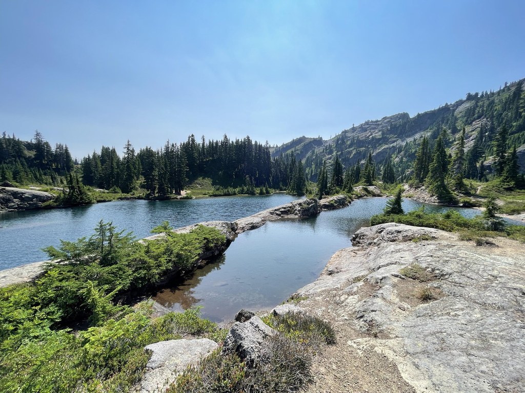
As you near Rampart Lakes, you’ll notice a maze of social trails. It can sometimes be difficult to tell which one to take. Look carefully at trail junctions; sometimes you will see a pile of rocks or sticks blocking a trail. This indicates a trail to avoid using.
Following the main trail, you’ll encounter lots of berries, several lakes, a signed backcountry privy, and eventually the two largest lakes. You’ll probably also find plenty of people swimming, camping, and enjoying picnic lunches.
This environment is fragile and overused. To help keep it intact, be careful to stay on the trail or durable surfaces such as rock. If you’re staying overnight, take note that there is a back-country privy near the large lake, with signs pointing to it.
WTA Pro Tip: If you’re backpacking, consider side trips to Lila Lake and Alta Mountain.
Rampart Ridge - Rampart Lakes

-
 Length
- 11.0 miles, roundtrip
-
 Elevation Gain
- 2,200 feet
-
 Highest Point
- 5,100 feet
Rampart Lakes is a pretty collection of pothole lakes with a maze of social trails lacing them together. Though doable as a day hike, it is better enjoyed as an overnight destination, with nearby Alta Mountain and Lila Lake making excellent side trips.
Continue reading
Hiking Rampart Ridge - Rampart Lakes

WTA worked here in 2018!
Map & Directions
 Trailhead
Before You Go
Parking Pass/Entry Fee
Northwest Forest PassWTA Pro Tip: Save a copy of our directions before you leave! App-based driving directions aren't always accurate and data connections may be unreliable as you drive to the trailhead.
Getting There
From I-90 East, take exit 62. Take a left, heading over the highway. At 5.2 miles, the road veers left, passing Lake Kachess Campground. Go another 0.3 miles, now on gravel, and take a right at a sign for Rachel Lake/Trail 1313. At this point, the road gets a little rough. Continue following signs to Rachel Lake/Trail 1313, turning left at a gated intersection. 3.8 miles from the campground, take a left into a pair of one-way parking lots. Check the lower lot first–there are likely to be spaces available when the upper lot is full. There is space for 30 cars in the upper lot, and at least another 20 cars in the lower lot.


