

Forest fires often reach or exceed temperatures of 2,000° Fahrenheit—that’s equivalent to one-fifth the temperature of the surface of the sun. What is the impact of such high temperatures on the soil and plants of our forests? And how do the intensity and heat of a wildfire impact its behavior, smoke and the surrounding weather?
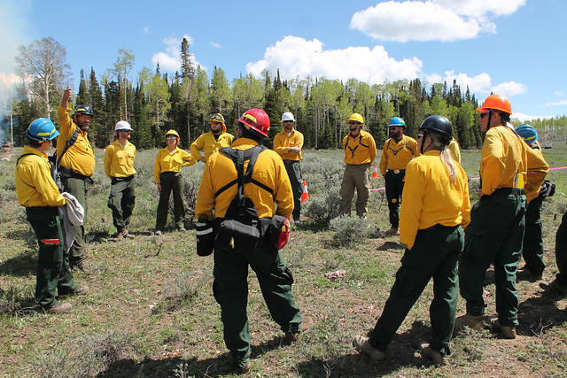
Answering these questions is challenging since it is hard to predict when and where fires will occur. Therefore, USDA Forest Service scientists and others with the interagency Fire and Smoke Model Evaluation Experiment, or FASMEE, teamed up with the Fishlake National Forest Richfield Ranger District to study a prescribed fire from start to finish.
After months of planning and preparation, Fishlake National Forest fire crews ignited more than 2,000 acres of Utah forest in an effort to consume living upper canopy vegetation and initiate growth of new vegetation. This June 2019 prescribed fire was designed to restore aspen ecosystems by removing conifer trees and stimulating the regrowth of aspen.
Researchers at the Pacific Northwest Research Station and Rocky Mountain Research Station, as well as other FASMEE participants, saw the fire as a unique opportunity for study. Prior to the fire, Forest Service research experts took measurements of the forest vegetation and fuel loads. They also set up special fire-proof equipment to record and measure the heat of the fire throughout the project. Embedded below is a video recorded during the burn.
During the fire, scientists used LiDAR, radar, aircraft and satellite imagery, weather and atmospheric measurements, and ground monitoring to study the fuel (dead materials) consumed, fire behavior and the fire’s impact on living vegetation. Scientists will continue to monitor the area to determine how vegetation recovers after fire.
“More than 40 scientists from multiple agencies participated in the effort, gathering a variety of data on the fire itself and its impacts,” said Pacific Northwest research forester Roger Ottmar, one of the lead scientists for the project. “The data is invaluable to our efforts to predict fire behavior, smoke impacts and the short- and long-term effects of extreme fires.”
Over the next several months, scientists will gather more data as the landscape recovers, comparing burn severity maps generated from remote sensors with observed plant regrowth. Other data from the fire is already being used to validate and improve models that predict fire and smoke severity, as well as to improve firefighter safety standards and guidelines.
Building upon this success, experts are planning a similar project for later this fall to continue studying and learning about fire.
