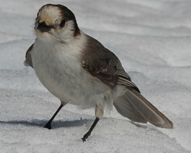
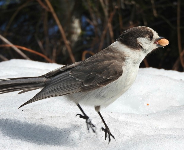
Gray jays are one of the most entertaining birds of the Pacific Northwest. They have earned the nickname “camp robbers” because they are quite adept at sneaking into campsites and cabins (and flying onto hikers’ hands!) to steal food.
These little gray jays are cute and sneaky, but they are tough little critters, too! They live in very cold climates (think northern Canada and Alaska, as well as the Cascade and Rocky Mountain ranges), rarely migrating out of high elevations or south. They can do that because they store food in the bark of trees (using sticky saliva to keep it there) all summer, so they have plenty to eat during the winter.
Their diet is varied. They will catch insects in flight, eat seeds and nuts, attack rodents and birds, and eat carrion (left by wolves or other predators) in winter.
These little birds are so tough they even nest and raise their young during the late winter and early spring rather than wait for warm summer days like most other songbirds. Typically they lay 3 or 4 eggs. Mom incubates them for 20 or so days while dad feeds her. After hatching, parents take turns feeding the young. They leave the nest at about 24 days, then hang around for parental guidance for another 30 days before they fly off to live their own lives.
We’ve seen them at Mirror Lake near Mt. Hood, begging food. Friends of ours had them land right on their hands eating gorp while they were out snowshoeing at Trillium Lake one day this winter. They make a lot of different sounds, from whistles to harsh, scolding cries. If you are up in the mountains here in the Oregon, be on the lookout for these cute little “camp robbers.”
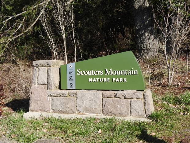
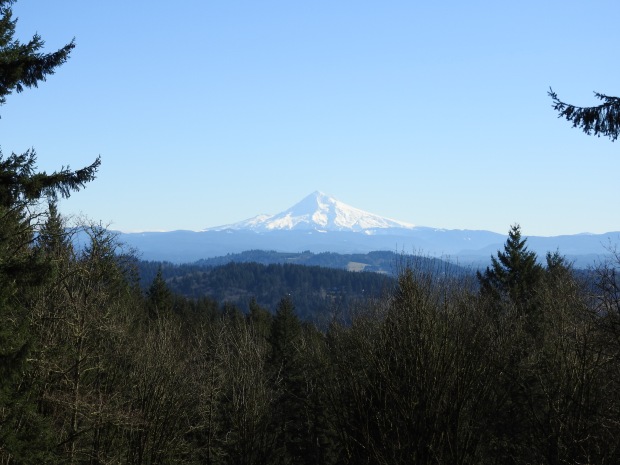
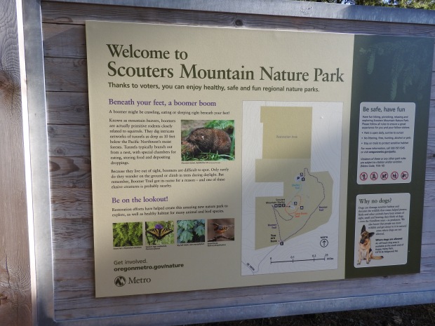
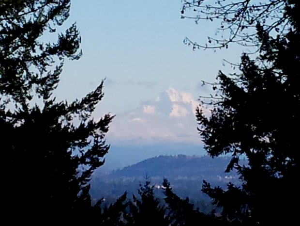
Scouters Mountain Nature Park sits above the eastern edge of Happy Valley, Oregon, just 6 miles from Portland. Happy Valley, once home to early Oregon settlers (1851) and abundant wildlife, now hosts nearly 20,000 residents nestled in upscale housing developments where old farm fields used to prosper. Much of the wildlife of yore has fled the valley, but Scouters Mountain Nature Park provides a notable piece of restored habitat and one of the most impressive views of Mt. Hood in the area.
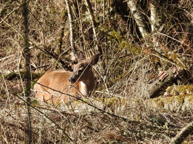
Whenever I hike in small nature areas near urban or suburban interfaces, I expect to see birds, bugs, butterflies and snails, but I don’t count on seeing any large, charismatic mammals. Today, as we rounded a bend in the trail, we spotted two black-tailed deer – a doe and fawn – browsing in the sunshine. We watched them for a good 10 minutes. Never once did they appear to notice our presence. A third deer even snuck up on us from behind as we were watching the other two.
The view of Mt. Hood from the summit was stunning. On this clear, bright day, it stood tall and clear, framed by the Douglas firs of Scouter Mountain.
Birds were abundant – juncos, chickadees, woodpeckers, towhees – but no flowers were blooming yet. This cold, snowy winter has kept the buds at bay so far. As we walked along the “Boomer Trail,” we wondered about the reference to the term “boomer.” Soon, we came upon a sign explaining that Scouters Mountain is home to the elusive mountain beaver, also known as a “boomer.”
What’s a mountain beaver, you say? I only recently learned that mountain beavers existed, when I was researching real beavers for this post. Mountain beavers are not beavers at all, and, often, they do not even live in mountains. They are actually the world’s most primitive rodents, and they love living in the rainy, wet Pacific northwest. Why? They are so primitive that their kidneys don’t work very well, so they need to drink as much as 1/3 of their body weight in water every day.
They tend to stay underground and out of sight. They love to eat ferns, rhododendrons, and, especially, the tender bark of seedling trees. That makes them very destructive to commercial forestry outfits. They are also host to the world’s largest flea species. Oh, boy!
We did not see a mountain beaver on our Scouters Mountain walk. I suppose that is a good thing, since they are said to be very brave and kinda mean. So mean, in fact, that they don’t even like each other. Males and females will hiss and fight and only spend enough time together for a quick mating session, then they go their respective ways. But, my curiosity is piqued now, and I’ll go back to see if I can spy one someday.
Getting there from Portland requires a drive over Mt. Scott through the sprawling Lincoln Memorial Park cemetery, down into the heart of Happy Valley, and back up the western slope of Scouters Mountain. The park is managed by Metro and has a couple miles of trails, a picnic shelter, restrooms, and views worth the trip!
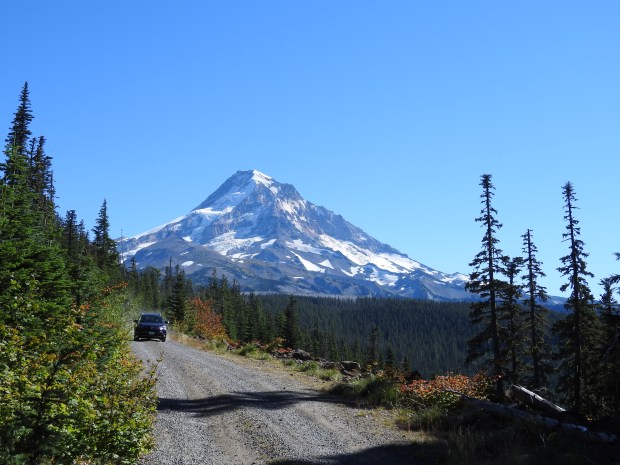
I watched the temperature dropping on the dashboard thermometer as our car bumped up the winding, gravel forest road. We had already passed the Bull Run Watershed, intersected the Pacific Crest Trail, crossed over McGee, Ladd and Red Hill Creeks on Lolo Pass Road and were now grinding our way up to the Vista Ridge Trailhead at 4500 feet.
Bright pink and blue loggers tape marked trees near the road, and slash piles as big as mammoths lined the edges of logged cuts along the roadside. A log loader worked a pile of freshly cut logs as we took a sharp left turn, hoping we wouldn’t meet a fully-loaded truck coming down the narrow lane. When the road finally ended we were 30 miles and a world away from the civilization of Hwy 26, the main road leading to Mt. Hood from Portland. Sometimes, half the adventure of hiking on and around Mt. Hood is just getting there.
To The Rockpile Through Forest and Meadows
Mt. Hood stood so close and looked so big it felt like I could reach out and touch her. Be still my heart! I opened the car door and the wind wrapped around me, making me shiver. Even though the day was bright with sunshine, it was cool and windy at this elevation – a good reminder to always be prepared for any type of weather when you go hiking in the mountains.
We pulled on our packs and headed up the rocky path that was marked by one sad, old sign that warned us to not linger under dead or burned tree snags. Good advice. Just five years ago this month, lightning struck near here and started the Dollar Lake Fire, scorching 6,304 acres of forest on the north side of Mt. Hood. We were about to get a good look at the extent and damage caused by that fire.
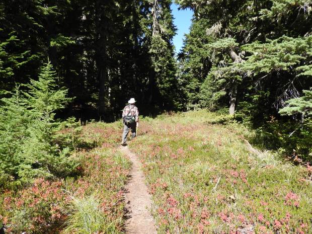
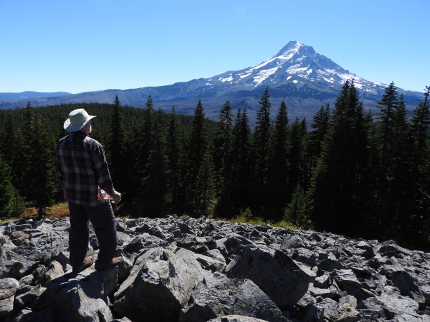
Our destination today was Owl Point – a rocky viewpoint off the Old Vista Ridge Trail. The first 1/3 of a mile lead us up to an intersection with the Vista Ridge Trail. Here, a right turn takes you to the Timberline Trail and on out to McNeil Point and Cairn Basin. But, we turned left onto what is now called the “Old Vista Ridge Trail”. In 2007, PortlandHikers made the effort to re-open this forgotten segment of the Vista Ridge Trail, clearing hundreds of down trees and smoothing out trail to Owl Point and Perry Lake.
Because of their efforts, we were able to hike easily through the forest of Douglas firs and hemlocks, through some sweet little alpine meadows and on up to the viewpoints at The Rockpile and Owl Point.
One of the meadows along the trail
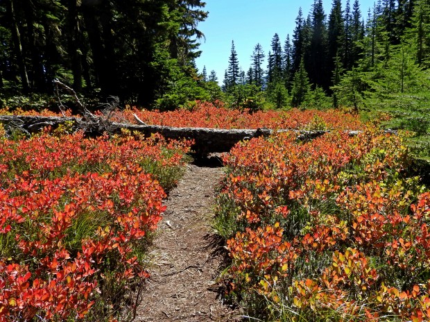
In spite of the wind, which blew at a steady 15 – 20 mph (gusting to 30 mph) during our entire hike, we appreciated the easy hike and the unobstructed views of Mt. Hood from several vantage points along the ridge. Our first side trip was to the aptly named Rockpile, a beautiful talus slope that falls out of a huckleberry patch and offers a stunning view of Mt. Hood just a few miles in the distance.
Spur trail leading to The RockpileView from The Rockpile
On to Owl Point
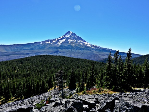
Beyond The Rockpile, another spur trail leads us out to Owl Point. Mt. Hood is, again, the star of attraction, but a careful climb over large boulders to the north rewards us with an expansive view of the Upper Hood River Valley. At our feet, the Owl Point Register beckons. It’s an old ammo box containing a hiker log, photos of the 2007 trail clean-up efforts, and laminated photos of Mt. Hood with its prominent north-facing features identified.
We signed the logbook, perused the photos and spent some time locating the marked points of interest on Mt. Hood – Langille Crags, Cooper Spur, The Pinnacle, Coe Glacier and more. It was nice to see the faces of the volunteers who recovered this trail and made this hike possible for us.
Mt Hood from Owl PointUpper Hood River Valley below Owl Point
A Geologic Wonder
Sitting there studying the north face of Mt. Hood – a view I rarely get to see – I tried to imagine the collapse of the summit and this northern face 100,000 years ago as it sent a debris avalanche and lahar into the Hood River Valley and across the Columbia River. I tried to imagine how subsequent slow volcanic eruptions built the mountain back up, erasing any visible signs of its earlier collapse. I looked at the sloping west flank of Cooper Spur, formed from a pyroclastic flow after a lava dome collapse 15,000 to 30,000 years ago, and decided I needed to hike up there soon.
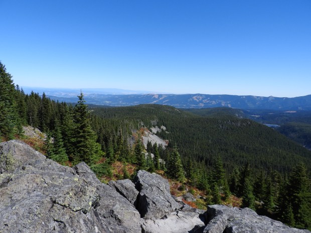
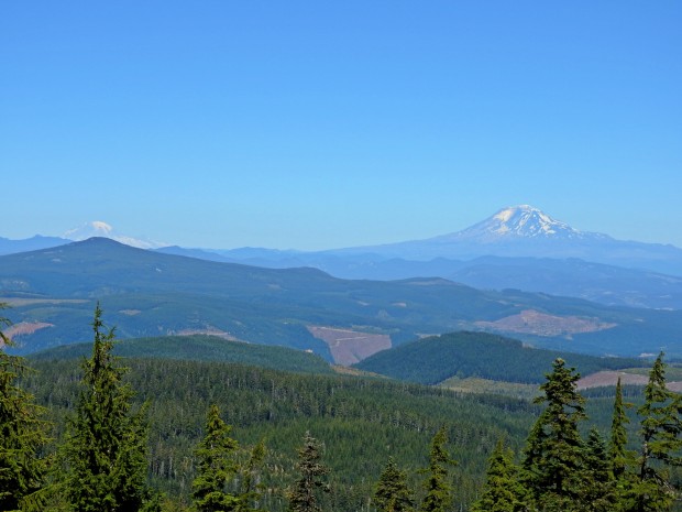
Reluctant to leave this view behind, we returned to the main trail and ventured further west to see if we might catch a glimpse of mountains to the north. After bushwhacking a bit around a fallen tree, we made it to Alki Point, a viewpoint on the opposite side of the trail from Owl Point. Alki Point is a large talus slope filled with large lichen-covered rocks. In one dazzling beyond the slope lies a trifecta of Washington mountains – Mt. St. Helens, Mt. Rainier and Mt. Adams – all lined up in a row like ducks. I was struck by the appearance of Mt. Rainier from here. At nearly 160 miles to the north, it looked almost as big as Mt. Adams, which is just 55 miles from where we stood. As we were taking pictures of the mountains, a lovely Cooper’s hawk swooped in near us and skirted the slope around the ridge.
Mt Rainier and Mt. Adams beyond the Hood River Valley – from Alki Point
Surprises
On our return hike, we stopped multiple times at scree piles to listen for pikas, the cute, secretive rock rabbits of the Pacific Northwest. Either we can’t hear their high-pitched “meeps” or they weren’t talking. But, we did spot a Townsend’s Solitaire – a life bird for both of us – landing on a scree pile, a nice bonus to our trip. We also found an interesting looking plant and fungus along the way…I’ve no idea what they are (yet), but I’ll let you know when I do.
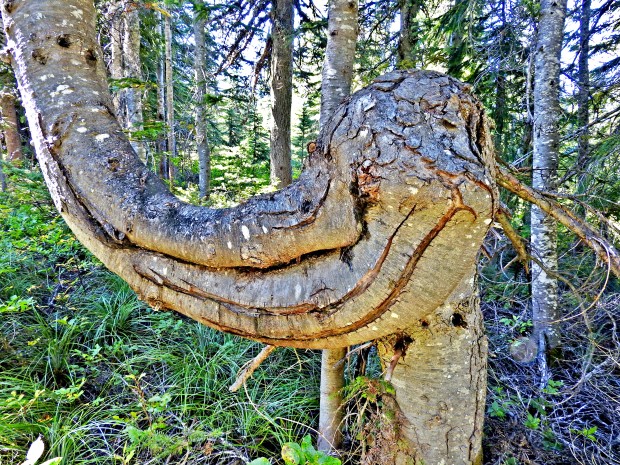
Another fun surprise on the way back to the trailhead was this tree trunk that looked sort of like an elephant head 🙂
By mid-afternoon the sun lit up the northwest slope of Mt. Hood, and we headed back toward town, grateful for another inspiring day with my mountain.
The hummingbird hovered 3 feet from our faces, looking at us with tiny black eyes. It dipped and came closer then backed up to hover again. For ten seconds we watched as the tiny green flash tried to decide whether to charge us or go around. In the end it flew around and perched on a nearby branch. We looked at each other and grinned. We were standing on an open, rocky slope filled with lupine and paintbrush flowers, signs of regeneration after a massive landslide.
The slopes of the peaks within the Bull of the Woods Wilderness range from 30 to 90 degrees. Landslides are inevitable and tree blow-down is common. This is a rugged, relatively isolated wilderness within the Mt. Hood National Forest.
Our destination was Bull of the Woods Peak – the hub of 75 miles of challenging hiking trails in this wilderness area. Roads leading to some of the trailheads are as rugged as the peaks and often unpaved. Signage is sparse. Cell phone coverage is nearly non-existent (except on some peaks). If you want solitude, this is a good place to hike.
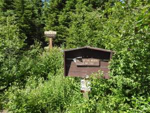
The Bull of the Woods Trail (#550) starts at the end of Road 6340 in Clackamas County, about 45 miles from the town of Estacada. It’s ten miles of gravel road that gets narrower and narrower, the last mile sporting ruts, washouts and large loose rocks. The trailhead is marked with signs nearly overgrown with vegetation. There was no one else in sight.
Bull of the Woods Trailhead
This trail, while not very steep, is bushy and littered with downed trees – we had to climb over, under or around 42 of them – twice. It is clear from the start that this trail doesn’t get nearly the same level of maintenance (or traffic) as the PCT, Timberline or Mirror Lake Trails, but that just enhances the feeling of remoteness and solitude. It also makes you wish you’d brought extra food and water and a GPS beacon in case something happens.
“Whoa, did you see that?”My husband was looking down between my feet. “A vole or shrew just ran into my shoe and then went between your feet on the trail.” I’d missed it, but wasn’t surprised. We’d seen another small rodent cross the road as we pulled up at the trailhead. Plenty of owl food here.
Bee on bear grass flower
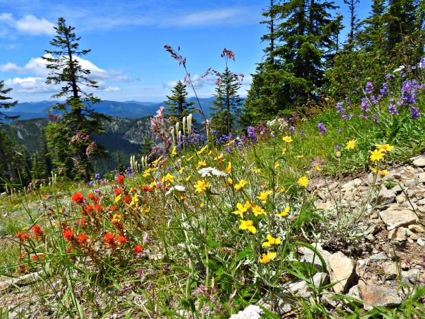
Within minutes of starting our hike, we got glimpses of Mt. Hood and started seeing flowers in bloom. The bear grass was near peak, and there were hundreds of beautiful cream-colored flower heads filled with bees and other pollinators along the trail. Lots of other wildflowers were blooming, too, especially in the open, sunny areas. Lupines, penstemons, lilies, paintbrushes, and several new-to-me flowers.
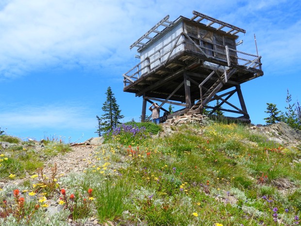
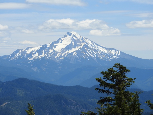
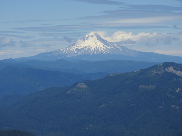
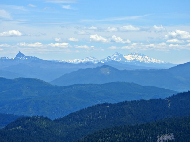
At the 5,523 foot peak of Bull of the Woods is a 1942-era fire tower that is registered on the National Historic Lookout Tower Register. The building is chained shut, but you can still climb the stairs and get a feel for the near 360-degree view. We could see Mt. Hood, Mt. Jefferson, Mt. Washington, Broken Top, the Three Sisters, and Three Fingered Jack.
Old fire tower at Bull of the Woods PeakMt. Jefferson to the southMt. Hood to the northMt. Washington, Broken Top, the Sisters
Sitting there under a bright blue sky, soaking up the sun, I marveled at the silence broken only by a distant raven’s honk or fluttering breeze through the hemlocks. Surrounded by forests, mountains and all their unseen inhabitants, I thought, this is why we have wilderness. This is where nature can just be. It’s purpose is not to serve us. We are only a small part of the universe, and we are not in control.
“Mountains seem to answer an increasing imaginative need in the West. More and more people are discovering a desire for them, and a powerful solace in them. At bottom, mountains, like all wildernesses, challenge our complacent conviction – so easy to lapse into – that the world has been made for humans by humans. Most of us exist for most of the time in worlds which are humanly arranged, themed and controlled. One forgets that there are environments which do not respond to the flick of a switch or the twist of a dial, and which have their own rhythms and orders of existence. Mountains correct this amnesia. By speaking of greater forces than we can possibly invoke, and by confronting us with greater spans of time than we can possibly envisage, mountains refute our excessive trust in the man-made. They pose profound questions about our durability and the importance of our schemes. They induce, I suppose, a modesty in us.”
― Robert Macfarlane, Mountains of the Mind: Adventures in Reaching the Summit
Below the Bull of the Woods peak, markers pointed to trails leading to Welcome Lakes and Twin Lakes, but we neither saw not heard another hiker all day. On this cool, bright weekday of mid-summer, we found solitude in the wilderness.
**By the way, Bull of the Woods was a common phrase in Oregon’s ox-logging days for the title of a tough crew boss (according to William L. Sullivan’s 100 Hikes of NW Oregon hiking guide).
I’ve always loved hiking up to the summit of Tom, Dick and Harry Mountain because it gets me so up close and personal with Mt. Hood. But, today I hiked a trail that outshines Tom, Dick and Harry so completelythat I may never go back to Tom, Dick and Harry again! Today, I hiked the Pacific Crest Trail (PCT) from the Lolo Pass Trailhead to the summit of Bald Mountain, and every step of the way was breath-taking.
This slideshow requires JavaScript.
First of all, Lolo Pass Road winds around the west side of Mt. Hood, instead of around the east like Hwy 26. Along the road, stunning views of Mt. Hood make your heart race in anticipation of hiking so near it. The road curves and climbs into the wilderness instead of toward the busy tourist areas. So, once you arrive at the trailhead 11 miles away from Hwy 26, you already feel like you have left the human world behind.
At multiple points along the trail, heart-stirring views of Mt. Adams and Mt. Hood await, and today the spring wildflowers were nearing their peak of bloom at this elevation (3100 – 4600 feet). To top it off, we saw no other people on the 3-mile PCT portion of the hike and had the trail all to ourselves. So, everything about this hike was pure magic.
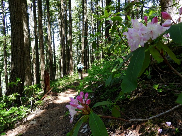
An old clearcut growing up with flowering rhododendrons…
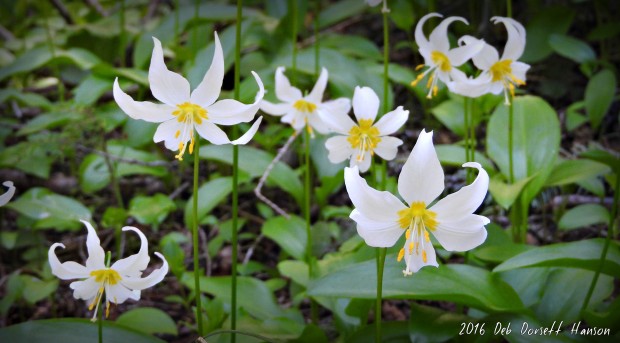
Carpets of Avalanche lilies and Solomon’s seal lining the trails…
Avalanche lily
Cool, shaded forests of Doug fir, hemlock, western red cedar and grand fir…
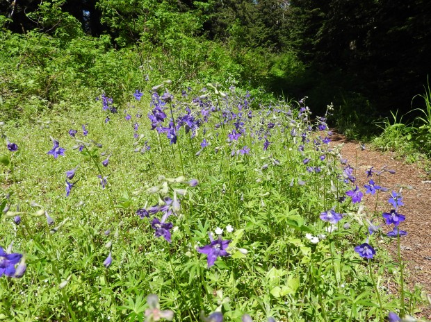
Sunny meadows full of Menzie’s Larkspur…
Cool breezes along the ridgetops…and…
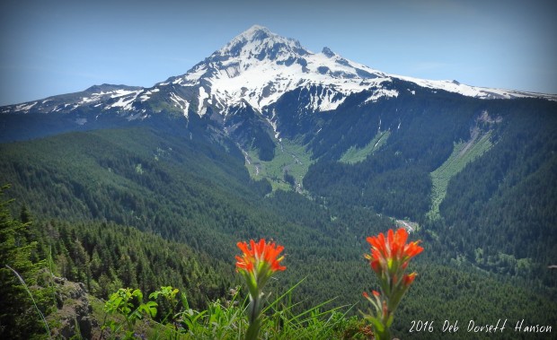
About three miles in we intersected the Top Spur Trail and then Timberline Trail, where we filled out our Mt. Hood Wilderness Permit and headed uphill to an unmarked (and unmaintained) path leading to the summit of Bald Mountain. After walking through dark, dense forest up a 20-degree slope the trail curved out into a small open space on the edge of a flower-filled cliff with an awe-inspiring view of Mt. Hood.
Sitting there we could hear only the birds in the trees and the distant rush of water from the melting snow on Mt. Hood. Waterfalls cascaded down from the glaciers into rivulets and creeks, making their way to the Sandy River below. The glaciers and ridges of Mt. Hood formed a frozen backdrop for the deep green forests below.
Wildflowers of every texture and hue dotted the steep, rocky slopes of Bald Mountain. Butterflies flitted by, and we sat there soaking up the sun, the view and the joy of being in that magical place at that perfect moment.
*************************************
Directions for this hike can be found on the OregonHikers.org website here.
(Thanks to Gina Anzaldúa for her post on the Oregon Wildflowers Facebook page that got me interested in trying this hike)
Reading books about Oregon is one of the many ways I develop my own sense of place here. So, I try to choose books that capture other people’s experiences as well as the history and natural phenomena that make Oregon so special.
Recently I finished reading On Mount Hood: A Biography of Oregon’s Perilous Peak by Jon Bell (2011). As I said before, Mt. Hood is MY mountain, so everything I learn about it fascinates me. This book is an easy read – accessible and personal – and a quick lesson about the marvels and perils of the most summited peak in the world.
I connected immediately to his story from his very first sentence…
Mount Hood is not a story that I intentionally set out to know. It’s one that instead has slowly been built for me since the first time I laid eyes on the mountain.
Bell weaves the story of his own 41-mile trip around Hood on the Timberline Trail into a fascinating tale of volcanic eruptions, melting glaciers, waterfalls, forests, heroes and heartache as he reveals the mystery and magic that is Mt. Hood. He did his homework – researching documents and events and meeting face-to-face with people whose lives were changed by Mt. Hood.
From the Mazamas to the building of Timberline Lodge to the chilling accounts of lives lost on the mountain, Bell captures beautifully the spirit of the mountain and the people who love it.
I’ve been toying with the idea of hiking the Timberline Trail all the way around Mount Hood. It seems like a rite of passage for someone who wants to make Oregon their home. After reading this book, I’m more convinced I should do it. In the afterward, Bell explains…
After eight years of exploring Mount Hood, climbing it, camping around it, paddling the lakes at its base…I felt like I knew the mountain pretty well. But something about ticking off the Timberline Trail made me look at Mount Hood in a different way…
This is what “sense of place” is all about…knowing a place through time and experience. Seeing it from a perspective that is yours and your alone. Understanding it through seasons, terrain, weather, plants, animals and spirit.
For anyone who loves Mount Hood, this book will add to your own experience and knowledge and inspire you to spend more time with the mountain.
The sun beckoned. I hopped on my bike and rode up the hill, pressing into strong headwinds. Legs pumping, I passed frozen puddles and felt the cold air fill my lungs. The cold didn’t matter. Getting to the top did.
I pushed my bike up the last few feet of frozen, grassy slope and sat down. Turning into the east winds, cold wind biting at my face, I lifted my eyes to the view.
Tears came – sudden, unbidden and unexpected.
I stared. The wind blew straight into my face, and I breathed in the majesty and spirit of Mt. Hood – white, frozen, stunning, beautiful.
My mountain.
I fell in love with this mountain the first day I laid eyes on it. No matter what direction or distance I am from it, I feel it. This is my mountain.
It’s no wonder John Muir described Hood as “the pride of Oregonians,” their “mountain of mountains.”