File:Serb lands in the 9th century (hu).svg
Jump to navigation
Jump to search

Size of this PNG preview of this SVG file: 770 × 600 pixels. Other resolutions: 308 × 240 pixels | 617 × 480 pixels | 987 × 768 pixels | 1,280 × 997 pixels | 2,560 × 1,993 pixels | 935 × 728 pixels.
Original file (SVG file, nominally 935 × 728 pixels, file size: 64 KB)
Captions
Captions
Add a one-line explanation of what this file represents
Summary[edit]
.svg&action=edit§ion=1)
.svg)
| Description |
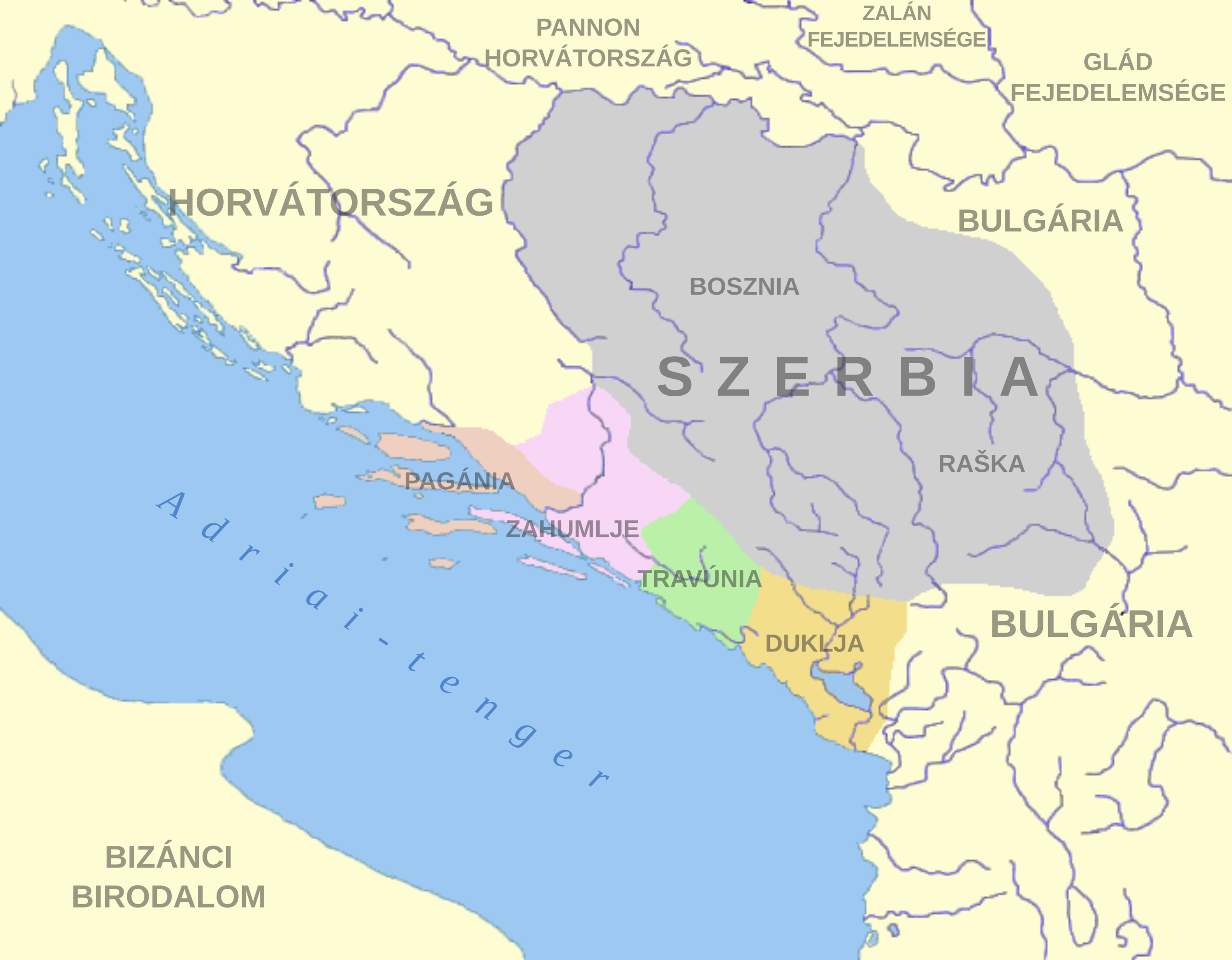
Magyar: A szerb állam és környezete 10. században Bíborbanszületett Konstantin alapján. |
| Date | |
| Source | File:Serb_lands_in_the_9th_century_(en).png |
| Author | User:PANONIAN |
.png)
Licensing[edit]
.svg&action=edit§ion=2)
| This file is made available under the Creative Commons CC0 1.0 Universal Public Domain Dedication. | |
| The person who associated a work with this deed has dedicated the work to the public domain by waiving all of their rights to the work worldwide under copyright law, including all related and neighboring rights, to the extent allowed by law. You can copy, modify, distribute and perform the work, even for commercial purposes, all without asking permission.
|
File history
Click on a date/time to view the file as it appeared at that time.
| Date/Time | Thumbnail | Dimensions | User | Comment | |
|---|---|---|---|---|---|
| current | 14:52, 18 January 2022 | | 935 × 728 (64 KB) | Sepultura (talk | contribs) | Uploaded a work by User:PANONIAN from https://commons.wikimedia.org/wiki/File:Serb_lands_in_the_9th_century_(en).png with UploadWizard |
You cannot overwrite this file.
File usage on Commons
There are no pages that use this file.
File usage on other wikis
The following other wikis use this file:
- Usage on hu.wikipedia.org
Metadata
.svg&oldid=858196591)
Categories:
- Maps of the history of Serbia in the Early Middle Ages
- Maps of the history of Montenegro in the Early Middle Ages
- Maps of medieval Bosnian and neighboring states
- Maps of the history of Herzegovina
- Maps of Pagania
- Maps of Zachlumia
- Maps of Travunija
- Maps of Duklja
- Maps of the Principality of Serbia (early medieval)